Beesby Village

Heritage Site in Lincolnshire

England

Beesby Village

Westfield Farm, Hawerby: aerial 2021
Westfield Farm, Hawerby: aerial 2021 Credit: Chris

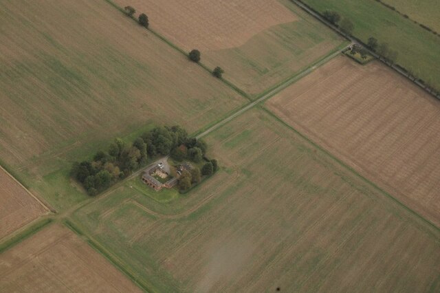
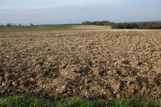
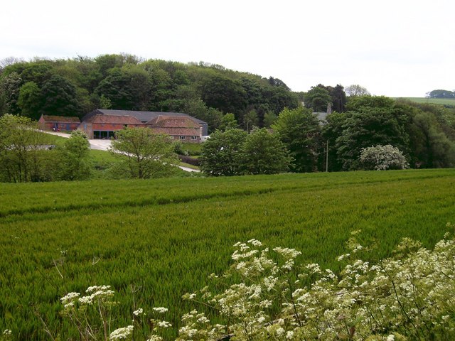
Beesby Village is a charming heritage site located in the county of Lincolnshire, England. Situated in the East Lindsey district, this small village is nestled amidst picturesque countryside and offers visitors a glimpse into the region's rich history.

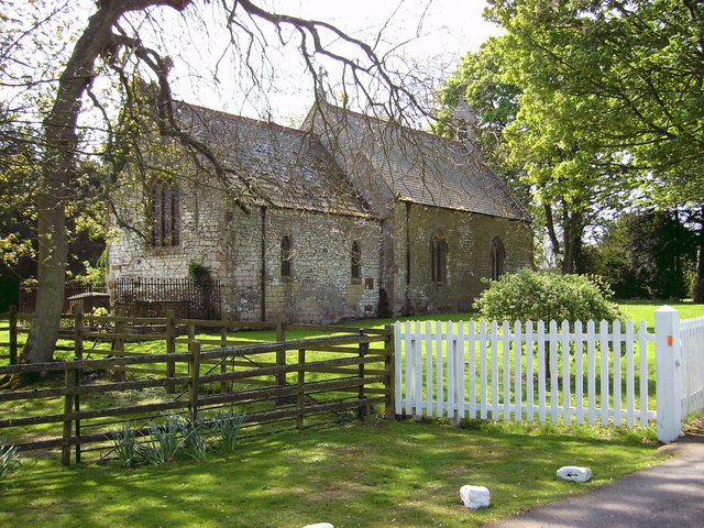
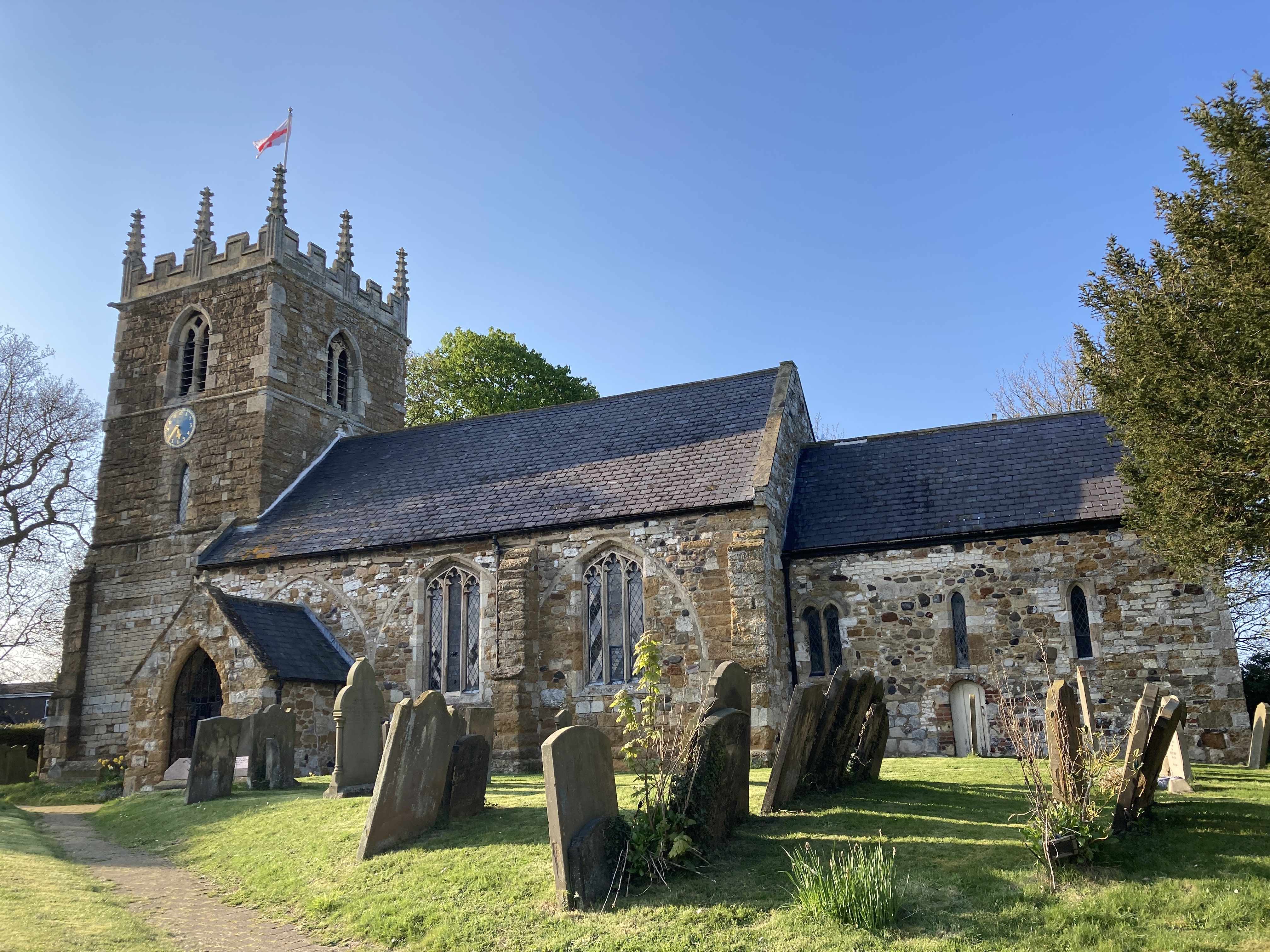
The village dates back to medieval times and is known for its well-preserved medieval church, dedicated to St. Andrew. This Grade I listed building is a remarkable example of Gothic architecture, with its towering spire and intricate stone carvings. Inside, visitors can admire the beautiful stained glass windows and the ancient stone font.

Another notable feature of Beesby Village is its collection of traditional thatched-roof cottages. These quaint dwellings, some of which are over 200 years old, provide visitors with a glimpse into rural life in the past. The village's well-manicured gardens and flower-filled lanes further enhance its idyllic ambiance.

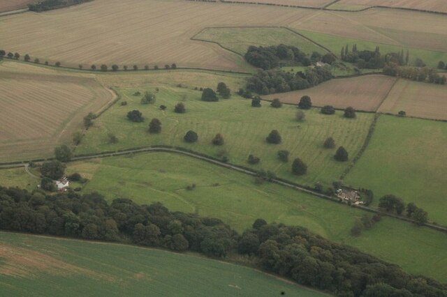
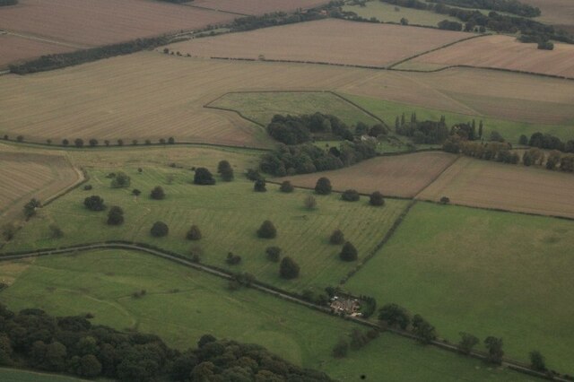
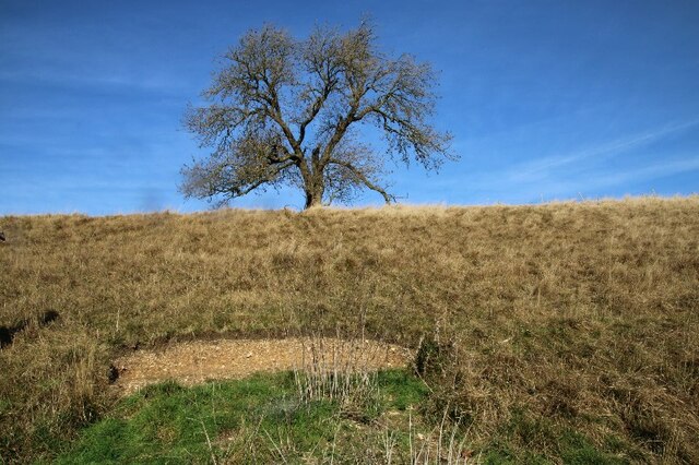
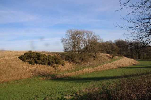
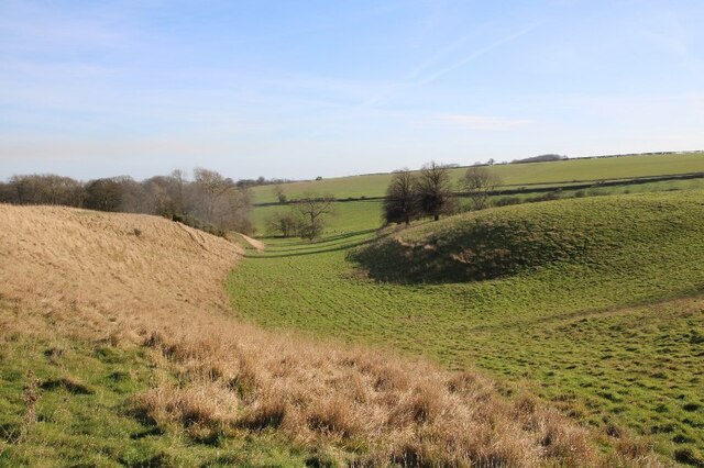
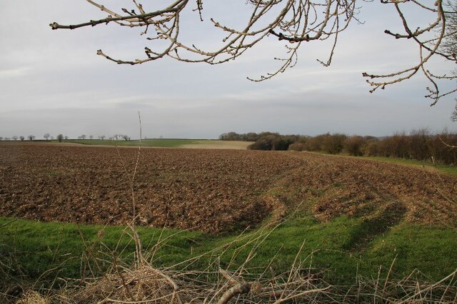
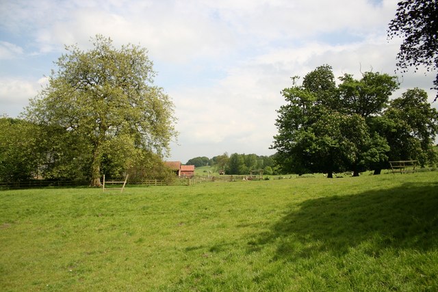
In addition to its architectural and historical significance, Beesby Village is surrounded by stunning natural beauty. The village is located near the Lincolnshire Wolds, an Area of Outstanding Natural Beauty renowned for its rolling hills and scenic countryside. Visitors can enjoy leisurely walks or bike rides along the many trails that crisscross the area.

Overall, Beesby Village offers a serene and captivating experience for history enthusiasts and nature lovers alike. Whether exploring its medieval church, admiring its thatched-roof cottages, or immersing oneself in the surrounding countryside, a visit to this charming village is sure to leave a lasting impression.

If you have any feedback on the listing, please let us know in the comments section below.

Beesby Village Images

Images are sourced within 2km of 53.45/-0.095 or Grid Reference TF2696. Thanks to Geograph Open Source API. All images are credited.

Westfield Farm, Hawerby: aerial 2021
Beesby DMV: aerial 2021 (1) Mentioned in "Beresford's Lost Villages": <span class="nowrap"><a title="http://www.dmvhull.org/dmvDetail.cfm?dbkey=3727&county=true" rel="nofollow ugc noopener" href="http://www.dmvhull.org/dmvDetail.cfm?dbkey=3727&county=true">Link</a><img style="margin-left:2px;" alt="External link" title="External link - shift click to open in new window" src="https://s1.geograph.org.uk/img/external.png" width="10" height="10"/></span>

Otherwise seems to be undocumented.
Beesby DMV: aerial 2021 (1)
Mentioned in "Beresford's Lost Villages": LinkExternal link Otherwise seems to be undocumented.
Beesby DMV: aerial 2021 (2) Mentioned in "Beresford's Lost Villages": <span class="nowrap"><a title="http://www.dmvhull.org/dmvDetail.cfm?dbkey=3727&county=true" rel="nofollow ugc noopener" href="http://www.dmvhull.org/dmvDetail.cfm?dbkey=3727&county=true">Link</a><img style="margin-left:2px;" alt="External link" title="External link - shift click to open in new window" src="https://s1.geograph.org.uk/img/external.png" width="10" height="10"/></span>

Otherwise seems to be undocumented.
Beesby DMV: aerial 2021 (2)
Mentioned in "Beresford's Lost Villages": LinkExternal link Otherwise seems to be undocumented.
Near Hawerby: an offering to the Wanderlust Gods or a rescue package for exhausted walkers? Beside the Wanderlust Way.
Near Hawerby: an offering to the Wanderlust Gods or a rescue package for exhausted walkers?
Beside the Wanderlust Way.
Glacial valley, Beesby, near the Wanderlust Way (1)
The one that got away? Lone sheep near Beesby, by the Wanderlust Way
The Valley, approaching Wold Newton
Glacial valley, Beesby, near the Wanderlust Way (2)
Glacial valley, Beesby, near the Wanderlust Way (3)
Glacial valley, Beesby, near the Wanderlust Way (4)
Chalky soil, and more chalky soil, near Hawerby (1) The field in the distance seems to be more chalk than soil.
Chalky soil, and more chalky soil, near Hawerby (1)
The field in the distance seems to be more chalk than soil.
Chalky soil, and more chalky soil, near Hawerby (2)
Wyham DMV: aerial 2022 See: <span class="nowrap"><a title="https://www.heritagegateway.org.uk/Gateway/Results_Single.aspx?uid=MLI40796&resourceID=1006" rel="nofollow ugc noopener" href="https://www.heritagegateway.org.uk/Gateway/Results_Single.aspx?uid=MLI40796&resourceID=1006">Link</a><img style="margin-left:2px;" alt="External link" title="External link - shift click to open in new window" src="https://s1.geograph.org.uk/img/external.png" width="10" height="10"/></span>
Wyham DMV: aerial 2022
See: LinkExternal link
Cadeby DMV: aerial 2022 See: <span class="nowrap"><a title="https://www.heritagegateway.org.uk/Gateway/Results_Single.aspx?uid=MLI43622&resourceID=1006" rel="nofollow ugc noopener" href="https://www.heritagegateway.org.uk/Gateway/Results_Single.aspx?uid=MLI43622&resourceID=1006">Link</a><img style="margin-left:2px;" alt="External link" title="External link - shift click to open in new window" src="https://s1.geograph.org.uk/img/external.png" width="10" height="10"/></span>
Cadeby DMV: aerial 2022
See: LinkExternal link
Historic settlement of Beesby: aerial 2022 (1) See: <span class="nowrap"><a title="https://www.heritagegateway.org.uk/Gateway/Results_Single.aspx?uid=MNL234&resourceID=1039" rel="nofollow ugc noopener" href="https://www.heritagegateway.org.uk/Gateway/Results_Single.aspx?uid=MNL234&resourceID=1039">Link</a><img style="margin-left:2px;" alt="External link" title="External link - shift click to open in new window" src="https://s1.geograph.org.uk/img/external.png" width="10" height="10"/></span>
Historic settlement of Beesby: aerial 2022 (1)
See: LinkExternal link
Historic settlement of Beesby: aerial 2022 (2) See: <span class="nowrap"><a title="https://www.heritagegateway.org.uk/Gateway/Results_Single.aspx?uid=MNL234&resourceID=1039" rel="nofollow ugc noopener" href="https://www.heritagegateway.org.uk/Gateway/Results_Single.aspx?uid=MNL234&resourceID=1039">Link</a><img style="margin-left:2px;" alt="External link" title="External link - shift click to open in new window" src="https://s1.geograph.org.uk/img/external.png" width="10" height="10"/></span>
Historic settlement of Beesby: aerial 2022 (2)
See: LinkExternal link
Wold Newton: aerial 2022 (4)
Cadeby Hall (1) See <span class="nowrap"><a title="https://www.heritagegateway.org.uk/Gateway/Results_Single.aspx?uid=MLI83090&resourceID=1006" rel="nofollow ugc noopener" href="https://www.heritagegateway.org.uk/Gateway/Results_Single.aspx?uid=MLI83090&resourceID=1006">Link</a><img style="margin-left:2px;" alt="External link" title="External link - shift click to open in new window" src="https://s1.geograph.org.uk/img/external.png" width="10" height="10"/></span>
Cadeby Hall (1)
See LinkExternal link
Show me another place!

Beesby Village is located at Grid Ref: TF2696 (Lat: 53.45, Lng: -0.095)

Division: Parts of Lindsey

Unitary Authority: North East Lincolnshire

Police Authority: Humberside

What 3 Words

///meal.ownership.shopper. Near Wold Newton, Lincolnshire

Related Wikis

Wold Newton, Lincolnshire

Wold Newton is a village and civil parish in North East Lincolnshire, England. It is situated just over 1 mile (1.6 km) west from the A18 road, 7 miles...

Wyham cum Cadeby

Wyham cum Cadeby (otherwise Wyham with Caldeby) is a depopulated civil parish in the East Lindsey district of Lincolnshire, England. The nearest village...

Grainsby

Grainsby is a hamlet and civil parish in the East Lindsey district of Lincolnshire, England. It is situated 5 miles (8 km) south from Grimsby, and just...

Ludborough

Ludborough is a village and civil parish in the East Lindsey district of Lincolnshire, England. It is situated approximately 5 miles (8 km) north from...

North Thoresby

North Thoresby is a village and civil parish in the East Lindsey district of Lincolnshire, England. It is situated between Louth and Grimsby, approximately...

St Helen's Church, North Thoresby

St Helen's Church is the Anglican parish church in the village of North Thoresby in Lincolnshire, England. Built of squared limestone rubble, chalk and...

North Ormsby

North Ormsby (sometimes Ormesby) is a village and civil parish in the East Lindsey district of Lincolnshire, England. It is situated approximately 7 miles...

North Ormsby Priory

North Ormsby Priory was a Gilbertine priory in North Ormsby, Lincolnshire, England. It was founded by Gilbert son of Robert of Ormsby with the consent...

Nearby Amenities

Located within 500m of 53.45,-0.095
Beesby
Is In: Lincolnshire, England, UK
Place: hamlet
Source: npe
Lat/Long: 53.4501414/-0.0948214
Power: pole
Lat/Long: 53.4471555/-0.0898897
Power: pole
Lat/Long: 53.4478853/-0.0915676
Power: pole
Lat/Long: 53.448526/-0.093065
Power: pole
Lat/Long: 53.4493354/-0.0949266
Power: pole
Lat/Long: 53.4501358/-0.0967612
Power: pole
Lat/Long: 53.4509735/-0.0986816
Power: pole
Lat/Long: 53.4518323/-0.1006231
Power: pole
Lat/Long: 53.4510814/-0.0937432
Power: pole
Lat/Long: 53.4506885/-0.0926811
Power: pole
Lat/Long: 53.4503467/-0.0917798
Power: pole
Lat/Long: 53.4498259/-0.0908947
Power: pole
Lat/Long: 53.4493723/-0.0901973
Power: pole
Lat/Long: 53.4488292/-0.0893551
Power: pole
Lat/Long: 53.4482573/-0.0886899
The data included in this document is from www.openstreetmap.org. The data is made available under ODbL.

Have you been to Beesby Village?

Leave your review of Beesby Village below (or comments, questions and feedback).