Beesby Wood

Wood, Forest in Lincolnshire

England

Beesby Wood

Westfield Farm, Hawerby: aerial 2021
Westfield Farm, Hawerby: aerial 2021 Credit: Chris

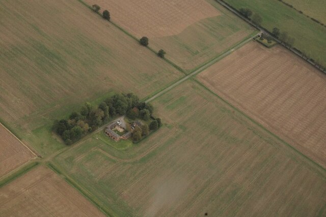
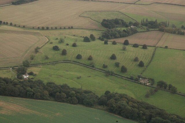
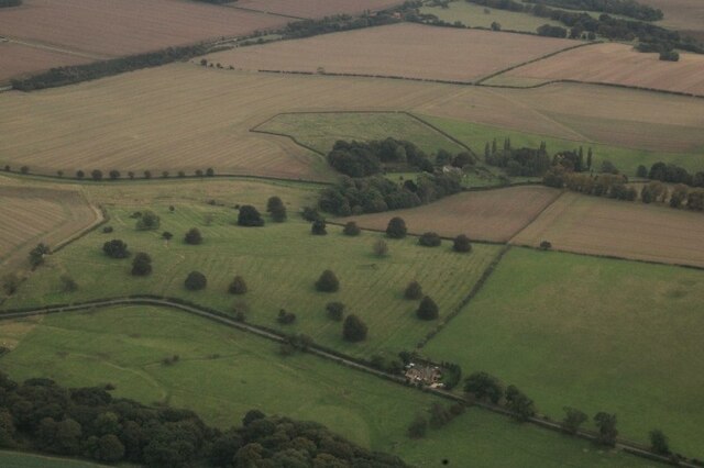
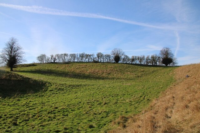
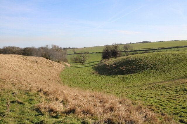
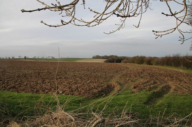
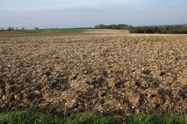
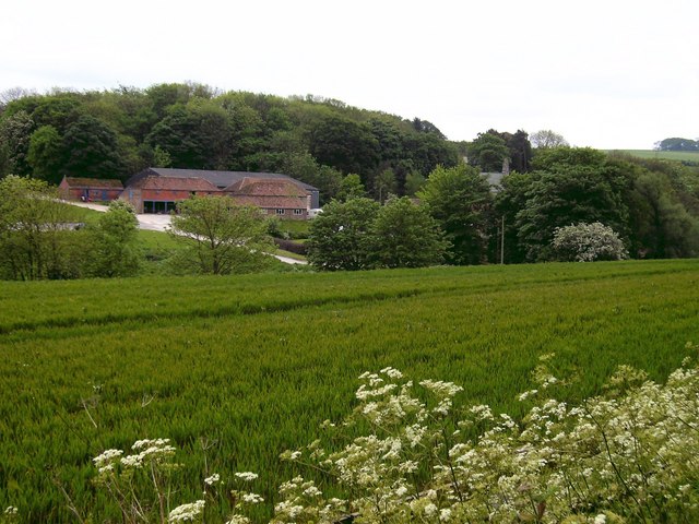
Beesby Wood is a charming woodland located in the county of Lincolnshire, England. Situated near the village of Beesby, it covers an area of approximately 70 hectares. The woodland is a designated Site of Special Scientific Interest (SSSI) due to its rich biodiversity and historical significance.

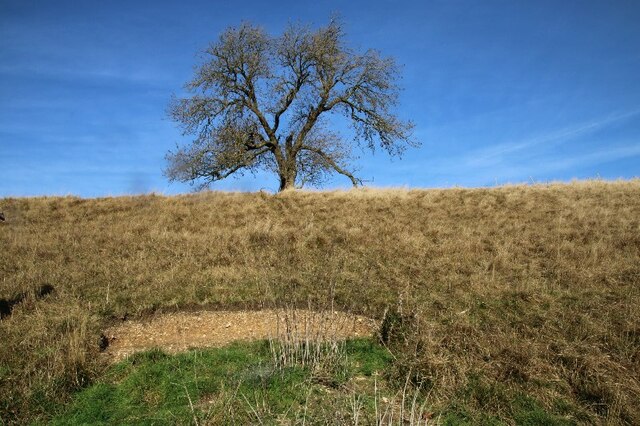
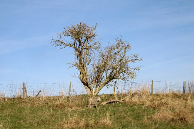
The wood is predominantly composed of native broadleaf trees, including oak, ash, beech, and birch. These trees create a dense and diverse canopy, providing a suitable habitat for a wide range of flora and fauna. Bluebells, wood sorrel, and wild garlic carpet the forest floor during spring, creating a picturesque scene.

Beesby Wood is renowned for its wildlife. The woodland supports a variety of bird species, including the great spotted woodpecker, tawny owl, and nuthatch. Mammals such as badgers, foxes, and squirrels can also be spotted within the wood. Additionally, the area is home to several species of butterflies and insects, adding to its ecological importance.

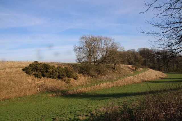
The wood has a rich history dating back centuries. It was once part of the medieval Waltham Forest, an ancient hunting ground for royalty. The remnants of an ancient deer park wall can still be seen within the wood, reminding visitors of its historical significance.

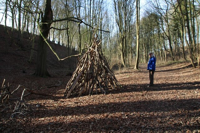
Beesby Wood offers visitors a tranquil and peaceful environment, perfect for walking, birdwatching, and photography. It is a popular destination for nature enthusiasts and provides an opportunity to experience the beauty of a Lincolnshire woodland firsthand.

If you have any feedback on the listing, please let us know in the comments section below.

Beesby Wood Images

Images are sourced within 2km of 53.451109/-0.096086905 or Grid Reference TF2696. Thanks to Geograph Open Source API. All images are credited.

Westfield Farm, Hawerby: aerial 2021
Beesby DMV: aerial 2021 (1) Mentioned in "Beresford's Lost Villages": <span class="nowrap"><a title="http://www.dmvhull.org/dmvDetail.cfm?dbkey=3727&county=true" rel="nofollow ugc noopener" href="http://www.dmvhull.org/dmvDetail.cfm?dbkey=3727&county=true">Link</a><img style="margin-left:2px;" alt="External link" title="External link - shift click to open in new window" src="https://s1.geograph.org.uk/img/external.png" width="10" height="10"/></span>

Otherwise seems to be undocumented.
Beesby DMV: aerial 2021 (1)
Mentioned in "Beresford's Lost Villages": LinkExternal link Otherwise seems to be undocumented.
Beesby DMV: aerial 2021 (2) Mentioned in "Beresford's Lost Villages": <span class="nowrap"><a title="http://www.dmvhull.org/dmvDetail.cfm?dbkey=3727&county=true" rel="nofollow ugc noopener" href="http://www.dmvhull.org/dmvDetail.cfm?dbkey=3727&county=true">Link</a><img style="margin-left:2px;" alt="External link" title="External link - shift click to open in new window" src="https://s1.geograph.org.uk/img/external.png" width="10" height="10"/></span>

Otherwise seems to be undocumented.
Beesby DMV: aerial 2021 (2)
Mentioned in "Beresford's Lost Villages": LinkExternal link Otherwise seems to be undocumented.
Near Hawerby: an offering to the Wanderlust Gods or a rescue package for exhausted walkers? Beside the Wanderlust Way.
Near Hawerby: an offering to the Wanderlust Gods or a rescue package for exhausted walkers?
Beside the Wanderlust Way.
Glacial valley, Beesby, near the Wanderlust Way (1)
The one that got away? Lone sheep near Beesby, by the Wanderlust Way
The Valley, approaching Wold Newton
Glacial valley, Beesby, near the Wanderlust Way (2)
Glacial valley, Beesby, near the Wanderlust Way (3)
Glacial valley, Beesby, near the Wanderlust Way (4)
Chalky soil, and more chalky soil, near Hawerby (1) The field in the distance seems to be more chalk than soil.
Chalky soil, and more chalky soil, near Hawerby (1)
The field in the distance seems to be more chalk than soil.
Chalky soil, and more chalky soil, near Hawerby (2)
Wyham DMV: aerial 2022 See: <span class="nowrap"><a title="https://www.heritagegateway.org.uk/Gateway/Results_Single.aspx?uid=MLI40796&resourceID=1006" rel="nofollow ugc noopener" href="https://www.heritagegateway.org.uk/Gateway/Results_Single.aspx?uid=MLI40796&resourceID=1006">Link</a><img style="margin-left:2px;" alt="External link" title="External link - shift click to open in new window" src="https://s1.geograph.org.uk/img/external.png" width="10" height="10"/></span>
Wyham DMV: aerial 2022
See: LinkExternal link
Cadeby DMV: aerial 2022 See: <span class="nowrap"><a title="https://www.heritagegateway.org.uk/Gateway/Results_Single.aspx?uid=MLI43622&resourceID=1006" rel="nofollow ugc noopener" href="https://www.heritagegateway.org.uk/Gateway/Results_Single.aspx?uid=MLI43622&resourceID=1006">Link</a><img style="margin-left:2px;" alt="External link" title="External link - shift click to open in new window" src="https://s1.geograph.org.uk/img/external.png" width="10" height="10"/></span>
Cadeby DMV: aerial 2022
See: LinkExternal link
Historic settlement of Beesby: aerial 2022 (1) See: <span class="nowrap"><a title="https://www.heritagegateway.org.uk/Gateway/Results_Single.aspx?uid=MNL234&resourceID=1039" rel="nofollow ugc noopener" href="https://www.heritagegateway.org.uk/Gateway/Results_Single.aspx?uid=MNL234&resourceID=1039">Link</a><img style="margin-left:2px;" alt="External link" title="External link - shift click to open in new window" src="https://s1.geograph.org.uk/img/external.png" width="10" height="10"/></span>
Historic settlement of Beesby: aerial 2022 (1)
See: LinkExternal link
Historic settlement of Beesby: aerial 2022 (2) See: <span class="nowrap"><a title="https://www.heritagegateway.org.uk/Gateway/Results_Single.aspx?uid=MNL234&resourceID=1039" rel="nofollow ugc noopener" href="https://www.heritagegateway.org.uk/Gateway/Results_Single.aspx?uid=MNL234&resourceID=1039">Link</a><img style="margin-left:2px;" alt="External link" title="External link - shift click to open in new window" src="https://s1.geograph.org.uk/img/external.png" width="10" height="10"/></span>
Historic settlement of Beesby: aerial 2022 (2)
See: LinkExternal link
Wold Newton: aerial 2022 (2)
Wold Newton: aerial 2022 (4)
Show me another place!

Beesby Wood is located at Grid Ref: TF2696 (Lat: 53.451109, Lng: -0.096086905)

Unitary Authority: North East Lincolnshire

Police Authority: Humberside

What 3 Words

///gossiping.regretted.term. Near Wold Newton, Lincolnshire

Related Wikis

Wold Newton, Lincolnshire

Wold Newton is a village and civil parish in North East Lincolnshire, England. It is situated just over 1 mile (1.6 km) west from the A18 road, 7 miles...

Wyham cum Cadeby

Wyham cum Cadeby (otherwise Wyham with Caldeby) is a depopulated civil parish in the East Lindsey district of Lincolnshire, England. The nearest village...

Grainsby

Grainsby is a hamlet and civil parish in the East Lindsey district of Lincolnshire, England. It is situated 5 miles (8 km) south from Grimsby, and just...

North Thoresby

North Thoresby is a village and civil parish in the East Lindsey district of Lincolnshire, England. It is situated between Louth and Grimsby, approximately...

Ludborough

Ludborough is a village and civil parish in the East Lindsey district of Lincolnshire, England. It is situated approximately 5 miles (8 km) north from...

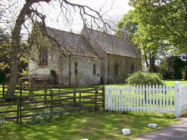
St Helen's Church, North Thoresby

St Helen's Church is the Anglican parish church in the village of North Thoresby in Lincolnshire, England. Built of squared limestone rubble, chalk and...

North Ormsby

North Ormsby (sometimes Ormesby) is a village and civil parish in the East Lindsey district of Lincolnshire, England. It is situated approximately 7 miles...

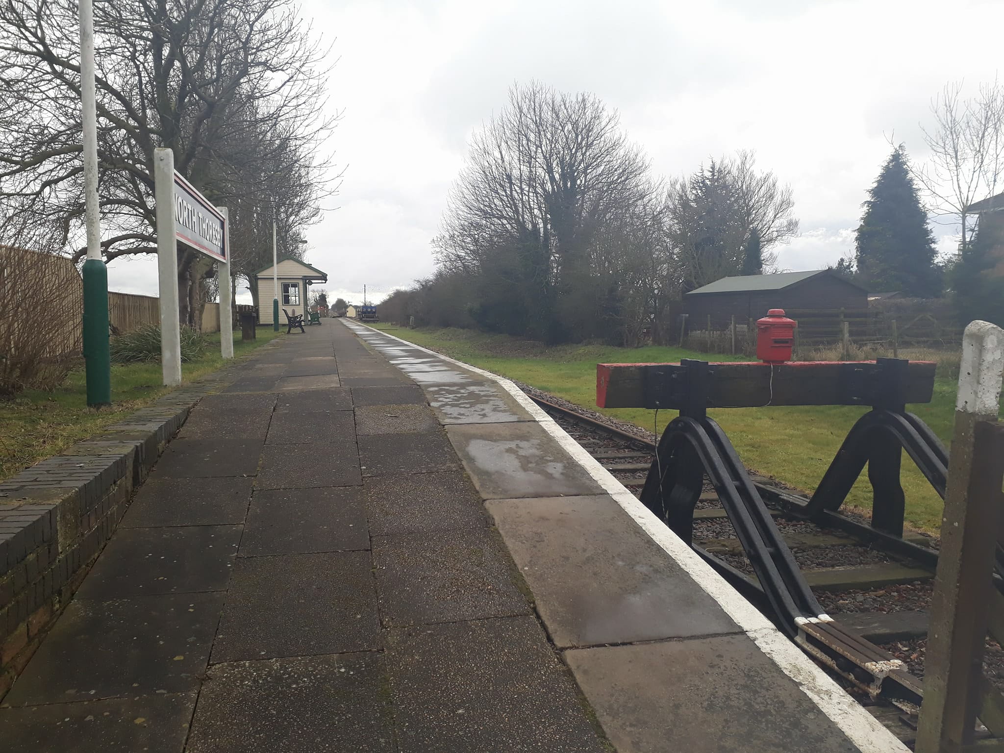
North Thoresby railway station

North Thoresby is a heritage railway station in North Thoresby, Lincolnshire. The station, which was previously part of the East Lincolnshire Railway,...

Nearby Amenities

Located within 500m of 53.451109,-0.096086905
Beesby
Is In: Lincolnshire, England, UK
Place: hamlet
Source: npe
Lat/Long: 53.4501414/-0.0948214
Power: pole
Lat/Long: 53.4478853/-0.0915676
Power: pole
Lat/Long: 53.448526/-0.093065
Power: pole
Lat/Long: 53.4493354/-0.0949266
Power: pole
Lat/Long: 53.4501358/-0.0967612
Power: pole
Lat/Long: 53.4509735/-0.0986816
Power: pole
Lat/Long: 53.4518323/-0.1006231
Power: pole
Lat/Long: 53.4526521/-0.1024806
Power: pole
Lat/Long: 53.4510814/-0.0937432
Power: pole
Lat/Long: 53.4506885/-0.0926811
Power: pole
Lat/Long: 53.4503467/-0.0917798
Power: pole
Lat/Long: 53.4498259/-0.0908947
Power: pole
Lat/Long: 53.4493723/-0.0901973
The data included in this document is from www.openstreetmap.org. The data is made available under ODbL.

Have you been to Beesby Wood?

Leave your review of Beesby Wood below (or comments, questions and feedback).