Begwns

Heritage Site in Radnorshire

Wales

Begwns

Ruin at Bird's Nest Was this once a cottage, or simply a barn?  Situated at the edge of the open common with a fine view across the Wye valley towards the Black Mountains.
Ruin at Bird's Nest Credit: Gordon Hatton

Begwns, located in Radnorshire, is a remarkable heritage site known for its stunning natural beauty and historical significance. Situated in the heart of Wales, this vast expanse of open moorland covers an area of approximately 1,200 acres.

The landscape of Begwns is characterized by rolling hills, heather-clad moorland, and ancient woodlands, offering panoramic views of the surrounding countryside. It is home to a diverse range of flora and fauna, including rare species such as the black grouse and the red kite. The site also boasts a rich archaeological heritage, with numerous prehistoric features scattered across its terrain, including Bronze Age burial mounds and Iron Age hillforts.

Begwns has long been a popular destination for walkers, hikers, and nature enthusiasts. The area is crisscrossed by a network of well-maintained footpaths and trails, offering visitors the opportunity to explore its vast expanse and discover its hidden treasures. There are also several picnic spots, making it an ideal location for a day out in nature.

The heritage site is managed by a local conservation trust, ensuring the preservation of its natural and cultural heritage. The trust organizes regular guided walks and educational events to raise awareness about the importance of protecting this unique landscape.

Begwns is not only a place of natural beauty but also a site of historical significance, offering a glimpse into Wales' ancient past. Its stunning vistas, abundant wildlife, and rich history make it a must-visit destination for anyone seeking to immerse themselves in the natural and cultural heritage of Radnorshire.

If you have any feedback on the listing, please let us know in the comments section below.

Begwns Images

Images are sourced within 2km of 52.09/-3.223 or Grid Reference SO1644. Thanks to Geograph Open Source API. All images are credited.

Ruin at Bird's Nest Was this once a cottage, or simply a barn?  Situated at the edge of the open common with a fine view across the Wye valley towards the Black Mountains.
Ruin at Bird's Nest
Was this once a cottage, or simply a barn? Situated at the edge of the open common with a fine view across the Wye valley towards the Black Mountains.
Cattle on the hillside Cattle resting in the first of the improved pastures below the open common of The Begwns. In the distance are Hay Bluff and Lord Hereford's Knob, separated by the Gospel Pass.
Cattle on the hillside
Cattle resting in the first of the improved pastures below the open common of The Begwns. In the distance are Hay Bluff and Lord Hereford's Knob, separated by the Gospel Pass.
Track junction at the moor edge Two of the many tracks and paths that criss-cross the open area of the Begwns.
Track junction at the moor edge
Two of the many tracks and paths that criss-cross the open area of the Begwns.
Large pond below the Begwns This must be an artificially created pond as it isn't shown on OS maps of 100 years ago.  The distant view is towards the whaleback of Mynydd Troed which reaches 609m.
Large pond below the Begwns
This must be an artificially created pond as it isn't shown on OS maps of 100 years ago. The distant view is towards the whaleback of Mynydd Troed which reaches 609m.
Hillside with gorse The southern fringes of The Begwns area of open moorland, here with grassland and gorse bushes. The view across the Wye valley is towards the northern flanks of the Black Mountains with Hay Bluff to the left.
Hillside with gorse
The southern fringes of The Begwns area of open moorland, here with grassland and gorse bushes. The view across the Wye valley is towards the northern flanks of the Black Mountains with Hay Bluff to the left.
Open country south of The Roundabout Track across the common with a fine view towards Pen-y-Fan, the highest of the Brecon Beacons.
Open country south of The Roundabout
Track across the common with a fine view towards Pen-y-Fan, the highest of the Brecon Beacons.
Trig point close to The Roundabout The trig marks the high point of a stretch of fine open common land now managed by the National Trust. This view looks south towards the distant line of the Black Mountains with Lord Hereford's Knob to the left and Waun Fach, the highest point in the range appearing above the shaded slopes towards the right.
Trig point close to The Roundabout
The trig marks the high point of a stretch of fine open common land now managed by the National Trust. This view looks south towards the distant line of the Black Mountains with Lord Hereford's Knob to the left and Waun Fach, the highest point in the range appearing above the shaded slopes towards the right.
Sheep on the hillside All looking to see if two approaching walkers could be safely ignored or whether it would be better to flee.
Sheep on the hillside
All looking to see if two approaching walkers could be safely ignored or whether it would be better to flee.
Which path to take? Several options for walkers on The Begwns. It would be hard to get lost up here, unless in a thick hill fog.
Which path to take?
Several options for walkers on The Begwns. It would be hard to get lost up here, unless in a thick hill fog.
Sheep on The Begwns The grazed area in the foreground has grass growing where once there was a general cover of bracken. This has been cut back allowing sheep to graze. The view is across the Wye valley towards the big hills on the English side of the border beyond Hay on Wye.
Sheep on The Begwns
The grazed area in the foreground has grass growing where once there was a general cover of bracken. This has been cut back allowing sheep to graze. The view is across the Wye valley towards the big hills on the English side of the border beyond Hay on Wye.
Painscastle Castle
Painscastle Castle
Painscastle Castle
Painscastle Castle
Countryside from Painscastle Castle
Countryside from Llanddewi Fach
The Cwm (Llanddewi Fach)
The Roundabout, The Begwns
Trig Point, The Begwns
Road heading to Clyro Road from Painscastle passing The Begwns heading to Clyro
Road heading to Clyro
Road from Painscastle passing The Begwns heading to Clyro
Show me another place!

Begwns is located at Grid Ref: SO1644 (Lat: 52.09, Lng: -3.223)

Unitary Authority: Powys

Police Authority: Dyfed Powys

What 3 Words

///themes.strikers.manage. Near Hay, Powys

Nearby Locations

Begwns

Related Wikis

Painscastle

Painscastle (Welsh: Castell-paen) is a village and community in Powys (formerly Radnorshire), Wales which takes its name from the castle at its heart....

Painscastle Castle

Painscastle Castle is a castle in the village of Painscastle in Powys, Wales. It lies between Builth and Hay-on-Wye, approximately 3 miles from the Wales...

Painscastle Rural District

Painscastle was, from 1894 to 1974, a rural district in the administrative county of Radnorshire, Wales. The district was formed by the Local Government...

Maesyronnen Chapel

Maesyronnen Chapel is about 1 mile (2 km) north of the village of Glasbury, Powys, Wales (grid reference SO176410). It is designated by Cadw as a Grade...
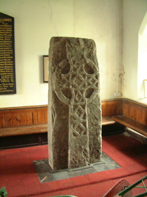
Llowes

Llowes is a small village in the community of Glasbury, Powys, Wales. The village has approximately 110 inhabitants (2005). The nearest town is Hay-on...

Llanstephan, Powys

Llanstephan is a small rural settlement in the community of Glasbury, Powys (formerly Radnorshire), Wales. Llanstephan is centred around the isolated church...

Clyro

Clyro (Welsh: Cleirwy) is a village and community in Radnorshire, Powys, Wales, with 781 inhabitants as of the 2011 UK Census. The nearest town is Hay...

Rhos Goch National Nature Reserve

Rhos Goch National Nature Reserve, located near Painscastle on the England/Wales border, is one of the largest raised bogs in mid and south Wales. ‘Goch...

Related Videos

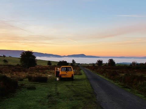
VW Road Trip: Walking in Radnorshire.

A short trip to Radnorshire and Hay on Wye. Walking in the Begwyns and an ascent of Whimble.

We Wish You a Merry Christmas!

A short Christmas video from us to everyone this year :)

Freerein August 2020

Welsh Prince trail.

Nearby Amenities

Located within 500m of 52.09,-3.223
Ford: yes
Source: survey
Lat/Long: 52.0918057/-3.2294985
Bicycle: no
Foot: yes
Horse: no
Motor Vehicle: no
Lat/Long: 52.0918754/-3.2227412
Ford: yes
Lat/Long: 52.0858143/-3.2223397
The data included in this document is from www.openstreetmap.org. The data is made available under ODbL.

Have you been to Begwns?

Leave your review of Begwns below (or comments, questions and feedback).