Bargany

Heritage Site in Ayrshire

Scotland

Bargany

Old mine shaft at Hawkhill Farm A closer look at the old mine shaft at Hawkhill Farm. Killochan Castle is shown in the background on the other side of the Water of Girvan. The top of the strange boulder <a href="https://www.geograph.org.uk/photo/7024967">NS2300 : The strange boulder at Hawkhill Farm</a> is just visible on the left.
Old mine shaft at Hawkhill Farm Credit: Mary and Angus Hogg

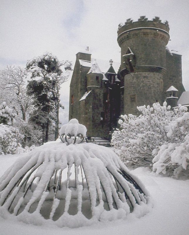
Bargany, located in Ayrshire, Scotland, is a renowned heritage site that holds great historical and cultural significance. This historic mansion, situated near the village of Dailly, is a grand example of Scottish baronial architecture. It was originally built in the early 17th century by the Kennedy family, who were prominent figures in Scottish history.

Bargany has witnessed a multitude of historical events over the centuries. The mansion played a pivotal role during the Wars of Independence and was even visited by King James VI of Scotland. However, during the 18th century, Bargany was tragically destroyed by fire, leaving only ruins behind.

In recent years, efforts have been made to preserve and restore this important heritage site. The ruins have been stabilized, and visitors can now explore the remaining walls and gain insights into its former grandeur. The site also offers guided tours, providing visitors with a deeper understanding of Bargany's rich history and its significance within Scottish culture.

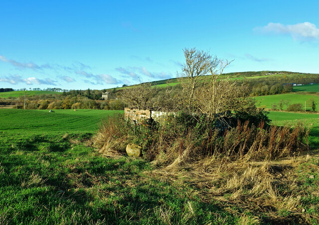
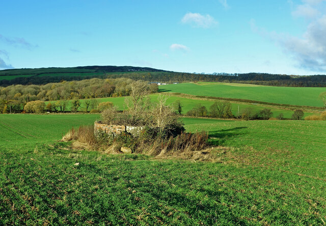
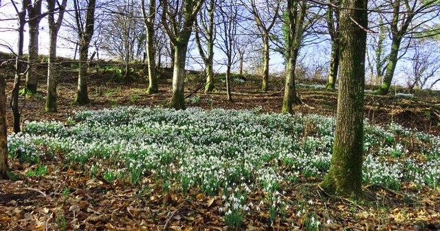
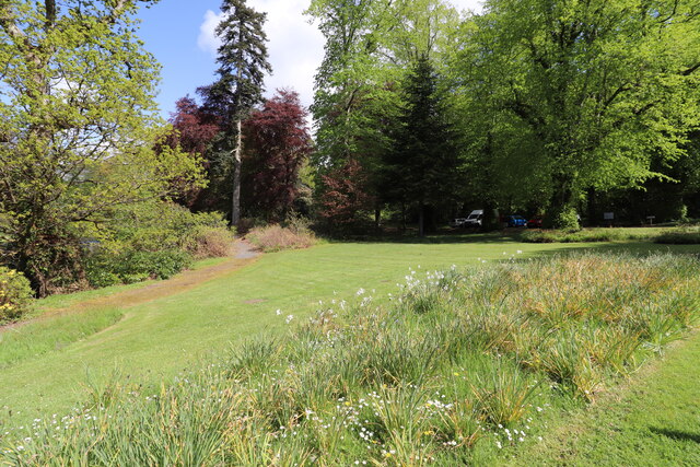
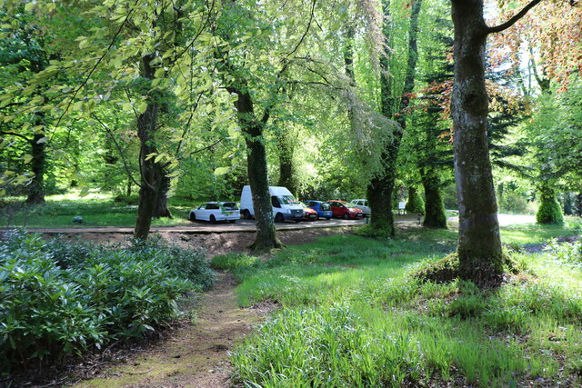
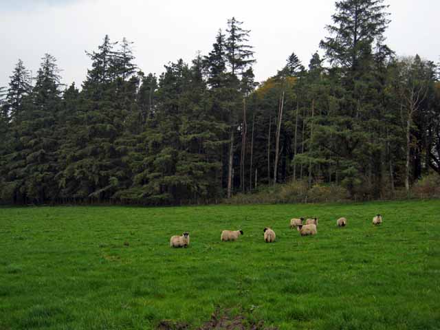
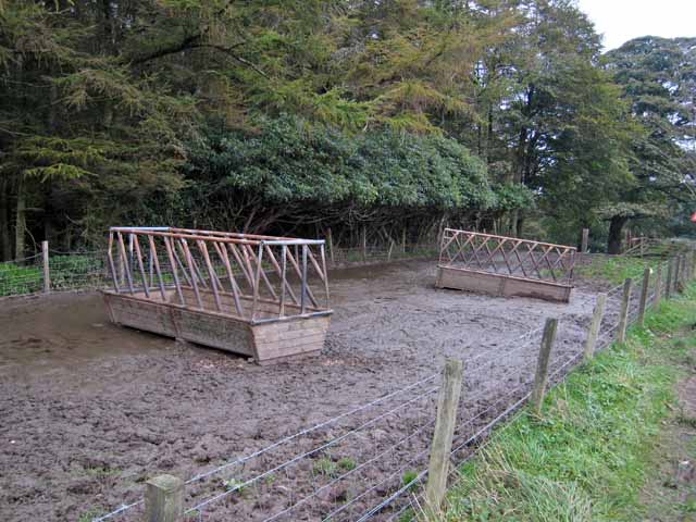
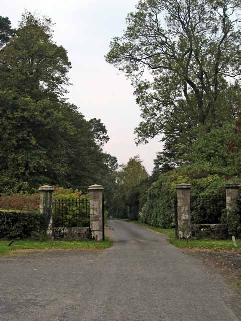
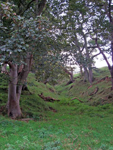
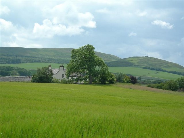
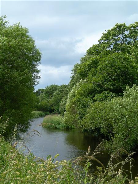
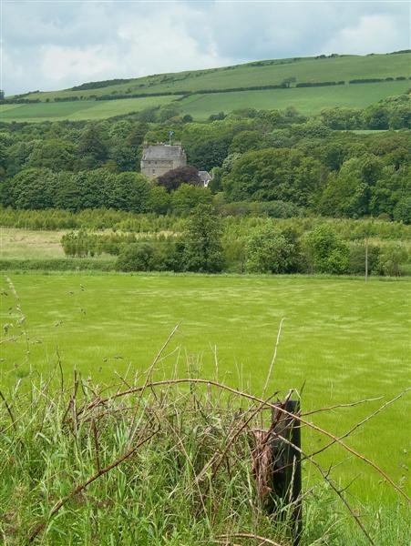
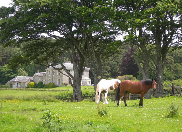
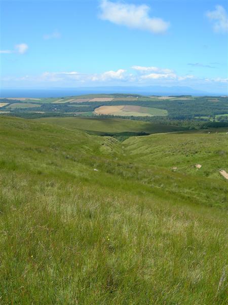
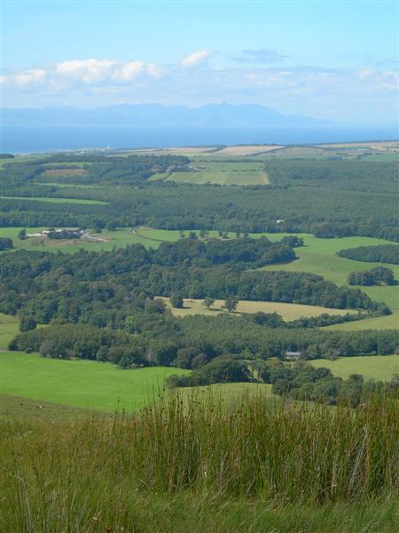
Bargany is not only known for its architectural beauty but also for its picturesque surroundings. The estate is nestled amidst stunning landscapes, with rolling hills, lush greenery, and a nearby river. This natural beauty adds to the allure of the site and attracts nature enthusiasts and history buffs alike.

Today, Bargany stands as a testament to Scotland's fascinating past. Its restoration and preservation efforts have transformed it into a popular tourist destination, allowing visitors to step back in time and immerse themselves in its historical charm.

If you have any feedback on the listing, please let us know in the comments section below.
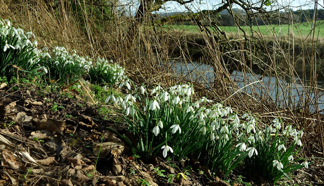
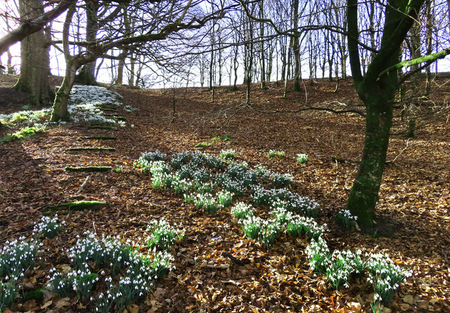
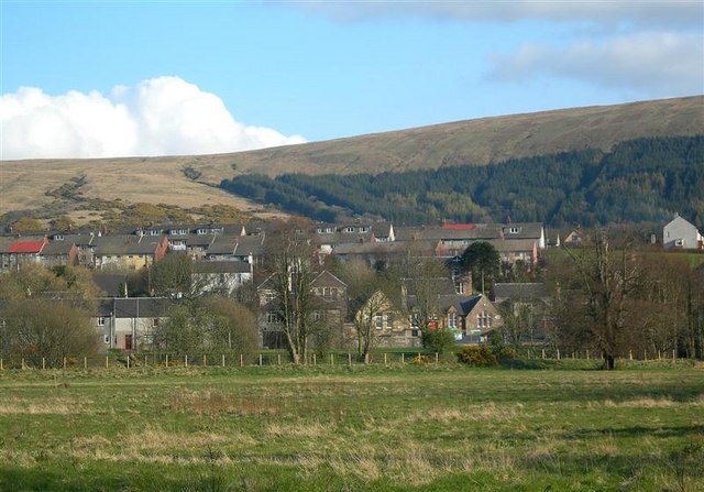
Bargany Images

Images are sourced within 2km of 55.267/-4.763 or Grid Reference NS2400. Thanks to Geograph Open Source API. All images are credited.

Old mine shaft at Hawkhill Farm A closer look at the old mine shaft at Hawkhill Farm. Killochan Castle is shown in the background on the other side of the Water of Girvan. The top of the strange boulder <a href="https://www.geograph.org.uk/photo/7024967">NS2300 : The strange boulder at Hawkhill Farm</a> is just visible on the left.
Old mine shaft at Hawkhill Farm
A closer look at the old mine shaft at Hawkhill Farm. Killochan Castle is shown in the background on the other side of the Water of Girvan. The top of the strange boulder NS2300 : The strange boulder at Hawkhill Farm is just visible on the left.
The old mine shaft at Hawkhill Farm The strange circular structure in the field at Hawkhill Farm is a shaft from an old coal mine, walled off for protection. The main part of the mine was on the other side of the road on Bargany Estate. See <a href="https://www.geograph.org.uk/photo/6783144">NX2399 : Old colliery site near Lovestone</a>
The old mine shaft at Hawkhill Farm
The strange circular structure in the field at Hawkhill Farm is a shaft from an old coal mine, walled off for protection. The main part of the mine was on the other side of the road on Bargany Estate. See NX2399 : Old colliery site near Lovestone
Snowdrops beside the Water of Girvan Occasional patches of snowdrops enjoy the sunshine alongside the Water of Girvan at Killochan Estate. The flowers have to fight their way through the previous year’s brambles and nettles.
Snowdrops beside the Water of Girvan
Occasional patches of snowdrops enjoy the sunshine alongside the Water of Girvan at Killochan Estate. The flowers have to fight their way through the previous year’s brambles and nettles.
Snowdrops in Lovestone woods My previous visit to this site in March 2021 was too late to see the flowers in bloom. The snowdrops were lovely this time though the February sun was only just reaching the slope.
Snowdrops in Lovestone woods
My previous visit to this site in March 2021 was too late to see the flowers in bloom. The snowdrops were lovely this time though the February sun was only just reaching the slope.
Snowdrops near Lovestone These snowdrops were spreading out in the woodland near the old colliery site. My previous visit to this spot <a href="https://www.geograph.org.uk/photo/6783144">NX2399 : Old colliery site near Lovestone</a> was too late to see the flowers in bloom. It was worth the return visit.
Snowdrops near Lovestone
These snowdrops were spreading out in the woodland near the old colliery site. My previous visit to this spot NX2399 : Old colliery site near Lovestone was too late to see the flowers in bloom. It was worth the return visit.
Picnic Area, Bargany Gardens Beautiful Garden but only open for the Month of May.
Picnic Area, Bargany Gardens
Beautiful Garden but only open for the Month of May.
Car Park, Bargany Gardens This is the main car park but there is also and overflow car park. Beautiful Garden but only open for the Month of May.
Car Park, Bargany Gardens
This is the main car park but there is also and overflow car park. Beautiful Garden but only open for the Month of May.
Garryloop, Old Dailly Garryloop is the Anglicized form of "Gearaidh Lub" meaning "The Shieling at the bend between arable and hill ground". Notice how succinct Gaelic is compared with English? An old barn and cobbler's cottage, now rebuilt as comfortable modern accommodation, which operates as a well-appointed bed-and-breakfast and base for deer-stalking holidays. <span class="nowrap"><a title="http://www.ayrstalk.co.uk/accomodation.asp" rel="nofollow ugc noopener" href="http://www.ayrstalk.co.uk/accomodation.asp">Link</a><img style="margin-left:2px;" alt="External link" title="External link - shift click to open in new window" src="https://s1.geograph.org.uk/img/external.png" width="10" height="10"/></span>
Garryloop, Old Dailly
Garryloop is the Anglicized form of "Gearaidh Lub" meaning "The Shieling at the bend between arable and hill ground". Notice how succinct Gaelic is compared with English? An old barn and cobbler's cottage, now rebuilt as comfortable modern accommodation, which operates as a well-appointed bed-and-breakfast and base for deer-stalking holidays. LinkExternal link
Bargany Estate, near Old Dailly The tall trees line the southern driveway into the estate.
Bargany Estate, near Old Dailly
The tall trees line the southern driveway into the estate.
Cattle troughs near Dailly
Gateway to the Bargany Estate Off the Dailly to Old Dailly road.
Gateway to the Bargany Estate
Off the Dailly to Old Dailly road.
Small wooded valley near Dailly
Hawkhill Farm This shot shows a field of barley beside the Water of Girvan, with Hawkhill Farm behind.
Hawkhill Farm
This shot shows a field of barley beside the Water of Girvan, with Hawkhill Farm behind.
Water of Girvan Looking downstream in mid-June, after a night of heavy rain.
Water of Girvan
Looking downstream in mid-June, after a night of heavy rain.
Towards Killochan Castle Looking across the Girvan Valley at a barley field near Hawkhill Farm.  The Saltire is flying over Killochan Castle.
Towards Killochan Castle
Looking across the Girvan Valley at a barley field near Hawkhill Farm. The Saltire is flying over Killochan Castle.
Lovestone House Formerly living accommodation for workers on Bargany Estate.
Now a private house.
Lovestone House
Formerly living accommodation for workers on Bargany Estate. Now a private house.
Moorland burn Looking down Lauchlan Burn, across the Girvan Valley, towards the Firth of Clyde and Arran.
Moorland burn
Looking down Lauchlan Burn, across the Girvan Valley, towards the Firth of Clyde and Arran.
View From Maxwellston Hill Looking across the lower Girvan Valley, towards the Firth of Clyde and Arran, on a fine July afternoon.
View From Maxwellston Hill
Looking across the lower Girvan Valley, towards the Firth of Clyde and Arran, on a fine July afternoon.
Show me another place!

Bargany is located at Grid Ref: NS2400 (Lat: 55.267, Lng: -4.763)

Unitary Authority: South Ayrshire

Police Authority: Ayrshire

What 3 Words

///alerting.swerves.fellow. Near Girvan, South Ayrshire

Related Wikis

Killochan Castle

Killochan Castle is a 16th-century L-plan tower house about 3 miles (4.8 km) north east of Girvan, South Ayrshire, Scotland, north of the Water of Girvan...

Killochan railway station

Killochan railway station was located in a rural part of South Ayrshire, Scotland and mainly served the nearby Killochan Castle estate. The Killochan bank...

Dailly railway station

Dailly railway station served the village of Dailly, South Ayrshire, Scotland, from 1860 to 1965 on the Maybole and Girvan Railway. == History == The station...

Penkill Castle

Penkill Castle is a 16th-century castle with later additions. It is around 1⁄2 mile (800 metres) south of Old Dailly, northeast of Girvan in south Ayrshire...

Dailly

Dailly (Scottish Gaelic: Dail Mhaol Chiarain) is a village in South Ayrshire, Scotland. It is located on the Water of Girvan, five miles (eight kilometres...

Old Dailly

Old Dailly is a hamlet in South Ayrshire, Scotland. It is located west of Dailly (or "New Dailly"). The Charter or Blue stones of Old Dailly in Ayrshire...

Dalquharran Castle

Dalquharran Castle is a category A listed building in South Ayrshire, Scotland, designed by Robert Adam and completed around 1790. The first recorded lord...

Hadyard Hill Wind Farm

Hadyard Hill Wind Farm is located in Carrick district of South Ayrshire. Costing £85 million, the wind farm consists of 52 three-bladed Siemens wind turbines...

Related Videos

The Blue Stones of Old Dailly | Official Clip | Stones | Stonelifting Documentary

An official clip from 'Stones: The Rise, Fall, and Rise of Scottish Stonelifting'. Pre-order the documentary for £6.99, or get your ...

Old Dailly Kirk, Blue Charter Stones and Memorials

Dalmakerran Kirk at Old Dailly dates from before 1200 and its Charter Stones from the feudal lord confirming the ownership of the ...

Nearby Amenities

Located within 500m of 55.267,-4.763
Bargany
Place: hamlet
Lat/Long: 55.2645903/-4.7674248
Power: pole
Lat/Long: 55.2669928/-4.7554018
Power: pole
Lat/Long: 55.2668193/-4.7568986
The data included in this document is from www.openstreetmap.org. The data is made available under ODbL.

Have you been to Bargany?

Leave your review of Bargany below (or comments, questions and feedback).