Ashlack Hall

Heritage Site in Lancashire South Lakeland

England

Ashlack Hall

A595 at Ellermire Bridge
A595 at Ellermire Bridge Credit: Colin Pyle

Ashlack Hall, located in Lancashire, is a heritage site that holds significant historical and architectural value. This grand country house is situated in the picturesque Furness Peninsula, near the village of Broughton-in-Furness. Built in the 18th century, Ashlack Hall exhibits the classic Georgian architectural style, with its elegant symmetrical facade and grand proportions.

The hall is surrounded by acres of stunning landscaped gardens, offering visitors a glimpse into its glorious past. The estate boasts beautiful lawns, vibrant flower beds, and majestic trees, creating a peaceful and tranquil atmosphere. Additionally, the gardens offer breathtaking views of the surrounding countryside and the nearby Estuary of the River Duddon.

Ashlack Hall has a rich history, having been home to various notable families throughout the centuries. Its striking interiors showcase a blend of original period features and modern amenities. The hall's grand reception rooms, adorned with ornate plasterwork and exquisite detailing, are a testament to the wealth and opulence of its former inhabitants.

Today, Ashlack Hall is open to the public and serves as a popular venue for weddings, events, and luxury accommodation. Guests can immerse themselves in the beauty and charm of the estate, exploring its gardens, enjoying traditional afternoon tea, or even staying overnight in one of the hall's luxurious guest rooms.

Ashlack Hall, with its historical significance, remarkable architecture, and stunning surroundings, offers visitors a unique opportunity to experience the grandeur of the past in the heart of Lancashire.

If you have any feedback on the listing, please let us know in the comments section below.

Ashlack Hall Images

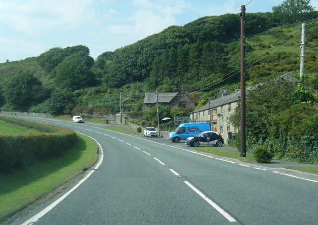
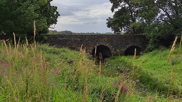
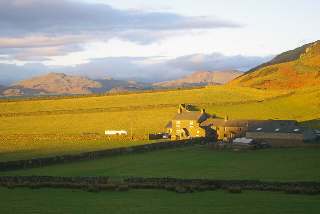
Images are sourced within 2km of 54.26/-3.158 or Grid Reference SD2485. Thanks to Geograph Open Source API. All images are credited.
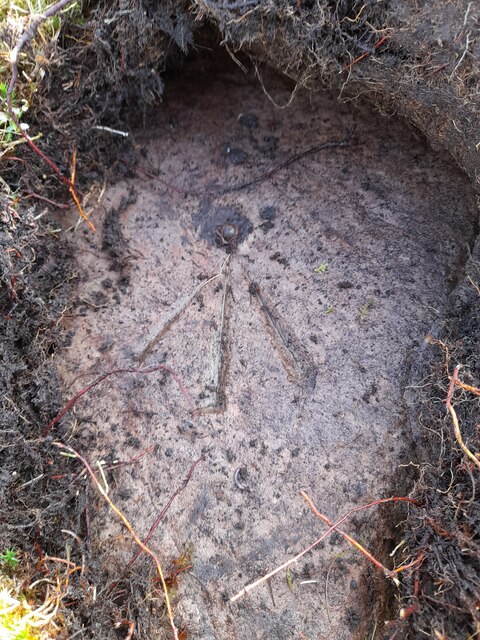
A595 at Ellermire Bridge
Wreaks Causeway End Bridge over Kirkby Pool Wreaks Causeway End Bridge carrying the A595.
Listed Building entry number 1138084. Grade II.
Listing includes carvings on the coping stones of the parapets.
<span class="nowrap"><a title="https://historicengland.org.uk/listing/the-list/list-entry/1138084?section=official-listing" rel="nofollow ugc noopener" href="https://historicengland.org.uk/listing/the-list/list-entry/1138084?section=official-listing">Link</a><img style="margin-left:2px;" alt="External link" title="External link - shift click to open in new window" src="https://s1.geograph.org.uk/img/external.png" width="10" height="10"/></span>
Wreaks Causeway End Bridge over Kirkby Pool
Wreaks Causeway End Bridge carrying the A595. Listed Building entry number 1138084. Grade II. Listing includes carvings on the coping stones of the parapets. LinkExternal link
Carved words on Wreaks Causeway End Bridge Wreaks Causeway End Bridge carrying the A595.
Listed Building entry number 1138084. Grade II.
Listing includes carvings on the coping stones of the parapets.
<span class="nowrap"><a title="https://historicengland.org.uk/listing/the-list/list-entry/1138084?section=official-listing" rel="nofollow ugc noopener" href="https://historicengland.org.uk/listing/the-list/list-entry/1138084?section=official-listing">Link</a><img style="margin-left:2px;" alt="External link" title="External link - shift click to open in new window" src="https://s1.geograph.org.uk/img/external.png" width="10" height="10"/></span>

"Do not stop long at the fair". One of many carvings on the parapets. Many of the stones have been damaged, presumably during bridge widening. Other carvings include "Yellow for ever", "Be kind to the poor", "A sensible man wont offend me and no other can", "Forget me not", "Happy land", "England for ever", "I can paddle my own canoe", "Tomorrow may be silent", "Thomas Dawson post messenger arrives [6 10 a m]".
Carved words on Wreaks Causeway End Bridge
Wreaks Causeway End Bridge carrying the A595. Listed Building entry number 1138084. Grade II. Listing includes carvings on the coping stones of the parapets. LinkExternal link "Do not stop long at the fair". One of many carvings on the parapets. Many of the stones have been damaged, presumably during bridge widening. Other carvings include "Yellow for ever", "Be kind to the poor", "A sensible man wont offend me and no other can", "Forget me not", "Happy land", "England for ever", "I can paddle my own canoe", "Tomorrow may be silent", "Thomas Dawson post messenger arrives [6 10 a m]".
Moorhouse Farm After a generally dull day, a burst of afternoon sunshine picks out the fells beyond Moorhouse Farm.
Moorhouse Farm
After a generally dull day, a burst of afternoon sunshine picks out the fells beyond Moorhouse Farm.
Ordnance Survey Flush Bracket (G2834) This OS Flush Bracket can be found on the north buttress of Wreaks Causeway Bridge. It marks a point 6.471m above mean sea level.
Ordnance Survey Flush Bracket (G2834)
This OS Flush Bracket can be found on the north buttress of Wreaks Causeway Bridge. It marks a point 6.471m above mean sea level.
Ordnance Survey Rivet This OS rivet can be found on a rock south side of the road. It marks a point 200.156m above mean sea level.
Ordnance Survey Rivet
This OS rivet can be found on a rock south side of the road. It marks a point 200.156m above mean sea level.
Remains of OSBM Bolt The hole and remains of bolt thread can be found on a large boulder in field wall. It marked a point 170.505m above mean sea level.
Remains of OSBM Bolt
The hole and remains of bolt thread can be found on a large boulder in field wall. It marked a point 170.505m above mean sea level.
Ordnance Survey Rivet This OS rivet can be found on the wall east side of Woodlands Road. It marks a point 79.376m above mean sea level.
Ordnance Survey Rivet
This OS rivet can be found on the wall east side of Woodlands Road. It marks a point 79.376m above mean sea level.
Ordnance Survey Rivet This OS rivet can be found on the wall west side of Woodlands Road. It marks a point 93.637m above mean sea level.
Ordnance Survey Rivet
This OS rivet can be found on the wall west side of Woodlands Road. It marks a point 93.637m above mean sea level.
Ordnance Survey Rivet This OS rivet can be found on the wall east side of Woodlands Road. It marks a point 69.758m above mean sea level.
Ordnance Survey Rivet
This OS rivet can be found on the wall east side of Woodlands Road. It marks a point 69.758m above mean sea level.
Ordnance Survey Rivet This OS rivet can be found on the rock south side of the road. It marks a point 202.140m above mean sea level.
Ordnance Survey Rivet
This OS rivet can be found on the rock south side of the road. It marks a point 202.140m above mean sea level.
Ordnance Survey Flush Bracket (S7106) This OS Flush Bracket can be found on old school building which is now a private property. It marks a point 14.673m above mean sea level.
Ordnance Survey Flush Bracket (S7106)
This OS Flush Bracket can be found on old school building which is now a private property. It marks a point 14.673m above mean sea level.
Ordnance Survey Cut Mark This OS cut mark can be found on the NE parapet of Ellermire Bridge. It marks a point 11.408m above mean sea level.
Ordnance Survey Cut Mark
This OS cut mark can be found on the NE parapet of Ellermire Bridge. It marks a point 11.408m above mean sea level.
Ordnance Survey Cut Mark This OS cut mark can be found on the house which was once the Mission Church. It marks a point 12.722m above mean sea level.
Ordnance Survey Cut Mark
This OS cut mark can be found on the house which was once the Mission Church. It marks a point 12.722m above mean sea level.
Ordnance Survey Cut Mark This OS cut mark can be found on the gatepost east side of Woodlands Road. It marks a point 34.203m above mean sea level.
Ordnance Survey Cut Mark
This OS cut mark can be found on the gatepost east side of Woodlands Road. It marks a point 34.203m above mean sea level.
Ordnance Survey Cut Mark This OS cut mark can be found on the gatepost of The Hermitage. It marks a point 29.942m above mean sea level.
Ordnance Survey Cut Mark
This OS cut mark can be found on the gatepost of The Hermitage. It marks a point 29.942m above mean sea level.
Ordnance Survey Cut Mark This hidden OS cut mark can be found on the wall SW side of the road. It marks a point 32.935m above mean sea level.
Ordnance Survey Cut Mark
This hidden OS cut mark can be found on the wall SW side of the road. It marks a point 32.935m above mean sea level.
Hallstead Farm
Hallstead Farm
Show me another place!

Ashlack Hall is located at Grid Ref: SD2485 (Lat: 54.26, Lng: -3.158)

Administrative County: Cumbria

District: South Lakeland

Police Authority: Cumbria

What 3 Words

///contained.threading.splashes. Near Ulverston, Cumbria

Related Wikis

Beanthwaite

Beanthwaite is a hamlet in Cumbria, England.

Burney (hill)

Burney is a hill in Cumbria, England, to the north of the A5092 road between Greenodd and Broughton-in-Furness. It is the subject of a chapter of Wainwright...

Kirkby Slate Quarries

Kirkby Slate Quarries, formally known as Burlington Slate Quarries, are located near Kirkby-in-Furness in Cumbria, England. The quarries have produced...

Kirkby Moor

Kirkby Moor is a poorly defined moorland area in southern Cumbria, England, named after the village of Kirkby-in-Furness, but stretching both sides of...

Nearby Amenities

Located within 500m of 54.26,-3.158
Barrier: stile
Lat/Long: 54.2584793/-3.1542768
Power: pole
Lat/Long: 54.2562378/-3.1574296
Power: pole
Lat/Long: 54.2562881/-3.1557738
Power: pole
Lat/Long: 54.2563892/-3.1546654
Power: pole
Lat/Long: 54.2572173/-3.1561894
Power: pole
Lat/Long: 54.2580523/-3.1564903
Power: pole
Lat/Long: 54.2589258/-3.1568368
Power: pole
Lat/Long: 54.2597794/-3.1572176
The data included in this document is from www.openstreetmap.org. The data is made available under ODbL.

Have you been to Ashlack Hall?

Leave your review of Ashlack Hall below (or comments, questions and feedback).