Aberedw Castle

Heritage Site in Radnorshire

Wales

Aberedw Castle

Ordnance Survey Cut Mark This OS cut mark can be found on the brick pump stand NE side of the road. It marks a point 130.700m above mean sea level.
Ordnance Survey Cut Mark Credit: Adrian Dust

Aberedw Castle, located in Radnorshire, Wales, is a historical site that holds significant cultural and architectural importance. Dating back to the 11th century, the castle stands on the banks of the River Wye and showcases the rich history of the region.

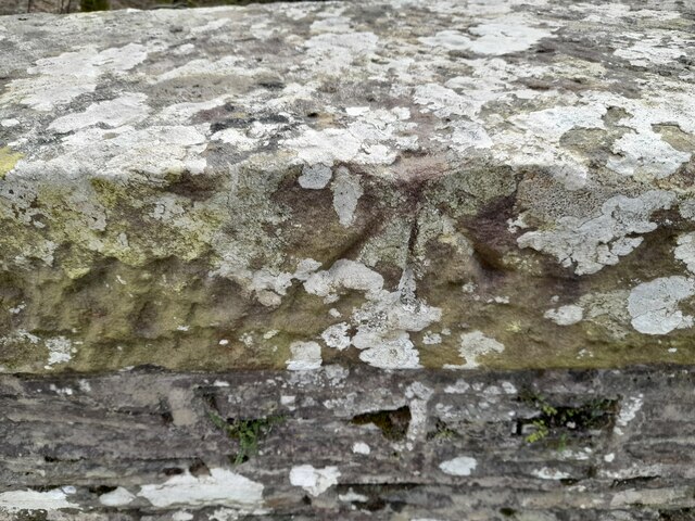
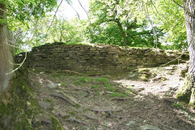
Originally built as a motte and bailey castle, Aberedw Castle was constructed by the Normans as a strategic stronghold during the Norman conquest of Wales. Over the centuries, the castle underwent several architectural transformations, evolving into a fortified manor house with a stone keep and a surrounding curtain wall.

The castle played a vital role in the medieval conflicts between the Welsh and English, witnessing various sieges and battles. It changed hands multiple times, reflecting the turbulent history of the region. Today, the ruins of Aberedw Castle offer visitors a glimpse into its former grandeur, with remnants of the keep, curtain wall, and a gatehouse still visible.

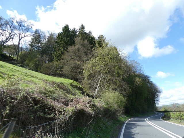
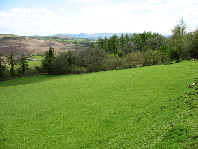
The castle's strategic location, amidst the breathtaking natural beauty of the Radnorshire countryside, makes it an ideal destination for history enthusiasts and nature lovers alike. Visitors can explore the castle ruins, imagining the lives of its former inhabitants and appreciating the stunning views of the River Wye.

Aberedw Castle, designated as a heritage site, is managed by the local authorities and is open to the public. It serves as a reminder of the region's historical significance and offers a unique opportunity to experience the rich cultural heritage of Radnorshire.

If you have any feedback on the listing, please let us know in the comments section below.

Aberedw Castle Images

Images are sourced within 2km of 52.118/-3.35 or Grid Reference SO0747. Thanks to Geograph Open Source API. All images are credited.

Ordnance Survey Cut Mark This OS cut mark can be found on the brick pump stand NE side of the road. It marks a point 130.700m above mean sea level.
Ordnance Survey Cut Mark
This OS cut mark can be found on the brick pump stand NE side of the road. It marks a point 130.700m above mean sea level.
Ordnance Survey Rivet This damaged OS rivet can be found on the SW parapet of the bridge. It marks a point 127.703m above mean sea level.
Ordnance Survey Rivet
This damaged OS rivet can be found on the SW parapet of the bridge. It marks a point 127.703m above mean sea level.
Chapel Plantation
Chapel Plantation
Trees by the track to Ysgiog
Approaching Aberedw Rocks
Pantau, Aberedw
Pantau, Aberedw
Llewelyn's Cave, Aberedw
St Cewydd's, Aberedw
View to part of Aberedw Rocks from the A470 road A cold day but the Rocks look as inviting as ever. One of my favourite spots in all of Wales.
View to part of Aberedw Rocks from the A470 road
A cold day but the Rocks look as inviting as ever. One of my favourite spots in all of Wales.
Aberedw Rocks on a February afternoon The sun warms the hillside but the near side of the valley above the mighty River Wye is cold and still.
Aberedw Rocks on a February afternoon
The sun warms the hillside but the near side of the valley above the mighty River Wye is cold and still.
The fields of Hendy Farm Seen from the Wye Valley Walk.
The fields of Hendy Farm
Seen from the Wye Valley Walk.
Above the River Wye At this point the Wye Valley Walk follows a minor road for about 2 kilometres.
The pronounced top in the distance is Twmpa (Lord Hereford's Knob).
Above the River Wye
At this point the Wye Valley Walk follows a minor road for about 2 kilometres. The pronounced top in the distance is Twmpa (Lord Hereford's Knob).
Coed-yr-aber Taken from the Wye Valley Walk. The River itself can just be seen at the bottom right of this photo.
Coed-yr-aber
Taken from the Wye Valley Walk. The River itself can just be seen at the bottom right of this photo.
The River Edw near Aberedw Getting overgrown in summer.
The River Edw near Aberedw
Getting overgrown in summer.
Llywelyn's cave near Aberedw Always worth a visit.
Llywelyn's cave near Aberedw
Always worth a visit.
Fox in the field This fox was preoccupied with eating and I was able to watch him for several minutes before attracting his attention.
Fox in the field
This fox was preoccupied with eating and I was able to watch him for several minutes before attracting his attention.
Preoccupied Fox in the field He was absorbed in what he was doing so I was able to observe undetected and take a few shots before he made good his escape.
Preoccupied Fox in the field
He was absorbed in what he was doing so I was able to observe undetected and take a few shots before he made good his escape.
Fox fleeing After staring at me for 30 seconds or so while I whistled, snapped my finger and attempted to mimic a baby animal this young fox at last understood that maybe he should turn tail. Off he trotted and with a lithe bound vanished through the fence and hedge here.
Fox fleeing
After staring at me for 30 seconds or so while I whistled, snapped my finger and attempted to mimic a baby animal this young fox at last understood that maybe he should turn tail. Off he trotted and with a lithe bound vanished through the fence and hedge here.
Show me another place!

Aberedw Castle is located at Grid Ref: SO0747 (Lat: 52.118, Lng: -3.35)

Unitary Authority: Powys

Police Authority: Dyfed Powys

What 3 Words

///staring.dozed.blackouts. Near Builth Wells, Powys

Related Wikis

Aberedw railway station

Aberedw railway station served the village of Aberedw in Powys, Wales. Aberedw Castle was demolished to build the station and some of the stone from the...

Aberedw

Aberedw is a village and community in Radnorshire, Powys, Wales. The community covers an area of 3,055 hectares (11.80 sq mi). Its population was 229,...

Aberedw Castle

The remains of Aberedw Castle, also known as 'Castle in Elfael Uwch Mynydd', are located at the small village of Aberedw in the county of Powys, Mid-Wales...

Alltmawr

Alltmawr is a village in the community of Erwood, Powys, Wales, which is 44 miles (71 km) from Cardiff and 144 miles (232 km) from London. St Mauritius...

District of Radnorshire

The District of Radnorshire (Welsh: Maesyfed) was one of three local government districts of the county of Powys, Wales, from 1974 until 1996. The district...

Llanfaredd Halt railway station

Llanfaredd Halt railway station was an unstaffed railway station opened by the Great Western Railway on 7 May 1934 on the old Mid-Wales line between Builth...

Brecon and Radnorshire (UK Parliament constituency)

Brecon and Radnorshire (Welsh: Brycheiniog a Sir Faesyfed) is a county constituency in Wales of the House of Commons of the Parliament of the United Kingdom...

Brecon and Radnorshire (Senedd constituency)

Brecon and Radnorshire (Welsh: Brycheiniog a Sir Faesyfed) is a constituency of the Senedd. It elects one Member of the Senedd by the first past the post...

Nearby Amenities

Located within 500m of 52.118,-3.35
Aberedw
Is In: Powys,Wales,UK
Place: village
Source: npe
Wikidata: Q4667057
Lat/Long: 52.1170369/-3.3462025
Post Box
Post Box Type: lamp
Royal Cypher: EIIR
Royal Cypher Wikidata: Q33102113
Lat/Long: 52.1172357/-3.3469902
Pub
The Seven Stars
Wikidata: Q80858727
Lat/Long: 52.1166854/-3.3451415
Place: farm
Lat/Long: 52.1187708/-3.3453205
Post Office
Aberedw Post Office
Addr City: Builth Wells
Addr Country: GB
Addr Housename: Aberedw Church Hall
Addr Place: Aberedw
Addr Postcode: LD2 3UH
Brand: Post Office
Brand Wikidata: Q1783168
Fixme: verify by survey
Opening Hours: We 12:15-14:15
Ref Pol Id: 135403
Source: pol_branch_list_2019-10-29
Website: https://www.postoffice.co.uk/branch-finder/4134710/aberedw
Lat/Long: 52.11816/-3.35057
Direction: SSW
Generator Method: photovoltaic
Generator Output Electricity: yes
Generator Solar Modules: 17
Generator Source: solar
Generator Type: solar_photovoltaic_panel
Location: roof
Power: generator
Lat/Long: 52.1167113/-3.3459914
Direction: 215
Generator Method: photovoltaic
Generator Output Electricity: yes
Generator Solar Modules: 4
Generator Source: solar
Generator Type: solar_photovoltaic_panel
Location: roof
Power: generator
Lat/Long: 52.1176509/-3.3490491
Direction: 215
Generator Method: photovoltaic
Generator Output Electricity: yes
Generator Solar Modules: 8
Generator Source: solar
Generator Type: solar_photovoltaic_panel
Location: roof
Power: generator
Lat/Long: 52.1175949/-3.3491772
Direction: SSW
Generator Method: photovoltaic
Generator Output Electricity: yes
Generator Solar Modules: 10
Generator Source: solar
Generator Type: solar_photovoltaic_panel
Location: roof
Power: generator
Lat/Long: 52.1171066/-3.3464071
Direction: 35
Generator Method: photovoltaic
Generator Output Electricity: yes
Generator Solar Modules: 4
Generator Source: solar
Generator Type: solar_photovoltaic_panel
Location: roof
Power: generator
Lat/Long: 52.1176196/-3.3491389
The data included in this document is from www.openstreetmap.org. The data is made available under ODbL.

Have you been to Aberedw Castle?

Leave your review of Aberedw Castle below (or comments, questions and feedback).