Abergeldie Castle

Heritage Site in Aberdeenshire

Scotland

Abergeldie Castle

Way to Dalraddie House (July 2012) Dalraddie - 'dark red haugh' [Watson & Allen (1984)]. A sign by the access point from the B976.
Way to Dalraddie House (July 2012) Credit: Stanley Howe

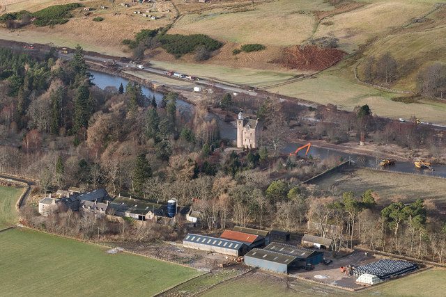
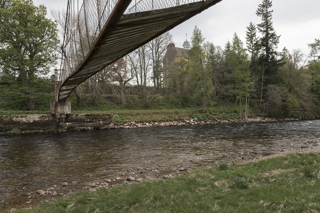
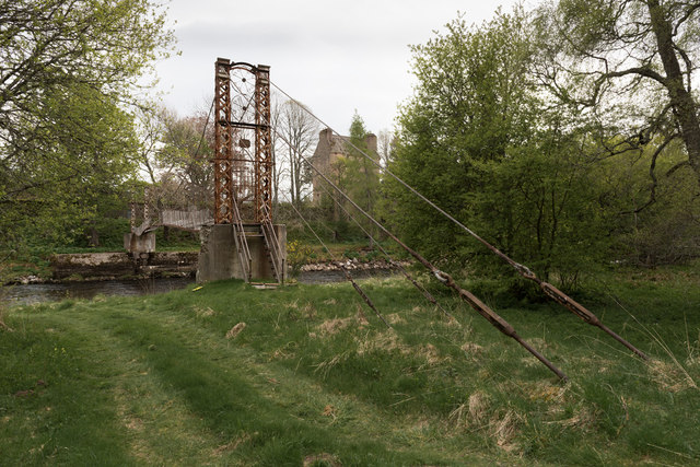
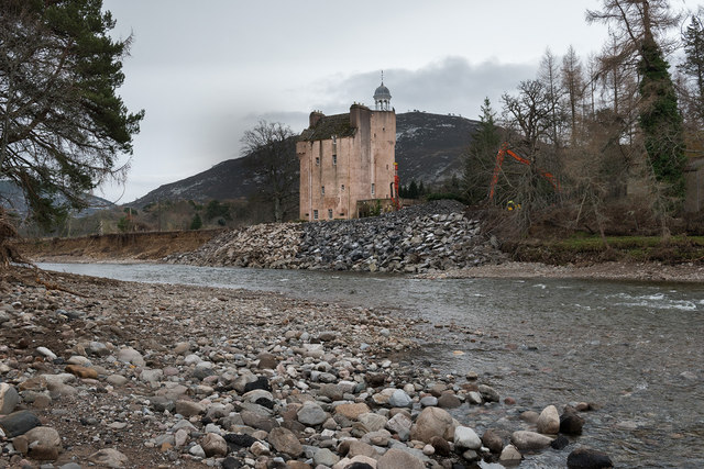
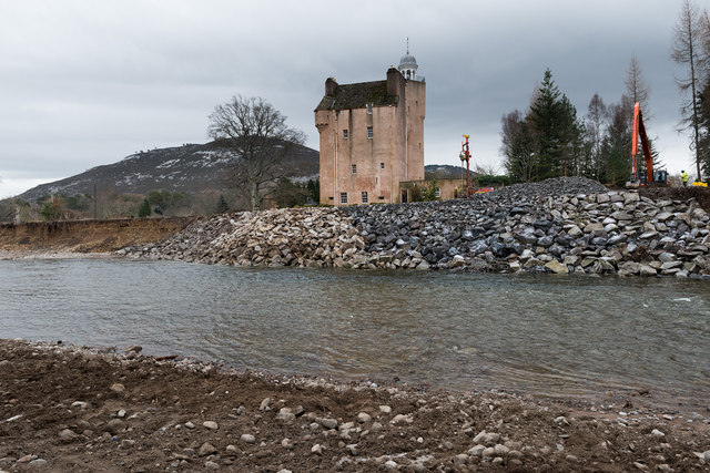
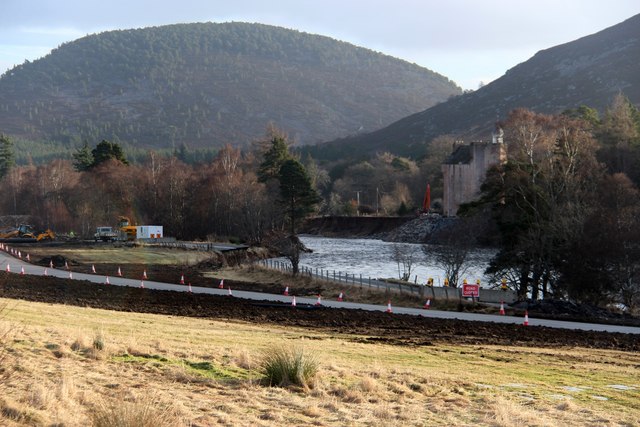
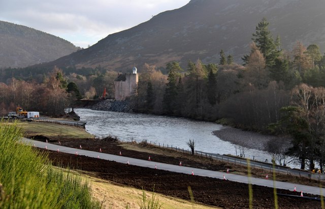
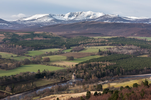
Abergeldie Castle, located in Aberdeenshire, Scotland, is a historic heritage site that dates back to the 16th century. Situated near the River Dee, this castle has a rich history and is known for its architectural beauty and stunning surroundings.

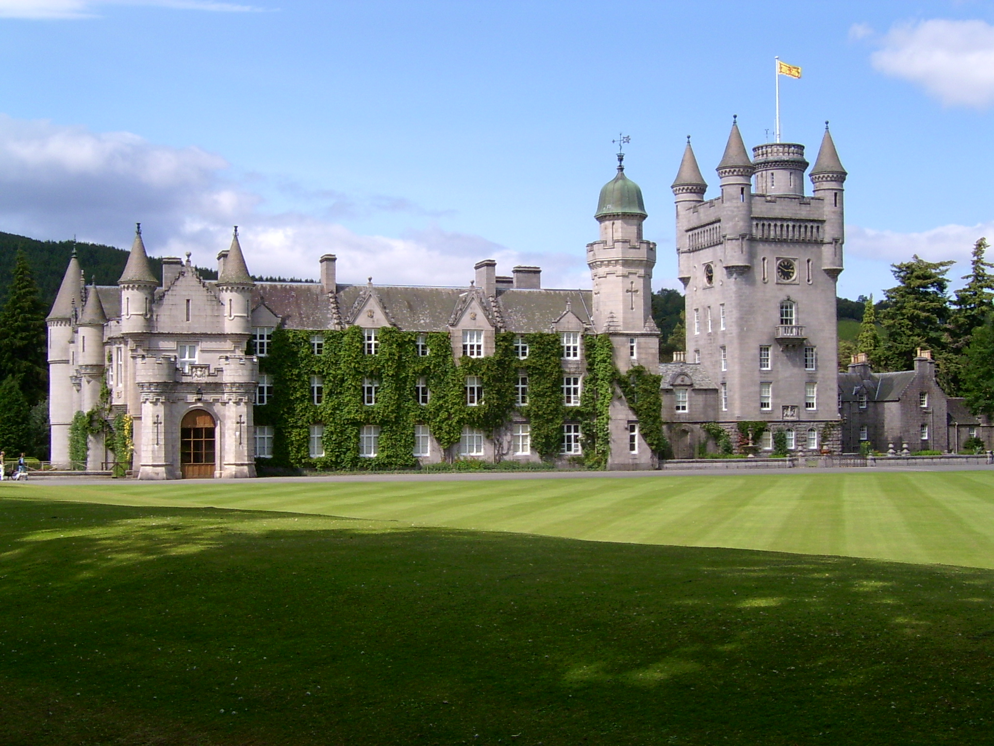
The castle was originally built as a tower house by Sir Alexander Gordon of Midmar in the 1550s. It was later extended and modified in the 17th and 19th centuries, resulting in its current appearance. The castle features a combination of medieval and Victorian architectural styles, with its thick stone walls, turrets, and crow-stepped gables adding to its grandeur.

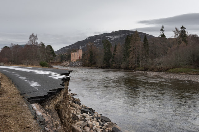
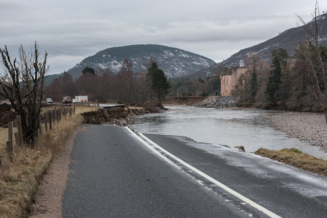
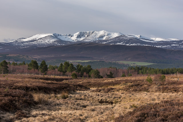
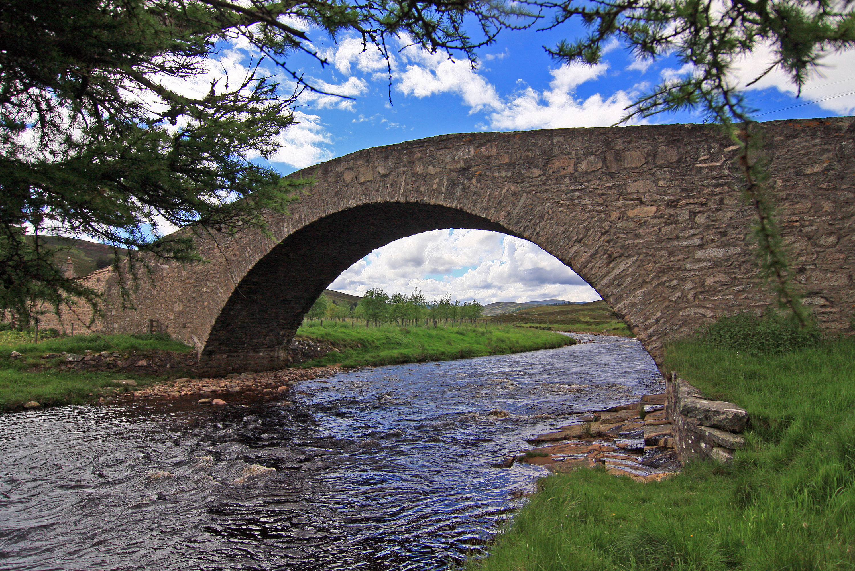
Surrounded by picturesque landscapes, Abergeldie Castle offers breathtaking views of the Scottish countryside. The River Dee flows nearby, providing a serene and tranquil atmosphere. The castle is also located close to the Cairngorms National Park, making it an ideal base for exploring the surrounding natural beauty.

Despite its historical significance, Abergeldie Castle is not open to the public. It is a private property and serves as a residence for the current owners. However, its exterior can still be admired from a distance, allowing visitors to appreciate its architectural splendor and capture stunning photographs.

Abergeldie Castle stands as a testament to Scotland's rich history and architectural heritage. Its majestic presence and idyllic location make it a prominent landmark in Aberdeenshire, attracting visitors from near and far who appreciate its historical and aesthetic value.

If you have any feedback on the listing, please let us know in the comments section below.

Abergeldie Castle Images

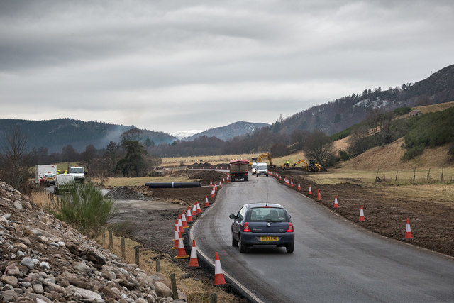
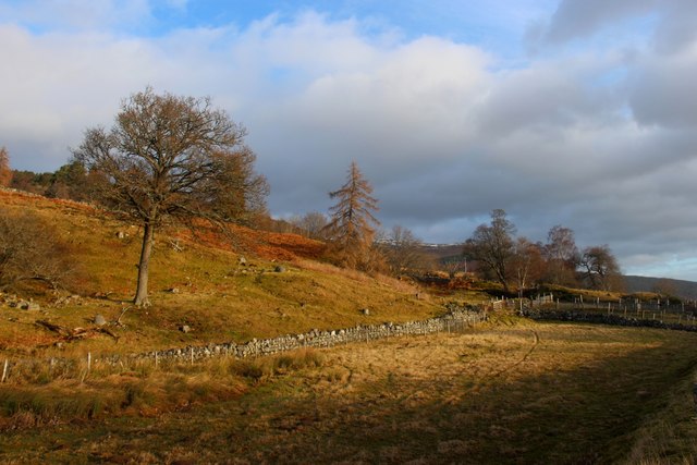
Images are sourced within 2km of 57.045/-3.178 or Grid Reference NO2895. Thanks to Geograph Open Source API. All images are credited.

Way to Dalraddie House (July 2012) Dalraddie - 'dark red haugh' [Watson & Allen (1984)]. A sign by the access point from the B976.
Way to Dalraddie House (July 2012)
Dalraddie - 'dark red haugh' [Watson & Allen (1984)]. A sign by the access point from the B976.
Wood near Dalraddie House Thinning of the commercial forest to the side of the track has resulted in more light on the birch trees
Wood near Dalraddie House
Thinning of the commercial forest to the side of the track has resulted in more light on the birch trees
Abergeldie and Micras - after the flood The flood of December 2015 removed a large section of the bank of the River Dee close to Abergeldie Castle as well as causing part of the A93 road at nearby Micras to collapse into the river.  The photograph shows work in progress to reinforce the river bank at the castle.  Meanwhile a temporary road to bypass the collapsed part of the A93 is nearing completion.
Abergeldie and Micras - after the flood
The flood of December 2015 removed a large section of the bank of the River Dee close to Abergeldie Castle as well as causing part of the A93 road at nearby Micras to collapse into the river. The photograph shows work in progress to reinforce the river bank at the castle. Meanwhile a temporary road to bypass the collapsed part of the A93 is nearing completion.
Abergeldie suspension bridge The footbridge was built in 1885 at Queen Victoria's expense for the benefit of her guests using Abergeldie Castle.  It was destroyed by the flood of December 2015.
Abergeldie suspension bridge
The footbridge was built in 1885 at Queen Victoria's expense for the benefit of her guests using Abergeldie Castle. It was destroyed by the flood of December 2015.
Abergeldie suspension bridge The footbridge was built in 1885 at Queen Victoria's expense for the benefit of her guests using Abergeldie Castle. It was destroyed by the flood of December 2015.
Abergeldie suspension bridge
The footbridge was built in 1885 at Queen Victoria's expense for the benefit of her guests using Abergeldie Castle. It was destroyed by the flood of December 2015.
A93 at Micras after the flood The flood of December 2015 caused severe erosion of both the left and right banks of the River Dee at Micras and nearby Abergeldie.  Part of the A93 road from Ballater to Braemar collapsed into the river.
A93 at Micras after the flood
The flood of December 2015 caused severe erosion of both the left and right banks of the River Dee at Micras and nearby Abergeldie. Part of the A93 road from Ballater to Braemar collapsed into the river.
New road at Micras The flood of December 2015 caused severe erosion of the banks of the River Dee at Micras.  Part of the A93 road from Ballater to Braemar collapsed into the river however Aberdeenshire Council quickly constructed a temporary road to bypass the damaged section.
New road at Micras
The flood of December 2015 caused severe erosion of the banks of the River Dee at Micras. Part of the A93 road from Ballater to Braemar collapsed into the river however Aberdeenshire Council quickly constructed a temporary road to bypass the damaged section.
New road at Micras The flood of December 2015 caused severe erosion of the banks of the River Dee at Micras. Part of the A93 road from Ballater to Braemar collapsed into the river however Aberdeenshire Council quickly constructed a temporary road to bypass the damaged section.
New road at Micras
The flood of December 2015 caused severe erosion of the banks of the River Dee at Micras. Part of the A93 road from Ballater to Braemar collapsed into the river however Aberdeenshire Council quickly constructed a temporary road to bypass the damaged section.
Abergeldie Castle after the flood The flood of December 2015 caused severe erosion of the river bank at Abergeldie Castle. The castle was left only a few feet from a large drop down to the river.  The photograph shows work in progress to reinforce the bank around the castle.
Abergeldie Castle after the flood
The flood of December 2015 caused severe erosion of the river bank at Abergeldie Castle. The castle was left only a few feet from a large drop down to the river. The photograph shows work in progress to reinforce the bank around the castle.
Crofthouse at Gerach
Rough grazing at Torgalter
Flood damaged A93 at Abergeldie A new stretch has been laid over the field to rejoin Braemar and Ballater. Work has also been done to save Abergeldie Castle from collapse.
Flood damaged A93 at Abergeldie
A new stretch has been laid over the field to rejoin Braemar and Ballater. Work has also been done to save Abergeldie Castle from collapse.
A quiet River Dee hides its destructive power A quick patchup has reopened the A93 but the town of Ballater, downstream, will take at least a year to recover from the recent flood damage.
A quiet River Dee hides its destructive power
A quick patchup has reopened the A93 but the town of Ballater, downstream, will take at least a year to recover from the recent flood damage.
Torgalter Burn Morning light on the moorland above Torgalter below The Maim.  Lochnagar is in the distance.
Torgalter Burn
Morning light on the moorland above Torgalter below The Maim. Lochnagar is in the distance.
Abergeldie Castle below Lochnagar The castle is situated close to the River Dee.  The major flood of December 2015 caused severe erosion of the river bank near to the castle.  The work which was done to repair the bank and protect the castle is clearly visible.
Abergeldie Castle below Lochnagar
The castle is situated close to the River Dee. The major flood of December 2015 caused severe erosion of the river bank near to the castle. The work which was done to repair the bank and protect the castle is clearly visible.
Show me another place!

Abergeldie Castle is located at Grid Ref: NO2895 (Lat: 57.045, Lng: -3.178)

Unitary Authority: Aberdeenshire

Police Authority: North East

What 3 Words

///choppers.tiredness.imported. Near Ballater, Aberdeenshire

Related Wikis

Nearby Amenities

Located within 500m of 57.045,-3.178
Mains of Abergeldie
Place: hamlet
Lat/Long: 57.0423757/-3.1737207
Power: pole
Lat/Long: 57.047799/-3.1727149
Power: pole
Lat/Long: 57.0477478/-3.1740479
Power: pole
Lat/Long: 57.0476968/-3.1726744
Power: pole
Lat/Long: 57.0475537/-3.1740852
Power: pole
Lat/Long: 57.0474195/-3.1752943
Power: pole
Lat/Long: 57.0471806/-3.1775096
Power: pole
Lat/Long: 57.0470077/-3.1784169
Power: pole
Lat/Long: 57.0476292/-3.1765511
Power: pole
Lat/Long: 57.0475852/-3.1777567
Power: pole
Lat/Long: 57.0472696/-3.1789193
Power: pole
Lat/Long: 57.046934/-3.180086
Power: pole
Lat/Long: 57.0463081/-3.1823793
Power: pole
Lat/Long: 57.0460265/-3.1834146
Power: pole
Lat/Long: 57.0458018/-3.1844339
Power: pole
Lat/Long: 57.0467297/-3.1797695
Power: pole
Lat/Long: 57.0462424/-3.1820038
Power: pole
Lat/Long: 57.0459346/-3.1834254
Power: pole
Lat/Long: 57.0456617/-3.1847182
Power: pole
Lat/Long: 57.0454093/-3.1858581
Public Bookcase
Booth: K6
Colour: red
Man Made: telephone_box
Public Bookcase Type: phone_box
Lat/Long: 57.0413043/-3.177474
Post Box
Brand: Royal Mail
Brand Wikidata: Q638098
Operator: Royal Mail
Operator Wikidata: Q638098
Post Box Design: 2010_pattern
Post Box Type: lamp
Ref: AB35 100
Royal Cypher: scottish_crown
Lat/Long: 57.0411426/-3.1777941
Power: pole
Lat/Long: 57.047691/-3.1752474
Power: pole
Lat/Long: 57.0472846/-3.176545
Power: pole
Lat/Long: 57.0464409/-3.1810936
Power: pole
Lat/Long: 57.0466238/-3.1812227
Power: pole
Lat/Long: 57.0455899/-3.1854087
Power: pole
Lat/Long: 57.041783/-3.1735373
Power: pole
Lat/Long: 57.043443/-3.1749597
Power: pole
Lat/Long: 57.0437481/-3.17389
Power: pole
Lat/Long: 57.0440594/-3.1727481
Power: pole
Lat/Long: 57.0443771/-3.1715571
Power: pole
Lat/Long: 57.0439368/-3.1712448
Power: pole
Lat/Long: 57.0434209/-3.1708416
Power: pole
Lat/Long: 57.0441766/-3.1757373
Power: pole
Lat/Long: 57.0446893/-3.1761883
Power: pole
Lat/Long: 57.0453749/-3.1766162
The data included in this document is from www.openstreetmap.org. The data is made available under ODbL.

Have you been to Abergeldie Castle?

Leave your review of Abergeldie Castle below (or comments, questions and feedback).