Woodhill Fold

Settlement in Lancashire

England

Woodhill Fold

East Lancashire Railway - City of Wells coming under Jubilee Way One of Bulleid's light Pacific 4-6-2 locomotives in unrebuilt (spam can) form. I recall it was getting rather gloomy at that time of year. Approaching the platforms at Bury Bolton Street Station.
East Lancashire Railway - City of Wells coming under Jubilee Way Credit: Chris Allen

Woodhill Fold is a charming village located in the county of Lancashire, England. Situated amidst picturesque countryside, it offers a tranquil and idyllic setting for residents and visitors alike. The village is nestled within the larger Ribble Valley region, renowned for its natural beauty and historical significance.

Woodhill Fold is a small community with a population of approximately 500 residents. The village is characterized by its quaint and well-preserved architecture, featuring traditional stone houses and cottages that exude a sense of rustic charm. The streets are lined with vibrant gardens, adding to the overall visual appeal of the area.

The village offers a range of amenities to cater to residents' needs. A local convenience store provides essential groceries, while a post office ensures easy access to postal services. Additionally, there is a community center that serves as a social hub, hosting various events and activities throughout the year.

Woodhill Fold boasts a strong sense of community spirit, with residents actively participating in local initiatives and organizations. The village holds regular events, such as summer fairs and Christmas markets, which foster a sense of togetherness among its inhabitants.

Surrounded by stunning countryside, Woodhill Fold offers ample opportunities for outdoor activities. The village is encompassed by rolling hills and lush green fields, making it an ideal destination for hiking, cycling, and leisurely walks. For nature enthusiasts, nearby forests and nature reserves provide the perfect backdrop for birdwatching and wildlife spotting.

In summary, Woodhill Fold is a picturesque village in Lancashire that offers a peaceful and close-knit community experience. Its charming architecture, beautiful surroundings, and strong community spirit make it an appealing place to live or visit for those seeking a serene countryside escape.

If you have any feedback on the listing, please let us know in the comments section below.

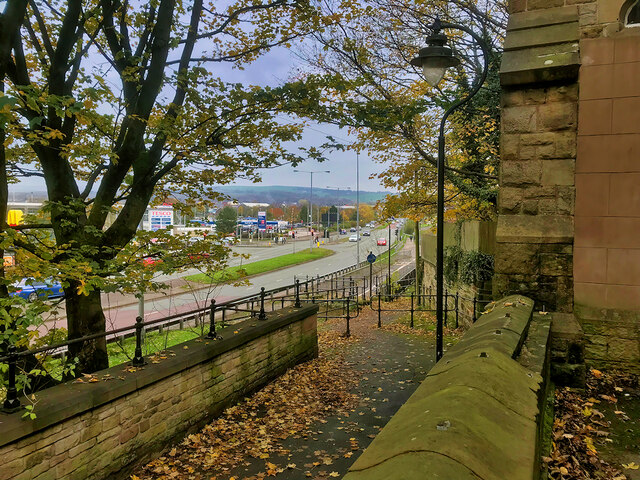
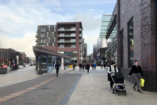
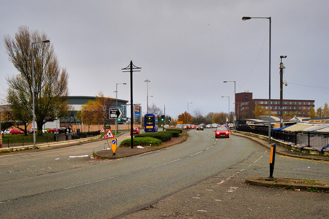
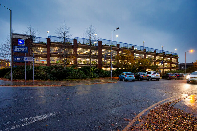
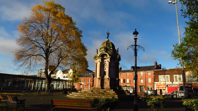
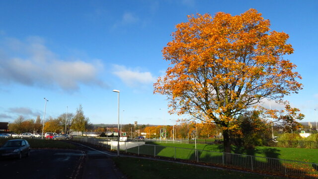
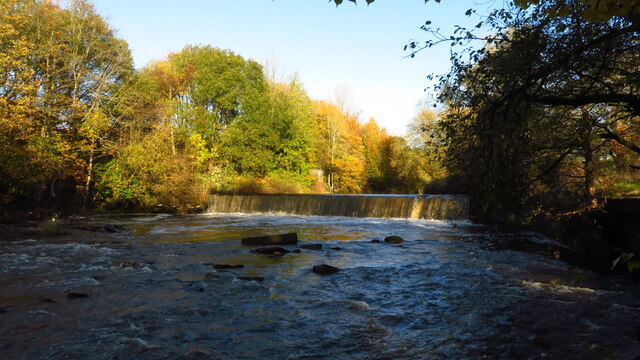
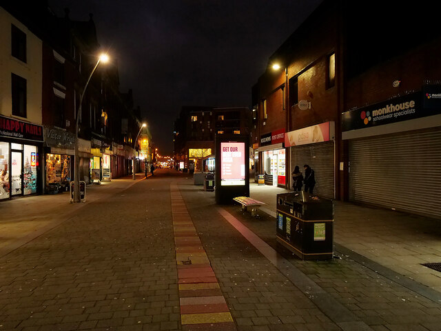
Woodhill Fold Images

Images are sourced within 2km of 53.598535/-2.3057319 or Grid Reference SD7911. Thanks to Geograph Open Source API. All images are credited.

East Lancashire Railway - City of Wells coming under Jubilee Way One of Bulleid's light Pacific 4-6-2 locomotives in unrebuilt (spam can) form. I recall it was getting rather gloomy at that time of year. Approaching the platforms at Bury Bolton Street Station.
East Lancashire Railway - City of Wells coming under Jubilee Way
One of Bulleid's light Pacific 4-6-2 locomotives in unrebuilt (spam can) form. I recall it was getting rather gloomy at that time of year. Approaching the platforms at Bury Bolton Street Station.
Pacer DMU at Buckley Wells (East Lancashire Railway) Ex-Northern Rail 144009 was one of 23 class 144 Pacer Diesel Multiple Units (DMUs) built for British Rail between 1986 and 1987; all were withdrawn by May 2020 as they did not meet new disability regulations (<span class="nowrap"><a title="https://www.railwaymagazine.co.uk/1984/northern-pacer-withdrawals-scheduled-to-begin-in-2018/" rel="nofollow ugc noopener" href="https://www.railwaymagazine.co.uk/1984/northern-pacer-withdrawals-scheduled-to-begin-in-2018/">Link</a><img style="margin-left:2px;" alt="External link" title="External link - shift click to open in new window" src="https://s1.geograph.org.uk/img/external.png" width="10" height="10"/></span>  The Railway Magazine 19 April 2017).

144009 was acquired by Greater Manchester Fire & Rescue Service (GMFRS) and moved to the East Lancashire Railway by road in September 2020 for temporary storage at the Buckley Wells yard awaiting its final movement to the GMFRS Bury Training and Safety Centre nearby (<a href="https://www.geograph.org.uk/photo/5802695">SD7910 : GMFRS Training and Safety Centre, Wellington Street</a>). 144009 is currently fully operational and the fire service agreed for it to operate a few services at the East Lancashire Railway’s 2020 railcar gala. This event was cancelled due to Covid-19 so the runs did not take place but the set did appear in passenger service during the ELR Diesel Gala event in summer 2021.

Recently repainted in the fictitious livery of “Great Midlands Trains” for a filming contract, it is expected that 144009 will be used by GMFRS as a training aid for staff and so operation as a train again will be extremely unlikely once it has been transferred to the fire service.
Pacer DMU at Buckley Wells (East Lancashire Railway)
Ex-Northern Rail 144009 was one of 23 class 144 Pacer Diesel Multiple Units (DMUs) built for British Rail between 1986 and 1987; all were withdrawn by May 2020 as they did not meet new disability regulations (LinkExternal link The Railway Magazine 19 April 2017). 144009 was acquired by Greater Manchester Fire & Rescue Service (GMFRS) and moved to the East Lancashire Railway by road in September 2020 for temporary storage at the Buckley Wells yard awaiting its final movement to the GMFRS Bury Training and Safety Centre nearby (SD7910 : GMFRS Training and Safety Centre, Wellington Street). 144009 is currently fully operational and the fire service agreed for it to operate a few services at the East Lancashire Railway’s 2020 railcar gala. This event was cancelled due to Covid-19 so the runs did not take place but the set did appear in passenger service during the ELR Diesel Gala event in summer 2021. Recently repainted in the fictitious livery of “Great Midlands Trains” for a filming contract, it is expected that 144009 will be used by GMFRS as a training aid for staff and so operation as a train again will be extremely unlikely once it has been transferred to the fire service.
East Lancashire Railway, Bolton Street Station A view of Bolton Street Station, through the Jubilee Way Bridge.
East Lancashire Railway, Bolton Street Station
A view of Bolton Street Station, through the Jubilee Way Bridge.
Preserved DMU at Bolton Street Station (East Lancashire Railway)
Burrs Mill Pond Former mill pond at Burrs Country Park.
Burrs Mill Pond
Former mill pond at Burrs Country Park.
Path behind St Mary's Parish Rooms, Bury Footpath leading from The Wylde towards Peel Way.
Path behind St Mary's Parish Rooms, Bury
Footpath leading from The Wylde towards Peel Way.
Tributes at Bury War Memorial Some of the wreaths that were laid at Bury's war memorial on Remembrance Sunday 2021.

Bury War Memorial was unveiled in 1924, by the Earl of Derby. It stands at the corner of Market Place and The Rock outside St Mary's, the Parish Church of Bury. The memorial, which is Grade II*-listed (<span class="nowrap"><a title="https://historicengland.org.uk/listing/the-list/list-entry/1444845" rel="nofollow ugc noopener" href="https://historicengland.org.uk/listing/the-list/list-entry/1444845">Link</a><img style="margin-left:2px;" alt="External link" title="External link - shift click to open in new window" src="https://s1.geograph.org.uk/img/external.png" width="10" height="10"/></span> Historic England List Entry Number: 1444845), takes the form of a tall stone cross rising from an octagonal base which is flanked by a curving wall on which are two rectangular bronze panels. The panels have compositions comprising a procession of military and civilian figures.
Tributes at Bury War Memorial
Some of the wreaths that were laid at Bury's war memorial on Remembrance Sunday 2021. Bury War Memorial was unveiled in 1924, by the Earl of Derby. It stands at the corner of Market Place and The Rock outside St Mary's, the Parish Church of Bury. The memorial, which is Grade II*-listed (LinkExternal link Historic England List Entry Number: 1444845), takes the form of a tall stone cross rising from an octagonal base which is flanked by a curving wall on which are two rectangular bronze panels. The panels have compositions comprising a procession of military and civilian figures.
The War Memorial, Market Place, Bury Bury War Memorial was unveiled in 1924, by the Earl of Derby. It stands at the corner of Market Place and The Rock outside St Mary's, the Parish Church of Bury. The memorial, which is Grade II*-listed (<span class="nowrap"><a title="https://historicengland.org.uk/listing/the-list/list-entry/1444845" rel="nofollow ugc noopener" href="https://historicengland.org.uk/listing/the-list/list-entry/1444845">Link</a><img style="margin-left:2px;" alt="External link" title="External link - shift click to open in new window" src="https://s1.geograph.org.uk/img/external.png" width="10" height="10"/></span> Historic England List Entry Number: 1444845), takes the form of a tall stone cross rising from an octagonal base which is flanked by a curving wall on which are two rectangular bronze panels. The panels have compositions comprising a procession of military and civilian figures.

See <a href="https://www.geograph.org.uk/photo/7020418">SD8010 : Tributes at Bury War Memorial</a> for a closer look.
The War Memorial, Market Place, Bury
Bury War Memorial was unveiled in 1924, by the Earl of Derby. It stands at the corner of Market Place and The Rock outside St Mary's, the Parish Church of Bury. The memorial, which is Grade II*-listed (LinkExternal link Historic England List Entry Number: 1444845), takes the form of a tall stone cross rising from an octagonal base which is flanked by a curving wall on which are two rectangular bronze panels. The panels have compositions comprising a procession of military and civilian figures. See SD8010 : Tributes at Bury War Memorial for a closer look.
The Rock, Bury
The Rock, Bury
Santa at the Millgate The giant figure of Father Christmas at the Millgate Shopping Centre in Bury.
Santa at the Millgate
The giant figure of Father Christmas at the Millgate Shopping Centre in Bury.
Bury, Angouleme Way Part of the ring road around Bury town centre.
Bury, Angouleme Way
Part of the ring road around Bury town centre.
Bury, St John's Square Centre of the Rock shopping centre.
Bury, St John's Square
Centre of the Rock shopping centre.
Millgate Car Park, Bury Multi-storey car park attached to Bury's Millgate Centre.
Millgate Car Park, Bury
Multi-storey car park attached to Bury's Millgate Centre.
Bury - Kay Gardens & Monument
Bury - Parish Church & Peel Monument
Bury - Autumn colours by Jubilee Way
Bury - Weir on River Irwell off Woodhill Road
The Rock, Bury
The Rock, Bury
Show me another place!

Woodhill Fold is located at Grid Ref: SD7911 (Lat: 53.598535, Lng: -2.3057319)

Unitary Authority: Bury

Police Authority: Greater Manchester

What 3 Words

///weep.steps.editor. Near Bury, Manchester

Related Wikis

Woodhill Road Halt railway station

Woodhill Road Halt was a stopping point on the Bury to Holcombe Brook Line from 1905 until 1918 and from 1934 until the line closed in 1952. == History... ==

Brandlesholme Road Halt railway station

Brandlesholme Road Halt was a stopping point on the Bury to Holcombe Brook railway line from 1905 until the line closed in 1952. == History == The line...

Ramsbottom Urban District

Ramsbottom Urban District was, from 1894 to 1974, a local government district of the administrative county of Lancashire, England. Its area was coterminate...

Bury power station

Bury power stations are two generating stations that supplied electricity to the town of Bury, Lancashire and the surrounding area from 1896 to 1970. They...

Nearby Amenities

Located within 500m of 53.598535,-2.3057319
Mini Roundabout
Direction: clockwise
Lat/Long: 53.6014/-2.3051398
Crossing
Crossing: unmarked
Crossing Island: no
Crossing Markings: no
Tactile Paving: yes
Traffic Calming: table
Lat/Long: 53.6018364/-2.30458
Traffic Signals
Lat/Long: 53.5945037/-2.3045168
Crossing
Bicycle: yes
Crossing: traffic_signals
Crossing Island: no
Crossing Markings: dots
Crossing Ref: toucan
Tactile Paving: yes
Lat/Long: 53.601832/-2.3101263
Traffic Signals
Traffic Signals: signal
Lat/Long: 53.5945146/-2.3081115
Traffic Signals
Lat/Long: 53.5946533/-2.3032562
Traffic Signals
Lat/Long: 53.5946829/-2.3030997
Traffic Signals
Lat/Long: 53.5947743/-2.3033259
Traffic Signals
Traffic Signals: signal
Traffic Signals Direction: forward
Lat/Long: 53.5965375/-2.3093452
Police
Bury Police Station
Lat/Long: 53.5959684/-2.3023547
Bus Stop
Crostons Road/Bury Bridge
Bus: yes
Naptan AtcoCode: 1800NC20071
Naptan Bearing: E
Naptan CommonName: Crostons Road/Bury Bridge
Naptan Indicator: Homex Ltd
Naptan Landmark: EVANS HALSHAW
Naptan NaptanCode: mandpgjp
Naptan PlusbusZoneRef: MNCRPIC
Naptan ShortCommonName: Bury Bridge
Naptan Street: BOLTON STREET
Naptan Verified: no
Network: TfGM
Public Transport: platform
Source: naptan_import
Lat/Long: 53.5948322/-2.3083355
Bus Stop
Tottington Road/Whittle Street
Bus: yes
Naptan AtcoCode: 1800NC20641
Naptan Bearing: NW
Naptan CommonName: Tottington Road/Whittle Street
Naptan Indicator: Bakery
Naptan Landmark: BAKERY
Naptan NaptanCode: mandpjdw
Naptan PlusbusZoneRef: MNCRPIC
Naptan ShortCommonName: Whittle Street
Naptan Street: TOTTINGTON ROAD
Naptan Verified: no
Network: TfGM
Public Transport: platform
Source: naptan_import
Lat/Long: 53.5983733/-2.3119274
Bus Stop
Tottington Road/Whittle Street
Bus: yes
Naptan AtcoCode: 1800NC20651
Naptan Bearing: SE
Naptan CommonName: Tottington Road/Whittle Street
Naptan Indicator: Garden Centre
Naptan Landmark: GARDEN CENTRE
Naptan NaptanCode: mandpjga
Naptan PlusbusZoneRef: MNCRPIC
Naptan ShortCommonName: Whittle Street
Naptan Street: TOTTINGTON ROAD
Naptan Verified: no
Network: TfGM
Public Transport: platform
Source: naptan_import
Lat/Long: 53.5982307/-2.311458
Bus Stop
Tottington Road/Walshaw Road
Bus: yes
Naptan AtcoCode: 1800NC20661
Naptan Bearing: SE
Naptan CommonName: Tottington Road/Walshaw Road
Naptan Indicator: O/s Woodcharm
Naptan Landmark: WOODCHARM
Naptan NaptanCode: mandpjgd
Naptan PlusbusZoneRef: MNCRPIC
Naptan ShortCommonName: Walshaw Road
Naptan Street: TOTTINGTON ROAD
Naptan Verified: no
Network: TfGM
Public Transport: platform
Source: naptan_import
Lat/Long: 53.5968694/-2.3095592
Bus Stop
Waterloo Street/Bury Bridge
Bus: yes
Naptan AtcoCode: 1800NC20671
Naptan Bearing: N
Naptan CommonName: Waterloo Street/Bury Bridge
Naptan Indicator: Sullavan Mtl Se
Naptan Landmark: SILLAVAN WORKS
Naptan NaptanCode: mandpjgj
Naptan PlusbusZoneRef: MNCRPIC
Naptan ShortCommonName: Bury Bridge
Naptan Street: WATERLOO STREET
Naptan Verified: no
Network: TfGM
Public Transport: platform
Source: naptan_import
Lat/Long: 53.5946136/-2.3094369
Bus Stop
Woodhill Road/Lichfield Drive
Bus: yes
Naptan AtcoCode: 1800NC21591
Naptan Bearing: NE
Naptan CommonName: Woodhill Road/Lichfield Drive
Naptan Indicator: House 71
Naptan Landmark: HOUSE 69
Naptan NaptanCode: mandpmwg
Naptan Notes: INDICATOR AMENDED
Naptan PlusbusZoneRef: MNCRPIC
Naptan ShortCommonName: Lichfield Drive
Naptan Street: WOODHILL ROAD
Naptan Verified: no
Network: TfGM
Public Transport: platform
Source: naptan_import
Lat/Long: 53.6018886/-2.3046543
Bus Stop
Woodhill Road/Lichfield Drive
Bus: yes
Naptan AtcoCode: 1800NC21601
Naptan Bearing: SW
Naptan CommonName: Woodhill Road/Lichfield Drive
Naptan Indicator: Op House 69
Naptan Landmark: RIVERSIDE WORKS
Naptan NaptanCode: mandpmwj
Naptan Notes: LOCATION AMENDED
Naptan PlusbusZoneRef: MNCRPIC
Naptan ShortCommonName: Lichfield Drive
Naptan Street: WOODHILL ROAD
Naptan Verified: no
Network: TfGM
Public Transport: platform
Source: naptan_import
Lat/Long: 53.6014925/-2.3048932
Bus Stop
Woodhill Road/Logwood Avenue
Bus: yes
Naptan AtcoCode: 1800NC21611
Naptan Bearing: NE
Naptan CommonName: Woodhill Road/Logwood Avenue
Naptan Indicator: O/s House 15
Naptan Landmark: HOUSE 15
Naptan NaptanCode: mandpmwm
Naptan PlusbusZoneRef: MNCRPIC
Naptan ShortCommonName: Logwood Avenue
Naptan Street: WOODHILL ROAD
Naptan Verified: no
Network: TfGM
Public Transport: platform
Source: naptan_import
Lat/Long: 53.5995092/-2.3071607
Bus Stop
Woodhill Road/Logwood Avenue
Bus: yes
Naptan AtcoCode: 1800NC21621
Naptan Bearing: SW
Naptan CommonName: Woodhill Road/Logwood Avenue
Naptan Indicator: O/s House 34
Naptan Landmark: HOUSE 34
Naptan NaptanCode: mandpmwp
Naptan PlusbusZoneRef: MNCRPIC
Naptan ShortCommonName: Logwood Avenue
Naptan Street: WOODHILL ROAD
Naptan Verified: no
Network: TfGM
Public Transport: platform
Source: naptan_import
Lat/Long: 53.5995548/-2.3069344
Bus Stop
Brandlesholme Road/Woodhill Street
Bus: yes
Naptan AtcoCode: 1800NC22961
Naptan Bearing: N
Naptan CommonName: Brandlesholme Road/Woodhill Street
Naptan Indicator: Nr Open Land
Naptan Landmark: BP GARAGE
Naptan NaptanCode: mandtadm
Naptan PlusbusZoneRef: MNCRPIC
Naptan ShortCommonName: Woodhill Street
Naptan Street: Brandleshlme Road
Naptan Verified: no
Network: TfGM
Public Transport: platform
Source: naptan_import
Lat/Long: 53.6000159/-2.3093857
Bus Stop
Brandlesholme Road/Woodhill Street
Bus: yes
Naptan AtcoCode: 1800NC22971
Naptan Bearing: S
Naptan CommonName: Brandlesholme Road/Woodhill Street
Naptan Indicator: O/s Norwich Dr
Naptan Landmark: NORWICH DRIVE
Naptan NaptanCode: mandtadp
Naptan Notes: INDICATOR AMENDED
Naptan PlusbusZoneRef: MNCRPIC
Naptan ShortCommonName: Woodhill Street
Naptan Street: Brandleshlme Road
Naptan Verified: no
Network: TfGM
Public Transport: platform
Source: naptan_import
Lat/Long: 53.5997563/-2.3089607
Bus Stop
Crostons Road/Merton Street
Bus: yes
Naptan AtcoCode: 1800NC22981
Naptan Bearing: N
Naptan CommonName: Crostons Road/Merton Street
Naptan Indicator: O/s House 159
Naptan Landmark: HOUSE 159
Naptan NaptanCode: mandtadt
Naptan PlusbusZoneRef: MNCRPIC
Naptan ShortCommonName: Merton Street
Naptan Street: CROSTONS ROAD
Naptan Verified: no
Network: TfGM
Public Transport: platform
Source: naptan_import
Lat/Long: 53.5978781/-2.3087959
Bus Stop
Crostons Road/Tottington Road
Bus: yes
Naptan AtcoCode: 1800NC22991
Naptan Bearing: S
Naptan CommonName: Crostons Road/Tottington Road
Naptan Indicator: Opp House 97
Naptan Landmark: WORKS UNIT
Naptan NaptanCode: mandtadw
Naptan PlusbusZoneRef: MNCRPIC
Naptan ShortCommonName: Tottington Road
Naptan Street: CROSTONS ROAD
Naptan Verified: no
Network: TfGM
Public Transport: platform
Source: naptan_import
Lat/Long: 53.5967995/-2.3088032
Bus Stop
Crostons Road/Bury Bridge
Bus: yes
Naptan AtcoCode: 1800NC23001
Naptan Bearing: N
Naptan CommonName: Crostons Road/Bury Bridge
Naptan Indicator: B & Q
Naptan Landmark: B&Q
Naptan NaptanCode: mandtaga
Naptan PlusbusZoneRef: MNCRPIC
Naptan ShortCommonName: Bury Bridge
Naptan Street: CROSTONS ROAD
Naptan Verified: no
Network: TfGM
Public Transport: platform
Source: naptan_import
Lat/Long: 53.595395/-2.3096844
Traffic Signals
Traffic Signals: signal
Lat/Long: 53.5945528/-2.3086925
Mini Roundabout
Direction: clockwise
Lat/Long: 53.5964908/-2.3030385
Turning Circle
Source: bing
Lat/Long: 53.5977483/-2.2996669
Crossing
Crossing: uncontrolled
Crossing Island: yes
Crossing Markings: dots
Tactile Paving: yes
Lat/Long: 53.5962195/-2.3089444
Pub
Help Me Thro
Addr City: Bury
Addr Housenumber: 141-143
Addr Postcode: BL8 1AL
Addr Street: Crostons Road
Fhrs Id: 365147
Source Addr: FHRS Open Data
Lat/Long: 53.5974131/-2.3089255
Power: substation
Lat/Long: 53.5951491/-2.3050802
Crossing
Crossing: unmarked
Lat/Long: 53.5948443/-2.3093284
Traffic Signals
Traffic Signals: signal
Lat/Long: 53.5945153/-2.3085945
Traffic Signals
Traffic Signals: signal
Lat/Long: 53.5946436/-2.3079088
Traffic Signals
Traffic Signals: signal
Lat/Long: 53.5947551/-2.3083877
Barrier: cycle_barrier
Bicycle: yes
Foot: yes
Motor Vehicle: no
Lat/Long: 53.6017923/-2.3044214
Barrier: bollard
Bicycle: yes
Foot: yes
Motor Vehicle: no
Lat/Long: 53.601867/-2.3046919
Woodhill
Place: quarter
Lat/Long: 53.599592/-2.3118134
Woodhill Fold
Place: quarter
Lat/Long: 53.5978414/-2.3070491
Millennium Milepost Bury
Description: 1) Manchester11, Radcliffe 3 2) Preston 36, Ramsbottom 5.75
Image: https://www.cyclestreets.net/location/195516/cyclestreets195516-size640.jpg
Information: guidepost
Ncn Milepost: mills
Sustrans Ref: MP 376
Tourism: information
Lat/Long: 53.59423/-2.3047424
Crossing
Crossing: unmarked
Lat/Long: 53.5949488/-2.3094336
Crossing
Crossing: traffic_signals
Crossing Island: yes
Crossing Markings: dots
Crossing Ref: pelican
Tactile Paving: yes
Lat/Long: 53.5947517/-2.3083574
Crossing
Crossing: traffic_signals
Crossing Island: yes
Crossing Markings: dots
Crossing Ref: pelican
Tactile Paving: yes
Lat/Long: 53.5946682/-2.3085738
Crossing
Crossing: unmarked
Lat/Long: 53.5947281/-2.3091259
Crossing
Bicycle: yes
Crossing: traffic_signals
Crossing Island: yes
Crossing Markings: dots
Tactile Paving: yes
Lat/Long: 53.5945856/-2.308697
Crossing
Bicycle: yes
Crossing: traffic_signals
Crossing Island: yes
Crossing Markings: dots
Tactile Paving: yes
Lat/Long: 53.594547/-2.3085172
Crossing
Bicycle: yes
Crossing: traffic_signals
Crossing Island: yes
Crossing Markings: dots
Tactile Paving: yes
Lat/Long: 53.5944918/-2.3081886
Power: pole
Lat/Long: 53.600774/-2.3008031
Power: pole
Lat/Long: 53.6012628/-2.300658
Power: pole
Lat/Long: 53.600265/-2.3006338
Power: pole
Lat/Long: 53.6002452/-2.3007681
Power: pole
Lat/Long: 53.600829/-2.300919
Brandlesholme Road
Historic Railway: station
Railway: site
Wikidata: Q4956718
Wikipedia: en:Brandlesholme Road Halt railway station
Lat/Long: 53.6016861/-2.3097625
Woodhill Road
Historic Railway: station
Railway: site
Wikidata: Q8032739
Wikipedia: en:Woodhill Road Halt railway station
Lat/Long: 53.6017525/-2.3051203
Barrier: cycle_barrier
Bicycle: yes
Foot: yes
Lat/Long: 53.6018144/-2.3102403
Restaurant
Suru
Addr City: Bury
Addr Housenumber: 71
Addr Street: Crostons Road
Cuisine: noodle
Lat/Long: 53.5962108/-2.3096673
Cycleway: asl
Direction: forward
Lat/Long: 53.5945361/-2.3085439
Cycleway: asl
Direction: forward
Lat/Long: 53.5961881/-2.3093852
Traffic Signals
Traffic Signals: signal
Traffic Signals Direction: forward
Lat/Long: 53.5961495/-2.3094054
Traffic Signals
Traffic Signals: signal
Traffic Signals Direction: forward
Lat/Long: 53.596337/-2.3094982
Traffic Signals
Traffic Signals: signal
Traffic Signals Direction: forward
Lat/Long: 53.5964766/-2.3094095
Traffic Signals
Traffic Signals: signal
Traffic Signals Direction: forward
Lat/Long: 53.5964663/-2.3090567
Crossing
Crossing: traffic_signals
Lat/Long: 53.5965335/-2.3093009
Crossing
Crossing: traffic_signals
Lat/Long: 53.5964506/-2.3093884
Crossing
Crossing: traffic_signals
Lat/Long: 53.5963667/-2.3095013
Crossing
Crossing: traffic_signals
Lat/Long: 53.5964634/-2.3092087
Crossing
Crossing: traffic_signals
Lat/Long: 53.5964377/-2.3090692
Traffic Signals
Traffic Signals: signal
Traffic Signals Direction: backward
Lat/Long: 53.5962107/-2.3089061
Turning Circle
Lat/Long: 53.5979428/-2.3055382
Turning Circle
Lat/Long: 53.5992676/-2.3045892
Turning Circle
Lat/Long: 53.5981168/-2.3046043
Parking
Access: customers
Parking: surface
Lat/Long: 53.6020699/-2.3094051
The data included in this document is from www.openstreetmap.org. The data is made available under ODbL.

Have you been to Woodhill Fold?

Leave your review of Woodhill Fold below (or comments, questions and feedback).