West End

Settlement in Roxburghshire

Scotland

West End

Woodland on Vertish Hill Looking over Hawick Golf Club's course towards Vertish Hill.
Woodland on Vertish Hill Credit: Richard Webb

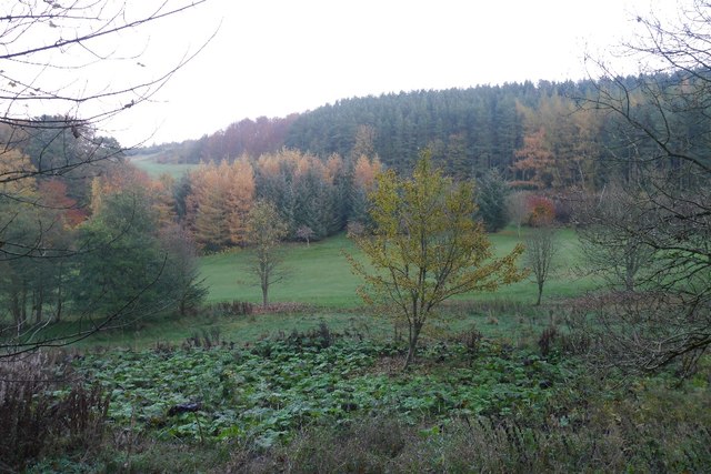
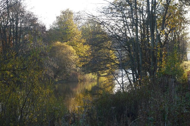
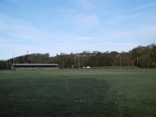
West End is a small hamlet located in the county of Roxburghshire, Scotland. Situated in the Scottish Borders region, it lies approximately 3 miles northwest of the town of Jedburgh. This picturesque village is surrounded by lush green fields and rolling hills, offering stunning views of the surrounding countryside.

Despite its small size, West End has a rich history dating back several centuries. The hamlet was once an important center for the local farming community, and remnants of its agricultural past can still be seen today. Traditional stone cottages and farmhouses dot the landscape, adding to the village's charm and character.

One of the notable landmarks in West End is the historic West End House, a grand Georgian mansion that has been converted into a luxury hotel. This elegant property attracts visitors from far and wide, who come to experience its luxurious accommodations and explore the area's natural beauty.

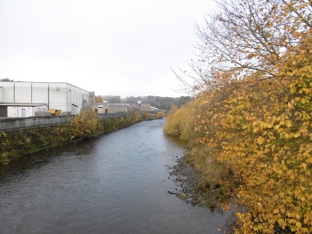
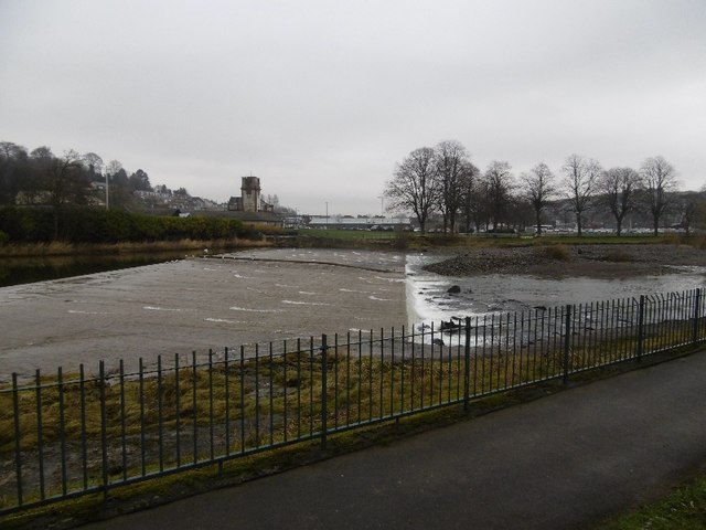
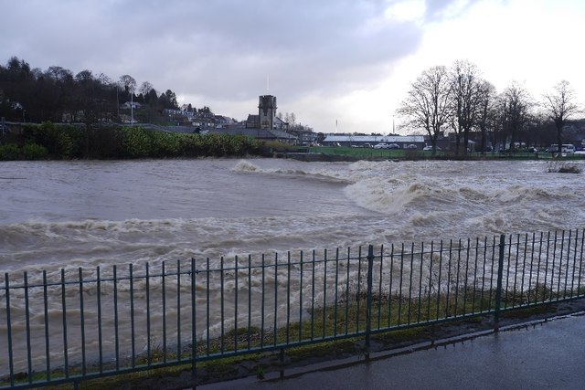
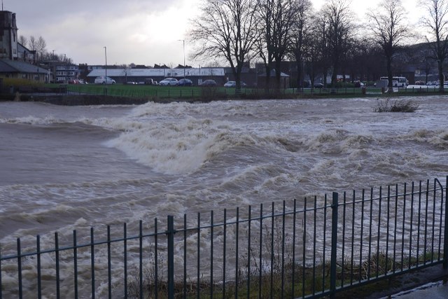
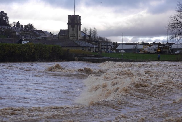
Outdoor enthusiasts will find plenty to do in and around West End. The nearby Jed Water offers excellent fishing opportunities, while the surrounding countryside is perfect for walking, hiking, and cycling. The hamlet is also within easy reach of several golf courses, including the renowned Roxburghe Golf Course.

For those seeking a peaceful and idyllic setting, West End provides the perfect escape. Its tranquil ambiance, stunning landscapes, and historical charm make it a hidden gem within the Scottish Borders.

If you have any feedback on the listing, please let us know in the comments section below.
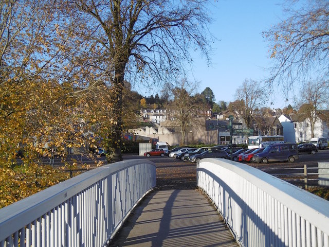
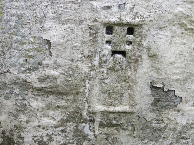
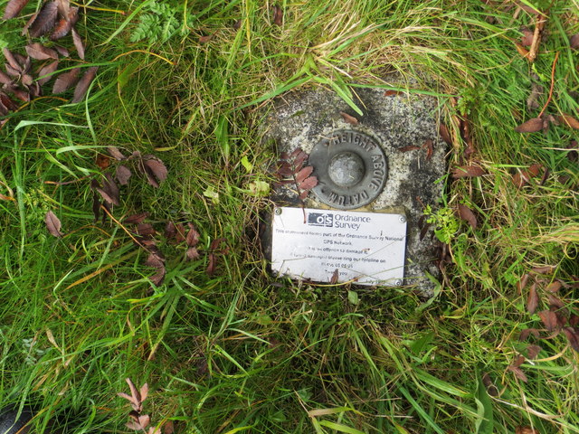
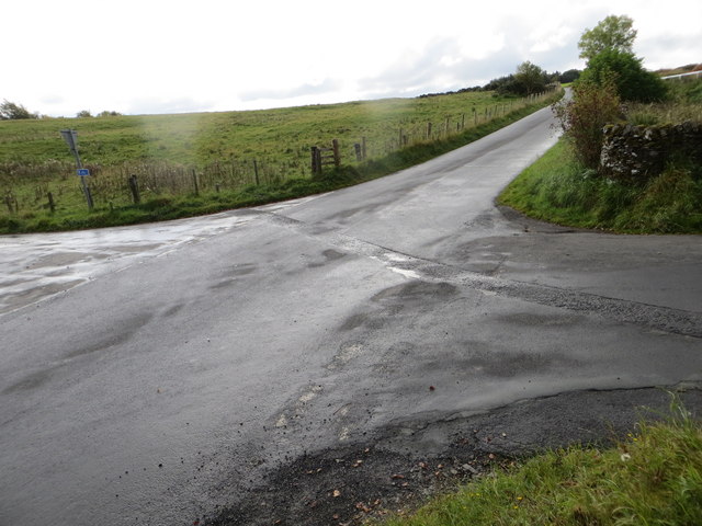
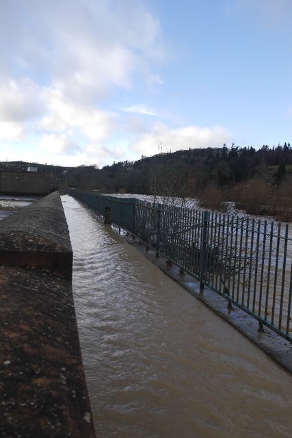
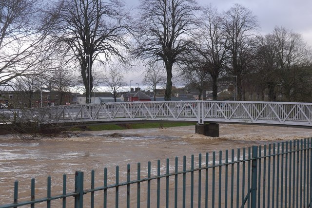
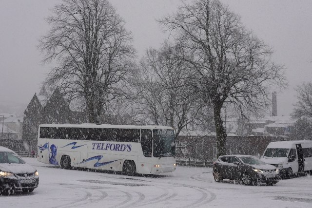
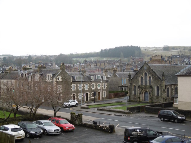
West End Images

Images are sourced within 2km of 55.416283/-2.7967566 or Grid Reference NT4913. Thanks to Geograph Open Source API. All images are credited.

Woodland on Vertish Hill Looking over Hawick Golf Club's course towards Vertish Hill.
Woodland on Vertish Hill
Looking over Hawick Golf Club's course towards Vertish Hill.
River Teviot Downstream of Martin's Bridge.
River Teviot
Downstream of Martin's Bridge.
River Teviot, Hawick Hawick High School on the left.
River Teviot, Hawick
Hawick High School on the left.
Common Haugh, Hawick The car park was empty as it was closed for line work.
Common Haugh, Hawick
The car park was empty as it was closed for line work.
Lawson Bridge, Hawick A little upstream of its predecessor, it is often used by Hawick High School pupils to get their buses on The Haugh.
Lawson Bridge, Hawick
A little upstream of its predecessor, it is often used by Hawick High School pupils to get their buses on The Haugh.
Ordnance Survey Flush Bracket 1491 This heavily over-painted bracket can be found on the wall of a private dwelling in Lynnwood.
For more detail see : <span class="nowrap"><a title="http://www.bench-marks.org.uk/bm1210" rel="nofollow ugc noopener" href="http://www.bench-marks.org.uk/bm1210">Link</a><img style="margin-left:2px;" alt="External link" title="External link - shift click to open in new window" src="https://s1.geograph.org.uk/img/external.png" width="10" height="10"/></span>
Ordnance Survey Flush Bracket 1491
This heavily over-painted bracket can be found on the wall of a private dwelling in Lynnwood. For more detail see : LinkExternal link
Ordnance Survey Fundamental Bench Mark - Hawick This can be found hidden in the grass on the roadside verge of the cross-roads near Nipknowes Quarry.
For more detail see : <span class="nowrap"><a title="http://www.bench-marks.org.uk/bm1079" rel="nofollow ugc noopener" href="http://www.bench-marks.org.uk/bm1079">Link</a><img style="margin-left:2px;" alt="External link" title="External link - shift click to open in new window" src="https://s1.geograph.org.uk/img/external.png" width="10" height="10"/></span>
Ordnance Survey Fundamental Bench Mark - Hawick
This can be found hidden in the grass on the roadside verge of the cross-roads near Nipknowes Quarry. For more detail see : LinkExternal link
Cross Roads near Nipknowes Quarry Looking westward.
Cross Roads near Nipknowes Quarry
Looking westward.
Cauld, Hawick The River Teviot in a relatively benign mood. Note the big shingle bank beneath the cauld.
Cauld, Hawick
The River Teviot in a relatively benign mood. Note the big shingle bank beneath the cauld.
Cauld, Hawick The weir upstream of the town during a spate. All footbridges were closed at the time.
Cauld, Hawick
The weir upstream of the town during a spate. All footbridges were closed at the time.
Teviot in spate After some hours of heavy rain.
Teviot in spate
After some hours of heavy rain.
Cauld, Hawick The Teviot shortly after it flooded the Common Haugh.
Cauld, Hawick
The Teviot shortly after it flooded the Common Haugh.
Flooded path, Hawick A wall gives some protection to Hawick High School as the Teviot rises to the edge of major flooding.
Flooded path, Hawick
A wall gives some protection to Hawick High School as the Teviot rises to the edge of major flooding.
Lawson Bridge, Hawick The river level is dropping after a rapid rise during heavy rain. The Common Haugh had flooded.
Lawson Bridge, Hawick
The river level is dropping after a rapid rise during heavy rain. The Common Haugh had flooded.
Common Haugh, Hawick The school bus for Newcastleton before a fraught journey home.
Common Haugh, Hawick
The school bus for Newcastleton before a fraught journey home.
Buccleuch Road, Hawick
Cauld, Hawick There is a big pile of shingle, deposited by recent spates.
Cauld, Hawick
There is a big pile of shingle, deposited by recent spates.
Cricket pitch, Hawick The square is being prepared for the forthcoming season. Looks strange on a frosty morning.
Cricket pitch, Hawick
The square is being prepared for the forthcoming season. Looks strange on a frosty morning.
Show me another place!

West End is located at Grid Ref: NT4913 (Lat: 55.416283, Lng: -2.7967566)

Unitary Authority: The Scottish Borders

Police Authority: The Lothians and Scottish Borders

What 3 Words

///stunning.fittingly.infringe. Near Hawick, Scottish Borders

Related Wikis

Hawick Cottage Hospital

Hawick Cottage Hospital was a health facility at Buccleuch Road in Hawick, Scotland. It was managed by NHS Borders. It is a Category B listed building...

Hawick High School

Hawick High School is a non-denominational secondary school in Hawick, in the Scottish Borders. As well as serving the town, it also takes in pupils from...

Hawick Community Hospital

Hawick Community Hospital is a health facility at Victoria Road in Hawick, Scotland. It is managed by NHS Borders. == History == The hospital was commissioned...

Slitrig Water

Slitrig Water (archaic Scots: Slitterick Waiter; current Southern Scots: Slitrig Witter), also known as the River Slitrig, is a river in the Scottish Borders...

Nearby Amenities

Located within 500m of 55.416283,-2.7967566
Bus Stop
Liddesdale Court
Bus: yes
Naptan AtcoCode: 6900468
Naptan Bearing: S
Naptan CommonName: Liddesdale Court
Naptan Indicator: nr
Naptan Landmark: Factory
Naptan NaptanCode: 72723245
Naptan Street: Liddesdale Road
Operator: Scottish Borders Council
Public Transport: platform
Ref: 6900468
Source: NaPTAN
Lat/Long: 55.4172356/-2.7899479
Bus Stop
Liddesdale Court
Bus: yes
Naptan AtcoCode: 6900469
Naptan Bearing: N
Naptan CommonName: Liddesdale Court
Naptan Indicator: opp
Naptan Landmark: stonefield
Naptan NaptanCode: 72723246
Naptan Street: Liddesdale Road
Operator: Scottish Borders Council
Public Transport: platform
Ref: 6900469
Source: NaPTAN
Lat/Long: 55.4175387/-2.7897708
Bus Stop
Renwick Terrace
Bus: yes
Naptan AtcoCode: 6900908
Naptan Bearing: N
Naptan CommonName: Renwick Terrace
Naptan Indicator: o/s 5
Naptan Landmark: Ramsey Road
Naptan NaptanCode: 72726467
Naptan Street: Renwick Terrace
Naptan Verified: no
Public Transport: platform
Source: naptan_import
Lat/Long: 55.4171491/-2.7944233
Bus Stop
Ramsay Road
Bus: yes
Naptan AtcoCode: 6900909
Naptan Bearing: N
Naptan CommonName: Ramsay Road
Naptan Indicator: o/s 25
Naptan Landmark: Ramsay Road
Naptan NaptanCode: 72726469
Naptan Street: Ramsay Road
Naptan Verified: no
Public Transport: platform
Source: naptan_import
Lat/Long: 55.4159078/-2.7946038
Bus Stop
Ramsey Road
Bus: yes
Naptan AtcoCode: 6900910
Naptan Bearing: S
Naptan CommonName: Ramsey Road
Naptan Indicator: o/s 65
Naptan Landmark: Ramsey Road
Naptan NaptanCode: 72726468
Naptan Street: Ramsey Road
Naptan Verified: no
Public Transport: platform
Source: naptan_import
Lat/Long: 55.4159198/-2.7955202
Bus Stop
Rosebank Road
Bus: yes
Naptan AtcoCode: 6900911
Naptan Bearing: S
Naptan CommonName: Rosebank Road
Naptan Indicator: Post Box
Naptan Landmark: Letter Box
Naptan NaptanCode: 72726459
Naptan Street: Rosebank Road
Naptan Verified: no
Public Transport: platform
Source: naptan_import
Lat/Long: 55.4159387/-2.7967686
Bus Stop
Rosebank Road
Bus: yes
Naptan AtcoCode: 6900912
Naptan Bearing: S
Naptan CommonName: Rosebank Road
Naptan Indicator: o/s 85
Naptan Landmark: Rosebank Road
Naptan NaptanCode: 72726462
Naptan Street: Rosebank Road
Naptan Verified: no
Public Transport: platform
Shelter: no
Source: naptan_import
Lat/Long: 55.414919/-2.7974273
Bus Stop
Rosebank Road
Bus: yes
Naptan AtcoCode: 6900913
Naptan Bearing: N
Naptan CommonName: Rosebank Road
Naptan Indicator: o/s 14
Naptan Landmark: Rosebank Road
Naptan NaptanCode: 72726465
Naptan Street: Rosebank Road
Naptan Verified: no
Public Transport: platform
Source: naptan_import
Lat/Long: 55.4154315/-2.7973745
Bus Stop
Vertish Hill
Naptan AtcoCode: 6900914
Naptan Bearing: S
Naptan CommonName: Vertish Hill
Naptan Indicator: Golf Course
Naptan Landmark: Burnflat Drive
Naptan NaptanCode: 72725963
Naptan Street: Haggis Ha' Brae
Naptan Verified: no
Source: naptan_import
Lat/Long: 55.4125617/-2.7992437
Bus Stop
Rosebank Road
Bench: yes
Bin: no
Bus: yes
Naptan AtcoCode: 6900915
Naptan Bearing: S
Naptan CommonName: Rosebank Road
Naptan Indicator: o/s 5
Naptan Landmark: Rosebank Road
Naptan NaptanCode: 72726463
Naptan Street: Rosebank Road
Naptan Verified: no
Public Transport: platform
Shelter: no
Source: naptan_import
Tactile Paving: yes
Lat/Long: 55.4172683/-2.7954368
Bus Stop
Longcroft Crescent
Bus: yes
Naptan AtcoCode: 6900916
Naptan Bearing: NE
Naptan CommonName: Longcroft Crescent
Naptan Indicator: o/s 87
Naptan Landmark: Longcroft Crescent
Naptan NaptanCode: 72726439
Naptan Street: Longcroft Crescent
Naptan Verified: no
Public Transport: platform
Source: naptan_import
Lat/Long: 55.4173482/-2.7983451
Bus Stop
Longcroft Crescent
Bus: yes
Naptan AtcoCode: 6900917
Naptan Bearing: S
Naptan CommonName: Longcroft Crescent
Naptan Indicator: o/s 23
Naptan Landmark: Longcroft Crescent
Naptan NaptanCode: 72726452
Naptan Street: Longcroft Crescent
Naptan Verified: no
Public Transport: platform
Source: naptan_import
Lat/Long: 55.4180988/-2.7962433
Bus Stop
Cheviot Road
Bus: yes
Naptan AtcoCode: 6900918
Naptan Bearing: N
Naptan CommonName: Cheviot Road
Naptan Indicator: o/s No 37
Naptan Landmark: Cheviot Road
Naptan NaptanCode: 72726486
Naptan Street: Cheviot Road
Naptan Verified: no
Public Transport: platform
Source: naptan_import
Lat/Long: 55.4184699/-2.7958243
Bus Stop
Crumhaugh Road
Bus: yes
Naptan AtcoCode: 6900919
Naptan Bearing: E
Naptan CommonName: Crumhaugh Road
Naptan Indicator: Crumhaugh House
Naptan Landmark: Crumhaugh House
Naptan NaptanCode: 72726484
Naptan Street: Crumhaugh Road
Naptan Verified: no
Public Transport: platform
Source: naptan_import
Lat/Long: 55.4194273/-2.7964596
Bus Stop
Myreslaw Green
Bus: yes
Naptan AtcoCode: 6900920
Naptan Bearing: E
Naptan CommonName: Myreslaw Green
Naptan Indicator: o/s 2
Naptan Landmark: Green Terrace
Naptan NaptanCode: 72726436
Naptan Street: Myreslaw Green
Naptan Verified: no
Public Transport: platform
Source: naptan_import
Lat/Long: 55.4197422/-2.793638
Bus Stop
Myreslaw Green
Bus: yes
Naptan AtcoCode: 6900921
Naptan Bearing: E
Naptan CommonName: Myreslaw Green
Naptan Indicator: o/s 18
Naptan Landmark: Gladstone Street
Naptan NaptanCode: 72726453
Naptan Street: Myreslaw Green
Naptan Verified: no
Public Transport: platform
Source: naptan_import
Lat/Long: 55.4197347/-2.7920106
Bus Stop
Loan
Bench: no
Bin: no
Bus: yes
Naptan AtcoCode: 6900922
Naptan Bearing: S
Naptan CommonName: Loan
Naptan Indicator: adj Moat
Naptan Landmark: Moat Park
Naptan NaptanCode: 72726475
Naptan Street: Loan
Naptan Verified: no
Public Transport: platform
Shelter: yes
Source: naptan_import
Lat/Long: 55.4183615/-2.7931522
Bus Stop
Loan
Bench: no
Bin: no
Bus: yes
Naptan AtcoCode: 6900923
Naptan Bearing: N
Naptan CommonName: Loan
Naptan Indicator: opp Moat
Naptan Landmark: Moat Park
Naptan NaptanCode: 72726456
Naptan Street: Loan
Naptan Verified: no
Public Transport: platform
Shelter: no
Source: naptan_import
Lat/Long: 55.4185046/-2.7932499
Bus Stop
Stonefield Place
Bus: yes
Naptan AtcoCode: 6900931
Naptan Bearing: N
Naptan CommonName: Stonefield Place
Naptan Indicator: o/s 34
Naptan Landmark: Stonefield Place
Naptan NaptanCode: 72725938
Naptan Street: Stonefield Place
Naptan Verified: no
Public Transport: platform
Source: naptan_import
Lat/Long: 55.4171565/-2.7891155
Mini Roundabout
Direction: clockwise
Source: survey
Lat/Long: 55.4126879/-2.7990765
Noexit: yes
Lat/Long: 55.4146451/-2.798552
Noexit: yes
Lat/Long: 55.4136372/-2.7993527
Noexit: yes
Lat/Long: 55.4140521/-2.7971653
Noexit: yes
Lat/Long: 55.4201113/-2.7960039
Give Way
Direction: backward
Lat/Long: 55.4196829/-2.7917312
Post Box
Post Box Type: pillar
Royal Cypher: GR
Royal Cypher Wikidata: Q33102273
Source: survey
Lat/Long: 55.4161053/-2.7967434
Telephone
Booth: K6
Covered: booth
Source: survey
Lat/Long: 55.4164237/-2.7965471
Motte
Historic: archaeological_site
Lat/Long: 55.4180154/-2.7922692
Noexit: yes
Lat/Long: 55.4191837/-2.798653
Noexit: yes
Lat/Long: 55.4199083/-2.7990139
Noexit: yes
Lat/Long: 55.4155276/-2.7930135
Post Box
Ref: TD9 39
Source: survey
Lat/Long: 55.4134897/-2.7921872
Noexit: yes
Lat/Long: 55.4197191/-2.7966205
West End
Name Sco: Wast End
Place: suburb
Lat/Long: 55.4171209/-2.796605
Barrier: cycle_barrier
Bicycle: yes
Foot: yes
Lat/Long: 55.4148152/-2.7977207
Bench
Backrest: yes
Material: wood
Lat/Long: 55.4184508/-2.7972748
Bench
Backrest: yes
Material: wood
Lat/Long: 55.4184683/-2.7972439
Ryan Patterson
Craft: electrician
Lat/Long: 55.419379/-2.7912497
Billy Ford Window Blinds
Addr City: Hawick
Addr Postcode: TD9 0AU
Addr Street: Loan
Shop: window_blind
Lat/Long: 55.4194107/-2.7911979
Lyle & Scott Ltd
Addr City: Hawick
Addr Housename: Unit 1
Addr Housenumber: 8
Addr Postcode: TD9 0BL
Addr Street: Liddesdale Road
Office: yes
Lat/Long: 55.4173103/-2.7903912
Natural: shrub
Lat/Long: 55.4169782/-2.7904558
Natural: shrub
Lat/Long: 55.4170014/-2.7904332
Natural: shrub
Lat/Long: 55.4170183/-2.7904062
Natural: shrub
Lat/Long: 55.4170485/-2.7903829
Natural: shrub
Lat/Long: 55.4170684/-2.7903618
Generator Method: photovoltaic
Generator Output Electricity: yes
Generator Source: solar
Generator Type: solar_photovoltaic_panel
Power: generator
Lat/Long: 55.4173929/-2.7950305
Noexit: yes
Lat/Long: 55.4189339/-2.7914881
Social Facility
Border Women's Aid
Addr City: Hawick
Addr Housenumber: Unit 5B
Addr Postcode: TD9 0BN
Addr Street: Liddesdale Road
Phone: +44 1450 218409
Website: https://www.borderwomensaid.co.uk/
Lat/Long: 55.4170633/-2.7905523
SMB Accessories
Addr City: Hawick
Addr Housenumber: Unit 5
Addr Postcode: TD9 0BN
Addr Street: Liddesdale Road
Phone: +44 7540 062788
Shop: fashion_accessories
Website: https://smbaccessories.co.uk/
Lat/Long: 55.416994/-2.7906458
Entrance: yes
Lat/Long: 55.4149/-2.7988949
Addr Street: Trystside
Entrance: yes
Lat/Long: 55.4147109/-2.7987382
Entrance: yes
Lat/Long: 55.4145746/-2.79861
Entrance: yes
Lat/Long: 55.4147834/-2.7983295
Entrance: yes
Lat/Long: 55.4148936/-2.7985855
Noexit: yes
Lat/Long: 55.415679/-2.7926126
Noexit: yes
Lat/Long: 55.4153959/-2.7927694
Generator Method: photovoltaic
Generator Output Electricity: yes
Generator Source: solar
Generator Type: solar_photovoltaic_panel
Power: generator
Lat/Long: 55.4177227/-2.7892627
Generator Method: photovoltaic
Generator Output Electricity: yes
Generator Source: solar
Generator Type: solar_photovoltaic_panel
Power: generator
Lat/Long: 55.4175613/-2.7893941
Generator Method: photovoltaic
Generator Output Electricity: yes
Generator Source: solar
Generator Type: solar_photovoltaic_panel
Power: generator
Lat/Long: 55.4176047/-2.7893364
Generator Method: photovoltaic
Generator Output Electricity: yes
Generator Source: solar
Generator Type: solar_photovoltaic_panel
Power: generator
Lat/Long: 55.4176527/-2.7893002
Generator Method: photovoltaic
Generator Output Electricity: yes
Generator Source: solar
Generator Type: solar_photovoltaic_panel
Power: generator
Lat/Long: 55.4173825/-2.7890709
Generator Method: photovoltaic
Generator Output Electricity: yes
Generator Source: solar
Generator Type: solar_photovoltaic_panel
Power: generator
Lat/Long: 55.4173124/-2.7891406
Generator Method: photovoltaic
Generator Output Electricity: yes
Generator Source: solar
Generator Type: solar_photovoltaic_panel
Power: generator
Lat/Long: 55.417419/-2.7895322
Generator Method: photovoltaic
Generator Output Electricity: yes
Generator Source: solar
Generator Type: solar_photovoltaic_panel
Power: generator
Lat/Long: 55.4173901/-2.7895618
Generator Method: photovoltaic
Generator Output Electricity: yes
Generator Source: solar
Generator Type: solar_photovoltaic_panel
Power: generator
Lat/Long: 55.4173261/-2.7896127
Generator Method: photovoltaic
Generator Output Electricity: yes
Generator Source: solar
Generator Type: solar_photovoltaic_panel
Power: generator
Lat/Long: 55.4172713/-2.7897388
Generator Method: photovoltaic
Generator Output Electricity: yes
Generator Source: solar
Generator Type: solar_photovoltaic_panel
Power: generator
Lat/Long: 55.4172363/-2.789779
Generator Method: photovoltaic
Generator Output Electricity: yes
Generator Source: solar
Generator Type: solar_photovoltaic_panel
Power: generator
Lat/Long: 55.4171891/-2.7898166
Generator Method: photovoltaic
Generator Output Electricity: yes
Generator Source: solar
Generator Type: solar_photovoltaic_panel
Power: generator
Lat/Long: 55.4170963/-2.7899185
Generator Method: photovoltaic
Generator Output Electricity: yes
Generator Source: solar
Generator Type: solar_photovoltaic_panel
Power: generator
Lat/Long: 55.4170186/-2.7899855
Generator Method: photovoltaic
Generator Output Electricity: yes
Generator Source: solar
Generator Type: solar_photovoltaic_panel
Power: generator
Lat/Long: 55.4169242/-2.789602
Generator Method: photovoltaic
Generator Output Electricity: yes
Generator Source: solar
Generator Type: solar_photovoltaic_panel
Power: generator
Lat/Long: 55.4169592/-2.789728
Generator Method: photovoltaic
Generator Output Electricity: yes
Generator Source: solar
Generator Type: solar_photovoltaic_panel
Power: generator
Lat/Long: 55.416166/-2.7908734
Generator Method: photovoltaic
Generator Output Electricity: yes
Generator Source: solar
Generator Type: solar_photovoltaic_panel
Power: generator
Lat/Long: 55.4162285/-2.7908197
Generator Method: photovoltaic
Generator Output Electricity: yes
Generator Source: solar
Generator Type: solar_photovoltaic_panel
Power: generator
Lat/Long: 55.4162726/-2.7907714
Generator Method: photovoltaic
Generator Output Electricity: yes
Generator Source: solar
Generator Type: solar_photovoltaic_panel
Power: generator
Lat/Long: 55.4163259/-2.7907205
Generator Method: photovoltaic
Generator Output Electricity: yes
Generator Source: solar
Generator Type: solar_photovoltaic_panel
Power: generator
Lat/Long: 55.4163716/-2.7906802
Generator Method: photovoltaic
Generator Output Electricity: yes
Generator Source: solar
Generator Type: solar_photovoltaic_panel
Power: generator
Lat/Long: 55.4164233/-2.7906212
Generator Method: photovoltaic
Generator Output Electricity: yes
Generator Source: solar
Generator Type: solar_photovoltaic_panel
Power: generator
Lat/Long: 55.416332/-2.7904254
Generator Method: photovoltaic
Generator Output Electricity: yes
Generator Source: solar
Generator Type: solar_photovoltaic_panel
Power: generator
Lat/Long: 55.416297/-2.7903262
Generator Method: photovoltaic
Generator Output Electricity: yes
Generator Source: solar
Generator Type: solar_photovoltaic_panel
Power: generator
Lat/Long: 55.4162604/-2.7902162
Generator Method: photovoltaic
Generator Output Electricity: yes
Generator Source: solar
Generator Type: solar_photovoltaic_panel
Power: generator
Lat/Long: 55.4162361/-2.790125
Give Way
Direction: forward
Lat/Long: 55.4163289/-2.7899761
Noexit: yes
Lat/Long: 55.4200177/-2.7960902
Give Way
Direction: backward
Lat/Long: 55.4170163/-2.7979108
Give Way
Direction: forward
Lat/Long: 55.4175897/-2.7954038
Give Way
Direction: backward
Lat/Long: 55.4175538/-2.7952776
Give Way
Direction: backward
Lat/Long: 55.4177917/-2.7945795
Give Way
Direction: forward
Lat/Long: 55.4195248/-2.7913343
Generator Method: photovoltaic
Generator Output Electricity: yes
Generator Source: solar
Generator Type: solar_photovoltaic_panel
Power: generator
Lat/Long: 55.4187496/-2.7929172
Give Way
Direction: forward
Lat/Long: 55.4193241/-2.7959744
Give Way
Direction: forward
Lat/Long: 55.419208/-2.796705
Give Way
Direction: backward
Lat/Long: 55.417824/-2.7947938
Give Way
Direction: forward
Lat/Long: 55.418702/-2.7948114
Give Way
Direction: forward
Lat/Long: 55.4182287/-2.7937803
Generator Method: photovoltaic
Generator Output Electricity: yes
Generator Source: solar
Generator Type: solar_photovoltaic_panel
Power: generator
Lat/Long: 55.41976/-2.7919449
Generator Method: photovoltaic
Generator Output Electricity: yes
Generator Source: solar
Generator Type: solar_photovoltaic_panel
Power: generator
Lat/Long: 55.4189406/-2.7942717
Give Way
Direction: backward
Lat/Long: 55.4196508/-2.7919195
Generator Method: photovoltaic
Generator Output Electricity: yes
Generator Source: solar
Generator Type: solar_photovoltaic_panel
Power: generator
Lat/Long: 55.4132809/-2.7967206
Generator Method: photovoltaic
Generator Output Electricity: yes
Generator Source: solar
Generator Type: solar_photovoltaic_panel
Power: generator
Lat/Long: 55.4130312/-2.7955994
Generator Method: photovoltaic
Generator Output Electricity: yes
Generator Source: solar
Generator Type: solar_photovoltaic_panel
Power: generator
Lat/Long: 55.4131804/-2.7958086
Generator Method: photovoltaic
Generator Output Electricity: yes
Generator Source: solar
Generator Type: solar_photovoltaic_panel
Power: generator
Lat/Long: 55.412914/-2.7962297
Entrance: yes
Lat/Long: 55.4146125/-2.7983783
Generator Method: photovoltaic
Generator Output Electricity: yes
Generator Source: solar
Generator Type: solar_photovoltaic_panel
Power: generator
Lat/Long: 55.4158631/-2.8018758
Generator Method: photovoltaic
Generator Output Electricity: yes
Generator Source: solar
Generator Type: solar_photovoltaic_panel
Power: generator
Lat/Long: 55.4141122/-2.7919704
Generator Method: photovoltaic
Generator Output Electricity: yes
Generator Source: solar
Generator Type: solar_photovoltaic_panel
Power: generator
Lat/Long: 55.4127381/-2.7932739
Generator Method: photovoltaic
Generator Output Electricity: yes
Generator Source: solar
Generator Type: solar_photovoltaic_panel
Power: generator
Lat/Long: 55.4126011/-2.7933262
Noexit: yes
Lat/Long: 55.4125455/-2.7967957
Generator Method: photovoltaic
Generator Output Electricity: yes
Generator Source: solar
Generator Type: solar_photovoltaic_panel
Power: generator
Lat/Long: 55.4135108/-2.8006259
Noexit: yes
Lat/Long: 55.4136166/-2.7995275
Generator Method: photovoltaic
Generator Output Electricity: yes
Generator Source: solar
Generator Type: solar_photovoltaic_panel
Power: generator
Lat/Long: 55.4147425/-2.7975172
Generator Method: photovoltaic
Generator Output Electricity: yes
Generator Source: solar
Generator Type: solar_photovoltaic_panel
Power: generator
Lat/Long: 55.4146786/-2.7975467
Waste Disposal
Lat/Long: 55.4179412/-2.793778
Lorry
Artwork Type: sculpture
Material: metal
Tourism: artwork
Lat/Long: 55.4184337/-2.7923057
Stonefield
Place: neighbourhood
Lat/Long: 55.4176048/-2.7891994
Bench
Lat/Long: 55.416349/-2.7965411
Bench
Lat/Long: 55.4174661/-2.7954326
Power: pole
Lat/Long: 55.4148549/-2.8042559
Power: pole
Lat/Long: 55.4151423/-2.8041465
Power: pole
Lat/Long: 55.4157592/-2.8039073
Power: pole
Lat/Long: 55.4163775/-2.803668
Power: pole
Lat/Long: 55.4169756/-2.8034211
The data included in this document is from www.openstreetmap.org. The data is made available under ODbL.

Have you been to West End?

Leave your review of West End below (or comments, questions and feedback).