Black Knowe Head

Hill, Mountain in Roxburghshire

Scotland

Black Knowe Head

Woodland on Vertish Hill Looking over Hawick Golf Club's course towards Vertish Hill.
Woodland on Vertish Hill Credit: Richard Webb

Black Knowe Head is a prominent hill located in the county of Roxburghshire, Scotland. Standing at an impressive height of 539 meters (1,768 feet), it is considered one of the notable peaks in the region. The hill is situated within the sprawling landscape of the Scottish Borders, offering stunning panoramic views of the surrounding countryside.

Black Knowe Head is characterized by its distinct conical shape and is predominantly covered in heather and grass. It is part of a larger range known as the Cheviot Hills, which straddle the border between Scotland and England. The hill is a popular destination for hikers and outdoor enthusiasts, attracting visitors from near and far who are eager to explore its rugged terrain.

At the summit of Black Knowe Head, visitors are rewarded with breathtaking vistas that stretch across the rolling hills and valleys of Roxburghshire. On clear days, the views can extend as far as the Northumberland National Park and the Scottish Lowlands. The hill also offers a glimpse into the rich history of the area, with remnants of ancient settlements and archaeological sites scattered throughout its slopes.

Access to Black Knowe Head is typically gained via well-marked footpaths and trails that wind their way through the surrounding countryside. Its convenient location near the town of Jedburgh makes it easily accessible for both locals and tourists, who often pair a hike up the hill with a visit to the nearby historical attractions and amenities.

In conclusion, Black Knowe Head is a striking hill in Roxburghshire, Scotland, renowned for its picturesque views and challenging hiking opportunities. Its natural beauty and historical significance make it a must-visit destination for those seeking an outdoor adventure in the Scottish Borders.

If you have any feedback on the listing, please let us know in the comments section below.

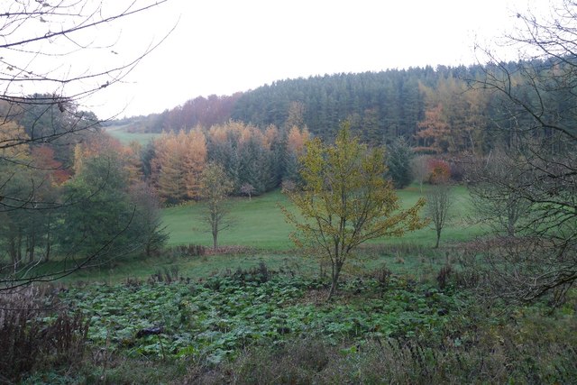
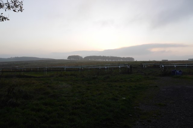
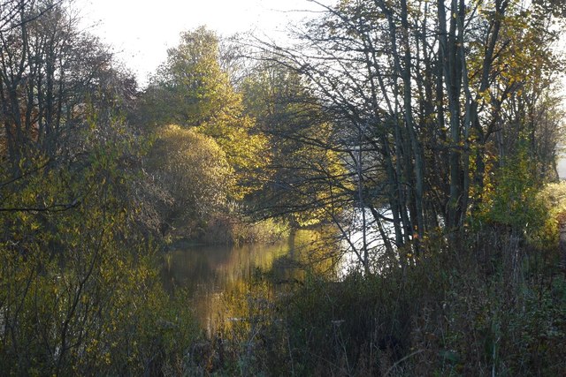
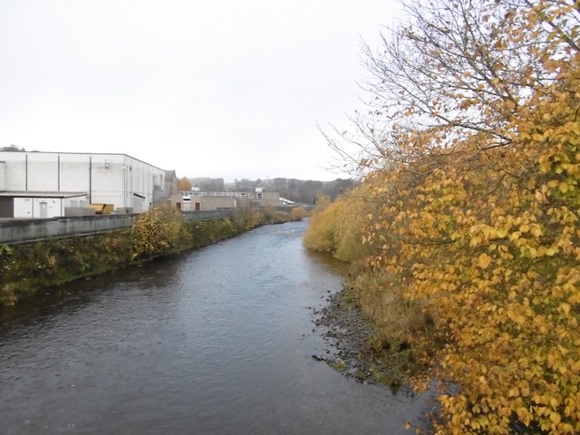
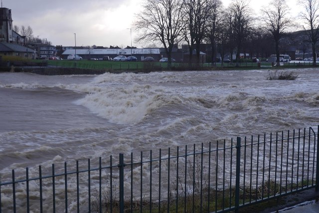
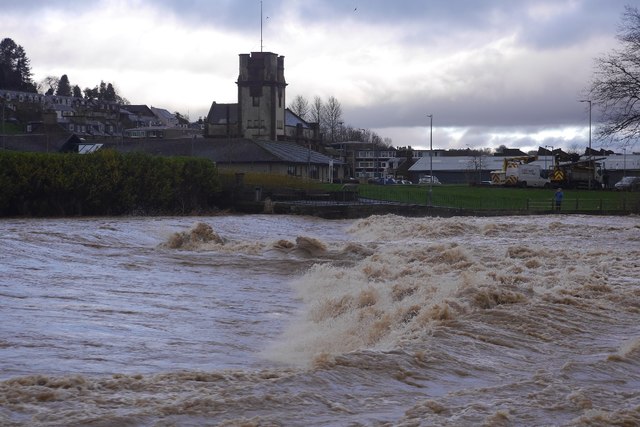
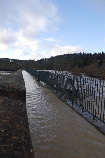
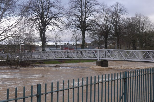
Black Knowe Head Images

Images are sourced within 2km of 55.412339/-2.7965666 or Grid Reference NT4913. Thanks to Geograph Open Source API. All images are credited.

Woodland on Vertish Hill Looking over Hawick Golf Club's course towards Vertish Hill.
Woodland on Vertish Hill
Looking over Hawick Golf Club's course towards Vertish Hill.
St Leonard's Park The racecourse plays a big part in the Common Riding.
St Leonard's Park
The racecourse plays a big part in the Common Riding.
River Teviot Downstream of Martin's Bridge.
River Teviot
Downstream of Martin's Bridge.
River Teviot, Hawick Hawick High School on the left.
River Teviot, Hawick
Hawick High School on the left.
Common Haugh, Hawick The car park was empty as it was closed for line work.
Common Haugh, Hawick
The car park was empty as it was closed for line work.
Lawson Bridge, Hawick A little upstream of its predecessor, it is often used by Hawick High School pupils to get their buses on The Haugh.
Lawson Bridge, Hawick
A little upstream of its predecessor, it is often used by Hawick High School pupils to get their buses on The Haugh.
Ordnance Survey Flush Bracket 1491 This heavily over-painted bracket can be found on the wall of a private dwelling in Lynnwood.
For more detail see : <span class="nowrap"><a title="http://www.bench-marks.org.uk/bm1210" rel="nofollow ugc noopener" href="http://www.bench-marks.org.uk/bm1210">Link</a><img style="margin-left:2px;" alt="External link" title="External link - shift click to open in new window" src="https://s1.geograph.org.uk/img/external.png" width="10" height="10"/></span>
Ordnance Survey Flush Bracket 1491
This heavily over-painted bracket can be found on the wall of a private dwelling in Lynnwood. For more detail see : LinkExternal link
Ordnance Survey Fundamental Bench Mark - Hawick This can be found hidden in the grass on the roadside verge of the cross-roads near Nipknowes Quarry.
For more detail see : <span class="nowrap"><a title="http://www.bench-marks.org.uk/bm1079" rel="nofollow ugc noopener" href="http://www.bench-marks.org.uk/bm1079">Link</a><img style="margin-left:2px;" alt="External link" title="External link - shift click to open in new window" src="https://s1.geograph.org.uk/img/external.png" width="10" height="10"/></span>
Ordnance Survey Fundamental Bench Mark - Hawick
This can be found hidden in the grass on the roadside verge of the cross-roads near Nipknowes Quarry. For more detail see : LinkExternal link
Cross Roads near Nipknowes Quarry Looking westward.
Cross Roads near Nipknowes Quarry
Looking westward.
Williestruther Loch Looking south-westward.
Williestruther Loch
Looking south-westward.
Cauld, Hawick The River Teviot in a relatively benign mood. Note the big shingle bank beneath the cauld.
Cauld, Hawick
The River Teviot in a relatively benign mood. Note the big shingle bank beneath the cauld.
Cauld, Hawick The weir upstream of the town during a spate. All footbridges were closed at the time.
Cauld, Hawick
The weir upstream of the town during a spate. All footbridges were closed at the time.
Teviot in spate After some hours of heavy rain.
Teviot in spate
After some hours of heavy rain.
Cauld, Hawick The Teviot shortly after it flooded the Common Haugh.
Cauld, Hawick
The Teviot shortly after it flooded the Common Haugh.
Flooded path, Hawick A wall gives some protection to Hawick High School as the Teviot rises to the edge of major flooding.
Flooded path, Hawick
A wall gives some protection to Hawick High School as the Teviot rises to the edge of major flooding.
Lawson Bridge, Hawick The river level is dropping after a rapid rise during heavy rain. The Common Haugh had flooded.
Lawson Bridge, Hawick
The river level is dropping after a rapid rise during heavy rain. The Common Haugh had flooded.
Common Haugh, Hawick The school bus for Newcastleton before a fraught journey home.
Common Haugh, Hawick
The school bus for Newcastleton before a fraught journey home.
Buccleuch Road, Hawick
Show me another place!

Black Knowe Head is located at Grid Ref: NT4913 (Lat: 55.412339, Lng: -2.7965666)

Unitary Authority: The Scottish Borders

Police Authority: The Lothians and Scottish Borders

What 3 Words

///spectacle.salaried.conceals. Near Hawick, Scottish Borders

Related Wikis

Hawick Cottage Hospital

Hawick Cottage Hospital was a health facility at Buccleuch Road in Hawick, Scotland. It was managed by NHS Borders. It is a Category B listed building...

Slitrig Water

Slitrig Water (archaic Scots: Slitterick Waiter; current Southern Scots: Slitrig Witter), also known as the River Slitrig, is a river in the Scottish Borders...

Hawick High School

Hawick High School is a non-denominational secondary school in Hawick, in the Scottish Borders. As well as serving the town, it also takes in pupils from...

Hawick

Hawick ( HOYK; Scots: Haaick; Scottish Gaelic: Hamhaig) is a town in the Scottish Borders council area and historic county of Roxburghshire in the east...

Nearby Amenities

Located within 500m of 55.412339,-2.7965666
Bus Stop
Ramsay Road
Bus: yes
Naptan AtcoCode: 6900909
Naptan Bearing: N
Naptan CommonName: Ramsay Road
Naptan Indicator: o/s 25
Naptan Landmark: Ramsay Road
Naptan NaptanCode: 72726469
Naptan Street: Ramsay Road
Naptan Verified: no
Public Transport: platform
Source: naptan_import
Lat/Long: 55.4159078/-2.7946038
Bus Stop
Ramsey Road
Bus: yes
Naptan AtcoCode: 6900910
Naptan Bearing: S
Naptan CommonName: Ramsey Road
Naptan Indicator: o/s 65
Naptan Landmark: Ramsey Road
Naptan NaptanCode: 72726468
Naptan Street: Ramsey Road
Naptan Verified: no
Public Transport: platform
Source: naptan_import
Lat/Long: 55.4159198/-2.7955202
Bus Stop
Rosebank Road
Bus: yes
Naptan AtcoCode: 6900911
Naptan Bearing: S
Naptan CommonName: Rosebank Road
Naptan Indicator: Post Box
Naptan Landmark: Letter Box
Naptan NaptanCode: 72726459
Naptan Street: Rosebank Road
Naptan Verified: no
Public Transport: platform
Source: naptan_import
Lat/Long: 55.4159387/-2.7967686
Bus Stop
Rosebank Road
Bus: yes
Naptan AtcoCode: 6900912
Naptan Bearing: S
Naptan CommonName: Rosebank Road
Naptan Indicator: o/s 85
Naptan Landmark: Rosebank Road
Naptan NaptanCode: 72726462
Naptan Street: Rosebank Road
Naptan Verified: no
Public Transport: platform
Shelter: no
Source: naptan_import
Lat/Long: 55.414919/-2.7974273
Bus Stop
Rosebank Road
Bus: yes
Naptan AtcoCode: 6900913
Naptan Bearing: N
Naptan CommonName: Rosebank Road
Naptan Indicator: o/s 14
Naptan Landmark: Rosebank Road
Naptan NaptanCode: 72726465
Naptan Street: Rosebank Road
Naptan Verified: no
Public Transport: platform
Source: naptan_import
Lat/Long: 55.4154315/-2.7973745
Bus Stop
Vertish Hill
Naptan AtcoCode: 6900914
Naptan Bearing: S
Naptan CommonName: Vertish Hill
Naptan Indicator: Golf Course
Naptan Landmark: Burnflat Drive
Naptan NaptanCode: 72725963
Naptan Street: Haggis Ha' Brae
Naptan Verified: no
Source: naptan_import
Lat/Long: 55.4125617/-2.7992437
Mini Roundabout
Direction: clockwise
Source: survey
Lat/Long: 55.4126879/-2.7990765
Noexit: yes
Lat/Long: 55.4146451/-2.798552
Noexit: yes
Lat/Long: 55.4136372/-2.7993527
Noexit: yes
Lat/Long: 55.4140521/-2.7971653
Post Box
Post Box Type: pillar
Royal Cypher: GR
Royal Cypher Wikidata: Q33102273
Source: survey
Lat/Long: 55.4161053/-2.7967434
Telephone
Booth: K6
Covered: booth
Source: survey
Lat/Long: 55.4164237/-2.7965471
Noexit: yes
Lat/Long: 55.4155276/-2.7930135
Post Box
Ref: TD9 39
Source: survey
Lat/Long: 55.4134897/-2.7921872
Power: pole
Lat/Long: 55.4108522/-2.8007467
Power: pole
Lat/Long: 55.4113882/-2.8033001
Power: pole
Lat/Long: 55.4110685/-2.8018571
Barrier: cycle_barrier
Bicycle: yes
Foot: yes
Lat/Long: 55.4148152/-2.7977207
Restaurant
Hawick Golf Club Bar & Restaurant
Website: http://www.hawickgolfclub.com/page.aspx?pid=58976
Lat/Long: 55.4118984/-2.7998132
Greer Exporting Co Ltd
Addr City: Hawick
Addr Housename: PO Box 13337
Addr Postcode: TD9 1AD
Company: distribution
Office: company
Lat/Long: 55.4119738/-2.7999652
Entrance: yes
Lat/Long: 55.4149/-2.7988949
Addr Street: Trystside
Entrance: yes
Lat/Long: 55.4147109/-2.7987382
Entrance: yes
Lat/Long: 55.4145746/-2.79861
Entrance: yes
Lat/Long: 55.4147834/-2.7983295
Entrance: yes
Lat/Long: 55.4148936/-2.7985855
Noexit: yes
Lat/Long: 55.415679/-2.7926126
Noexit: yes
Lat/Long: 55.4153959/-2.7927694
Generator Method: photovoltaic
Generator Output Electricity: yes
Generator Source: solar
Generator Type: solar_photovoltaic_panel
Power: generator
Lat/Long: 55.4132809/-2.7967206
Generator Method: photovoltaic
Generator Output Electricity: yes
Generator Source: solar
Generator Type: solar_photovoltaic_panel
Power: generator
Lat/Long: 55.4130312/-2.7955994
Generator Method: photovoltaic
Generator Output Electricity: yes
Generator Source: solar
Generator Type: solar_photovoltaic_panel
Power: generator
Lat/Long: 55.4131804/-2.7958086
Generator Method: photovoltaic
Generator Output Electricity: yes
Generator Source: solar
Generator Type: solar_photovoltaic_panel
Power: generator
Lat/Long: 55.412914/-2.7962297
Entrance: yes
Lat/Long: 55.4146125/-2.7983783
Generator Method: photovoltaic
Generator Output Electricity: yes
Generator Source: solar
Generator Type: solar_photovoltaic_panel
Power: generator
Lat/Long: 55.4141122/-2.7919704
Generator Method: photovoltaic
Generator Output Electricity: yes
Generator Source: solar
Generator Type: solar_photovoltaic_panel
Power: generator
Lat/Long: 55.4127381/-2.7932739
Generator Method: photovoltaic
Generator Output Electricity: yes
Generator Source: solar
Generator Type: solar_photovoltaic_panel
Power: generator
Lat/Long: 55.4126011/-2.7933262
Generator Method: photovoltaic
Generator Output Electricity: yes
Generator Source: solar
Generator Type: solar_photovoltaic_panel
Power: generator
Lat/Long: 55.4117004/-2.7902967
Noexit: yes
Lat/Long: 55.4125455/-2.7967957
Generator Method: photovoltaic
Generator Output Electricity: yes
Generator Source: solar
Generator Type: solar_photovoltaic_panel
Power: generator
Lat/Long: 55.4135108/-2.8006259
Noexit: yes
Lat/Long: 55.4136166/-2.7995275
Generator Method: photovoltaic
Generator Output Electricity: yes
Generator Source: solar
Generator Type: solar_photovoltaic_panel
Power: generator
Lat/Long: 55.4147425/-2.7975172
Generator Method: photovoltaic
Generator Output Electricity: yes
Generator Source: solar
Generator Type: solar_photovoltaic_panel
Power: generator
Lat/Long: 55.4146786/-2.7975467
Lynnwood
Name Sco: Lynnwud
Place: neighbourhood
Lat/Long: 55.4123524/-2.7922514
Bench
Lat/Long: 55.416349/-2.7965411
Outdoor Patio, Hawick Golf Club
Leisure: outdoor_seating
Lat/Long: 55.4120141/-2.8001845
Power: pole
Lat/Long: 55.4129883/-2.7911214
Power: pole
Lat/Long: 55.4128395/-2.7895905
Power: pole
Lat/Long: 55.4114568/-2.8018763
Power: pole
Lat/Long: 55.4116981/-2.8011357
The data included in this document is from www.openstreetmap.org. The data is made available under ODbL.

Have you been to Black Knowe Head?

Leave your review of Black Knowe Head below (or comments, questions and feedback).