West Antony

Settlement in Cornwall

England

West Antony

Tregantle Fort near Antony Tregantle Fort is one of several forts surrounding Plymouth that were built as a result of a decision in Lord Palmerston's premiership to deter the French from attacking naval bases on the Channel coast. The fort was originally designed by Captain William Crossman, with later modifications by Captain (later Maj General) Edmund Frederick Du Cane. Construction commenced in 1859 and was completed in 1865. When originally designed it had provision for 35 large guns. By 1893 the guns consisted of five RBL 7 inch Armstrong guns and nineteen RML 64-pounders, together with a number of 32 Pounder Smooth Bore Breech Loading guns. Early in the 1900s it became an infantry battalion headquarters with 14 officers and 423 other ranks, and from 1903 was used for rifle training. Tregantle is infamous within the armed forces because many of the rifle ranges located there slope steeply down towards the sea. These ranges are still in use, primarily by personnel located at HMS Raleigh. Tregantle was vacated after World War I until 1938, when it was used as the Territorial Army Passive Air Defence School. During World War II it was used first as the Army Gas School and from 1942 as US Army accommodation. (source Wikipedia)
Tregantle Fort near Antony Credit: Colin Park

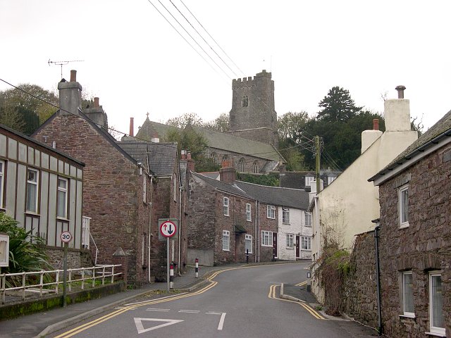
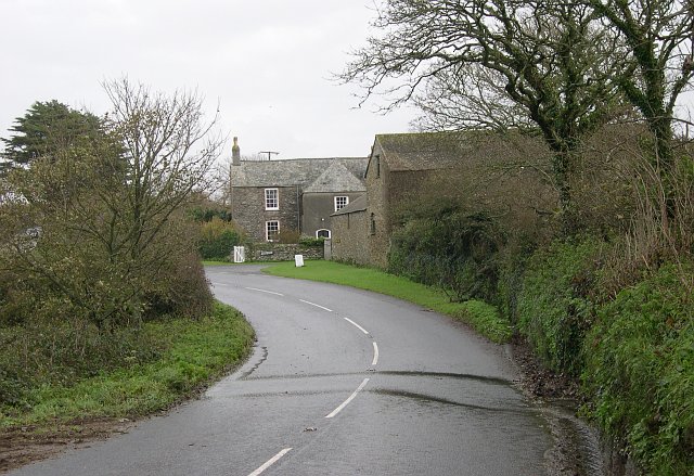
West Antony is a small village located in the county of Cornwall, England. Situated near the south coast of the county, West Antony is known for its picturesque countryside views and charming traditional architecture.

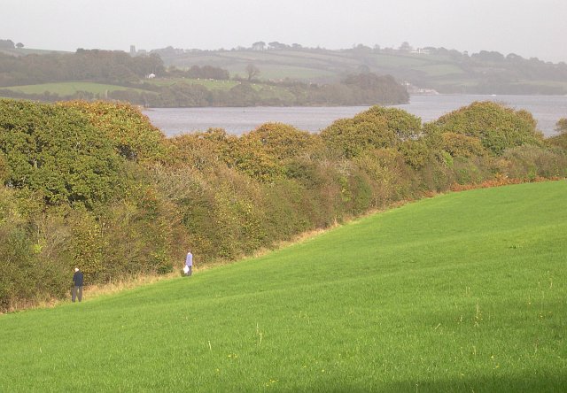
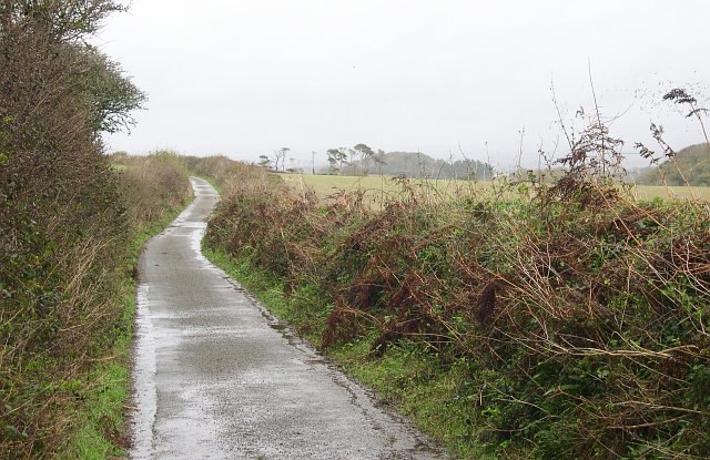
The village is surrounded by rolling green hills and farmland, making it a popular destination for those seeking a peaceful retreat in the English countryside. West Antony is also close to the Cornwall coast, offering residents and visitors the opportunity to explore nearby beaches and coastal walks.

The village itself is home to a small community, with a handful of local shops, pubs, and restaurants serving the residents and visitors. The village church, St James the Great, is a notable landmark in West Antony and dates back to the 12th century.

Overall, West Antony offers a tranquil and idyllic setting for those looking to escape the hustle and bustle of city life and immerse themselves in the natural beauty of the Cornish countryside.

If you have any feedback on the listing, please let us know in the comments section below.

West Antony Images

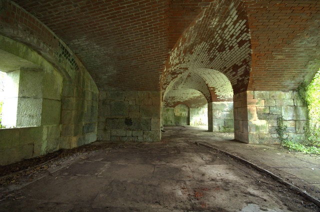
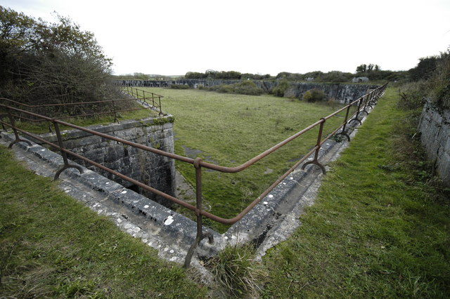
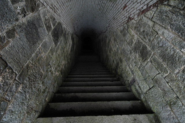
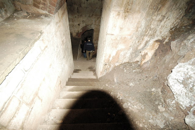
Images are sourced within 2km of 50.369481/-4.2502729 or Grid Reference SX4054. Thanks to Geograph Open Source API. All images are credited.

Tregantle Fort near Antony Tregantle Fort is one of several forts surrounding Plymouth that were built as a result of a decision in Lord Palmerston's premiership to deter the French from attacking naval bases on the Channel coast. The fort was originally designed by Captain William Crossman, with later modifications by Captain (later Maj General) Edmund Frederick Du Cane. Construction commenced in 1859 and was completed in 1865. When originally designed it had provision for 35 large guns. By 1893 the guns consisted of five RBL 7 inch Armstrong guns and nineteen RML 64-pounders, together with a number of 32 Pounder Smooth Bore Breech Loading guns. Early in the 1900s it became an infantry battalion headquarters with 14 officers and 423 other ranks, and from 1903 was used for rifle training. Tregantle is infamous within the armed forces because many of the rifle ranges located there slope steeply down towards the sea. These ranges are still in use, primarily by personnel located at HMS Raleigh. Tregantle was vacated after World War I until 1938, when it was used as the Territorial Army Passive Air Defence School. During World War II it was used first as the Army Gas School and from 1942 as US Army accommodation. (source Wikipedia)
Tregantle Fort near Antony
Tregantle Fort is one of several forts surrounding Plymouth that were built as a result of a decision in Lord Palmerston's premiership to deter the French from attacking naval bases on the Channel coast. The fort was originally designed by Captain William Crossman, with later modifications by Captain (later Maj General) Edmund Frederick Du Cane. Construction commenced in 1859 and was completed in 1865. When originally designed it had provision for 35 large guns. By 1893 the guns consisted of five RBL 7 inch Armstrong guns and nineteen RML 64-pounders, together with a number of 32 Pounder Smooth Bore Breech Loading guns. Early in the 1900s it became an infantry battalion headquarters with 14 officers and 423 other ranks, and from 1903 was used for rifle training. Tregantle is infamous within the armed forces because many of the rifle ranges located there slope steeply down towards the sea. These ranges are still in use, primarily by personnel located at HMS Raleigh. Tregantle was vacated after World War I until 1938, when it was used as the Territorial Army Passive Air Defence School. During World War II it was used first as the Army Gas School and from 1942 as US Army accommodation. (source Wikipedia)
Not the way into Wacker Woods While the footpath looks inviting, the sign warns that it leads into a military training area and that entry is forbidden.
Not the way into Wacker Woods
While the footpath looks inviting, the sign warns that it leads into a military training area and that entry is forbidden.
Wacker Quay and Warren Point Looking over the old quayside and across the entrance to the tidal creek called Wacker Lake to the woodlands at Warren Point.  Wacker Quay used to be where ammunition and other goods were brought in for the military fortifications of Scraesdon Fort and Tregantle Fort.  They were taken up to the forts on a railway line which started here but has long since disappeared.
Wacker Quay and Warren Point
Looking over the old quayside and across the entrance to the tidal creek called Wacker Lake to the woodlands at Warren Point. Wacker Quay used to be where ammunition and other goods were brought in for the military fortifications of Scraesdon Fort and Tregantle Fort. They were taken up to the forts on a railway line which started here but has long since disappeared.
A waterside field Note the two berry pickers at the field edge.
A waterside field
Note the two berry pickers at the field edge.
Antony Village This photograph was taken from the "bottom" of the village looking up the main street to the church.
Antony Village
This photograph was taken from the "bottom" of the village looking up the main street to the church.
Clampet Lane A narrow lane through mixed agricultural land to the north of Whitsand Bay.
Clampet Lane
A narrow lane through mixed agricultural land to the north of Whitsand Bay.
Higher Tregantle Farm
Fort Tregantle from the sea
Tregantle Fort Part of the fort near the viewpoint carpark.
Tregantle Fort
Part of the fort near the viewpoint carpark.
Scraesdon Fort Used by Marines for Training - used blanks / trip flares all around
Scraesdon Fort
Used by Marines for Training - used blanks / trip flares all around
Aerial View of Scraesdon Fort and Antony This picture clearly shows the outline of Scraesdon Fort with its defensive moat filled with mature trees. The village of Antony is in the picture as is Scraesdon Farm and all roads contained within the 1km square map image.
Aerial View of Scraesdon Fort and Antony
This picture clearly shows the outline of Scraesdon Fort with its defensive moat filled with mature trees. The village of Antony is in the picture as is Scraesdon Farm and all roads contained within the 1km square map image.
Scraesdon Fort - Caponier House Gun Embrasures that protect the gatehouse with musketfire, the upper floor is long gone but the stonework supports can be clearly seen.
Scraesdon Fort - Caponier
House Gun Embrasures that protect the gatehouse with musketfire, the upper floor is long gone but the stonework supports can be clearly seen.
Scraesdon Fort - Haxo Gun Casements Bomb proof gun positions that point north over the Lynher estuary.
Scraesdon Fort - Haxo Gun Casements
Bomb proof gun positions that point north over the Lynher estuary.
Scraesdon Fort - Interior
Scraesdon Fort - Steps leading down to lower levels Down down down we go into the eerie blackness below
Scraesdon Fort - Steps leading down to lower levels
Down down down we go into the eerie blackness below
Scraesdon Fort - Steps down to lower Gun Embrasures Spectacularly sturdy building - amazing to see where masonry and brick have been integrated into the rock that was cut away to form this forbiddable structure.
Scraesdon Fort - Steps down to lower Gun Embrasures
Spectacularly sturdy building - amazing to see where masonry and brick have been integrated into the rock that was cut away to form this forbiddable structure.
Scraesdon Fort - Caponier Picture of a Fortified Caponier. The fire coming from here would sweep across the entrance to the fort, inflicting devastating damage on any attempt to storm the fortificaton. 

To avoid fire from one caponier bearing on the next, caponiers are usually set at alternate corners of the fort, so that they fire towards a blank wall at the opposite end of the ditch, giving full coverage of the ditch without subjecting the next caponier to fire. The length of the straight sections of the ditch is chosen so that it can be covered by fire from a single caponier. Caponiers are often wedge shaped so that they can fire down both angles of the ditch.

Caponiers are a common feature of 19th century fortification, and are found on almost all the Victorian forts of Malta and the Palmerston Forts in UK - like this one.
Scraesdon Fort - Caponier
Picture of a Fortified Caponier. The fire coming from here would sweep across the entrance to the fort, inflicting devastating damage on any attempt to storm the fortificaton. To avoid fire from one caponier bearing on the next, caponiers are usually set at alternate corners of the fort, so that they fire towards a blank wall at the opposite end of the ditch, giving full coverage of the ditch without subjecting the next caponier to fire. The length of the straight sections of the ditch is chosen so that it can be covered by fire from a single caponier. Caponiers are often wedge shaped so that they can fire down both angles of the ditch. Caponiers are a common feature of 19th century fortification, and are found on almost all the Victorian forts of Malta and the Palmerston Forts in UK - like this one.
Scraesdon Fort - Entrance The entrance - seen here broken by an attack by a single bloke in wellies having come under considerable sustained fire from all angles.
Scraesdon Fort - Entrance
The entrance - seen here broken by an attack by a single bloke in wellies having come under considerable sustained fire from all angles.
Show me another place!

West Antony is located at Grid Ref: SX4054 (Lat: 50.369481, Lng: -4.2502729)

Unitary Authority: Cornwall

Police Authority: Devon and Cornwall

What 3 Words

///magazine.introduce.collapsed. Near Millbrook, Cornwall

Nearby Locations

Antony West Antony

Related Wikis

Antony, Cornwall

Antony (Cornish: Trevanta) is a coastal civil parish and a village in Cornwall, England, United Kingdom. The village is situated on the Rame Peninsula...

Church of St James, Antony

The Church of St James is a Grade I listed 12th-century Anglican parish church in Antony, Cornwall, England. == History == The church is located in Antony...

A374 road

The A374 is a main road in the United Kingdom, one of six A-roads making the border crossing between Devon and Cornwall. It is the most southerly of the...
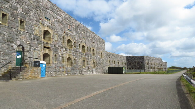
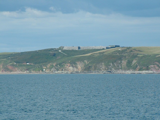
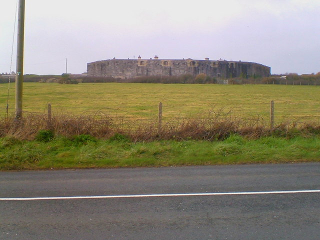
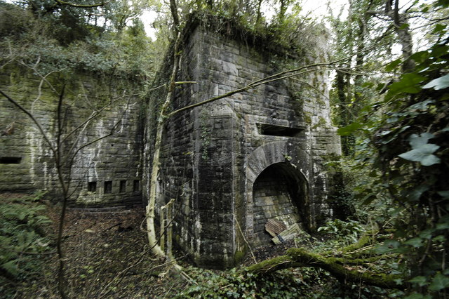
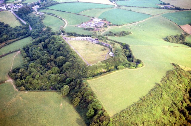
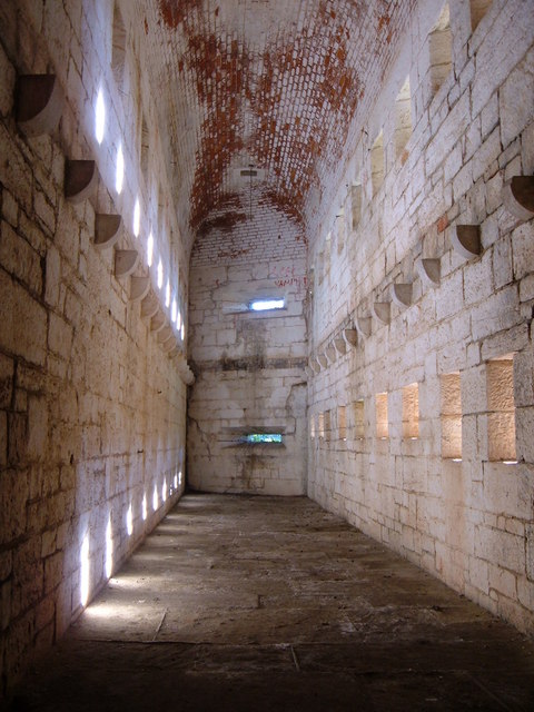
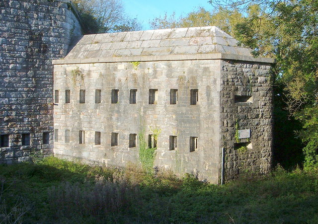
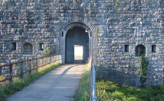
Scraesdon Fort

Scraesdon Fort, near the village of Antony, is one of several forts in South East Cornwall which formed part of the ring of forts surrounding Plymouth...

Nearby Amenities

Located within 500m of 50.369481,-4.2502729
Antony
Is In: Cornwall, England, UK
Name En: Antony
Name Kw: Anton
Place: village
Wikidata: Q4697677
Wikipedia: en:Antony, Cornwall
Lat/Long: 50.3698872/-4.2520782
Bus Stop
Ring O Bells
Naptan AtcoCode: 0800COA10287
Naptan Bearing: SW
Naptan CommonName: Ring O Bells
Naptan NaptanCode: cordwjwd
Naptan Street: Antony Hill
Naptan Verified: no
Source: naptan_import
Lat/Long: 50.3701008/-4.251811
Generator Method: photovoltaic
Generator Output Electricity: yes
Generator Source: solar
Generator Type: solar_photovoltaic_panel
Location: roof
Power: generator
Lat/Long: 50.3688652/-4.2540851
Generator Method: photovoltaic
Generator Output Electricity: yes
Generator Source: solar
Generator Type: solar_photovoltaic_panel
Location: roof
Power: generator
Lat/Long: 50.3697541/-4.2517641
Generator Method: photovoltaic
Generator Output Electricity: yes
Generator Source: solar
Generator Type: solar_photovoltaic_panel
Location: roof
Power: generator
Lat/Long: 50.3696278/-4.2530026
Pub
The Carew Arms
Lat/Long: 50.3701949/-4.2519591
Power: pole
Lat/Long: 50.366393/-4.2543778
Power: pole
Lat/Long: 50.3666889/-4.2531386
Power: pole
Lat/Long: 50.3669832/-4.2517465
Power: pole
Lat/Long: 50.3672416/-4.2505637
Power: pole
Lat/Long: 50.3675974/-4.2488712
Power: pole
Lat/Long: 50.3678866/-4.2475274
Power: pole
Lat/Long: 50.3682133/-4.2460442
Power: pole
Lat/Long: 50.3685076/-4.2447057
Power: pole
Lat/Long: 50.3680594/-4.245218
Power: pole
Lat/Long: 50.3676868/-4.2467248
Power: pole
Lat/Long: 50.3675204/-4.2477527
Power: pole
Lat/Long: 50.3671098/-4.2495686
Power: pole
Lat/Long: 50.3667642/-4.2512611
Power: pole
Lat/Long: 50.3665692/-4.2522669
Power: pole
Lat/Long: 50.3662082/-4.2529428
Power: pole
Lat/Long: 50.3657154/-4.2538199
Public Bookcase
Booth: K6
Disused Amenity: telephone
Man Made: telephone_box
Public Bookcase Type: phone_box
Survey Date: 2022-08-29
Lat/Long: 50.3704128/-4.2510196
Post Box
Brand: Royal Mail
Brand Wikidata: Q638098
Collection Times: Mo-Fr 16:30; Sa 11:00
Operator: Royal Mail
Operator Wikidata: Q638098
Post Box Mounting: pier
Post Box Type: lamp
Ref: PL11 401
Royal Cypher: EIIR
Royal Cypher Wikidata: Q33102113
Survey Date: 2023-01-07
Wikimedia Commons: File:Antony Village Stores - geograph.org.uk - 4248400.jpg
Lat/Long: 50.3704354/-4.2509932
The data included in this document is from www.openstreetmap.org. The data is made available under ODbL.

Have you been to West Antony?

Leave your review of West Antony below (or comments, questions and feedback).