Antony

Civil Parish in Cornwall

England

Antony

Not the way into Wacker Woods While the footpath looks inviting, the sign warns that it leads into a military training area and that entry is forbidden.
Not the way into Wacker Woods Credit: Tony Atkin

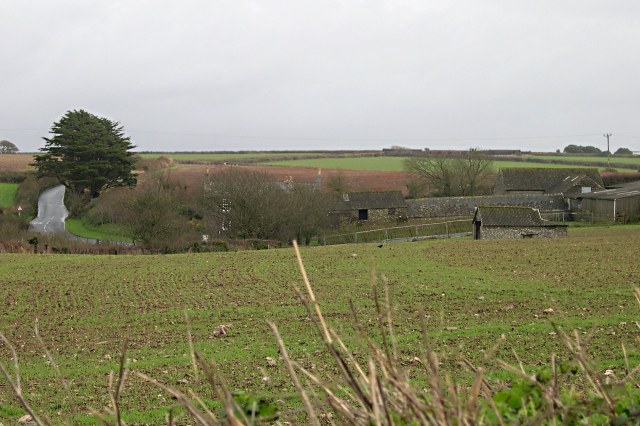
Antony is a civil parish located in the county of Cornwall, England. It is situated on the Rame Peninsula, which extends into the English Channel. The parish covers an area of about 2.7 square miles and has a population of around 1,200 people.

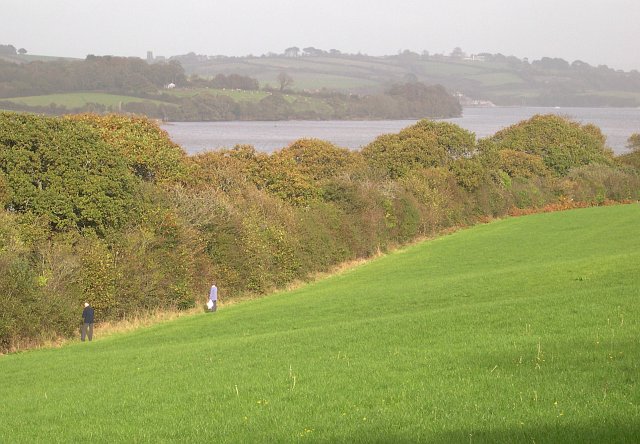
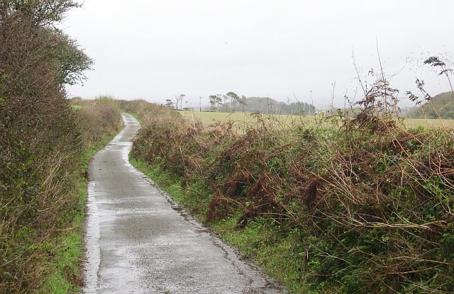
The village of Antony is the main settlement within the parish. It is known for its picturesque charm, with traditional stone cottages and narrow streets. The village is surrounded by beautiful countryside and offers stunning views of the surrounding coastline.

Antony House, a historic mansion, is one of the notable landmarks in the area. It was built in the early 18th century and is renowned for its elegant architecture and well-preserved interiors. The house is set within extensive gardens, which are open to the public and showcase a variety of exotic plants and flowers.

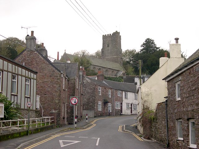
The parish also boasts a number of other historic buildings, including the 15th-century Church of St. James. This medieval church is known for its intricate stained glass windows and impressive tower. Additionally, there are several manor houses and farms that reflect the area's agricultural heritage.

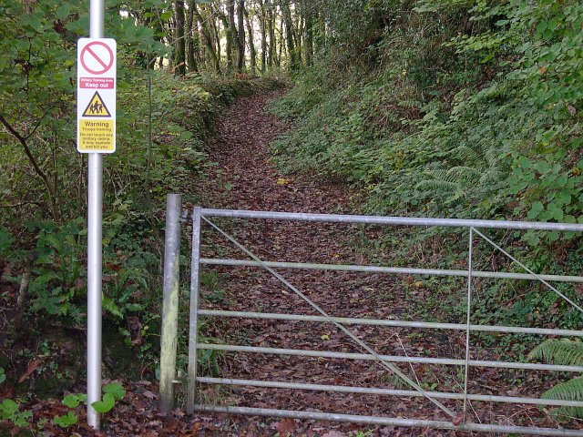
Antony offers a range of amenities for residents and visitors alike. There are a few local shops and pubs, as well as a primary school and a village hall. The area is popular for outdoor activities such as walking, cycling, and birdwatching due to its natural beauty and proximity to the coast.

Overall, Antony, Cornwall is a charming civil parish that combines historic architecture, beautiful landscapes, and a tight-knit community.

If you have any feedback on the listing, please let us know in the comments section below.

Antony Images

Images are sourced within 2km of 50.370982/-4.24874 or Grid Reference SX4054. Thanks to Geograph Open Source API. All images are credited.

Not the way into Wacker Woods While the footpath looks inviting, the sign warns that it leads into a military training area and that entry is forbidden.
Not the way into Wacker Woods
While the footpath looks inviting, the sign warns that it leads into a military training area and that entry is forbidden.
Wacker Quay and Warren Point Looking over the old quayside and across the entrance to the tidal creek called Wacker Lake to the woodlands at Warren Point.  Wacker Quay used to be where ammunition and other goods were brought in for the military fortifications of Scraesdon Fort and Tregantle Fort.  They were taken up to the forts on a railway line which started here but has long since disappeared.
Wacker Quay and Warren Point
Looking over the old quayside and across the entrance to the tidal creek called Wacker Lake to the woodlands at Warren Point. Wacker Quay used to be where ammunition and other goods were brought in for the military fortifications of Scraesdon Fort and Tregantle Fort. They were taken up to the forts on a railway line which started here but has long since disappeared.
A waterside field Note the two berry pickers at the field edge.
A waterside field
Note the two berry pickers at the field edge.
Antony Village This photograph was taken from the "bottom" of the village looking up the main street to the church.
Antony Village
This photograph was taken from the "bottom" of the village looking up the main street to the church.
Clampet Lane A narrow lane through mixed agricultural land to the north of Whitsand Bay.
Clampet Lane
A narrow lane through mixed agricultural land to the north of Whitsand Bay.
Scraesdon Fort Used by Marines for Training - used blanks / trip flares all around
Scraesdon Fort
Used by Marines for Training - used blanks / trip flares all around
Aerial View of Scraesdon Fort and Antony This picture clearly shows the outline of Scraesdon Fort with its defensive moat filled with mature trees. The village of Antony is in the picture as is Scraesdon Farm and all roads contained within the 1km square map image.
Aerial View of Scraesdon Fort and Antony
This picture clearly shows the outline of Scraesdon Fort with its defensive moat filled with mature trees. The village of Antony is in the picture as is Scraesdon Farm and all roads contained within the 1km square map image.
Scraesdon Fort - Caponier House Gun Embrasures that protect the gatehouse with musketfire, the upper floor is long gone but the stonework supports can be clearly seen.
Scraesdon Fort - Caponier
House Gun Embrasures that protect the gatehouse with musketfire, the upper floor is long gone but the stonework supports can be clearly seen.
Scraesdon Fort - Haxo Gun Casements Bomb proof gun positions that point north over the Lynher estuary.
Scraesdon Fort - Haxo Gun Casements
Bomb proof gun positions that point north over the Lynher estuary.
Scraesdon Fort - Interior
Scraesdon Fort - Steps leading down to lower levels Down down down we go into the eerie blackness below
Scraesdon Fort - Steps leading down to lower levels
Down down down we go into the eerie blackness below
Scraesdon Fort - Steps down to lower Gun Embrasures Spectacularly sturdy building - amazing to see where masonry and brick have been integrated into the rock that was cut away to form this forbiddable structure.
Scraesdon Fort - Steps down to lower Gun Embrasures
Spectacularly sturdy building - amazing to see where masonry and brick have been integrated into the rock that was cut away to form this forbiddable structure.
Scraesdon Fort - Caponier Picture of a Fortified Caponier. The fire coming from here would sweep across the entrance to the fort, inflicting devastating damage on any attempt to storm the fortificaton. 

To avoid fire from one caponier bearing on the next, caponiers are usually set at alternate corners of the fort, so that they fire towards a blank wall at the opposite end of the ditch, giving full coverage of the ditch without subjecting the next caponier to fire. The length of the straight sections of the ditch is chosen so that it can be covered by fire from a single caponier. Caponiers are often wedge shaped so that they can fire down both angles of the ditch.

Caponiers are a common feature of 19th century fortification, and are found on almost all the Victorian forts of Malta and the Palmerston Forts in UK - like this one.
Scraesdon Fort - Caponier
Picture of a Fortified Caponier. The fire coming from here would sweep across the entrance to the fort, inflicting devastating damage on any attempt to storm the fortificaton. To avoid fire from one caponier bearing on the next, caponiers are usually set at alternate corners of the fort, so that they fire towards a blank wall at the opposite end of the ditch, giving full coverage of the ditch without subjecting the next caponier to fire. The length of the straight sections of the ditch is chosen so that it can be covered by fire from a single caponier. Caponiers are often wedge shaped so that they can fire down both angles of the ditch. Caponiers are a common feature of 19th century fortification, and are found on almost all the Victorian forts of Malta and the Palmerston Forts in UK - like this one.
Scraesdon Fort - Entrance The entrance - seen here broken by an attack by a single bloke in wellies having come under considerable sustained fire from all angles.
Scraesdon Fort - Entrance
The entrance - seen here broken by an attack by a single bloke in wellies having come under considerable sustained fire from all angles.
Wacker Lake The main road out of Torpoint skirts the southern edge of this tidal creek but all you get to see is tantalising glances through the trees which line the road.  The far shore of the lake is in the next grid square to the north. <a href="https://www.geograph.org.uk/gridref/SX3855">SX3855</a>
Wacker Lake
The main road out of Torpoint skirts the southern edge of this tidal creek but all you get to see is tantalising glances through the trees which line the road. The far shore of the lake is in the next grid square to the north. SX3855
Bench and Shed at Wacker Quay Wacker Quay is a popular place for people to come and stare at the water.  I believe the corrugated iron shed beyond the car used to be the engine shed for the military railway that ran from here to Scraesdon Fort and Tregantle Fort.
Bench and Shed at Wacker Quay
Wacker Quay is a popular place for people to come and stare at the water. I believe the corrugated iron shed beyond the car used to be the engine shed for the military railway that ran from here to Scraesdon Fort and Tregantle Fort.
Arable Land around Higher Tregantle Farm
The River Lynher near Antony, Cornwall The wooden piles are the remains of a long abandoned jetty
The River Lynher near Antony, Cornwall
The wooden piles are the remains of a long abandoned jetty
Show me another place!

Antony is located at Grid Ref: SX4054 (Lat: 50.370982, Lng: -4.24874)

Unitary Authority: Cornwall

Police Authority: Devon & Cornwall

What 3 Words

///hiker.interview.tribe. Near Millbrook, Cornwall

Nearby Locations

Antony West Antony

Related Wikis

Antony, Cornwall

Antony (Cornish: Trevanta) is a coastal civil parish and a village in Cornwall, England, United Kingdom. The village is situated on the Rame Peninsula...

Church of St James, Antony

The Church of St James is a Grade I listed 12th-century Anglican parish church in Antony, Cornwall, England. == History == The church is located in Antony...

A374 road

The A374 is a main road in the United Kingdom, one of six A-roads making the border crossing between Devon and Cornwall. It is the most southerly of the...
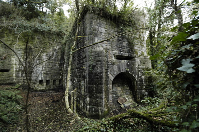
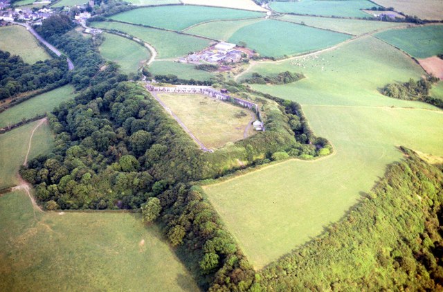
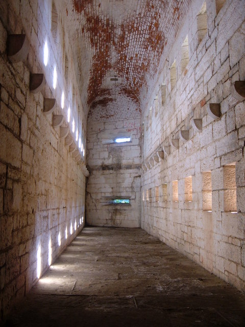
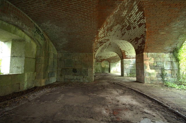
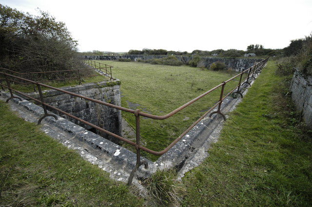
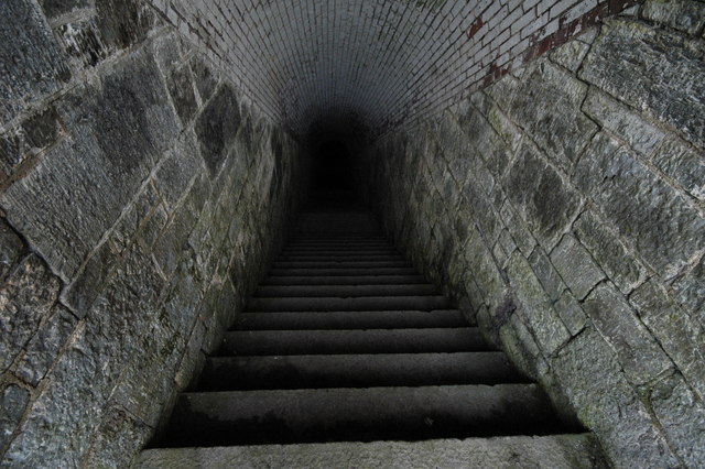
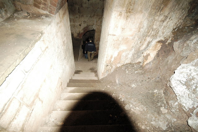
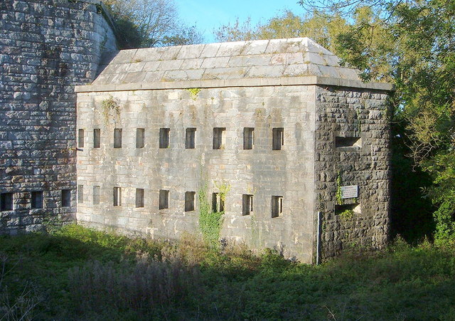
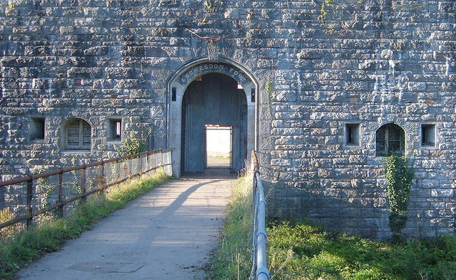
Scraesdon Fort

Scraesdon Fort, near the village of Antony, is one of several forts in South East Cornwall which formed part of the ring of forts surrounding Plymouth...

St John, Cornwall

St John (parish: Cornish: Pluwjowan, village: Cornish: S. Jowan) is a coastal civil parish and a village in south-east Cornwall, England, United Kingdom...
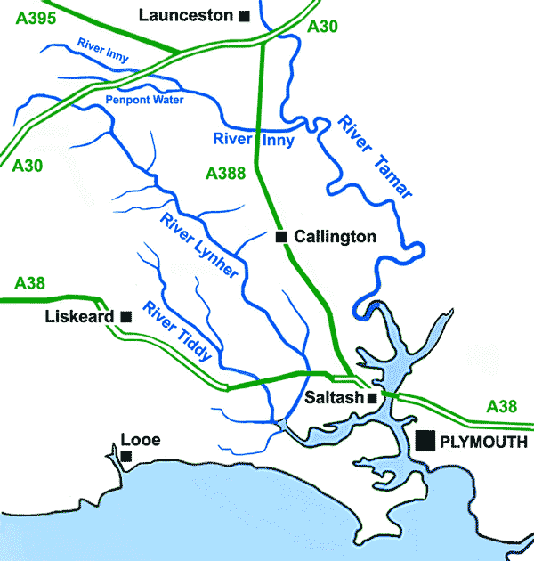
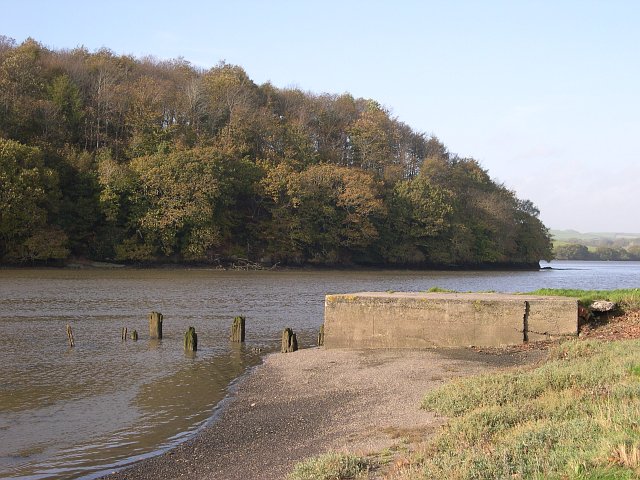
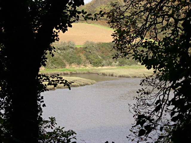
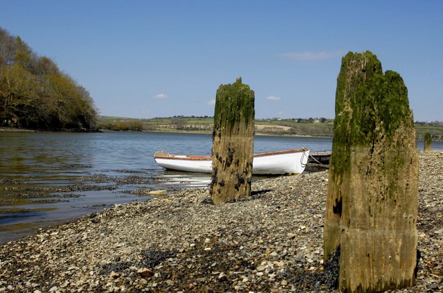
River Lynher

The River Lynher (Cornish: Linar) (or St Germans River downstream from its confluence with the Tiddy) flows through east Cornwall, England, and enters...

Lower Tregantle

Lower Tregantle is a hamlet in Cornwall, England, UK. It is about half a mile south of Antony; Higher Tregantle is about a quarter of a mile further south...

HMS Raleigh (shore establishment)

HMS Raleigh is a stone frigate (shore establishment), serving as the basic training facility of the Royal Navy at Torpoint, Cornwall, United Kingdom. It...

Nearby Amenities

Located within 500m of 50.370982,-4.24874
Source: PGS
Lat/Long: 50.3750971/-4.2492431
Source: PGS
Lat/Long: 50.3747745/-4.2488985
Source: PGS
Lat/Long: 50.3743752/-4.2494133
Created By: almien_coastlines
Source: PGS
Lat/Long: 50.3745281/-4.2501776
Created By: almien_coastlines
Source: PGS
Lat/Long: 50.3747064/-4.2506263
Antony
Is In: Cornwall, England, UK
Name En: Antony
Name Kw: Anton
Place: village
Wikidata: Q4697677
Wikipedia: en:Antony, Cornwall
Lat/Long: 50.3698872/-4.2520782
Bus Stop
Ring O Bells
Naptan AtcoCode: 0800COA10287
Naptan Bearing: SW
Naptan CommonName: Ring O Bells
Naptan NaptanCode: cordwjwd
Naptan Street: Antony Hill
Naptan Verified: no
Source: naptan_import
Lat/Long: 50.3701008/-4.251811
Clift
Place: hamlet
Lat/Long: 50.375303/-4.2484883
Generator Method: photovoltaic
Generator Output Electricity: yes
Generator Source: solar
Generator Type: solar_photovoltaic_panel
Location: roof
Power: generator
Lat/Long: 50.3688652/-4.2540851
Generator Method: photovoltaic
Generator Output Electricity: yes
Generator Source: solar
Generator Type: solar_photovoltaic_panel
Location: roof
Power: generator
Lat/Long: 50.3697541/-4.2517641
Generator Method: photovoltaic
Generator Output Electricity: yes
Generator Source: solar
Generator Type: solar_photovoltaic_panel
Location: roof
Power: generator
Lat/Long: 50.3696278/-4.2530026
Pub
The Carew Arms
Lat/Long: 50.3701949/-4.2519591
Power: pole
Lat/Long: 50.3669832/-4.2517465
Power: pole
Lat/Long: 50.3672416/-4.2505637
Power: pole
Lat/Long: 50.3675974/-4.2488712
Power: pole
Lat/Long: 50.3678866/-4.2475274
Power: pole
Lat/Long: 50.3682133/-4.2460442
Power: pole
Lat/Long: 50.3685076/-4.2447057
Power: pole
Lat/Long: 50.368896/-4.2429167
Power: pole
Lat/Long: 50.3684186/-4.2433673
Power: pole
Lat/Long: 50.3680594/-4.245218
Power: pole
Lat/Long: 50.3676868/-4.2467248
Power: pole
Lat/Long: 50.3675204/-4.2477527
Power: pole
Lat/Long: 50.3671098/-4.2495686
Public Bookcase
Booth: K6
Disused Amenity: telephone
Man Made: telephone_box
Public Bookcase Type: phone_box
Survey Date: 2022-08-29
Lat/Long: 50.3704128/-4.2510196
Post Box
Brand: Royal Mail
Brand Wikidata: Q638098
Collection Times: Mo-Fr 16:30; Sa 11:00
Operator: Royal Mail
Operator Wikidata: Q638098
Post Box Mounting: pier
Post Box Type: lamp
Ref: PL11 401
Royal Cypher: EIIR
Royal Cypher Wikidata: Q33102113
Survey Date: 2023-01-07
Wikimedia Commons: File:Antony Village Stores - geograph.org.uk - 4248400.jpg
Lat/Long: 50.3704354/-4.2509932
The data included in this document is from www.openstreetmap.org. The data is made available under ODbL.

Have you been to Antony?

Leave your review of Antony below (or comments, questions and feedback).