Meare

Settlement in Somerset Mendip

England

Meare

Telephone Exchange, Meare Situated in St Mary's Road, this TE dates from the GPO era with a red telephone box in front of it. It used to take the name "Meare Heath" after the area South of the B3151 road between Meare and Westhay. Two microwave dishes can be seen on the pole adjacent to the TE, which serves the two aforementioned villages. The TE has (01458) 860xxx numbers and its postcode is BA6 9SP.
Telephone Exchange, Meare Credit: David Hillas

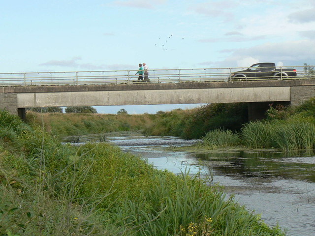
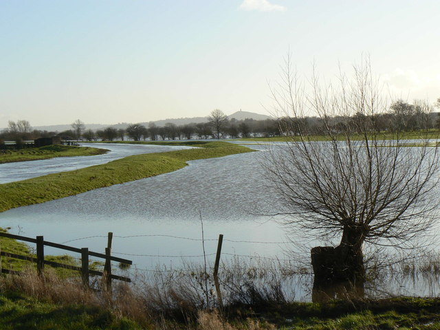
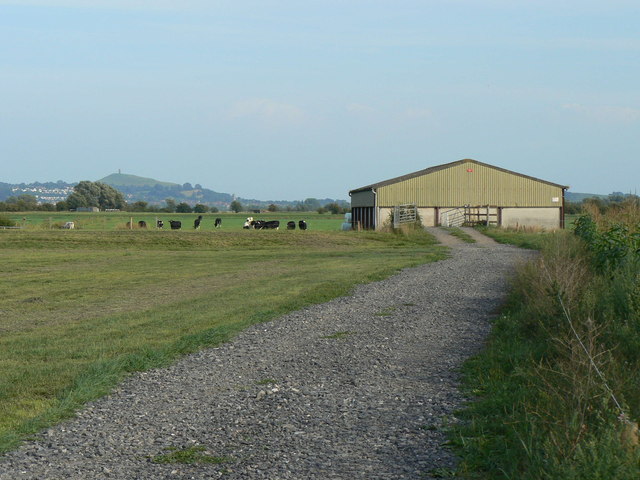
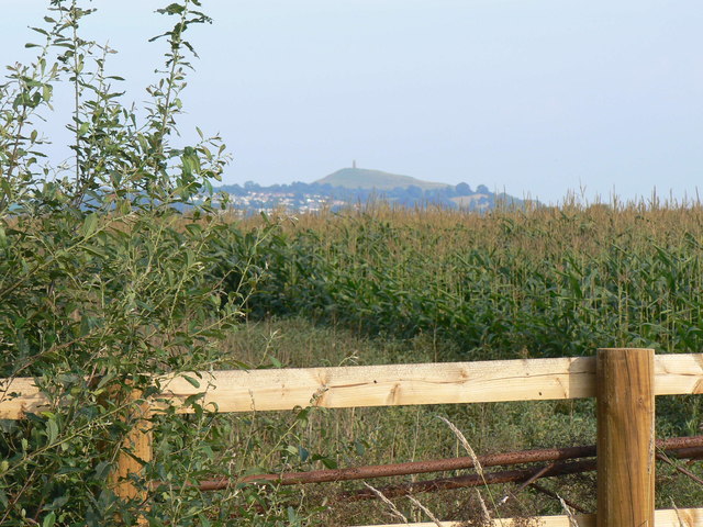
Meare is a small village located in the county of Somerset, England. Situated approximately 6 miles west of Glastonbury, this rural settlement is nestled in the heart of the Somerset Levels, a vast area of flat, marshy land known for its rich wildlife and historical significance.

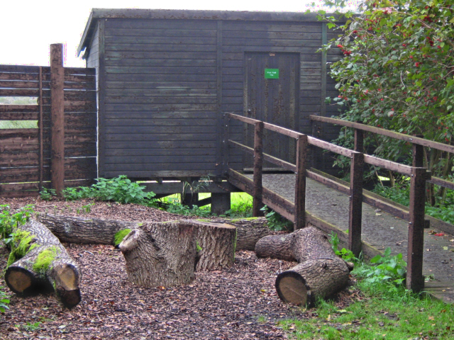
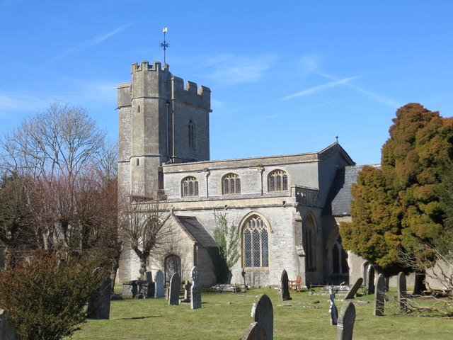
The village itself dates back to the Saxon era and is steeped in history. It is home to the intriguing Meare Lake Village, an ancient settlement from the Iron Age, which was discovered in the late 19th century. The site includes the remnants of several roundhouses, wooden walkways, and a causeway that connected the village to the mainland.

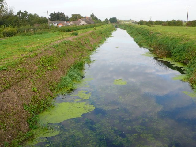
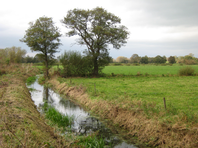
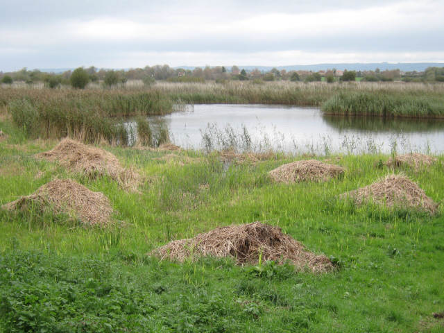
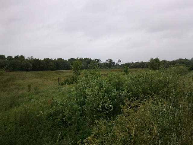
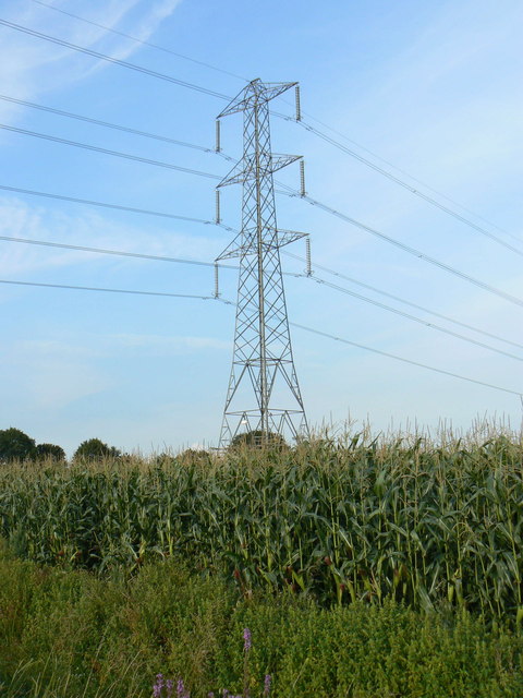
In addition to its historical significance, Meare is blessed with natural beauty. The surrounding countryside offers breathtaking views of the Somerset Levels and provides ample opportunities for walking, cycling, and birdwatching. The nearby Shapwick Heath National Nature Reserve, a designated Site of Special Scientific Interest, offers a haven for rare species of birds, insects, and plants.

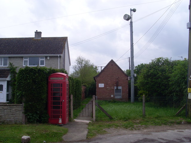
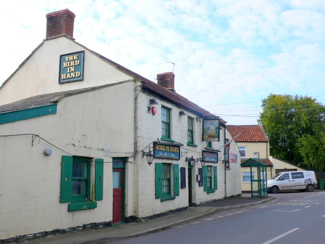
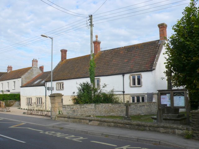
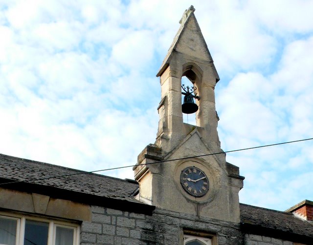
Meare is also known for its charming thatched cottages and traditional village pub, which exude a sense of quintessential English countryside living. While its size is modest, Meare has a strong sense of community and is a popular destination for those seeking a peaceful retreat away from the hustle and bustle of city life.

Overall, Meare is a picturesque and historically significant village, offering visitors a glimpse into the past and a chance to appreciate the natural wonders of the Somerset Levels.

If you have any feedback on the listing, please let us know in the comments section below.

Meare Images

Images are sourced within 2km of 51.17145/-2.78125 or Grid Reference ST4541. Thanks to Geograph Open Source API. All images are credited.

Telephone Exchange, Meare Situated in St Mary's Road, this TE dates from the GPO era with a red telephone box in front of it. It used to take the name "Meare Heath" after the area South of the B3151 road between Meare and Westhay. Two microwave dishes can be seen on the pole adjacent to the TE, which serves the two aforementioned villages. The TE has (01458) 860xxx numbers and its postcode is BA6 9SP.
Telephone Exchange, Meare
Situated in St Mary's Road, this TE dates from the GPO era with a red telephone box in front of it. It used to take the name "Meare Heath" after the area South of the B3151 road between Meare and Westhay. Two microwave dishes can be seen on the pole adjacent to the TE, which serves the two aforementioned villages. The TE has (01458) 860xxx numbers and its postcode is BA6 9SP.
Rice Farm The farm stand on the south side of the River Brue just to the west of Glastonbury.
Rice Farm
The farm stand on the south side of the River Brue just to the west of Glastonbury.
Meare School Built of local Blue Lias stone and standing on the main road through the village, the school was built by subscription in 1813.
Meare School
Built of local Blue Lias stone and standing on the main road through the village, the school was built by subscription in 1813.
Bird in Hand Westhay An unmodernised pub at the north end of the village close to Westhay bridge over the River Brue.
Bird in Hand Westhay
An unmodernised pub at the north end of the village close to Westhay bridge over the River Brue.
Cottages at Meare These cottages are on the main road through the villages next to the church. Some of the gravestones in the churchyard can be seen on the right.
Cottages at Meare
These cottages are on the main road through the villages next to the church. Some of the gravestones in the churchyard can be seen on the right.
Bell and Clock This bell and clock tower are above the front door of Meare village school.
Bell and Clock
This bell and clock tower are above the front door of Meare village school.
Abbot's Fish House, Meare
Heath Rhyne, Meare Heath
Meare Heath Hide
Meare Heath Hide
View from Meare Heath Hide
A fertile field, some trees and a wind pump
The church of St Mary at Meare
Westhay Bridge in summer The present bridge was built in the 1960's, and carries the B3151 Glastonbury-Wedmore road. 
Compare a winter flood scene<a href="https://www.geograph.org.uk/photo/664679">ST4342 : River Brue in flood at Westhay Bridge</a> (taken from the bridge looking West). The photographer's position for this summer photo would be under water in the winter scene.
The reclaimed nature of the landscape means there is no other bridge over the river for about 8km going westward (on the Burtle-Mark road) or 6km going East (minor road to Godney), so it is a vital communications link.
<a href="https://www.geograph.org.uk/photo/192924">ST4342 : The River Brue, Westhay</a> shows the view from the bridge looking East in a non-flood season.
Westhay Bridge in summer
The present bridge was built in the 1960's, and carries the B3151 Glastonbury-Wedmore road. Compare a winter flood sceneST4342 : River Brue in flood at Westhay Bridge (taken from the bridge looking West). The photographer's position for this summer photo would be under water in the winter scene. The reclaimed nature of the landscape means there is no other bridge over the river for about 8km going westward (on the Burtle-Mark road) or 6km going East (minor road to Godney), so it is a vital communications link. ST4342 : The River Brue, Westhay shows the view from the bridge looking East in a non-flood season.
Winter Floods at Westhay Bridge Looking East - the Brue has overtopped and flooded the surrounding pasture fields - a fairly regular winter occurrence after heavy rain. In the distance is Glastonbury Tor. Compare the summer scene  at <a href="https://www.geograph.org.uk/photo/2261686">ST4342 : River Brue</a> or <a href="https://www.geograph.org.uk/photo/192924">ST4342 : The River Brue, Westhay</a>.
Winter Floods at Westhay Bridge
Looking East - the Brue has overtopped and flooded the surrounding pasture fields - a fairly regular winter occurrence after heavy rain. In the distance is Glastonbury Tor. Compare the summer scene at ST4342 : River Brue or ST4342 : The River Brue, Westhay.
Farm building on Godney Moor The modern farm building enables feed and machinery to be kept out on this isolated moor, and offers shelter for cattle as well. Cattle graze the pasture in summer: in winter, flooding is a regular occurrence.
Glastonbury Tor is in the background.
Farm building on Godney Moor
The modern farm building enables feed and machinery to be kept out on this isolated moor, and offers shelter for cattle as well. Cattle graze the pasture in summer: in winter, flooding is a regular occurrence. Glastonbury Tor is in the background.
Maize almost ready for harvesting on Godney Moor While much of this remote moor is pasture, there are fields of maize grown for cattle fodder. The combine harvester will cut the complete plants, chop them, and the resulting fodder will be silaged (in a pit, silo or in round bales) and stored until needed in winter. 
Glastonbury Tor is in the background
Maize almost ready for harvesting on Godney Moor
While much of this remote moor is pasture, there are fields of maize grown for cattle fodder. The combine harvester will cut the complete plants, chop them, and the resulting fodder will be silaged (in a pit, silo or in round bales) and stored until needed in winter. Glastonbury Tor is in the background
Pylon in maize field on Godney Moor A line of pylons stretches dead straight across Westhay and Godney Moor, linking Hinckley Point nuclear power station into the National Grid.
They form a striking contrast with the lowland pastures and crops that make up the landscape.
Pylon in maize field on Godney Moor
A line of pylons stretches dead straight across Westhay and Godney Moor, linking Hinckley Point nuclear power station into the National Grid. They form a striking contrast with the lowland pastures and crops that make up the landscape.
Show me another place!

Meare is located at Grid Ref: ST4541 (Lat: 51.17145, Lng: -2.78125)

Administrative County: Somerset

District: Mendip

Police Authority: Avon and Somerset

What 3 Words

///venues.prestige.dwarf. Near Glastonbury, Somerset

Related Wikis

Manor Farmhouse, Meare

The Manor Farmhouse in Meare, Somerset, England, was built in the 14th century as the summer residence of the Abbots from Glastonbury Abbey and is now...

Meare

Meare is a village and civil parish in Somerset, England, 3 miles (4.8 km) north-west of Glastonbury on the Somerset Levels. The parish includes the village...

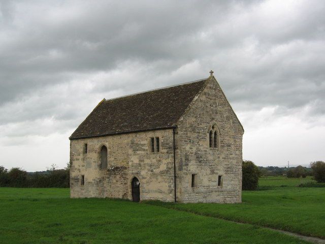
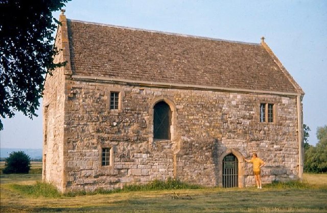
The Abbot's Fish House, Meare

The Abbot's Fish House in Meare, Somerset, England, was built in the 14th century and has been designated as a Grade I listed building and Scheduled Ancient...
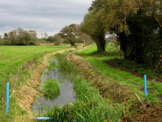
Meare Pool

Meare Pool (also known as Ferlingmere, Ferran Mere or Meare fish pool) was a lake in the Somerset Levels in South West England. Lake villages existed there...

Nearby Amenities

Located within 500m of 51.17145,-2.78125
Meare
Is In: Somerset, England, UK
Place: village
Source: npe
Website: http://meareandwesthay.com
Lat/Long: 51.172004/-2.7831288
Barrier: kissing_gate
Lat/Long: 51.1718801/-2.7762536
Tourism: information
Lat/Long: 51.1718339/-2.7763507
Meare Fish House
Alt Name: Abbots Fish House
Historic: building
Operator: English Heritage
Website: https://www.english-heritage.org.uk/visit/places/meare-fish-house/
Lat/Long: 51.1722174/-2.7766187
Barrier: kissing_gate
Lat/Long: 51.1694788/-2.7840044
A S Grenter & Son
Shop: car_repair
Lat/Long: 51.1712453/-2.7810685
Barrier: stile
Lat/Long: 51.1681005/-2.7802413
Barrier: stile
Lat/Long: 51.1682263/-2.7794544
Meare Fish House
Operator: Historic England
Tourism: attraction
Lat/Long: 51.1719706/-2.7762496
Crossing
Lat/Long: 51.17154/-2.7824864
Power: pole
Source: bing
Lat/Long: 51.1686234/-2.7866167
Poles: bipole
Power: pole
Source: bing
Transformer: distribution
Lat/Long: 51.168303/-2.7848974
Power: pole
Source: bing
Lat/Long: 51.1684073/-2.7840967
Power: pole
Source: bing
Lat/Long: 51.1685402/-2.783854
Power: pole
Source: bing
Lat/Long: 51.1694984/-2.7820395
Power: pole
Source: bing
Lat/Long: 51.168948/-2.7831312
Power: pole
Source: bing
Lat/Long: 51.1690111/-2.7821361
Power: pole
Source: bing
Lat/Long: 51.1691162/-2.7807172
Power: pole
Source: bing
Transformer: distribution
Lat/Long: 51.1708072/-2.7780913
Power: pole
Source: bing
Lat/Long: 51.1708947/-2.7772276
Power: pole
Source: bing
Lat/Long: 51.1703489/-2.7772357
Power: pole
Source: bing
Lat/Long: 51.1697738/-2.777245
Power: pole
Source: bing
Lat/Long: 51.1692112/-2.7793385
Power: pole
Source: bing
Lat/Long: 51.1693054/-2.7779464
Power: pole
Source: bing
Lat/Long: 51.1691481/-2.7768065
Power: pole
Source: bing
Lat/Long: 51.1689497/-2.7754587
Historic: memorial
Memorial: war_memorial
Lat/Long: 51.1715438/-2.7816707
Post Box
Brand: Royal Mail
Brand Wikidata: Q638098
Check Date: 2023-03-05
Collection Times: Mo-Fr 09:00; Sa 07:00
Mapillary: 702459578484026
Operator: Royal Mail
Operator Wikidata: Q638098
Post Box Mounting: pier
Post Box Type: lamp
Ref: BA6 162D
Royal Cypher: EIIR
Royal Cypher Wikidata: Q33102113
Survey Date: 2023-11-11
Lat/Long: 51.170803/-2.7880758
Telephone
Defibrillator
Booth: K6
Covered: booth
Defibrillator Location: inside old red phone box by telephone exchange in Meare
Emergency: defibrillator
Man Made: telephone_box
Lat/Long: 51.1712036/-2.7830173
The data included in this document is from www.openstreetmap.org. The data is made available under ODbL.

Have you been to Meare?

Leave your review of Meare below (or comments, questions and feedback).