Maypole

Settlement in Kent Canterbury

England

Maypole

Hoath, Holy Cross
Hoath, Holy Cross Credit: Dave Kelly

Maypole is a charming village located in the county of Kent, in southeastern England. Situated approximately 5 miles northeast of the historic town of Maidstone, Maypole offers a tranquil and picturesque setting for its residents and visitors alike.

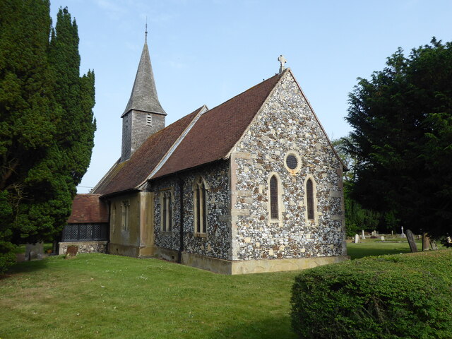
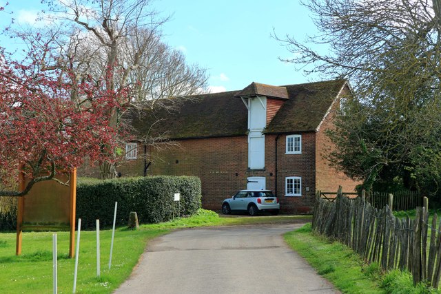
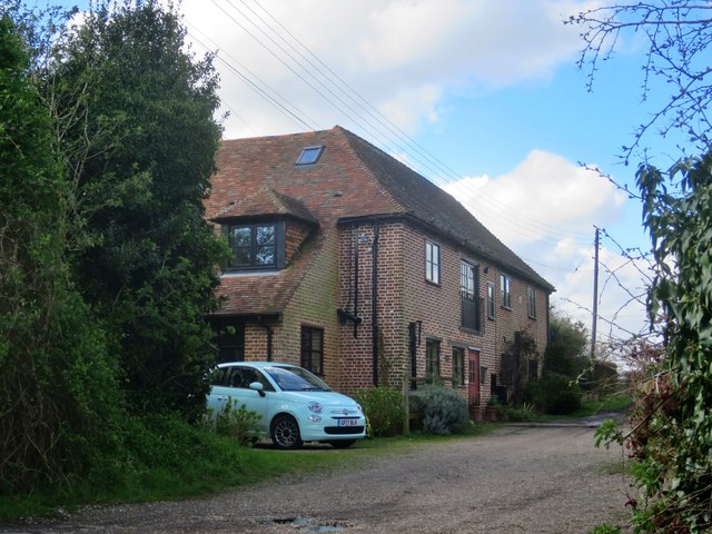
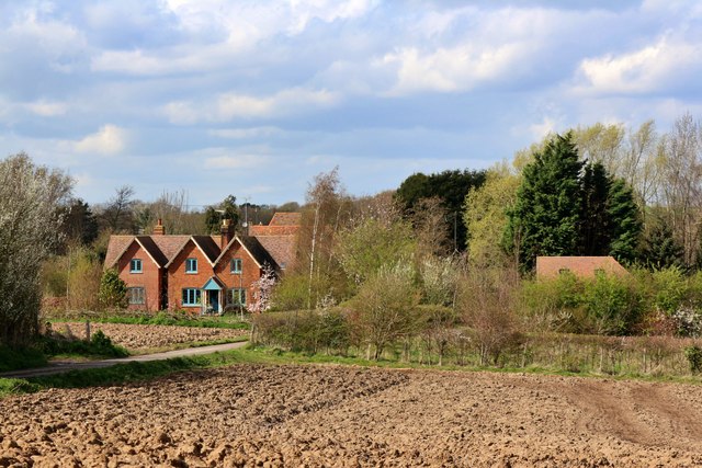
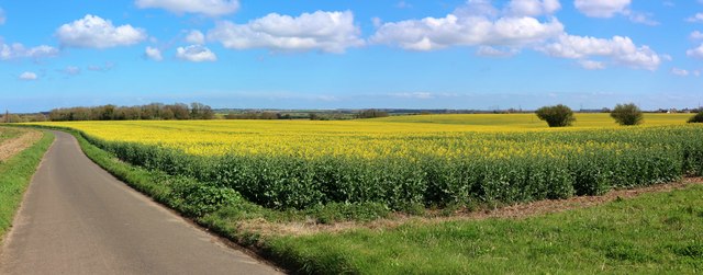
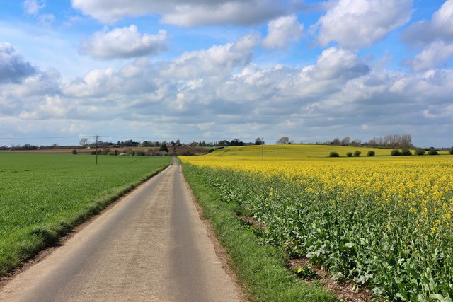
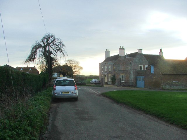
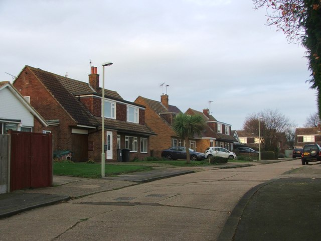
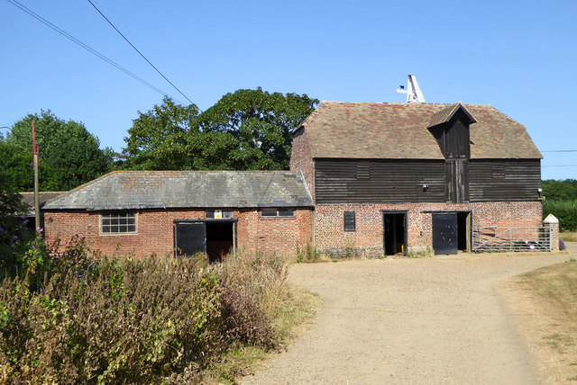
The village is characterized by its traditional English architecture, with many quaint cottages and old farmhouses dotting the landscape. The centerpiece of Maypole is its village green, a well-maintained open space where locals often gather for community events and recreational activities.

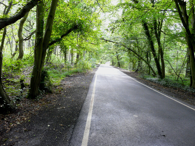
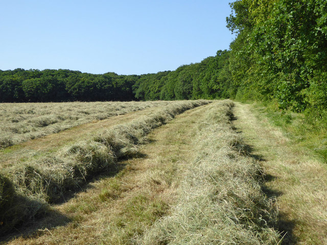
Surrounded by rolling hills and lush countryside, Maypole is a haven for nature enthusiasts. There are numerous walking and cycling trails that wind through the surrounding fields and woodlands, providing ample opportunities to explore the area's natural beauty.

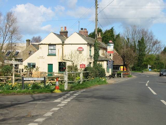
Although Maypole is a small village, it boasts a strong sense of community and is home to a number of local amenities. These include a village hall, a primary school, a post office, and a pub, which serves as a popular gathering spot for residents and visitors alike.

The village also benefits from its proximity to Maidstone, where residents can access a wider range of amenities, including shops, restaurants, and leisure facilities.

Overall, Maypole offers a peaceful and idyllic escape from the hustle and bustle of city life, with its scenic surroundings, close-knit community, and convenient location making it a desirable place to live or visit in the picturesque county of Kent.

If you have any feedback on the listing, please let us know in the comments section below.

Maypole Images

Images are sourced within 2km of 51.339109/1.160129 or Grid Reference TR2064. Thanks to Geograph Open Source API. All images are credited.

Hoath, Holy Cross
Hoath, Holy Cross
Margate Road, Broomfield
Ordnance Survey Cut Mark This somewhat damaged mark can be found on the wall of Holy Cross Church in Hoath.
For more detail see : <span class="nowrap"><a title="http://www.bench-marks.org.uk/bm75222" rel="nofollow ugc noopener" href="http://www.bench-marks.org.uk/bm75222">Link</a><img style="margin-left:2px;" alt="External link" title="External link - shift click to open in new window" src="https://s1.geograph.org.uk/img/external.png" width="10" height="10"/></span>
Ordnance Survey Cut Mark
This somewhat damaged mark can be found on the wall of Holy Cross Church in Hoath. For more detail see : LinkExternal link
The Entrance Porch and Spire of Holy Cross Church in Hoath Viewed from the south. The Spire was also used as an Intersected Station by the Ordnance Survey. <span class="nowrap"><a title="http://trigpointing.uk/trig/25473" rel="nofollow ugc noopener" href="http://trigpointing.uk/trig/25473">Link</a><img style="margin-left:2px;" alt="External link" title="External link - shift click to open in new window" src="https://s1.geograph.org.uk/img/external.png" width="10" height="10"/></span>
The Entrance Porch and Spire of Holy Cross Church in Hoath
Viewed from the south. The Spire was also used as an Intersected Station by the Ordnance Survey. LinkExternal link
Oast House -
Oast House
-
Oast House -
Oast House
-
Shelvingford Cottage
Rape field by Old Tree Road
Rape field by Hollow Road
Hicks Forstal Road The rood runs through East Blean Wood, which is a National Nature Reserve.
Hicks Forstal Road
The rood runs through East Blean Wood, which is a National Nature Reserve.
Ford Road, Broomfield
Pond Cottages, Broomfield
Hunters Chase, Herne Bay
Georgian farmhouse, Broomfield At least, I'm assuming this was once a farmhouse, in view of the yard entrance and big barn next door.  No name is given on the OS, and (I'm ashamed to say) I forgot to check at the time. 

The house stands at the eastern end of the village, by a small green.
Georgian farmhouse, Broomfield
At least, I'm assuming this was once a farmhouse, in view of the yard entrance and big barn next door. No name is given on the OS, and (I'm ashamed to say) I forgot to check at the time. The house stands at the eastern end of the village, by a small green.
Oasthouse at Buckwell Farm A grade II listed building.
Oasthouse at Buckwell Farm
A grade II listed building.
Mown hay, Hicks Forstal
Just turning autumnal Taken in mid November and the tree is still mostly green.
Just turning autumnal
Taken in mid November and the tree is still mostly green.
Footpath to Herne
Footpath to Herne
Show me another place!

Maypole is located at Grid Ref: TR2064 (Lat: 51.339109, Lng: 1.160129)

Administrative County: Kent

District: Canterbury

Police Authority: Kent

What 3 Words

///trim.cool.extra. Near Herne Bay, Kent

Related Wikis

Maypole Airfield

Maypole Airfield (ICAO: EGHB) was a general aviation airfield located 2.5 miles (4.0 km) south of Herne Bay, Kent and 5.2 miles (8.4 km) north east of...

Hoath

Hoath is a semi-rural village and civil parish in the City of Canterbury local government district. The hamlets of Knaves Ash, Maypole, Ford, Old Tree...

Ford Palace

Ford Palace was a residence of the Archbishops of Canterbury at Ford, about 6.6 miles (10.6 km) north-east of Canterbury and 2.6 miles (4.2 km) south-east...

East Blean Woods

East Blean Woods is a 151.4-hectare (374-acre) biological Site of Special Scientific Interest south of Herne Bay in Kent. It is also a National Nature...

Highstead

Highstead is a village near Chislet, off the A299 road, in the Canterbury District, in the English county of Kent. It is near the town of Herne Bay. Highstead...

Broomfield, Herne Bay

Broomfield is a village in Kent, England, divided by the Thanet Way from the seaside town of Herne Bay. It is part of the Herne and Broomfield civil parish...

Boyden Gate

Boyden Gate is a village in the civil parish of Chislet in Kent, England. == External links == Media related to Boyden Gate at Wikimedia Commons

Herne and Broomfield

Herne and Broomfield is a civil parish and electoral ward within the City of Canterbury. The parish is situated to the north of Canterbury in Kent. The...

Nearby Amenities

Located within 500m of 51.339109,1.160129
Barrier: stile
Lat/Long: 51.3402296/1.1542173
Post Box
Collection Times: Mo-Fr 09:00; Sa 07:00
Operator: Royal Mail
Operator Wikidata: Q638098
Post Box Mounting: metal_post
Post Box Type: lamp
Postal Code: CT3
Ref: CT3 28
Royal Cypher: EIIR
Royal Cypher Wikidata: Q33102113
Source: survey
Lat/Long: 51.3387828/1.1587364
Generator Method: photovoltaic
Generator Output Electricity: yes
Generator Source: solar
Generator Type: solar_photovoltaic_panel
Location: roof
Power: generator
Lat/Long: 51.339354/1.158902
Generator Output Electricity: yes
Generator Source: solar
Generator Type: solar_photovoltaic_panel
Location: roof
Power: generator
Lat/Long: 51.3388262/1.1578023
Power: pole
Lat/Long: 51.3396908/1.1625291
Power: pole
Lat/Long: 51.3395157/1.1630481
Power: pole
Lat/Long: 51.3393323/1.1639044
Power: pole
Lat/Long: 51.3389167/1.1654051
Power: pole
Lat/Long: 51.3385037/1.1669138
Power: pole
Lat/Long: 51.335061/1.1574027
The data included in this document is from www.openstreetmap.org. The data is made available under ODbL.

Have you been to Maypole?

Leave your review of Maypole below (or comments, questions and feedback).