Strathtummel

Settlement in Perthshire

Scotland

Strathtummel

Burn near Lick Flows into Loch Tummel.
Burn near Lick Credit: Russel Wills

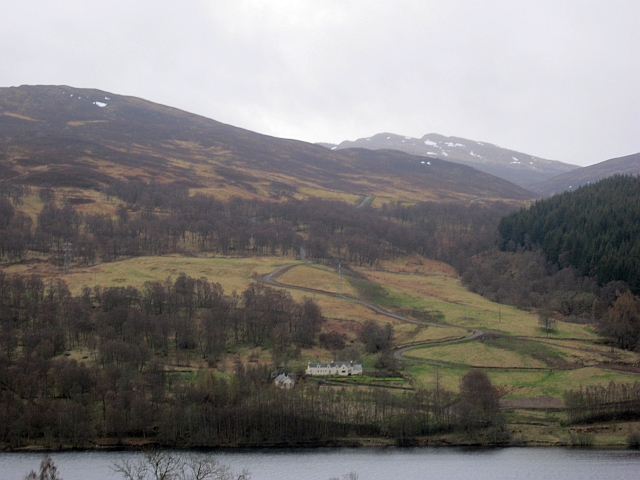
Strathtummel is a charming village located in Perthshire, Scotland. Nestled in the picturesque valley of the River Tummel, it is surrounded by breathtaking natural beauty. The village is situated approximately 10 miles northwest of Pitlochry, making it a popular destination for both locals and tourists seeking a tranquil retreat.

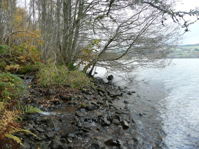
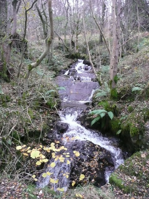
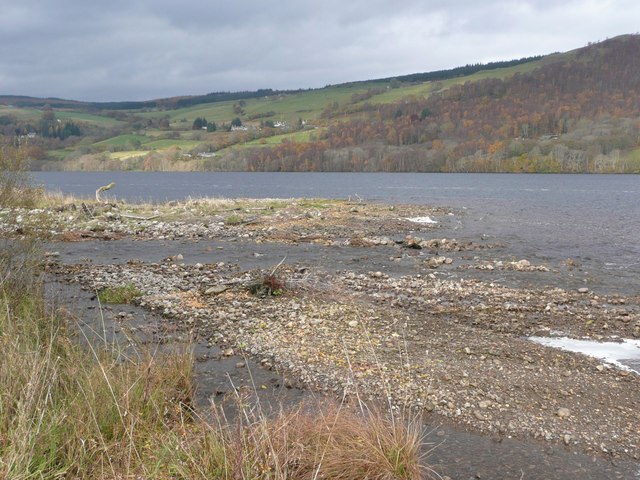
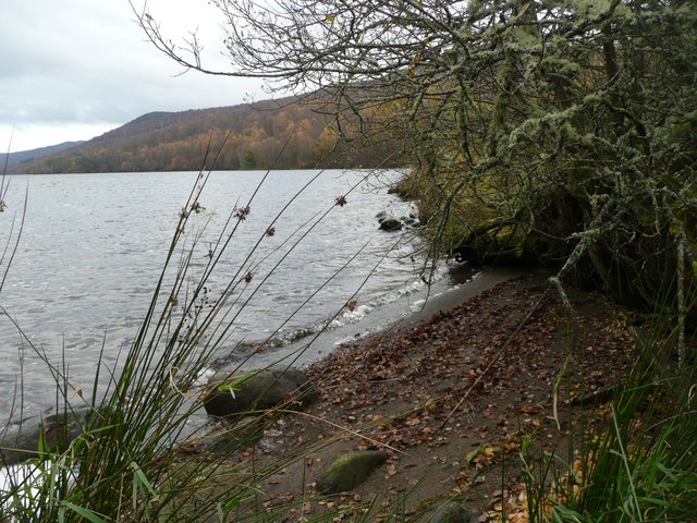
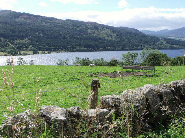
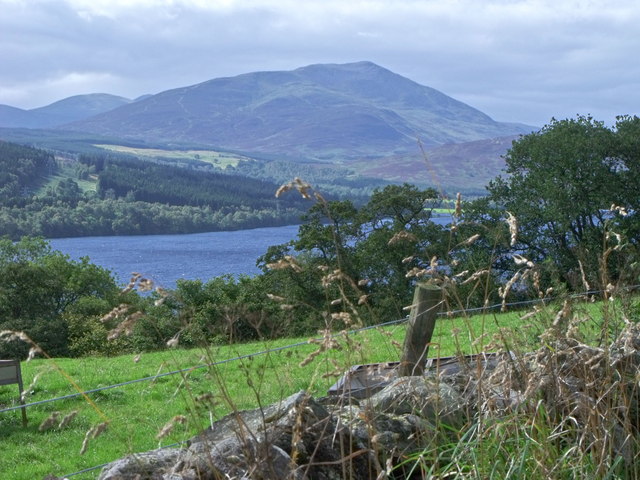
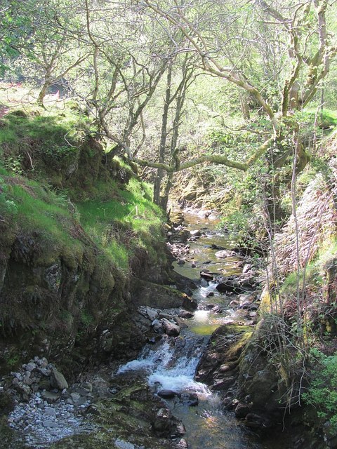
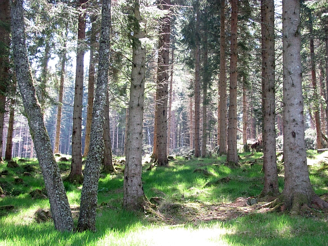
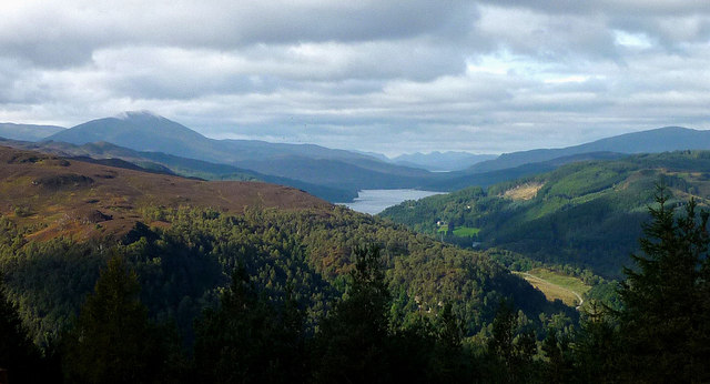
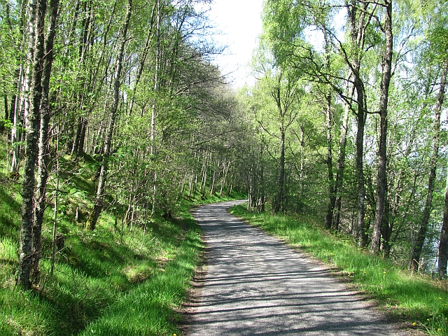
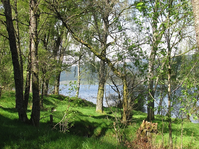
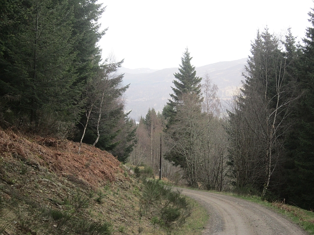
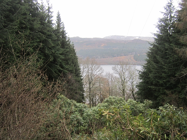
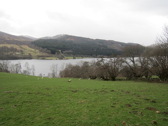
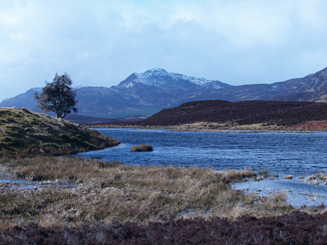
The main attraction in Strathtummel is the stunning Loch Tummel, a large freshwater loch that stretches for approximately 7 miles. The loch is renowned for its crystal-clear waters, which provide the perfect setting for a variety of outdoor activities such as fishing, boating, and kayaking. The surrounding hills and forests offer numerous walking and hiking trails, allowing visitors to immerse themselves in the area's stunning landscapes.

The village itself is small but boasts a close-knit community. Visitors can find a few shops, cafes, and a local pub where they can enjoy a hearty meal or a pint of local ale. The area is also home to a few holiday cottages and bed and breakfast accommodations, providing peaceful lodging options for those wishing to extend their stay.

Strathtummel is rich in history and culture, with several ancient sites and landmarks nearby. One notable attraction is the Queen's View, a famous viewpoint that offers panoramic vistas of Loch Tummel and the surrounding mountains. Additionally, the nearby Blair Castle, dating back to the 13th century, is a must-visit for history enthusiasts.

Overall, Strathtummel is a hidden gem in Perthshire, offering a peaceful escape from the hustle and bustle of city life. Its awe-inspiring natural beauty, outdoor recreational opportunities, and warm community make it a delightful destination for nature lovers and those seeking tranquility.

If you have any feedback on the listing, please let us know in the comments section below.

Strathtummel Images

Images are sourced within 2km of 56.718208/-3.9308502 or Grid Reference NN8160. Thanks to Geograph Open Source API. All images are credited.

Burn near Lick Flows into Loch Tummel.
Burn near Lick
Flows into Loch Tummel.
Burn flowing from Sròn Mhòr Entering Loch Tummel east of Lick.
Burn flowing from Sròn Mhòr
Entering Loch Tummel east of Lick.
Frenich Burn delta In Loch Tummel. 
Strathtummel on the far side of the loch.
Frenich Burn delta
In Loch Tummel. Strathtummel on the far side of the loch.
Miniature beach On the Frenich Burn delta.  Looking east along Loch Tummel.
Miniature beach
On the Frenich Burn delta. Looking east along Loch Tummel.
Dry stone wall above Loch Tummel
Schiehallion from Tressalt
Forest road west of Tressalt
Woodland above Loch Tummel Birch woods above the southern shore of Loch Tummel.
Woodland above Loch Tummel
Birch woods above the southern shore of Loch Tummel.
Frenich Burn A substatial burn running down through a gorge towards Loch Tummel. There is some construction work taking place here, probably a small hydroelectric scheme.
Frenich Burn
A substatial burn running down through a gorge towards Loch Tummel. There is some construction work taking place here, probably a small hydroelectric scheme.
Frenich Wood Mature conifer woodland near Loch Tummel, some trees were lost to windthrow nearby.
Frenich Wood
Mature conifer woodland near Loch Tummel, some trees were lost to windthrow nearby.
The view of Strathtummel from Craigower The graceful mountain on the left is Schiehallion with Loch Tummel below. The far mountains are above Glen Coe with a slice of Loch Rannoch just visible below them.
The view of Strathtummel from Craigower
The graceful mountain on the left is Schiehallion with Loch Tummel below. The far mountains are above Glen Coe with a slice of Loch Rannoch just visible below them.
South Loch Tummel road
Frenich Wood Birches beside Loch Tummel.
Frenich Wood
Birches beside Loch Tummel.
Logging road, Grenich Also used as access to Grenich.
Logging road, Grenich
Also used as access to Grenich.
Ride, Port-an-Eilean Rhododendron choked gap left for an electricity supply.
Ride, Port-an-Eilean
Rhododendron choked gap left for an electricity supply.
Ride,  near  Port-an-Eilean A gap in the trees carrying a power line.
Ride, near Port-an-Eilean
A gap in the trees carrying a power line.
North side of Loch Tummel Looking over the loch towards Frenich from just before the viewpoint layby near Croft Douglas.
North side of Loch Tummel
Looking over the loch towards Frenich from just before the viewpoint layby near Croft Douglas.
New road above Lick A view across Loch Tummel.
New road above Lick
A view across Loch Tummel.
Show me another place!

Strathtummel is located at Grid Ref: NN8160 (Lat: 56.718208, Lng: -3.9308502)

Unitary Authority: Perth and Kinross

Police Authority: Tayside

What 3 Words

///claw.patrol.thorax. Near Blair Atholl, Perth & Kinross

Related Wikis

Tummel hydro-electric power scheme

The Tummel hydro-electric power scheme is an interconnected network of dams, power stations, aqueducts and electric power transmission in the Grampian...

Loch Tummel

Loch Tummel (Scottish Gaelic: Loch Teimheil) is a long, narrow loch, seven kilometres (4+1⁄2 miles) northwest of Pitlochry in the council area of Perth...

Loch Bhac

Loch Bhac (Bhaic or Vach) is a fine freshwater trout loch, located in the west part of the Allean Forest, and east part of Tay Forest park, and slightly...

Farragon Hill

Farragon Hill (782 m) is a peak in the foothills of the Grampian Mountains of Scotland. It lies above the town of Aberfeldy in Perthshire. The hill is...

Nearby Amenities

Located within 500m of 56.718208,-3.9308502
Power: pole
Lat/Long: 56.7190164/-3.9340903
Power: pole
Lat/Long: 56.7182435/-3.9366636
Power: pole
Lat/Long: 56.7183162/-3.9251763
Power: pole
Lat/Long: 56.7175749/-3.9389045
Power: pole
Lat/Long: 56.7188545/-3.9320563
Power: pole
Lat/Long: 56.7182433/-3.9240076
Power: pole
Lat/Long: 56.7185064/-3.9357782
Strathtummel
Name Gd: Srath Teimheil
Place: hamlet
Lat/Long: 56.7176514/-3.9319045
Balnabodach
Name Gd: Baile na Bodaich
Place: isolated_dwelling
Lat/Long: 56.7214141/-3.9308962
Balintuim
Place: isolated_dwelling
Lat/Long: 56.7213552/-3.9357456
Post Box
Collection Times: Mo-Sa 12:45
Operator: Royal Mail
Post Box Type: lamp
Ref: PH16 111
Royal Cypher: scottish_crown
Lat/Long: 56.7182297/-3.9303683
Power: pole
Lat/Long: 56.7179302/-3.9377216
Power: pole
Lat/Long: 56.7187701/-3.9348876
Power: pole
Lat/Long: 56.7189343/-3.9329372
Power: pole
Lat/Long: 56.7186922/-3.9298133
Power: pole
Lat/Long: 56.7187599/-3.9308593
Power: pole
Lat/Long: 56.7184218/-3.9265072
Power: pole
Lat/Long: 56.7185196/-3.9277397
Power: pole
Lat/Long: 56.7159652/-3.929919
Power: pole
Lat/Long: 56.7167173/-3.9301202
Power: pole
Lat/Long: 56.7174283/-3.9302784
Frequency: 50
Power: pole
Transformer: distribution
Voltage Primary: 33000
Voltage Secondary: 400
Lat/Long: 56.7181223/-3.9293624
Power: pole
Lat/Long: 56.7184144/-3.9289735
Power: pole
Lat/Long: 56.7185992/-3.9287429
Power: pole
Lat/Long: 56.7178367/-3.9249703
Power: pole
Lat/Long: 56.7180185/-3.9253083
Power: pole
Lat/Long: 56.7181642/-3.9227468
The data included in this document is from www.openstreetmap.org. The data is made available under ODbL.

Have you been to Strathtummel?

Leave your review of Strathtummel below (or comments, questions and feedback).