Staunton

Settlement in Gloucestershire Forest of Dean

England

Staunton

Staunton Coleford Morning View of Staunton
Staunton Coleford Credit: Peter Randall-Cook

Staunton is a small village located in the county of Gloucestershire, England. Situated in the Forest of Dean district, it is nestled in the picturesque countryside, surrounded by lush green fields and rolling hills. The village is approximately 10 miles southwest of Gloucester and 110 miles west of London.

With a population of around 500 residents, Staunton maintains a close-knit community atmosphere. The village features a charming mix of traditional stone cottages and newer homes, giving it a distinctive rural character. The peaceful ambiance of Staunton makes it an idyllic place for those seeking a quiet and tranquil lifestyle.

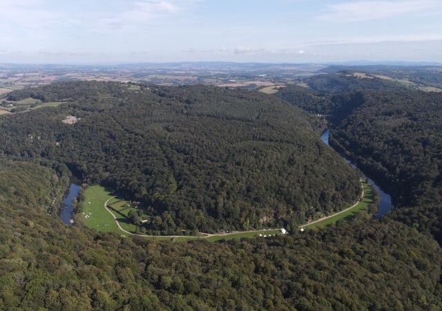
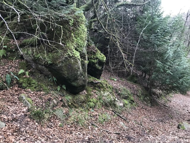
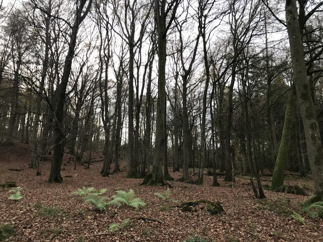
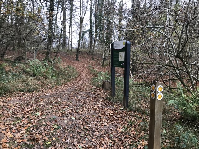
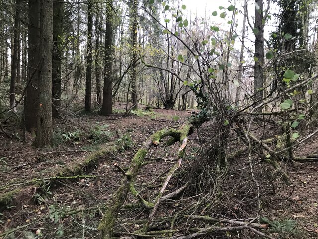
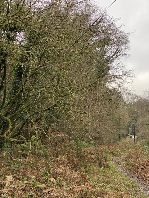
Staunton is known for its natural beauty and outdoor recreational opportunities. The nearby Forest of Dean offers an array of walking and cycling trails, allowing residents and visitors to explore the stunning woodlands and enjoy the abundant wildlife. The Wye Valley, a designated Area of Outstanding Natural Beauty, is also easily accessible from the village, offering breathtaking views and opportunities for outdoor activities such as canoeing and hiking.

Despite its small size, Staunton boasts a few amenities to cater to the local community. These include a village hall, a primary school, and a local pub, serving as a social hub for residents. For more extensive amenities, the nearby town of Gloucester provides a wider range of shops, supermarkets, and services.

Overall, Staunton, Gloucestershire, offers a peaceful and picturesque rural setting, making it an ideal place for those seeking a slower pace of life surrounded by natural beauty.

If you have any feedback on the listing, please let us know in the comments section below.

Staunton Images

Images are sourced within 2km of 51.80998/-2.6554556 or Grid Reference SO5412. Thanks to Geograph Open Source API. All images are credited.

Staunton Coleford Morning View of Staunton
Staunton Coleford
Morning View of Staunton
Bracelands Campsite Popular Caravan and Camping site.
Bracelands Campsite
Popular Caravan and Camping site.
Loop in the River Wye Biblins Youth Campsite.
<span class="nowrap"><a title="https://www.biblins.org.uk/contact-us/" rel="nofollow ugc noopener" href="https://www.biblins.org.uk/contact-us/">Link</a><img style="margin-left:2px;" alt="External link" title="External link - shift click to open in new window" src="https://s1.geograph.org.uk/img/external.png" width="10" height="10"/></span>
Loop in the River Wye
Biblins Youth Campsite. LinkExternal link
Forest Holidays Site, Forest of Dean
Stowefield Quarry from the South East Road Tarmac is produced at this quarry from the dolomitic limestone
Stowefield Quarry from the South East
Road Tarmac is produced at this quarry from the dolomitic limestone
Stowefield Quarry from the North Limestone Quarry
Stowefield Quarry from the North
Limestone Quarry
Large rock by the footpath
Forest from the path corner
Noticeboard at Lady Park Wood
Fallen trees on footpath
Path on the hillside
Track and field corner
Bug Hotel Accommodation for insects at Forest Holidays.
Bug Hotel
Accommodation for insects at Forest Holidays.
Archery targets Recreational facilities at Forest Retreat in the Forest of Dean.
Archery targets
Recreational facilities at Forest Retreat in the Forest of Dean.
Woodland track at Broom Hill
Woodland chalets Holiday accommodation at Forest Retreat.
Woodland chalets
Holiday accommodation at Forest Retreat.
Staunton - Showing most of the homes in the village Drone photo showing the extent of Staunton village.
Staunton - Showing most of the homes in the village
Drone photo showing the extent of Staunton village.
Campsite with Shepherd's Huts Secret Campsite near Staunton
Campsite with Shepherd's Huts
Secret Campsite near Staunton
Show me another place!

Staunton is located at Grid Ref: SO5412 (Lat: 51.80998, Lng: -2.6554556)

Administrative County: Gloucestershire

District: Forest of Dean

Police Authority: Gloucestershire

What 3 Words

///witless.choppers.sculpting. Near Coleford, Gloucestershire

Related Wikis

Staunton (near Coleford)

Staunton is a village and civil parish in the Forest of Dean in west Gloucestershire, England, close to the border with Wales. == Location == Staunton...

Stowfield quarry

Stowfield quarry is a quarry in the Forest of Dean about 2 km south of Staunton, near Coleford, Gloucestershire, England. == References ==

Dingle Wood

Dingle Wood (grid reference SO562115) is a 9.95-hectare (24.6-acre) biological Site of Special Scientific Interest in Gloucestershire, notified in 1972...

Upper Wye Gorge

Upper Wye Gorge is a Site of Special Scientific Interest (SSSI), noted for its biological and geological characteristics, around Symonds Yat in the Wye...

Lady Park Wood National Nature Reserve

Lady Park Wood National Nature Reserve (grid reference SO546144) is a 45-hectare (110-acre) nature reserve straddling the borders of Gloucestershire in...

Swanpool Wood and Furnace Grove

Swanpool Wood and Furnace Grove (grid reference SO541107) is a 13.59-hectare (33.6-acre) biological Site of Special Scientific Interest (a conservation...

Newland railway station

Newland railway station, also known as Cherry Orchard railway station, served the village of Newland, Gloucestershire, England, from 1883 to 1917 on the...

The Kymin

The Kymin (Welsh: Cae-y-Maen), is a hill overlooking Monmouth, in Monmouthshire, Wales. It is located approximately one mile east of Monmouth, on the eastern...

Nearby Amenities

Located within 500m of 51.80998,-2.6554556
Staunton
Is In: Gloucestershire, England, UK
Place: village
Wikidata: Q7604728
Wikipedia: en:Staunton (near Coleford)
Lat/Long: 51.8105955/-2.6554095
Bus Stop
Village Hall
Naptan AtcoCode: 1600GL3248
Naptan Bearing: W
Naptan CommonName: Village Hall
Naptan Indicator: Opp
Naptan NaptanCode: gloadgtd
Naptan Street: Main Street
Naptan Verified: no
Source: naptan_import
Lat/Long: 51.8099634/-2.6540703
Bus Stop
White Horse Inn
Naptan AtcoCode: 1600GL4423
Naptan Bearing: W
Naptan CommonName: White Horse Inn
Naptan NaptanCode: gloadgdw
Naptan Street: A4136
Naptan Verified: no
Source: naptan_import
Lat/Long: 51.8106098/-2.657474
Bus Stop
White Horse Inn
Naptan AtcoCode: 1600GL4424
Naptan Bearing: E
Naptan CommonName: White Horse Inn
Naptan Indicator: Opp
Naptan NaptanCode: gloadgdt
Naptan Street: A4136
Naptan Verified: no
Source: naptan_import
Lat/Long: 51.8107012/-2.6571997
Bus Stop
All Saints' Church
Naptan AtcoCode: 1600GLF293
Naptan Bearing: NW
Naptan CommonName: All Saints' Church
Naptan Indicator: Opp
Naptan NaptanCode: gloadgpm
Naptan Street: A4136
Naptan Verified: no
Source: naptan_import
Lat/Long: 51.8102805/-2.6536398
Bus Stop
All Saints' Church
Bench: yes
Bin: yes
Naptan AtcoCode: 1600GLF294
Naptan Bearing: E
Naptan CommonName: All Saints' Church
Naptan NaptanCode: gloadgpt
Naptan Street: A4136
Naptan Verified: no
Shelter: yes
Source: naptan_import
Lat/Long: 51.8100719/-2.6523458
Bus Stop
Staunton House
Naptan AtcoCode: 1600GLF577
Naptan Bearing: W
Naptan CommonName: Staunton House
Naptan NaptanCode: gloadgmd
Naptan Street: Main Street
Naptan Verified: no
Source: naptan_import
Lat/Long: 51.8099187/-2.6556363
Bus Stop
White Horse Inn Junction
Naptan AtcoCode: 1600GLF600
Naptan Bearing: NW
Naptan CommonName: White Horse Inn Junction
Naptan NaptanCode: gloadgjd
Naptan Street: Main Street
Naptan Verified: no
Source: naptan_import
Lat/Long: 51.8105404/-2.6570088
Bus Stop
Wellmeadow
Naptan AtcoCode: 1600GLF602
Naptan Bearing: E
Naptan CommonName: Wellmeadow
Naptan NaptanCode: gloadgja
Naptan Street: A4136
Naptan Verified: no
Source: naptan_import
Lat/Long: 51.8107933/-2.6568094
Pub
White Horse Inn
Addr City: Coleford
Addr Place: Staunton
Addr Postcode: GL16 8PA
Addr Street: Monmouth Road, Staunton
Fhrs Id: 34258
Internet Access: wlan
Website: https://www.whitehorseinnstaunton.com/
Lat/Long: 51.8105504/-2.6574372
The data included in this document is from www.openstreetmap.org. The data is made available under ODbL.

Have you been to Staunton?

Leave your review of Staunton below (or comments, questions and feedback).