Rotcher

Settlement in Yorkshire

England

Rotcher

Lock 30E on the Huddersfield Narrow Canal Lovely weather; lovely walk!
Lock 30E on the Huddersfield Narrow Canal Credit: Andy Beecroft

Rotcher, Yorkshire is a quaint and picturesque village located in the heart of Yorkshire, England. Situated amidst rolling green hills and surrounded by breathtaking natural beauty, this charming village is a hidden gem for those seeking tranquility and a taste of rural England.

With a population of around 500 residents, Rotcher offers a tight-knit community atmosphere. The village is known for its warm hospitality and friendly locals who take pride in their heritage and traditions. The architecture of the village is predominantly composed of traditional Yorkshire stone houses, adding to its timeless charm.

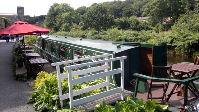
Rotcher is blessed with a variety of amenities to cater to the needs of its residents. The village boasts a well-stocked local grocery store, a post office, and a cozy pub, which serves as a gathering spot for locals and visitors alike. Additionally, there is a primary school that provides quality education to the children of the village and surrounding areas.

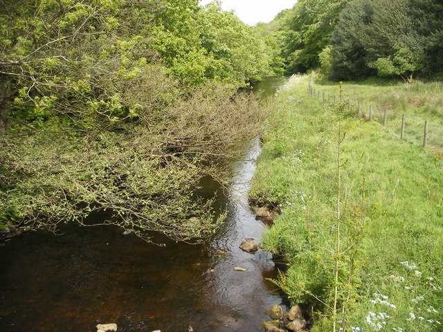
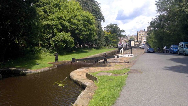
Nature enthusiasts will find themselves in paradise in Rotcher. The village is surrounded by idyllic countryside, perfect for long walks, cycling, and exploring the great outdoors. The nearby Moors National Park is a haven for hikers and nature lovers, offering stunning panoramic views and an abundance of wildlife.

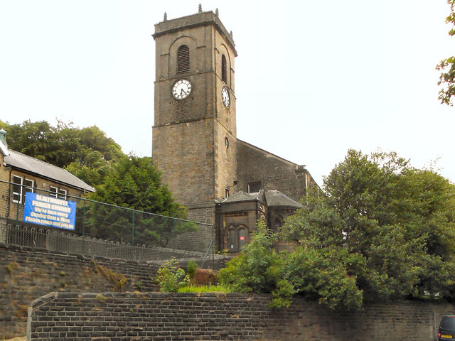
For history buffs, Rotcher is home to a 12th-century church, St. Mary's, which holds regular services and stands as a testament to the village's rich history. The village also hosts an annual summer fair, where locals and visitors come together to celebrate with traditional food, music, and games.

In conclusion, Rotcher, Yorkshire, is a captivating village that offers a peaceful and welcoming environment for its residents and visitors. Its natural beauty, friendly community, and historical landmarks make it a truly delightful destination for anyone seeking an authentic Yorkshire experience.

If you have any feedback on the listing, please let us know in the comments section below.
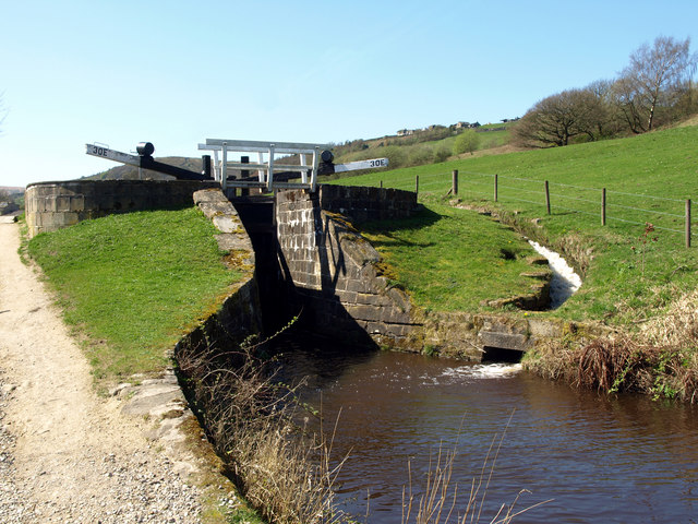
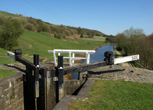
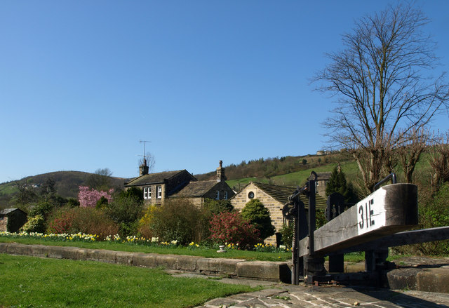
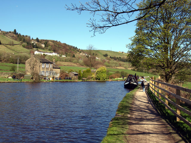
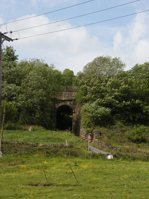
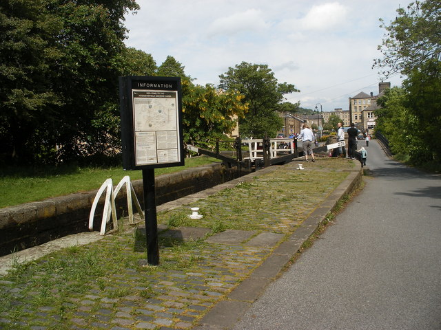
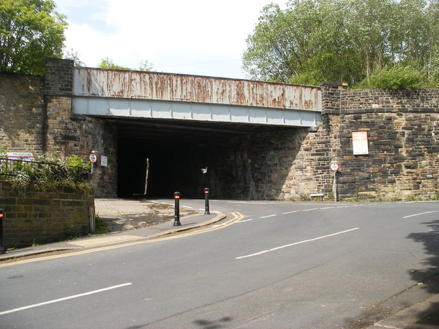
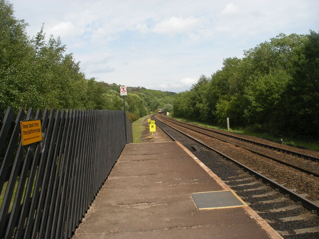
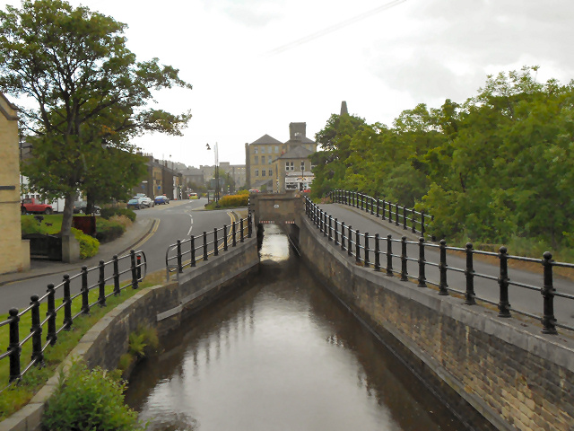
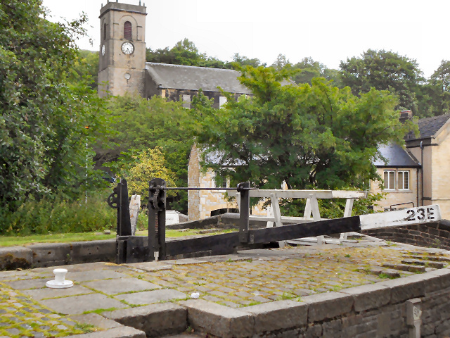
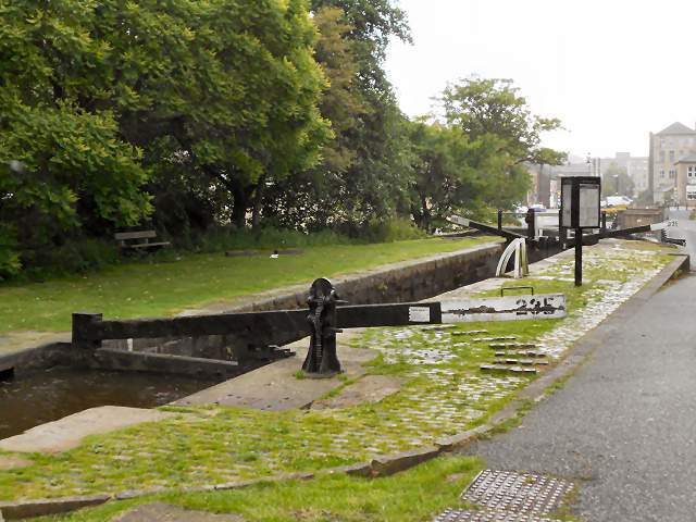
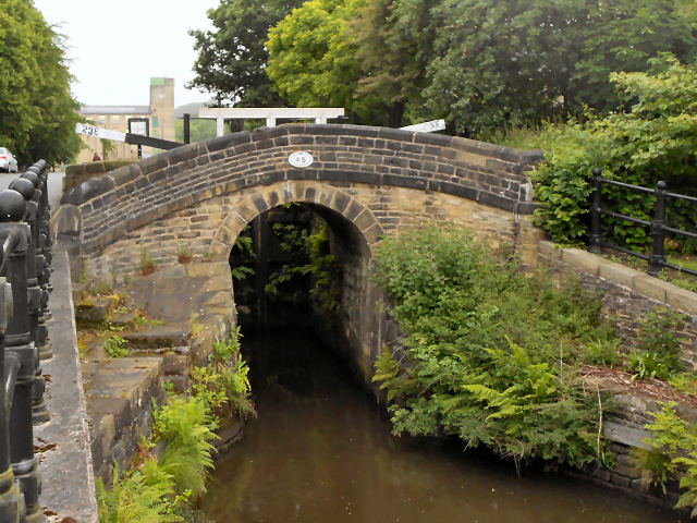
Rotcher Images

Images are sourced within 2km of 53.62078/-1.8902499 or Grid Reference SE0713. Thanks to Geograph Open Source API. All images are credited.

Lock 30E on the Huddersfield Narrow Canal Lovely weather; lovely walk!
Lock 30E on the Huddersfield Narrow Canal
Lovely weather; lovely walk!
The view from north eastwards from Lock 30E
At Lock 31E on the Huddersfield Narrow Canal
The Huddersfield Narrow Canal above Lock 31E There is a winding point (boat turning area) at this point - one of few on this stretch of the Huddersfield Narrow Canal.
The Huddersfield Narrow Canal above Lock 31E
There is a winding point (boat turning area) at this point - one of few on this stretch of the Huddersfield Narrow Canal.
Railway bridge near canal
Approaching Lock 23E Slaithwaite
Bridge near Slaithwaite Station
Looking east from Slaithwaite Station
River Colne looking downstream from a footbridge
Church of Saint James, Slaithwaite And Marsden St James' church was built by public subscription in 1796, replacing a 16th century chapel of  ease. It is a Grade II listed building (<span class="nowrap"><a title="http://www.britishlistedbuildings.co.uk/en-408960-church-of-saint-james-slaithwaite-and-ma" rel="nofollow ugc noopener" href="http://www.britishlistedbuildings.co.uk/en-408960-church-of-saint-james-slaithwaite-and-ma">Link</a><img style="margin-left:2px;" alt="External link" title="External link - shift click to open in new window" src="https://s1.geograph.org.uk/img/external.png" width="10" height="10"/></span> - British Listed Buildings)
Church of Saint James, Slaithwaite And Marsden
St James' church was built by public subscription in 1796, replacing a 16th century chapel of ease. It is a Grade II listed building (LinkExternal link - British Listed Buildings)
Silent Woman, Slaithwaite The Silent Woman public house on Nabbs Lane. Behind it is the railway viaduct.
Silent Woman, Slaithwaite
The Silent Woman public house on Nabbs Lane. Behind it is the railway viaduct.
Stone Bridge from Old Bank The stone footbridge over the Huddersfield Narrow Canal at Marsden.
Stone Bridge from Old Bank
The stone footbridge over the Huddersfield Narrow Canal at Marsden.
Huddersfield Narrow Canal, Slaithwaite Restored section of the canal, once filled in at this point. Views of the early stages of the restoration work, in 2000, may be seen at <a href="https://www.geograph.org.uk/photo/3119112">SE0713 : Huddersfield Narrow Canal, restoration works below Lock 23E (1)</a> and <a href="https://www.geograph.org.uk/photo/3119090">SE0713 : Huddersfield Narrow Canal, restoration works below Lock 23E (2)</a>.
Huddersfield Narrow Canal, Slaithwaite
Restored section of the canal, once filled in at this point. Views of the early stages of the restoration work, in 2000, may be seen at SE0713 : Huddersfield Narrow Canal, restoration works below Lock 23E (1) and SE0713 : Huddersfield Narrow Canal, restoration works below Lock 23E (2).
Lock and Church, Slaithwaite Lock 23E on the Huddersfield Narrow Canal, with <a href="https://www.geograph.org.uk/photo/2464983">SE0714 : Church of Saint James, Slaithwaite And Marsden</a> in the background.
Lock and Church, Slaithwaite
Lock 23E on the Huddersfield Narrow Canal, with SE0714 : Church of Saint James, Slaithwaite And Marsden in the background.
Huddersfield Narrow Canal, Lock 23E Lock 23E on the Huddersfield Narrow Canal at Slaithwaite.A view of this lock prior to restoration can be seen at <a href="https://www.geograph.org.uk/photo/3118677">SE0713 : Huddersfield Narrow Canal - Lock 23E before restoration</a>.

<span class="nowrap"><a title="http://www.huddersfieldcanal.com" rel="nofollow ugc noopener" href="http://www.huddersfieldcanal.com">Link</a><img style="margin-left:2px;" alt="External link" title="External link - shift click to open in new window" src="https://s1.geograph.org.uk/img/external.png" width="10" height="10"/></span> - Huddersfield Canal Society
<span class="nowrap"><a title="http://www.canaljunction.com/canal/huddersfield_narrow.htm" rel="nofollow ugc noopener" href="http://www.canaljunction.com/canal/huddersfield_narrow.htm">Link</a><img style="margin-left:2px;" alt="External link" title="External link - shift click to open in new window" src="https://s1.geograph.org.uk/img/external.png" width="10" height="10"/></span> - CanalJunction.com
Huddersfield Narrow Canal, Lock 23E
Lock 23E on the Huddersfield Narrow Canal at Slaithwaite.A view of this lock prior to restoration can be seen at SE0713 : Huddersfield Narrow Canal - Lock 23E before restoration. LinkExternal link - Huddersfield Canal Society LinkExternal link - CanalJunction.com
Huddersfield Narrow Canal, Bridge 45 at Slaithwaite Bridge number 45 on the Huddersfield Narrow Canal at Slaithwaite. A view of the bridge prior to restoration of the canal and lock can be seen at <a href="https://www.geograph.org.uk/photo/3118693">SE0713 : Huddersfield Narrow Canal, Lock 23E - Before canal restoration</a>.

<span class="nowrap"><a title="http://www.huddersfieldcanal.com" rel="nofollow ugc noopener" href="http://www.huddersfieldcanal.com">Link</a><img style="margin-left:2px;" alt="External link" title="External link - shift click to open in new window" src="https://s1.geograph.org.uk/img/external.png" width="10" height="10"/></span> - Huddersfield Canal Society
<span class="nowrap"><a title="http://www.canaljunction.com/canal/huddersfield_narrow.htm" rel="nofollow ugc noopener" href="http://www.canaljunction.com/canal/huddersfield_narrow.htm">Link</a><img style="margin-left:2px;" alt="External link" title="External link - shift click to open in new window" src="https://s1.geograph.org.uk/img/external.png" width="10" height="10"/></span> - CanalJunction.com
Huddersfield Narrow Canal, Bridge 45 at Slaithwaite
Bridge number 45 on the Huddersfield Narrow Canal at Slaithwaite. A view of the bridge prior to restoration of the canal and lock can be seen at SE0713 : Huddersfield Narrow Canal, Lock 23E - Before canal restoration. LinkExternal link - Huddersfield Canal Society LinkExternal link - CanalJunction.com
Tea Barge at Slaithwaite
Locks at Slaithwaite Lock 23E after restoration - a view of this lock before it was restored can be seen at <a href="https://www.geograph.org.uk/photo/3118677">SE0713 : Huddersfield Narrow Canal - Lock 23E before restoration</a>.
Locks at Slaithwaite
Lock 23E after restoration - a view of this lock before it was restored can be seen at SE0713 : Huddersfield Narrow Canal - Lock 23E before restoration.
Show me another place!

Rotcher is located at Grid Ref: SE0713 (Lat: 53.62078, Lng: -1.8902499)

Division: West Riding

Unitary Authority: Kirklees

Police Authority: West Yorkshire

What 3 Words

///jams.mixture.appoints. Near Blackmoorfoot, West Yorkshire

Related Wikis

Slaithwaite railway station

Slaithwaite railway station serves the town of Slaithwaite, West Yorkshire, England. The station is 4 miles (6 km) west of Huddersfield railway station...

Slaithwaite Town Hall

Slaithwaite Town Hall, also known as Empire House is a former municipal building in Lewisham Road in the town of Slaithwaite, West Yorkshire, England....

Slaithwaite

Slaithwaite (, locally 'Slaithwaite' ; Old Norse for "timber-fell thwaite/clearing") is a town and former civil parish in the Colne Valley area of the...

Wilberlee

Wilberlee is a hamlet in the Colne Valley, in the Kirklees district, in the county of West Yorkshire, England. It is near the town of Huddersfield and...

Moorside Edge

The Moorside Edge is a steeply sloping area of moorland at grid reference SE070154 just north of Slaithwaite and about 5 miles (8 km) west of Huddersfield...

Moorside Edge transmitting station

Moorside Edge transmitting station, opened in 1931, was originally constructed to radiate the BBC's North Regional (from 17 May on 626 kHz) and National...

Colne Valley (UK Parliament constituency)

Colne Valley is a constituency represented in the House of Commons of the UK Parliament since 2019 by Jason McCartney of the Conservative Party. ��2�...

Colne Valley

The Colne Valley is a steep sided valley on the east flank of the Pennine Hills in the English county of West Yorkshire. It takes its name from the River...

Nearby Amenities

Located within 500m of 53.62078,-1.8902499
Seamark Type: gate
Waterway: lock_gate
Lat/Long: 53.620915/-1.8873256
Seamark Type: gate
Waterway: lock_gate
Lat/Long: 53.6218716/-1.8830678
Bus Stop
Slaithwaite, Manchester Road / opposite Cemetery
Bench: no
Bus: yes
Local Ref: 45019385
Naptan AtcoCode: 450019385
Naptan Bearing: SW
Naptan CommonName: Manchester Road Cemetery
Naptan Crossing: Nr-At Lingards Road
Naptan Indicator: Stop 45019385
Naptan Landmark: Cemetery
Naptan PlusbusZoneRef: LEEDS
Naptan ShortCommonName: Slaithwaite Cem
Naptan Street: Manchester Road Slaithwaite
Naptan Verified: no
Network: WY Metro
Operator: WY Metro
Public Transport: platform
Shelter: no
Source: naptan_import
Lat/Long: 53.618055/-1.8904883
Bus Stop
Slaithwaite, Manchester Road / adjacent Cemetery
Bench: yes
Bin: yes
Bus: yes
Local Ref: 45019386
Naptan AtcoCode: 450019386
Naptan Bearing: NE
Naptan CommonName: Manchester Road Cemetery
Naptan Crossing: Nr-Opp Lingards Road
Naptan Indicator: Stop 45019386
Naptan Landmark: Cemetery
Naptan PlusbusZoneRef: LEEDS
Naptan ShortCommonName: Slaithwaite Cem
Naptan Street: Manchester Road Slaithwaite
Naptan Verified: no
Network: WY Metro
Operator: WY Metro
Public Transport: platform
Shelter: yes
Source: naptan_import
Lat/Long: 53.618154/-1.8905939
Bus Stop
Slaithwaite, Manchester Road / adjacent Lingards Road
Bus: yes
Local Ref: 45019387
Naptan AtcoCode: 450019387
Naptan Bearing: SW
Naptan CommonName: Manchester Road Lingards Road
Naptan Crossing: Lingards Road
Naptan Indicator: Stop 45019387
Naptan Landmark: Cemetery
Naptan PlusbusZoneRef: LEEDS
Naptan ShortCommonName: Lingards Road
Naptan Street: Manchester Road Slaithwaite
Naptan Verified: no
Network: WY Metro
Operator: WY Metro
Public Transport: platform
Shelter: no
Source: naptan_import
Lat/Long: 53.6188977/-1.8880824
Bus Stop
Slaithwaite, Manchester Road / opposite Lingards Road
Bench: yes
Bin: no
Bus: yes
Local Ref: 45019388
Naptan AtcoCode: 450019388
Naptan Bearing: NE
Naptan CommonName: Manchester Road Lingards Road
Naptan Crossing: Lingards Road
Naptan Indicator: Stop 45019388
Naptan Landmark: Cemetery
Naptan PlusbusZoneRef: LEEDS
Naptan ShortCommonName: Lingards Road
Naptan Street: Manchester Road Slaithwaite
Naptan Verified: no
Network: WY Metro
Operator: WY Metro
Public Transport: platform
Shelter: yes
Source: naptan_import
Lat/Long: 53.619418/-1.8869471
Bus Stop
Slaithwaite, Manchester Road / opposite Nields Road
Bench: no
Bin: no
Bus: yes
Local Ref: 45019389
Naptan AtcoCode: 450019389
Naptan Bearing: NE
Naptan CommonName: Manchester Road Nields Road
Naptan Crossing: Nields Road
Naptan Indicator: Stop 45019389
Naptan Landmark: Old Police Station
Naptan PlusbusZoneRef: LEEDS
Naptan ShortCommonName: Nields Road
Naptan Street: Manchester Road Slaithwaite
Naptan Verified: yes
Network: WY Metro
Operator: WY Metro
Public Transport: platform
Shelter: no
Source: naptan_import
Towards: Huddersfield
Lat/Long: 53.6204304/-1.8835277
Bus Stop
Slaithwaite, Manchester Road / adjacent Nields Road
Bench: no
Bin: yes
Bus: yes
Local Ref: 45019390
Naptan AtcoCode: 450019390
Naptan Bearing: SW
Naptan CommonName: Manchester Road Nields Road
Naptan Crossing: Nields Road
Naptan Indicator: Stop 45019390
Naptan Landmark: Old Police Station
Naptan PlusbusZoneRef: LEEDS
Naptan ShortCommonName: Nields Road
Naptan Street: Manchester Road Slaithwaite
Naptan Verified: no
Network: WY Metro
Operator: WY Metro
Public Transport: platform
Shelter: no
Source: naptan_import
Lat/Long: 53.6203673/-1.8832859
Bus Stop
Bank Gate Royd Street
Bus: yes
Local Ref: 45021762
Naptan AtcoCode: 450021762
Naptan Bearing: NW
Naptan CommonName: Bank Gate Royd Street
Naptan Crossing: Royd Street
Naptan Indicator: Stop 45021762
Naptan Notes: OSR taken place 120106
Naptan PlusbusZoneRef: LEEDS
Naptan ShortCommonName: Royd Street
Naptan Street: Bank Gate
Naptan Verified: no
Public Transport: platform
Source: naptan_import
Lat/Long: 53.6245596/-1.8870997
Bus Stop
Royd Street Bank Gate
Local Ref: 45021763
Naptan AtcoCode: 450021763
Naptan Bearing: W
Naptan CommonName: Royd Street Bank Gate
Naptan Crossing: Bank Gate
Naptan Indicator: Stop 45021763
Naptan Notes: ttcase end dated 09/09/09 M.Beswick (pole in RTA put back in but not ttcase)
Naptan PlusbusZoneRef: LEEDS
Naptan ShortCommonName: Bank Gate
Naptan Street: Royd Street
Naptan Verified: no
Source: naptan_import
Lat/Long: 53.6246943/-1.887054
Bus Stop
Royd Street Bank Gate
Bus: yes
Local Ref: 45021764
Naptan AtcoCode: 450021764
Naptan Bearing: E
Naptan CommonName: Royd Street Bank Gate
Naptan Crossing: Bank Gate
Naptan Indicator: Stop 45021764
Naptan PlusbusZoneRef: LEEDS
Naptan ShortCommonName: Bank Gate
Naptan Street: Royd Street
Naptan Verified: no
Public Transport: platform
Source: naptan_import
Lat/Long: 53.6247662/-1.8869933
Bus Stop
Longlands Road Longlands Avenue
Local Ref: 45025410
Naptan AtcoCode: 450025410
Naptan Bearing: W
Naptan CommonName: Longlands Road Longlands Avenue
Naptan Crossing: Longlands Avenue
Naptan Indicator: Stop 45025410
Naptan Notes: OSR taken place 120106 size 1 case fitted
Naptan PlusbusZoneRef: LEEDS
Naptan ShortCommonName: Longlands Avenue
Naptan Street: Longlands Road
Naptan Verified: no
Source: naptan_import
Lat/Long: 53.6251478/-1.8914527
Bank Gate Royd Street
Local Ref: 45051144
Naptan AtcoCode: 450051144
Naptan Bearing: SE
Naptan BusStopType: CUS
Naptan CommonName: Bank Gate Royd Street
Naptan Indicator: Stop 45051144
Naptan PlusbusZoneRef: LEEDS
Naptan ShortCommonName: Royd Street
Naptan Street: Bank Gate
Naptan Verified: no
Source: naptan_import
Lat/Long: 53.6246224/-1.8870088
Longlands Road Longlands Avenue
Local Ref: 45051537
Naptan AtcoCode: 450051537
Naptan Bearing: S
Naptan BusStopType: CUS
Naptan CommonName: Longlands Road Longlands Avenue
Naptan Indicator: Stop 45051537
Naptan PlusbusZoneRef: LEEDS
Naptan ShortCommonName: Longlands Avenue
Naptan Street: Longlands Road
Naptan Verified: no
Source: naptan_import
Lat/Long: 53.6252017/-1.8914375
Seamark Type: gate
Waterway: lock_gate
Lat/Long: 53.6187807/-1.8921282
Seamark Type: gate
Waterway: lock_gate
Lat/Long: 53.6189073/-1.8918349
Lock Gate Type: guillotine
Waterway: lock_gate
Lat/Long: 53.621045/-1.887024
Seamark Type: gate
Waterway: lock_gate
Lat/Long: 53.6217913/-1.8834105
Tourism: picnic_site
Lat/Long: 53.6204243/-1.8898994
Note: There are no steps from this end of the bridge, either west or north
Lat/Long: 53.624328/-1.8871482
Upper Rotcher
Place: hamlet
Lat/Long: 53.6203986/-1.8915786
Empire Brewing
Addr City: Huddersfield
Addr Housename: The Old Boiler House
Addr Parentstreet: Canal Side
Addr Postcode: HD7 5HA
Addr Substreet: Upper Mills
Addr Suburb: Slaithwaite
Addr Unit: Unit 33
Craft: brewery
Microbrewery: yes
Operator: Empire Brewing
Product: beer
Taproom: no
Website: http://www.empirebrewing.com/
Lat/Long: 53.621016/-1.8864034
Cafe
Handmade Bakery
Addr City: Huddersfield
Addr Country: GB
Addr Parentstreet: Canal Side
Addr Postcode: HD7 5HA
Addr Substreet: Upper Mills
Addr Suburb: Slaithwaite
Addr Unit: Unit 6
Cuisine: coffee_shop_and_artisan_bakery
Fhrs Id: 226954
Source Addr: FHRS Open Data
Lat/Long: 53.6212586/-1.8854621
Barrier: turnstile
Material: metal
Lat/Long: 53.6202454/-1.8931462
Barrier: stile
Material: stone
Stile: squeezer
Width: 0.2
Lat/Long: 53.6201213/-1.8940393
Barrier: kissing_gate
Height: 1.1
Material: wood
Lat/Long: 53.6204127/-1.8899242
Barrier: stile
Material: wood
Lat/Long: 53.6182133/-1.8855092
Fixme: How does this path cross the wall?
Lat/Long: 53.621192/-1.8975666
Barrier: swing_gate
Lat/Long: 53.6226985/-1.8843414
Man Made: chimney
Lat/Long: 53.6210044/-1.8866593
Spaceonly Ltd | Exhibition stands
Addr City: Huddersfield
Addr Country: GB
Addr Housename: Upper Mills
Addr Parentstreet: Canal Side
Addr Postcode: HD7 5HA
Addr Substreet: Upper Mills
Addr Suburb: Slaithwaite
Addr Unit: Unit 4
Description: Exhibition Stand Design and Build
Email: sean@spaceonly.co.uk
Phone: +44 1484 646754
Website: http://www.spaceonly.co.uk
Lat/Long: 53.6210219/-1.8858326
Barrier: kissing_gate
Material: wood
Note: 0.4m is the space to squeeze through. Width between posts is 1.0m
Width: 0.4
Lat/Long: 53.619685/-1.8913897
Barrier: stile
Height: 0.5
Material: wood
Stile: stepover
Lat/Long: 53.6191473/-1.8927491
Barrier: kissing_gate
Material: wood
Lat/Long: 53.6190057/-1.8928483
Barrier: stile
Dog Gate: yes
Material: wood
Lat/Long: 53.6241872/-1.8945596
Weave Tec
Industrial: factory
Note: Now signed as Marling and Evans (Oct 2017)
Lat/Long: 53.6211845/-1.8859403
Waves
Addr City: Huddersfield
Addr Country: GB
Addr Parentstreet: Canal Side
Addr Postcode: HD7 5HA
Addr Substreet: Upper Mills
Addr Suburb: Slaithwaite
Addr Unit: Unit 7
Fhrs Id: 1030707
Social Facility: day_centre
Source Addr: FHRS Open Data
Lat/Long: 53.6212855/-1.8852671
Lower Holme
Place: hamlet
Lat/Long: 53.6225057/-1.896362
Bench
Lat/Long: 53.6230281/-1.88776
Waste Basket
Lat/Long: 53.6230291/-1.8877925
Bench
Covered: yes
Layer: -1
Lat/Long: 53.6231567/-1.8841103
David L Hall
Addr Housenumber: 26
Craft: window_construction
Note: UPVC doors and windows
Lat/Long: 53.6210644/-1.8872613
HSN Glass
Fixme: This is a business, but I'm not sure yet whether retail or trade, and I don't yet know how to tag this
Lat/Long: 53.6211089/-1.8872532
Barrier: stile
Material: wood
Lat/Long: 53.6186889/-1.8845449
Waterway: waterfall
Lat/Long: 53.6242067/-1.8869354
Waterway: waterfall
Lat/Long: 53.6242234/-1.8869327
Barrier: stile
Stile: squeezer
Lat/Long: 53.6175939/-1.8862839
Post Box
Collection Times: Mo-Fr 16:00; Sa 10:45
Operator: Royal Mail
Operator Wikidata: Q638098
Post Box Type: wall
Ref: HD7 380
Lat/Long: 53.6225248/-1.8965404
Generator Method: photovoltaic
Generator Output Electricity: yes
Generator Source: solar
Generator Type: solar_photovoltaic_panel
Location: roof
Power: generator
Lat/Long: 53.6227205/-1.88704
Generator Method: photovoltaic
Generator Output Electricity: yes
Generator Source: solar
Generator Type: solar_photovoltaic_panel
Location: roof
Power: generator
Lat/Long: 53.6208718/-1.8848077
Generator Method: photovoltaic
Generator Output Electricity: yes
Generator Source: solar
Generator Type: solar_photovoltaic_panel
Location: roof
Power: generator
Lat/Long: 53.6211851/-1.8849058
Generator Method: photovoltaic
Generator Output Electricity: yes
Generator Source: solar
Generator Type: solar_photovoltaic_panel
Location: roof
Power: generator
Lat/Long: 53.6208072/-1.8847484
Generator Method: photovoltaic
Generator Output Electricity: yes
Generator Source: solar
Generator Type: solar_photovoltaic_panel
Location: roof
Power: generator
Lat/Long: 53.6211311/-1.8846847
Generator Method: photovoltaic
Generator Output Electricity: yes
Generator Source: solar
Generator Type: solar_photovoltaic_panel
Location: roof
Power: generator
Lat/Long: 53.6225207/-1.8870206
Generator Method: photovoltaic
Generator Output Electricity: yes
Generator Source: solar
Generator Type: solar_photovoltaic_panel
Location: roof
Power: generator
Lat/Long: 53.622428/-1.8873898
Generator Method: photovoltaic
Generator Output Electricity: yes
Generator Source: solar
Generator Type: solar_photovoltaic_panel
Location: roof
Power: generator
Lat/Long: 53.6208427/-1.8845369
Generator Method: photovoltaic
Generator Output Electricity: yes
Generator Source: solar
Generator Type: solar_photovoltaic_panel
Location: roof
Power: generator
Lat/Long: 53.6209648/-1.8846242
Generator Method: photovoltaic
Generator Output Electricity: yes
Generator Source: solar
Generator Type: solar_photovoltaic_panel
Location: roof
Power: generator
Lat/Long: 53.6209016/-1.88457
Generator Method: photovoltaic
Generator Output Electricity: yes
Generator Source: solar
Generator Type: solar_photovoltaic_panel
Location: roof
Power: generator
Lat/Long: 53.6210513/-1.8846465
Generator Method: photovoltaic
Generator Output Electricity: yes
Generator Source: solar
Generator Type: solar_photovoltaic_panel
Location: roof
Power: generator
Lat/Long: 53.6251965/-1.8888445
Generator Method: photovoltaic
Generator Output Electricity: yes
Generator Source: solar
Generator Type: solar_photovoltaic_panel
Location: roof
Power: generator
Lat/Long: 53.6247472/-1.8908009
Barrier: stile
Material: wood
Lat/Long: 53.6179732/-1.8857874
Barrier: stile
Material: wood
Lat/Long: 53.6180949/-1.8856533
Generator Method: photovoltaic
Generator Output Electricity: yes
Generator Source: solar
Generator Type: solar_photovoltaic_panel
Location: roof
Power: generator
Lat/Long: 53.6205377/-1.8858713
Generator Method: photovoltaic
Generator Output Electricity: yes
Generator Source: solar
Generator Type: solar_photovoltaic_panel
Location: roof
Power: generator
Lat/Long: 53.6205711/-1.885721
Orchard
Access: permissive
Fee: no
Garden Type: community
Leisure: garden
Operator: MASTT
Operator Type: community
Lat/Long: 53.6183295/-1.8947595
Generator Method: photovoltaic
Generator Output Electricity: yes
Generator Source: solar
Generator Type: solar_photovoltaic_panel
Power: generator
Lat/Long: 53.624756/-1.8909818
Generator Method: photovoltaic
Generator Output Electricity: yes
Generator Source: solar
Generator Type: solar_photovoltaic_panel
Power: generator
Lat/Long: 53.6247485/-1.8910949
Power: pole
Lat/Long: 53.620494/-1.8976227
Power: pole
Lat/Long: 53.6206127/-1.8953279
Power: pole
Lat/Long: 53.6222795/-1.8969098
Man Made: water_well
Lat/Long: 53.6225291/-1.8966683
Power: pole
Lat/Long: 53.6206824/-1.8941413
Power: pole
Lat/Long: 53.6208323/-1.8918739
Power: pole
Lat/Long: 53.6207514/-1.8930979
Power: pole
Lat/Long: 53.6205492/-1.8965555
Power: pole
Lat/Long: 53.6212978/-1.8926829
Power: pole
Lat/Long: 53.621959/-1.8921484
Power: pole
Lat/Long: 53.6225229/-1.8922798
Barrier: bollard
Bollard: foldable
Bollard Count: 1
Lat/Long: 53.6217657/-1.8896043
Waste Basket
Note: The bin is marked for general waste too
Waste: dog_excrement
Lat/Long: 53.6200032/-1.8905704
Waste Basket
Lat/Long: 53.6204177/-1.8899462
Leisure: picnic_table
Material: metal
Lat/Long: 53.6200477/-1.8905117
Addr Flats: 28-38
Addr Street: Empire Way
Entrance: yes
Lat/Long: 53.6218031/-1.8852612
Addr Flats: 7-12
Addr Housename: Canal View
Entrance: yes
Lat/Long: 53.6217895/-1.8845298
Addr Flats: 20-25
Addr Housename: Canal View
Entrance: yes
Lat/Long: 53.6218368/-1.8842305
Addr Flats: 14-19
Addr Housename: Canal View
Entrance: yes
Lat/Long: 53.6219808/-1.8842467
Parking
Lat/Long: 53.6172079/-1.8933083
Bench
Backrest: yes
Direction: NW
Lat/Long: 53.6185189/-1.890264
Bench
Backrest: yes
Direction: NW
Material: metal
Lat/Long: 53.6182429/-1.8909486
Bench
Backrest: yes
Direction: NW
Material: wood
Lat/Long: 53.6181164/-1.8910593
Entrance: yes
Lat/Long: 53.6204709/-1.8865938
DC21
Addr City: Slaithwaite
Addr Street: Canal Side
Service Wind Turbine: yes
Shop: trade
Lat/Long: 53.6206818/-1.8869716
Gutsibits
Addr City: Slaithwaite
Addr Street: Canal Side
Motorcycle Parts: yes
Shop: motorcycle
Lat/Long: 53.6208799/-1.8868764
Entrance: yes
Lat/Long: 53.6206669/-1.8870466
Entrance: service
Lat/Long: 53.6207979/-1.8871352
Entrance: yes
Lat/Long: 53.6208975/-1.8868883
Entrance: yes
Lat/Long: 53.6209079/-1.8868446
Velofondista
Addr City: Slaithwaite
Addr Street: Canal Side
Service Bicycle Repair: yes
Shop: bicycle
Lat/Long: 53.620887/-1.8868241
Henporium
Addr City: Huddersfield
Addr Parentstreet: Canal Side
Addr Substreet: Upper Mills
Addr Suburb: Slaithwaite
Addr Unit: Unit 25a
Shop: pet
Lat/Long: 53.6207033/-1.8863077
Entrance: yes
Lat/Long: 53.6207213/-1.8862107
Delgirl Beauty
Addr City: Huddersfield
Addr Parentstreet: Canal Side
Addr Substreet: Upper Mills
Addr Suburb: Slaithwaite
Addr Unit: Unit 28
Shop: beauty
Lat/Long: 53.6210429/-1.8866873
Entrance: yes
Lat/Long: 53.6211009/-1.8863619
Entrance: yes
Lat/Long: 53.6210972/-1.8864354
Entrance: yes
Lat/Long: 53.6210596/-1.8865706
Entrance: yes
Lat/Long: 53.6210631/-1.8866311
Barrier: bollard
Material: metal
Lat/Long: 53.6220157/-1.883014
Cafe
Takeaway: yes
Lat/Long: 53.6216517/-1.8898598
Barrier: bollard
Bollard Count: 1
Material: wood
Lat/Long: 53.619127/-1.8966034
Leisure: picnic_table
Material: metal
Lat/Long: 53.6196198/-1.8912068
Leisure: picnic_table
Material: metal
Lat/Long: 53.6198521/-1.8909024
Addr Flats: 1-6
Addr Housename: Canal View
Entrance: yes
Lat/Long: 53.6219018/-1.8846752
Addr Unit: 26
Entrance: yes
Lat/Long: 53.6210572/-1.886267
Entrance: yes
Lat/Long: 53.6205012/-1.883254
Colour: white
Colour Text: black
Height: 1.0
Historic: milestone
Inscription: Oldham 12½ miles Huddersfield 5 miles
Lat/Long: 53.6190358/-1.887696
Crossing
Lat/Long: 53.6190831/-1.8877226
Bench
Backrest: yes
Direction: SW
Material: wood
Lat/Long: 53.6170412/-1.8935281
Barrier: swing_gate
Height: 1.3
Material: metal
Lat/Long: 53.620854/-1.8873746
Barrier: bollard
Bollard Count: 1
Colour: black;white
Height: 1.2
Material: metal
Lat/Long: 53.6208283/-1.8873443
Barrier: bollard
Bollard Count: 2
Colour: black
Height: 1.3
Material: metal
Lat/Long: 53.6211855/-1.8864787
Height: 2
Information: board
Operator: Canal and River Trust
Tourism: information
Lat/Long: 53.6217747/-1.883305
Barrier: bollard
Bollard Count: 2
Colour: black
Height: 1.1
Material: metal
Lat/Long: 53.6216007/-1.883994
Man Made: flagpole
Lat/Long: 53.6216634/-1.8843598
Bench
Backrest: yes
Colour: brown
Direction: S
Material: wood
Lat/Long: 53.6216665/-1.8843142
Bench
Backrest: yes
Colour: white
Direction: N
Lat/Long: 53.6216932/-1.8843216
The data included in this document is from www.openstreetmap.org. The data is made available under ODbL.

Have you been to Rotcher?

Leave your review of Rotcher below (or comments, questions and feedback).