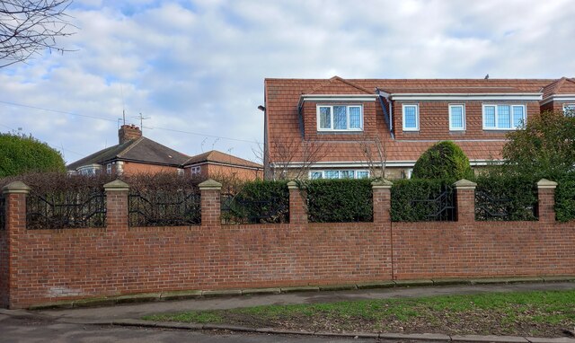
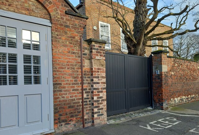
Ragworth

Settlement in Durham

England

Ragworth

National Cycle Route 1 The wooded cutting hides the fact that the cycle path is running through urban Stockton. The former railway ran between Stockton and eastern Billingham, serving the industries on the North bank of the Tees.
National Cycle Route 1 Credit: David Robinson

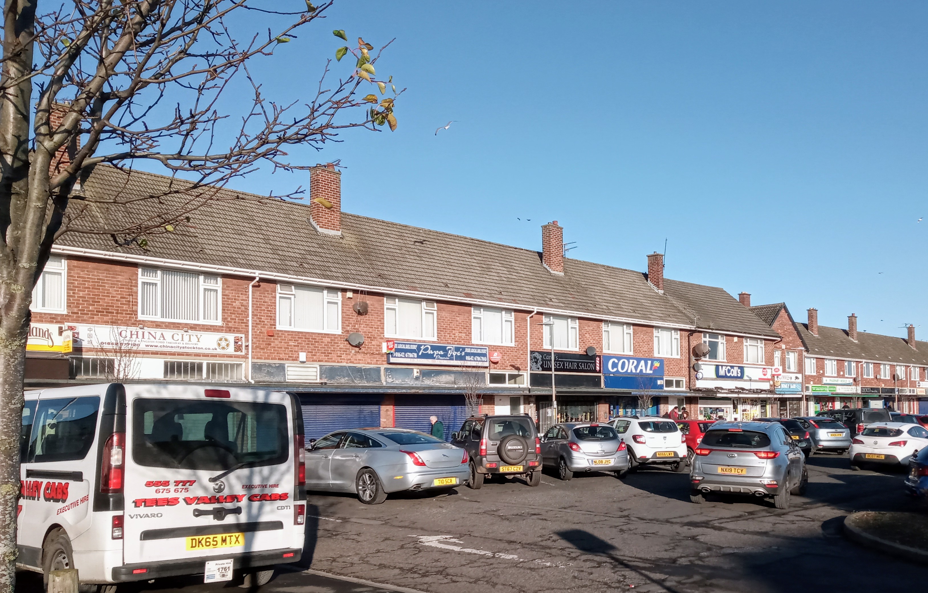
Ragworth is a small village located in the county of Durham, in the northeast of England. Situated approximately 3 miles southwest of Stockton-on-Tees, Ragworth is part of the borough of Stockton-on-Tees.

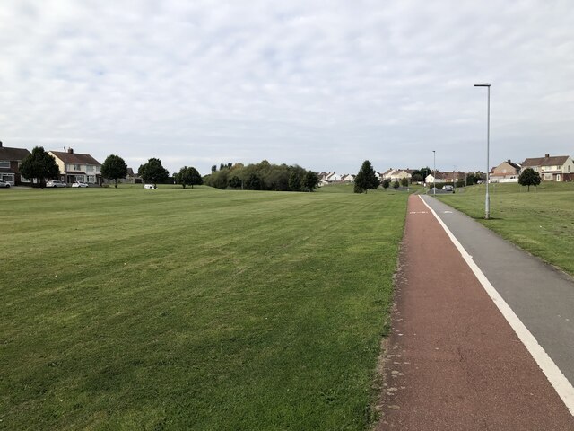
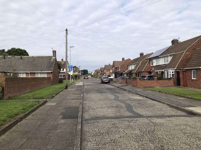
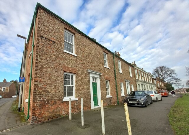
The village is primarily residential, with a mix of housing options ranging from traditional terraced houses to more modern developments. The community in Ragworth is close-knit and welcoming, with a strong sense of pride in the area.

Ragworth benefits from its proximity to Stockton-on-Tees, which provides residents with easy access to a range of amenities and services. The town offers a variety of shops, supermarkets, restaurants, and leisure facilities, ensuring that residents have all they need within a short distance.

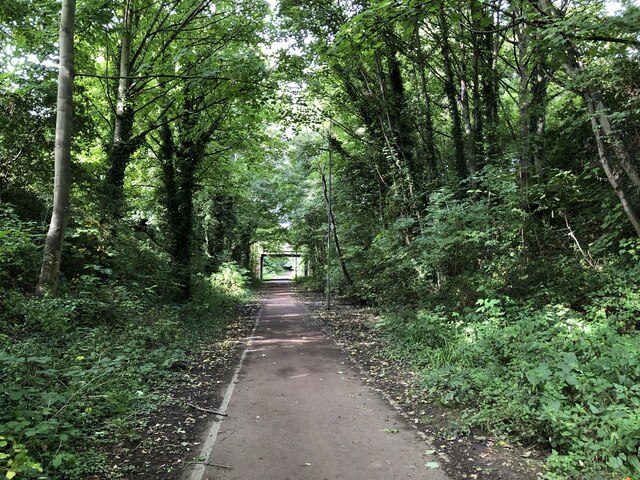
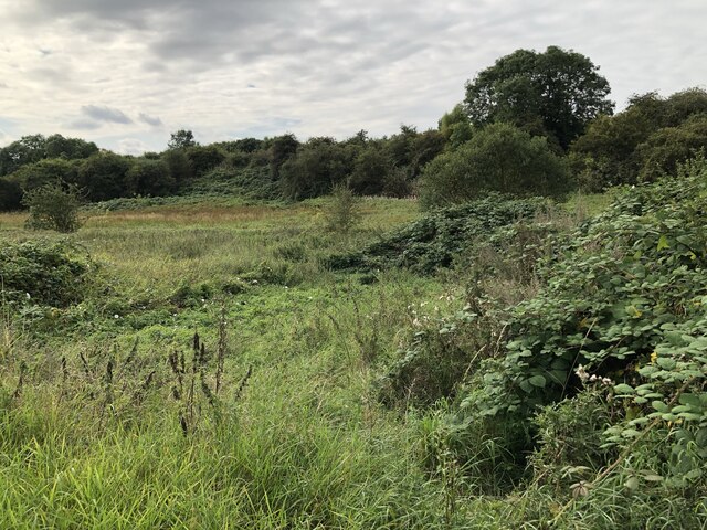
For those seeking outdoor activities and green spaces, Ragworth is not far from the beautiful Durham countryside. The village is surrounded by picturesque landscapes, making it an ideal location for nature lovers and those who enjoy outdoor pursuits.

Transport links in Ragworth are well-established, with regular bus services connecting the village to surrounding areas. The A177 road runs nearby, providing easy access to major towns and cities in the region, including Durham, Darlington, and Middlesbrough.

Overall, Ragworth offers a peaceful and friendly living environment, with the convenience of nearby urban amenities and the natural beauty of the Durham countryside within reach.

If you have any feedback on the listing, please let us know in the comments section below.
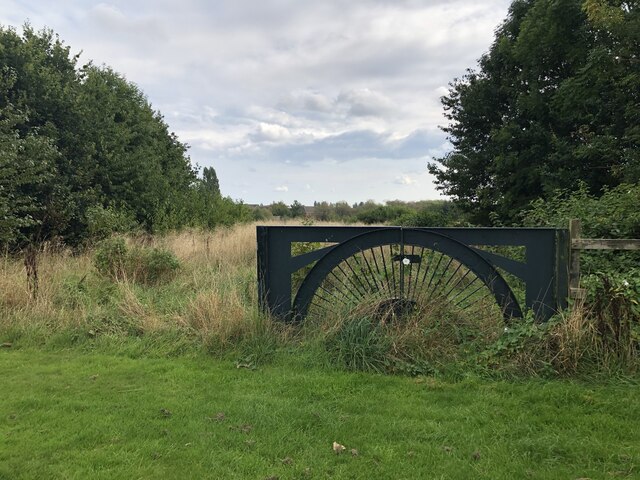
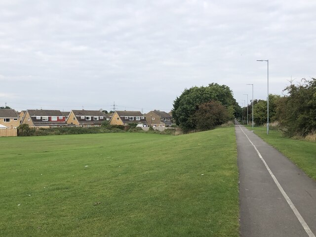
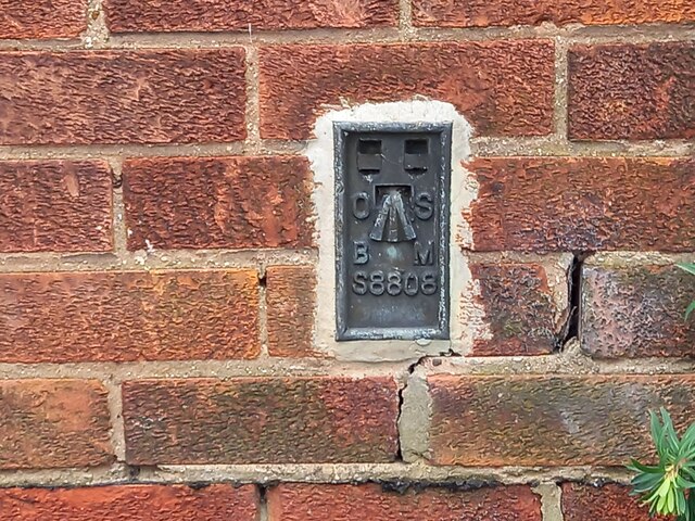
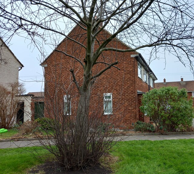
Ragworth Images

Images are sourced within 2km of 54.580839/-1.3286756 or Grid Reference NZ4320. Thanks to Geograph Open Source API. All images are credited.

National Cycle Route 1 The wooded cutting hides the fact that the cycle path is running through urban Stockton. The former railway ran between Stockton and eastern Billingham, serving the industries on the North bank of the Tees.
National Cycle Route 1
The wooded cutting hides the fact that the cycle path is running through urban Stockton. The former railway ran between Stockton and eastern Billingham, serving the industries on the North bank of the Tees.
Wetland Area Small area of wetland in urban Stockton. Residential estates are hidden by the line of shrubs and trees lining the Durham Coast Railway.
Wetland Area
Small area of wetland in urban Stockton. Residential estates are hidden by the line of shrubs and trees lining the Durham Coast Railway.
Pedestrian & Cycle Route, Roseworth
Rothwell Crescent, Roseworth, Stockton
Overgrown Entrance to Nature Reserve Gated entrance that doesn't appear to see a lot of use at the north end of Hardwick Dene & Elm Tree Woods Nature Reserve. The reserve lies within urban Stockton, behind the site of the General Hospital.
Overgrown Entrance to Nature Reserve
Gated entrance that doesn't appear to see a lot of use at the north end of Hardwick Dene & Elm Tree Woods Nature Reserve. The reserve lies within urban Stockton, behind the site of the General Hospital.
Pedestrian & Cycle Route Part of the National Cycle Route 1, this stretch of former railway line was an early example of electrification in Britain. The route was part of the Shildon - Newport (Middlesbrough) line that was electrified by NER in 1915 using 1500 V DC overhead. The electrification was removed in 1935, reduced coal traffic making renewal / upgrade uneconomic.
Pedestrian & Cycle Route
Part of the National Cycle Route 1, this stretch of former railway line was an early example of electrification in Britain. The route was part of the Shildon - Newport (Middlesbrough) line that was electrified by NER in 1915 using 1500 V DC overhead. The electrification was removed in 1935, reduced coal traffic making renewal / upgrade uneconomic.
Norton, 89 Renvyle Avenue The OS Flush Bracket, S8808, is embedded into the south west facing wall of the private house.
Norton, 89 Renvyle Avenue
The OS Flush Bracket, S8808, is embedded into the south west facing wall of the private house.
Norton, 89 Renvyle Avenue The OS Flush Bracket, S8808, is embedded into the south west facing wall of the private house. It can be seen at the bottom right of the gable end.
Norton, 89 Renvyle Avenue
The OS Flush Bracket, S8808, is embedded into the south west facing wall of the private house. It can be seen at the bottom right of the gable end.
Norton, St Mary's church The benchmark is cut into an east facing buttress.
Norton, St Mary's church
The benchmark is cut into an east facing buttress.
Norton, St Mary's church There is a benchmark cut into an east facing buttress, and it is to the right of the wooden bench.
Norton, St Mary's church
There is a benchmark cut into an east facing buttress, and it is to the right of the wooden bench.
Norton, signal box The benchmark is cut into the 6th and 7th course of the west facing wall of the signal box.
Norton, signal box
The benchmark is cut into the 6th and 7th course of the west facing wall of the signal box.
Norton, signal box There is a benchmark cut into the 6th and 7th course of bricks of the west facing wall of the signal box.
Norton, signal box
There is a benchmark cut into the 6th and 7th course of bricks of the west facing wall of the signal box.
Norton, 57 Station Road The benchmark is cut into the gable end of 57 Station Road.
Norton, 57 Station Road
The benchmark is cut into the gable end of 57 Station Road.
Norton, 57 Station Road There is a benchmark cut into the gable end of 57 Station Road. The gable end faces onto Crook Street.
Norton, 57 Station Road
There is a benchmark cut into the gable end of 57 Station Road. The gable end faces onto Crook Street.
Norton, 30 The Green The benchmark is cut into the front of the house which faces onto the village green.
Norton, 30 The Green
The benchmark is cut into the front of the house which faces onto the village green.
Norton, 30 The Green There is a benchmark cut into the front left of this corner house which faces onto the village green.
Norton, 30 The Green
There is a benchmark cut into the front left of this corner house which faces onto the village green.
Norton, Mill Lane According to the OS benchmark database there was a mark cut into a wall at this location. Today, there is a new property with a new brick wall. The benchmark has been destroyed.
Norton, Mill Lane
According to the OS benchmark database there was a mark cut into a wall at this location. Today, there is a new property with a new brick wall. The benchmark has been destroyed.
Norton, 108 High Street According to the OS benchmark database there was a benchmark cut into the gatepost to the right of the grey garage door. At some time, the gatepost has been rebuilt and no clear cut mark remains on the new build.
Norton, 108 High Street
According to the OS benchmark database there was a benchmark cut into the gatepost to the right of the grey garage door. At some time, the gatepost has been rebuilt and no clear cut mark remains on the new build.
Show me another place!

Ragworth is located at Grid Ref: NZ4320 (Lat: 54.580839, Lng: -1.3286756)

Unitary Authority: Stockton-on-Tees

Police Authority: Cleveland

What 3 Words

///surface.waddle.inflamed. Near Stockton-on-Tees, Co. Durham

Nearby Locations

Ragworth Gilpin Brown

Related Wikis

Newtown, Stockton-on-Tees

Newtown is an area of Stockton-on-Tees within the borough of Stockton-on-Tees, County Durham, England. It is next to the Stockton town centre's north-west...

Norton, County Durham

Norton, also known as Norton-on-Tees, is a market town and civil parish in the Borough of Stockton-on-Tees, in County Durham, England. The suburbs of Roseworth...

Roseworth

Roseworth is an area of Norton in the Borough of Stockton-on-Tees, County Durham, England. It borders Hardwick to the south west, Ragworth to the south...

University Hospital of North Tees

The University Hospital of North Tees is a general hospital in Stockton-on-Tees, England which provides healthcare to people living in the south east of...

Nearby Amenities

Located within 500m of 54.580839,-1.3286756
Crossing
Crossing: uncontrolled
Lat/Long: 54.5798371/-1.3282686
Public Transport: stop_position
Lat/Long: 54.5770596/-1.3325762
Post Box
Lat/Long: 54.5771582/-1.3324859
Turning Circle
Lat/Long: 54.5791437/-1.3352325
Traffic Signals
Lat/Long: 54.5820208/-1.3271539
Crossing
Bicycle: yes
Crossing: traffic_signals
Crossing Ref: toucan
Lat/Long: 54.5848973/-1.3256393
Noexit: yes
Lat/Long: 54.5811132/-1.3220783
Bus: yes
Public Transport: stop_position
Lat/Long: 54.5793549/-1.3251267
Bus: yes
Public Transport: stop_position
Lat/Long: 54.5810813/-1.3235434
Traffic Signals
Lat/Long: 54.5809607/-1.3364184
Crossing
Crossing: uncontrolled
Source: survey
Lat/Long: 54.577933/-1.3307766
Crossing
Crossing: uncontrolled
Source: survey
Lat/Long: 54.577705/-1.3305665
Traffic Calming: hump
Lat/Long: 54.5806827/-1.3258602
Traffic Calming: hump
Lat/Long: 54.5810771/-1.3249785
Traffic Calming: hump
Lat/Long: 54.5816227/-1.3259184
Barrier: block
Bicycle: yes
Foot: yes
Lat/Long: 54.5839967/-1.3255763
Bus: yes
Public Transport: stop_position
Lat/Long: 54.5845534/-1.3258132
Crossing
Crossing Island: yes
Lat/Long: 54.5849858/-1.328232
Crossing
Crossing: unmarked
Lat/Long: 54.5850029/-1.3285089
Public Transport: stop_position
Lat/Long: 54.5818749/-1.3262556
Public Transport: stop_position
Lat/Long: 54.581786/-1.3257165
Public Transport: stop_position
Lat/Long: 54.582052/-1.3285926
Public Transport: stop_position
Lat/Long: 54.5819924/-1.3290316
Bus: yes
Public Transport: stop_position
Lat/Long: 54.579967/-1.3247729
Bus: yes
Public Transport: stop_position
Lat/Long: 54.5808655/-1.3231007
Public Transport: stop_position
Lat/Long: 54.5812134/-1.3349243
Public Transport: stop_position
Lat/Long: 54.5811089/-1.3354592
Traffic Calming: cushion
Lat/Long: 54.5825969/-1.3357502
Traffic Calming: cushion
Lat/Long: 54.5815117/-1.3356107
Public Transport: stop_position
Lat/Long: 54.5813759/-1.3355075
Bus: yes
Public Transport: stop_position
Lat/Long: 54.5783346/-1.3324345
Bus: yes
Public Transport: stop_position
Lat/Long: 54.5844677/-1.3258521
Bus Stop
Mile House
Bus: yes
Loc Ref: 4
Local Ref: 4
Public Transport: platform
Source: Bing
Lat/Long: 54.5810735/-1.3354414
Bus Stop
Mile House
Bus: yes
Loc Ref: 3
Local Ref: 3
Public Transport: platform
Source: Bing
Lat/Long: 54.5812559/-1.3349384
Bus Stop
Mile House
Bus: yes
Loc Ref: 5
Local Ref: 5
Public Transport: platform
Source: Bing
Lat/Long: 54.5813818/-1.33558
Bus Stop
Ragworth Shops
Bus: yes
Naptan AtcoCode: 077072441B
Naptan NaptanCode: sktdjdg
Public Transport: platform
Source: Bing
Lat/Long: 54.5818231/-1.325695
Bus Stop
Ragworth Shops
Bus: yes
Naptan AtcoCode: 077072441A
Naptan NaptanCode: sktdjda
Public Transport: platform
Source: Bing
Lat/Long: 54.581837/-1.3262767
Bus Stop
Bus: yes
Kerb: raised
Public Transport: platform
Shelter: no
Source: survey
Tactile Paving: yes
Lat/Long: 54.5793593/-1.3250483
Bus Stop
Bus: yes
Kerb: raised
Public Transport: platform
Shelter: no
Source: survey
Tactile Paving: yes
Lat/Long: 54.5799997/-1.3248139
Bus Stop
Kerb: raised
Public Transport: platform
Shelter: no
Source: survey
Tactile Paving: yes
Lat/Long: 54.5808941/-1.3230621
Bus Stop
Kerb: raised
Naptan AtcoCode: 077072709A
Naptan NaptanCode: sktgwjm
Public Transport: platform
Shelter: no
Source: survey
Tactile Paving: yes
Lat/Long: 54.5810587/-1.3235873
Traffic Calming: hump
Lat/Long: 54.5818819/-1.3252326
Crossing
Crossing: traffic_signals
Source: survey
Lat/Long: 54.5819/-1.3272244
Bus Stop
Bus: yes
Naptan AtcoCode: 077072440B
Naptan NaptanCode: sktdjaw
Public Transport: platform
Shelter: no
Source: survey
Lat/Long: 54.5820102/-1.3285817
Bus Stop
Bus: yes
Naptan AtcoCode: 077072440A
Naptan NaptanCode: sktdjat
Public Transport: platform
Shelter: no
Source: survey
Lat/Long: 54.582035/-1.3290522
Crossing
Crossing: uncontrolled
Source: survey
Lat/Long: 54.5820581/-1.32736
Crossing
Crossing: traffic_signals
Source: survey
Lat/Long: 54.5821459/-1.3270911
Crossing
Crossing: uncontrolled
Source: survey
Lat/Long: 54.5822785/-1.3272762
Bus Stop
Naptan AtcoCode: 077072617A
Naptan NaptanCode: sktgjwt
Public Transport: platform
Source: Bing
Lat/Long: 54.577101/-1.3326459
Crossing
Crossing: uncontrolled
Source: survey
Lat/Long: 54.5774366/-1.3317232
Crossing
Crossing: uncontrolled
Source: survey
Lat/Long: 54.5775456/-1.3317764
Crossing
Crossing: uncontrolled
Source: survey
Lat/Long: 54.5775914/-1.3306386
Crossing
Crossing: uncontrolled
Lat/Long: 54.577854/-1.3317478
Crossing
Crossing: uncontrolled
Source: survey
Lat/Long: 54.57801/-1.3309372
Bus Stop
Public Transport: platform
Source: Bing
Lat/Long: 54.5783759/-1.332353
Bus Stop
Blue Bridge
Naptan AtcoCode: 077072813B
Naptan NaptanCode: sktjmwm
Public Transport: platform
Shelter: yes
Source: Bing
Lat/Long: 54.584451/-1.3257294
Bus Stop
Blue Bridge
Bench: yes
Naptan AtcoCode: 077072813A
Naptan NaptanCode: sktjmwp
Public Transport: platform
Shelter: yes
Source: Bing
Lat/Long: 54.584577/-1.3259233
Traffic Calming: cushion
Lat/Long: 54.5788036/-1.3249386
Bus Stop
Mile House
Bus: yes
Local Ref: 2
Naptan AtcoCode: 077072808B
Naptan NaptanCode: sktjmta
Public Transport: platform
Lat/Long: 54.5803751/-1.335683
Power: substation
Lat/Long: 54.5845564/-1.3249217
Veterinary
Harrison Family Vets
Disused Amenity: pub
Old Name: Mile House
Lat/Long: 54.5812526/-1.3361455
Bus: yes
Public Transport: stop_position
Lat/Long: 54.5804181/-1.3356086
Bus Stop
Bus: yes
Naptan AtcoCode: 077072485A
Naptan NaptanCode: sktdpag
Public Transport: platform
Lat/Long: 54.5788062/-1.3333027
Traffic Calming: island
Lat/Long: 54.5774874/-1.3317446
Waste Basket
Lat/Long: 54.5845346/-1.3252127
Cafe
Starbucks
Brand: Starbucks
Brand Wikidata: Q37158
Cuisine: coffee_shop
Drive Through: yes
Official Name: Starbucks Coffee
Takeaway: yes
Website: https://www.starbucks.com/store-locator/store/1033876/stockton-on-tees-durham-road-milehouse-pub-durham-road-stockton-on-tees-stockto
Lat/Long: 54.581292/-1.3363068
Headkandy
Shop: hairdresser
Lat/Long: 54.5812905/-1.336001
Fast Food
Greggs
Brand: Greggs
Brand Wikidata: Q3403981
Contact Website: https://www.greggs.co.uk/shop-finder?shop-code=6090
Cuisine: sandwich;bakery
Takeaway: yes
Lat/Long: 54.5812485/-1.3358293
The data included in this document is from www.openstreetmap.org. The data is made available under ODbL.

Have you been to Ragworth?

Leave your review of Ragworth below (or comments, questions and feedback).