Pwll-Gwaun

Settlement in Glamorgan

Wales

Pwll-Gwaun

View south at Pontypridd station
View south at Pontypridd station Credit: Peter Whatley

Pwll-Gwaun is a small village located in the county of Glamorgan, Wales. Situated in the southwestern part of the country, Pwll-Gwaun is nestled within a picturesque valley, surrounded by lush green hills and woodlands. The village is known for its natural beauty and tranquil atmosphere, making it a popular destination for those seeking a peaceful escape from the bustling city life.

With a population of around 400 residents, Pwll-Gwaun is a close-knit community where everyone knows each other. The village predominantly consists of traditional stone houses, giving it a charming and authentic feel. The local economy primarily revolves around agriculture, with many residents involved in farming or related industries.

Pwll-Gwaun is also famous for its annual festival called "Hen Galan," which takes place on January 13th, celebrating the old New Year's Day according to the Julian calendar. During this festival, locals dress up in traditional Welsh costumes and sing traditional songs, keeping alive the rich cultural heritage of the region.

The village is surrounded by stunning natural landscapes, providing ample opportunities for outdoor activities such as hiking, birdwatching, and exploring the nearby woodlands. Additionally, Pwll-Gwaun is within close proximity to the coast, allowing residents and visitors to enjoy the beautiful sandy beaches and breathtaking coastal walks.

In terms of amenities, Pwll-Gwaun has a primary school, a post office, a village hall, and a pub, which serves as a social hub for the community. However, for more extensive facilities and services, residents often have to travel to the nearby towns of Fishguard or Haverfordwest.

Overall, Pwll-Gwaun offers a peaceful and idyllic lifestyle amidst stunning natural surroundings, making it an attractive place for those seeking a slower pace of life in the heart of the Welsh countryside.

If you have any feedback on the listing, please let us know in the comments section below.
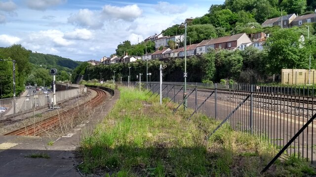
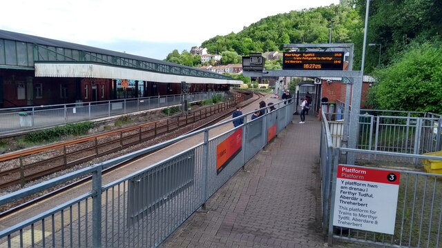
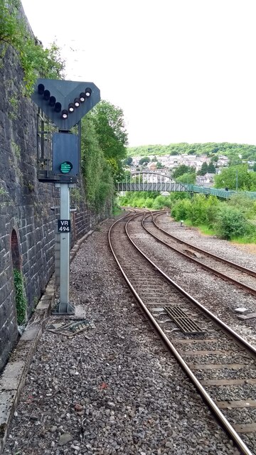
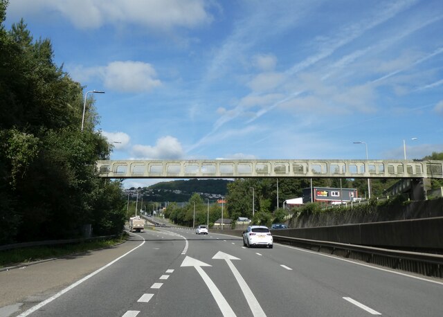
Pwll-Gwaun Images

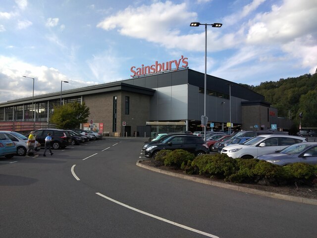
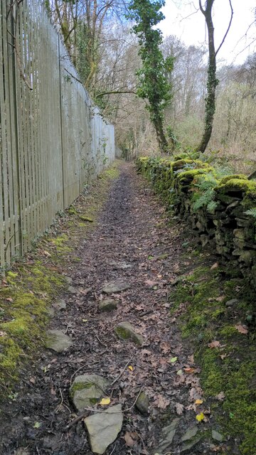
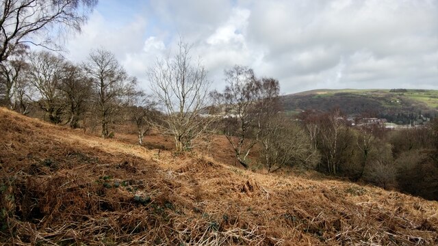
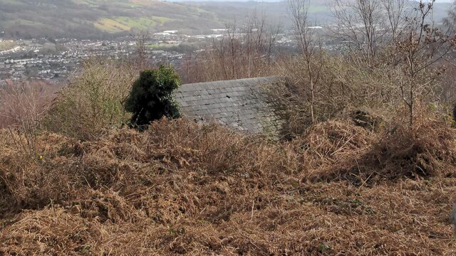
Images are sourced within 2km of 51.602826/-3.3503425 or Grid Reference ST0690. Thanks to Geograph Open Source API. All images are credited.

View south at Pontypridd station
Pontypridd station from platform 3
Line clear for Merthyr The signal at the north end of Pontypridd's platform 3 shows a clear aspect with a route indication using white lights for the Merthyr train next to depart.
Line clear for Merthyr
The signal at the north end of Pontypridd's platform 3 shows a clear aspect with a route indication using white lights for the Merthyr train next to depart.
A470 at Pentrebach
A470 at Pentrebach
Foot and cycle bridge over A470, Glyntaff The bridge is part of the Taff Trail
Foot and cycle bridge over A470, Glyntaff
The bridge is part of the Taff Trail
Sainsbury's superstore, Pontypridd The shopfloor is on the first floor, above a car park on ground level
Sainsbury's superstore, Pontypridd
The shopfloor is on the first floor, above a car park on ground level
A4058 bridge over A470, Pontypridd
Relief sculpture, wall between road and railway, Pontypridd
Wall between railway and road, Pontypridd An attempt has been made to make this wall more attractive, with textured panels and some relief sculpture.
Wall between railway and road, Pontypridd
An attempt has been made to make this wall more attractive, with textured panels and some relief sculpture.
Relief sculpture in wall near Pontypridd station
Staircase to Pontypridd railway station
Pentrebach Road, Glyntaff
Path going up the Pontypridd Circular trail Path goes along the fence surrounding the University of South Wales.
Path going up the Pontypridd Circular trail
Path goes along the fence surrounding the University of South Wales.
Looking over the heath
Farmer's entrance Path that goes towards some farmer's land.
Farmer's entrance
Path that goes towards some farmer's land.
View from the path to the farmer's land
A lone evergreen tree Amongst all the leafless trees is this one evergreen sticking out.
A lone evergreen tree
Amongst all the leafless trees is this one evergreen sticking out.
East view of an abandoned shack
Show me another place!

Pwll-Gwaun is located at Grid Ref: ST0690 (Lat: 51.602826, Lng: -3.3503425)

Unitary Authority: Rhondda Cynon Taf

Police Authority: South Wales

What 3 Words

///matter.stared.panel. Near Pontypridd, Rhondda Cynon Taf

Related Wikis

Pwllgwaun

Pwllgwaun (or Pwll-Gwaun) is a village and small suburb of Pontypridd within the 'Rhondda' electoral ward, bordered by Hopkinstown and Graigwen hill to...

Pontypridd (Senedd constituency)

Pontypridd is a constituency of the Senedd. It elects one Member of the Senedd by the first past the post method of election. It is also one of eight constituencies...

Pontypridd (UK Parliament constituency)

Pontypridd () is a constituency represented in the House of Commons of the UK Parliament since 2019 by Alex Davies-Jones of the Labour Party.The constituency...
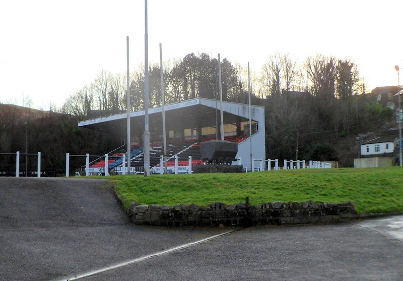
Sardis Road

Sardis Road (Welsh: Heol Sardis) is a rugby union stadium situated in Pontypridd, Wales. It is home to the Indigo Group Premiership team, Pontypridd RFC...

Nearby Amenities

Located within 500m of 51.602826,-3.3503425
Pontypridd
Name Cy: Pontypridd
Place: town
Population: 30457
Postal Code: CF
Wikidata: Q1024900
Wikipedia: en:Pontypridd
Lat/Long: 51.6001047/-3.3449362
Crossing
Crossing: traffic_signals
Lat/Long: 51.6022685/-3.3461185
Railway: switch
Lat/Long: 51.6014337/-3.3442956
Crossing
Crossing: zebra
Lat/Long: 51.5998191/-3.3475788
Crossing
Lat/Long: 51.6007867/-3.3443741
Crossing
Lat/Long: 51.6007415/-3.3445261
Parking
Lat/Long: 51.6045038/-3.3558566
Parking
Lat/Long: 51.6044775/-3.3530166
Bus Stop
Shelter: yes
Lat/Long: 51.6045434/-3.3544863
Bus Stop
Naptan AtcoCode: 5520AWA14189
Naptan NaptanCode: rhodpaw
Lat/Long: 51.6046588/-3.35342
Spar
Addr Housenumber: 117
Addr Postcode: CF37 2PT
Addr Street: Hopkinstown Road
Brand: Spar
Brand Wikidata: Q610492
Fhrs Id: 1211121
Shop: convenience
Website: https://www.spar.co.uk/store-locator/afb29889-spar-hopkinstown/
Lat/Long: 51.6047068/-3.3534044
Fast Food
Ming Hong
Addr City: Pontypridd
Addr Housenumber: 105
Addr Postcode: CF37 2PS
Addr Street: Hopkinstown Road
Addr Suburb: Hopkinstown
Cuisine: chinese
Fhrs Id: 187608
Takeaway: yes
Lat/Long: 51.6046776/-3.354679
Pwll Gwaun
Place: village
Wikidata: Q7262773
Lat/Long: 51.603416/-3.3509416
Maesycoed
Place: village
Wikidata: Q6729365
Lat/Long: 51.6000441/-3.3488602
Atm
Source: survey
Lat/Long: 51.6046996/-3.3534586
P.A.R.C. Garage
Shop: car_repair
Source: survey
Lat/Long: 51.6042665/-3.3497381
Crossing
Crossing: traffic_signals
Crossing Ref: pelican
Source: survey
Lat/Long: 51.6023993/-3.3449752
Railway: switch
Lat/Long: 51.6012331/-3.34393
Bicycle Parking
Bicycle Parking: stands
Capacity: 10
Operator: Lidl
Lat/Long: 51.601159/-3.3452078
Barrier: bollard
Bollard: fixed
Lat/Long: 51.6047642/-3.3550157
Parking
Parking: surface
Lat/Long: 51.600528/-3.3466976
Parking
Parking: surface
Lat/Long: 51.5990983/-3.3470467
Turning Circle
Lat/Long: 51.6015179/-3.3502078
Pontypridd Northern Junction
Historic Railway: junction
Railway: site
Lat/Long: 51.6034122/-3.343337
Rhondda Cutting Junction
Historic Railway: junction
Railway: site
Lat/Long: 51.6033084/-3.3467892
Traffic Signals
Traffic Signals: signal
Traffic Signals Direction: forward
Lat/Long: 51.6019947/-3.3444471
Traffic Signals
Traffic Signals: signal
Traffic Signals Direction: forward
Lat/Long: 51.6018949/-3.343403
Traffic Signals
Traffic Signals: signal
Traffic Signals Direction: forward
Lat/Long: 51.6018846/-3.3443425
Direction: SSE
Generator Method: photovoltaic
Generator Output Electricity: yes
Generator Solar Modules: 15
Generator Source: solar
Generator Type: solar_photovoltaic_panel
Power: generator
Lat/Long: 51.6000647/-3.3499054
Parking
Parking: surface
Lat/Long: 51.600118/-3.3502192
Direction: SSE
Generator Method: photovoltaic
Generator Output Electricity: yes
Generator Solar Modules: 7
Generator Source: solar
Generator Type: solar_photovoltaic_panel
Location: roof
Power: generator
Lat/Long: 51.5997275/-3.3503902
Direction: WSW
Generator Method: photovoltaic
Generator Output Electricity: yes
Generator Solar Modules: 7
Generator Source: solar
Generator Type: solar_photovoltaic_panel
Location: roof
Power: generator
Lat/Long: 51.5997198/-3.3503288
Direction: WSW
Generator Method: photovoltaic
Generator Output Electricity: yes
Generator Solar Modules: 9
Generator Source: solar
Generator Type: solar_photovoltaic_panel
Location: roof
Power: generator
Lat/Long: 51.6038215/-3.3465919
Direction: SE
Generator Method: photovoltaic
Generator Output Electricity: yes
Generator Solar Modules: 10
Generator Source: solar
Generator Type: solar_photovoltaic_panel
Location: roof
Power: generator
Lat/Long: 51.6037238/-3.3454885
Direction: SW
Generator Method: photovoltaic
Generator Output Electricity: yes
Generator Solar Modules: 6
Generator Source: solar
Generator Type: solar_photovoltaic_panel
Location: roof
Power: generator
Lat/Long: 51.6037155/-3.3457067
Direction: SSW
Generator Method: photovoltaic
Generator Output Electricity: yes
Generator Solar Modules: 10
Generator Source: solar
Generator Type: solar_photovoltaic_panel
Location: roof
Power: generator
Lat/Long: 51.6043941/-3.3449574
Direction: 215
Generator Method: photovoltaic
Generator Output Electricity: yes
Generator Solar Modules: 16
Generator Source: solar
Generator Type: solar_photovoltaic_panel
Location: roof
Power: generator
Lat/Long: 51.6020343/-3.3542905
Direction: 215
Generator Method: photovoltaic
Generator Output Electricity: yes
Generator Solar Modules: 10
Generator Source: solar
Generator Type: solar_photovoltaic_panel
Location: roof
Power: generator
Lat/Long: 51.6031705/-3.3572915
Direction: 145
Generator Method: photovoltaic
Generator Output Electricity: yes
Generator Solar Modules: 8
Generator Source: solar
Generator Type: solar_photovoltaic_panel
Location: roof
Power: generator
Lat/Long: 51.6035487/-3.3517139
Direction: 145
Generator Method: photovoltaic
Generator Output Electricity: yes
Generator Solar Modules: 10
Generator Source: solar
Generator Type: solar_photovoltaic_panel
Location: roof
Power: generator
Lat/Long: 51.6041059/-3.3516079
Direction: WNW
Generator Method: photovoltaic
Generator Output Electricity: yes
Generator Solar Modules: 7
Generator Source: solar
Generator Type: solar_photovoltaic_panel
Location: roof
Power: generator
Lat/Long: 51.6048662/-3.3548323
Direction: ESE
Generator Method: photovoltaic
Generator Output Electricity: yes
Generator Solar Modules: 8
Generator Source: solar
Generator Type: solar_photovoltaic_panel
Location: roof
Power: generator
Lat/Long: 51.6048523/-3.3547501
Direction: SSW
Generator Method: photovoltaic
Generator Output Electricity: yes
Generator Solar Modules: 20
Generator Source: solar
Generator Type: solar_photovoltaic_panel
Location: roof
Power: generator
Lat/Long: 51.6048414/-3.3555695
Direction: SSW
Generator Method: photovoltaic
Generator Output Electricity: yes
Generator Solar Modules: 20
Generator Source: solar
Generator Type: solar_photovoltaic_panel
Location: roof
Power: generator
Lat/Long: 51.6068483/-3.3484241
Direction: 235
Generator Method: photovoltaic
Generator Output Electricity: yes
Generator Solar Modules: 16
Generator Source: solar
Generator Type: solar_photovoltaic_panel
Location: roof
Power: generator
Lat/Long: 51.6005772/-3.3522739
Booth: K6
Covered: booth
Disused Amenity: telephone
Man Made: telephone_box
Lat/Long: 51.60378/-3.3459632
Post Box
Post Box Type: pillar
Lat/Long: 51.6038017/-3.345982
Bench
Lat/Long: 51.6063296/-3.3508675
Bench
Lat/Long: 51.606766/-3.3509265
Crossing
Crossing: traffic_signals
Lat/Long: 51.6022181/-3.3454639
Give Way
Direction: forward
Lat/Long: 51.6022871/-3.3442188
Traffic Signals
Traffic Signals: signal
Traffic Signals Direction: forward
Lat/Long: 51.601973/-3.3432653
Crossing
Lat/Long: 51.599726/-3.3460635
Give Way
Direction: forward
Lat/Long: 51.6008106/-3.3442443
Crossing
Crossing: traffic_signals
Lat/Long: 51.6006498/-3.3443454
Traffic Signals
Traffic Signals: pedestrian_crossing
Traffic Signals Direction: forward
Lat/Long: 51.6006604/-3.3442844
Traffic Signals
Traffic Signals: signal
Traffic Signals Direction: forward
Lat/Long: 51.6007102/-3.3445473
Traffic Signals
Traffic Signals: signal
Traffic Signals Direction: forward
Lat/Long: 51.6007739/-3.3443286
The data included in this document is from www.openstreetmap.org. The data is made available under ODbL.

Have you been to Pwll-Gwaun?

Leave your review of Pwll-Gwaun below (or comments, questions and feedback).