Paradise

Settlement in Warwickshire

England

Paradise

St Mary Magdalene, Wyken Built in the early 1100’s by Earl Ranulf of Chester, St Mary Magdalene, Wyken, is Coventry’s oldest church. The tower was added in the fifteenth century to house the single bell, but otherwise the building has remained largely unaltered for 900 years.
From <span class="nowrap"><a title="http://www.coventrysoldestchurch.org/" rel="nofollow ugc noopener" href="http://www.coventrysoldestchurch.org/">Link</a><img style="margin-left:2px;" alt="External link" title="External link - shift click to open in new window" src="https://s1.geograph.org.uk/img/external.png" width="10" height="10"/></span>
St Mary Magdalene, Wyken Credit: Kevin Croucher

Paradise, Warwickshire is a charming village located in the heart of England. Situated in the county of Warwickshire, this picturesque settlement is renowned for its idyllic countryside views, historic architecture, and vibrant community.

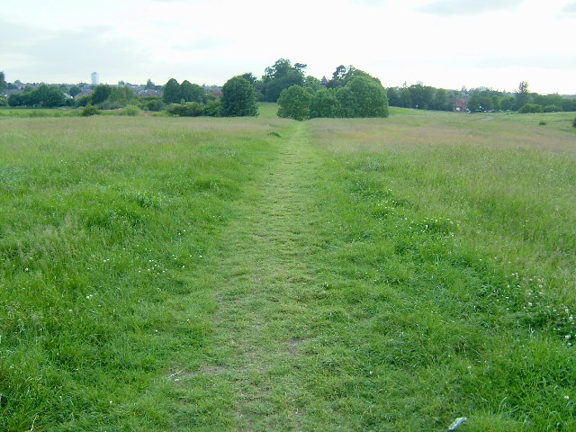
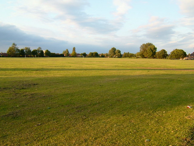
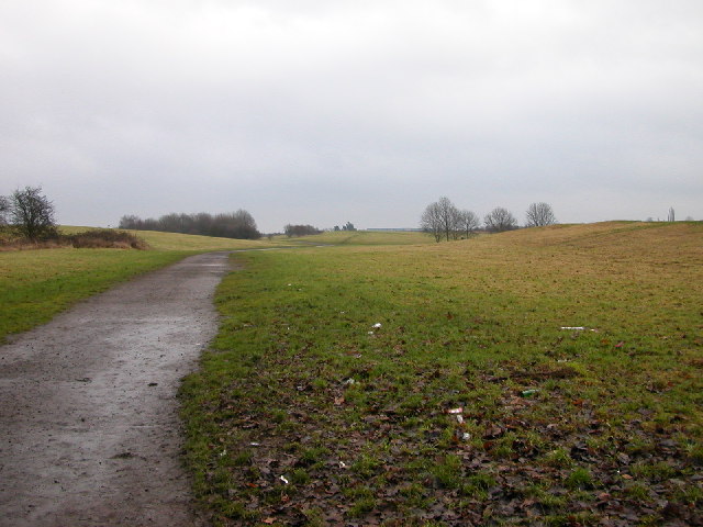
With a population of around 1,500 residents, Paradise offers a tranquil escape from the hustle and bustle of city life. The village is surrounded by lush green fields, rolling hills, and meandering rivers, making it a haven for nature enthusiasts and outdoor lovers. The nearby Warwickshire countryside provides ample opportunities for hiking, cycling, and horseback riding.

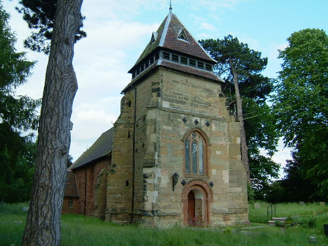
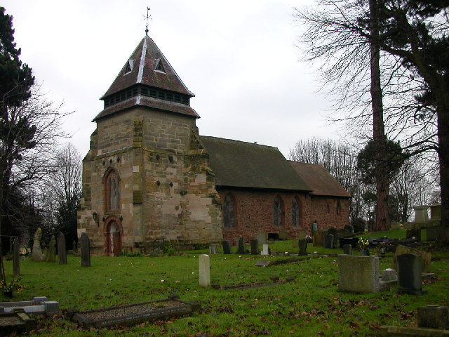
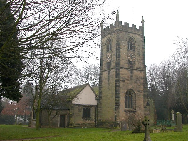
Paradise is steeped in history, with its origins dating back to medieval times. The village is home to several well-preserved historic buildings, including St. Peter's Church, a beautiful 12th-century structure that showcases intricate architectural details. The church is a focal point of the community, hosting regular religious services and cultural events.

Despite its small size, Paradise boasts a close-knit and active community. The village has a primary school, a village hall, and a local pub, serving as gathering places for residents to socialize and connect. The community organizes various events throughout the year, such as summer fairs, Christmas markets, and sports tournaments, fostering a strong sense of belonging and camaraderie.

Paradise is conveniently located near major transportation routes, allowing for easy access to nearby towns and cities. The village offers a peaceful and serene lifestyle, making it an appealing destination for those seeking a harmonious balance between rural tranquility and modern amenities.

If you have any feedback on the listing, please let us know in the comments section below.
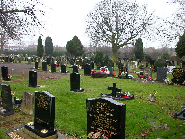
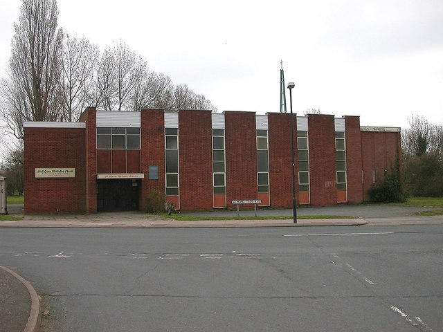
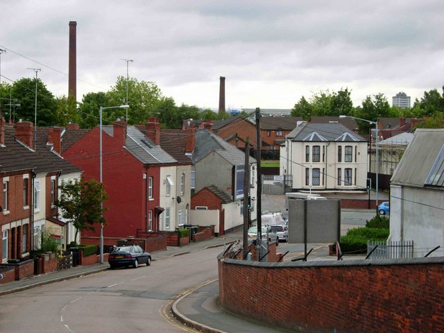
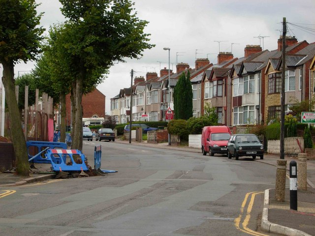
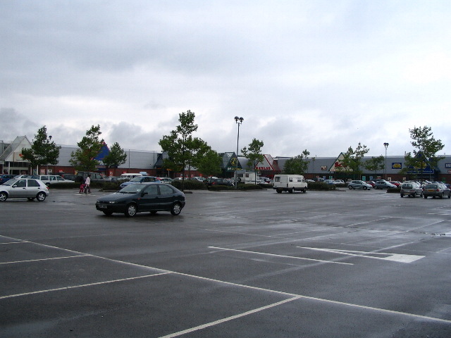
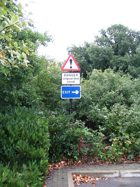
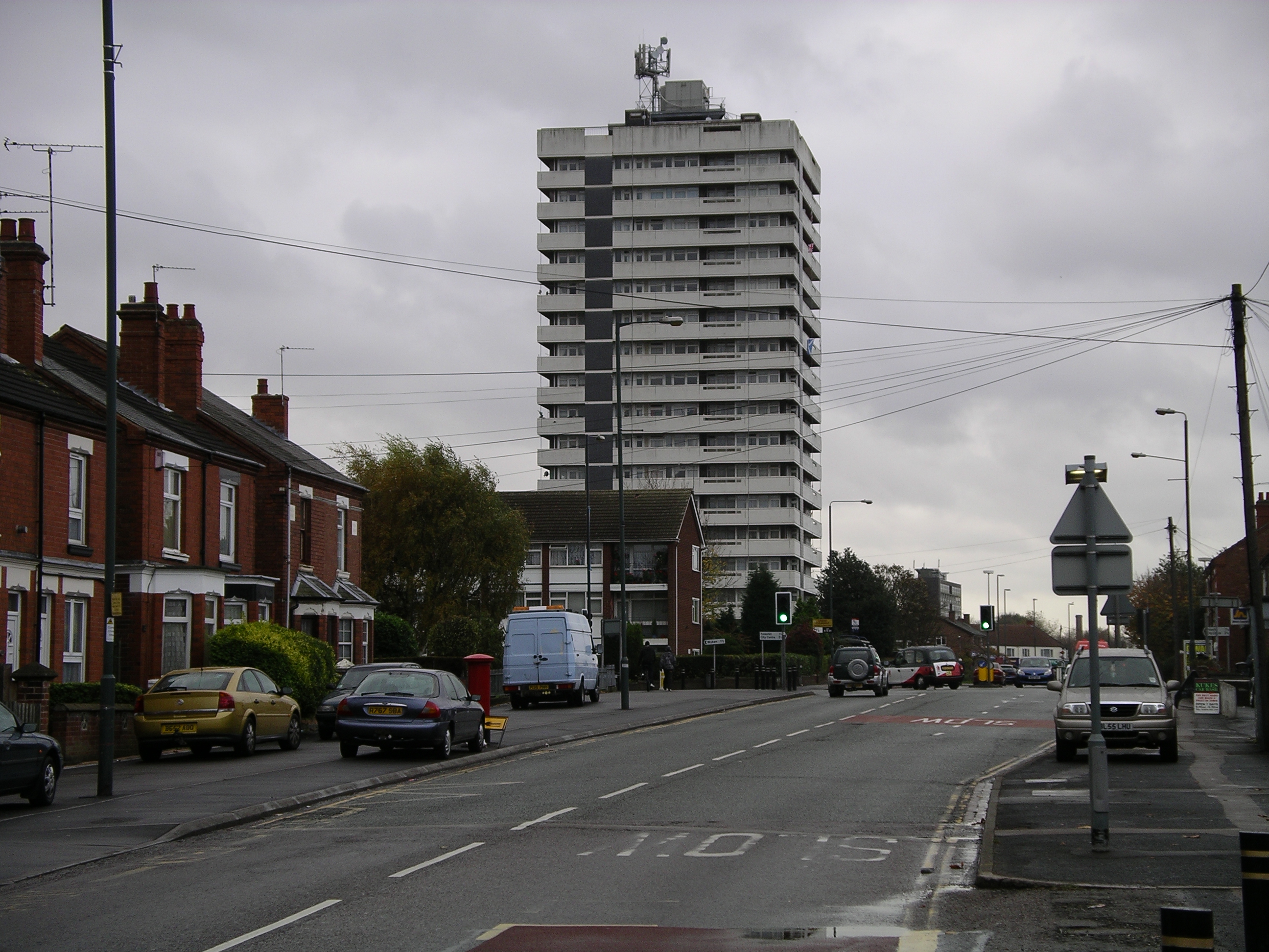
Paradise Images

Images are sourced within 2km of 52.428791/-1.4883849 or Grid Reference SP3481. Thanks to Geograph Open Source API. All images are credited.

St Mary Magdalene, Wyken Built in the early 1100’s by Earl Ranulf of Chester, St Mary Magdalene, Wyken, is Coventry’s oldest church. The tower was added in the fifteenth century to house the single bell, but otherwise the building has remained largely unaltered for 900 years.
From <span class="nowrap"><a title="http://www.coventrysoldestchurch.org/" rel="nofollow ugc noopener" href="http://www.coventrysoldestchurch.org/">Link</a><img style="margin-left:2px;" alt="External link" title="External link - shift click to open in new window" src="https://s1.geograph.org.uk/img/external.png" width="10" height="10"/></span>
St Mary Magdalene, Wyken
Built in the early 1100’s by Earl Ranulf of Chester, St Mary Magdalene, Wyken, is Coventry’s oldest church. The tower was added in the fifteenth century to house the single bell, but otherwise the building has remained largely unaltered for 900 years. From LinkExternal link
Wyken Croft Nature Park This is the City's first ecological park. It was created by Coventry City Council as part of a Department of Environment reclamation scheme, and has involved top soiling to new contours, landscaping, planting native trees and wild flowers.It lies over what was once a coal mining area, Craven Colliery, and in the 1950's and 60s the site was used as a refuse tip.
Wyken Croft Nature Park
This is the City's first ecological park. It was created by Coventry City Council as part of a Department of Environment reclamation scheme, and has involved top soiling to new contours, landscaping, planting native trees and wild flowers.It lies over what was once a coal mining area, Craven Colliery, and in the 1950's and 60s the site was used as a refuse tip.
Henley College Further Education College on the North side of Coventry.
Henley College
Further Education College on the North side of Coventry.
Courthouse Green Once the Morris Engine Works. Now home to the AT7 Sports Centre, a car hypermarket and Sainsbury's supermarket.
Courthouse Green
Once the Morris Engine Works. Now home to the AT7 Sports Centre, a car hypermarket and Sainsbury's supermarket.
Stoke Heath A valuable open space in a rather run down part of Coventry
Stoke Heath
A valuable open space in a rather run down part of Coventry
Red Lane Ordnance Works An enormous building. Amongst other things, First World War naval guns were made here.
Red Lane Ordnance Works
An enormous building. Amongst other things, First World War naval guns were made here.
Inside the Ordnance Works Difficult to photograph. Trying to give an idea of the size of the building. Now used for storing Jaguar car parts
Inside the Ordnance Works
Difficult to photograph. Trying to give an idea of the size of the building. Now used for storing Jaguar car parts
Where the wives spend Saturday afternoon. Where the Sky Blues widows shop on a Saturday afternoon.
Where the wives spend Saturday afternoon.
Where the Sky Blues widows shop on a Saturday afternoon.
Wyken Entrance to Wyken Croft Park
Wyken
Entrance to Wyken Croft Park
Wyken Church of St Mary Magdalene, the oldest church in Coventry.
Wyken
Church of St Mary Magdalene, the oldest church in Coventry.
Coventry - Foleshill Church of St Laurence stands alone some distance from any road.
Coventry - Foleshill
Church of St Laurence stands alone some distance from any road.
Coventry - Little Heath Chimney and cooling tower from old factory shrouded in mist. Taken from just west of Coventry Canal.
Coventry - Little Heath
Chimney and cooling tower from old factory shrouded in mist. Taken from just west of Coventry Canal.
Coventry - Foleshill Cemetery in Little Heath
Coventry - Foleshill
Cemetery in Little Heath
Coventry - Wood End Hall Green Methodist Church on Almond Tree Avenue.
Coventry - Wood End
Hall Green Methodist Church on Almond Tree Avenue.
Cash's Lane, Coventry Looking from the bridge over the Coventry Canal towards Foleshill Road.  The chimneys belonged to the defunct Webster's brick works which is scheduled for redevelopment.
Cash's Lane, Coventry
Looking from the bridge over the Coventry Canal towards Foleshill Road. The chimneys belonged to the defunct Webster's brick works which is scheduled for redevelopment.
Kingfield Road, Coventry Taken from the junction with Marion Road.  The land on the left hand side is being redeveloped for housing and has been given the twee name 'Swallowcroft' by the builder.
Kingfield Road, Coventry
Taken from the junction with Marion Road. The land on the left hand side is being redeveloped for housing and has been given the twee name 'Swallowcroft' by the builder.
Gallagher Retail Park On the former Alfred Herberts factory site, off Stoney Stanton Road.
Gallagher Retail Park
On the former Alfred Herberts factory site, off Stoney Stanton Road.
Danger unguarded canal ! There are several of these signs along the edge of the car park at the Gallagher Retail Park.  The Coventry Canal is immediately behind, and several feet below the shrubbery.
Danger unguarded canal !
There are several of these signs along the edge of the car park at the Gallagher Retail Park. The Coventry Canal is immediately behind, and several feet below the shrubbery.
Show me another place!

Paradise is located at Grid Ref: SP3481 (Lat: 52.428791, Lng: -1.4883849)

Unitary Authority: Coventry

Police Authority: West Midlands

What 3 Words

///undulation.drops.cloth. Near Coventry, West Midlands

Related Wikis

Edgwick

Edgwick is a residential area of Coventry, West Midlands, England. It is situated approximately 2 miles north of the city centre, between the districts...

Courthouse Green

Courthouse Green is a suburb in the north of Coventry. It is bordered by Bell Green in the northwest, by Stoke Heath in the south, Wyken to the east, and...

Morris Motors Ground, Coventry

The Morris Motors Ground was a cricket ground in Coventry, Warwickshire. The ground was owned by Morris Motors Limited, which operated in Coventry. The...

Coventry and Bedworth urban area

The Coventry/Bedworth Urban Area or Coventry Built-up area as defined by the Office for National Statistics had a population of 359,252 at the 2011 census...

Nearby Amenities

Located within 500m of 52.428791,-1.4883849
Traffic Signals
Lat/Long: 52.4297917/-1.4857936
Crossing
Button Operated: yes
Crossing: traffic_signals
Lat/Long: 52.4296783/-1.4856609
Traffic Signals
Lat/Long: 52.4304645/-1.4859654
Traffic Signals
Lat/Long: 52.4303707/-1.485299
Traffic Signals
Button Operated: yes
Crossing: traffic_signals
Tactile Paving: yes
Traffic Signals Sound: no
Traffic Signals Vibration: yes
Lat/Long: 52.4264853/-1.4928042
Traffic Signals
Lat/Long: 52.430503/-1.4856917
Traffic Signals
Lat/Long: 52.4299883/-1.4862404
Traffic Signals
Crossing: traffic_signals
Lat/Long: 52.4306453/-1.4860412
Crossing
Lat/Long: 52.4297867/-1.4864969
Turning Circle
Lat/Long: 52.4312317/-1.4857794
Post Office
Courthouse Green Post Office
Addr City: Coventry
Addr Housenumber: 10-12
Addr Postcode: CV6 7GP
Addr Street: Bell Green Road
Brand: Post Office
Brand Wikidata: Q1783168
Opening Hours: Mo-Sa 08:00-20:00; Su 11:00-17:00
Ref Pol Id: 5118
Website: https://www.postoffice.co.uk/branch-finder/1782053/courthouse-green
Lat/Long: 52.4306394/-1.4841311
Telephone
Booth: KX100
Covered: booth
Lat/Long: 52.4307108/-1.4840444
Courthouse Green
Alt Name: Court House Green
Is In: Coventry
Place: suburb
Wikidata: Q15211860
Wikipedia: en:Courthouse Green
Lat/Long: 52.4306375/-1.4828774
Post Box
Lat/Long: 52.4287398/-1.4882116
Bus Stop
Stoney Stanton Rd / Station St East
NaPTANAreaCode: 43000023201
Bus: yes
Naptan AtcoCode: 43000023201
Naptan Bearing: NE
Naptan BusStopType: MKD
Naptan CommonName: Station St East
Naptan Indicator: adj
Naptan NaptanCode: nwmpwawg
Naptan PlusbusZoneRef: BHAMNWS
Naptan Status: ACT
Naptan StopType: BCT
Naptan Street: STONEY STANTON RD
Naptan Towards: Bell Green
Naptan Verified: no
Public Transport: platform
Route Ref: 21;30
Shelter: yes
Shelter Ref: 711669
Source: WMCA
Lat/Long: 52.4271586/-1.4916486
Bus Stop
Stoney Stanton Rd / Station St East
NaPTANAreaCode: 43000023202
Bus: yes
Naptan AtcoCode: 43000023202
Naptan Bearing: SW
Naptan BusStopType: MKD
Naptan CommonName: Station St East
Naptan Indicator: opp
Naptan NaptanCode: nwmpwawj
Naptan PlusbusZoneRef: BHAMNWS
Naptan Status: ACT
Naptan StopType: BCT
Naptan Street: STONEY STANTON RD
Naptan Towards: City Centre
Naptan Verified: no
Public Transport: platform
Route Ref: 21;30
Shelter: yes
Shelter Ref: 711668
Source: WMCA
Lat/Long: 52.4267462/-1.4921129
Bus Stop
Stoney Stanton Rd / Eden St
NaPTANAreaCode: 43000023301
Bus: yes
Naptan AtcoCode: 43000023301
Naptan Bearing: NE
Naptan BusStopType: MKD
Naptan CommonName: Eden St
Naptan Indicator: opp
Naptan NaptanCode: nwmpwawm
Naptan PlusbusZoneRef: BHAMNWS
Naptan Status: ACT
Naptan StopType: BCT
Naptan Street: STONEY STANTON RD
Naptan Towards: Bell Green
Naptan Verified: no
Public Transport: platform
Route Ref: 21;30
Shelter: yes
Shelter Ref: 7116100
Source: WMCA
Lat/Long: 52.4286596/-1.4887977
Bus Stop
Stoney Stanton Rd / Eden St
NaPTANAreaCode: 43000023302
Bus: yes
Naptan AtcoCode: 43000023302
Naptan Bearing: SW
Naptan BusStopType: MKD
Naptan CommonName: Eden St
Naptan Indicator: adj
Naptan NaptanCode: nwmpwawp
Naptan PlusbusZoneRef: BHAMNWS
Naptan Status: ACT
Naptan StopType: BCT
Naptan Street: STONEY STANTON RD
Naptan Towards: City Centre
Naptan Verified: no
Public Transport: platform
Route Ref: 21;30
Shelter: yes
Shelter Ref: 711633
Source: WMCA
Lat/Long: 52.4285084/-1.4887561
Bus Stop
Austin Drive / Sainsburys
NaPTANAreaCode: 43000023501
Bus: yes
Naptan AtcoCode: 43000023501
Naptan Bearing: W
Naptan BusStopType: MKD
Naptan CommonName: Sainsburys
Naptan Indicator: adj
Naptan NaptanCode: nwmpwdad
Naptan PlusbusZoneRef: BHAMNWS
Naptan Status: ACT
Naptan StopType: BCT
Naptan Street: AUSTIN DRIVE
Naptan Towards: Both directions
Naptan Verified: no
Public Transport: platform
Route Ref: 30
Shelter: yes
Shelter Ref: 711772
Source: WMCA
Lat/Long: 52.4273979/-1.4830176
Bus Stop
Bell Green Rd / Nuffield Rd
NaPTANAreaCode: 43000025001
Bench: yes
Bin: yes
Bus: yes
Lit: yes
Naptan AtcoCode: 43000025001
Naptan Bearing: SW
Naptan BusStopType: MKD
Naptan CommonName: Nuffield Rd
Naptan Indicator: adj
Naptan NaptanCode: nwmpwdmg
Naptan PlusbusZoneRef: BHAMNWS
Naptan Status: ACT
Naptan StopType: BCT
Naptan Street: BELL GREEN RD
Naptan Towards: City Centre
Naptan Verified: no
Public Transport: platform
Route Ref: 21;30
Shelter: yes
Shelter Ref: 711767
Source: WMCA
Tactile Paving: yes
Lat/Long: 52.4310478/-1.4837837
Bus Stop
Bell Green Rd / Nuffield Rd
NaPTANAreaCode: 43000025002
Bench: yes
Bin: yes
Bus: yes
Lit: yes
Naptan AtcoCode: 43000025002
Naptan Bearing: NE
Naptan BusStopType: MKD
Naptan CommonName: Nuffield Rd
Naptan Indicator: opp
Naptan NaptanCode: nwmpwdmj
Naptan PlusbusZoneRef: BHAMNWS
Naptan Status: ACT
Naptan StopType: BCT
Naptan Street: BELL GREEN RD
Naptan Towards: Bell Green
Naptan Verified: no
Public Transport: platform
Route Ref: 21;30
Shelter: yes
Shelter Ref: 0025002
Source: WMCA
Tactile Paving: yes
Lat/Long: 52.4312195/-1.483771
Bus Stop
Austin Drive / Northern Park & Ride
NaPTANAreaCode: 43001058001
Bus: yes
Naptan AtcoCode: 43001058001
Naptan Bearing: W
Naptan BusStopType: MKD
Naptan CommonName: Northern Park & Ride
Naptan Indicator: adj
Naptan NaptanCode: nwmptgtp
Naptan PlusbusZoneRef: BHAMNWS
Naptan Status: ACT
Naptan StopType: BCT
Naptan Street: AUSTIN DRIVE
Naptan Towards: City Centre
Naptan Verified: no
Public Transport: platform
Shelter: yes
Shelter Ref: 711771
Source: WMCA
Lat/Long: 52.4276694/-1.4831583
Crossing
Lat/Long: 52.430018/-1.4849967
Crossing
Lat/Long: 52.4298466/-1.4865813
Traffic Signals
Lat/Long: 52.4299671/-1.4864315
Crossing
Crossing: traffic_signals
Lat/Long: 52.4306837/-1.4864137
Crossing
Crossing: traffic_signals
Lat/Long: 52.4306221/-1.4859954
Paradise
Place: suburb
Lat/Long: 52.4281301/-1.4880354
Crossing
Crossing: traffic_signals
Crossing Island: no
Tactile Paving: yes
Lat/Long: 52.4295028/-1.484679
Crossing
Lat/Long: 52.4301103/-1.4849661
Crossing
Lat/Long: 52.4303939/-1.4850771
Crossing
Crossing: traffic_signals
Lat/Long: 52.4295577/-1.4852997
Crossing
Crossing: traffic_signals
Lat/Long: 52.4306144/-1.4849493
Traffic Signals
Crossing: traffic_signals
Lat/Long: 52.4296361/-1.4856156
Edgwick
Place: neighbourhood
Wikidata: Q5337966
Wikipedia: en:Edgwick
Lat/Long: 52.4307235/-1.494489
Broad Street Young Peoples Centre
Tourism: information
Lat/Long: 52.4270705/-1.494825
Dentist
Densmile Dental Care
Healthcare: dentist
Lat/Long: 52.4269201/-1.4940042
Top Lane Cars
Shop: car
Lat/Long: 52.4268645/-1.4936287
Pharmacy
Addr City: Coventry
Addr Housenumber: 585
Addr Postcode: CV6 5BG
Addr Street: Stoney Stanton Road
Healthcare: pharmacy
Opening Hours: Mo-We,Fr 09:00-18:30; Th 09:00-17:30; Sa 09:00-13:00
Website: https://www.nhs.uk/services/pharmacy/stoney-stanton-pharmacy/FH764
Lat/Long: 52.4259184/-1.4935539
3D Insurance And Property Management
Building: yes
Lat/Long: 52.4259004/-1.4935968
Immigration Link
Building: yes
Lat/Long: 52.4258728/-1.4936422
Fast Food
Hickory Chickory
Lat/Long: 52.4257892/-1.4937496
Doctors
Paradise Medical Centre
Healthcare: doctor
Lat/Long: 52.4263351/-1.4935512
Designer Touch
Shop: hairdresser
Lat/Long: 52.4261214/-1.4933608
Fast Food
Royal Grill
Lat/Long: 52.4261932/-1.4932159
RS Furniture
Shop: doityourself
Lat/Long: 52.426589/-1.4924432
Dur Dur Somali Shop
Shop: convenience
Lat/Long: 52.4266577/-1.4923359
Kalma Foods
Shop: convenience
Lat/Long: 52.4268997/-1.4918641
Addr City: Coventry
Addr Housenumber: 631
Addr Postcode: CV6 5BG
Addr Street: Stoney Stanton Road
Fixme: There doesn't seem to be a pharmacy at this address. Stoney Stanton Pharmacy is further along the road. Needs a survey.
Shop: yes
Lat/Long: 52.426952/-1.4917619
Stoney Stanton News
Shop: convenience
Lat/Long: 52.4270044/-1.4916707
Explosion
Building: yes
Lat/Long: 52.4270503/-1.4916012
BoyleSports
Addr City: Coventry
Addr Housenumber: 639
Addr Postcode: CV6 5BG
Addr Street: Stoney Stanton Road
Building: yes
Contact Facebook: https://m.facebook.com/BoyleSports-110727303718564/
Lat/Long: 52.4270829/-1.4915419
Optician
Addr City: Coventry
Addr Housenumber: 639a
Addr Postcode: CV6 5BG
Addr Street: Stoney Stanton Road
Shop: optician
Website: https://www.nhs.uk/Services/Opticians/Overview/DefaultView.aspx?id=OP_5MD_8223__000001_CV65GA
Lat/Long: 52.427122/-1.4914832
Fast Food
Pizza Planet
Lat/Long: 52.4271614/-1.4914135
Al Khair Mini Market
Shop: convenience
Lat/Long: 52.4270175/-1.4919443
Coventry Blinds And Carpets
Shop: doityourself
Lat/Long: 52.4270633/-1.491848
Fast Food
Eastern Fried Chicken
Lat/Long: 52.4271156/-1.4917622
New World Tech
Shop: hifi
Lat/Long: 52.4271843/-1.4916441
Green Organs
Shop: hifi
Lat/Long: 52.4272365/-1.4915368
Express Appliances
Shop: hifi
Lat/Long: 52.4272988/-1.4914239
Crazy Carpets
Shop: doityourself
Lat/Long: 52.4273542/-1.4913276
Cafe
Sizzlers Café
Lat/Long: 52.4272301/-1.4912794
Fast Food
Wonderful Kitchen
Lat/Long: 52.4272823/-1.4911667
Master Carpets And Flooring
Shop: doityourself
Lat/Long: 52.4274362/-1.491204
Barber Salon
Shop: hairdresser
Lat/Long: 52.4274558/-1.4908446
Home And Furniture
Shop: doityourself
Lat/Long: 52.4276455/-1.4907107
NR Superstore
Shop: convenience
Lat/Long: 52.427577/-1.4906303
Bismillah Halaal Meat Company
Shop: butcher
Lat/Long: 52.4276455/-1.4905012
Fast Food
Chippers
Lat/Long: 52.4278123/-1.4901579
Car Wash
Star Hand Car Wash And Valetting Centre
Lat/Long: 52.4279433/-1.4903403
A2Z
Shop: car
Lat/Long: 52.4279955/-1.4902118
Spraywell Paints
Shop: car_repair
Lat/Long: 52.4280675/-1.4900775
School
ESOL With Citizenship
Lat/Long: 52.4281556/-1.4899112
Pheonix Hair And Beauty
Shop: hairdresser
Lat/Long: 52.4279922/-1.4897934
Stoney Car Parts
Shop: car_repair
Lat/Long: 52.4282245/-1.4897824
Place Of Worship
Shree Mandahata Samai
Lat/Long: 52.4282703/-1.4896432
Addr City: Coventry
Addr Country: GB
Addr Housename: Gallagher Retail Park
Addr Postcode: CV6 5QG
Addr Street: Stoney Stanton Road
Addr Unit: I
Disused Shop: electronics
Old Name: Maplin
Lat/Long: 52.4315215/-1.4902815
Addr City: Coventry
Addr Country: GB
Addr Housename: Gallagher Retail Park
Addr Postcode: CV6 5QG
Addr Street: Stoney Stanton Road
Addr Unit: J
Disused Shop: variety_store
Old Name: Pound Stretcher Extra
Lat/Long: 52.4316336/-1.4900317
Dreams
Brand: Dreams
Brand Wikidata: Q5306688
Contact Website: https://dreams.co.uk/store/coventry-gallagher-retail-park
Shop: bed
Lat/Long: 52.4303048/-1.4882211
Nisa Local
Brand: Nisa Local
Brand Wikidata: Q16999069
Brand Wikipedia: en:Nisa (retailer)
Shop: convenience
Lat/Long: 52.4306628/-1.4841326
Topps Tiles
Brand: Topps Tiles
Brand Wikidata: Q17026595
Brand Wikipedia: en:Topps Tiles
Shop: tiles
Lat/Long: 52.4309009/-1.4837153
Valley House Childrens Centre
Building: yes
Lat/Long: 52.4310602/-1.4841015
Bike Bits
Shop: motorcycle
Lat/Long: 52.4311879/-1.4839245
Matalan
Addr City: Coventry
Addr Country: GB
Addr Housename: Gallagher Retail Park
Addr Postcode: CV6 5QG
Addr Street: Stoney Stanton Road
Addr Unit: F
Brand: Matalan
Brand Wikidata: Q12061509
Brand Wikipedia: en:Matalan
Shop: clothes
Lat/Long: 52.4311517/-1.4911057
Traffic Signals
Crossing: traffic_signals
Lat/Long: 52.4304289/-1.4850351
Traffic Signals
Button Operated: yes
Crossing: traffic_signals
Tactile Paving: yes
Traffic Signals Sound: no
Traffic Signals Vibration: yes
Lat/Long: 52.4267453/-1.4923114
Traffic Signals
Button Operated: yes
Crossing: traffic_signals
Tactile Paving: yes
Traffic Signals Sound: no
Traffic Signals Vibration: yes
Lat/Long: 52.4266607/-1.4928318
Crossing
Crossing: traffic_signals
Crossing Island: yes
Source: Warwicks CC Aerial Imagery 2013
Tactile Paving: yes
Lat/Long: 52.4281699/-1.4895764
Crossing
Button Operated: yes
Crossing Island: yes
Tactile Paving: yes
Traffic Signals Sound: no
Traffic Signals Vibration: yes
Lat/Long: 52.4265163/-1.4927486
Crossing
Button Operated: yes
Crossing Island: no
Tactile Paving: yes
Traffic Signals Sound: no
Traffic Signals Vibration: yes
Lat/Long: 52.4266488/-1.4927807
Crossing
Button Operated: yes
Crossing Island: no
Tactile Paving: yes
Traffic Signals Sound: no
Traffic Signals Vibration: yes
Lat/Long: 52.4266701/-1.4924589
Crossing
Button Operated: yes
Crossing: traffic_signals
Tactile Paving: yes
Traffic Signals Sound: no
Traffic Signals Vibration: yes
Lat/Long: 52.4265773/-1.4929437
Give Way
Source: Warwicks CC Aerial Imagery 2013
Lat/Long: 52.4271742/-1.4913592
Give Way
Source: Warwicks CC Aerial Imagery 2013
Lat/Long: 52.4269841/-1.4920036
Post Box
Collection Times: Mo-Fr 17:00; Sa 11:30
Operator: Royal Mail
Operator Wikidata: Q638098
Post Box Type: pillar
Royal Cypher: GVIR
Royal Cypher Wikidata: Q33102169
Source: drive-by survey
Lat/Long: 52.4306307/-1.4844049
Crossing
Crossing: marked
Lat/Long: 52.4305981/-1.4871311
Addr City: Coventry
Addr Country: GB
Addr Housename: Gallagher Retail Park
Addr Postcode: CV6 5QG
Addr Street: Stoney Stanton Road
Addr Unit: H
Disused Shop: yes
Lat/Long: 52.4314019/-1.490548
Generator Method: photovoltaic
Generator Output Electricity: yes
Generator Source: solar
Generator Type: solar_photovoltaic_panel
Location: roof
Power: generator
Lat/Long: 52.425306/-1.483735
Generator Method: photovoltaic
Generator Output Electricity: yes
Generator Source: solar
Generator Type: solar_photovoltaic_panel
Location: roof
Power: generator
Lat/Long: 52.4249854/-1.4844619
Generator Method: photovoltaic
Generator Output Electricity: yes
Generator Source: solar
Generator Type: solar_photovoltaic_panel
Location: roof
Power: generator
Lat/Long: 52.4249756/-1.4845799
Generator Method: photovoltaic
Generator Output Electricity: yes
Generator Source: solar
Generator Type: solar_photovoltaic_panel
Location: roof
Power: generator
Lat/Long: 52.4254033/-1.4854489
Generator Method: photovoltaic
Generator Output Electricity: yes
Generator Source: solar
Generator Type: solar_photovoltaic_panel
Location: roof
Power: generator
Lat/Long: 52.4253142/-1.4851405
Generator Method: photovoltaic
Generator Output Electricity: yes
Generator Source: solar
Generator Type: solar_photovoltaic_panel
Location: roof
Power: generator
Lat/Long: 52.4278321/-1.4928988
Addr City: Coventry
Addr Country: GB
Addr Housename: Gallagher Retail Park
Addr Postcode: CV6 5QG
Addr Street: Stoney Stanton Road
Disused Shop: furniture
Note: Moved location
Old Name: SCS
Lat/Long: 52.4312751/-1.4907932
The data included in this document is from www.openstreetmap.org. The data is made available under ODbL.

Have you been to Paradise?

Leave your review of Paradise below (or comments, questions and feedback).