Orton Northgate

Settlement in Huntingdonshire

England

Orton Northgate

Vetchfield, road
Vetchfield, road Credit: Alex McGregor

Orton Northgate is a small village located in the district of Huntingdonshire, Cambridgeshire, England. Situated approximately 5 miles south of the city of Peterborough, the village is known for its picturesque countryside surroundings and peaceful atmosphere.

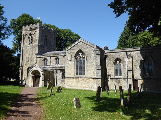
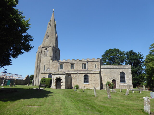
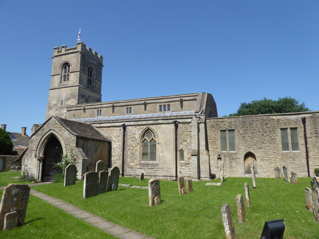
With a population of around 400 residents, Orton Northgate offers a close-knit community feel. The village is characterized by its traditional English architecture, including charming thatched cottages and historic buildings. The centerpiece of the village is the St. Mary's Church, a beautiful medieval structure that dates back to the 12th century.

Despite its small size, Orton Northgate benefits from its proximity to nearby amenities. The village is conveniently located near major road networks, including the A1(M) and A605, providing easy access to neighboring towns and cities. The city of Peterborough offers a wide range of shopping, dining, and entertainment options, while also serving as a major transportation hub with direct train links to London and other major cities.

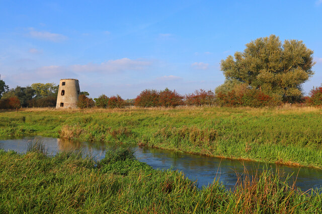
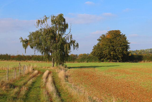
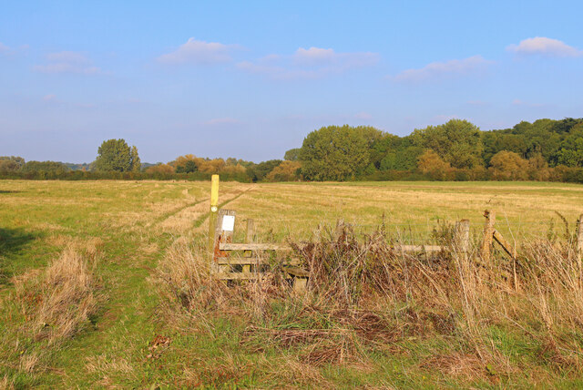
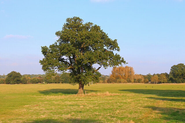
Surrounded by rolling farmland and countryside, Orton Northgate also appeals to nature enthusiasts. The village is an ideal starting point for exploring the nearby Nene Park, a vast green space that offers walking trails, lakes, and wildlife spotting opportunities.

In conclusion, Orton Northgate is a charming village with a strong sense of community and a rich historical heritage. Its idyllic location, combined with convenient access to nearby amenities, makes it an attractive place to live for those seeking a peaceful countryside lifestyle.

If you have any feedback on the listing, please let us know in the comments section below.

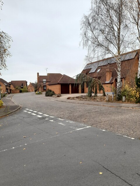
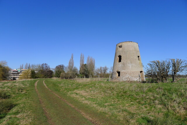
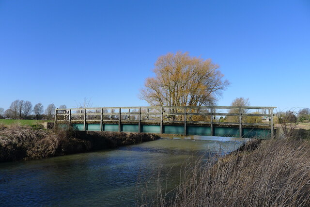
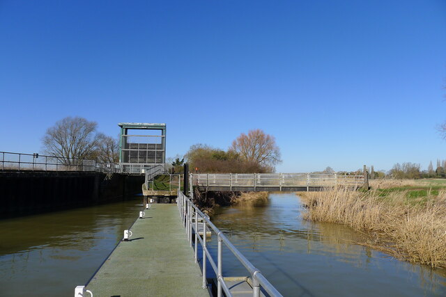
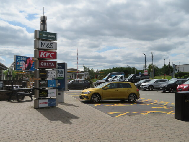
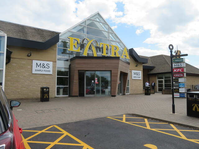
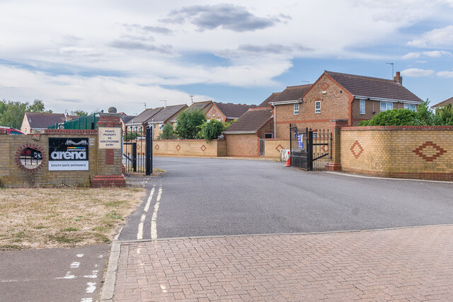
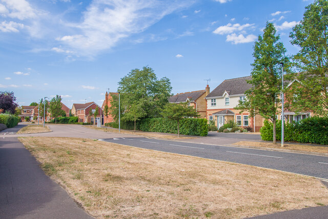
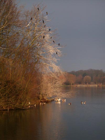
Orton Northgate Images

Images are sourced within 2km of 52.548473/-0.32155259 or Grid Reference TL1395. Thanks to Geograph Open Source API. All images are credited.

Vetchfield, road
Vetchfield, road
Castor Mills A mid 19th century tower windmill and, behind left, an early 19th century water mill undergoing restoration  <span class="nowrap"><a title="https://historicengland.org.uk/listing/the-list/list-entry/1162635" rel="nofollow ugc noopener" href="https://historicengland.org.uk/listing/the-list/list-entry/1162635">Link</a><img style="margin-left:2px;" alt="External link" title="External link - shift click to open in new window" src="https://s1.geograph.org.uk/img/external.png" width="10" height="10"/></span>
Castor Mills
A mid 19th century tower windmill and, behind left, an early 19th century water mill undergoing restoration LinkExternal link
The Hereward Way crossing Back Dike The dike is a short, separate course of the Nene supplying Castor Mill. The small area of land to the left of the bridge, essentially an island between two courses of the river, is Nene Park's 'East Holmes' (see description for <a href="https://www.geograph.org.uk/photo/7110621">TL1097 : Footpath along West Holmes</a>)
The Hereward Way crossing Back Dike
The dike is a short, separate course of the Nene supplying Castor Mill. The small area of land to the left of the bridge, essentially an island between two courses of the river, is Nene Park's 'East Holmes' (see description for TL1097 : Footpath along West Holmes)
Alwalton Lock A common lock type on the Nene: a steel guillotine lock gate on the downstream side, and 'conventional' double 'V door', wooden gates upstream.
Alwalton Lock
A common lock type on the Nene: a steel guillotine lock gate on the downstream side, and 'conventional' double 'V door', wooden gates upstream.
Alwalton, St Andrew
Alwalton, St Andrew
Chesterton, St Michael
Orton Waterville, St Mary
Former Windmill Windmill near Castor on the River Nene.
Former Windmill
Windmill near Castor on the River Nene.
Footpath near the River Nene Sharp turn in the path near Castor.
Footpath near the River Nene
Sharp turn in the path near Castor.
Nene Way Footpath near Castor.
Nene Way
Footpath near Castor.
Lynch Bridge Nene Valley Railway, near Peterborough.
Lynch Bridge
Nene Valley Railway, near Peterborough.
Ferry Meadows Prominent tree, in Ferry Meadows.
Ferry Meadows
Prominent tree, in Ferry Meadows.
Peterborough Services At the A1/A1(M)/A605/A1139 interchange. Looking west, from the entrance to the Extra concourse.
Peterborough Services
At the A1/A1(M)/A605/A1139 interchange. Looking west, from the entrance to the Extra concourse.
Peterborough Services At the A1/A1(M)/A605/A1139 interchange. Looking northwest, from the entrance to the Extra concourse.
Peterborough Services
At the A1/A1(M)/A605/A1139 interchange. Looking northwest, from the entrance to the Extra concourse.
Peterborough Services At the A1/A1(M)/A605/A1139 interchange. Looking south to the entrance to the Extra concourse.
Peterborough Services
At the A1/A1(M)/A605/A1139 interchange. Looking south to the entrance to the Extra concourse.
Peterborough Services At the A1/A1(M)/A605/A1139 interchange. Looking northeast, from the entrance to the Extra concourse.
Peterborough Services
At the A1/A1(M)/A605/A1139 interchange. Looking northeast, from the entrance to the Extra concourse.
South gate, East of England Showground Side entrance to the East of England Showground off Dunblane Drive.
South gate, East of England Showground
Side entrance to the East of England Showground off Dunblane Drive.
Dunblane Drive 1990s housing.
Dunblane Drive
1990s housing.
Show me another place!

Orton Northgate is located at Grid Ref: TL1395 (Lat: 52.548473, Lng: -0.32155259)

Unitary Authority: Peterborough

Police Authority: Cambridgeshire

What 3 Words

///pounds.stages.range. Near Castor, Cambridgeshire

Related Wikis

East of England Showground

The East of England Showground is a large showground area (667,731sqm) located on East of England Way near Peterborough, Cambridgeshire, England. The Showground...

Greatest Hits Radio South

Greatest Hits Radio South is a regional radio station serving the South of England, as part of Bauer’s Greatest Hits Radio network. == Coverage == The...

Alwalton

Alwalton is a village and civil parish in Cambridgeshire, England. Alwalton lies approximately 5 miles (8 km) west of Peterborough city centre. Alwalton...

Chesterton, Huntingdonshire

Chesterton is a small village and civil parish of exactly 56 households in Cambridgeshire, England. The village lies approximately 5 miles (8 km) west...

Ferry Meadows railway station

Ferry Meadows is a station on the Nene Valley Railway between Wansford and Orton Mere. The current station has one platform, and has no car park of its...

A605 road

The A605 road is a main road in the English counties of Northamptonshire and Cambridgeshire. == Route (west to east) == The A605 strikes north from junction...

Nene Park, Peterborough

Nene Park is a country park in the city of Peterborough, Cambridgeshire in the United Kingdom. Opened in 1978, it occupies a site approximately three and...
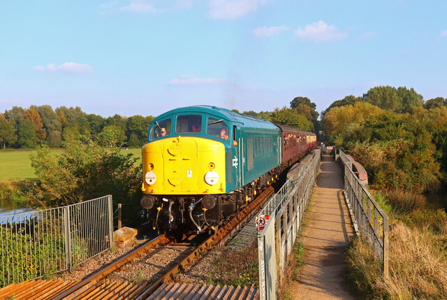
Nene Valley Railway

The Nene Valley Railway (NVR) is a preserved railway in Cambridgeshire, England, running between Peterborough Nene Valley and Yarwell Junction. The line...

Nearby Amenities

Located within 500m of 52.548473,-0.32155259
Barrier: height_restrictor
Maxheight: 2
Lat/Long: 52.5506213/-0.3234526
Holiday Inn Express Peterborough
Addr City: Peterborough
Addr Postcode: PE2 6HE
Addr Street: East Of England Way
Brand: Holiday Inn Express
Brand Wikidata: Q5880423
Fhrs Id: 433907
Internet Access: wlan
Operator: Holiday Inn Express
Tourism: hotel
Wheelchair: yes
Lat/Long: 52.5483448/-0.3233621
Restaurant
Harvester Alwalton
Addr City: Peterborough
Addr Country: GB
Addr Postcode: PE2 6HE
Addr Street: East Of England Way
Brand: Harvester
Brand Wikidata: Q5676915
Brand Wikipedia: en:Harvester (restaurant)
Contact Website: https://www.harvester.co.uk/restaurants/eastofengland/harvesteralwaltonpeterborough
Cuisine: american
Fhrs Id: 246931
Operator: Harvester
Lat/Long: 52.5490213/-0.3227564
Post Box
Post Box Design: type_k
Post Box Type: pillar
Ref: PE2 243
Royal Cypher: EIIR
Royal Cypher Wikidata: Q33102113
Lat/Long: 52.5519082/-0.321781
Barrier: bollard
Bicycle: designated
Foot: designated
Motor Vehicle: no
Lat/Long: 52.5514642/-0.3235457
Barrier: cycle_barrier
Lat/Long: 52.5513594/-0.3197657
Kindergarten
Whiz Kids Day Nursery
Addr City: Peterborough
Addr Housenumber: 60
Addr Postcode: PE2 6FL
Addr Street: Innovation Way
Fhrs Id: 783846
Lat/Long: 52.5505288/-0.3210338
Barrier: lift_gate
Lat/Long: 52.5507871/-0.3214601
Bus Stop
Post Office
Bus: yes
Naptan AtcoCode: 0500HALWA001
Naptan Bearing: E
Naptan CommonName: Post Office
Naptan Indicator: near
Naptan Landmark: Church Street
Naptan NaptanCode: cmbgdwmw
Naptan PlusbusZoneRef: PBRO
Naptan ShortCommonName: Post Office
Naptan Street: Oundle Road
Naptan Verified: no
Public Transport: platform
Source: naptan_import
Lat/Long: 52.5485369/-0.3285962
Orton Northgate
Is In: Peterborough
Place: suburb
Lat/Long: 52.5493289/-0.3196827
Lynch Wood
Is In: Peterborough
Place: suburb
Lat/Long: 52.5528665/-0.3206951
Post Box
Ref: PE7 220
Lat/Long: 52.5485595/-0.3287359
Crossing
Bicycle: yes
Crossing: unmarked
Crossing Island: yes
Crossing Markings: no
Kerb: flush
Tactile Paving: yes
Lat/Long: 52.5487244/-0.3254472
Barrier: cycle_barrier
Lat/Long: 52.5488669/-0.3255482
Barrier: cycle_barrier
Bicycle: yes
Foot: yes
Motor Vehicle: no
Lat/Long: 52.5496138/-0.3221075
Crossing
Crossing: uncontrolled
Lat/Long: 52.5497883/-0.3222248
Crossing
Crossing: uncontrolled
Lat/Long: 52.5498679/-0.322275
Mini Roundabout
Lat/Long: 52.5447327/-0.3216965
Clock dedication
Information: plaque
Tourism: information
Lat/Long: 52.5449099/-0.3205898
Clock
Disused: yes
Lat/Long: 52.5448662/-0.320703
Information: map
Map Size: site
Tourism: information
Lat/Long: 52.5448746/-0.3208721
Entrance: yes
Lat/Long: 52.5449446/-0.320607
Bench
Lat/Long: 52.5450413/-0.3205384
Entrance: yes
Lat/Long: 52.5450869/-0.3207934
Entrance: yes
Lat/Long: 52.5450909/-0.3206275
Waste Basket
Waste: dog_excrement
Lat/Long: 52.5494787/-0.3175965
Waste Basket
Lat/Long: 52.5487949/-0.320857
Addr Housenumber: 3
Addr Street: Loch Fyne Close
Survey Date: 2017-08-02
Lat/Long: 52.5489321/-0.3205967
Addr Housenumber: 1
Addr Street: Loch Fyne Close
Survey Date: 2017-08-02
Lat/Long: 52.5490508/-0.3203305
Addr Housenumber: 4
Addr Street: Loch Fyne Close
Survey Date: 2017-08-02
Lat/Long: 52.5492223/-0.3193174
Addr Housenumber: 6
Addr Street: Loch Fyne Close
Survey Date: 2017-08-02
Lat/Long: 52.549278/-0.319033
Addr Housenumber: 2
Addr Street: Arbroath Gardens
Survey Date: 2017-08-02
Lat/Long: 52.5495064/-0.3183455
Addr Housenumber: 4
Addr Street: Arbroath Gardens
Survey Date: 2017-08-02
Lat/Long: 52.5495594/-0.3180862
Addr Housename: Anderson's Shelter
Addr Housenumber: 2
Addr Street: Dundee Court
Survey Date: 2017-08-02
Lat/Long: 52.5496861/-0.3164713
Addr Housenumber: 4
Addr Street: Dundee Court
Survey Date: 2017-08-02
Lat/Long: 52.5497094/-0.3161268
Addr Housenumber: 7
Addr Street: Syke Close
Survey Date: 2017-08-02
Lat/Long: 52.5497687/-0.3148245
Addr Housenumber: 5
Addr Street: Syke Close
Survey Date: 2017-08-02
Lat/Long: 52.5498361/-0.3149528
Addr Housenumber: 3
Addr Street: Syke Close
Survey Date: 2017-08-02
Lat/Long: 52.5498338/-0.3151027
Addr Housenumber: 1
Addr Street: Syke Close
Survey Date: 2017-08-02
Lat/Long: 52.5498265/-0.3151829
Addr Housenumber: 19
Addr Street: Syke Close
Survey Date: 2017-08-02
Lat/Long: 52.5500118/-0.3152527
Addr Housenumber: 66
Addr Street: Syke Close
Survey Date: 2017-08-02
Lat/Long: 52.5503693/-0.3149465
Addr Housenumber: 68
Addr Street: Syke Close
Survey Date: 2017-08-02
Lat/Long: 52.550424/-0.3149447
Playground: seesaw
Lat/Long: 52.5502274/-0.3155787
Playground: structure
Lat/Long: 52.5502775/-0.3156138
Bench
Lat/Long: 52.5502172/-0.3155334
Waste Basket
Lat/Long: 52.5502408/-0.3156809
Waste Basket
Lat/Long: 52.5502364/-0.3155331
Capacity: 2
Playground: swing
Lat/Long: 52.550196/-0.3156433
Waste Basket
Waste: dog_excrement
Lat/Long: 52.550229/-0.315163
Bus Stop
Lynch Wood, Commerce Road
Bench: yes
Network: stagecoach
Operator: Stagecoach
Public Transport: platform
Shelter: yes
Lat/Long: 52.5521771/-0.3206413
Bus Stop
Lynch Wood, Commerce Road
Bench: yes
Network: stagecoach
Operator: Stagecoach
Public Transport: platform
Shelter: yes
Lat/Long: 52.5520267/-0.3208036
Post Box
Post Box Type: meter
Ref: PE2 227
Lat/Long: 52.5519217/-0.321738
Barrier: cycle_barrier
Lat/Long: 52.551103/-0.3208241
Barrier: bollard
Lat/Long: 52.5510868/-0.3208908
Bench
Lat/Long: 52.551134/-0.3220377
Addr Housenumber: 16
Addr Street: Innovation Way
Lat/Long: 52.5512123/-0.3221383
Bus Stop
Lynch Wood, Showground
Bus: yes
Naptan AtcoCode: 0590PLW176
Naptan NaptanCode: PETGDAJ
Network: stagecoach
Operator: Stagecoach
Public Transport: platform
Lat/Long: 52.5503009/-0.3228786
Communication Mobile Phone: yes
Man Made: mast
Tower Construction: freestanding
Tower Type: communication
Lat/Long: 52.545938/-0.3247806
Leisure: picnic_table
Lat/Long: 52.5527735/-0.323168
Leisure: picnic_table
Lat/Long: 52.5527987/-0.3232343
Leisure: picnic_table
Lat/Long: 52.5527794/-0.3232218
Leisure: picnic_table
Lat/Long: 52.5528089/-0.323211
Leisure: picnic_table
Lat/Long: 52.5527636/-0.3231994
Leisure: picnic_table
Lat/Long: 52.5527909/-0.3231896
Bench
Backrest: no
Lat/Long: 52.5525843/-0.3238282
Restaurant
Cast Iron Grill
Addr City: Peterborough
Addr Postcode: PE2 6GB
Level: 0
Wheelchair: yes
Lat/Long: 52.5498324/-0.3247133
Bus Stop
Lynch Wood, Showground
Bus: yes
Network: stagecoach
Operator: Stagecoach
Public Transport: platform
Lat/Long: 52.5502391/-0.3230114
Bicycle Parking
Bicycle Parking: wall_loops
Lat/Long: 52.5501849/-0.3242499
Street Lamp
Lat/Long: 52.5524997/-0.3191818
Addr Postcode: PE2 6HB
Building: yes
Lat/Long: 52.5479065/-0.3253498
Lynch Wood, Showground
Bus: yes
Network: stagecoach
Operator: Stagecoach
Public Transport: stop_position
Lat/Long: 52.5502552/-0.3229303
Lynch Wood, Showground
Bus: yes
Network: stagecoach
Operator: Stagecoach
Public Transport: stop_position
Lat/Long: 52.5502872/-0.3229475
Lynch Wood, Commerce Road
Bus: yes
Network: stagecoach
Operator: Stagecoach
Public Transport: stop_position
Lat/Long: 52.5520594/-0.3208287
Lynch Wood, Commerce Road
Bus: yes
Network: stagecoach
Operator: Stagecoach
Public Transport: stop_position
Lat/Long: 52.5521259/-0.3205939
Crossing
Crossing: unmarked
Crossing Island: yes
Crossing Markings: no
Tactile Paving: yes
Lat/Long: 52.5497237/-0.3154072
Generator Method: photovoltaic
Generator Output Electricity: yes
Generator Source: solar
Generator Type: solar_photovoltaic_panel
Location: roof
Power: generator
Lat/Long: 52.5492446/-0.319038
Barrier: bollard
Bicycle: yes
Lat/Long: 52.5505342/-0.3191081
Barrier: bollard
Bicycle: yes
Lat/Long: 52.5506966/-0.3192341
Barrier: cycle_barrier
Lat/Long: 52.5506183/-0.3191739
Bench
Lat/Long: 52.5508807/-0.3200387
Bench
Lat/Long: 52.5508451/-0.320011
Bench
Lat/Long: 52.5508348/-0.3200803
Bench
Lat/Long: 52.5508648/-0.3201003
Bus Stop
Bus: yes
Naptan AtcoCode: 0590PLW178
Naptan NaptanCode: PETGDAD
Public Transport: platform
Lat/Long: 52.5500825/-0.3210378
Crossing
Bicycle: yes
Crossing: traffic_signals
Crossing Island: no
Crossing Ref: toucan
Kerb: lowered
Tactile Paving: yes
Lat/Long: 52.5495085/-0.3230989
Anglo-saxons
Board Type: history
Information: board
Tourism: information
Lat/Long: 52.5514906/-0.3235941
Street Lamp
Lat/Long: 52.5482306/-0.3216673
Street Lamp
Lat/Long: 52.5483271/-0.3220838
Street Lamp
Lat/Long: 52.5485898/-0.3219096
Crossing
Bicycle: yes
Crossing: traffic_signals
Crossing Island: no
Crossing Ref: toucan
Kerb: lowered
Tactile Paving: yes
Lat/Long: 52.550124/-0.3228589
Crossing
Crossing: unmarked
Crossing Island: no
Crossing Markings: no
Tactile Paving: yes
Lat/Long: 52.5483884/-0.3281791
Crossing
Crossing: unmarked
Crossing Island: no
Crossing Markings: no
Tactile Paving: yes
Lat/Long: 52.5485508/-0.3257073
Leisure: swimming_pool
Location: indoor
Swimming Pool: spa
Lat/Long: 52.5499009/-0.3243309
The data included in this document is from www.openstreetmap.org. The data is made available under ODbL.

Have you been to Orton Northgate?

Leave your review of Orton Northgate below (or comments, questions and feedback).