Nesfield

Settlement in Yorkshire Harrogate

England

Nesfield

Round Hill tumulus, Middleton Moor To the north are a number of cupstones with which this tumulus may be associated... or maybe not. Beyond is the view across Wharfedale, with Addingham Moor in the distance to the left.
Round Hill tumulus, Middleton Moor Credit: David Spencer

Nesfield is a small village located in the county of Yorkshire, England. Situated in the district of Craven, it is nestled in the beautiful countryside of the Yorkshire Dales National Park. With a population of around 200 residents, Nesfield offers a tranquil and picturesque setting for those seeking a peaceful retreat.

The village is characterized by its charming stone cottages, many of which date back to the 18th and 19th centuries, lending it a quaint and traditional feel. The local community is close-knit, with a strong sense of camaraderie evident in the various village events and gatherings that take place throughout the year.

Despite its small size, Nesfield boasts a range of amenities to cater to the needs of its residents. These include a village hall, a primary school, and a local pub, providing a focal point for socializing and community activities. The surrounding landscape offers ample opportunities for outdoor enthusiasts, with numerous walking trails and cycling routes winding through the nearby hills and dales.

For those interested in history and culture, the village is conveniently located near several notable landmarks. The historic market town of Skipton, with its medieval castle, is just a short drive away, offering a glimpse into the region's rich heritage.

Overall, Nesfield is a quintessential Yorkshire village, offering a peaceful and idyllic lifestyle amidst stunning natural beauty. Its strong sense of community and its proximity to both nature and historical attractions make it a desirable place to live or visit.

If you have any feedback on the listing, please let us know in the comments section below.
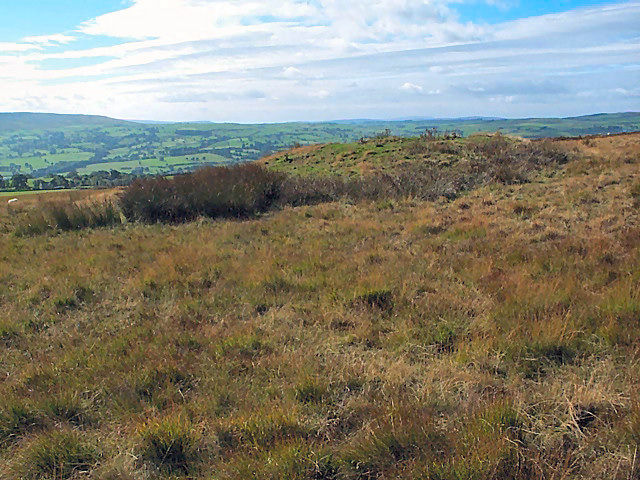
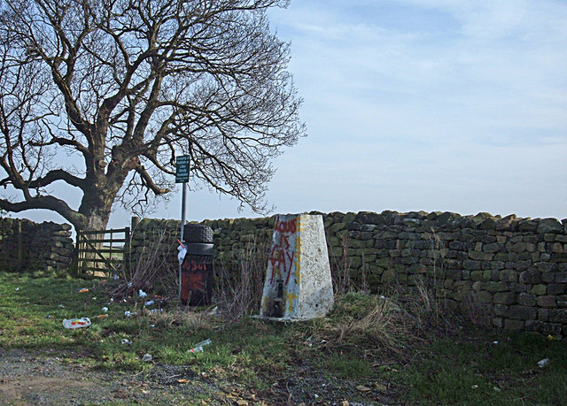
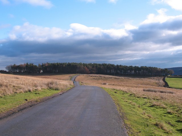
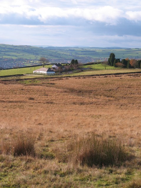
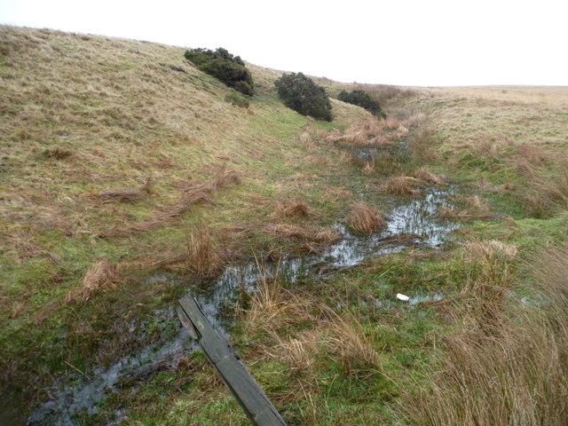
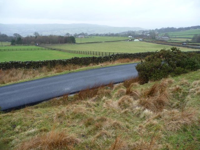
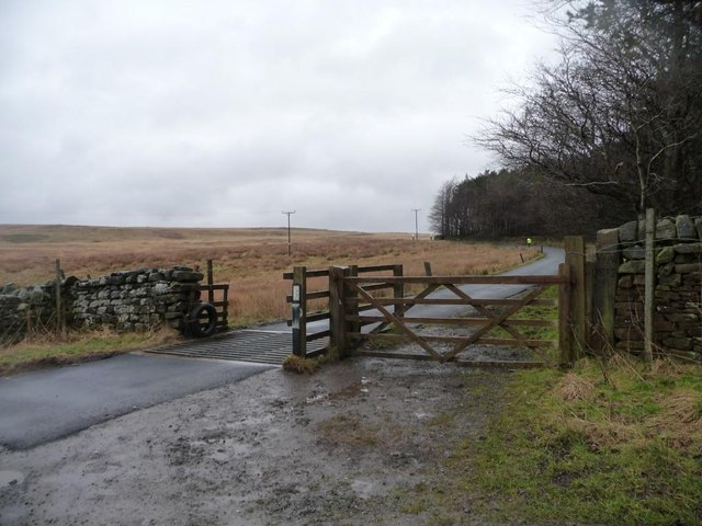
Nesfield Images

Images are sourced within 2km of 53.942313/-1.8606324 or Grid Reference SE0949. Thanks to Geograph Open Source API. All images are credited.

Round Hill tumulus, Middleton Moor To the north are a number of cupstones with which this tumulus may be associated... or maybe not. Beyond is the view across Wharfedale, with Addingham Moor in the distance to the left.
Round Hill tumulus, Middleton Moor
To the north are a number of cupstones with which this tumulus may be associated... or maybe not. Beyond is the view across Wharfedale, with Addingham Moor in the distance to the left.
Ling Park Trig Pillar Situated at 245 metres above sea level on the back road between Ilkley and Beamsley. This would have been a very pleasant location had it not been for the rubbish strewn around and the graffiti.
Ling Park Trig Pillar
Situated at 245 metres above sea level on the back road between Ilkley and Beamsley. This would have been a very pleasant location had it not been for the rubbish strewn around and the graffiti.
Road across Middleton Low Moor A section of the road between Langbar and Middleton where it runs across open moorland. Ling Park Plantation is seen in the distance.
Road across Middleton Low Moor
A section of the road between Langbar and Middleton where it runs across open moorland. Ling Park Plantation is seen in the distance.
Low Moor, Langbar Low Moor, close to where it gives way to improved land at about 250m above sea level in lower Wharfedale.
Low Moor, Langbar
Low Moor, close to where it gives way to improved land at about 250m above sea level in lower Wharfedale.
Footpath on Low Moor A rather muddy soggy excuse for a footpath follows the stunted wall on Low Moor, heading towards Chapel House
Footpath on Low Moor
A rather muddy soggy excuse for a footpath follows the stunted wall on Low Moor, heading towards Chapel House
Moor End Farm Farmhouse on the edge of Langbar Moor
Moor End Farm
Farmhouse on the edge of Langbar Moor
Track leading onto Langbar Moor Rough track leaving the lane beside Moor End Farm
Track leading onto Langbar Moor
Rough track leaving the lane beside Moor End Farm
Lane to Nesfield at Low Moor
Moor End Farm
Moor End Farm
Gully of a moorland stream coming from Delves Tarn On the east side of Hardings Lane, near Moor End Farm.
Gully of a moorland stream coming from Delves Tarn
On the east side of Hardings Lane, near Moor End Farm.
Moorland stream coming from Delves Tarn About to pass under Hardings Lane.
Moorland stream coming from Delves Tarn
About to pass under Hardings Lane.
Moor End Farm, Langbar Farming at the edge of moorland, about 240 metres above sea level.
Moor End Farm, Langbar
Farming at the edge of moorland, about 240 metres above sea level.
Fencing in a land of drystone walls Field boundaries on the west side of Hardings Lane at Moor End, Langbar.
Fencing in a land of drystone walls
Field boundaries on the west side of Hardings Lane at Moor End, Langbar.
Unmapped path on Middleton Low Moor On the east side of Hardings Lane. A continuation of Nesfield Lane.
Unmapped path on Middleton Low Moor
On the east side of Hardings Lane. A continuation of Nesfield Lane.
Cattle grid, Hardings Lane On a wet and windy winter's afternoon, a runner in bright yellow is making their way up Ellishaw Hill.
Cattle grid, Hardings Lane
On a wet and windy winter's afternoon, a runner in bright yellow is making their way up Ellishaw Hill.
Trig point between Ellishaw Hill and Ling Park At 245 metres above sea level.
Trig point between Ellishaw Hill and Ling Park
At 245 metres above sea level.
Farmland north-west of Ling Park Looking towards Ling Park from the field gate by the trig point off Hardings Lane.
Farmland north-west of Ling Park
Looking towards Ling Park from the field gate by the trig point off Hardings Lane.
Hardings Lane crossing Middleton Low Moor The nearby cattle grid is also on Hardings Lane.
Hardings Lane crossing Middleton Low Moor
The nearby cattle grid is also on Hardings Lane.
Show me another place!

Nesfield is located at Grid Ref: SE0949 (Lat: 53.942313, Lng: -1.8606324)

Division: West Riding

Administrative County: North Yorkshire

District: Harrogate

Police Authority: North Yorkshire

What 3 Words

///strutted.purses.swing. Near Addingham, West Yorkshire

Related Wikis

Nesfield

Nesfield is a small village, 2 miles (3.2 km) north-west of Ilkley on the north bank of the River Wharfe, in the civil parish of Nesfield with Langbar...

St Peter's Church, Addingham

St Peter's Church is a Church of England parish church in Addingham, West Yorkshire. It is a Grade I listed building, with the main structure dating to...

Ilkley Golf Club

Ilkley Golf Club is a golf club in North Yorkshire, England, just outside the town of Ilkley in West Yorkshire. It is located about a mile to the northwest...

Addingham railway station

Addingham railway station was on the Midland Railway route from Skipton to Ilkley. It served the village of Addingham in West Yorkshire, England. ��2...

Nearby Amenities

Located within 500m of 53.942313,-1.8606324
Turning Circle
Source: Bing
Lat/Long: 53.9386793/-1.8631925
Castleberg Hillfort
Archaeological Site: fortification
Description: Reputed Iron Age fort, but never properly excavated.
Historic: archaeological_site
Historic Civilization: prehistoric
Historic Period: iron-age
Source: OS 1:25k;OS sheet 169,publ 1853
Lat/Long: 53.9412325/-1.8606354
Barrier: stile
Lat/Long: 53.9402992/-1.8574622
Post Box
Collection Times: Mo-Fr 17:15; Sa 11:00
Operator: Royal Mail
Post Box Type: wall
Ref: LS29 846
Royal Cypher: VR
Royal Cypher Wikidata: Q33102356
Source: survey
Survey Date: 2017-06-12
Lat/Long: 53.9401291/-1.8626699
Post Box
Operator: Royal Mail
Post Box Type: wall
Ref: LS29 808
Lat/Long: 53.9411813/-1.8585482
Low Mill
Archaeological Site: industrial
Historic: archaeological_site
Output: cotton
Source: OS sheet 169,publ 1853
Lat/Long: 53.9397956/-1.8623955
Addr City: Addingham
Addr Housename: Mill Lodge
Addr Housenumber: 1-6
Source: survey
Lat/Long: 53.9392673/-1.8627831
Addr City: Addingham
Addr Housenumber: 3
Addr Street: Mill Fold
Source: survey
Lat/Long: 53.9387053/-1.8635904
Addr City: Addingham
Addr Housenumber: 4
Addr Street: Mill Fold
Source: survey
Lat/Long: 53.9386563/-1.8635958
Ford: yes
Lat/Long: 53.942697/-1.8552578
Public Bookcase
Booth: K6
Disused Amenity: telephone
Man Made: telephone_box
Public Bookcase Type: phone_box
Lat/Long: 53.9423654/-1.8604981
The data included in this document is from www.openstreetmap.org. The data is made available under ODbL.

Have you been to Nesfield?

Leave your review of Nesfield below (or comments, questions and feedback).