Mull of Galloway

Settlement in Wigtownshire

Scotland

Mull of Galloway

Gateway to Mull of Galloway Lighthouse Viewed from the car park above Gallie Craig Coffee House.
Gateway to Mull of Galloway Lighthouse Credit: Billy McCrorie

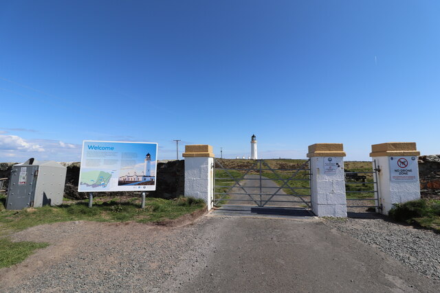
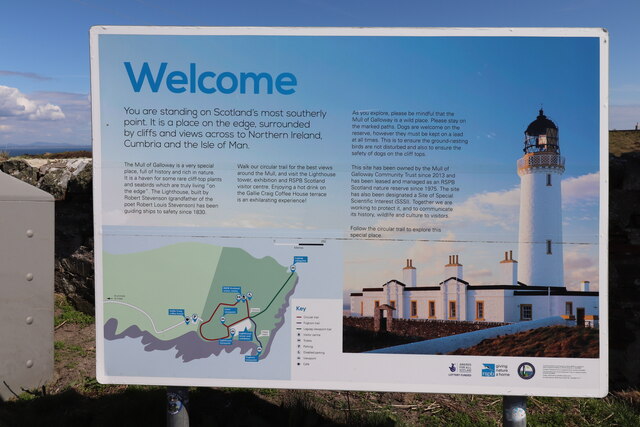
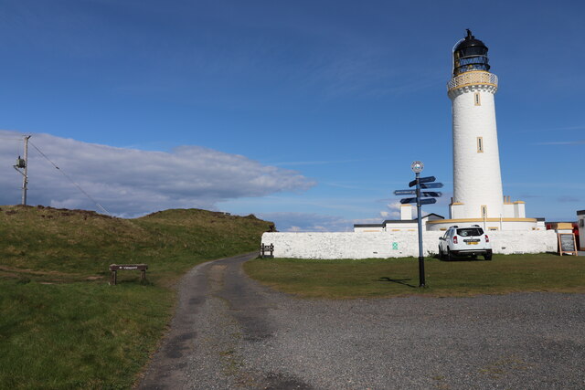
Mull of Galloway is a picturesque headland located in Wigtownshire, Dumfries and Galloway, Scotland. Situated at the southern tip of the Rhins of Galloway peninsula, it is the most southerly point of Scotland. The Mull of Galloway lighthouse, perched atop the cliffs, is a prominent feature and acts as both a navigational aid for ships and a popular tourist attraction.

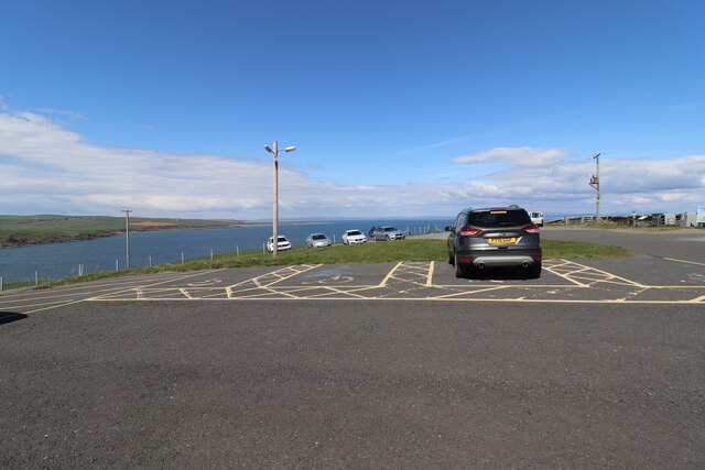
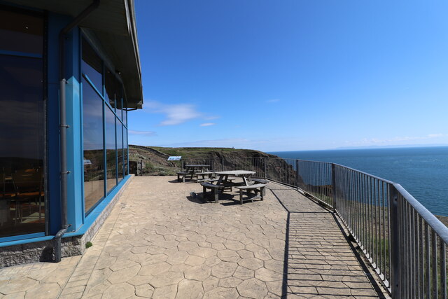
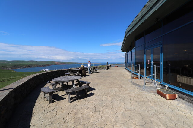
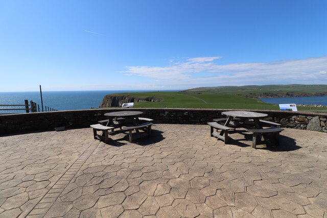
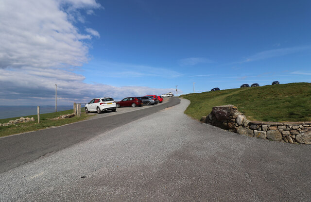
The headland offers breathtaking panoramic views of the surrounding coastline, including views across the Irish Sea to the Isle of Man, Cumbria, and even the Isle of Skye on clear days. The rugged cliffs, dotted with heather and wildflowers, create a stunning backdrop for visitors. The area is also a haven for birdwatchers, with various species of seabirds, including puffins, gannets, and kittiwakes, making their home here.

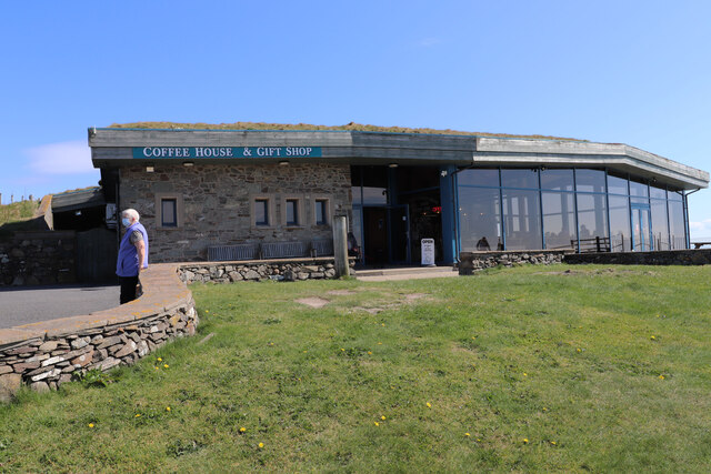
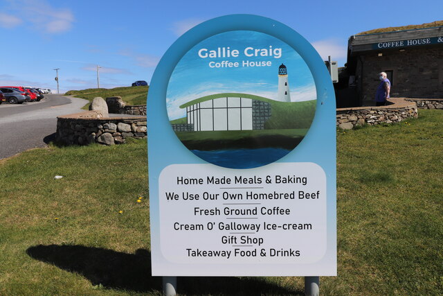
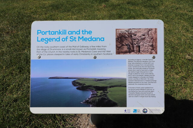
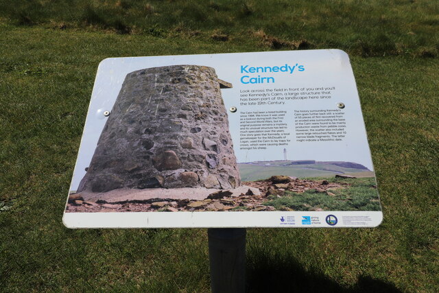
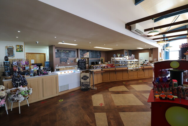
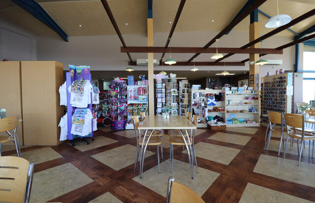
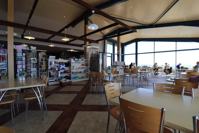
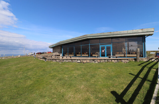
In addition to the lighthouse, visitors can explore the Mull of Galloway Experience, a visitor center that provides information on the local wildlife, history, and geology of the area. The center also houses a café and a gift shop, offering a range of local products and souvenirs.

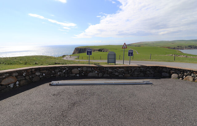
For those seeking outdoor activities, there are several walking trails along the coastline, allowing visitors to fully immerse themselves in the natural beauty of the area. The Mull of Galloway Trail, a long-distance footpath, offers a challenging and rewarding hike along the coast, showcasing the diverse landscapes and wildlife.

Mull of Galloway is a truly captivating destination, offering a unique blend of natural beauty, historical significance, and outdoor adventure.

If you have any feedback on the listing, please let us know in the comments section below.

Mull of Galloway Images

Images are sourced within 2km of 54.638811/-4.8791415 or Grid Reference NX1430. Thanks to Geograph Open Source API. All images are credited.

Gateway to Mull of Galloway Lighthouse Viewed from the car park above Gallie Craig Coffee House.
Gateway to Mull of Galloway Lighthouse
Viewed from the car park above Gallie Craig Coffee House.
Welcome to Mull of Galloway Next to the car park above Gallie Craig Coffee House.
Welcome to Mull of Galloway
Next to the car park above Gallie Craig Coffee House.
Disabled Parking at Mull of Galloway Located just above Gallie Craig Coffee House, with a fine Sea View.
Disabled Parking at Mull of Galloway
Located just above Gallie Craig Coffee House, with a fine Sea View.
Gallie Craig Coffee House At the Mull of Galloway.
Gallie Craig Coffee House
At the Mull of Galloway.
Name Sign at Gallie Craig Coffee House At the Mull of Galloway.
Name Sign at Gallie Craig Coffee House
At the Mull of Galloway.
Seating Area at Gallie Craig Coffee House With a lovel Sea view at the  Mull of Galloway.
Seating Area at Gallie Craig Coffee House
With a lovel Sea view at the Mull of Galloway.
Outdoor Area at Gallie Craig Coffee House At the Mull of Galloway with lovely views.
Outdoor Area at Gallie Craig Coffee House
At the Mull of Galloway with lovely views.
Patio Area at Gallie Craig Coffee House With fine views at the Mull of Galloway.
Patio Area at Gallie Craig Coffee House
With fine views at the Mull of Galloway.
Portankill and the Legend of St. Medana At the Mull of Galloway, panel at Gallie Craig Coffee House.
Portankill and the Legend of St. Medana
At the Mull of Galloway, panel at Gallie Craig Coffee House.
Kennedy's Cairn At the Mull of Galloway, panel at the front of Gallie Craig Coffee House.
Kennedy's Cairn
At the Mull of Galloway, panel at the front of Gallie Craig Coffee House.
Gallie Craig Coffee House Interior (1) Lovely meals and lovely views at the Mull of Galloway.
Gallie Craig Coffee House Interior (1)
Lovely meals and lovely views at the Mull of Galloway.
Gallie Craig Coffee House Interior (2) With Gift Shop. Lovely meals and lovely views at the Mull of Galloway.
Gallie Craig Coffee House Interior (2)
With Gift Shop. Lovely meals and lovely views at the Mull of Galloway.
Gallie Craig Coffee House Interior (3) With gift shop. Lovely meals and lovely views at the Mull of Galloway.
Gallie Craig Coffee House Interior (3)
With gift shop. Lovely meals and lovely views at the Mull of Galloway.
Reserved Parking at Gallie Craig Coffee House For disabled drivers at the Mull of Galloway.
Reserved Parking at Gallie Craig Coffee House
For disabled drivers at the Mull of Galloway.
Road to Car Park at Mull of Galloway Viewed from the entrance to Gallie Craig Coffee House.
Road to Car Park at Mull of Galloway
Viewed from the entrance to Gallie Craig Coffee House.
Name Stone at Gallie Craig Coffee House At the Mull of Galloway.
Name Stone at Gallie Craig Coffee House
At the Mull of Galloway.
Gallie Craig Coffee House And Gift Shop at the Mull of Galloway.
Gallie Craig Coffee House
And Gift Shop at the Mull of Galloway.
Lighthouse, Mull of Galloway Road on the left leads to the RSPB Reserve.
Lighthouse, Mull of Galloway
Road on the left leads to the RSPB Reserve.
Show me another place!

Mull of Galloway is located at Grid Ref: NX1430 (Lat: 54.638811, Lng: -4.8791415)

Unitary Authority: Dumfries and Galloway

Police Authority: Dumfries and Galloway

What 3 Words

///yesterday.octagonal.squish. Near Drummore, Dumfries & Galloway

Related Wikis

Mull of Galloway

The Mull of Galloway (Scottish Gaelic: Maol nan Gall, pronounced [mɯːlˠ̪ nəŋ ˈkaulˠ̪]; grid reference NX158303) is the southernmost point of Scotland....

Cairngaan

Cairngaan, Wigtownshire, is the southmost settlement in Scotland. The hamlet of Cairngaan lies just north of the Mull of Galloway (which contains Scotland...

Drummore

Drummore (drum-ORE; (from Gaelic An Druim Mòr meaning "the great ridge") is the southernmost village in Scotland, located at the southern end of the Rhins...

Kirkmaiden (village)

Kirkmaiden (sometimes Maidenkirk; Scottish Gaelic: Cill M'Eudan) is a small settlement in Galloway, Scotland, located approximately 17 miles (27 km) south...

Nearby Amenities

Located within 500m of 54.638811,-4.8791415
Source: PGS
Lat/Long: 54.6382485/-4.871986
Source: PGS
Lat/Long: 54.6385714/-4.8732735
Source: PGS
Lat/Long: 54.6388073/-4.8746253
Source: PGS
Lat/Long: 54.6392235/-4.8765201
Source: PGS
Lat/Long: 54.638954/-4.8770035
Source: PGS
Lat/Long: 54.6395272/-4.8776788
Source: PGS
Lat/Long: 54.6400965/-4.8781021
Source: PGS
Lat/Long: 54.6405211/-4.8781419
Source: PGS
Lat/Long: 54.6406532/-4.8780448
Source: PGS
Lat/Long: 54.6407942/-4.877844
Source: PGS
Lat/Long: 54.6410798/-4.8774577
Source: PGS
Lat/Long: 54.6413033/-4.8772646
Source: PGS
Lat/Long: 54.6414523/-4.8771788
Source: PGS
Lat/Long: 54.6414999/-4.8768491
Source: PGS
Lat/Long: 54.6419366/-4.8767925
Source: PGS
Lat/Long: 54.6424215/-4.8774362
Source: PGS
Lat/Long: 54.6426594/-4.8775554
Source: PGS
Lat/Long: 54.639201/-4.886692
Source: PGS
Lat/Long: 54.639333/-4.886478
Source: PGS
Lat/Long: 54.639464/-4.886262
Source: PGS
Lat/Long: 54.639471/-4.885821
Source: PGS
Lat/Long: 54.639478/-4.88538
Source: PGS
Lat/Long: 54.6398007/-4.8841311
Source: PGS
Lat/Long: 54.6396269/-4.8832942
Source: PGS
Lat/Long: 54.6394282/-4.8826505
Source: PGS
Lat/Long: 54.6388942/-4.8823286
Source: PGS
Lat/Long: 54.6385962/-4.8824359
Source: PGS
Lat/Long: 54.6383602/-4.8834444
Source: PGS
Lat/Long: 54.6380746/-4.8837663
Source: PGS
Lat/Long: 54.6379008/-4.8842383
Source: PGS
Lat/Long: 54.6377517/-4.8847319
Source: PGS
Lat/Long: 54.6373295/-4.8847748
Source: PGS
Lat/Long: 54.6369818/-4.8840023
Source: PGS
Lat/Long: 54.6370315/-4.883423
Source: PGS
Lat/Long: 54.6365347/-4.8830367
Source: PGS
Lat/Long: 54.636205/-4.881695
Source: PGS
Lat/Long: 54.636081/-4.881469
Source: PGS
Lat/Long: 54.635956/-4.881242
Source: PGS
Lat/Long: 54.635842/-4.880353
Passing Place
Lat/Long: 54.6379001/-4.8765463
Passing Place
Lat/Long: 54.6375307/-4.8731654
West Tarbet
Natural: bay
Lat/Long: 54.6380433/-4.8861324
East Tarbet
Natural: bay
Lat/Long: 54.6401427/-4.8750764
Leisure: slipway
Lat/Long: 54.6395315/-4.8776075
Barrier: cattle_grid
Lat/Long: 54.6399665/-4.8809879
Bench
Source: survey;gps
Lat/Long: 54.6411311/-4.8782234
Cairnie Hill
Natural: peak
Lat/Long: 54.635803/-4.8738021
Power: pole
Lat/Long: 54.6420568/-4.8829549
Power: pole
Lat/Long: 54.6412035/-4.8822487
Power: pole
Lat/Long: 54.6404894/-4.8816666
Power: pole
Lat/Long: 54.6397169/-4.8810089
Power: pole
Lat/Long: 54.6391488/-4.8799729
Power: pole
Lat/Long: 54.6384863/-4.8787176
Power: pole
Lat/Long: 54.6382729/-4.8773847
Power: pole
Lat/Long: 54.6380495/-4.875947
Power: pole
Lat/Long: 54.6378631/-4.8746626
Power: pole
Lat/Long: 54.6376576/-4.8732889
Power: pole
Lat/Long: 54.6374532/-4.8719987
Passing Place
Lat/Long: 54.6378159/-4.8746643
The data included in this document is from www.openstreetmap.org. The data is made available under ODbL.

Have you been to Mull of Galloway?

Leave your review of Mull of Galloway below (or comments, questions and feedback).