Gallie Heughs

Cliff, Slope in Wigtownshire

Scotland

Gallie Heughs

Mull of Galloway Lighthouse The Mull of Galloway is the southernmost point on the mainland of Scotland

Mull of Galloway Lighthouse

Light Established: 1830
Engineer: Robert Stevenson
Position: Latitude 54° 38.1’N Longitude 04° 51.4’W
Character: Flashing White every 20 seconds
Elevation: 99 metres
Nominal Range: 28 miles
Structure: White round tower 26 metres high. There are 114 steps to the top of the tower.
Mull of Galloway Lighthouse Credit: Beth Loft

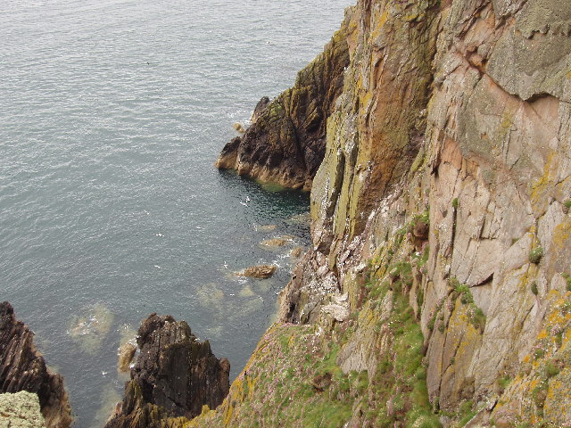
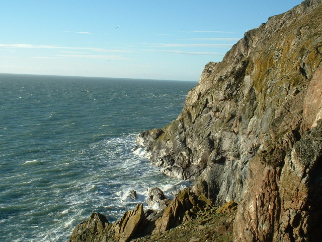
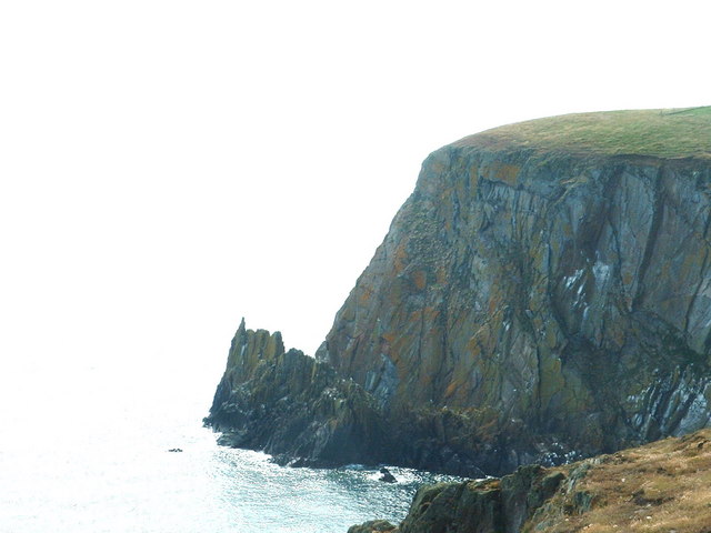
Gallie Heughs is a spectacular cliff located in Wigtownshire, a historic county in southwest Scotland. This natural wonder is situated on the picturesque coastline of the Irish Sea, near the charming town of Wigtown. The cliff is renowned for its breathtaking views and geological significance.

Rising to an impressive height of approximately 90 meters (300 feet), Gallie Heughs offers a dramatic vista of the surrounding landscape. The sheer rock face is composed of layers of sedimentary rock, showcasing the area's rich geological history. The cliff is particularly famous for its striking reddish-brown sandstone, which adds to its visual appeal.

Gallie Heughs is not only a visual spectacle but also home to a diverse range of flora and fauna. The cliff supports a variety of plant species, including hardy grasses, mosses, and wildflowers, which cling to the rocky surface. Sea birds, such as gulls and fulmars, can often be seen nesting on the ledges, making it a popular spot for birdwatching enthusiasts.

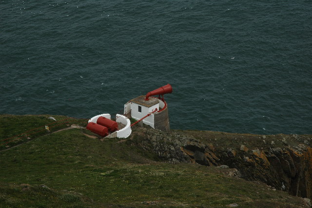
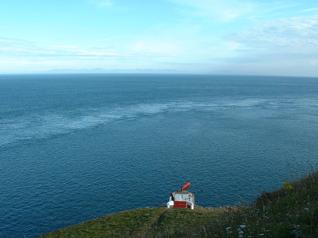
Access to Gallie Heughs is relatively easy, with a designated walking trail leading visitors to the cliff's edge. However, caution is advised as the area is steep and can be slippery, especially during wet weather. Safety barriers have been installed to ensure the well-being of visitors.

Gallie Heughs is a must-visit destination for nature lovers, geology enthusiasts, and anyone seeking awe-inspiring views of Scotland's rugged coastline. Its natural beauty and rich geological heritage make it a truly remarkable site in Wigtownshire.

If you have any feedback on the listing, please let us know in the comments section below.

Gallie Heughs Images

Images are sourced within 2km of 54.633875/-4.8685484 or Grid Reference NX1430. Thanks to Geograph Open Source API. All images are credited.

Mull of Galloway Lighthouse The Mull of Galloway is the southernmost point on the mainland of Scotland

Mull of Galloway Lighthouse

Light Established: 1830
Engineer: Robert Stevenson
Position: Latitude 54° 38.1’N Longitude 04° 51.4’W
Character: Flashing White every 20 seconds
Elevation: 99 metres
Nominal Range: 28 miles
Structure: White round tower 26 metres high. There are 114 steps to the top of the tower.
Mull of Galloway Lighthouse
The Mull of Galloway is the southernmost point on the mainland of Scotland Mull of Galloway Lighthouse Light Established: 1830 Engineer: Robert Stevenson Position: Latitude 54° 38.1’N Longitude 04° 51.4’W Character: Flashing White every 20 seconds Elevation: 99 metres Nominal Range: 28 miles Structure: White round tower 26 metres high. There are 114 steps to the top of the tower.
Southernmost point of Scotland Cliffs at the Mull of Galloway. This is as far as you can go, in a southerly direction in Scotland. Due East is Hartlepool!

On a better day, you can see the Isle of Man and Ireland from here.
Southernmost point of Scotland
Cliffs at the Mull of Galloway. This is as far as you can go, in a southerly direction in Scotland. Due East is Hartlepool! On a better day, you can see the Isle of Man and Ireland from here.
Cliffs by Gallie Craig and Carrick-Kee, Mull of Galloway These cliffs are at the southernmost point of Scotland. Many seabirds nest on the cliffs.
Cliffs by Gallie Craig and Carrick-Kee, Mull of Galloway
These cliffs are at the southernmost point of Scotland. Many seabirds nest on the cliffs.
Fog Horn, Mull of Galloway This is the now disused fog horn on the Mull of Galloway. Picture taken from the lighthouse.
Fog Horn, Mull of Galloway
This is the now disused fog horn on the Mull of Galloway. Picture taken from the lighthouse.
Mull of Galloway Lighthouse The Mull of Galloway is at the end of this peninsula in Scotland.  However, Carrick-kee, less than a mile to the west <a href="https://www.geograph.org.uk/photo/14826">NX1430 : Cliffs by Gallie Craig and Carrick-Kee, Mull of Galloway</a>, is actually the most southerly point in Scotland.
Mull of Galloway Lighthouse
The Mull of Galloway is at the end of this peninsula in Scotland. However, Carrick-kee, less than a mile to the west NX1430 : Cliffs by Gallie Craig and Carrick-Kee, Mull of Galloway, is actually the most southerly point in Scotland.
Wall This picture was taken looking SE from NX141313. The dry stone wall typical of this area is clearly shown. In the distance can be seen the Mull of Galloway Lighthouse.
Wall
This picture was taken looking SE from NX141313. The dry stone wall typical of this area is clearly shown. In the distance can be seen the Mull of Galloway Lighthouse.
Lythe Mead rocks, Mull of Galloway, Scotland's most South Westerly point. The stunning scenery and sea views at the Mull of Galloway. This is also an RSPB reserve where thousands of seabirds nest and breed each year.
Lythe Mead rocks, Mull of Galloway, Scotland's most South Westerly point.
The stunning scenery and sea views at the Mull of Galloway. This is also an RSPB reserve where thousands of seabirds nest and breed each year.
Foghorn, Mull of Galloway
Mull of Galloway Visitors' Centre Taken from the viewing platform at the top of the lighthouse.
Mull of Galloway Visitors' Centre
Taken from the viewing platform at the top of the lighthouse.
Mull of Galloway car park Taken looking westwards, from the viewing platform at the top of the lighthouse. The car park serves visitors to the light and to the nature reserve. The narrow neck of the Mull is visible in the middle distance - it is almost an island.
Mull of Galloway car park
Taken looking westwards, from the viewing platform at the top of the lighthouse. The car park serves visitors to the light and to the nature reserve. The narrow neck of the Mull is visible in the middle distance - it is almost an island.
Snail sanctuary? This is the northern wall of the lighthouse compound, and it's covered with snails, as was the eastern wall. Clearly they like the shade, but what else attracts them?  The colour?  The taste? The sense of history?  Or just being in a Nature Reserve?
Snail sanctuary?
This is the northern wall of the lighthouse compound, and it's covered with snails, as was the eastern wall. Clearly they like the shade, but what else attracts them? The colour? The taste? The sense of history? Or just being in a Nature Reserve?
Gallie Craig Cafe This is an interesting building, built into the rock a few metres from the cliff edge, with an earth, grass covered roof. Its large picture windows, looking south west, give fantastic exposure to the cliff scenery. And the coffee's good too.
Gallie Craig Cafe
This is an interesting building, built into the rock a few metres from the cliff edge, with an earth, grass covered roof. Its large picture windows, looking south west, give fantastic exposure to the cliff scenery. And the coffee's good too.
Mull of Galloway Lighthouse Taken from the viewing gallery at Gallie Craig Cafe.
Mull of Galloway Lighthouse
Taken from the viewing gallery at Gallie Craig Cafe.
Gallie Craig Cafe The gallery railings are right on the edge of the cliff.
Gallie Craig Cafe
The gallery railings are right on the edge of the cliff.
Gallie Craig rocks
Gallie Craig rocks
Cottage and Quay On the eastern, Luce Bay, side of the Mull of Galloway.  The cottage appears intact from this angle, but the other side of the roof is missing.
Cottage and Quay
On the eastern, Luce Bay, side of the Mull of Galloway. The cottage appears intact from this angle, but the other side of the roof is missing.
East Tarbet This is the 'neck' of the Mull of Galloway. A tarbet is a place where a boat could be dragged from one side of a headland or island to the other [which is probably not done much these days]. This side is on Luce Bay, the point on the other side of the headland is on the Irish Sea and is called, somewhat predictably, West Tarbet.
East Tarbet
This is the 'neck' of the Mull of Galloway. A tarbet is a place where a boat could be dragged from one side of a headland or island to the other [which is probably not done much these days]. This side is on Luce Bay, the point on the other side of the headland is on the Irish Sea and is called, somewhat predictably, West Tarbet.
East Tarbet Quay, Mull of Galloway A swimmer was rescued and treated for hypothermia after trying to swim out to his boat.  The currents hereabouts are notoriously treacherous.
East Tarbet Quay, Mull of Galloway
A swimmer was rescued and treated for hypothermia after trying to swim out to his boat. The currents hereabouts are notoriously treacherous.
Show me another place!

Gallie Heughs is located at Grid Ref: NX1430 (Lat: 54.633875, Lng: -4.8685484)

Unitary Authority: Dumfries and Galloway

Police Authority: Dumfries and Galloway

What 3 Words

///broads.daydream.spindles. Near Drummore, Dumfries & Galloway

Related Wikis

Mull of Galloway

The Mull of Galloway (Scottish Gaelic: Maol nan Gall, pronounced [mɯːlˠ̪ nəŋ ˈkaulˠ̪]; grid reference NX158303) is the southernmost point of Scotland....

Cairngaan

Cairngaan, Wigtownshire, is the southmost settlement in Scotland. The hamlet of Cairngaan lies just north of the Mull of Galloway (which contains Scotland...

Pasages (steam trawler)

ST Pasages (FD 119) was originally a Canadian "Castle" – TR series minesweeping trawler built by the Dominion Shipbuilding Company, Toronto, in 1917 for...

Drummore

Drummore (drum-ORE; (from Gaelic An Druim Mòr meaning "the great ridge") is the southernmost village in Scotland, located at the southern end of the Rhins...

Nearby Amenities

Located within 500m of 54.633875,-4.8685484
Source: PGS
Lat/Long: 54.633641/-4.867952
Source: PGS
Lat/Long: 54.633989/-4.867683
Source: PGS
Lat/Long: 54.63412/-4.867468
Source: PGS
Lat/Long: 54.634127/-4.867026
Source: PGS
Lat/Long: 54.63414/-4.866144
Source: PGS
Lat/Long: 54.6343862/-4.8657633
Source: PGS
Lat/Long: 54.6344359/-4.8652698
Source: PGS
Lat/Long: 54.6345104/-4.8642398
Source: PGS
Lat/Long: 54.6342372/-4.8643256
Source: PGS
Lat/Long: 54.6339267/-4.8640467
Source: PGS
Lat/Long: 54.6339639/-4.8637463
Source: PGS
Lat/Long: 54.6340012/-4.8631669
Source: PGS
Lat/Long: 54.6339391/-4.8628236
Source: PGS
Lat/Long: 54.6340757/-4.8621799
Source: PGS
Lat/Long: 54.6340633/-4.8618151
Source: PGS
Lat/Long: 54.6335913/-4.8612143
Source: PGS
Lat/Long: 54.6378014/-4.8656775
Source: PGS
Lat/Long: 54.6378138/-4.8666216
Source: PGS
Lat/Long: 54.6378883/-4.8684026
Source: PGS
Lat/Long: 54.6381615/-4.8687459
Source: PGS
Lat/Long: 54.6381367/-4.8694111
Source: PGS
Lat/Long: 54.6381119/-4.8706771
Source: PGS
Lat/Long: 54.633516/-4.875982
Source: PGS
Lat/Long: 54.633354/-4.875603
Source: PGS
Lat/Long: 54.633229/-4.875375
Source: PGS
Lat/Long: 54.63325/-4.874051
Source: PGS
Lat/Long: 54.633526/-4.872739
Source: PGS
Lat/Long: 54.633533/-4.872298
Source: PGS
Lat/Long: 54.6337404/-4.870999
Source: PGS
Lat/Long: 54.6340757/-4.8698832
Source: PGS
Lat/Long: 54.633443/-4.869866
Source: PGS
Lat/Long: 54.6335168/-4.8693038
Source: PGS
Lat/Long: 54.6333181/-4.8689819
Source: PGS
Lat/Long: 54.6334796/-4.8682738
Cairnie Hill
Natural: peak
Lat/Long: 54.635803/-4.8738021
Power: pole
Lat/Long: 54.6374532/-4.8719987
Power: pole
Lat/Long: 54.6372511/-4.8706406
Power: pole
Lat/Long: 54.6370557/-4.8693019
Power: pole
Lat/Long: 54.6369019/-4.8682969
Power: pole
Lat/Long: 54.6367761/-4.8674781
Power: pole
Lat/Long: 54.6366448/-4.8665856
Power: pole
Lat/Long: 54.6364269/-4.8652042
Power: pole
Lat/Long: 54.6362259/-4.8638752
Power: pole
Lat/Long: 54.6360238/-4.8625598
Kennedy's Cairn
Access: yes
Historic: monument
Lat/Long: 54.6355137/-4.873713
Passing Place
Lat/Long: 54.636808/-4.871601
Passing Place
Lat/Long: 54.6357902/-4.8682968
Passing Place
Lat/Long: 54.6356721/-4.8643591
Passing Place
Lat/Long: 54.6348978/-4.8622549
The data included in this document is from www.openstreetmap.org. The data is made available under ODbL.

Have you been to Gallie Heughs?

Leave your review of Gallie Heughs below (or comments, questions and feedback).