Makerstoun

Settlement in Roxburghshire

Scotland

Makerstoun

A phone box at Makerstoun It appears to be used as the village library.
A phone box at Makerstoun Credit: Walter Baxter

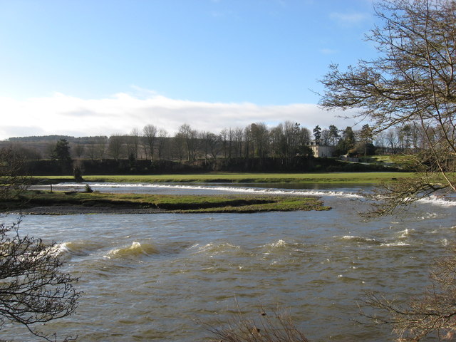
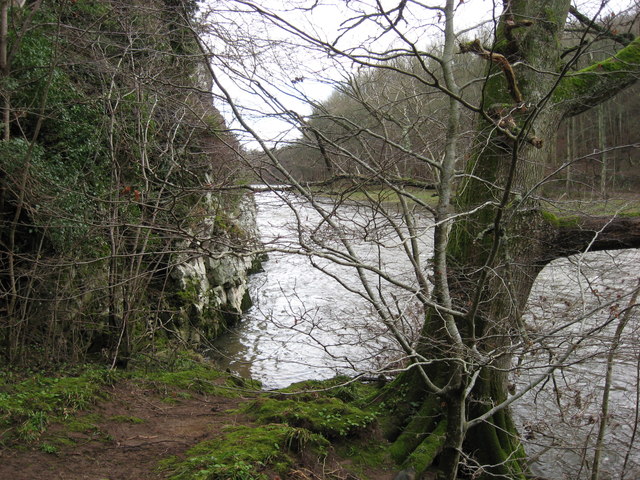
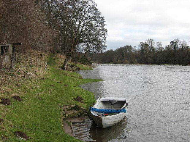
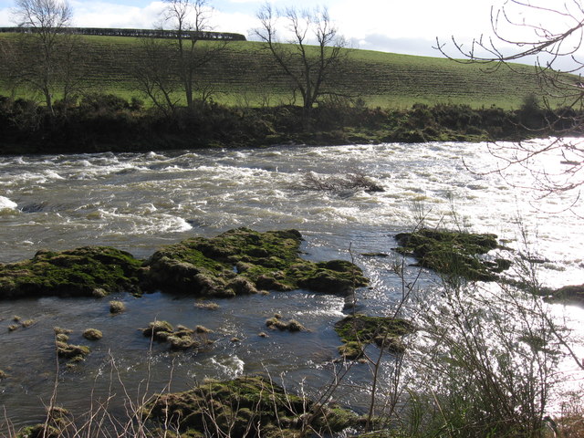
Makerstoun is a small village located in Roxburghshire, a historic county in the Scottish Borders region of Scotland. Situated on the banks of the River Tweed, Makerstoun is known for its picturesque rural setting and tranquil atmosphere.

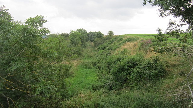
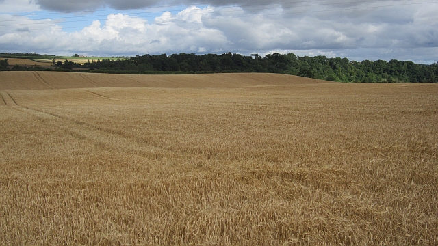
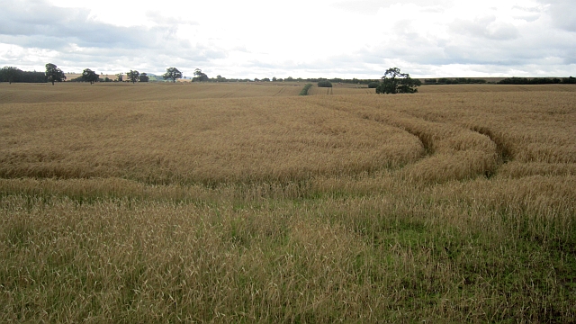
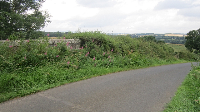
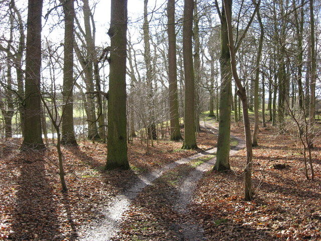
The village is home to a population of around 100 residents, making it a close-knit community. The surrounding countryside is characterized by rolling hills, verdant farmlands, and charming woodland areas, providing ample opportunities for outdoor activities such as hiking, fishing, and birdwatching.

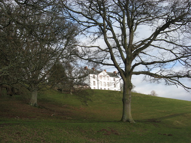
One of the notable landmarks in Makerstoun is Makerstoun House, an elegant mansion dating back to the 18th century. This stunning Georgian building is surrounded by well-maintained gardens and offers a glimpse into the region's architectural heritage.

Although Makerstoun is a small village, it benefits from its proximity to larger towns and cities. The town of Kelso is just a short drive away, offering a range of amenities including shops, restaurants, and leisure facilities. Additionally, the nearby River Tweed is renowned for its salmon fishing, attracting anglers from far and wide.

Overall, Makerstoun is a charming and idyllic village that appeals to those seeking a peaceful and rural lifestyle. With its natural beauty, historic architecture, and easy access to amenities, it is no wonder that Makerstoun is a popular destination for both locals and visitors alike.

If you have any feedback on the listing, please let us know in the comments section below.

Makerstoun Images

Images are sourced within 2km of 55.585323/-2.5248677 or Grid Reference NT6732. Thanks to Geograph Open Source API. All images are credited.

A phone box at Makerstoun It appears to be used as the village library.
A phone box at Makerstoun
It appears to be used as the village library.
Makerstoun phone box The box is being used as a library.
Makerstoun phone box
The box is being used as a library.
A sundial at Makerstoun Parish Churchyard According to The Churches and Graveyards of Roxburghshire by G A C Binnie, the sundial and pedestal was gifted by General Sir Thomas Makdougall Brisbane, once Governor General of New South Wales.
A sundial at Makerstoun Parish Churchyard
According to The Churches and Graveyards of Roxburghshire by G A C Binnie, the sundial and pedestal was gifted by General Sir Thomas Makdougall Brisbane, once Governor General of New South Wales.
Tweed flood plain near Rutherford Grassland beside the Tweed.
Tweed flood plain near Rutherford
Grassland beside the Tweed.
Roxburgh Newtown Sheep graze beside the Stockstruther Burn on land obviously unsuited to arable use.
Roxburgh Newtown
Sheep graze beside the Stockstruther Burn on land obviously unsuited to arable use.
Stockstruther Burn Flowing between steep banks towards the Tweed.
Stockstruther Burn
Flowing between steep banks towards the Tweed.
Kelso Branch Railway Overgrown railway trackbed at Roxburgh Newtown.
Kelso Branch Railway
Overgrown railway trackbed at Roxburgh Newtown.
Barley, Trows Above the unseen River Tweed.
Barley, Trows
Above the unseen River Tweed.
Barley near Trows
Barley near Trows
Railway bridge, Roxburgh Newtown A road bridge over the Kelso Branch Railway.
Railway bridge, Roxburgh Newtown
A road bridge over the Kelso Branch Railway.
The Weir at Rutherford Lodge Crossing the Tweed from bank to bank this weir may well be the longest on the river. In spate conditions it's certainly one of the noisiest.
The Weir at Rutherford Lodge
Crossing the Tweed from bank to bank this weir may well be the longest on the river. In spate conditions it's certainly one of the noisiest.
'Footpaths End' This footpath near Corbie Craigs by the River Tweed suddenly ends,needing one to detour somewhat. Unless of course you can walk on water.
'Footpaths End'
This footpath near Corbie Craigs by the River Tweed suddenly ends,needing one to detour somewhat. Unless of course you can walk on water.
Makerstoun House The house stands in a prominent position above the River Tweed.
Makerstoun House
The house stands in a prominent position above the River Tweed.
River Tweed Looking downstream from below Makerstoun House
River Tweed
Looking downstream from below Makerstoun House
Rough Water Rocky extrusions causing white water on the River Tweed downstream from Makerstoun House.
Rough Water
Rocky extrusions causing white water on the River Tweed downstream from Makerstoun House.
Tweed Shelter A novel use for an old boat beside the River Tweed.
Tweed Shelter
A novel use for an old boat beside the River Tweed.
'Winter Woodland' A pleasant track passing through broadleaved woodland above the River Tweed.
'Winter Woodland'
A pleasant track passing through broadleaved woodland above the River Tweed.
A dedicated bench seat at Makerstoun Kirkyard The kirk is in the background to the left.
A dedicated bench seat at Makerstoun Kirkyard
The kirk is in the background to the left.
Show me another place!

Makerstoun is located at Grid Ref: NT6732 (Lat: 55.585323, Lng: -2.5248677)

Unitary Authority: The Scottish Borders

Police Authority: The Lothians and Scottish Borders

What 3 Words

///vanished.defers.scratches. Near Kelso, Scottish Borders

Related Wikis

Makerstoun

Makerstoun is a parish in the Scottish Borders area of Scotland, as well as the historic county of Roxburghshire, 4 miles (6 km) south-west of Kelso.The...

Rutherford railway station

Rutherford railway station served the parish of Maxton, Roxburghshire, Scotland from 1851 to 1964 on the Kelso Line. == History == The station opened in...

Borders Abbeys Way

The Borders Abbeys Way is a long-distance footpath in the Scottish Borders area of Scotland. It is a circular walkway and is 109 kilometres (68 mi) in...

Roxburgh railway station

Roxburgh railway station was on the Kelso Line, and served the village of Roxburgh, Scottish Borders, from 1850 to 1964. == History == The station was...

Nearby Amenities

Located within 500m of 55.585323,-2.5248677
Telephone
Booth: K6
Covered: booth
Note: the box is also being used as a book exchange even though there is still a phone in the box
Lat/Long: 55.5864696/-2.5255777
Post Box
Post Box Type: wall
Postal Code: TD5
Ref: TD5 25
Royal Cypher: GR
Royal Cypher Wikidata: Q33102273
Source: survey
Lat/Long: 55.5855974/-2.5241529
Manorhill
Place: hamlet
Lat/Long: 55.5863723/-2.5255765
Makerstoun Lodge
Place: hamlet
Lat/Long: 55.5852547/-2.5245577
Power: pole
Lat/Long: 55.5879259/-2.5189698
Power: pole
Lat/Long: 55.5874393/-2.520036
Power: pole
Lat/Long: 55.5869732/-2.5278787
Power: pole
Lat/Long: 55.587409/-2.5213596
Power: pole
Lat/Long: 55.5873544/-2.5225747
Power: pole
Lat/Long: 55.5873089/-2.5239962
Power: pole
Lat/Long: 55.5871073/-2.526657
Defibrillator
Defibrillator Location: next to red phone box in Makerstoun
Emergency: defibrillator
Indoor: no
Lat/Long: 55.5864909/-2.5256207
Power: pole
Lat/Long: 55.5816894/-2.5260325
Power: pole
Lat/Long: 55.5821304/-2.5255081
Power: pole
Lat/Long: 55.5825666/-2.5249858
Power: pole
Lat/Long: 55.5830004/-2.5244571
Power: pole
Lat/Long: 55.5831594/-2.5242674
Power: pole
Lat/Long: 55.5835836/-2.5238027
Power: pole
Lat/Long: 55.5835197/-2.5229201
Power: pole
Lat/Long: 55.5850222/-2.5295138
Power: pole
Lat/Long: 55.5856704/-2.528951
Power: pole
Lat/Long: 55.5864439/-2.5283242
Power: pole
Lat/Long: 55.5859981/-2.5327008
Power: pole
Lat/Long: 55.5853246/-2.5318332
Power: pole
Lat/Long: 55.5845366/-2.5307886
Power: pole
Lat/Long: 55.5841137/-2.5285779
Power: pole
Lat/Long: 55.5830149/-2.5274118
Power: pole
Lat/Long: 55.5824714/-2.5268298
Power: pole
Lat/Long: 55.5809508/-2.525248
Power: pole
Lat/Long: 55.5809941/-2.5235298
Power: pole
Lat/Long: 55.5815834/-2.5235532
Power: pole
Lat/Long: 55.5821509/-2.5235874
Power: pole
Lat/Long: 55.5872039/-2.5253823
Power: pole
Lat/Long: 55.5872776/-2.5253802
Power: pole
Lat/Long: 55.5879957/-2.5254037
Power: pole
Lat/Long: 55.5886788/-2.5254399
Power: pole
Lat/Long: 55.5893161/-2.5254676
The data included in this document is from www.openstreetmap.org. The data is made available under ODbL.

Have you been to Makerstoun?

Leave your review of Makerstoun below (or comments, questions and feedback).