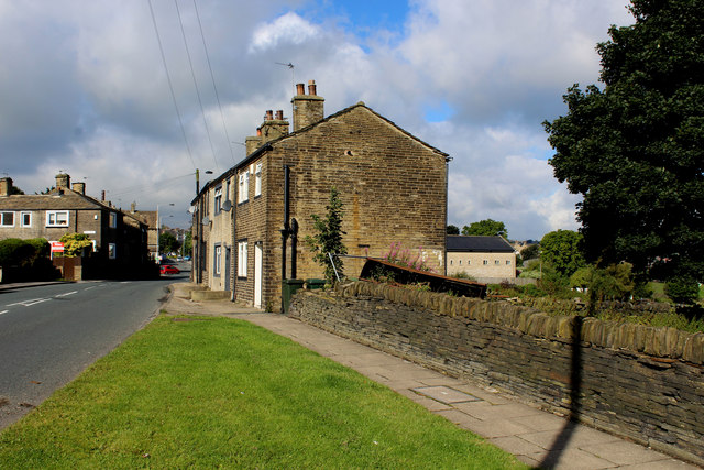
Leaventhorpe

Settlement in Yorkshire

England

Leaventhorpe
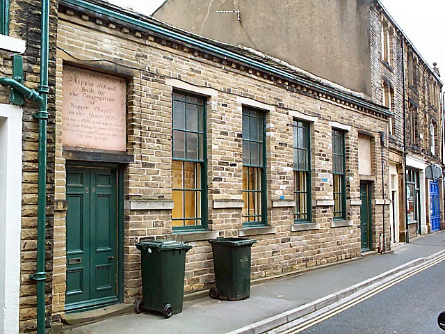
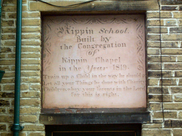
Old school, Thornton village The Kipping School on Market Street, built 1819.  For details of the stone above the doorway see <a href="https://www.geograph.org.uk/photo/39912">SE0932 : Inscribed stone, old school in Market Street, Thornton</a>.
Old school, Thornton village Credit: David Spencer

Leaventhorpe is a quaint village located in the picturesque region of Yorkshire, England. Situated in the metropolitan borough of Bradford, it is nestled amidst rolling green hills and idyllic countryside landscapes. With a population of approximately 3,000 residents, Leaventhorpe offers a peaceful and tight-knit community atmosphere.

The village is known for its rich historical heritage, with records dating back to the Domesday Book of 1086. Leaventhorpe boasts several well-preserved heritage buildings, including the St. Mary's Church, which dates back to the 12th century, and the charming Leaventhorpe Hall, a Grade II listed manor house.

Leaventhorpe's natural beauty attracts outdoor enthusiasts and nature lovers alike. The village is surrounded by lush green fields, providing ample opportunities for countryside walks, hiking, and cycling. The nearby Leaventhorpe Reservoir is a popular spot for fishing and birdwatching, with a variety of bird species frequenting the area.

Despite its rural charm, Leaventhorpe offers convenient amenities for its residents. The village has a primary school, a local convenience store, and a village hall that serves as a hub for community events and gatherings. Additionally, the nearby town of Bradford provides access to a wider range of amenities, including shopping centers, restaurants, and cultural attractions.

Leaventhorpe is well-connected to neighboring areas via a reliable public transportation network, allowing residents to easily commute to larger towns and cities for work or leisure. With its serene countryside setting and strong community spirit, Leaventhorpe provides a delightful escape from the hustle and bustle of city life.

If you have any feedback on the listing, please let us know in the comments section below.

Leaventhorpe Images

Images are sourced within 2km of 53.792881/-1.8203691 or Grid Reference SE1132. Thanks to Geograph Open Source API. All images are credited.

Old school, Thornton village The Kipping School on Market Street, built 1819.  For details of the stone above the doorway see <a href="https://www.geograph.org.uk/photo/39912">SE0932 : Inscribed stone, old school in Market Street, Thornton</a>.
Old school, Thornton village
The Kipping School on Market Street, built 1819. For details of the stone above the doorway see SE0932 : Inscribed stone, old school in Market Street, Thornton.
Inscribed stone, old school in Market Street, Thornton The Kipping School (or, as the stone has it, 'Kippin') on Market Street, built 1819. This inscribed stone is set above the left hand doorway.
Inscribed stone, old school in Market Street, Thornton
The Kipping School (or, as the stone has it, 'Kippin') on Market Street, built 1819. This inscribed stone is set above the left hand doorway.
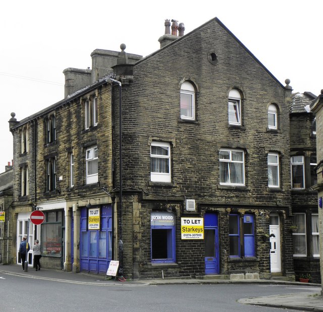
Commercial Building in Main Street
High Street, Thornton
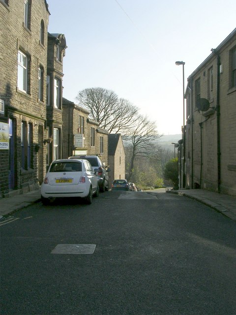
Fountain Street - Market Street
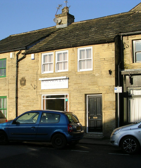
Robinson & Co - Accountants - Market Street
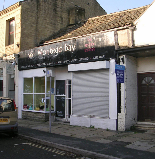
Montego Bay - Market Street
Ackroyd Court - Market Street
Benchmark at St James Church, Thornton Benchmark spotted at SE base on east side of St James Church tower. Type: cutmark at ODN 228.5360m (above sea level) the mark is 0.2m above ground level. Grid Ref: SE10553272 Waypoint: B27781 ID:56898     <a title="https://www.geograph.org.uk/photo/4194000" href="https://www.geograph.org.uk/photo/4194000">Link</a>
Benchmark at St James Church, Thornton
Benchmark spotted at SE base on east side of St James Church tower. Type: cutmark at ODN 228.5360m (above sea level) the mark is 0.2m above ground level. Grid Ref: SE10553272 Waypoint: B27781 ID:56898 Link
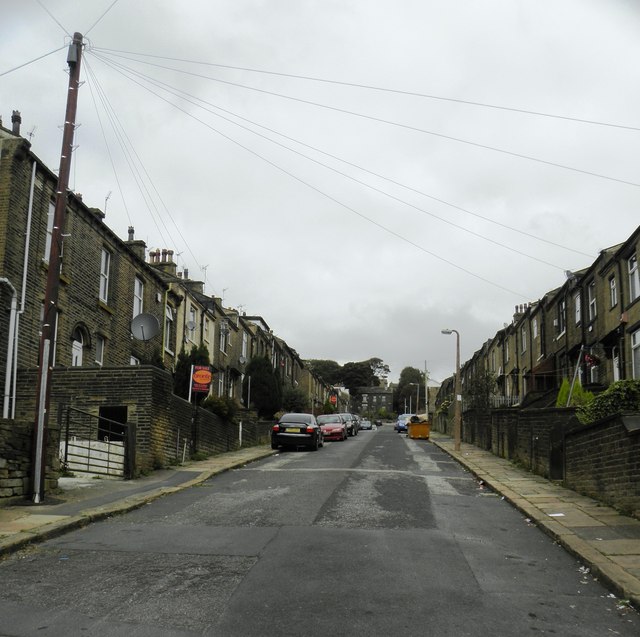
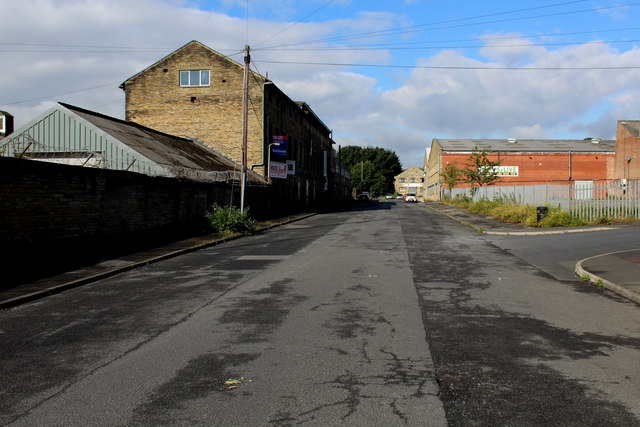
York Street, Bradford Deserted street in the Crossley Hall district of Bradford
York Street, Bradford
Deserted street in the Crossley Hall district of Bradford
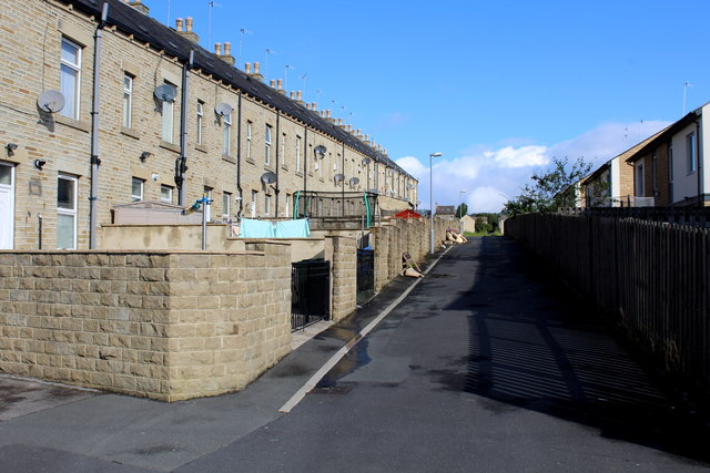
Alleyway behind Lund Street Alleyway leading off York Street, in the Crossley Hall district of Bradford
Alleyway behind Lund Street
Alleyway leading off York Street, in the Crossley Hall district of Bradford
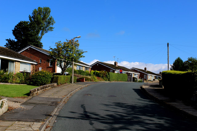
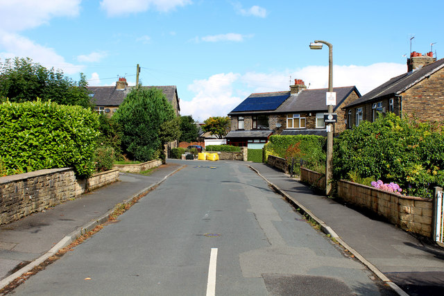
Middlebrook Drive Bradford suburban thoroughfare leading towards Thornton Road.
Middlebrook Drive
Bradford suburban thoroughfare leading towards Thornton Road.
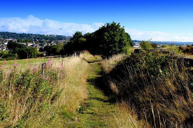
Deep Lane Section of a deserted long path stretching between Clayton and Crossley Hall in the western region of Bradford - some of which is impassable and overgrown with vegetation.
Deep Lane
Section of a deserted long path stretching between Clayton and Crossley Hall in the western region of Bradford - some of which is impassable and overgrown with vegetation.
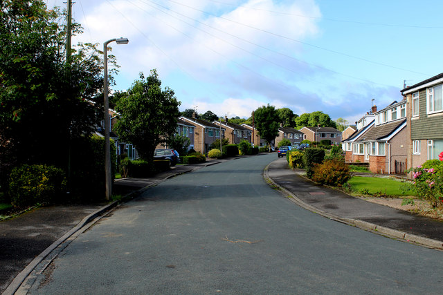
Middlebrook Crescent, Bradford Housing estate in the western area of Bradford
Middlebrook Crescent, Bradford
Housing estate in the western area of Bradford
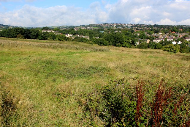
View towards Allerton View from Deep Lane, looking northwards towards the Bradford suburb of Allerton.
View towards Allerton
View from Deep Lane, looking northwards towards the Bradford suburb of Allerton.
Bradford Road, Clayton Approaching Clayton from the east.
Bradford Road, Clayton
Approaching Clayton from the east.
Fieldway - looking away from The Avenue Quiet crescent in Clayton Village - a western suburb of Bradford.
Fieldway - looking away from The Avenue
Quiet crescent in Clayton Village - a western suburb of Bradford.
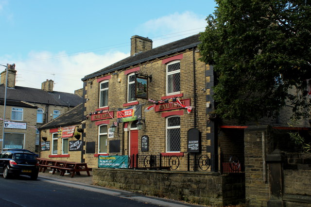
Royal Hotel, Clayton Local hostelry and public house opposite Victoria Park in the centre of Clayton Village in Bradford.
Royal Hotel, Clayton
Local hostelry and public house opposite Victoria Park in the centre of Clayton Village in Bradford.
Show me another place!

Leaventhorpe is located at Grid Ref: SE1132 (Lat: 53.792881, Lng: -1.8203691)

Division: West Riding

Unitary Authority: Bradford

Police Authority: West Yorkshire

What 3 Words

///teeth.aspect.easy. Near Clayton, West Yorkshire

Related Wikis

Beckfoot Thornton

Beckfoot Thornton (Thornton Grammar School until 2016) is a mixed secondary school and sixth form located in Thornton, West Yorkshire, England. It is...

Allerton, West Yorkshire

Allerton is a village within the metropolitan borough of the City of Bradford, West Yorkshire, England, now increasingly part of the Bradford conurbation...

Dixons Allerton Academy

Dixons Allerton Academy (formerly Rhodesway Academy) is a coeducational all-through school and sixth form located in Allerton area of the City of Bradford...

Clayton, West Yorkshire

Clayton, or Clayton Village, is a civil parish in the City of Bradford metropolitan borough in West Yorkshire, England, situated 3 miles (4.8 km) to the...

Nearby Amenities

Located within 500m of 53.792881,-1.8203691
Mini Roundabout
Direction: clockwise
Lat/Long: 53.7953187/-1.8186499
Mini Roundabout
Direction: clockwise
Lat/Long: 53.7964148/-1.8210923
Turning Circle
Lat/Long: 53.7924579/-1.8188163
Bus Stop
Thornton Road Bell Dean Road
Local Ref: 45021012
Naptan AtcoCode: 450021012
Naptan Bearing: W
Naptan CommonName: Thornton Road Bell Dean Road
Naptan Crossing: Bell Dean Road
Naptan Indicator: Stop 45021012
Naptan Notes: OSR taken place 280705L/C 197
Naptan PlusbusZoneRef: LEEDS
Naptan ShortCommonName: Bell Dean Road
Naptan Street: Thornton Road
Naptan Verified: no
Source: naptan_import
Lat/Long: 53.7938119/-1.8159036
Bus Stop
Thornton Road Southlands Grove
Local Ref: 45021013
Naptan AtcoCode: 450021013
Naptan Bearing: E
Naptan CommonName: Thornton Road Southlands Grove
Naptan Crossing: Southlands Grove
Naptan Indicator: Stop 45021013
Naptan Landmark: Thornton School
Naptan Notes: OSR taken place 290705
Naptan PlusbusZoneRef: LEEDS
Naptan ShortCommonName: Southlands Grove
Naptan Street: Thornton Road
Naptan Verified: no
Source: naptan_import
Lat/Long: 53.7928397/-1.8208718
Bus Stop
Thornton Road Southlands Grove
Local Ref: 45021014
Naptan AtcoCode: 450021014
Naptan Bearing: W
Naptan CommonName: Thornton Road Southlands Grove
Naptan Crossing: Southlands Grove
Naptan Indicator: Stop 45021014
Naptan Notes: OSR taken place 040805
Naptan PlusbusZoneRef: LEEDS
Naptan ShortCommonName: Southlands Grove
Naptan Street: Thornton Road
Naptan Verified: no
Source: naptan_import
Lat/Long: 53.7927139/-1.820842
Bus Stop
Thornton Road Leaventhorpe Lane
Local Ref: 45021015
Naptan AtcoCode: 450021015
Naptan Bearing: SW
Naptan CommonName: Thornton Road Leaventhorpe Lane
Naptan Crossing: Leaventhorpe Lane
Naptan Indicator: Stop 45021015
Naptan Landmark: Leaventhorpe Hall
Naptan PlusbusZoneRef: LEEDS
Naptan ShortCommonName: Leaventhorpe Lane
Naptan Street: Thornton Road
Naptan Verified: no
Source: naptan_import
Lat/Long: 53.7923119/-1.8225439
Bus Stop
Thornton Road Old Road
Local Ref: 45021016
Naptan AtcoCode: 450021016
Naptan Bearing: E
Naptan CommonName: Thornton Road Old Road
Naptan Crossing: Old Road
Naptan Indicator: Stop 45021016
Naptan Notes: OSR taken place 290705
Naptan PlusbusZoneRef: LEEDS
Naptan ShortCommonName: Old Road
Naptan Street: Thornton Road
Naptan Verified: no
Source: naptan_import
Lat/Long: 53.7915912/-1.8275411
Bus Stop
Thornton Road Thorpe Road
Local Ref: 45021017
Naptan AtcoCode: 450021017
Naptan Bearing: W
Naptan CommonName: Thornton Road Thorpe Road
Naptan Crossing: Thorpe Road
Naptan Indicator: Stop 45021017
Naptan Notes: OSR taken place 040805
Naptan PlusbusZoneRef: LEEDS
Naptan ShortCommonName: Thorpe Road
Naptan Street: Thornton Road
Naptan Verified: no
Source: naptan_import
Lat/Long: 53.7914294/-1.8275418
Bus Stop
Bell Dean Road Avocet Close
Local Ref: 45021046
Naptan AtcoCode: 450021046
Naptan Bearing: NW
Naptan CommonName: Bell Dean Road Avocet Close
Naptan Crossing: Avocet Close
Naptan Indicator: Stop 45021046
Naptan PlusbusZoneRef: LEEDS
Naptan ShortCommonName: Avocet Close
Naptan Street: Bell Dean Road
Naptan Verified: no
Source: naptan_import
Lat/Long: 53.794406/-1.8164778
Bus Stop
Bell Dean Road Marmion Avenue
Local Ref: 45021047
Naptan AtcoCode: 450021047
Naptan Bearing: SE
Naptan CommonName: Bell Dean Road Marmion Avenue
Naptan Crossing: Marmion Avenue
Naptan Indicator: Stop 45021047
Naptan PlusbusZoneRef: LEEDS
Naptan ShortCommonName: Marmion Avenue
Naptan Street: Bell Dean Road
Naptan Verified: no
Source: naptan_import
Lat/Long: 53.7951097/-1.8181902
Bus Stop
Bell Dean Road Marmion Avenue
Local Ref: 45021048
Naptan AtcoCode: 450021048
Naptan Bearing: NW
Naptan CommonName: Bell Dean Road Marmion Avenue
Naptan Crossing: Marmion Avenue
Naptan Indicator: Stop 45021048
Naptan PlusbusZoneRef: LEEDS
Naptan ShortCommonName: Marmion Avenue
Naptan Street: Bell Dean Road
Naptan Verified: no
Source: naptan_import
Lat/Long: 53.7953804/-1.8188722
Bus Stop
Bell Dean Road Wallingford Mount
Local Ref: 45021049
Naptan AtcoCode: 450021049
Naptan Bearing: SE
Naptan CommonName: Bell Dean Road Wallingford Mount
Naptan Crossing: Wallingford Mount
Naptan Indicator: Stop 45021049
Naptan Landmark: Bell Dean PH
Naptan Notes: OSR taken place 270705
Naptan PlusbusZoneRef: LEEDS
Naptan ShortCommonName: Wallingford Mount
Naptan Street: Bell Dean Road
Naptan Verified: no
Source: naptan_import
Lat/Long: 53.7966065/-1.8213416
Bus Stop
Bell Dean Road Greenway Drive
Local Ref: 45021050
Naptan AtcoCode: 450021050
Naptan Bearing: NW
Naptan CommonName: Bell Dean Road Greenway Drive
Naptan Crossing: Greenway Drive
Naptan Indicator: Stop 45021050
Naptan Notes: OSR taken place 270705Old Timetable information transferred - 22/1/07
Naptan PlusbusZoneRef: LEEDS
Naptan ShortCommonName: Greenway Drive
Naptan Street: Bell Dean Road
Naptan Verified: no
Source: naptan_import
Lat/Long: 53.7967602/-1.821933
Bus Stop
Thornton Road Bell Dean Road
Local Ref: 45021065
Naptan AtcoCode: 450021065
Naptan Bearing: E
Naptan CommonName: Thornton Road Bell Dean Road
Naptan Crossing: Bell Dean Road
Naptan Indicator: Stop 45021065
Naptan Notes: OSR taken place 010805
Naptan PlusbusZoneRef: LEEDS
Naptan ShortCommonName: Bell Dean Road
Naptan Street: Thornton Road
Naptan Verified: no
Source: naptan_import
Lat/Long: 53.7941971/-1.8150366
School Services
Local Ref: 45025004
Naptan AtcoCode: 450025004
Naptan Bearing: W
Naptan BusStopType: CUS
Naptan CommonName: School Services
Naptan Crossing: Southlands Avenue
Naptan Indicator: Stop 45025004
Naptan Landmark: Thornton Grammer School
Naptan PlusbusZoneRef: LEEDS
Naptan ShortCommonName: Thornton G School
Naptan Street: Leaventhorpe Lane
Naptan Verified: no
Source: naptan_import
Lat/Long: 53.7917666/-1.8185387
School Services
Local Ref: 45025007
Naptan AtcoCode: 450025007
Naptan Bearing: W
Naptan BusStopType: CUS
Naptan CommonName: School Services
Naptan Crossing: Southlands Avenue
Naptan Indicator: Stop 45025007
Naptan Landmark: Thornton Grammer School
Naptan PlusbusZoneRef: LEEDS
Naptan ShortCommonName: Thornton G School
Naptan Street: Leaventhorpe Lane
Naptan Verified: no
Source: naptan_import
Lat/Long: 53.7917495/-1.8191004
Bus Stop
Leaventhorpe Lane Thornton Road
Local Ref: 45025008
Naptan AtcoCode: 450025008
Naptan Bearing: NW
Naptan CommonName: Leaventhorpe Lane Thornton Road
Naptan Crossing: Thornton Road
Naptan Indicator: Stop 45025008
Naptan Landmark: Thornton Grammer School
Naptan Notes: OSR taken place 040805
Naptan PlusbusZoneRef: LEEDS
Naptan ShortCommonName: Grammar School
Naptan Street: Leaventhorpe Lane
Naptan Verified: no
Source: naptan_import
Lat/Long: 53.7919324/-1.8212249
Bus Stop
Leaventhorpe Lane Leaventhorpe Hall
Local Ref: 45025009
Naptan AtcoCode: 450025009
Naptan Bearing: NW
Naptan CommonName: Leaventhorpe Lane Leaventhorpe Hall
Naptan Crossing: Thornton Road
Naptan Indicator: Stop 45025009
Naptan Landmark: Thornton Grammer School
Naptan PlusbusZoneRef: LEEDS
Naptan ShortCommonName: School Services
Naptan Street: Leaventhorpe Lane
Naptan Verified: no
Source: naptan_import
Lat/Long: 53.7919866/-1.821346
St James Primary School
Fixme: This is not tagged as Bus Stop. Also needs survey to confirm existence.
Local Ref: 45028193
Naptan AtcoCode: 450028193
Naptan Bearing: S
Naptan BusStopType: CUS
Naptan CommonName: St James Primary School
Naptan Crossing: Greenway Drive
Naptan Indicator: Stop 45028193
Naptan Landmark: Unknown
Naptan PlusbusZoneRef: LEEDS
Naptan ShortCommonName: St James Primary
Naptan Street: Maitland Close
Naptan Verified: no
Source: naptan_import
Lat/Long: 53.7962687/-1.8238632
Ford: yes
Lat/Long: 53.793507/-1.8224867
Ford: yes
Lat/Long: 53.7939507/-1.8166282
Entrance: main
Lat/Long: 53.796368/-1.8235233
Entrance: exit
Exit: emergency
Lat/Long: 53.7963074/-1.8233471
Community Centre
Lower Grange Community Centre
Addr City: Bradford
Addr Housenumber: 10
Addr Postcode: BD8 0RF
Addr Street: Chaffinch Road
Operator: Lower Grange Community Association
Phone: +44 1274 880328
Website: https://ourcommunitycan.co.uk/
Lat/Long: 53.7952112/-1.8174645
The data included in this document is from www.openstreetmap.org. The data is made available under ODbL.

Have you been to Leaventhorpe?

Leave your review of Leaventhorpe below (or comments, questions and feedback).