School Green

Settlement in Yorkshire

England

School Green

Pinch Beck seen from Thornton Viaduct
Pinch Beck seen from Thornton Viaduct Credit: habiloid

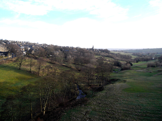
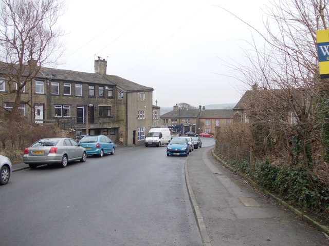
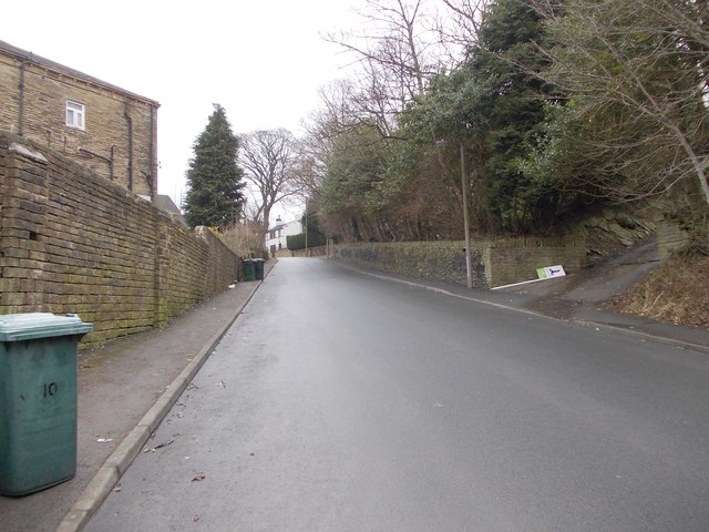
School Green is a picturesque village located in the county of Yorkshire, England. Situated amidst the rolling hills and lush greenery, it offers a tranquil and idyllic setting for its residents. The village is part of the larger district of Yorkshire Dales, renowned for its natural beauty and stunning landscapes.

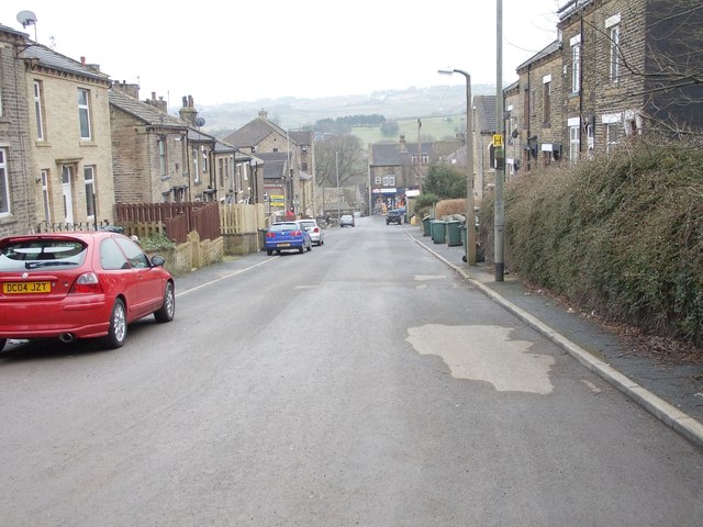
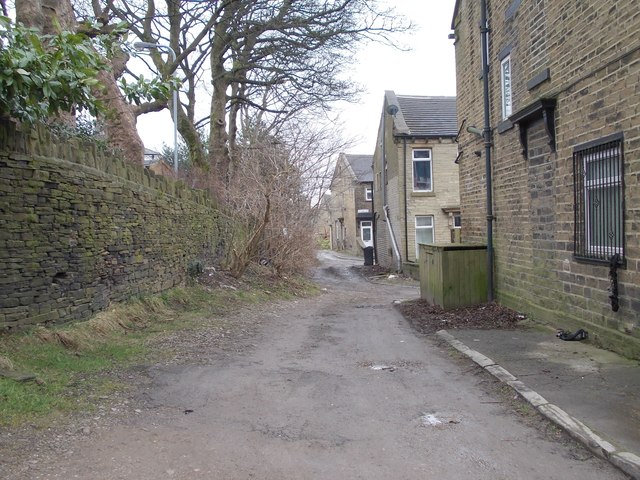
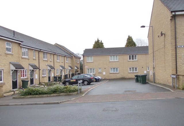
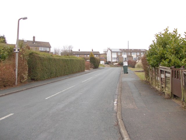
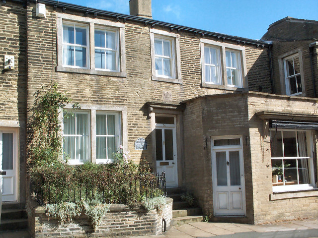
School Green is characterized by its charming architecture, with traditional stone-built houses that exude a sense of history and heritage. The village is home to a close-knit community, where residents take pride in maintaining the village's rich cultural traditions and values.

One of the notable features of School Green is its proximity to several renowned schools and educational institutions. The village takes its name from the historic school that has been a centerpiece of the community for generations. The school not only provides quality education but also serves as a focal point for various community activities and events.

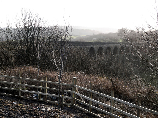
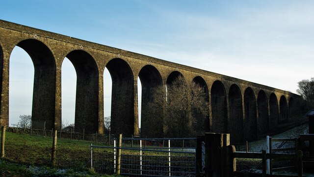
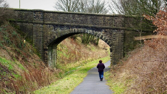
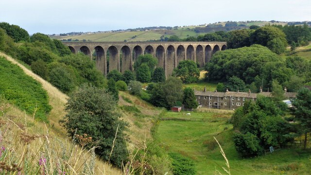
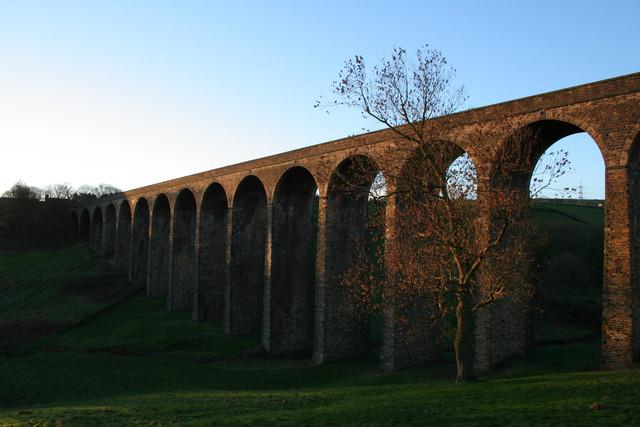
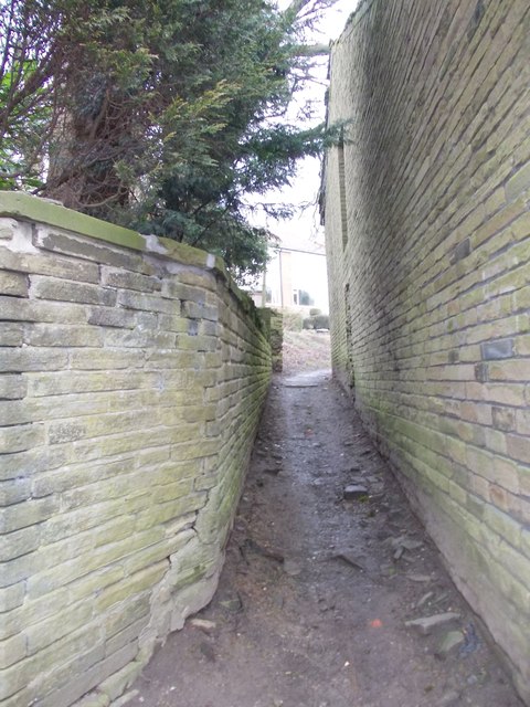
Nature enthusiasts will find School Green to be an ideal destination. The village is surrounded by vast expanses of unspoiled countryside, offering numerous opportunities for outdoor activities such as hiking, cycling, and horseback riding. Nearby, the Yorkshire Dales National Park provides a haven for wildlife and offers breathtaking views of the surrounding scenery.

Though School Green is predominantly a residential area, it offers convenient access to nearby towns and cities. The bustling market town of Skipton is just a short drive away, providing residents with a range of amenities including shops, restaurants, and cultural attractions.

In conclusion, School Green in Yorkshire is a charming village that combines natural beauty, a strong sense of community, and access to modern amenities. It offers a serene and picturesque lifestyle that is highly coveted by residents and visitors alike.

If you have any feedback on the listing, please let us know in the comments section below.
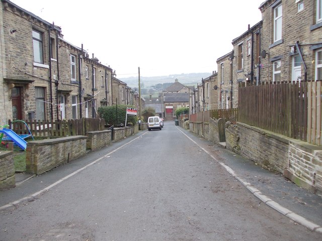
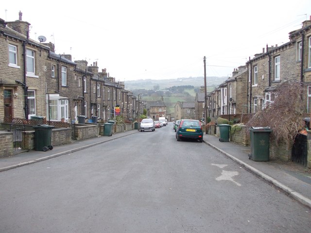
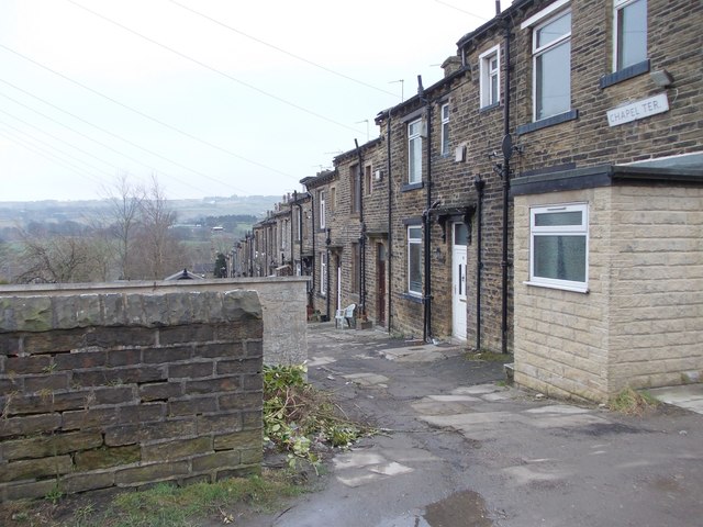
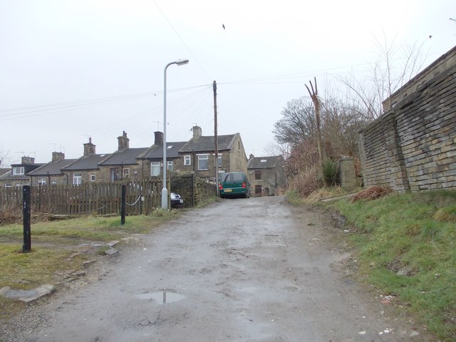
School Green Images

Images are sourced within 2km of 53.791844/-1.832229 or Grid Reference SE1132. Thanks to Geograph Open Source API. All images are credited.

Pinch Beck seen from Thornton Viaduct
Thornton Viaduct Thornton Viaduct once carried a railway but now carries part of the Great Northern Railway Trail, a cycle route.
Thornton Viaduct
Thornton Viaduct once carried a railway but now carries part of the Great Northern Railway Trail, a cycle route.
Thornton Viaduct View from the west on Alderscholes Lane. The former railway viaduct is now part of the Great Northern Railway Trail
Thornton Viaduct
View from the west on Alderscholes Lane. The former railway viaduct is now part of the Great Northern Railway Trail
Bridge at Upper Headley Over the trackbed of the former railway to Thornton. Now the Great Northern Railway Trail but the bridge carries a private entry to the hall property
Bridge at Upper Headley
Over the trackbed of the former railway to Thornton. Now the Great Northern Railway Trail but the bridge carries a private entry to the hall property
Thornton Railway Viaduct Viewed from near the start of the Great Northern Railway Trail off Woodsley Fold
Thornton Railway Viaduct
Viewed from near the start of the Great Northern Railway Trail off Woodsley Fold
Thornton Viaduct
Thornton Viaduct
Bede's Close - looking towards James Street
Firth Street - looking towards Thornton Road
Westville Way - viewed from Firth Street
Mary Street - Westville Way
Henry Street - Westville Way
Chapel Terrace - Westville Way
Westville Way - West Lane
West Lane - viewed from Westville Way
Footpath - West Lane
Upper Kipping Close - West Lane
Alpine Rise - West Lane
Show me another place!

School Green is located at Grid Ref: SE1132 (Lat: 53.791844, Lng: -1.832229)

Division: West Riding

Unitary Authority: Bradford

Police Authority: West Yorkshire

What 3 Words

///shakes.plays.passes. Near Clayton, West Yorkshire

Related Wikis

Beckfoot Thornton

Beckfoot Thornton (Thornton Grammar School until 2016) is a mixed secondary school and sixth form located in Thornton, West Yorkshire, England. It is...

Allerton, West Yorkshire

Allerton is a village within the metropolitan borough of the City of Bradford, West Yorkshire, England, now increasingly part of the Bradford conurbation...

Brontë Birthplace

The Brontë Birthplace is a house in Market Street, Thornton, West Yorkshire, England, where writers Anne, Charlotte and Emily Brontë, and their brother...

Thornton and Allerton

Thornton and Allerton (population 18,000 - 2021 ward profile) is a ward within the City of Bradford Metropolitan District Council in the county of West...

Nearby Amenities

Located within 500m of 53.791844,-1.832229
Mini Roundabout
Source: bing
Lat/Long: 53.7911753/-1.8330903
Mini Roundabout
Source: bing
Lat/Long: 53.7910883/-1.8333105
Turning Circle
Lat/Long: 53.7917581/-1.8372878
Turning Circle
Lat/Long: 53.792022/-1.8305401
Fuel
Esso
Brand: Esso
Brand Wikidata: Q867662
Operator: Esso / Tesco
Lat/Long: 53.7916065/-1.8293121
Turning Circle
Lat/Long: 53.7908747/-1.8289577
Tesco Express
Brand: Tesco Express
Brand Wikidata: Q98456772
Contact Website: https://www.tesco.com/store-locator/bradford/thornton-rd
Shop: convenience
Lat/Long: 53.7918529/-1.8291851
Turning Circle
Lat/Long: 53.7903311/-1.8297591
Turning Circle
Lat/Long: 53.7894791/-1.8301861
Addr City: Bradford
Addr Housenumber: 11
Addr Postcode: BD13 3DL
Addr Street: Allerton Lane
Addr Village: Thornton
Lat/Long: 53.7925832/-1.8332551
Bus Stop
Thornton Road Old Road
Local Ref: 45021016
Naptan AtcoCode: 450021016
Naptan Bearing: E
Naptan CommonName: Thornton Road Old Road
Naptan Crossing: Old Road
Naptan Indicator: Stop 45021016
Naptan Notes: OSR taken place 290705
Naptan PlusbusZoneRef: LEEDS
Naptan ShortCommonName: Old Road
Naptan Street: Thornton Road
Naptan Verified: no
Source: naptan_import
Lat/Long: 53.7915912/-1.8275411
Bus Stop
Thornton Road Thorpe Road
Local Ref: 45021017
Naptan AtcoCode: 450021017
Naptan Bearing: W
Naptan CommonName: Thornton Road Thorpe Road
Naptan Crossing: Thorpe Road
Naptan Indicator: Stop 45021017
Naptan Notes: OSR taken place 040805
Naptan PlusbusZoneRef: LEEDS
Naptan ShortCommonName: Thorpe Road
Naptan Street: Thornton Road
Naptan Verified: no
Source: naptan_import
Lat/Long: 53.7914294/-1.8275418
Bus Stop
Thornton Road School Green
Local Ref: 45021018
Naptan AtcoCode: 450021018
Naptan Bearing: E
Naptan CommonName: Thornton Road School Green
Naptan Crossing: School Green
Naptan Indicator: Stop 45021018
Naptan Landmark: School Green PH
Naptan PlusbusZoneRef: LEEDS
Naptan ShortCommonName: School Green
Naptan Street: Thornton Road
Naptan Verified: no
Source: naptan_import
Lat/Long: 53.7912567/-1.8325822
Bus Stop
Thornton Road Chat Hill Road
Local Ref: 45021019
Naptan AtcoCode: 450021019
Naptan Bearing: W
Naptan CommonName: Thornton Road Chat Hill Road
Naptan Crossing: Chat Hill Road
Naptan Indicator: Stop 45021019
Naptan Notes: OSR taken place 010805
Naptan PlusbusZoneRef: LEEDS
Naptan ShortCommonName: Chat Hill Road
Naptan Street: Thornton Road
Naptan Verified: no
Source: naptan_import
Lat/Long: 53.7910427/-1.8338126
Bus Stop
Thornton Road Churchill Road
Local Ref: 45021020
Naptan AtcoCode: 450021020
Naptan Bearing: W
Naptan CommonName: Thornton Road Churchill Road
Naptan Crossing: Churchill Road
Naptan Indicator: Stop 45021020
Naptan Notes: OSR taken place 270705L/C 253
Naptan PlusbusZoneRef: LEEDS
Naptan ShortCommonName: Churchill Road
Naptan Street: Thornton Road
Naptan Verified: no
Source: naptan_import
Lat/Long: 53.7908847/-1.8365607
Bus Stop
Thornton Road Hoyle Ings Road
Local Ref: 45021021
Naptan AtcoCode: 450021021
Naptan Bearing: E
Naptan CommonName: Thornton Road Hoyle Ings Road
Naptan Crossing: Hoyle Ings Road
Naptan Indicator: Stop 45021021
Naptan PlusbusZoneRef: LEEDS
Naptan ShortCommonName: Hoyle Ings Road
Naptan Street: Thornton Road
Naptan Verified: no
Source: naptan_import
Lat/Long: 53.7910384/-1.837228
Bus Stop
Thornton Road Coach Lane
Local Ref: 45021022
Naptan AtcoCode: 450021022
Naptan Bearing: W
Naptan CommonName: Thornton Road Coach Lane
Naptan Crossing: Coach Lane
Naptan Indicator: Stop 45021022
Naptan Landmark: Thornton Hall Farm
Naptan Notes: OSR taken place 050805
Naptan PlusbusZoneRef: LEEDS
Naptan ShortCommonName: Coach Lane
Naptan Street: Thornton Road
Naptan Verified: no
Source: naptan_import
Lat/Long: 53.7907403/-1.8391239
Chat Hill Road Hughendon Drive
Local Ref: 45025797
Naptan AtcoCode: 450025797
Naptan Bearing: N
Naptan BusStopType: CUS
Naptan CommonName: Chat Hill Road Hughendon Drive
Naptan Crossing: Hughenden Drive
Naptan Indicator: Stop 45025797
Naptan PlusbusZoneRef: LEEDS
Naptan ShortCommonName: Hughenden Drive
Naptan Street: Chat Hill Road
Naptan Verified: no
Source: naptan_import
Lat/Long: 53.7903232/-1.8334511
Ford: yes
Lat/Long: 53.793214/-1.8281751
Ford: yes
Lat/Long: 53.7945839/-1.8306883
Atm
Brand: Tesco Bank
Currency GBP: yes
Operator: Tesco Bank
Operator Wikidata: Q7705429
Lat/Long: 53.7917295/-1.8290331
The data included in this document is from www.openstreetmap.org. The data is made available under ODbL.

Have you been to School Green?

Leave your review of School Green below (or comments, questions and feedback).