Leacnasaide

Settlement in Ross-shire

Scotland

Leacnasaide

Aird Cottage
Aird Cottage Credit: Peter Bond

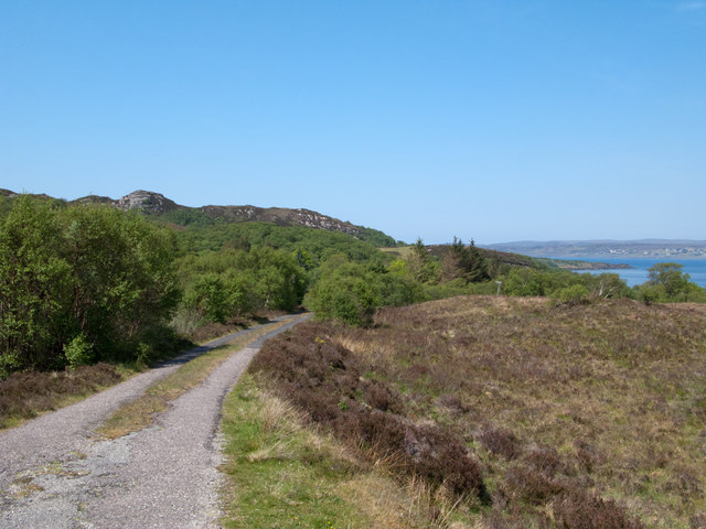
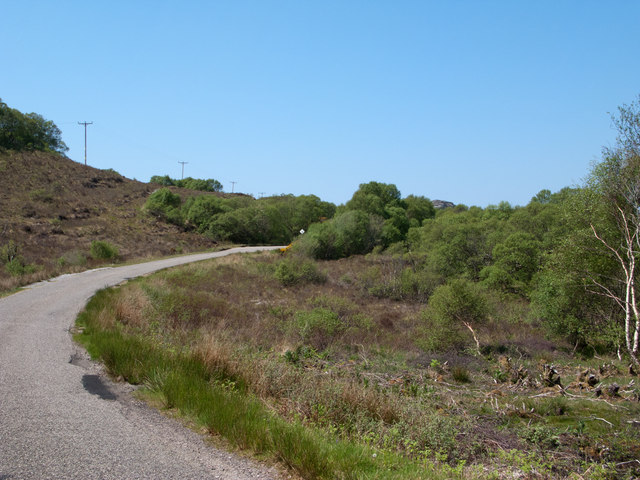
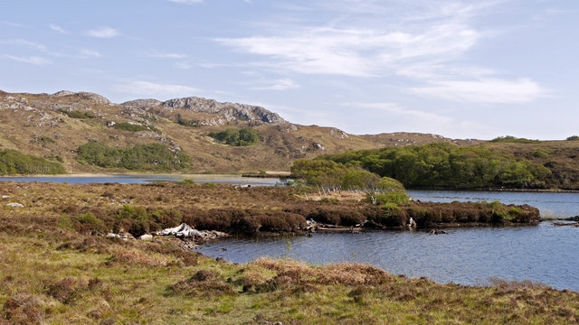
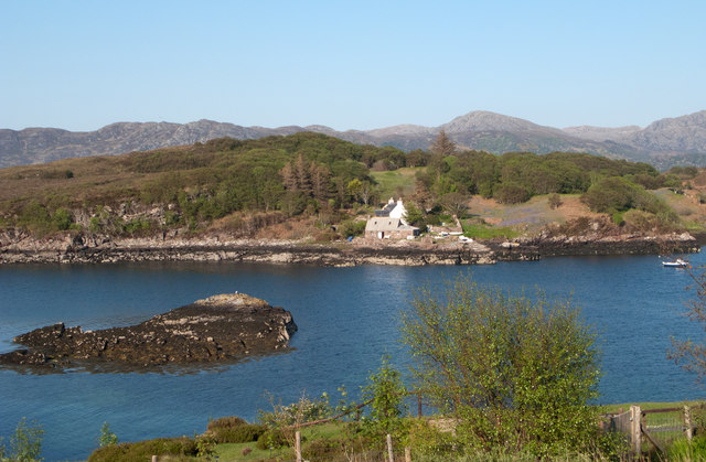
Leacnasaide is a small village located in the county of Ross-shire, in the northern part of Scotland. Situated amidst the breathtaking Scottish Highlands, this picturesque village is surrounded by stunning natural landscapes and offers a tranquil and serene environment for residents and visitors alike.

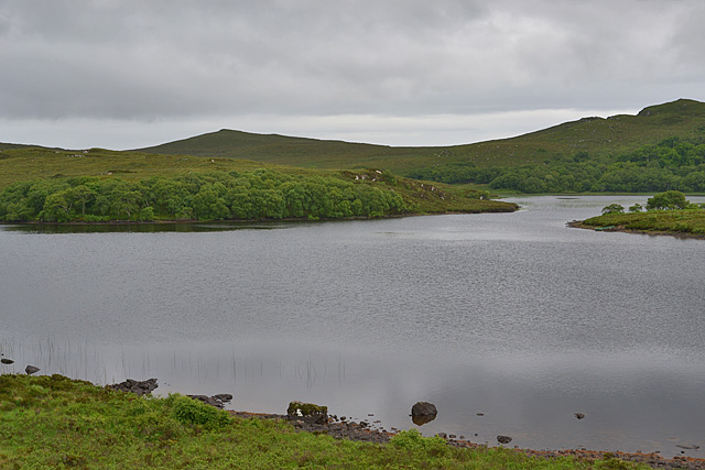
The village is known for its idyllic setting, with rolling green hills, lush forests, and crystal-clear streams that flow through the area. Leacnasaide is particularly popular among nature enthusiasts who enjoy activities such as hiking, fishing, and birdwatching. The nearby mountain ranges, including Ben Wyvis and the Cairngorms, provide ample opportunities for outdoor adventures.

Despite its small size, Leacnasaide has a close-knit and friendly community. The village is home to a quaint primary school, a local church, and a few small businesses that cater to the needs of the residents. Additionally, the village has a rich history, with several historical landmarks and archaeological sites scattered throughout the area.

The village is well-connected to the surrounding towns and cities through a network of well-maintained roads. Inverness, the capital of the Highlands, is located approximately 20 miles southeast of Leacnasaide and offers a wide range of amenities and services.

Overall, Leacnasaide is a hidden gem in the heart of the Scottish Highlands, offering visitors a chance to escape the hustle and bustle of city life and immerse themselves in the beauty of nature.

If you have any feedback on the listing, please let us know in the comments section below.
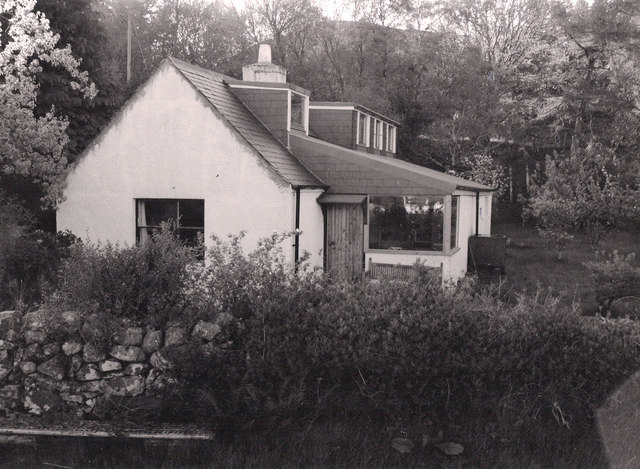
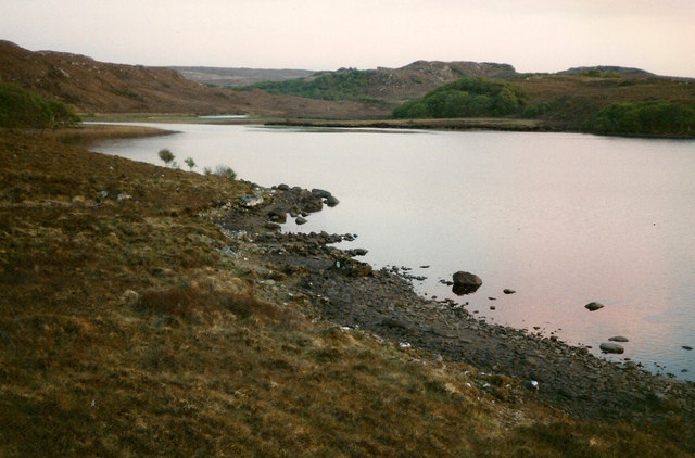
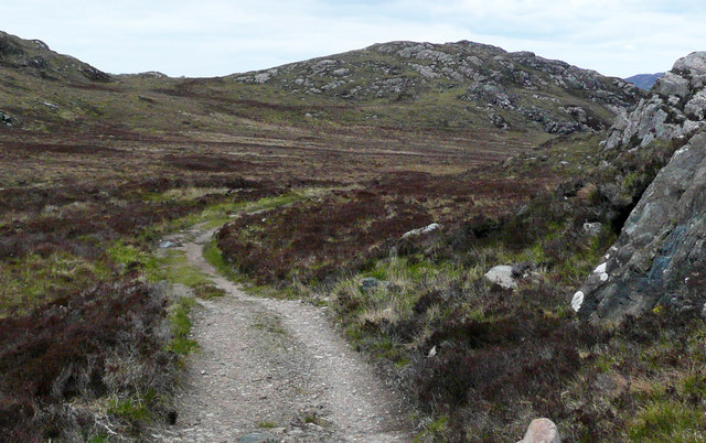
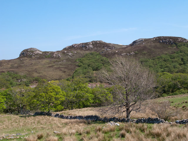
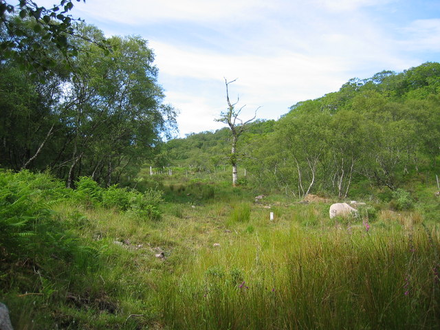
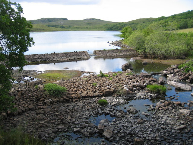
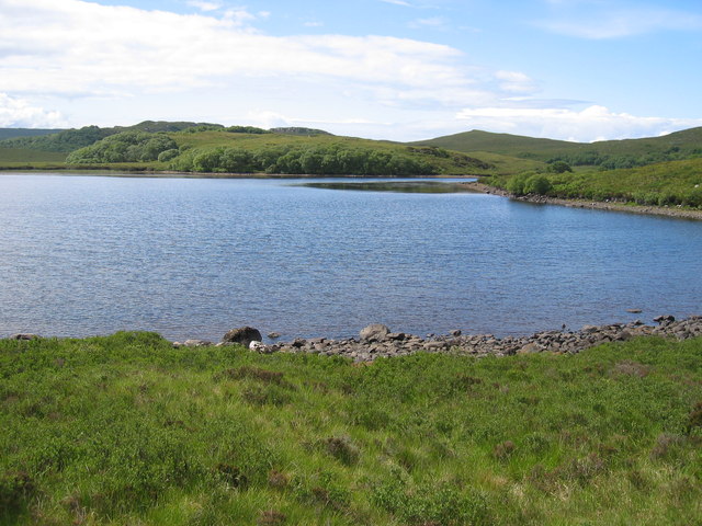
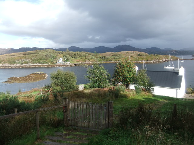
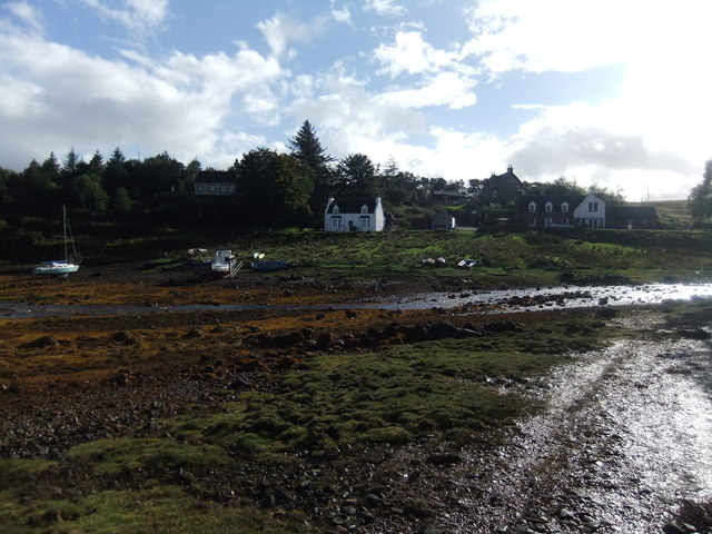
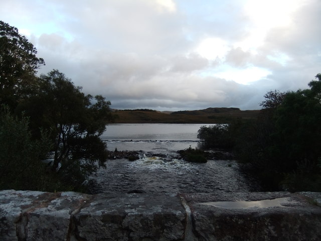
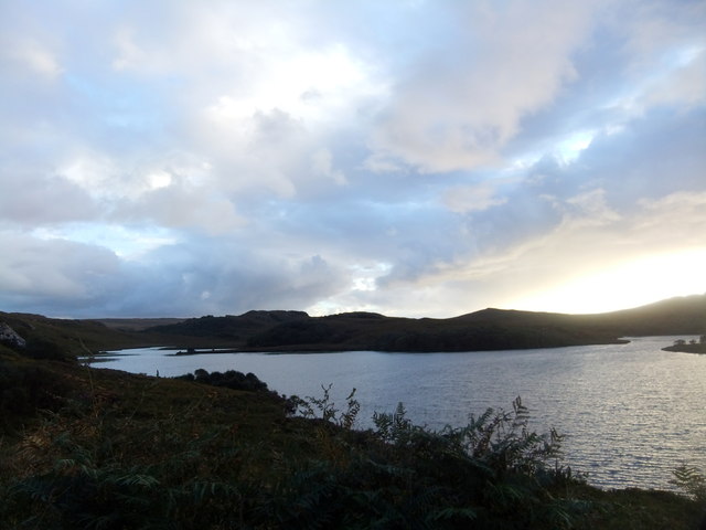
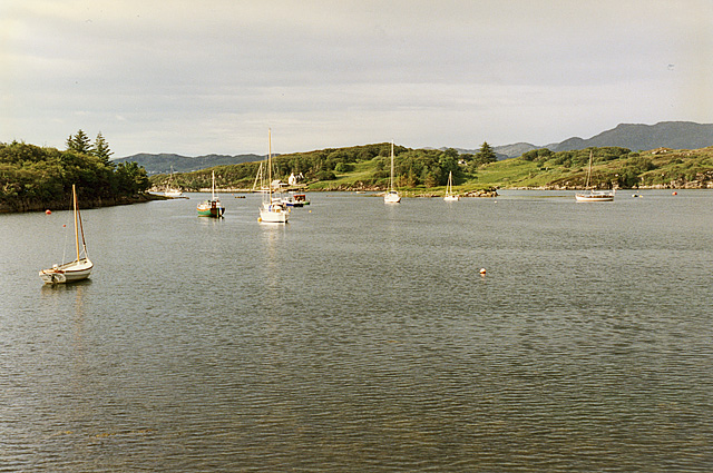
Leacnasaide Images

Images are sourced within 2km of 57.692341/-5.698299 or Grid Reference NG7972. Thanks to Geograph Open Source API. All images are credited.

Aird Cottage
Aird Cottage
Loch Bad a' Chrotha
Loch Bad a' Chrotha
Estate road passing Creag an Fhithich This road leaves the B8056 near to Loch Shieldaig and heads south towards Loch Bràigh Horrisdale which lies behind the camera position.
Estate road passing Creag an Fhithich
This road leaves the B8056 near to Loch Shieldaig and heads south towards Loch Bràigh Horrisdale which lies behind the camera position.
An Torr An Torr is a minor hill rising to just 96m, lying east of the village of Badachro.
An Torr
An Torr is a minor hill rising to just 96m, lying east of the village of Badachro.
Road descending to Camas na h-Airigh The road leaves the B8056 near to Badachro giving access to the few homes above the bay. Loch Gairloch lies in the distance.
Road descending to Camas na h-Airigh
The road leaves the B8056 near to Badachro giving access to the few homes above the bay. Loch Gairloch lies in the distance.
B8056 above Leacnasaide Leacnasaide is a small community above Loch Shieldaig; the B8056 is seen here passing above it on its way to Red Point.
B8056 above Leacnasaide
Leacnasaide is a small community above Loch Shieldaig; the B8056 is seen here passing above it on its way to Red Point.
Loch Bad a' Chròtha Loch Bad a' Chròtha as seen from close to the B8032. A promontory bearing a few trees juts into the water; seen at its base are the remains of ancient trees preserved in peat bog and now exposed again.
Loch Bad a' Chròtha
Loch Bad a' Chròtha as seen from close to the B8032. A promontory bearing a few trees juts into the water; seen at its base are the remains of ancient trees preserved in peat bog and now exposed again.
Eilean Horrisdale Eilean Horrisdale as seen from Aird, to the west.
Eilean Horrisdale
Eilean Horrisdale as seen from Aird, to the west.
Woodland above Leacnasaide
Scrubland near Leacnasaide
Weir at Loch Bad a' Chrotha
Loch Bad a' Chrotha
Loch Bad a' Chrotha
Eilean Horrisdale
Eilean Horrisdale
Badachro
Badachro
Weir at Loch Badachro
Loch Bad a Chrotha
Loch Bad a Chrotha
Badachro Bay A small, but sheltered, anchorage.
Badachro Bay
A small, but sheltered, anchorage.
Loch Bad a' Chròtha Looking directly across the eastern half of the loch.
Loch Bad a' Chròtha
Looking directly across the eastern half of the loch.
Show me another place!

Leacnasaide is located at Grid Ref: NG7972 (Lat: 57.692341, Lng: -5.698299)

Unitary Authority: Highland

Police Authority: Highlands and Islands

What 3 Words

///albums.modern.states. Near Gairloch, Highland

Nearby Locations

Cammassie Wood Leacnasaide

Related Wikis

Broadford Beds Formation

The Broadford Beds Formation is a Sinemurian geologic formation in western Scotland. An indeterminate partial tibia of a theropod dinosaur are among the...

Badachro

Badachro (Scottish Gaelic: Bad a' Chrò) is a former fishing village, in the northwest Highlands of Scotland. == Geography == Badachro sits about 3 km south...

Eilean Horrisdale

Eilean Horrisdale is an uninhabited island in Loch Gairloch in Wester Ross, Scotland. == Geography == Eilean Horrisdale is the largest island in Loch Gairloch...

Fairy Lochs

The Fairy Lochs is a recent English name for Na Lochan Sgeireach and are a small group of freshwater lochans approximately 2 mi (3.2 km) south-east of...

Nearby Amenities

Located within 500m of 57.692341,-5.698299
Source: PGS
Lat/Long: 57.6923668/-5.6900875
Created By: almien_coastlines
Source: PGS
Lat/Long: 57.692569/-5.689967
Source: PGS
Lat/Long: 57.6928871/-5.6899981
Source: PGS
Lat/Long: 57.6905457/-5.6909432
Source: PGS
Lat/Long: 57.690696/-5.6915722
Source: PGS
Lat/Long: 57.6908488/-5.6916246
Source: PGS
Lat/Long: 57.6913123/-5.6915766
Created By: almien_coastlines
Source: PGS
Lat/Long: 57.691505/-5.691801
Created By: almien_coastlines
Source: PGS
Lat/Long: 57.692007/-5.692317
Source: PGS
Lat/Long: 57.6922247/-5.6923502
Source: PGS
Lat/Long: 57.6924945/-5.6920474
Source: PGS
Lat/Long: 57.6927445/-5.6922156
Source: PGS
Lat/Long: 57.6934232/-5.692705
Source: PGS
Lat/Long: 57.6935419/-5.693756
Source: PGS
Lat/Long: 57.6944561/-5.693703
Source: PGS
Lat/Long: 57.6944891/-5.6938369
Source: PGS
Lat/Long: 57.6949603/-5.6941576
Source: PGS
Lat/Long: 57.6953553/-5.6941826
Source: PGS
Lat/Long: 57.6959212/-5.6944988
Source: PGS
Lat/Long: 57.6965831/-5.6959568
Source: PGS
Lat/Long: 57.6963107/-5.697748
Source: PGS
Lat/Long: 57.6961119/-5.6986177
Source: PGS
Lat/Long: 57.6959361/-5.6996082
Source: PGS
Lat/Long: 57.6960521/-5.6998564
Created By: almien_coastlines
Source: PGS
Lat/Long: 57.696068/-5.700032
Source: PGS
Lat/Long: 57.6957471/-5.7004658
Source: PGS
Lat/Long: 57.6952513/-5.7015772
Created By: almien_coastlines
Source: PGS
Lat/Long: 57.695485/-5.703336
Created By: almien_coastlines
Source: PGS
Lat/Long: 57.695603/-5.703824
Druimdarroch
Place: locality
Lat/Long: 57.6925378/-5.6940635
Barrier: cattle_grid
Bicycle: yes
Foot: yes
Motorcar: yes
Motorcycle: yes
Lat/Long: 57.6921198/-5.6941784
Post Box
Ref: IV21 239
Source: survey
Lat/Long: 57.6918785/-5.6940783
Power: pole
Lat/Long: 57.6937388/-5.7061476
Power: pole
Lat/Long: 57.6934654/-5.7050157
Power: pole
Lat/Long: 57.6931869/-5.7038762
Power: pole
Lat/Long: 57.6930819/-5.703441
Power: pole
Lat/Long: 57.6928416/-5.7024331
Power: pole
Lat/Long: 57.6925937/-5.7013633
Power: pole
Lat/Long: 57.692304/-5.7001989
Power: pole
Lat/Long: 57.6920255/-5.6991052
Power: pole
Lat/Long: 57.6917602/-5.6980649
Power: pole
Lat/Long: 57.6915562/-5.6972632
Power: pole
Lat/Long: 57.6912154/-5.6959061
Power: pole
Lat/Long: 57.6910053/-5.6950433
Power: pole
Lat/Long: 57.6908053/-5.6942894
Power: pole
Lat/Long: 57.6904503/-5.693022
Power: pole
Lat/Long: 57.6901503/-5.6918423
Power: pole
Lat/Long: 57.6915394/-5.6956017
Power: pole
Lat/Long: 57.6918563/-5.6953235
Power: pole
Lat/Long: 57.6919843/-5.6953143
Power: pole
Lat/Long: 57.6923557/-5.6957697
Power: pole
Lat/Long: 57.6927509/-5.6962448
Power: pole
Lat/Long: 57.6931139/-5.6966937
Power: pole
Lat/Long: 57.6921214/-5.6948733
Power: pole
Lat/Long: 57.6924081/-5.6939965
Power: pole
Lat/Long: 57.6928313/-5.6934456
Power: pole
Lat/Long: 57.6944602/-5.7009507
Power: pole
Lat/Long: 57.6940539/-5.7015226
Power: pole
Lat/Long: 57.6936056/-5.7023353
Power: pole
Lat/Long: 57.6934594/-5.7026415
Power: pole
Lat/Long: 57.6941686/-5.7021626
Power: pole
Lat/Long: 57.694321/-5.7029661
Power: pole
Lat/Long: 57.6944127/-5.7034699
The data included in this document is from www.openstreetmap.org. The data is made available under ODbL.

Have you been to Leacnasaide?

Leave your review of Leacnasaide below (or comments, questions and feedback).