Cammassie Wood

Wood, Forest in Ross-shire

Scotland

Cammassie Wood

Loch Bad a' Chrotha
Loch Bad a' Chrotha Credit: Peter Bond

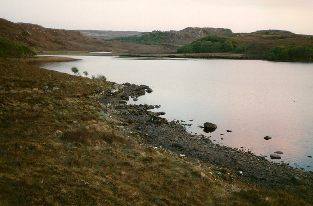
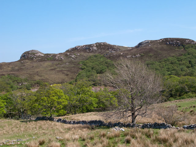
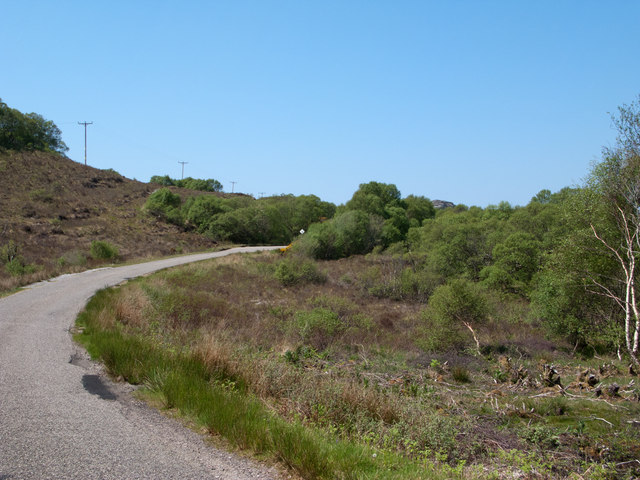
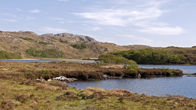
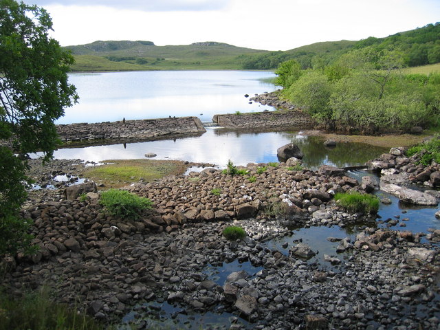
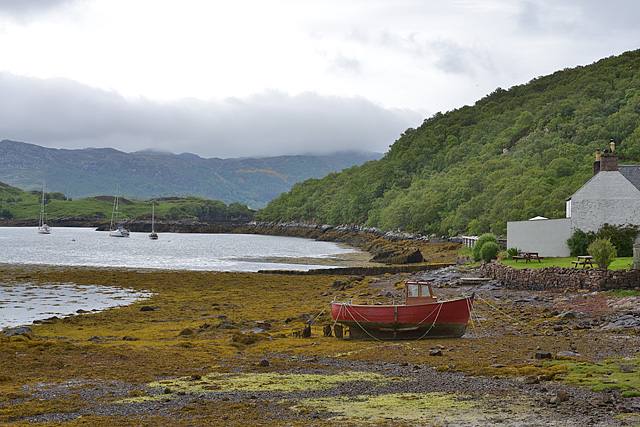
Cammassie Wood is a stunning forest located in Ross-shire, Scotland. Covering an area of approximately 200 acres, it is nestled within the picturesque countryside of the Scottish Highlands. The wood is known for its diverse and abundant wildlife, making it a popular destination for nature enthusiasts and outdoor lovers.

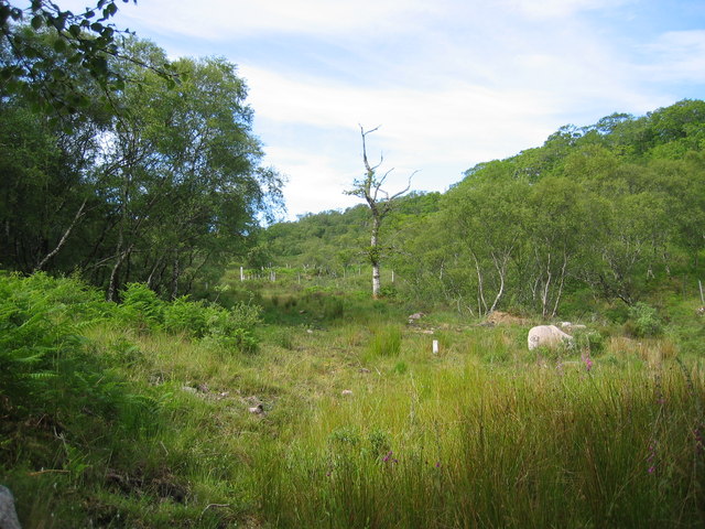
The woodland is predominantly composed of native tree species such as oak, birch, and rowan. These trees create a dense and lush canopy, providing a habitat for a variety of bird species, including woodpeckers, thrushes, and owls. Additionally, the forest floor is adorned with a vibrant carpet of wildflowers during the spring and summer months, adding a burst of color to the landscape.

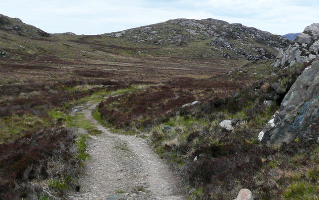
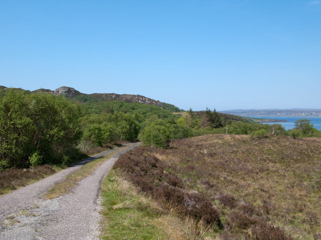
Exploring Cammassie Wood offers visitors a chance to immerse themselves in the tranquility of nature. There are several well-maintained walking trails that wind through the forest, providing opportunities to observe the local flora and fauna up close. The trails vary in difficulty, catering to both casual strollers and more experienced hikers.

In addition to its natural beauty, Cammassie Wood also holds historical significance. The remains of an ancient settlement can be found within the woodland, offering a glimpse into the area's past. These archaeological remnants add an extra layer of intrigue and fascination to the forest.

Overall, Cammassie Wood is a captivating destination that showcases the natural wonders of the Scottish Highlands. Its combination of breathtaking scenery, diverse wildlife, and historical significance make it a must-visit location for anyone seeking a peaceful and enriching outdoor experience.

If you have any feedback on the listing, please let us know in the comments section below.

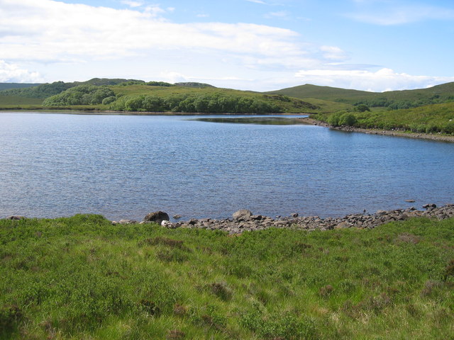
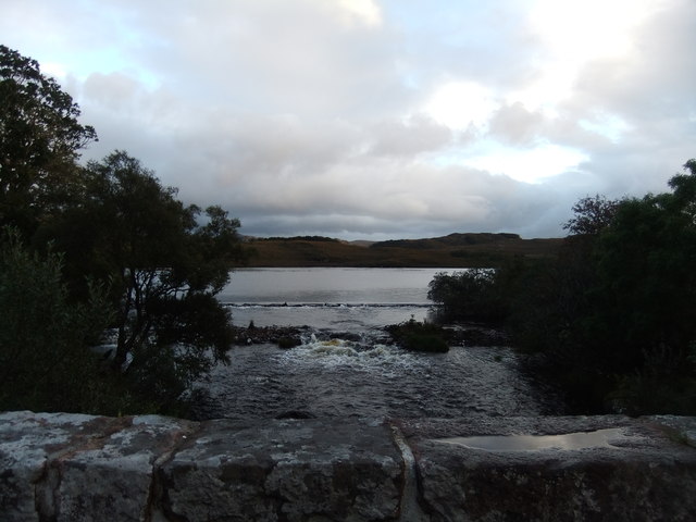
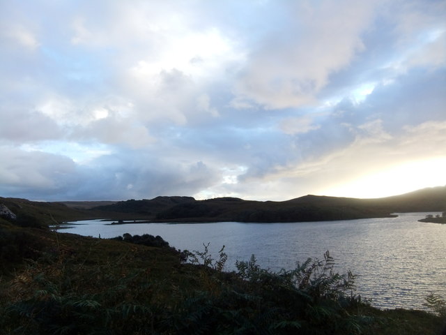
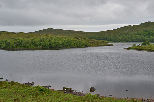
Cammassie Wood Images

Images are sourced within 2km of 57.688773/-5.6973475 or Grid Reference NG7972. Thanks to Geograph Open Source API. All images are credited.

Loch Bad a' Chrotha
Loch Bad a' Chrotha
Estate road passing Creag an Fhithich This road leaves the B8056 near to Loch Shieldaig and heads south towards Loch Bràigh Horrisdale which lies behind the camera position.
Estate road passing Creag an Fhithich
This road leaves the B8056 near to Loch Shieldaig and heads south towards Loch Bràigh Horrisdale which lies behind the camera position.
Lochan Fuar Lochan Fuar as seen from an estate road passing on its east side. The cragged knoll at the right side of the image is Creag an Fhithich, one of two knolls so named overlooking this sheet of water.
Lochan Fuar
Lochan Fuar as seen from an estate road passing on its east side. The cragged knoll at the right side of the image is Creag an Fhithich, one of two knolls so named overlooking this sheet of water.
An Torr An Torr is a minor hill rising to just 96m, lying east of the village of Badachro.
An Torr
An Torr is a minor hill rising to just 96m, lying east of the village of Badachro.
Road descending to Camas na h-Airigh The road leaves the B8056 near to Badachro giving access to the few homes above the bay. Loch Gairloch lies in the distance.
Road descending to Camas na h-Airigh
The road leaves the B8056 near to Badachro giving access to the few homes above the bay. Loch Gairloch lies in the distance.
B8056 above Leacnasaide Leacnasaide is a small community above Loch Shieldaig; the B8056 is seen here passing above it on its way to Red Point.
B8056 above Leacnasaide
Leacnasaide is a small community above Loch Shieldaig; the B8056 is seen here passing above it on its way to Red Point.
Loch Bad a' Chròtha Loch Bad a' Chròtha as seen from close to the B8032. A promontory bearing a few trees juts into the water; seen at its base are the remains of ancient trees preserved in peat bog and now exposed again.
Loch Bad a' Chròtha
Loch Bad a' Chròtha as seen from close to the B8032. A promontory bearing a few trees juts into the water; seen at its base are the remains of ancient trees preserved in peat bog and now exposed again.
Woodland above Leacnasaide
Scrubland near Leacnasaide
Weir at Loch Bad a' Chrotha
Loch Bad a' Chrotha
Loch Bad a' Chrotha
Weir at Loch Badachro
Loch Bad a Chrotha
Loch Bad a Chrotha
Loch Bad a' Chròtha Looking directly across the eastern half of the loch.
Loch Bad a' Chròtha
Looking directly across the eastern half of the loch.
The eastern shore of Loch Bad a' Chròtha
Badachro shoreline, boat and pub With the Badachro Inn on the right.
Badachro shoreline, boat and pub
With the Badachro Inn on the right.
Boats at anchor off Badachro Making full use of the sheltered anchorage.
Boats at anchor off Badachro
Making full use of the sheltered anchorage.
Wreck at Badachro
Wreck at Badachro
Show me another place!

Cammassie Wood is located at Grid Ref: NG7972 (Lat: 57.688773, Lng: -5.6973475)

Unitary Authority: Highland

Police Authority: Highlands and Islands

What 3 Words

///yield.utter.juror. Near Gairloch, Highland

Nearby Locations

Cammassie Wood Leacnasaide

Related Wikis

Broadford Beds Formation

The Broadford Beds Formation is a Sinemurian geologic formation in western Scotland. An indeterminate partial tibia of a theropod dinosaur are among the...

Fairy Lochs

The Fairy Lochs is a recent English name for Na Lochan Sgeireach and are a small group of freshwater lochans approximately 2 mi (3.2 km) south-east of...

Badachro

Badachro (Scottish Gaelic: Bad a' Chrò) is a former fishing village, in the northwest Highlands of Scotland. == Geography == Badachro sits about 3 km south...

Eilean Horrisdale

Eilean Horrisdale is an uninhabited island in Loch Gairloch in Wester Ross, Scotland. == Geography == Eilean Horrisdale is the largest island in Loch Gairloch...

Nearby Amenities

Located within 500m of 57.688773,-5.6973475
Source: PGS
Lat/Long: 57.6904511/-5.6901674
Source: PGS
Lat/Long: 57.6905457/-5.6909432
Source: PGS
Lat/Long: 57.690696/-5.6915722
Source: PGS
Lat/Long: 57.6908488/-5.6916246
Source: PGS
Lat/Long: 57.6913123/-5.6915766
Created By: almien_coastlines
Source: PGS
Lat/Long: 57.691505/-5.691801
Created By: almien_coastlines
Source: PGS
Lat/Long: 57.692007/-5.692317
Source: PGS
Lat/Long: 57.6922247/-5.6923502
Druimdarroch
Place: locality
Lat/Long: 57.6925378/-5.6940635
Barrier: cattle_grid
Bicycle: yes
Foot: yes
Motorcar: yes
Motorcycle: yes
Lat/Long: 57.6921198/-5.6941784
Post Box
Ref: IV21 239
Source: survey
Lat/Long: 57.6918785/-5.6940783
Power: pole
Lat/Long: 57.6925937/-5.7013633
Power: pole
Lat/Long: 57.692304/-5.7001989
Power: pole
Lat/Long: 57.6920255/-5.6991052
Power: pole
Lat/Long: 57.6917602/-5.6980649
Power: pole
Lat/Long: 57.6915562/-5.6972632
Power: pole
Lat/Long: 57.6912154/-5.6959061
Power: pole
Lat/Long: 57.6910053/-5.6950433
Power: pole
Lat/Long: 57.6908053/-5.6942894
Power: pole
Lat/Long: 57.6904503/-5.693022
Power: pole
Lat/Long: 57.6901503/-5.6918423
Power: pole
Lat/Long: 57.6892321/-5.6898782
Power: pole
Lat/Long: 57.6915394/-5.6956017
Power: pole
Lat/Long: 57.6918563/-5.6953235
Power: pole
Lat/Long: 57.6919843/-5.6953143
Power: pole
Lat/Long: 57.6923557/-5.6957697
Power: pole
Lat/Long: 57.6927509/-5.6962448
Power: pole
Lat/Long: 57.6931139/-5.6966937
Power: pole
Lat/Long: 57.6921214/-5.6948733
Power: pole
Lat/Long: 57.6924081/-5.6939965
The data included in this document is from www.openstreetmap.org. The data is made available under ODbL.

Have you been to Cammassie Wood?

Leave your review of Cammassie Wood below (or comments, questions and feedback).