Lawley Common

Settlement in Shropshire

England

Lawley Common

At the end of Fifth Avenue Here the Fifth Avenue joins Grange Road.
At the end of Fifth Avenue Credit: Richard Law

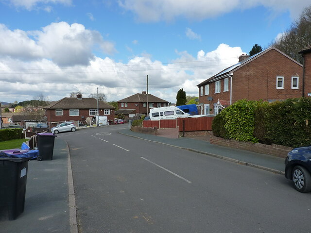
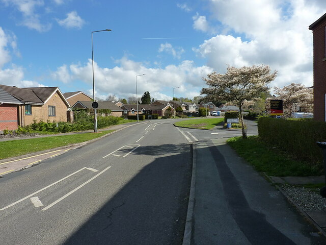
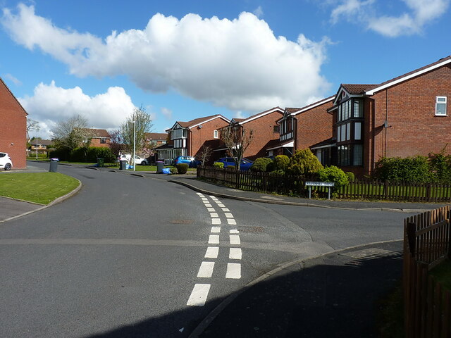
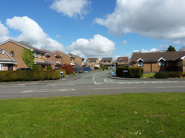
Lawley Common is a small village located in the county of Shropshire, England. Situated approximately 3 miles southwest of the town of Telford, Lawley Common is a rural community surrounded by picturesque countryside.

The village is known for its peaceful and idyllic setting, offering a quiet retreat from the hustle and bustle of urban life. It is characterized by its charming cottages and traditional architecture, giving it a quintessentially English feel. The village is surrounded by green fields and woodlands, providing ample opportunities for outdoor activities such as walking, cycling, and horse riding.

Lawley Common is well-connected to the nearby town of Telford, which offers a wide range of amenities including shops, restaurants, and leisure facilities. The village itself has a small convenience store and a local pub, serving as a focal point for the community.

Historically, Lawley Common was primarily an agricultural community, with farming playing an important role in its economy. However, in recent years, the village has seen some residential development, attracting new residents looking for a peaceful countryside lifestyle within easy reach of urban amenities.

Overall, Lawley Common is a charming and tranquil village, offering a relaxed and rural way of life. With its beautiful surroundings and close proximity to Telford, it is an attractive place to live for those seeking a balance between countryside living and urban convenience.

If you have any feedback on the listing, please let us know in the comments section below.

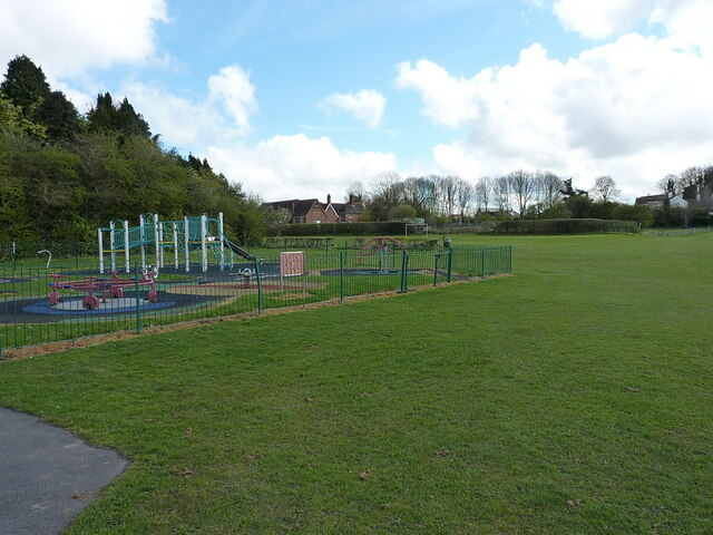
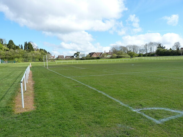
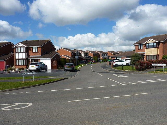
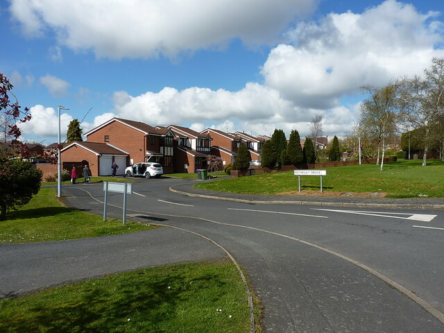
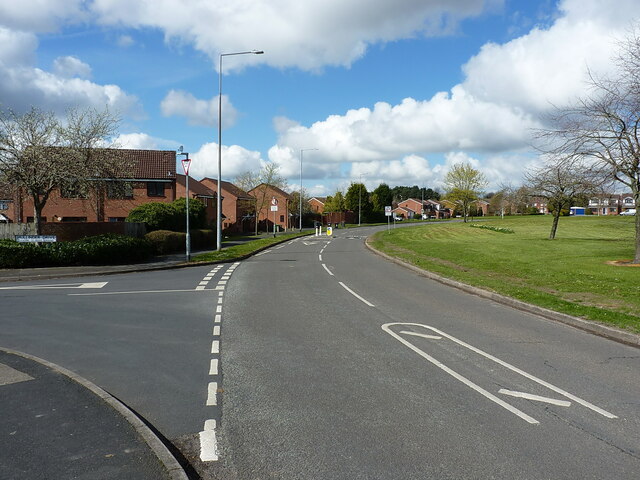
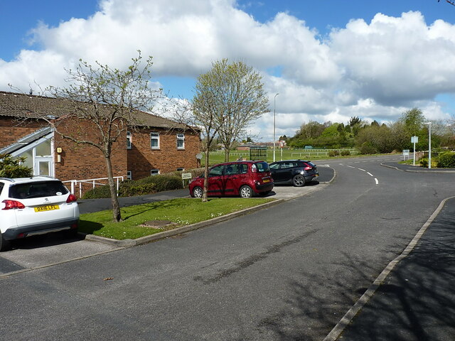
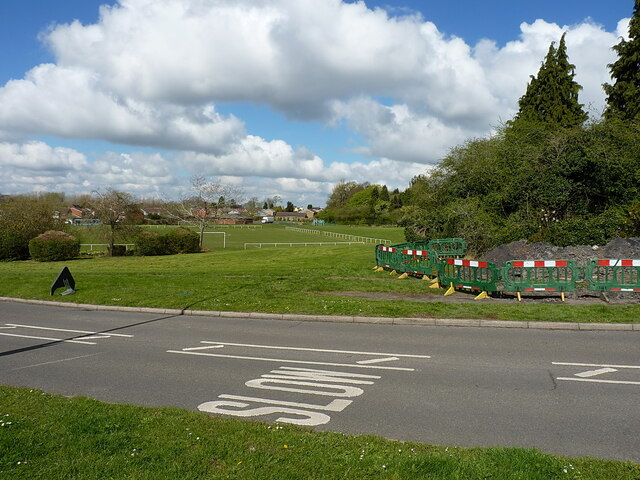
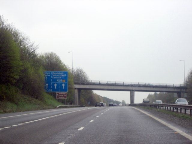
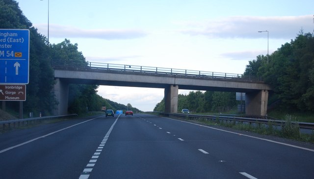
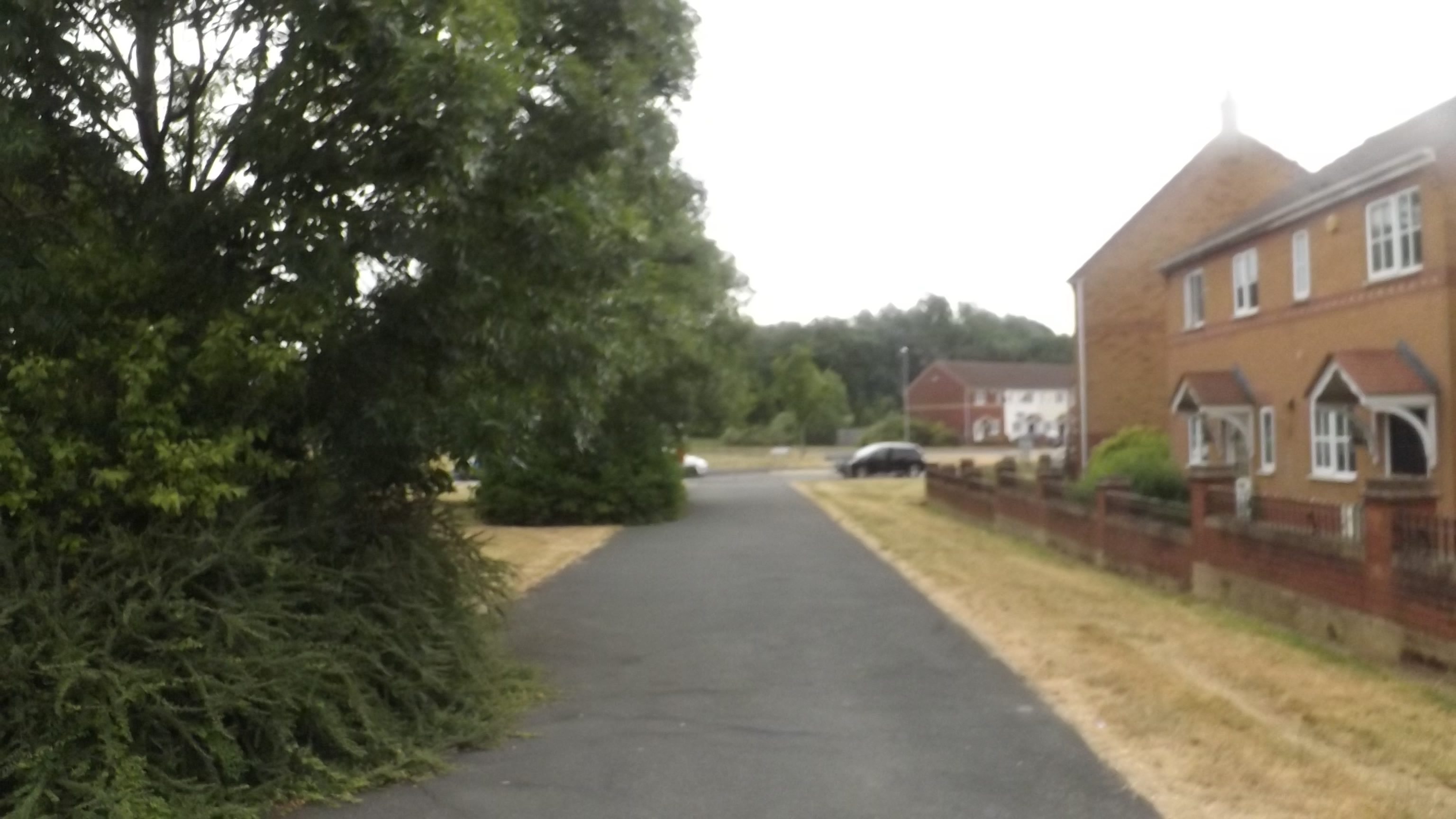
Lawley Common Images

Images are sourced within 2km of 52.67384/-2.4740849 or Grid Reference SJ6808. Thanks to Geograph Open Source API. All images are credited.

At the end of Fifth Avenue Here the Fifth Avenue joins Grange Road.
At the end of Fifth Avenue
Here the Fifth Avenue joins Grange Road.
New houses on Mossey Green
Bank Way at the junction of Ryebank Road New houses on the Mosseygreen estate at Ketley Bank.
Bank Way at the junction of Ryebank Road
New houses on the Mosseygreen estate at Ketley Bank.
Ryebank Road at the junction with Ravenhill Drive New houses on the Mosseygreen estate in Ketley Bank.
Ryebank Road at the junction with Ravenhill Drive
New houses on the Mosseygreen estate in Ketley Bank.
Looking north along Weavers Rise
The corner of a play area on the recreation ground Much of the open space here is marked out as football pitches, but this corner is reserved for the smaller childrens' play area.
The corner of a play area on the recreation ground
Much of the open space here is marked out as football pitches, but this corner is reserved for the smaller childrens' play area.
Another football pitch A lightly different view of the area shown in <a href="https://www.geograph.org.uk/photo/7141161">SJ6910 : Football pitch marked out on the playing fields of Ketley Bank</a>, much of which is landscaped from disused mining spoil.
Another football pitch
A lightly different view of the area shown in SJ6910 : Football pitch marked out on the playing fields of Ketley Bank, much of which is landscaped from disused mining spoil.
Looking west along Redburn Close New houses on the Mosseygreen estate at Ketley Bank.
Looking west along Redburn Close
New houses on the Mosseygreen estate at Ketley Bank.
Rothesay Grove New houses on the Mosseygreen estate at Ketley Bank
Rothesay Grove
New houses on the Mosseygreen estate at Ketley Bank
West along Bank Way at the junction with Mullinder Drive
Car park for sheltered housing in Sadlers Fold These houses around Sadlers Fold are mostly sheltered housing for elderly and vulnerable residents of the area.
Car park for sheltered housing in Sadlers Fold
These houses around Sadlers Fold are mostly sheltered housing for elderly and vulnerable residents of the area.
Maintenance work on the corner of the recreation field It wasn't immediately clear what the works here were in aid of, but quite a deep excavation had been made behind the fencing.
Maintenance work on the corner of the recreation field
It wasn't immediately clear what the works here were in aid of, but quite a deep excavation had been made behind the fencing.
M54 Eastbound Junction 5 One Third of a Mile
M54, Junction 6 The M54 is a 23 mile east-west motorway in Shropshire and Staffordshire. It is a two-lane dual carriageway for the majority of its length, with sections of three-lane.
The M54 spur connects the M6 motorway near Essington, Staffordshire with the A5 trunk road at Wellington, Shropshire. The motorway forms part of the route to North Wales, roughly following the path of the Roman Watling Street and the A5 north-westwards, towards the port of Holyhead.
M54, Junction 6
The M54 is a 23 mile east-west motorway in Shropshire and Staffordshire. It is a two-lane dual carriageway for the majority of its length, with sections of three-lane. The M54 spur connects the M6 motorway near Essington, Staffordshire with the A5 trunk road at Wellington, Shropshire. The motorway forms part of the route to North Wales, roughly following the path of the Roman Watling Street and the A5 north-westwards, towards the port of Holyhead.
M54, eastbound The M54 is a 23 mile east-west motorway in Shropshire and Staffordshire. It is a two-lane dual carriageway for the majority of its length, with sections of three-lane.
The M54 spur connects the M6 motorway near Essington, Staffordshire with the A5 trunk road at Wellington, Shropshire. The motorway forms part of the route to North Wales, roughly following the path of the Roman Watling Street and the A5 north-westwards, towards the port of Holyhead.
M54, eastbound
The M54 is a 23 mile east-west motorway in Shropshire and Staffordshire. It is a two-lane dual carriageway for the majority of its length, with sections of three-lane. The M54 spur connects the M6 motorway near Essington, Staffordshire with the A5 trunk road at Wellington, Shropshire. The motorway forms part of the route to North Wales, roughly following the path of the Roman Watling Street and the A5 north-westwards, towards the port of Holyhead.
M54, Garfield Road Bridge The M54 is a 23 mile east-west motorway in Shropshire and Staffordshire. It is a two-lane dual carriageway for the majority of its length, with sections of three-lane.
The M54 spur connects the M6 motorway near Essington, Staffordshire with the A5 trunk road at Wellington, Shropshire. The motorway forms part of the route to North Wales, roughly following the path of the Roman Watling Street and the A5 north-westwards, towards the port of Holyhead.
M54, Garfield Road Bridge
The M54 is a 23 mile east-west motorway in Shropshire and Staffordshire. It is a two-lane dual carriageway for the majority of its length, with sections of three-lane. The M54 spur connects the M6 motorway near Essington, Staffordshire with the A5 trunk road at Wellington, Shropshire. The motorway forms part of the route to North Wales, roughly following the path of the Roman Watling Street and the A5 north-westwards, towards the port of Holyhead.
M54, Mossey Green Bridge The M54 is a 23 mile east-west motorway in Shropshire and Staffordshire. It is a two-lane dual carriageway for the majority of its length, with sections of three-lane.
The M54 spur connects the M6 motorway near Essington, Staffordshire with the A5 trunk road at Wellington, Shropshire. The motorway forms part of the route to North Wales, roughly following the path of the Roman Watling Street and the A5 north-westwards, towards the port of Holyhead.
M54, Mossey Green Bridge
The M54 is a 23 mile east-west motorway in Shropshire and Staffordshire. It is a two-lane dual carriageway for the majority of its length, with sections of three-lane. The M54 spur connects the M6 motorway near Essington, Staffordshire with the A5 trunk road at Wellington, Shropshire. The motorway forms part of the route to North Wales, roughly following the path of the Roman Watling Street and the A5 north-westwards, towards the port of Holyhead.
Show me another place!

Lawley Common is located at Grid Ref: SJ6808 (Lat: 52.67384, Lng: -2.4740849)

Unitary Authority: Telford and Wrekin

Police Authority: West Merica

What 3 Words

///tiny.carver.scooters. Near Telford, Shropshire

Related Wikis

Lawley Bank railway station

Lawley Bank railway station was a station to the north of Horsehay, Shropshire, England. The station was opened in 1859 and closed in 1962. == References... ==

Springwell Pit disaster

The Springwell Pit disaster occurred on 6 December 1872 at Springwell coal mining pit near Dawley, Shropshire (now part of Telford). Miners at the pit...

New Dale Halt railway station

New Dale Halt railway station was a station to the south of Ketley, Shropshire, England. The station was opened in 1934 and closed in 1962. == References... ==

Malinslee

Malinslee is an estate in the town of Telford and Wrekin, Shropshire, England. It is near the Town Park and Telford Shopping Centre, and next to the Dawley...

Thomas Telford School

Thomas Telford School is a City Technology College in Telford, Shropshire and is sponsored by The Mercers Company and Tarmac Holdings Limited. == History... ==

Telford Steam Railway

The Telford Steam Railway (TSR) is a heritage railway located at Horsehay, Telford in Shropshire, England, formed in 1976. The railway is operated by volunteers...

Dawley

Dawley ( DAW-lee) is a constituent town of Telford and a civil parish in the borough of Telford and Wrekin, Shropshire, England. It was originally, in...

Horsehay and Dawley railway station

Horsehay and Dawley railway station was a station in Horsehay, Shropshire, England. The station was opened in 1859, closed in 1962, then reopened in 1976...

Nearby Amenities

Located within 500m of 52.67384,-2.4740849
Lawley Bank
Is In: Telford
Place: suburb
Lat/Long: 52.6730516/-2.4760728
Turning Circle
Lat/Long: 52.6766599/-2.4689671
Traffic Calming: choker
Lat/Long: 52.6770502/-2.4715282
Traffic Calming: choker
Lat/Long: 52.6770921/-2.4740513
Dawley Bank
Is In: Telford
Place: suburb
Source: OS_OpenData_StreetView
Lat/Long: 52.6759041/-2.469822
Mini Roundabout
Lat/Long: 52.673835/-2.478669
Traffic Signals
Lat/Long: 52.6765402/-2.4793979
Railway: buffer_stop
Lat/Long: 52.6717466/-2.4800226
Railway: buffer_stop
Lat/Long: 52.6717401/-2.4800744
Barrier: bollard
Lat/Long: 52.6700092/-2.4718749
Traffic Signals
Lat/Long: 52.6768207/-2.4790641
Traffic Signals
Lat/Long: 52.6769737/-2.4793922
Lawley Village
Railway: station
Usage: tourism
Lat/Long: 52.6714844/-2.4799836
Pub
Bulls Head
Addr City: Telford
Addr Postcode: TF4 2LJ
Addr Street: Milners Lane
Addr Suburb: Dawley Bank
Fhrs Id: 1212324
Source Addr: FHRS Open Data
Lat/Long: 52.6727881/-2.4704624
Pub
Wrekin View
Addr City: Telford
Addr Postcode: TF4 2JH
Addr Street: Milners Lane
Addr Suburb: Dawley Bank
Fhrs Id: 997354
Source Addr: FHRS Open Data
Lat/Long: 52.6737334/-2.4702137
Crossing
Lat/Long: 52.6744119/-2.4796624
Crossing
Crossing: traffic_signals
Crossing Ref: toucan
Lat/Long: 52.6774183/-2.4776221
Crossing
Crossing: traffic_signals
Crossing Ref: toucan
Lat/Long: 52.6774791/-2.4776871
Crossing
Crossing: pedestrian_signals
Lat/Long: 52.67662/-2.479861
Barrier: bollard
Lat/Long: 52.6721739/-2.4680373
Generator Method: photovoltaic
Generator Output Electricity: yes
Generator Source: solar
Generator Type: solar_photovoltaic_panel
Location: roof
Power: generator
Lat/Long: 52.6766211/-2.4736807
Generator Method: photovoltaic
Generator Output Electricity: yes
Generator Source: solar
Generator Type: solar_photovoltaic_panel
Location: roof
Power: generator
Lat/Long: 52.6767366/-2.4734795
Generator Method: photovoltaic
Generator Output Electricity: yes
Generator Source: solar
Generator Type: solar_photovoltaic_panel
Location: roof
Power: generator
Lat/Long: 52.6773221/-2.4722537
Generator Method: photovoltaic
Generator Output Electricity: yes
Generator Source: solar
Generator Type: solar_photovoltaic_panel
Location: roof
Power: generator
Lat/Long: 52.6775741/-2.4719963
Generator Method: photovoltaic
Generator Output Electricity: yes
Generator Source: solar
Generator Type: solar_photovoltaic_panel
Location: roof
Power: generator
Lat/Long: 52.6695104/-2.4722003
Generator Method: photovoltaic
Generator Output Electricity: yes
Generator Source: solar
Generator Type: solar_photovoltaic_panel
Location: roof
Power: generator
Lat/Long: 52.6705109/-2.4721116
Generator Method: photovoltaic
Generator Output Electricity: yes
Generator Source: solar
Generator Type: solar_photovoltaic_panel
Location: roof
Power: generator
Lat/Long: 52.6704751/-2.4717924
Generator Method: photovoltaic
Generator Output Electricity: yes
Generator Source: solar
Generator Type: solar_photovoltaic_panel
Location: roof
Power: generator
Lat/Long: 52.6725098/-2.4704379
Generator Method: photovoltaic
Generator Output Electricity: yes
Generator Source: solar
Generator Type: solar_photovoltaic_panel
Location: roof
Power: generator
Lat/Long: 52.6733978/-2.4699283
Generator Method: photovoltaic
Generator Output Electricity: yes
Generator Source: solar
Generator Type: solar_photovoltaic_panel
Location: roof
Power: generator
Lat/Long: 52.6741524/-2.4688527
Generator Method: photovoltaic
Generator Output Electricity: yes
Generator Source: solar
Generator Type: solar_photovoltaic_panel
Location: roof
Power: generator
Lat/Long: 52.6741475/-2.4689466
Generator Method: photovoltaic
Generator Output Electricity: yes
Generator Source: solar
Generator Type: solar_photovoltaic_panel
Location: roof
Power: generator
Lat/Long: 52.6742158/-2.4719426
Generator Method: photovoltaic
Generator Output Electricity: yes
Generator Source: solar
Generator Type: solar_photovoltaic_panel
Location: roof
Power: generator
Lat/Long: 52.6742419/-2.4727446
Generator Method: photovoltaic
Generator Output Electricity: yes
Generator Source: solar
Generator Type: solar_photovoltaic_panel
Location: roof
Power: generator
Lat/Long: 52.6727928/-2.4715322
Generator Method: photovoltaic
Generator Output Electricity: yes
Generator Source: solar
Generator Type: solar_photovoltaic_panel
Location: roof
Power: generator
Lat/Long: 52.6751347/-2.479037
Generator Method: photovoltaic
Generator Output Electricity: yes
Generator Source: solar
Generator Type: solar_photovoltaic_panel
Location: roof
Power: generator
Lat/Long: 52.6751038/-2.4791095
Generator Method: photovoltaic
Generator Output Electricity: yes
Generator Source: solar
Generator Type: solar_photovoltaic_panel
Location: roof
Power: generator
Lat/Long: 52.6739003/-2.4796593
Generator Method: photovoltaic
Generator Output Electricity: yes
Generator Source: solar
Generator Type: solar_photovoltaic_panel
Location: roof
Power: generator
Lat/Long: 52.6736645/-2.4801904
Generator Method: photovoltaic
Generator Output Electricity: yes
Generator Source: solar
Generator Type: solar_photovoltaic_panel
Location: roof
Power: generator
Lat/Long: 52.6733766/-2.4800965
Crossing
Crossing: unmarked
Lat/Long: 52.6779771/-2.4754535
Traffic Signals
Traffic Signals: signal
Lat/Long: 52.6778233/-2.4757981
Traffic Signals
Traffic Signals: signal
Lat/Long: 52.6778123/-2.4750109
Traffic Signals
Traffic Signals Direction: backward
Lat/Long: 52.678/-2.4754569
Crossing
Lat/Long: 52.6711912/-2.4699388
Bench
Backrest: yes
Lat/Long: 52.6729389/-2.4708137
Crossing
Crossing: traffic_signals
Lat/Long: 52.6777604/-2.4755397
The data included in this document is from www.openstreetmap.org. The data is made available under ODbL.

Have you been to Lawley Common?

Leave your review of Lawley Common below (or comments, questions and feedback).