Heath Hill

Hill, Mountain in Shropshire

England

Heath Hill

Telford International Hotel Typical modern sleeping facility.
Telford International Hotel Credit: Robert Struthers

Heath Hill is a small hill located in the county of Shropshire, England. Situated within the Bridgnorth district, it is part of the larger Shropshire Hills Area of Outstanding Natural Beauty. With an elevation of approximately 193 meters (633 feet), it is not considered a mountain but rather a hill.

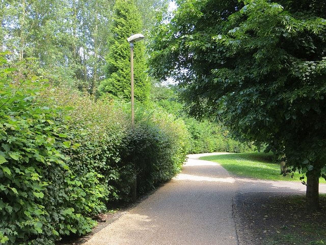
Heath Hill is characterized by its picturesque landscapes and rolling green hills, offering visitors stunning panoramic views of the surrounding countryside. The hill is covered in heathland vegetation, which includes heather, gorse, and various grasses, giving it its distinctive name. This unique habitat supports a diverse range of wildlife, including rare species such as the red grouse and the green hairstreak butterfly.

The hill is a popular destination for outdoor enthusiasts, providing ample opportunities for hiking, walking, and wildlife spotting. There are several well-marked trails that crisscross the area, allowing visitors to explore the hill and its surroundings at their own pace. Additionally, there are designated picnic areas that offer a chance to relax and enjoy the peaceful atmosphere.

Heath Hill is easily accessible by road, with ample parking available nearby. It is located just a short distance from the village of Highley, which offers amenities such as shops, cafes, and accommodation for those looking to spend more time in the area.

Overall, Heath Hill is a beautiful natural landmark in Shropshire, offering visitors a chance to immerse themselves in the region's stunning countryside and diverse wildlife.

If you have any feedback on the listing, please let us know in the comments section below.
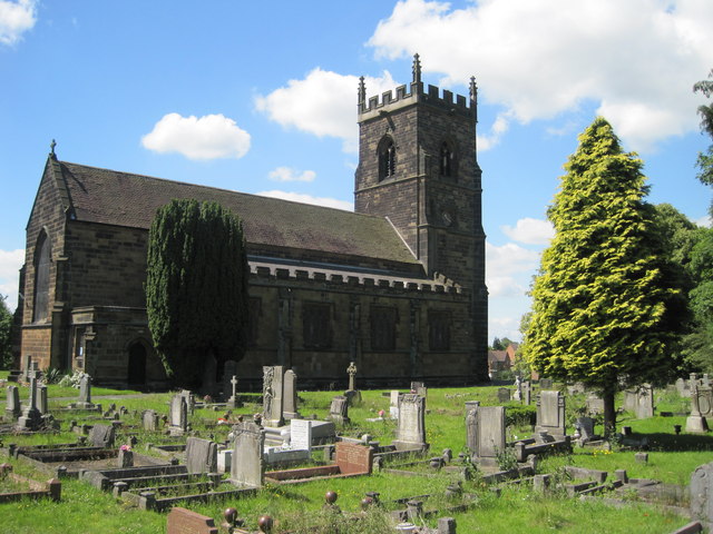
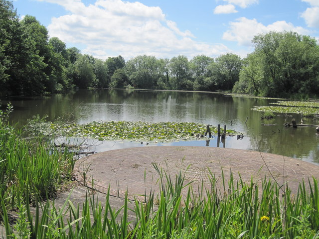
Heath Hill Images

Images are sourced within 2km of 52.669682/-2.470757 or Grid Reference SJ6808. Thanks to Geograph Open Source API. All images are credited.

Telford International Hotel Typical modern sleeping facility.
Telford International Hotel
Typical modern sleeping facility.
M54 Eastbound Junction 5 One Third of a Mile
M54, Mossey Green Bridge The M54 is a 23 mile east-west motorway in Shropshire and Staffordshire. It is a two-lane dual carriageway for the majority of its length, with sections of three-lane.
The M54 spur connects the M6 motorway near Essington, Staffordshire with the A5 trunk road at Wellington, Shropshire. The motorway forms part of the route to North Wales, roughly following the path of the Roman Watling Street and the A5 north-westwards, towards the port of Holyhead.
M54, Mossey Green Bridge
The M54 is a 23 mile east-west motorway in Shropshire and Staffordshire. It is a two-lane dual carriageway for the majority of its length, with sections of three-lane. The M54 spur connects the M6 motorway near Essington, Staffordshire with the A5 trunk road at Wellington, Shropshire. The motorway forms part of the route to North Wales, roughly following the path of the Roman Watling Street and the A5 north-westwards, towards the port of Holyhead.
Telford Town Park A more formal part of the park on landscaped colliery sites.
Telford Town Park
A more formal part of the park on landscaped colliery sites.
Stirchley Chimney An iconic landmark, this chimney provides a permanent reminder of the industry that once covered the whole area of the Town Park.
Constructed of Randley brick in 1873 by the Old Park Iron Co., the chimney is approximately 209 feet (64 metres) high.
Stirchley Chimney
An iconic landmark, this chimney provides a permanent reminder of the industry that once covered the whole area of the Town Park. Constructed of Randley brick in 1873 by the Old Park Iron Co., the chimney is approximately 209 feet (64 metres) high.
One of the entrances to Wonderland Wonderland is an adventure playground type attraction within the Town Park. <span class="nowrap"><a title="http://www.wonderlandmidlands.com/" rel="nofollow ugc noopener" href="http://www.wonderlandmidlands.com/">Link</a><img style="margin-left:2px;" alt="External link" title="External link - shift click to open in new window" src="https://s1.geograph.org.uk/img/external.png" width="10" height="10"/></span>
One of the entrances to Wonderland
Wonderland is an adventure playground type attraction within the Town Park. LinkExternal link
Mossey Greenway crosses the M54
M54 Motorway - Garfield Road overbridge
Spout Farm House: isolated The Southwater development has removed the pool and left Spout Farm House isolated in a wasted land.
Spout Farm House: isolated
The Southwater development has removed the pool and left Spout Farm House isolated in a wasted land.
Southwater Development The pool has been removed and the ground is being cleared in preparation for the Southwater Development, planned to include a palatial council office building.  Following the May 2011 council election, the party now in power is reviewing this and says that the hundreds of millions of pounds involved might be better spent elsewhere - or not spent at all.  This sea of mud may become a permanent feature.  <a href="https://www.geograph.org.uk/photo/2408098">SJ6908 : Spout Farm House: isolated</a> (centre) remains.
Southwater Development
The pool has been removed and the ground is being cleared in preparation for the Southwater Development, planned to include a palatial council office building. Following the May 2011 council election, the party now in power is reviewing this and says that the hundreds of millions of pounds involved might be better spent elsewhere - or not spent at all. This sea of mud may become a permanent feature. SJ6908 : Spout Farm House: isolated (centre) remains.
Dawley High St This image was taken during the late afternoon, early evening during mid-week. During 2010 and 2011 the outgoing (Tory) council spent tens if not hundreds of thousands of Council Tax payers Pounds sterling on bringing life back to the town centre. This seems to be the result - typical. Or is it a case of the law of unintended consequences.
Dawley High St
This image was taken during the late afternoon, early evening during mid-week. During 2010 and 2011 the outgoing (Tory) council spent tens if not hundreds of thousands of Council Tax payers Pounds sterling on bringing life back to the town centre. This seems to be the result - typical. Or is it a case of the law of unintended consequences.
Church of the Holy Trinity The sandstone church of the Holy Trinity in Dawley was built 1845 and was designed by Harvey Eginton of Worcester. It replaced Dawley's old Norman church which stood a little to the south-east of the present church. The earliest part of the church is probably its font, which dates back to the Norman period (12th-century).
Church of the Holy Trinity
The sandstone church of the Holy Trinity in Dawley was built 1845 and was designed by Harvey Eginton of Worcester. It replaced Dawley's old Norman church which stood a little to the south-east of the present church. The earliest part of the church is probably its font, which dates back to the Norman period (12th-century).
Church of the Holy Trinity
Old Park Primitive Methodist Old Park Primitive Methodist (Bethesda) dated 1857, now used as commercial premises.
Old Park Primitive Methodist
Old Park Primitive Methodist (Bethesda) dated 1857, now used as commercial premises.
Withy Pool, Town Park
Public Art, Town Park Public Art in the Chelsea Gardens, Town Park.
Public Art, Town Park
Public Art in the Chelsea Gardens, Town Park.
Public Art, Town Park Public Art in the Chelsea Gardens, Town Park.
Public Art, Town Park
Public Art in the Chelsea Gardens, Town Park.
Public Art, Town Park Public Art in the Chelsea Gardens, Town Park.
Public Art, Town Park
Public Art in the Chelsea Gardens, Town Park.
Show me another place!

Heath Hill is located at Grid Ref: SJ6808 (Lat: 52.669682, Lng: -2.470757)

Unitary Authority: Telford and Wrekin

Police Authority: West Mercia

What 3 Words

///craft.taking.songbird. Near Telford, Shropshire

Related Wikis

Springwell Pit disaster

The Springwell Pit disaster occurred on 6 December 1872 at Springwell coal mining pit near Dawley, Shropshire (now part of Telford). Miners at the pit...

Dawley

Dawley ( DAW-lee) is a constituent town of Telford and a civil parish in the borough of Telford and Wrekin, Shropshire, England. It was originally, in...

The Telford Langley School

The Telford Langley School is a coeducational secondary school with academy status, located in the Dawley area of Telford in Shropshire, England. Its predecessor...

Malinslee

Malinslee is an estate in the town of Telford and Wrekin, Shropshire, England. It is near the Town Park and Telford Shopping Centre, and next to the Dawley...

Nearby Amenities

Located within 500m of 52.669682,-2.470757
Direction: both
Traffic Calming: cushion
Lat/Long: 52.6675767/-2.4649192
Turning Circle
Lat/Long: 52.6655573/-2.4681691
Turning Circle
Lat/Long: 52.6667058/-2.4665832
Heath Hill
Is In: Telford
Place: suburb
Source: OS_OpenData_StreetView
Lat/Long: 52.6686386/-2.4718947
Barrier: bollard
Lat/Long: 52.6700092/-2.4718749
Livian Autos
Shop: car_parts
Lat/Long: 52.666495/-2.4745462
Pub
Bulls Head
Addr City: Telford
Addr Postcode: TF4 2LJ
Addr Street: Milners Lane
Addr Suburb: Dawley Bank
Fhrs Id: 1212324
Source Addr: FHRS Open Data
Lat/Long: 52.6727881/-2.4704624
Pub
Wrekin View
Addr City: Telford
Addr Postcode: TF4 2JH
Addr Street: Milners Lane
Addr Suburb: Dawley Bank
Fhrs Id: 997354
Source Addr: FHRS Open Data
Lat/Long: 52.6737334/-2.4702137
Generator Method: photovoltaic
Generator Output Biogas: yes
Generator Output Electricity: yes
Generator Source: solar
Generator Type: solar_photovoltaic_panel
Location: roof
Power: generator
Lat/Long: 52.6667177/-2.4675331
Generator Method: photovoltaic
Generator Output Biogas: yes
Generator Output Electricity: yes
Generator Source: solar
Generator Type: solar_photovoltaic_panel
Location: roof
Power: generator
Lat/Long: 52.6675066/-2.4742278
Generator Method: photovoltaic
Generator Output Biogas: yes
Generator Output Electricity: yes
Generator Source: solar
Generator Type: solar_photovoltaic_panel
Location: roof
Power: generator
Lat/Long: 52.6678206/-2.473568
Generator Method: photovoltaic
Generator Output Biogas: yes
Generator Output Electricity: yes
Generator Source: solar
Generator Type: solar_photovoltaic_panel
Location: roof
Power: generator
Lat/Long: 52.6684598/-2.4757835
Generator Method: photovoltaic
Generator Output Biogas: yes
Generator Output Electricity: yes
Generator Source: solar
Generator Type: solar_photovoltaic_panel
Location: roof
Power: generator
Lat/Long: 52.6687168/-2.4747133
Generator Method: photovoltaic
Generator Output Biogas: yes
Generator Output Electricity: yes
Generator Source: solar
Generator Type: solar_photovoltaic_panel
Location: roof
Power: generator
Lat/Long: 52.6688469/-2.4732649
Generator Method: photovoltaic
Generator Output Biogas: yes
Generator Output Electricity: yes
Generator Source: solar
Generator Type: solar_photovoltaic_panel
Location: roof
Power: generator
Lat/Long: 52.6693043/-2.4721002
Barrier: bollard
Lat/Long: 52.6721739/-2.4680373
Generator Method: photovoltaic
Generator Output Electricity: yes
Generator Source: solar
Generator Type: solar_photovoltaic_panel
Location: roof
Power: generator
Lat/Long: 52.669182/-2.4670368
Generator Method: photovoltaic
Generator Output Electricity: yes
Generator Source: solar
Generator Type: solar_photovoltaic_panel
Location: roof
Power: generator
Lat/Long: 52.6694227/-2.4693677
Generator Method: photovoltaic
Generator Output Electricity: yes
Generator Source: solar
Generator Type: solar_photovoltaic_panel
Location: roof
Power: generator
Lat/Long: 52.6687786/-2.4696788
Generator Method: photovoltaic
Generator Output Electricity: yes
Generator Source: solar
Generator Type: solar_photovoltaic_panel
Location: roof
Power: generator
Lat/Long: 52.6685964/-2.4731201
Generator Method: photovoltaic
Generator Output Electricity: yes
Generator Source: solar
Generator Type: solar_photovoltaic_panel
Location: roof
Power: generator
Lat/Long: 52.6695104/-2.4722003
Generator Method: photovoltaic
Generator Output Electricity: yes
Generator Source: solar
Generator Type: solar_photovoltaic_panel
Location: roof
Power: generator
Lat/Long: 52.6705109/-2.4721116
Generator Method: photovoltaic
Generator Output Electricity: yes
Generator Source: solar
Generator Type: solar_photovoltaic_panel
Location: roof
Power: generator
Lat/Long: 52.6704751/-2.4717924
Generator Method: photovoltaic
Generator Output Electricity: yes
Generator Source: solar
Generator Type: solar_photovoltaic_panel
Location: roof
Power: generator
Lat/Long: 52.6725098/-2.4704379
Generator Method: photovoltaic
Generator Output Electricity: yes
Generator Source: solar
Generator Type: solar_photovoltaic_panel
Location: roof
Power: generator
Lat/Long: 52.6733978/-2.4699283
Generator Method: photovoltaic
Generator Output Electricity: yes
Generator Source: solar
Generator Type: solar_photovoltaic_panel
Location: roof
Power: generator
Lat/Long: 52.6727928/-2.4715322
Crossing
Crossing: unmarked
Crossing Island: yes
Tactile Paving: yes
Lat/Long: 52.6664026/-2.4723502
Crossing
Crossing: unmarked
Crossing Island: yes
Tactile Paving: yes
Lat/Long: 52.6662915/-2.4724998
Crossing
Crossing: unmarked
Lat/Long: 52.6688212/-2.4658533
Crossing
Crossing: unmarked
Lat/Long: 52.6689456/-2.4660073
Crossing
Lat/Long: 52.6711912/-2.4699388
Bench
Backrest: yes
Lat/Long: 52.6729389/-2.4708137
Crossing
Crossing: unmarked
Lat/Long: 52.6691815/-2.4647493
Crossing
Crossing: unmarked
Lat/Long: 52.6692734/-2.4647941
Crossing
Crossing: unmarked
Lat/Long: 52.6687613/-2.4652232
Crossing
Crossing: unmarked
Lat/Long: 52.6688048/-2.4650892
Turning Circle
Lat/Long: 52.6685255/-2.4704931
Bench
Lat/Long: 52.669657/-2.4705619
Bench
Lat/Long: 52.6695873/-2.4705195
Direction: both
Traffic Calming: cushion
Lat/Long: 52.6680647/-2.4648841
Direction: both
Traffic Calming: cushion
Lat/Long: 52.6671652/-2.4650322
Direction: both
Traffic Calming: cushion
Lat/Long: 52.6668919/-2.4651046
The data included in this document is from www.openstreetmap.org. The data is made available under ODbL.

Have you been to Heath Hill?

Leave your review of Heath Hill below (or comments, questions and feedback).