Sinclair's Hill

Hill, Mountain in Berwickshire

Scotland

Sinclair's Hill

Benchmark on wall near Rawburn Farm Ordnance Survey benchmark. For database entry, see <span class="nowrap"><a title="https://www.bench-marks.org.uk/bm189613" rel="nofollow ugc noopener" href="https://www.bench-marks.org.uk/bm189613">Link</a><img style="margin-left:2px;" alt="External link" title="External link - shift click to open in new window" src="https://s1.geograph.org.uk/img/external.png" width="10" height="10"/></span>.
Benchmark on wall near Rawburn Farm Credit: Becky Williamson

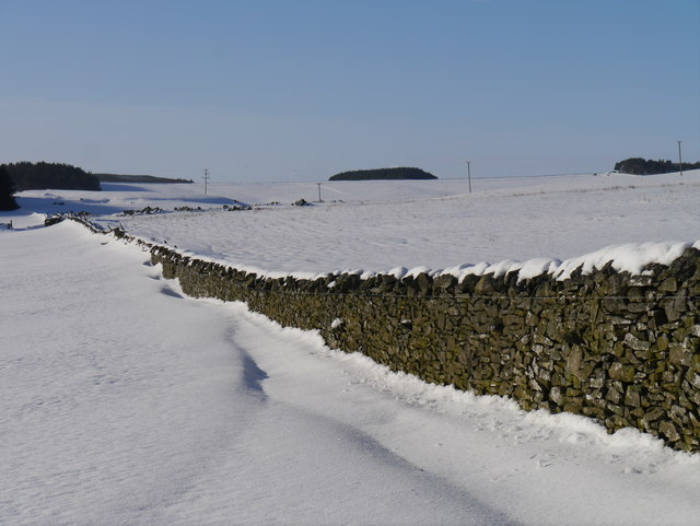
Sinclair's Hill is a prominent hill located in the Scottish Borders region of Berwickshire. It is situated approximately 3 miles northeast of the town of Duns and stands at an elevation of around 178 meters (584 feet). The hill is part of the wider Lammermuir Hills, which are known for their scenic beauty and offer breathtaking views of the surrounding countryside.

Sinclair's Hill is characterized by its gently sloping terrain and is covered in grass and heather, adding to its natural charm. It is a popular destination for walkers and hikers due to its accessibility and well-maintained paths. The hill provides a variety of routes for all abilities, making it suitable for both leisurely strolls and more challenging hikes.

At the summit of Sinclair's Hill, visitors are rewarded with panoramic views of the surrounding landscape, including the rolling hills, picturesque valleys, and the nearby towns and villages. On a clear day, it is even possible to catch a glimpse of the North Sea coastline.

The hill is also of historical significance, as it is said to be the site of a hill fort dating back to the Iron Age. There are remnants of ancient earthworks, which add to the intrigue and sense of history associated with Sinclair's Hill.

Overall, Sinclair's Hill offers a wonderful opportunity to immerse oneself in the natural beauty of the Scottish Borders, enjoy outdoor pursuits, and explore the region's rich history.

If you have any feedback on the listing, please let us know in the comments section below.

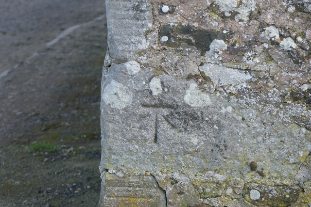
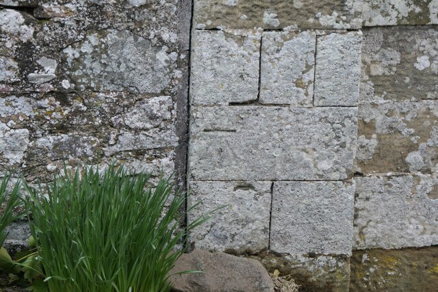
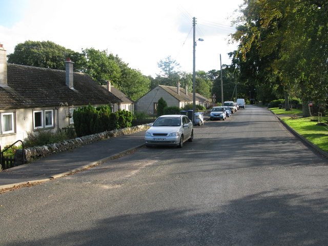
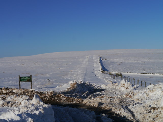
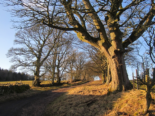
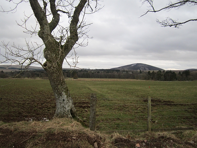
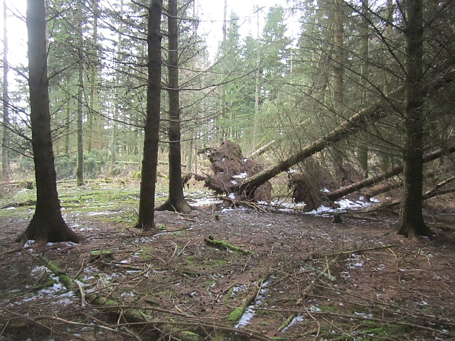
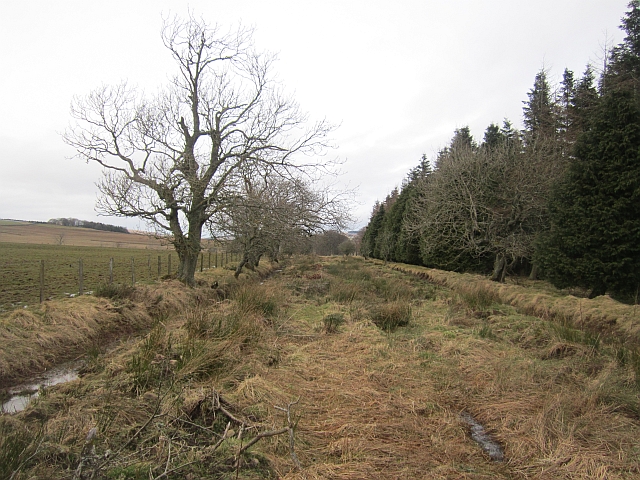
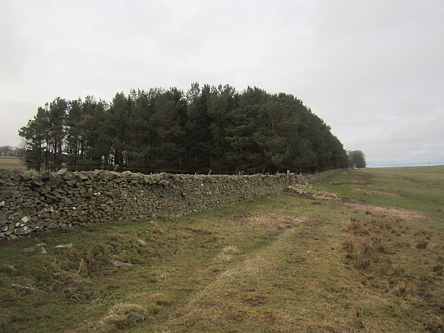
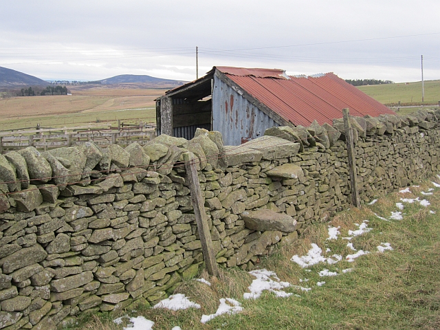
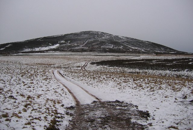
Sinclair's Hill Images

Images are sourced within 2km of 55.814411/-2.5078101 or Grid Reference NT6858. Thanks to Geograph Open Source API. All images are credited.

Benchmark on wall near Rawburn Farm Ordnance Survey benchmark. For database entry, see <span class="nowrap"><a title="https://www.bench-marks.org.uk/bm189613" rel="nofollow ugc noopener" href="https://www.bench-marks.org.uk/bm189613">Link</a><img style="margin-left:2px;" alt="External link" title="External link - shift click to open in new window" src="https://s1.geograph.org.uk/img/external.png" width="10" height="10"/></span>.
Benchmark on wall near Rawburn Farm
Ordnance Survey benchmark. For database entry, see LinkExternal link.
Benchmark, Longformacus House Lodge Ordnance Survey benchmark, described on database at <span class="nowrap"><a title="https://www.bench-marks.org.uk/bm85346" rel="nofollow ugc noopener" href="https://www.bench-marks.org.uk/bm85346">Link</a><img style="margin-left:2px;" alt="External link" title="External link - shift click to open in new window" src="https://s1.geograph.org.uk/img/external.png" width="10" height="10"/></span>.
Benchmark, Longformacus House Lodge
Ordnance Survey benchmark, described on database at LinkExternal link.
Longformacus House Once home of Sir Robert Sinclair, a supporter of the Covenanters.
Longformacus House
Once home of Sir Robert Sinclair, a supporter of the Covenanters.
Road Bridge on the minor road from Longformacus to Watch Water Reservoir Spans Watch Water.
Road Bridge on the minor road from Longformacus to Watch Water Reservoir
Spans Watch Water.
Longformacus Entering Longformacus from the north.
Longformacus
Entering Longformacus from the north.
Road Closed? The road to Gifford from Longformacus is viewed here with the sign indicating the road to Horseupcleuch visible to the left.  A 121 point turn and the use of a shovel was required shortly after this photograph was taken!
Road Closed?
The road to Gifford from Longformacus is viewed here with the sign indicating the road to Horseupcleuch visible to the left. A 121 point turn and the use of a shovel was required shortly after this photograph was taken!
Snow Off A Dyke Melting snow on a drystone dyke north of Longformacus on the slope of Sinclair's Hill.
Snow Off A Dyke
Melting snow on a drystone dyke north of Longformacus on the slope of Sinclair's Hill.
Bus stop, Longformacus
Manse Road, Longformacus A signposted path uses this farm access road.
Manse Road, Longformacus
A signposted path uses this farm access road.
Snowdrops, Longformacus Beside Manse Road.
Snowdrops, Longformacus
Beside Manse Road.
Manse Road
Manse Road
Ash, Muirton The road to Muirton is tree lined. The field was occupied by curlews, geese (species unknown) and peewits.
Ash, Muirton
The road to Muirton is tree lined. The field was occupied by curlews, geese (species unknown) and peewits.
Twiggy's Belt Wind thrown trees in a conifer plantation. Older maps show no woodland here, so the name may be as modern as it sounds.
Twiggy's Belt
Wind thrown trees in a conifer plantation. Older maps show no woodland here, so the name may be as modern as it sounds.
Peat Ford A wide trackway between two ditches. Other than appearing on the Scottish Borders Council core paths map, it is no longer used. If you follow this, you need to jump a few ditches running at right angles across the route and find the stiles in and out of Twiggy's Belt.
Peat Ford
A wide trackway between two ditches. Other than appearing on the Scottish Borders Council core paths map, it is no longer used. If you follow this, you need to jump a few ditches running at right angles across the route and find the stiles in and out of Twiggy's Belt.
Dyke, Redpath The woodland is a recent addition to the landscape, it does not appear on older maps.
Dyke, Redpath
The woodland is a recent addition to the landscape, it does not appear on older maps.
Townhead Plantation A small wood, next to a house.
Townhead Plantation
A small wood, next to a house.
Stile, Redpath A stone stile off the road to Redpath.
Stile, Redpath
A stone stile off the road to Redpath.
Moorland Road, Longformacus Some remaining snow after a few showers earlier in the week.
Moorland Road, Longformacus
Some remaining snow after a few showers earlier in the week.
Show me another place!

Sinclair's Hill is located at Grid Ref: NT6858 (Lat: 55.814411, Lng: -2.5078101)

Unitary Authority: The Scottish Borders

Police Authority: The Lothians and Scottish Borders

What 3 Words

///streaks.alongside.decoding. Near Duns, Scottish Borders

Related Wikis

Longformacus

Longformacus (Scottish Gaelic: Longphort Mhacais) is a small village in Berwickshire in the Scottish Borders area of Scotland. It is around 10 kilometres...

Longformacus House

Longformacus House is a mansion near the village of Longformacus, Scottish Borders, Scotland. == History == The estate was once owned by the Earls of...

Watch Water

The Watch Water is a river in the Scottish Borders area of Scotland. It rises in the Lammermuir Hills, around 8 kilometres (5.0 mi) west of Longformacus...

Dirrington Great Law

Dirrington Great Law is a hill in the Scottish Borders area of Scotland, in the former county of Berwickshire. The summit is around 2.5 kilometres (1.6...

Nearby Amenities

Located within 500m of 55.814411,-2.5078101
Power: pole
Lat/Long: 55.8130066/-2.5152656
Power: pole
Lat/Long: 55.8127384/-2.5140841
Power: pole
Lat/Long: 55.8124671/-2.5128999
Power: pole
Lat/Long: 55.8121905/-2.5117064
Power: pole
Lat/Long: 55.8171991/-2.5023285
Power: pole
Lat/Long: 55.8170135/-2.5024734
Power: pole
Lat/Long: 55.8163664/-2.5029819
Power: pole
Lat/Long: 55.8157437/-2.50347
Power: pole
Lat/Long: 55.8150881/-2.503986
Power: pole
Lat/Long: 55.8146053/-2.504375
Power: pole
Lat/Long: 55.8139968/-2.504863
Power: pole
Lat/Long: 55.8133898/-2.505341
Power: pole
Lat/Long: 55.8127998/-2.505824
Power: pole
Lat/Long: 55.8121739/-2.506877
Power: pole
Lat/Long: 55.8121807/-2.5081766
Power: pole
Lat/Long: 55.812177/-2.5094721
Power: pole
Lat/Long: 55.8121792/-2.5104135
Power: pole
Lat/Long: 55.8121672/-2.506291
Power: pole
Lat/Long: 55.8117693/-2.5055748
Power: pole
Lat/Long: 55.8107564/-2.503936
The data included in this document is from www.openstreetmap.org. The data is made available under ODbL.

Have you been to Sinclair's Hill?

Leave your review of Sinclair's Hill below (or comments, questions and feedback).