Hollins

Settlement in Lancashire

England

Hollins

Harwood Fold A group of buildings in a pasture near Pot House, consisting of two in a ruinous state including a farmhouse - and a stone barn, still in service.
Harwood Fold Credit: Chris Heaton

Hollins is a small village located in the county of Lancashire, England. Situated in the borough of Rossendale, Hollins is nestled in the picturesque countryside, offering residents and visitors a serene and tranquil environment.

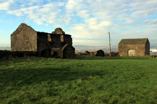
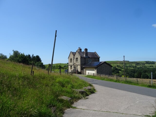
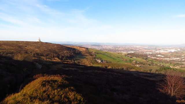
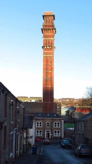
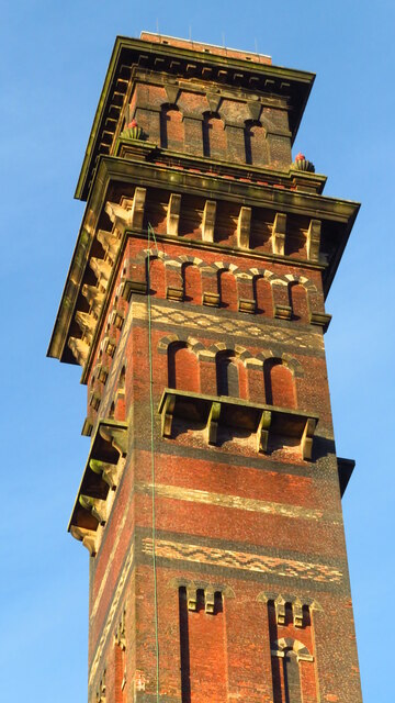
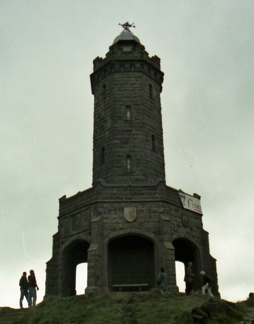
The village has a rich history that dates back centuries. The area was primarily known for its agriculture and farming traditions, with many of the original buildings and structures still standing today. The landscape is characterized by rolling hills, expansive fields, and charming stone houses, which add to the village's charm and beauty.

Hollins is a close-knit community with a population of around 500 residents. The village offers a range of amenities to cater to the needs of its residents, including a local pub, a post office, and a primary school. Additionally, the village is well-connected to the wider region, with excellent transport links to nearby towns and cities.

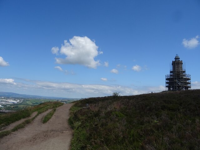
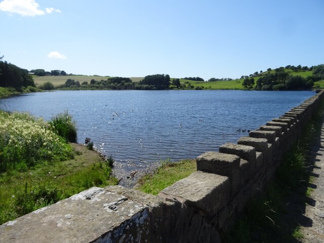
For outdoor enthusiasts, Hollins is a paradise. The surrounding countryside provides ample opportunities for hiking, cycling, and exploring the great outdoors. The village is also located in close proximity to several popular tourist attractions, such as the picturesque town of Ramsbottom and the stunning Hollingworth Lake.

Overall, Hollins offers a peaceful and idyllic lifestyle, making it an attractive place to live or visit for those seeking a charming rural retreat in the heart of Lancashire.

If you have any feedback on the listing, please let us know in the comments section below.
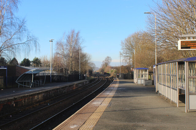
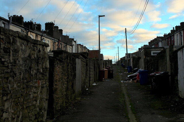
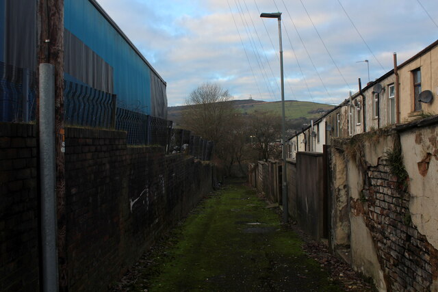
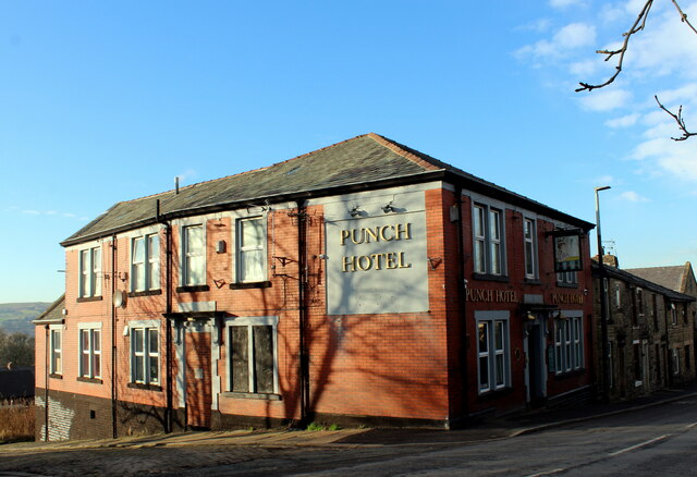
Hollins Images

Images are sourced within 2km of 53.705742/-2.4774769 or Grid Reference SD6823. Thanks to Geograph Open Source API. All images are credited.

Harwood Fold A group of buildings in a pasture near Pot House, consisting of two in a ruinous state including a farmhouse - and a stone barn, still in service.
Harwood Fold
A group of buildings in a pasture near Pot House, consisting of two in a ruinous state including a farmhouse - and a stone barn, still in service.
Footpath towards the Jubilee Tower, Darwen Moor Approaching Darwen Tower, under renovation during the summer of 2021.
Footpath towards the Jubilee Tower, Darwen Moor
Approaching Darwen Tower, under renovation during the summer of 2021.
The Waterhouse, Sunnyhurst Hey The Waterhouse associated with the (now much depleted and disused) Sunnyhurst Hey Reservoir.
The Waterhouse, Sunnyhurst Hey
The Waterhouse associated with the (now much depleted and disused) Sunnyhurst Hey Reservoir.
Earnsdale Reservoir
Earnsdale Reservoir
Olive Lane, Darwen Residential thoroughfare in the old Lancashire town of Darwen
Olive Lane, Darwen
Residential thoroughfare in the old Lancashire town of Darwen
Darwen Station This is Platform 1 on Darwen Station.
Currently on the Clitheroe or Ribble Valley Line, which runs services from Manchester through Blackburn, terminating in Clitheroe
Darwen Station
This is Platform 1 on Darwen Station. Currently on the Clitheroe or Ribble Valley Line, which runs services from Manchester through Blackburn, terminating in Clitheroe
Back Alley behind Sarah Street, Darwen A rather untidy back alley running north from Kay Street in Darwen
Back Alley behind Sarah Street, Darwen
A rather untidy back alley running north from Kay Street in Darwen
Kay Street, Darwen Residential street in the old Lancashire town of Darwen
Kay Street, Darwen
Residential street in the old Lancashire town of Darwen
Back Alley heading South off Ratcliffe Street, Darwen Short alleyway, leading to a dead end at the railway lines
Back Alley heading South off Ratcliffe Street, Darwen
Short alleyway, leading to a dead end at the railway lines
Back Alley behind Pine Street, Darwen Runs between Ratcliffe Street and Starkie Street, giving views over the town towards India Mill.
Back Alley behind Pine Street, Darwen
Runs between Ratcliffe Street and Starkie Street, giving views over the town towards India Mill.
Punch Hotel, Darwen Located at 25, Chapels - in Darwen
Punch Hotel, Darwen
Located at 25, Chapels - in Darwen
Moor Lane leading into Knowle Lane, Darwen
Holden Fold, Darwen
Holden Fold, Darwen
On Witton Weavers Way, Darwen Moor heading towards Jubilee Tower
Jubilee Tower under restoration, Darwen Hill These restoration works are taking longer than originally planned.
Jubilee Tower under restoration, Darwen Hill
These restoration works are taking longer than originally planned.
India Mill Chimney, Darwen India Mill was owned by Shorrocks Brothers and the chimney was built to resemble an Italian bell tower and stands at 303 feet tall and is 24 feet square. Completed in 1867 it was designed by E.Bates of Manchester and built by B. Lloyd of Darwen. It’s claimed that the foundation stone it rests on was one of the biggest ever quarried in Britain. The chimney is built from red handmade bricks, and there are layered decorative bands of blue and yellow brick on the way up. Towards the top some of the bricks have been arranged in a diamond style. The blocked up windows have led to the local myth that there are stairs inside, but these are just for decorative effect. Italian bell towers have similar shaped windows, and the arches at the very top are reminiscent of those at St Mark’s campanile, Venice.
India Mill Chimney, Darwen
India Mill was owned by Shorrocks Brothers and the chimney was built to resemble an Italian bell tower and stands at 303 feet tall and is 24 feet square. Completed in 1867 it was designed by E.Bates of Manchester and built by B. Lloyd of Darwen. It’s claimed that the foundation stone it rests on was one of the biggest ever quarried in Britain. The chimney is built from red handmade bricks, and there are layered decorative bands of blue and yellow brick on the way up. Towards the top some of the bricks have been arranged in a diamond style. The blocked up windows have led to the local myth that there are stairs inside, but these are just for decorative effect. Italian bell towers have similar shaped windows, and the arches at the very top are reminiscent of those at St Mark’s campanile, Venice.
India Mill Chimney, Darwen (close up of top) India Mill was owned by Shorrocks Brothers and the chimney was built to resemble an Italian bell tower and stands at 303 feet tall and is 24 feet square. Completed in 1867 it was designed by E.Bates of Manchester and built by B. Lloyd of Darwen. It’s claimed that the foundation stone it rests on was one of the biggest ever quarried in Britain. The chimney is built from red handmade bricks, and there are layered decorative bands of blue and yellow brick on the way up. Towards the top some of the bricks have been arranged in a diamond style. The blocked up windows have led to the local myth that there are stairs inside, but these are just for decorative effect. Italian bell towers have similar shaped windows, and the arches at the very top are reminiscent of those at St Mark’s campanile, Venice.
India Mill Chimney, Darwen (close up of top)
India Mill was owned by Shorrocks Brothers and the chimney was built to resemble an Italian bell tower and stands at 303 feet tall and is 24 feet square. Completed in 1867 it was designed by E.Bates of Manchester and built by B. Lloyd of Darwen. It’s claimed that the foundation stone it rests on was one of the biggest ever quarried in Britain. The chimney is built from red handmade bricks, and there are layered decorative bands of blue and yellow brick on the way up. Towards the top some of the bricks have been arranged in a diamond style. The blocked up windows have led to the local myth that there are stairs inside, but these are just for decorative effect. Italian bell towers have similar shaped windows, and the arches at the very top are reminiscent of those at St Mark’s campanile, Venice.
Jubilee Tower in 1996 Celebrations were in progress re 100 years access to Darwen Moor. A brass band performed at the base of the tower
Jubilee Tower in 1996
Celebrations were in progress re 100 years access to Darwen Moor. A brass band performed at the base of the tower
Show me another place!

Hollins is located at Grid Ref: SD6823 (Lat: 53.705742, Lng: -2.4774769)

Unitary Authority: Blackburn with Darwen

Police Authority: Lancashire

What 3 Words

///never.volunteered.trend. Near Darwen, Lancashire

Related Wikis

St Cuthbert's Church, Darwen

St Cuthbert's Church is an Anglican church in the English market town of Darwen, Lancashire. It is an active parish church in the Diocese of Blackburn...

Barley Bank

Barley Bank was a cricket and football ground in Darwen in England. It was the home ground of Darwen F.C. during their time in the Football League. �...

Earcroft

Earcroft is the northern ward in the town of Darwen, Lancashire, England. It borders Blackburn on the A666. It has a mix of residential, manufacturing...

Darwen F.C.

Darwen Football Club is a football club from Darwen, Lancashire, England. The club was formed in 2009 as A.F.C. Darwen, a successor to the original Darwen...

Nearby Amenities

Located within 500m of 53.705742,-2.4774769
Place Of Worship
Hollins Grove Congregational Church
Religion: christian
Lat/Long: 53.7069581/-2.4796709
Place Of Worship
New Methodist Church
Denomination: methodist
Religion: christian
Source: OS_OpenData_StreetView
Lat/Long: 53.7020203/-2.4755725
Post Box
Source: local_knowledge
Lat/Long: 53.7025864/-2.4798337
Fuel
Shell
Addr City: Darwen
Addr Housenumber: 80
Addr Postcode: BB3 1ET
Addr Street: Blackburn Road
Brand: Shell
Brand Wikidata: Q110716465
Name En: Shell
Phone: +44 1254 705807
Ref Navads: NVDS353_10954482
Website: https://find.shell.com/gb/fuel/10954482-mfg-savoy
Lat/Long: 53.70426/-2.476462
Turning Loop
Lat/Long: 53.7060555/-2.4814716
Barrier: yes
Foot: yes
Lat/Long: 53.706291/-2.4767555
Telephone
Booth: KX100
Covered: booth
Lat/Long: 53.7060133/-2.478103
Traffic Signals
Traffic Signals: crossing
Lat/Long: 53.705747/-2.4780644
Traffic Signals
Traffic Signals: signal
Lat/Long: 53.7059009/-2.4780729
Traffic Signals
Traffic Signals: signal
Traffic Signals Direction: backward
Lat/Long: 53.7057012/-2.4776841
Crossing
Crossing: traffic_signals
Crossing Island: yes
Crossing Ref: puffin
Tactile Paving: yes
Lat/Long: 53.7058583/-2.478033
Crossing
Crossing: traffic_signals
Crossing Island: yes
Crossing Ref: puffin
Tactile Paving: yes
Lat/Long: 53.7057857/-2.4780963
Traffic Signals
Traffic Signals: signal
Traffic Signals Direction: forward
Lat/Long: 53.7053758/-2.4776939
Crossing
Crossing: uncontrolled
Crossing Island: yes
Tactile Paving: yes
Lat/Long: 53.7054055/-2.4777162
Traffic Signals
Traffic Signals: signal
Traffic Signals Direction: forward
Lat/Long: 53.705444/-2.477979
The data included in this document is from www.openstreetmap.org. The data is made available under ODbL.

Have you been to Hollins?

Leave your review of Hollins below (or comments, questions and feedback).