Hollins

Settlement in Lancashire

England

Hollins

Remaining parts of Hartford Mill, Oldham
Remaining parts of Hartford Mill, Oldham Credit: Colin Park

Hollins is a small village located in the county of Lancashire, England. Situated in the borough of Rossendale, it is nestled within the picturesque countryside of the South Pennines. The village is located approximately 9 miles north of the city of Manchester.

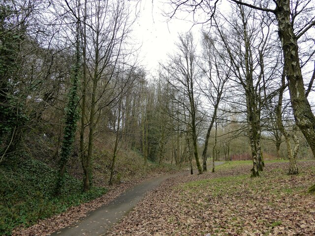
Hollins is known for its charming rural setting, with rolling hills, lush green fields, and scenic landscapes surrounding the area. The village is primarily residential, with a population of around 2,000 residents. It offers a peaceful and idyllic atmosphere, making it an attractive place to live for those seeking a quieter lifestyle away from the hustle and bustle of city life.

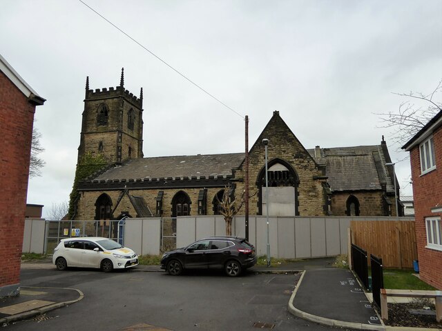
The village has a close-knit community, with a range of local amenities to serve its residents. These include a primary school, a post office, a convenience store, and a few small businesses. Additionally, there are several public houses in the area, providing a place for locals to gather and socialize.

Hollins is well-connected to neighboring towns and cities, with good transportation links. The village is easily accessible by road, with the A56 passing nearby, connecting it to larger towns such as Burnley and Bury. There are also regular bus services that run through the village, providing convenient travel options for residents.

Overall, Hollins offers a peaceful and scenic place to reside, with a strong sense of community and a range of amenities to cater to the needs of its residents.

If you have any feedback on the listing, please let us know in the comments section below.
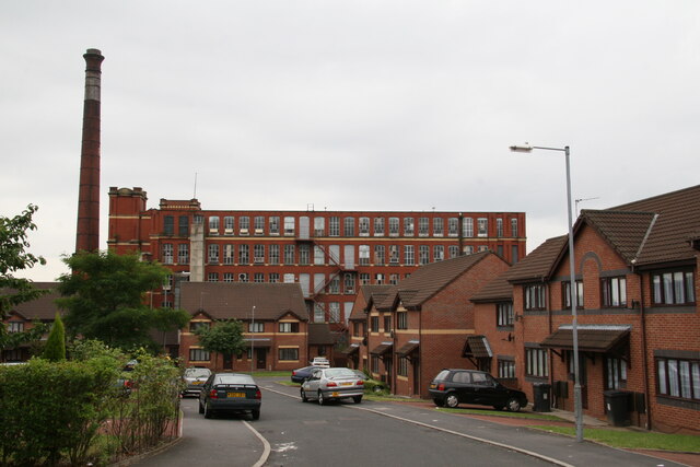
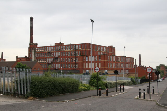
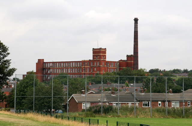
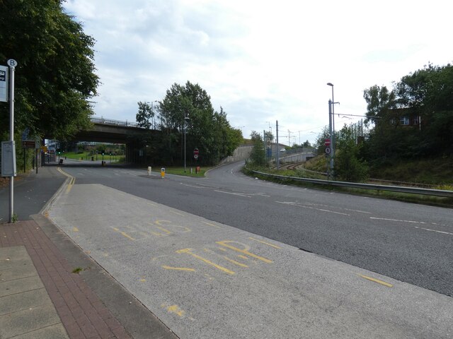
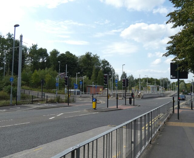
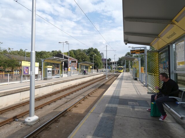
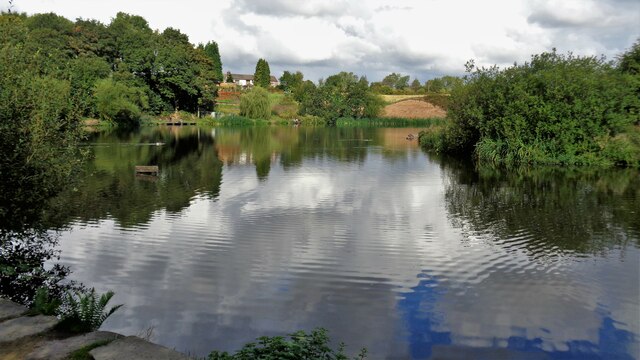
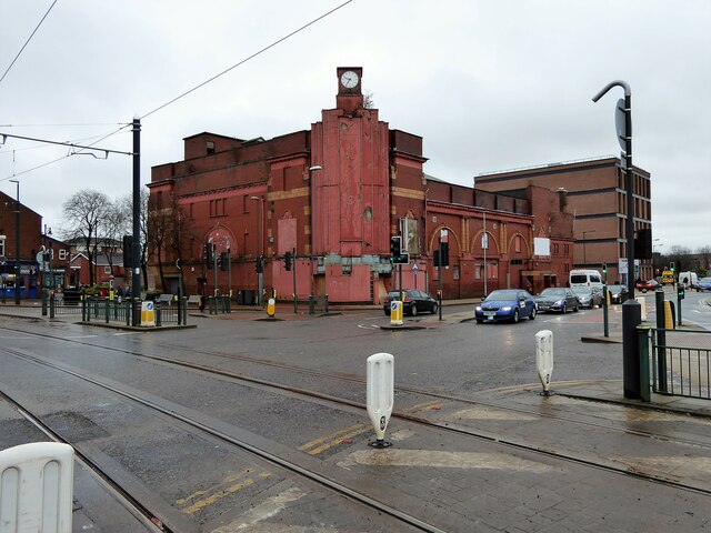
Hollins Images

Images are sourced within 2km of 53.524445/-2.126213 or Grid Reference SD9103. Thanks to Geograph Open Source API. All images are credited.

Remaining parts of Hartford Mill, Oldham
Royd Mill, Hollinwood A magnificent Edwardian era spinning mill built in 1907 and photographed in 2006. It has now been demolished and the site has been built on. I can no longer work out where the photographers position was as there has been redevelopment of this area in the meantime. The six figure reference for the mill is correct.
Royd Mill, Hollinwood
A magnificent Edwardian era spinning mill built in 1907 and photographed in 2006. It has now been demolished and the site has been built on. I can no longer work out where the photographers position was as there has been redevelopment of this area in the meantime. The six figure reference for the mill is correct.
Royd Mill, Chamber Road, Hollinwood This mill was built in 1907 and has now been demolished with housing built on the site. This shows the engine house that once held a J & E Wood of Bolton inverted vertical triple expansion steam engine. That was  scrapped long ago but a small steam fire pump survived and is now at the Astley Green Mining Museum site. This was a fine Edwardian era mill and really deserved listing, especially as the chimney survived intact with its oversailing cap.
Royd Mill, Chamber Road, Hollinwood
This mill was built in 1907 and has now been demolished with housing built on the site. This shows the engine house that once held a J & E Wood of Bolton inverted vertical triple expansion steam engine. That was scrapped long ago but a small steam fire pump survived and is now at the Astley Green Mining Museum site. This was a fine Edwardian era mill and really deserved listing, especially as the chimney survived intact with its oversailing cap.
Royd Mill, Hollinwood Seen from about the end of Mulmount Close. The mill was built in 1907 as a cotton spinning mill and has now been replaced by houses.
Royd Mill, Hollinwood
Seen from about the end of Mulmount Close. The mill was built in 1907 as a cotton spinning mill and has now been replaced by houses.
Royd Mill from Armitage Close, Hollinwood The mill was built in 1907 and has now been replaced by undistinguished housing. I was able to locate this shot accurately by the modern housing development. Oldham Council has now produced a plan for the surviving mill stock but this was gone before that.
Royd Mill from Armitage Close, Hollinwood
The mill was built in 1907 and has now been replaced by undistinguished housing. I was able to locate this shot accurately by the modern housing development. Oldham Council has now produced a plan for the surviving mill stock but this was gone before that.
Hawksley Street, Hollinwood The large former cotton spinning mill was built in 1907 as Royd Mill and has now been replaced with housing.
Hawksley Street, Hollinwood
The large former cotton spinning mill was built in 1907 as Royd Mill and has now been replaced with housing.
Royd Mill, Hollinwood Built as a cotton spinning mill in 1907 and since demolished and replaced with houses. A shame it was not listed as it was one of the better Edwardian mills in Oldham. I have struggled to locate the photographer positions and not succeeded with them all.
Royd Mill, Hollinwood
Built as a cotton spinning mill in 1907 and since demolished and replaced with houses. A shame it was not listed as it was one of the better Edwardian mills in Oldham. I have struggled to locate the photographer positions and not succeeded with them all.
Bus Stop B 
On the A669 Middleton Road near Westwood Tram Stop.
Bus Stop B
On the A669 Middleton Road near Westwood Tram Stop.
Middleton Road 
 The A669 Middleton Road passing Westwood Tram Stop.
Middleton Road
The A669 Middleton Road passing Westwood Tram Stop.
Westwood Tram Stop The approaching tram is heading to East Didsbury.
Westwood Tram Stop
The approaching tram is heading to East Didsbury.
Crime Lake A former supply reservoir for the now abandoned Hollinwood Branch canal. The canal actually passed through the reservoir.
Crime Lake
A former supply reservoir for the now abandoned Hollinwood Branch canal. The canal actually passed through the reservoir.
Former Grand Theatre Like many such buildings has seen many alternative uses from when it was built as a theatre
Former Grand Theatre
Like many such buildings has seen many alternative uses from when it was built as a theatre
Cycle route following line of former railway This is the route from Ashton to Oldham and is here close to Alexandra Park, Oldham
Cycle route following line of former railway
This is the route from Ashton to Oldham and is here close to Alexandra Park, Oldham
Church of St John Apparently awaiting demolition
Church of St John
Apparently awaiting demolition
Freehold Metrolink Station Robinson Street seems to be the car park for the station. Hartford Mill chimney is beyond the station standing alone since the mill is demolished.
Freehold Metrolink Station
Robinson Street seems to be the car park for the station. Hartford Mill chimney is beyond the station standing alone since the mill is demolished.
Music Room awaiting restoration At Werneth Park
Music Room awaiting restoration
At Werneth Park
Memorial to Sarah Lees Historic monument in Werneth Park
Memorial to Sarah Lees
Historic monument in Werneth Park
Werneth Primary School On Coppice Street with its amazing clock tower
Werneth Primary School
On Coppice Street with its amazing clock tower
Show me another place!

Hollins is located at Grid Ref: SD9103 (Lat: 53.524445, Lng: -2.126213)

Unitary Authority: Oldham

Police Authority: Greater Manchester

What 3 Words

///motor.wiped.teeth. Near Oldham, Manchester

Nearby Locations

Hollins

Related Wikis

Heron Mill, Hollinwood

Heron Mill is a cotton spinning mill in Hollinwood, Oldham, Greater Manchester. It was designed by architect P. S. Stott and was constructed in 1905 by...

Oasis Academy Oldham

Oasis Academy Oldham is a coeducational secondary school with academy status for 11- to 16-year-olds in the Hollinwood area of Oldham, Greater Manchester...

Hollins, Oldham

Hollins is an area of Oldham, Greater Manchester, England, 1.7 miles south of the town centre. Formerly a hamlet set amongst open moorland and farmland...

Copster Hill

Copster Hill is a locality in the town of Oldham in Greater Manchester, lying 1.6 miles to the south of Oldham town centre. Archaically a hamlet and private...

Nearby Amenities

Located within 500m of 53.524445,-2.126213
Copster Hill
Is In: Oldham, Greater Manchester, England, UK
Place: suburb
Source: npe
Wikidata: Q27956528
Lat/Long: 53.5247067/-2.1193038
Bus Stop
Copster Hill, Frederick Street / near Hollins Road
Bus: yes
Naptan AtcoCode: 1800ED05771
Naptan Bearing: SE
Naptan CommonName: Frederick Street/Hollins Road
Naptan Indicator: O/s House 327
Naptan Landmark: HOUSE 333
Naptan NaptanCode: manamawa
Naptan PlusbusZoneRef: MNCRPIC
Naptan ShortCommonName: Hollins Road
Naptan Street: Frederick Street
Naptan Verified: no
Network: TfGM
Operator: TfGM
Public Transport: platform
Source: naptan_import
Lat/Long: 53.5262355/-2.120347
Bus Stop
Copster Hill, Frederick Street / by Hollins Road
Bus: yes
Naptan AtcoCode: 1800ED05781
Naptan Bearing: NW
Naptan CommonName: Frederick Street/Hollins Road
Naptan Indicator: Nr Spare Land
Naptan Landmark: House 290
Naptan NaptanCode: manamawd
Naptan PlusbusZoneRef: MNCRPIC
Naptan ShortCommonName: Hollins Road
Naptan Street: Frederick Street
Naptan Verified: no
Network: TfGM
Operator: TfGM
Public Transport: platform
Source: naptan_import
Lat/Long: 53.5258852/-2.1201047
Bus Stop
Coppice, Frederick Street / opposite Grendon Avenue
Bus: yes
Naptan AtcoCode: 1800ED05831
Naptan Bearing: NW
Naptan CommonName: Frederick Street/Grendon Avenue
Naptan Indicator: Playing Fields
Naptan Landmark: PLAYING FIELDS
Naptan NaptanCode: manamawm
Naptan PlusbusZoneRef: MNCRPIC
Naptan ShortCommonName: Grendon Avenue
Naptan Street: Frederick Street
Naptan Verified: no
Network: TfGM
Operator: TfGM
Public Transport: platform
Source: naptan_import
Lat/Long: 53.5276897/-2.1222821
Bus Stop
Werneth, Chamber Road / adjacent Heron Street
Bus: yes
Naptan AtcoCode: 1800ED08541
Naptan Bearing: NE
Naptan CommonName: Chamber Road/Heron Street
Naptan Indicator: School
Naptan Landmark: SCHOOL
Naptan NaptanCode: manamdpg
Naptan PlusbusZoneRef: MNCRPIC
Naptan ShortCommonName: Heron Street
Naptan Street: CHAMBER ROAD
Naptan Verified: no
Network: TfGM
Operator: TfGM
Public Transport: platform
Source: naptan_import
Lat/Long: 53.5272332/-2.1290239
Bus Stop
Werneth, Chamber Road / corner Grange Avenue
Bus: yes
Naptan AtcoCode: 1800ED08551
Naptan Bearing: NE
Naptan CommonName: Chamber Road/Grange Avenue
Naptan Indicator: Op House 231
Naptan Landmark: House 235
Naptan NaptanCode: manamdpj
Naptan PlusbusZoneRef: MNCRPIC
Naptan ShortCommonName: Grange Avenue
Naptan Street: CHAMBER ROAD
Naptan Verified: no
Network: TfGM
Operator: TfGM
Public Transport: platform
Source: naptan_import
Lat/Long: 53.5278018/-2.1267929
Bus Stop
Werneth, Chamber Road / opposite Grange Avenue
Bus: yes
Naptan AtcoCode: 1800ED08561
Naptan Bearing: SW
Naptan CommonName: Chamber Road/Grange Avenue
Naptan Indicator: O/s House 233
Naptan Landmark: HOUSE 225
Naptan NaptanCode: manamdpm
Naptan PlusbusZoneRef: MNCRPIC
Naptan ShortCommonName: Grange Avenue
Naptan Street: CHAMBER ROAD
Naptan Verified: no
Network: TfGM
Operator: TfGM
Public Transport: platform
Source: naptan_import
Lat/Long: 53.527703/-2.1267927
Bus Stop
Coppice, Chamber Road / adjacent Frederick Street
Bus: yes
Naptan AtcoCode: 1800ED08571
Naptan Bearing: NE
Naptan CommonName: Chamber Road/Frederick Street
Naptan Indicator: Opp Rest Home
Naptan Landmark: PREP SCHOOL
Naptan NaptanCode: manamdpt
Naptan PlusbusZoneRef: MNCRPIC
Naptan ShortCommonName: Frederick Street
Naptan Street: CHAMBER ROAD
Naptan Verified: no
Network: TfGM
Operator: TfGM
Public Transport: platform
Source: naptan_import
Lat/Long: 53.5288306/-2.1248673
Bus Stop
Hollins, Heron Street / near Colenso Street
Bus: yes
Naptan AtcoCode: 1800ED17331
Naptan Bearing: NW
Naptan CommonName: Heron Street/Colenso Street
Naptan Indicator: Mill Car Park
Naptan Landmark: MILL
Naptan NaptanCode: manaptpg
Naptan PlusbusZoneRef: MNCRPIC
Naptan ShortCommonName: Colenso Street
Naptan Street: HERON STREET
Naptan Verified: no
Network: TfGM
Operator: TfGM
Public Transport: platform
Source: naptan_import
Lat/Long: 53.5250062/-2.1269958
Bus Stop
Hollins, Heron Street / near Merton Avenue
Bus: yes
Naptan AtcoCode: 1800ED27131
Naptan Bearing: SE
Naptan CommonName: Heron Street/Merton Avenue
Naptan Indicator: Tennis Courts
Naptan Landmark: MILL
Naptan NaptanCode: manatgjg
Naptan PlusbusZoneRef: MNCRPIC
Naptan ShortCommonName: Merton Avenue
Naptan Street: HERON STREET
Naptan Verified: no
Network: TfGM
Operator: TfGM
Public Transport: platform
Source: naptan_import
Lat/Long: 53.5248807/-2.1266334
Bus Stop
Werneth, Heron Street / near Chamber Road
Bus: yes
Naptan AtcoCode: 1800ED27151
Naptan Bearing: SE
Naptan CommonName: Heron Street/Chamber Road
Naptan Indicator: O/s House 175
Naptan Landmark: HOUSE 175
Naptan NaptanCode: manatgjm
Naptan PlusbusZoneRef: MNCRPIC
Naptan ShortCommonName: Chamber Road
Naptan Street: HERON STREET
Naptan Verified: no
Network: TfGM
Operator: TfGM
Public Transport: platform
Source: naptan_import
Lat/Long: 53.5268915/-2.1291435
Bus Stop
Werneth, Chamber Road / opposite Heron Street
Bus: yes
Naptan AtcoCode: 1800ED27161
Naptan Bearing: W
Naptan CommonName: Chamber Road/Heron Street
Naptan Indicator: O/s House 499
Naptan Landmark: House 499
Naptan NaptanCode: manatgjp
Naptan PlusbusZoneRef: MNCRPIC
Naptan ShortCommonName: Heron Street
Naptan Street: CHAMBER ROAD
Naptan Verified: no
Network: TfGM
Operator: TfGM
Public Transport: platform
Source: naptan_import
Lat/Long: 53.5267285/-2.1302291
Bus Stop
Werneth, Chamber Road / near Vaal Street
Bus: yes
Naptan AtcoCode: 1800ED27171
Naptan Bearing: W
Naptan CommonName: Chamber Road/Vaal Street
Naptan Indicator: Os House 555
Naptan Landmark: HOUSE 555
Naptan NaptanCode: manatgjt
Naptan Notes: INDICATOR AMENDED
Naptan PlusbusZoneRef: MNCRPIC
Naptan ShortCommonName: Vaal Street
Naptan Street: CHAMBER ROAD
Naptan Verified: no
Network: TfGM
Operator: TfGM
Public Transport: platform
Source: naptan_import
Lat/Long: 53.5260885/-2.1319167
Bus Stop
Werneth, Chamber Road / opposite Vaal Street
Bus: yes
Naptan AtcoCode: 1800ED27181
Naptan Bearing: E
Naptan CommonName: Chamber Road/Vaal Street
Naptan Indicator: Opp House 573
Naptan Landmark: CATHOLIC CENTRE
Naptan NaptanCode: manatgjw
Naptan Notes: INDICATOR AMENDED
Naptan PlusbusZoneRef: MNCRPIC
Naptan ShortCommonName: Vaal Street
Naptan Street: CHAMBER ROAD
Naptan Verified: no
Network: TfGM
Operator: TfGM
Public Transport: platform
Source: naptan_import
Lat/Long: 53.5259799/-2.1325197
Bus Stop
Copster Hill, Hollins Road / opposite Frederick Street
Bench: no
Bus: yes
Naptan AtcoCode: 1800ED28731
Naptan Bearing: SW
Naptan CommonName: Hollins Road/Frederick Street
Naptan Indicator: Nr House 249
Naptan Landmark: HOUSE 249
Naptan NaptanCode: manatjwd
Naptan Notes: LOCATION AMENDED
Naptan PlusbusZoneRef: MNCRPIC
Naptan ShortCommonName: Frederick Street
Naptan Street: HOLLINS ROAD
Naptan Verified: no
Network: TfGM
Operator: TfGM
Public Transport: platform
Shelter: no
Source: naptan_import
Lat/Long: 53.5250945/-2.1198309
Bus Stop
Copster Hill, Hollins Road / near Frederick Street
Bench: no
Bin: yes
Bus: yes
Lit: yes
Naptan AtcoCode: 1800ED28741
Naptan Bearing: NE
Naptan CommonName: Hollins Road/Frederick Street
Naptan Indicator: Off Licence
Naptan Landmark: PROPERTY 276
Naptan NaptanCode: manatjwg
Naptan PlusbusZoneRef: MNCRPIC
Naptan ShortCommonName: Frederick Street
Naptan Street: HOLLINS ROAD
Naptan Verified: no
Network: TfGM
Operator: TfGM
Public Transport: platform
Shelter: no
Source: naptan_import
Tactile Paving: no
Lat/Long: 53.5250851/-2.1201628
Bus Stop
Hollins, Hollins Road / at Garden Suburb
Bench: no
Bin: yes
Bus: yes
Check Date Bin: 2023-06-28
Naptan AtcoCode: 1800ED28751
Naptan Bearing: SW
Naptan CommonName: Hollins Road/Garden Suburb
Naptan Indicator: Floral Bowl
Naptan Landmark: BEAUTICIANS
Naptan NaptanCode: manatjwj
Naptan PlusbusZoneRef: MNCRPIC
Naptan ShortCommonName: Garden Suburb
Naptan Street: HOLLINS ROAD
Naptan Verified: no
Network: TfGM
Operator: TfGM
Public Transport: platform
Shelter: no
Source: naptan_import
Tactile Paving: no
Lat/Long: 53.5231598/-2.1218769
Bus Stop
Hollins, Hollins Road / in Garden Suburb
Bench: no
Bus: yes
Naptan AtcoCode: 1800ED28761
Naptan Bearing: NE
Naptan CommonName: Hollins Road/Garden Suburb
Naptan Indicator: Os Bookmakers
Naptan Landmark: PROPERTY 382
Naptan NaptanCode: manatjwm
Naptan Notes: INDICATOR AMENDED
Naptan PlusbusZoneRef: MNCRPIC
Naptan ShortCommonName: Garden Suburb
Naptan Street: HOLLINS ROAD
Naptan Verified: no
Network: TfGM
Operator: TfGM
Public Transport: platform
Shelter: no
Source: naptan_import
Lat/Long: 53.523141/-2.1226762
Bus Stop
Hollins, Trough Gate / adjacent Hollins Road
Bus: yes
Naptan AtcoCode: 1800ED28771
Naptan Bearing: N
Naptan CommonName: Trough Gate/Hollins Road
Naptan Indicator: Opp House 3
Naptan Landmark: FIRE STATION
Naptan NaptanCode: manatjwp
Naptan Notes: INDICATOR AMENDED
Naptan PlusbusZoneRef: MNCRPIC
Naptan ShortCommonName: Hollins Road
Naptan Street: ELM ROAD
Naptan Verified: no
Network: TfGM
Operator: TfGM
Public Transport: platform
Shelter: no
Source: naptan_import
Lat/Long: 53.5227356/-2.123565
Bus Stop
Hollins, Trough Gate / near Hollins Road
Bus: yes
Naptan AtcoCode: 1800ED28781
Naptan Bearing: S
Naptan CommonName: Trough Gate/Hollins Road
Naptan Indicator: O/s House 15
Naptan Landmark: HOUSE 7
Naptan NaptanCode: manatjwt
Naptan PlusbusZoneRef: MNCRPIC
Naptan ShortCommonName: Hollins Road
Naptan Street: ELM ROAD
Naptan Verified: no
Network: TfGM
Operator: TfGM
Public Transport: platform
Source: naptan_import
Lat/Long: 53.5224483/-2.1232776
Bus Stop
Hollins, Hollins Road / near Oak Road
Bench: no
Bin: no
Bus: yes
Naptan AtcoCode: 1800ED28951
Naptan Bearing: W
Naptan CommonName: Hollins Road/Oak Road
Naptan Indicator: O/s House 619
Naptan Landmark: HOUSE 611
Naptan NaptanCode: manatmgm
Naptan PlusbusZoneRef: MNCRPIC
Naptan ShortCommonName: Oak Road
Naptan Street: HOLLINS ROAD
Naptan Verified: no
Network: TfGM
Operator: TfGM
Public Transport: platform
Shelter: no
Source: naptan_import
Lat/Long: 53.5215224/-2.1317969
Bus Stop
Hollins, Hollins Road / opposite Glencoe Street
Bench: no
Bin: no
Bus: yes
Naptan AtcoCode: 1800ED28961
Naptan Bearing: E
Naptan CommonName: Hollins Road/Glencoe Street
Naptan Indicator: Opp House 585
Naptan Landmark: SCHOOL
Naptan NaptanCode: manatmgp
Naptan Notes: INDICATOR AMENDED
Naptan PlusbusZoneRef: MNCRPIC
Naptan ShortCommonName: Glencoe Street
Naptan Street: Hollins Rad
Naptan Verified: no
Network: TfGM
Operator: TfGM
Public Transport: platform
Shelter: yes
Source: naptan_import
Lat/Long: 53.5220586/-2.1302529
Bus Stop
Hollins, Hollins Road / near Glencoe Street
Bus: yes
Naptan AtcoCode: 1800ED28971
Naptan Bearing: W
Naptan CommonName: Hollins Road/Victoria Inn
Naptan Indicator: Nut House
Naptan Landmark: HOUSE 555
Naptan NaptanCode: manatmgt
Naptan PlusbusZoneRef: MNCRPIC
Naptan ShortCommonName: Victoria Inn
Naptan Street: HOLLINS ROAD
Naptan Verified: no
Network: TfGM
Operator: TfGM
Public Transport: platform
Source: naptan_import
Lat/Long: 53.5224519/-2.1283909
Bus Stop
Hollins, Hollins Road / near Mill Gate
Bus: yes
Naptan AtcoCode: 1800ED28981
Naptan Bearing: E
Naptan CommonName: Hollins Road/Victoria Inn
Naptan Indicator: Victoria Inn Op
Naptan Landmark: CHURCH
Naptan NaptanCode: manatmgw
Naptan PlusbusZoneRef: MNCRPIC
Naptan ShortCommonName: Victoria Inn
Naptan Street: HOLLINS ROAD
Naptan Verified: no
Network: TfGM
Operator: TfGM
Public Transport: platform
Shelter: yes
Source: naptan_import
Lat/Long: 53.5225599/-2.1282706
Bus Stop
Hollins, Hollins Road / near Houghton Avenue
Bench: yes
Bin: yes
Bus: yes
Lit: yes
Naptan AtcoCode: 1800ED28991
Naptan Bearing: W
Naptan CommonName: Hollins Road/Houghton Avenue
Naptan Indicator: Britannia Opp
Naptan Landmark: BRITANNIA PUB
Naptan NaptanCode: manatmja
Naptan PlusbusZoneRef: MNCRPIC
Naptan ShortCommonName: Houghton Avenue
Naptan Street: HOLLINS ROAD
Naptan Verified: no
Network: TfGM
Operator: TfGM
Public Transport: platform
Shelter: yes
Source: naptan_import
Tactile Paving: no
Lat/Long: 53.5226702/-2.1259329
Bus Stop
Hollins, Hollins Road / opposite Houghton Avenue
Bus: yes
Naptan AtcoCode: 1800ED29001
Naptan Bearing: E
Naptan CommonName: Hollins Road/Houghton Avenue
Naptan Indicator: Britannia Pub
Naptan Landmark: BRITANNIA PUB
Naptan NaptanCode: manatmjd
Naptan PlusbusZoneRef: MNCRPIC
Naptan ShortCommonName: Houghton Avenue
Naptan Street: HOLLINS ROAD
Naptan Verified: no
Network: TfGM
Operator: TfGM
Public Transport: platform
Source: naptan_import
Lat/Long: 53.5228238/-2.1252697
Mini Roundabout
Source: Bing
Lat/Long: 53.5204583/-2.1296297
Fire Station
Source: OS OpenData StreetView
Lat/Long: 53.5225148/-2.1239261
Turning Circle
Lat/Long: 53.5266932/-2.1223684
Turning Circle
Lat/Long: 53.5262958/-2.1232173
Mini Roundabout
Lat/Long: 53.5254311/-2.129934
Turning Circle
Lat/Long: 53.5262915/-2.1301246
Turning Circle
Lat/Long: 53.5283948/-2.1243306
Addr Housenumber: 555
Source: NaPTAN
Lat/Long: 53.525992/-2.1318549
Addr Housenumber: 499
Source: NaPTAN
Lat/Long: 53.5266298/-2.1301919
Addr Housenumber: 175
Source: NaPTAN
Lat/Long: 53.5267956/-2.1292585
Addr Housenumber: 619
Addr Postcode: OL8 3UT
Addr Street: Hollins Road
Source: Naptan
Source Postcode: ONS Postcode Open Data
Lat/Long: 53.5214439/-2.131691
Generator Method: photovoltaic
Generator Output Electricity: yes
Generator Source: solar
Generator Type: solar_photovoltaic_panel
Location: roof
Power: generator
Lat/Long: 53.5271117/-2.1274613
Generator Method: photovoltaic
Generator Output Electricity: yes
Generator Source: solar
Generator Type: solar_photovoltaic_panel
Location: roof
Power: generator
Lat/Long: 53.5269789/-2.1277416
Generator Method: photovoltaic
Generator Output Electricity: yes
Generator Source: solar
Generator Type: solar_photovoltaic_panel
Location: roof
Power: generator
Lat/Long: 53.523495/-2.1257393
Generator Method: photovoltaic
Generator Output Electricity: yes
Generator Source: solar
Generator Type: solar_photovoltaic_panel
Location: roof
Power: generator
Lat/Long: 53.5233825/-2.1260022
Generator Method: photovoltaic
Generator Output Electricity: yes
Generator Source: solar
Generator Type: solar_photovoltaic_panel
Location: roof
Power: generator
Lat/Long: 53.5228846/-2.1262959
Barrier: bollard
Bicycle: yes
Foot: yes
Horse: yes
Motor Vehicle: no
Lat/Long: 53.5225751/-2.1290372
Crossing
Crossing: marked
Crossing Island: no
Tactile Paving: yes
Lat/Long: 53.5225613/-2.1274864
Barrier: bollard
Bicycle: yes
Foot: yes
Horse: yes
Motor Vehicle: no
Lat/Long: 53.5247038/-2.1282828
Hollins
Place: suburb
Lat/Long: 53.522407/-2.1301327
The data included in this document is from www.openstreetmap.org. The data is made available under ODbL.

Have you been to Hollins?

Leave your review of Hollins below (or comments, questions and feedback).