Hole Bottom

Settlement in Yorkshire

England

Hole Bottom

Old milestone On the A635 from Shepley Lane Head down into New Mills and Holmfirth is a West Riding CC 19C milestone which is the last in the series east from Greenfield which used to be in Yorkshire.  The tollroad from Greenfield to Shepley Lane Head was first enacted in 1823. The milestone is opposite Gate Foot Lane and a pub.   This used to be the Crossroads PH then renamed Toss 'o Coin now derelict.   This metal attachment has the name of the foundry on the bevel, Brayshaw & Booth/Makers/Liversedge.  The stone is painted black.  Grade II listed 1313617.
Old milestone Credit: Chris Minto

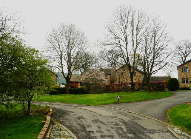
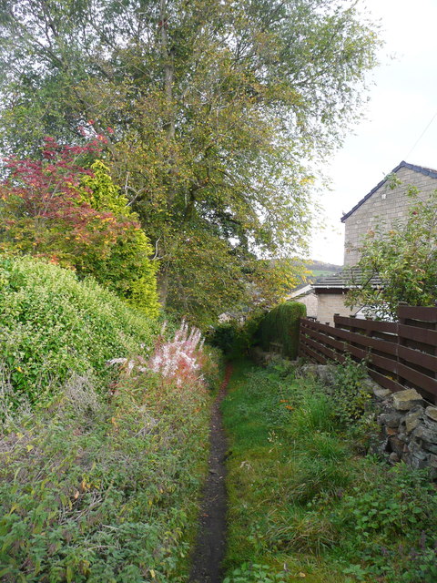
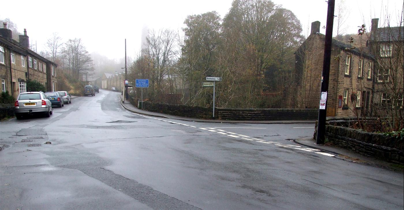
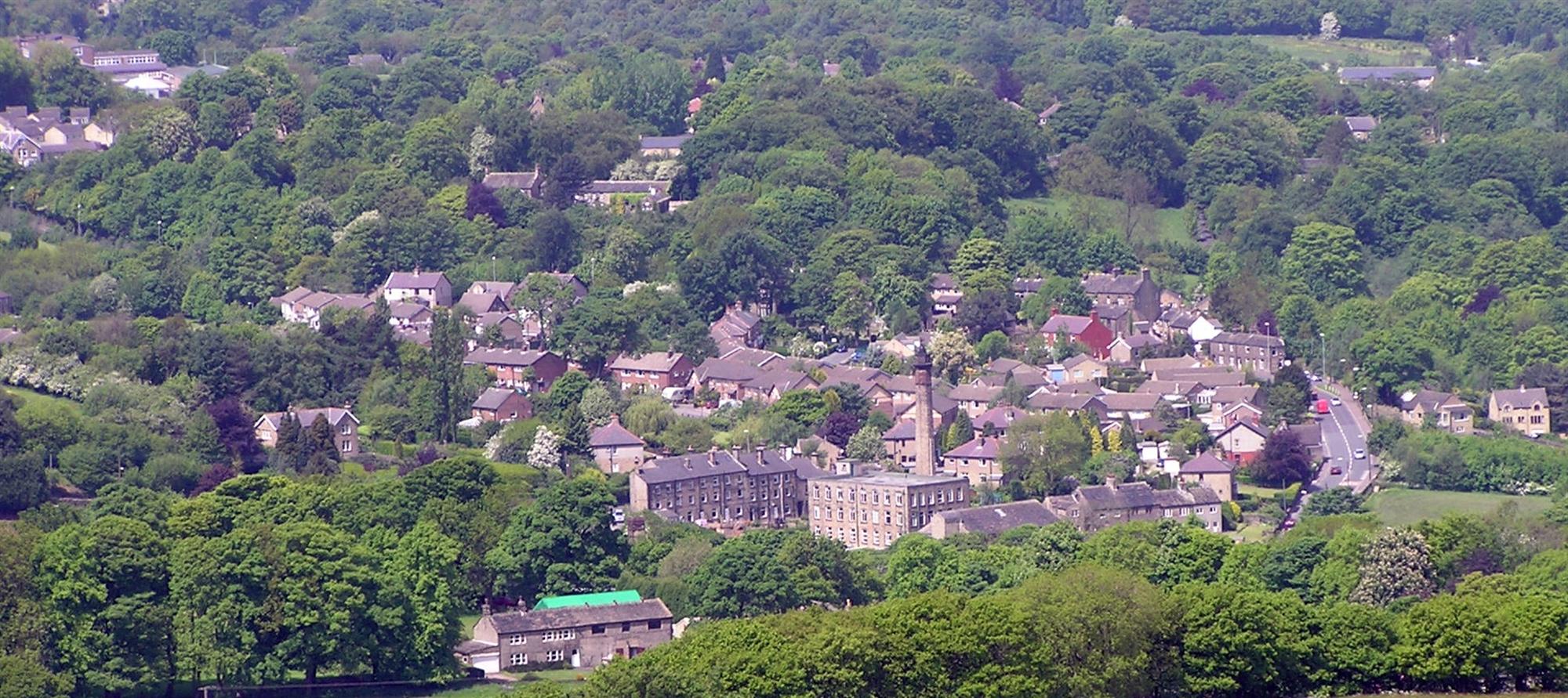
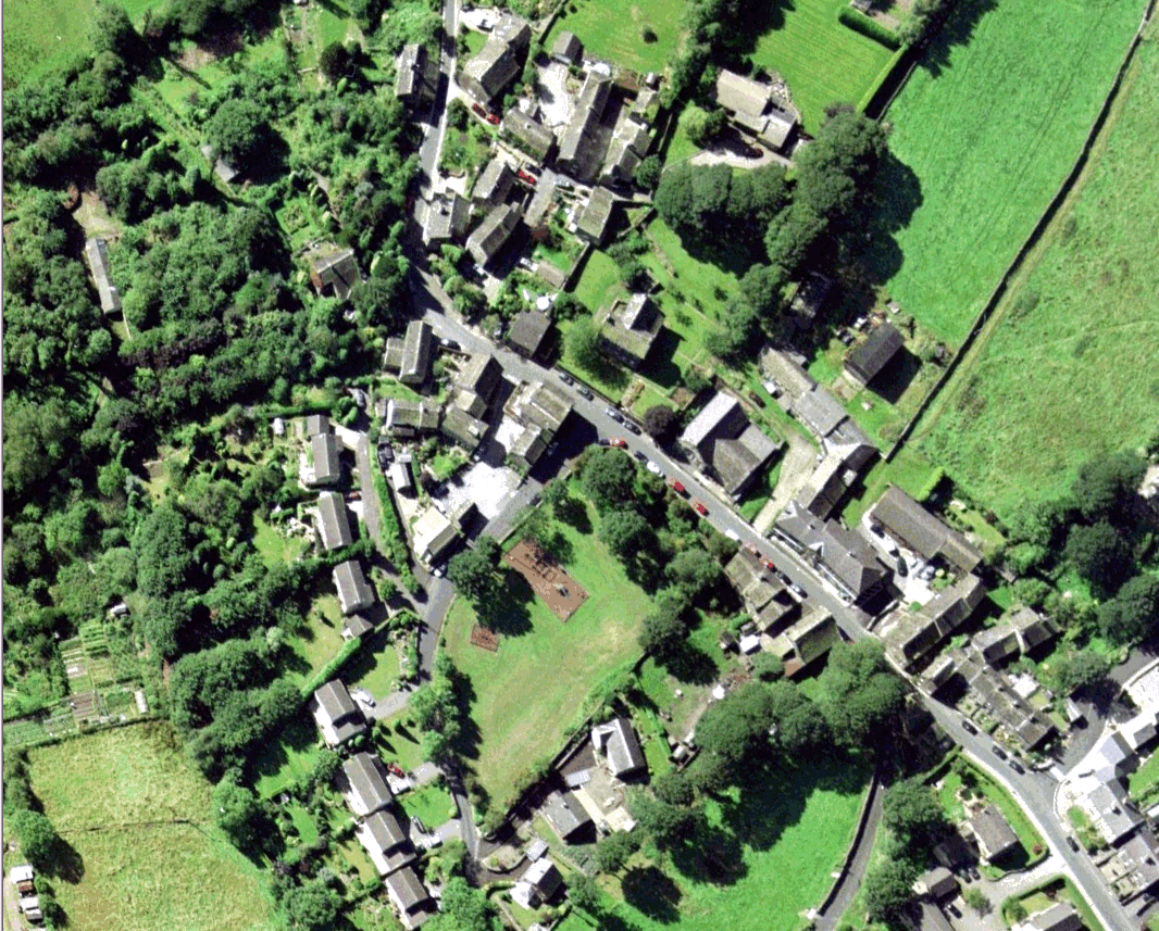
Hole Bottom is a small village located in the picturesque region of Yorkshire, England. Situated in the heart of the countryside, this tranquil settlement offers a peaceful escape from the hustle and bustle of city life. With its charming rural setting, Hole Bottom is a popular destination for nature lovers and outdoor enthusiasts.

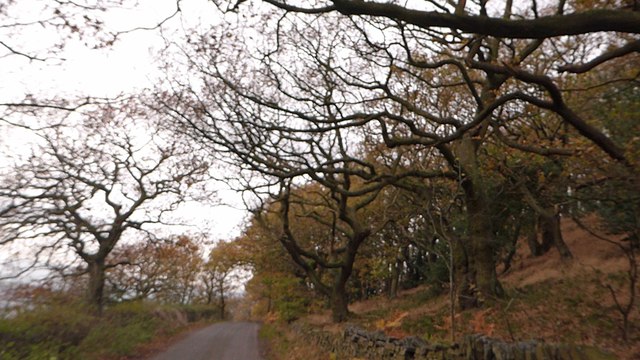
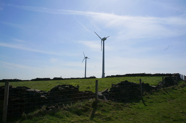
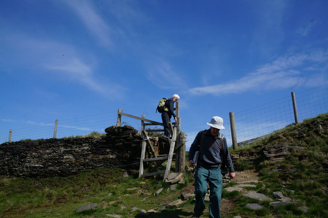
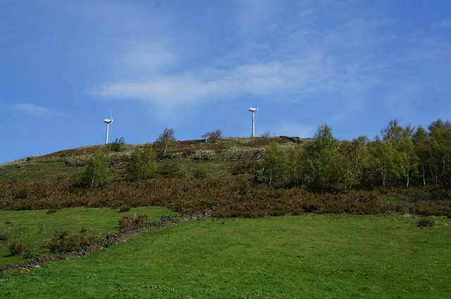
Surrounded by rolling hills and lush green meadows, the village boasts stunning panoramic views that attract visitors from far and wide. The area is known for its scenic walking trails, providing ample opportunities to explore the breathtaking landscapes and observe the local wildlife.

Despite its small size, Hole Bottom has a tight-knit community that takes pride in preserving its heritage and traditions. The village is dotted with traditional stone cottages, giving it a quaint and timeless appeal. The locals are friendly and welcoming, often engaging in community events and gatherings.

While Hole Bottom may lack the amenities of a larger town, it offers a sense of tranquility and a chance to reconnect with nature. The village is home to a charming country pub, serving up hearty meals and a selection of local ales, where residents and visitors can gather and unwind.

For those seeking a peaceful retreat in the heart of the countryside, Hole Bottom provides an idyllic setting. Its natural beauty and warm community spirit make it a hidden gem in the Yorkshire region, offering a slice of rural paradise for all who visit.

If you have any feedback on the listing, please let us know in the comments section below.
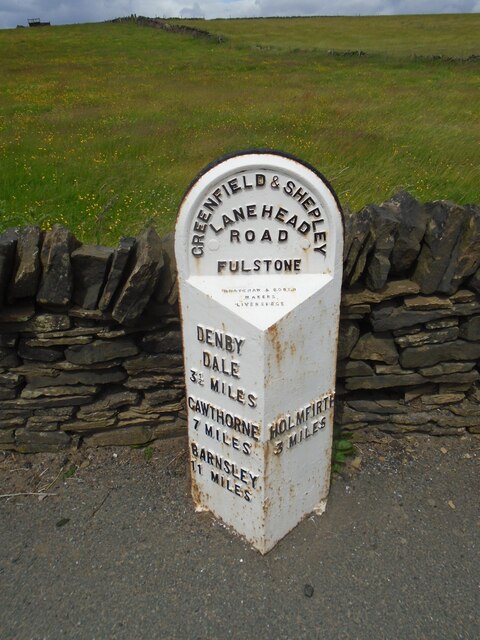
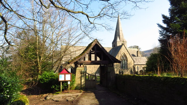
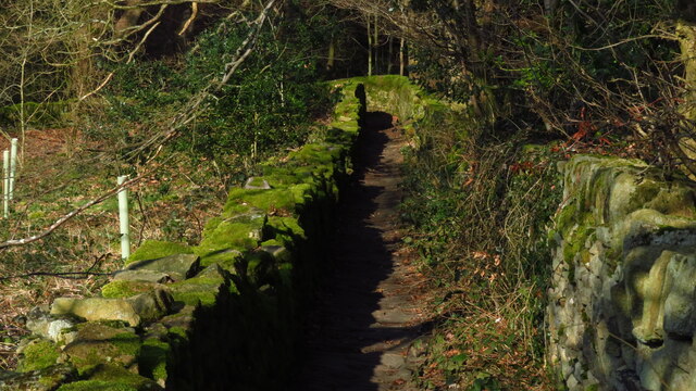
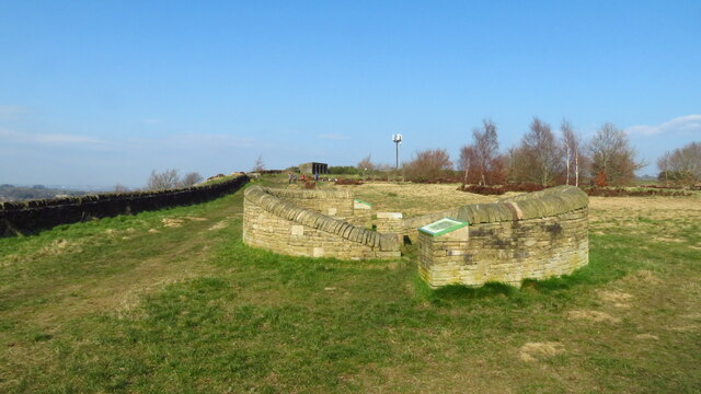
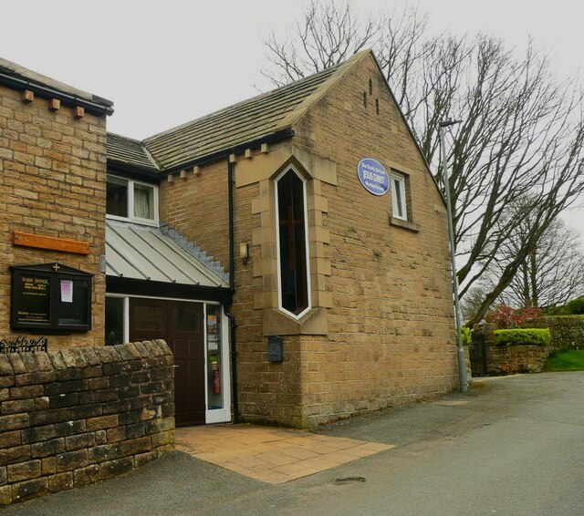
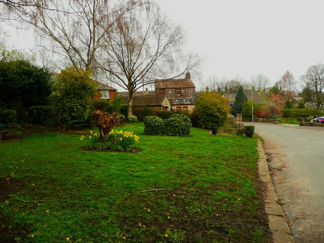
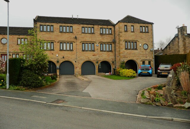
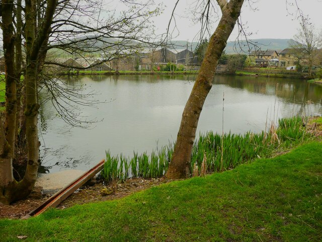
Hole Bottom Images

Images are sourced within 2km of 53.569076/-1.7501979 or Grid Reference SE1608. Thanks to Geograph Open Source API. All images are credited.

Old milestone On the A635 from Shepley Lane Head down into New Mills and Holmfirth is a West Riding CC 19C milestone which is the last in the series east from Greenfield which used to be in Yorkshire.  The tollroad from Greenfield to Shepley Lane Head was first enacted in 1823. The milestone is opposite Gate Foot Lane and a pub.   This used to be the Crossroads PH then renamed Toss 'o Coin now derelict.   This metal attachment has the name of the foundry on the bevel, Brayshaw & Booth/Makers/Liversedge.  The stone is painted black.  Grade II listed 1313617.
Old milestone
On the A635 from Shepley Lane Head down into New Mills and Holmfirth is a West Riding CC 19C milestone which is the last in the series east from Greenfield which used to be in Yorkshire. The tollroad from Greenfield to Shepley Lane Head was first enacted in 1823. The milestone is opposite Gate Foot Lane and a pub. This used to be the Crossroads PH then renamed Toss 'o Coin now derelict. This metal attachment has the name of the foundry on the bevel, Brayshaw & Booth/Makers/Liversedge. The stone is painted black. Grade II listed 1313617.
Hepworth - Holy Trinity Church
Enclosed path running N down to Dean Dike from Hepworth Church
Stone sculpture with seating area at Wooldale Cliff above Holmfirth
Scholes Methodist Church, Wadman Road This is the entrance doorway and a tall corner window.
Scholes Methodist Church, Wadman Road
This is the entrance doorway and a tall corner window.
A little park at the wells, White Wells Road, Scholes The pump base and well weren't photogenic; they could do with cleaning and tidying.
A little park at the wells, White Wells Road, Scholes
The pump base and well weren't photogenic; they could do with cleaning and tidying.
Houses on Wickleton Gate, Scholes Houses with an unusual design, with arched entrances to the lower ground floor.
Houses on Wickleton Gate, Scholes
Houses with an unusual design, with arched entrances to the lower ground floor.
Millpond, Lee Mills, Scholes This is now a fishing lake. I had hoped that there was a path alongside it to the bottom end of St George's Road but the gate was locked, with a Keep Out sign. The heron that I saw had no such problems.
Millpond, Lee Mills, Scholes
This is now a fishing lake. I had hoped that there was a path alongside it to the bottom end of St George's Road but the gate was locked, with a Keep Out sign. The heron that I saw had no such problems.
Grass and trees, Wickleden Gate, Scholes It is good that three mature trees have been spared and a grass are created for them. These trees were on an old field boundary, so were probably hedgerow trees. there was a small mill dam behind them.
Grass and trees, Wickleden Gate, Scholes
It is good that three mature trees have been spared and a grass are created for them. These trees were on an old field boundary, so were probably hedgerow trees. there was a small mill dam behind them.
Old milestone The 1893/94 West Riding CC milestone on the A616 in Hepworth becomes more desperate for a repaint as years roll by.   It is on a narrow verge on a sharp bend, Sheffield Road, Hepworth.   Eight milestones were commissioned for the New Mill District of the Sheffield to Huddersfield route, 7 are still in situ.  This one is Grade II listed 1134817.
Old milestone
The 1893/94 West Riding CC milestone on the A616 in Hepworth becomes more desperate for a repaint as years roll by. It is on a narrow verge on a sharp bend, Sheffield Road, Hepworth. Eight milestones were commissioned for the New Mill District of the Sheffield to Huddersfield route, 7 are still in situ. This one is Grade II listed 1134817.
Old milestone Where space on a road or path was limited, Brayshaw and Booth of Liversedge made flat castings for the West Riding CC instead of protruding ones.   This one is on the A616 Sheffield Road, New Mill opposite No. 30 Fulstone.   When a town name had more than 10 letters the name had to be cast at an angle as with Huddersfield.   Then Sheffield was cast the same way to match.   The foundry name on these flat plates is always at the top of the left-hand side.  This milestone is Grade II listed 1228473.
Old milestone
Where space on a road or path was limited, Brayshaw and Booth of Liversedge made flat castings for the West Riding CC instead of protruding ones. This one is on the A616 Sheffield Road, New Mill opposite No. 30 Fulstone. When a town name had more than 10 letters the name had to be cast at an angle as with Huddersfield. Then Sheffield was cast the same way to match. The foundry name on these flat plates is always at the top of the left-hand side. This milestone is Grade II listed 1228473.
Old Milestone, A616, Sheffield Road, New Mill Opposite No 30 Fulstone. Located on the West side of road, opposite a terrace row, against stone wall. Metal plate attached to stone post, Brayshaw & Booth casting design, erected by Wadsley & Langsett - New Mill District turnpike trust, 19th century. An earlier photograph can be found here <a title="https://www.geograph.org.uk/photo/6748931" href="https://www.geograph.org.uk/photo/6748931">Link</a>.

Inscription reads: HUDDERSFIELD / 6½ MILES :: SHEFFIELD / 20 MILES // NEW MILL DISTRICT / ROAD / FULSTONE :: BRAYSHAW & BOOTH / MAKERS / LIVERSEDGE 

Grade II listed by Historic England. <span class="nowrap"><a title="https://historicengland.org.uk/listing/the-list/list-entry/1228473" rel="nofollow ugc noopener" href="https://historicengland.org.uk/listing/the-list/list-entry/1228473">Link</a><img style="margin-left:2px;" alt="External link" title="External link - shift click to open in new window" src="https://s1.geograph.org.uk/img/external.png" width="10" height="10"/></span>

Milestone Society National ID: YW_SFHU20
Old Milestone, A616, Sheffield Road, New Mill
Opposite No 30 Fulstone. Located on the West side of road, opposite a terrace row, against stone wall. Metal plate attached to stone post, Brayshaw & Booth casting design, erected by Wadsley & Langsett - New Mill District turnpike trust, 19th century. An earlier photograph can be found here Link. Inscription reads: HUDDERSFIELD / 6½ MILES :: SHEFFIELD / 20 MILES // NEW MILL DISTRICT / ROAD / FULSTONE :: BRAYSHAW & BOOTH / MAKERS / LIVERSEDGE Grade II listed by Historic England. LinkExternal link Milestone Society National ID: YW_SFHU20
Interesting tree lined Halstead Lane
Wind Turbines at Haw Cliff Top
The path down from Haw Cliff Top
Stile at Haw Cliff Top
Wind Turbines at Haw Cliff Top Taken from Occupation Lane.
Wind Turbines at Haw Cliff Top
Taken from Occupation Lane.
Sycamore Lane, Thongsbridge, Wooldale This is one of the old lanes between the present-day roads. It is part of Holmfirth Bridleway 51.
Sycamore Lane, Thongsbridge, Wooldale
This is one of the old lanes between the present-day roads. It is part of Holmfirth Bridleway 51.
Show me another place!

Hole Bottom is located at Grid Ref: SE1608 (Lat: 53.569076, Lng: -1.7501979)

Division: West Riding

Unitary Authority: Kirklees

Police Authority: West Yorkshire

What 3 Words

///rinsed.socket.losing. Near Holmfirth, West Yorkshire

Related Wikis

Jackson Bridge

Jackson Bridge is a small village in the civil parish of Holme Valley in the Metropolitan Borough of Kirklees in West Yorkshire, England and within the...

New Mill, West Yorkshire

New Mill, West Yorkshire, England, is a small, semi-rural village near the town of Holmfirth. It is in the metropolitan borough of Kirklees and the civil...

A635 road

The A635 is a main road that runs between Manchester and Doncaster running east–west through Stalybridge, Saddleworth Moor, Holmfirth, Barnsley and the...

Totties

Totties is a hamlet between New Mill and Scholes near Holmfirth in West Yorkshire, England. Although it consists of no more than 70-80 houses, it has within...

Scholes, Holme Valley

Scholes is a village and former civil parish, now in the parish of Holme Valley, in Kirklees, West Yorkshire, England. It is situated 1 mile (2 km) to...

Hepworth, West Yorkshire

Hepworth is a village and former civil parish, now in the parish of Holme Valley, in the metropolitan borough of Kirklees, in West Yorkshire, England....

Wooldale

Wooldale is a small village nestled on a hill, overlooking the Kirkroyds area of New Mill, Holmfirth in West Yorkshire, England. It has a population of...

Holmfirth High School

Holmfirth High School is a coeducational secondary school located on Heys Road in Thongsbridge, Holmfirth, West Yorkshire, England. Holmfirth High School...

Nearby Amenities

Located within 500m of 53.569076,-1.7501979
Bus Stop
Sheffield Road Butterley Lane
Bench: no
Bin: no
Bus: yes
Lit: yes
Local Ref: 45021991
Naptan AtcoCode: 450021991
Naptan Bearing: SE
Naptan CommonName: Sheffield Road Butterley Lane
Naptan Crossing: Butterley Lane
Naptan Indicator: Stop 45021991
Naptan PlusbusZoneRef: LEEDS
Naptan ShortCommonName: Butterley Lane
Naptan Street: Sheffield Road
Naptan Verified: no
Public Transport: platform
Shelter: no
Source: naptan_import
Tactile Paving: no
Lat/Long: 53.5683797/-1.754144
Bus Stop
Sheffield Road Butterley Lane
Bench: no
Bus: yes
Local Ref: 45021992
Naptan AtcoCode: 450021992
Naptan Bearing: NW
Naptan CommonName: Sheffield Road Butterley Lane
Naptan Crossing: Butterley Lane
Naptan Indicator: Stop 45021992
Naptan PlusbusZoneRef: LEEDS
Naptan ShortCommonName: Butterley Lane
Naptan Street: Sheffield Road
Naptan Verified: no
Public Transport: platform
Shelter: no
Source: naptan_import
Lat/Long: 53.5686233/-1.7545956
Bus Stop
Sheffield Road Spring Lane
Bus: yes
Local Ref: 45021993
Naptan AtcoCode: 450021993
Naptan Bearing: N
Naptan CommonName: Sheffield Road Spring Lane
Naptan Crossing: Nr-Opp Spring Lane
Naptan Indicator: Stop 45021993
Naptan Landmark: Wildspur Mills
Naptan PlusbusZoneRef: LEEDS
Naptan ShortCommonName: Spring Lane
Naptan Street: Sheffield Road
Naptan Verified: no
Public Transport: platform
Source: naptan_import
Lat/Long: 53.5704063/-1.7561708
Bus Stop
Sheffield Road Spring Lane
Bus: yes
Local Ref: 45021994
Naptan AtcoCode: 450021994
Naptan Bearing: S
Naptan CommonName: Sheffield Road Spring Lane
Naptan Crossing: Nr-At Spring Lane
Naptan Indicator: Stop 45021994
Naptan PlusbusZoneRef: LEEDS
Naptan ShortCommonName: Spring Lane
Naptan Street: Sheffield Road
Naptan Verified: no
Public Transport: platform
Source: naptan_import
Lat/Long: 53.5706488/-1.7560788
Sheffield Road
Local Ref: 45051178
Naptan AtcoCode: 450051178
Naptan Bearing: S
Naptan BusStopType: CUS
Naptan CommonName: Sheffield Road
Naptan Indicator: Stop 45051178
Naptan PlusbusZoneRef: LEEDS
Naptan ShortCommonName: Mearhouse Terrace
Naptan Street: Sheffield Road
Naptan Verified: no
Source: naptan_import
Lat/Long: 53.5654773/-1.7546138
Wildspur Mills
Place: hamlet
Lat/Long: 53.5694825/-1.7567067
Power: pole
Lat/Long: 53.5660484/-1.7459513
Power: pole
Lat/Long: 53.5675488/-1.7462286
Power: pole
Lat/Long: 53.5686814/-1.7464628
Power: pole
Lat/Long: 53.569986/-1.746697
Power: pole
Lat/Long: 53.571479/-1.7469558
Power: pole
Lat/Long: 53.5726517/-1.7471992
Barrier: stile
Lat/Long: 53.5689702/-1.7539595
Barrier: stile
Stile: stepover
Lat/Long: 53.571714/-1.753205
Barrier: stile
Material: stone
Step Count: 2
Stile: stepover
Lat/Long: 53.5660695/-1.7486992
Barrier: stile
Stile: squeezer
Lat/Long: 53.566843/-1.7496538
Barrier: stile
Lat/Long: 53.5675688/-1.7524231
Addr Housename: Scaly Gate
Lat/Long: 53.5693615/-1.7447763
Addr Housename: Four Acres
Lat/Long: 53.5692819/-1.74461
Barrier: stile
Stile: stepover
Lat/Long: 53.5681929/-1.7436864
Barrier: stile
Material: stone
Step Count: 2
Stile: stepover
Lat/Long: 53.5645816/-1.7499812
Barrier: stile
Stile: stepover
Lat/Long: 53.5671382/-1.7438015
Barrier: stile
Stile: stepover
Lat/Long: 53.5670048/-1.7501856
Barrier: stile
Lat/Long: 53.5685308/-1.7495539
Post Box
Post Box Type: wall
Ref: HD9 136D
Royal Cypher: EIIR
Royal Cypher Wikidata: Q33102113
Lat/Long: 53.568206/-1.754148
Barrier: stile
Lat/Long: 53.5674907/-1.7522344
Barrier: stile
Step Count: 3
Stile: stepover
Lat/Long: 53.5696952/-1.7514974
Barrier: stile
Lat/Long: 53.5665251/-1.7442284
Bench
Backrest: yes
Lat/Long: 53.5702624/-1.7466588
Bench
Backrest: yes
Lat/Long: 53.5697344/-1.756439
The data included in this document is from www.openstreetmap.org. The data is made available under ODbL.

Have you been to Hole Bottom?

Leave your review of Hole Bottom below (or comments, questions and feedback).