Hole Bottom

Settlement in Yorkshire Craven

England

Hole Bottom

Fletcher Brow Taken from the point on the River Wharfe where it meanders past Linton, North Yorkshire, I am looking northwards to Fletcher Brow above Brow Well Fish Farm. The 12th century church of St Michael and All Saints, Linton, is to the left of shot.
Fletcher Brow Credit: Carroll Pierce

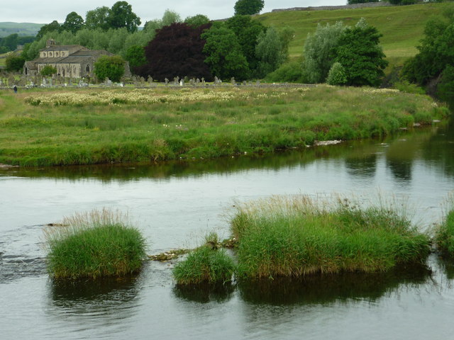
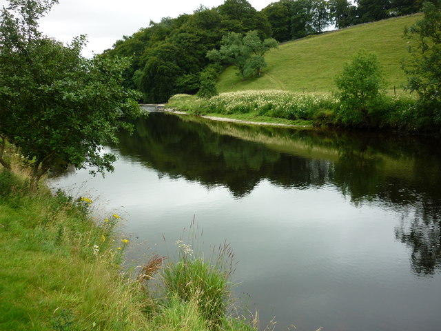
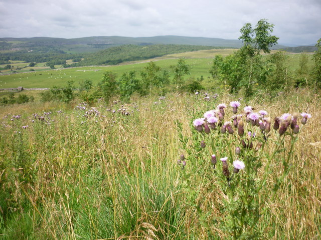
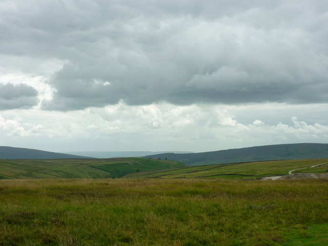
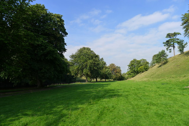
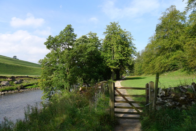
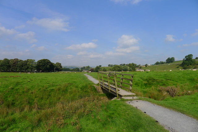
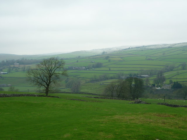
Hole Bottom is a small village located in the county of Yorkshire, England. Situated in the rural countryside, it is nestled within the picturesque landscape of the Pennines. The village is known for its tranquility and natural beauty, attracting visitors who seek a peaceful retreat away from the bustling city life.

With a population of around 300 residents, Hole Bottom maintains a close-knit community feel. The village is characterized by its charming stone cottages and narrow winding lanes, which add to its rustic charm. Surrounded by rolling hills and lush green fields, the area is a haven for nature lovers and outdoor enthusiasts.

Despite its small size, Hole Bottom boasts a few amenities for its residents and visitors. A local pub serves as a gathering place for villagers to socialize and enjoy a pint, while a small convenience store provides basic necessities. The village also has a primary school, ensuring that children have access to education within their community.

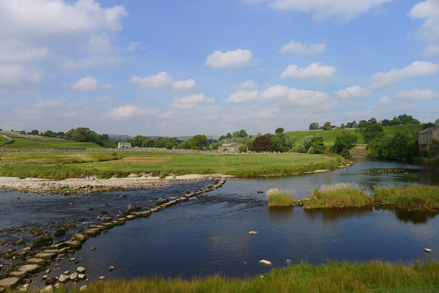
The village's location offers easy access to the stunning Yorkshire Dales National Park, which is renowned for its breathtaking scenery and extensive walking trails. From Hole Bottom, visitors can explore the park's picturesque valleys, limestone cliffs, and cascading waterfalls.

Overall, Hole Bottom provides an idyllic escape for those seeking a peaceful and scenic retreat in the heart of Yorkshire's countryside. Its quaint charm, natural beauty, and proximity to the Yorkshire Dales make it an attractive destination for both locals and tourists alike.

If you have any feedback on the listing, please let us know in the comments section below.
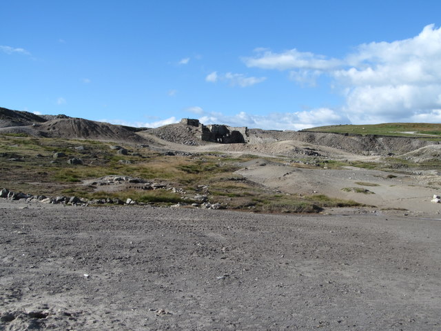
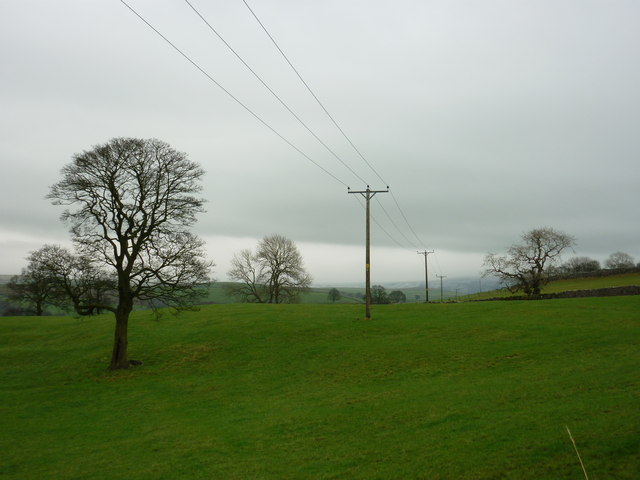
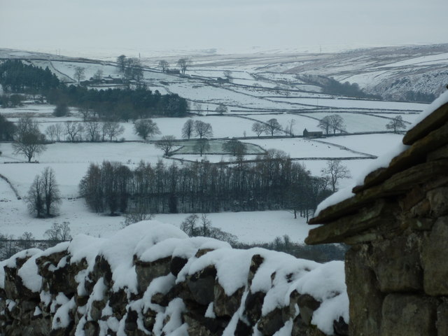
Hole Bottom Images

Images are sourced within 2km of 54.072808/-1.9648926 or Grid Reference SE0264. Thanks to Geograph Open Source API. All images are credited.
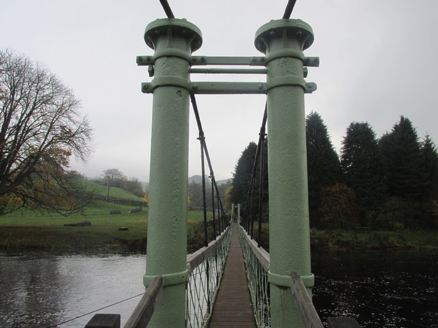
Fletcher Brow Taken from the point on the River Wharfe where it meanders past Linton, North Yorkshire, I am looking northwards to Fletcher Brow above Brow Well Fish Farm. The 12th century church of St Michael and All Saints, Linton, is to the left of shot.
Fletcher Brow
Taken from the point on the River Wharfe where it meanders past Linton, North Yorkshire, I am looking northwards to Fletcher Brow above Brow Well Fish Farm. The 12th century church of St Michael and All Saints, Linton, is to the left of shot.
Meadowsweet in Wharfedale Taken on the section of the Dales Way between Linton and Hebden as I near Hebden, I am looking across the River Wharfe at the glorious display of meadowsweet on the opposite bank.
Meadowsweet in Wharfedale
Taken on the section of the Dales Way between Linton and Hebden as I near Hebden, I am looking across the River Wharfe at the glorious display of meadowsweet on the opposite bank.
Lea Green and Bastow Wood Taken on the plantation beside Spring House, Grassington, North Yorkshire, I am looking north west across Kimpergill Hill to Lea Green and Bastow and Grass Woods.
Lea Green and Bastow Wood
Taken on the plantation beside Spring House, Grassington, North Yorkshire, I am looking north west across Kimpergill Hill to Lea Green and Bastow and Grass Woods.
Yarnbury to Barden Moor Taken on Duke's New Road which connects the old smelting works with the lead mine workings and spoils at Yarnbury, Grassington, I am looking south west towards Barden Moor. Scar Top House is just discernible at the head of Slate Pit Ridge to the left of shot.
Yarnbury to Barden Moor
Taken on Duke's New Road which connects the old smelting works with the lead mine workings and spoils at Yarnbury, Grassington, I am looking south west towards Barden Moor. Scar Top House is just discernible at the head of Slate Pit Ridge to the left of shot.
The suspension bridge and stepping stones to Hebden "In 1884, following the drowning of a local man while trying to cross the stepping stones on the River Wharfe below Hebden, a committee was formed with the intention of building a footbridge. A great storm the previous year had also destroyed Burnsall Bridge down stream causing the villagers great problems. The new bridge was designed as a suspension bridge and was built by the village blacksmith, William Bell [in 1885, and recently refurbished by the National Park Authority]" from <span class="nowrap"><a title="http://www.outofoblivion.org.uk/record.asp?id=282" rel="nofollow ugc noopener" href="http://www.outofoblivion.org.uk/record.asp?id=282">Link</a><img style="margin-left:2px;" alt="External link" title="External link - shift click to open in new window" src="https://s1.geograph.org.uk/img/external.png" width="10" height="10"/></span>
The suspension bridge and stepping stones to Hebden
"In 1884, following the drowning of a local man while trying to cross the stepping stones on the River Wharfe below Hebden, a committee was formed with the intention of building a footbridge. A great storm the previous year had also destroyed Burnsall Bridge down stream causing the villagers great problems. The new bridge was designed as a suspension bridge and was built by the village blacksmith, William Bell [in 1885, and recently refurbished by the National Park Authority]" from LinkExternal link
A line of horse chestnut trees alongside the Dales Way
The Dales Way through Lythe Plantation
Crossing Isingdale Beck A very small stream; hardly worthy of being called a beck. The 'ising' prefix is likely an Old English reference to iron.
Crossing Isingdale Beck
A very small stream; hardly worthy of being called a beck. The 'ising' prefix is likely an Old English reference to iron.
Stepping stones across the Wharfe to Linton church The church of St Michael, at Linton, serves a widely spread community; including Grassington, which has never had its own parish church.
Stepping stones across the Wharfe to Linton church
The church of St Michael, at Linton, serves a widely spread community; including Grassington, which has never had its own parish church.
Hebden suspension bridge. Walking the Dales way.
Hebden suspension bridge.
Walking the Dales way.
Old mine shaft at Yarnbury There has been some attempt to persuade humans and animals not to approach too closely to this open shaft, mainly through the use of some old corrugated sheeting and a rusting wheelbarrow, neither of which succeed in closing off the shaft, whilst the surrounding drystone wall now has large gaps.
Old mine shaft at Yarnbury
There has been some attempt to persuade humans and animals not to approach too closely to this open shaft, mainly through the use of some old corrugated sheeting and a rusting wheelbarrow, neither of which succeed in closing off the shaft, whilst the surrounding drystone wall now has large gaps.
Old mine shaft at Yarnbury Until recently this shaft was covered by timber planks, but one appears to have decayed to the point where it has fallen in. Some plastic netting warns people not to get too close.  There are thousands of these old shafts in the dales area, most of which appear to be shallow grassy bowls, but one never knows what the grass hides as there is a fair chance that there will be rotting timbers over a hidden shaft.
Old mine shaft at Yarnbury
Until recently this shaft was covered by timber planks, but one appears to have decayed to the point where it has fallen in. Some plastic netting warns people not to get too close. There are thousands of these old shafts in the dales area, most of which appear to be shallow grassy bowls, but one never knows what the grass hides as there is a fair chance that there will be rotting timbers over a hidden shaft.
Recently repaired stonework at Yarnbury These buttresses once supported a small bridge, used to carry waste material from the nearby lead mine to a tip. The stonework had decayed over the years and the whole lot was in danger of collapse, so work has been done to consolidate the stonework some of which is now mortared using lime mortar.
Recently repaired stonework at Yarnbury
These buttresses once supported a small bridge, used to carry waste material from the nearby lead mine to a tip. The stonework had decayed over the years and the whole lot was in danger of collapse, so work has been done to consolidate the stonework some of which is now mortared using lime mortar.
Yarnbury mining area The scarred landscape of Grassington Moor at Yarnbury, an area once busy with lead mining. This view shows the recently repaired buttresses of a former bridge which carried tubs laden with waste material. Close by were the Beevers and Union shafts, plus a crushing and dressing floor. On the skyline is the chimney at the top end of the extensive flue system which snaked across the moor from the smelt mill.
Yarnbury mining area
The scarred landscape of Grassington Moor at Yarnbury, an area once busy with lead mining. This view shows the recently repaired buttresses of a former bridge which carried tubs laden with waste material. Close by were the Beevers and Union shafts, plus a crushing and dressing floor. On the skyline is the chimney at the top end of the extensive flue system which snaked across the moor from the smelt mill.
Old mining ground at Yarnbury Old tips and polluted ground close to the former Beevers and Union shafts at Yarnbury. The distant ruins were part of a crushing and dressing area, but were renovated and reused in the 20thC when the area was reworked for minerals such as barytes and fluorite. Although the tips have been untouched for decades, nothing grows on them.
Old mining ground at Yarnbury
Old tips and polluted ground close to the former Beevers and Union shafts at Yarnbury. The distant ruins were part of a crushing and dressing area, but were renovated and reused in the 20thC when the area was reworked for minerals such as barytes and fluorite. Although the tips have been untouched for decades, nothing grows on them.
To Hebden Taken on the lane leading up to Thorpe, North Yorkshire, just off the B6160 to Burnsall, I am looking east towards where Hebden is located.
To Hebden
Taken on the lane leading up to Thorpe, North Yorkshire, just off the B6160 to Burnsall, I am looking east towards where Hebden is located.
Fletcher Brow Taken on the lane running down from Thorpe, North Yorkshire, I am looking north across the Wharfedale valley to Fletcher Brow. Lythe House is to the right of shot and High Cross Farm is directly above Fletcher Brow, on the Hebden road. Grassington Moor rises above in the distance.
Fletcher Brow
Taken on the lane running down from Thorpe, North Yorkshire, I am looking north across the Wharfedale valley to Fletcher Brow. Lythe House is to the right of shot and High Cross Farm is directly above Fletcher Brow, on the Hebden road. Grassington Moor rises above in the distance.
Hebden Moor Taken on the access road up to Thorpe from the B6160 Threshfield to Burnsall road, I am looking north across Grassington Park Estate to Hebden Moor. Grassington Moor is beyond to the left of shot and the chimney at the disused mine workings is discernible against the snowy background.
Hebden Moor
Taken on the access road up to Thorpe from the B6160 Threshfield to Burnsall road, I am looking north across Grassington Park Estate to Hebden Moor. Grassington Moor is beyond to the left of shot and the chimney at the disused mine workings is discernible against the snowy background.
Show me another place!

Hole Bottom is located at Grid Ref: SE0264 (Lat: 54.072808, Lng: -1.9648926)

Division: West Riding

Administrative County: North Yorkshire

District: Craven

Police Authority: North Yorkshire

What 3 Words

///technical.trespass.watching. Near Grassington, North Yorkshire

Related Wikis

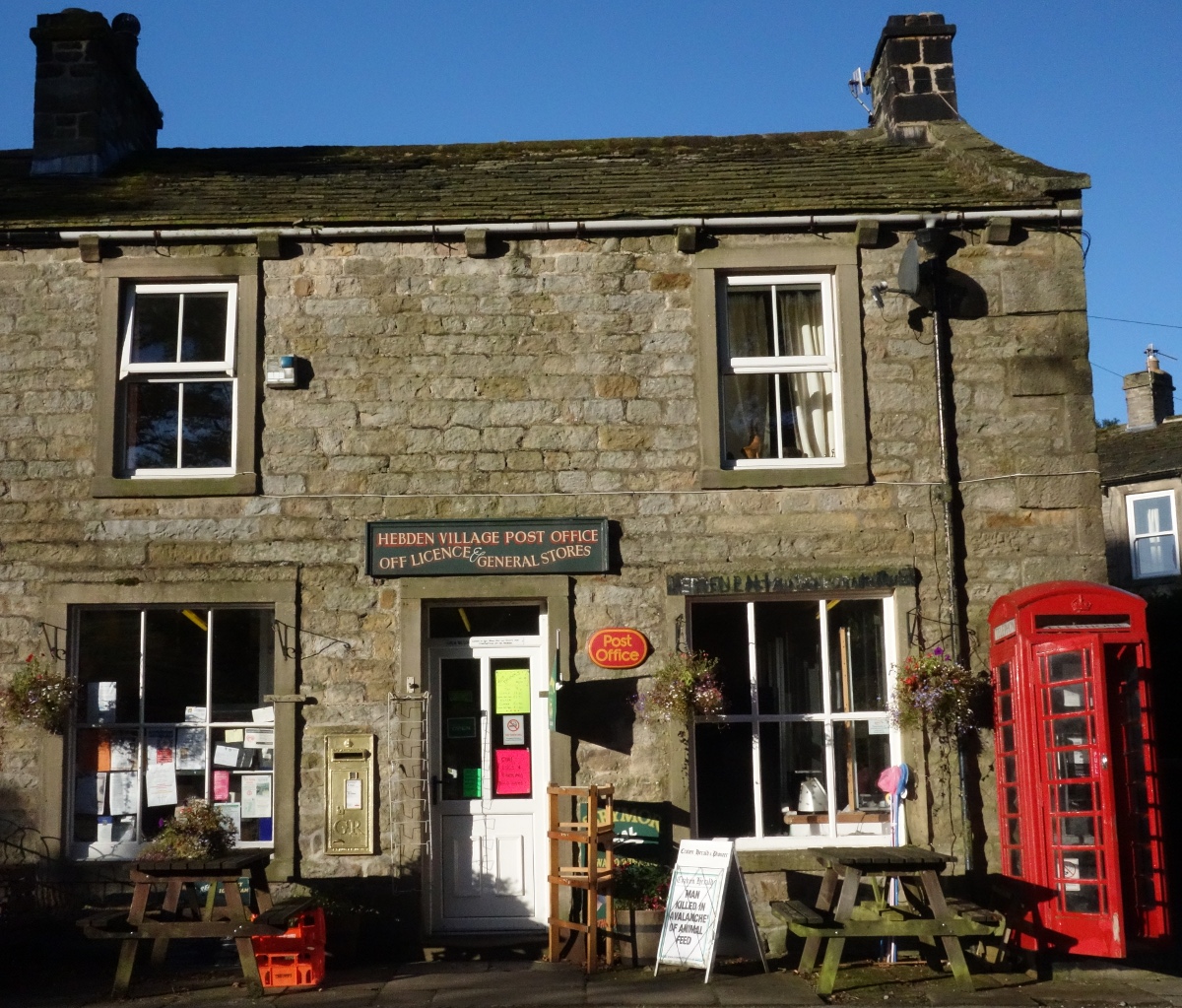
Hebden, North Yorkshire

Hebden ( HEB-dərn) is a village and civil parish in the Craven District of North Yorkshire, England, and one of four villages in the ecclesiastical parish...

Grassington

Grassington is a village and civil parish in North Yorkshire, England. The population of the parish at the 2011 Census was 1,126. Historically part of...

Thorpe, North Yorkshire

Thorpe is a village and civil parish in the Craven district of North Yorkshire, England. It is 2 miles (3 km) south of Grassington and 6 miles (10 km)...

Linton Falls Hydro

Linton Falls Hydro is a hydroelectric generating power station located on the Linton Falls Weir of the River Wharfe, near Grassington, North Yorkshire...

Burnsall

Burnsall is a village and civil parish in the Craven district of North Yorkshire, England. It is situated on the River Wharfe in Wharfedale, and is in...

Grassington & Threshfield railway station

Grassington & Threshfield railway station (or Threshfield station) was a railway station that served the town of Grassington and village of Threshfield...

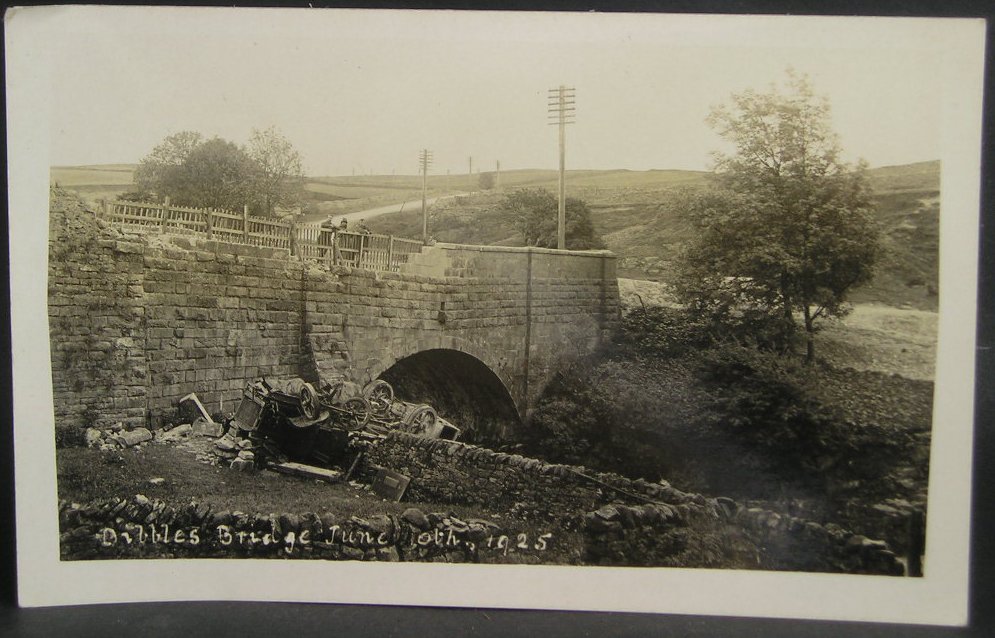
1925 Dibbles Bridge coach crash

On 10 June 1925, a coach crashed at the bottom of a steep hill at Dibbles Bridge, near Hebden in North Yorkshire, England. Seven people were killed and...

1975 Dibbles Bridge coach crash

On 27 May 1975, a coach carrying elderly passengers crashed at the bottom of a steep hill at Dibble's Bridge, near Hebden in North Yorkshire, England....

Nearby Amenities

Located within 500m of 54.072808,-1.9648926
Scala Waterfall
Fixme: check exact location
Source: OS sheet 134,1853
Waterway: waterfall
Lat/Long: 54.0711064/-1.9644025
Hole Bottom
Is In: UK, England, North Yorkshire, Wharfedale, Yorkshire Dales
Place: hamlet
Lat/Long: 54.0723197/-1.9645429
Mossy Moor Ridge
Is In: UK,Yorkshire,North Yorkshire,Nidderdale
Is In Country: UK
Is In County: North Yorkshire
Is In Historical County: Yorkshire
Natural: peak
Source: OS 1:25k
Lat/Long: 54.0730402/-1.9586987
Barrier: cattle_grid
Source: Bing
Lat/Long: 54.069302/-1.9679748
Fixme: gate or stile?
Lat/Long: 54.0719763/-1.9702076
Barrier: stile
Material: stone
Source: survey;gps
Stile: stepover
Lat/Long: 54.0718932/-1.9664463
Barrier: entrance
Source: survey;gps
Lat/Long: 54.0712064/-1.9615988
Barrier: stile
Material: stone
Source: survey;gps
Stile: stepover
Lat/Long: 54.0704317/-1.9673708
Barrier: stile
Material: steel
Source: survey;gps
Stile: squeezer
Lat/Long: 54.0727909/-1.965031
Barrier: stile
Material: wood
Source: survey;gps
Stile: stepover
Lat/Long: 54.0728317/-1.9650732
Barrier: cattle_grid
Bicycle: yes
Foot: yes
Lat/Long: 54.0728338/-1.9649624
Barrier: cattle_grid
Bicycle: yes
Foot: yes
Lat/Long: 54.0731111/-1.9663782
Barrier: stile
Material: steel
Source: survey;gps
Stile: squeezer
Lat/Long: 54.0734098/-1.9669263
Fixme: gate or stile?
Lat/Long: 54.0723181/-1.9680693
Barrier: stile
Material: stone
Source: survey;gps
Stile: stepover
Lat/Long: 54.0690764/-1.9637274
Barrier: stile
Material: stone
Source: survey;gps
Stile: stepover
Lat/Long: 54.0709331/-1.9615292
Scale Haw
Natural: peak
Source: OS Yorshire 134, 1853
Lat/Long: 54.0719236/-1.9647724
Description: Marked as "ruin" in OS Yorkshire 134, 1853, no other detail.
Historic: archaeological_site
Source: OS Yorkshire 134, 1853
Lat/Long: 54.0731008/-1.9700285
New Years Lathe
Archaeological Site: building
Description: Former barn, extant in mid-C19th
Historic: archaeological_site
Source: OS Yorkshire 134, 1853
Lat/Long: 54.0745331/-1.9691433
Archaeological Site: building
Description: building extant in C19th
Historic: archaeological_site
Source: OS sheet 134,1853
Lat/Long: 54.0691459/-1.9631461
Description: ruin in mid-C9th. Unknown
Historic: archaeological_site
Source: OS sheet 134,1853
Lat/Long: 54.0709415/-1.9624862
Historic: lime_kiln
Mineral: limestone
Output: lime
Source: OS sheet 134,1853
Lat/Long: 54.0710014/-1.9632318
Pickering Low Lathe
Archaeological Site: building
Description: Barn extant n mid-C19th. Possibly rebuilt to SW
Historic: archaeological_site
Source: OS sheet 134,1853
Lat/Long: 54.0691285/-1.9654233
Natural: spring
Source: NLS-OS-1st_Series
Lat/Long: 54.0719088/-1.9714758
Natural: spring
Source: NLS-OS-1st_Series
Lat/Long: 54.076579/-1.9671414
Leisure: picnic_table
Lat/Long: 54.0732997/-1.9638987
Bench
Source: survey
Lat/Long: 54.0691253/-1.9651658
Archaeological Site: mineral_extraction
Description: Almost certainly lead mining
Historic: mine_shaft
Source: Bing
Lat/Long: 54.074744/-1.9613091
Archaeological Site: mineral_extraction
Description: Almost certainly lead mining
Historic: mine_shaft
Source: Bing
Lat/Long: 54.0754631/-1.9606842
Archaeological Site: mineral_extraction
Description: Almost certainly lead mining
Historic: mine_shaft
Source: Bing
Lat/Long: 54.0744355/-1.9607539
Archaeological Site: mineral_extraction
Description: Almost certainly lead mining
Historic: mine_shaft
Source: Bing
Lat/Long: 54.0760406/-1.9610463
Ford: yes
Lat/Long: 54.0709493/-1.964385
Power: pole
Lat/Long: 54.0749992/-1.9714955
Power: pole
Lat/Long: 54.074355/-1.9717611
Power: pole
Lat/Long: 54.0738607/-1.97195
Power: pole
Lat/Long: 54.0732314/-1.9721824
Power: pole
Lat/Long: 54.0724973/-1.9724326
Power: pole
Lat/Long: 54.0730651/-1.9713755
Power: pole
Lat/Long: 54.0728719/-1.9704512
Power: pole
Lat/Long: 54.0726007/-1.9691414
Power: pole
Lat/Long: 54.072767/-1.9682758
Power: pole
Lat/Long: 54.0729423/-1.967446
Power: pole
Lat/Long: 54.0728794/-1.9665778
Power: pole
Lat/Long: 54.0728075/-1.9656535
Power: pole
Lat/Long: 54.072791/-1.9652654
Power: pole
Lat/Long: 54.0703609/-1.9592863
The data included in this document is from www.openstreetmap.org. The data is made available under ODbL.

Have you been to Hole Bottom?

Leave your review of Hole Bottom below (or comments, questions and feedback).