Hill Street

Settlement in Dorset

England

Hill Street

Repairing Higher Wood Bridge, Bishop's Caundle
Repairing Higher Wood Bridge, Bishop's Caundle Credit: David Smith

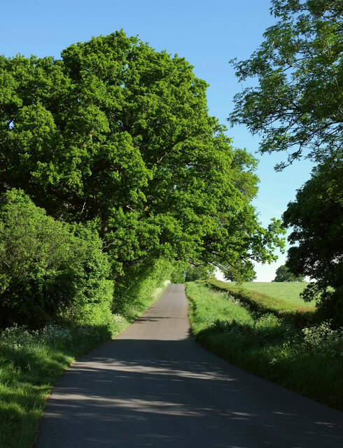
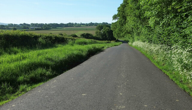
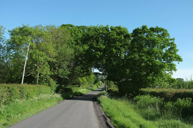
Hill Street is a charming and picturesque residential area located in the beautiful county of Dorset, England. Nestled among the rolling hills and countryside, this quaint street is known for its idyllic setting and peaceful atmosphere.

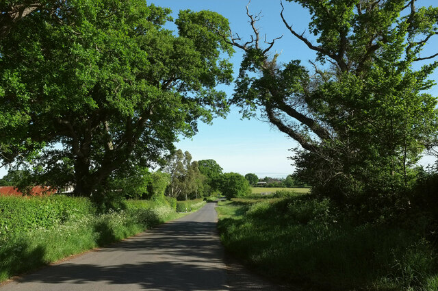
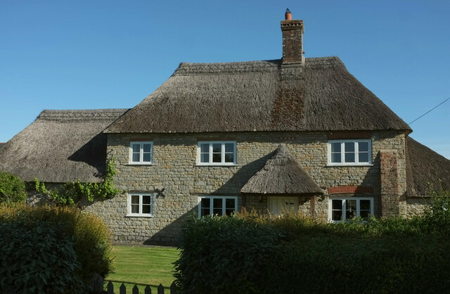
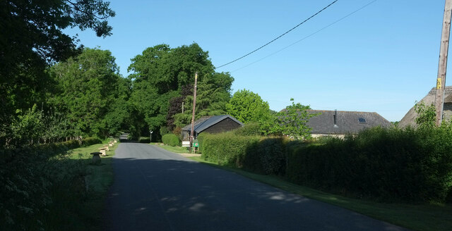
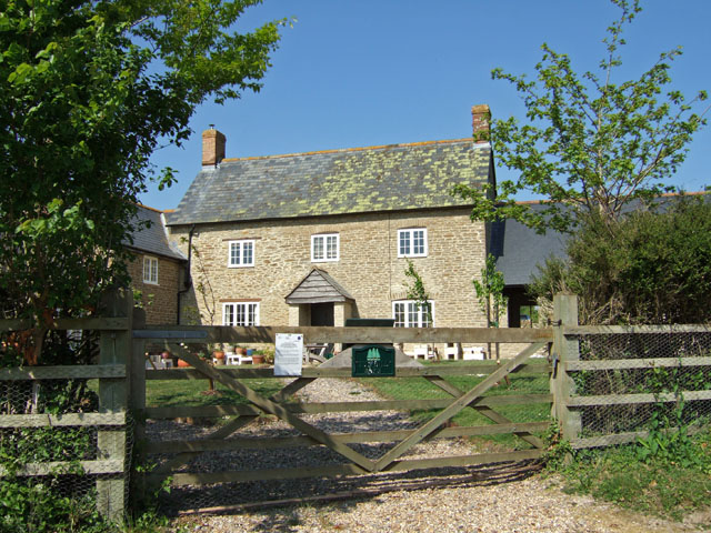
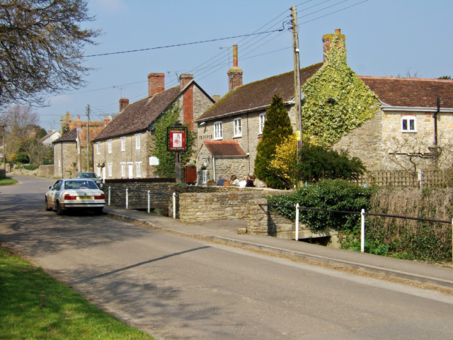
Situated in the heart of Dorset, Hill Street is characterized by its traditional stone cottages, which line both sides of the road. These charming houses exude a sense of history and authenticity, with their thatched roofs and colorful, well-maintained gardens. The architecture of the street reflects the region's rich heritage and offers a glimpse into a bygone era.

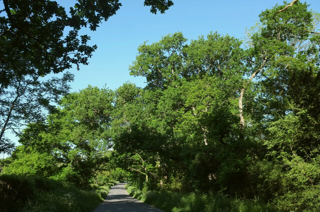
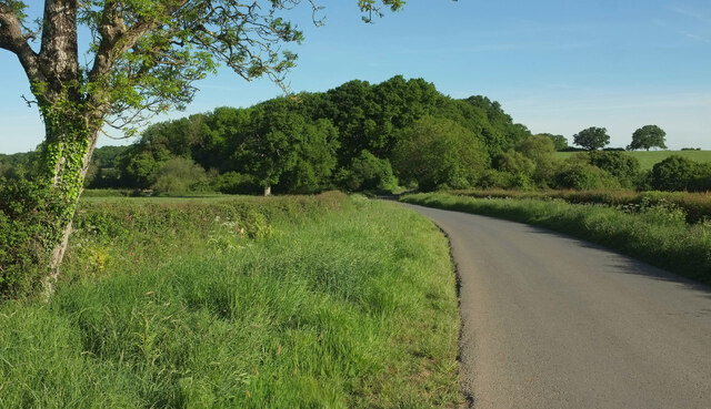
The street itself is relatively narrow, providing a sense of intimacy and tranquility. Residents and visitors alike can enjoy leisurely strolls along the cobblestone pavement, taking in the delightful sights and sounds of the surrounding countryside. The street is well-maintained and often adorned with hanging flower baskets or decorative flags, enhancing its appeal.

Hill Street is conveniently located near a range of amenities, including shops, cafes, and local pubs, which offer a warm welcome and a taste of traditional Dorset hospitality. The community spirit is strong, with residents often organizing events and gatherings to foster a sense of belonging and camaraderie.

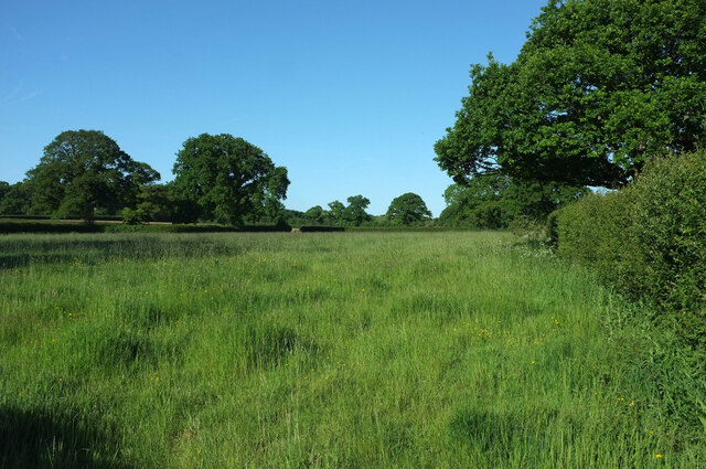
Nature enthusiasts will appreciate the close proximity of Hill Street to some of Dorset's most breathtaking natural attractions. Lush green fields, meandering rivers, and picturesque hiking trails are just a short distance away, providing ample opportunities for outdoor activities and exploration.

In summary, Hill Street in Dorset offers a picturesque and tranquil setting, steeped in history and natural beauty. Whether you are a resident or a visitor, this charming street is sure to captivate with its timeless charm and warm community spirit.

If you have any feedback on the listing, please let us know in the comments section below.
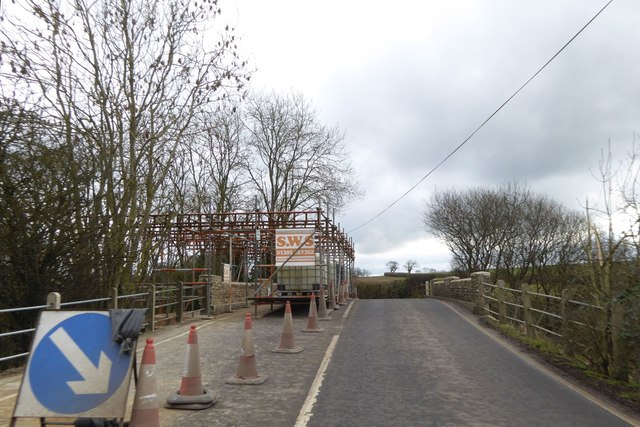
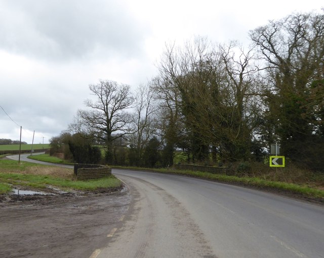
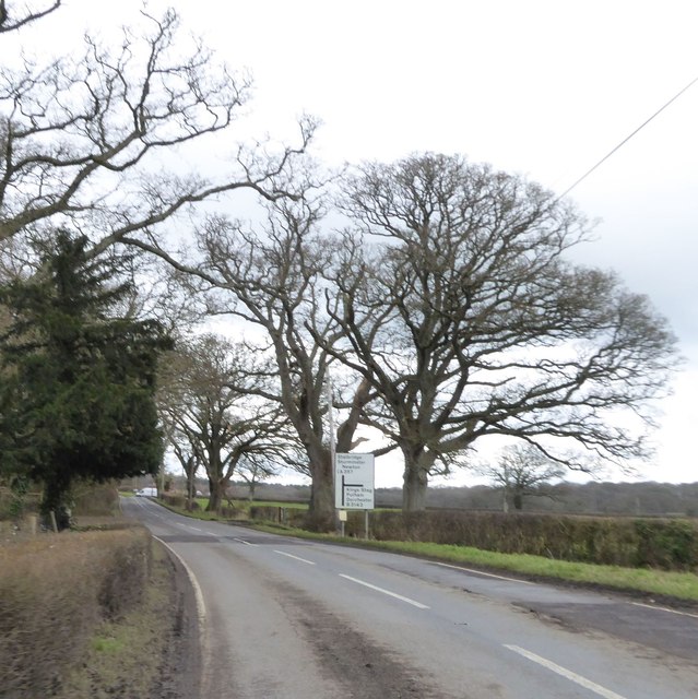
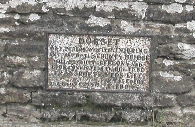
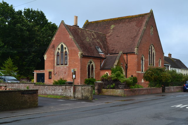
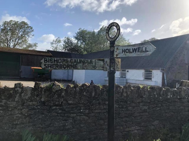
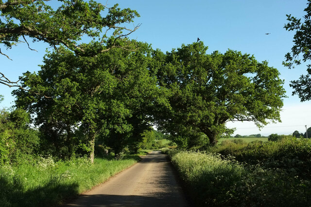
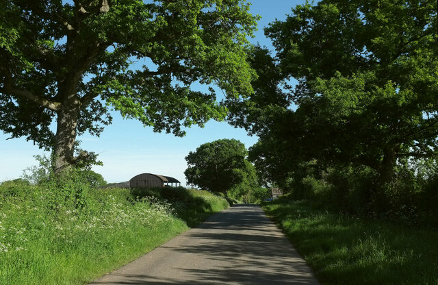
Hill Street Images

Images are sourced within 2km of 50.90124/-2.4167552 or Grid Reference ST7011. Thanks to Geograph Open Source API. All images are credited.

Repairing Higher Wood Bridge, Bishop's Caundle
Lower Wood Bridge, east of Bishop's Caundle
Bare trees by the A3030 near Blackrow Lane The sign indicates the turn for Blackrow Lane, leading to King's Stag
Bare trees by the A3030 near Blackrow Lane
The sign indicates the turn for Blackrow Lane, leading to King's Stag
Old Bridge Marker by the A3030, Higher Wood Bridge, Bishops Caundle parish Bridge Marker by the A3030, in parish of Bishops Caundle (West Dorset District), Higher Wood Bridge, Northeast side of road. (Dangerous road). For some reason this plate was replaced by a new inaccurate plate between 2015/6, presumably when the bridge was re-pointed. 

Inscription reads:-
DORSET
ANY PERSON WILFULLY INJURING
ANY PART OF THIS COUNTY BRIDGE
WILL BE GUILTY OF FELONY AND
UPON CONVICTION LIABLE TO BE
TRANSPORTED FOR LIFE
BY THE COURT
7&8 GEO 4 C30 S13 T FOOKS

Surveyed

Milestone Society National ID: DO_TRAHWObr
Old Bridge Marker by the A3030, Higher Wood Bridge, Bishops Caundle parish
Bridge Marker by the A3030, in parish of Bishops Caundle (West Dorset District), Higher Wood Bridge, Northeast side of road. (Dangerous road). For some reason this plate was replaced by a new inaccurate plate between 2015/6, presumably when the bridge was re-pointed. Inscription reads:- DORSET ANY PERSON WILFULLY INJURING ANY PART OF THIS COUNTY BRIDGE WILL BE GUILTY OF FELONY AND UPON CONVICTION LIABLE TO BE TRANSPORTED FOR LIFE BY THE COURT 7&8 GEO 4 C30 S13 T FOOKS Surveyed Milestone Society National ID: DO_TRAHWObr
Former chapel at Holwell
Direction Sign – Signpost Located on the north side of the A3030 beside the entrance to Woodbridge Farm, opposite Peaceful Lane in Holwell parish. 3 arms, 1 missing, and annulus finial. See also <a title="https://www.geograph.org.uk/photo/458327" href="https://www.geograph.org.uk/photo/458327">Link</a>.

Milestone Society National ID: DO_ST7112
Direction Sign – Signpost
Located on the north side of the A3030 beside the entrance to Woodbridge Farm, opposite Peaceful Lane in Holwell parish. 3 arms, 1 missing, and annulus finial. See also Link. Milestone Society National ID: DO_ST7112
Lane to Holwell Roadside trees on a straight lane passing Oakwood View.
Lane to Holwell
Roadside trees on a straight lane passing Oakwood View.
Passing Holwell Hill Farm On the lane from Pulham to Holwell.
Passing Holwell Hill Farm
On the lane from Pulham to Holwell.
Lane to Holwell A little further north from <a href="https://www.geograph.org.uk/photo/7184565">ST7010 : Passing Holwell Hill Farm</a>. A little of the village of Holwell is visible ahead right of centre.
Lane to Holwell
A little further north from ST7010 : Passing Holwell Hill Farm. A little of the village of Holwell is visible ahead right of centre.
Crouch Hill Farm The thatched farmhouse on Holwell Drove is "possibly of C17 origin ..." <span class="nowrap"><a title="https://historicengland.org.uk/listing/the-list/list-entry/1304895?section=official-list-entry" rel="nofollow ugc noopener" href="https://historicengland.org.uk/listing/the-list/list-entry/1304895?section=official-list-entry">Link</a><img style="margin-left:2px;" alt="External link" title="External link - shift click to open in new window" src="https://s1.geograph.org.uk/img/external.png" width="10" height="10"/></span> .
Crouch Hill Farm
The thatched farmhouse on Holwell Drove is "possibly of C17 origin ..." LinkExternal link .
Holwell Drove Approaching a slight right bend, the only bend in the one and a half kilometres road between Holwell and Sandhills. Its drove-like quality is more pronounced towards the western end.
Holwell Drove
Approaching a slight right bend, the only bend in the one and a half kilometres road between Holwell and Sandhills. Its drove-like quality is more pronounced towards the western end.
Road to Holwell The road from Pulham approaches Parsons' Bridge, with Holwell Hill Gorse ahead.
Road to Holwell
The road from Pulham approaches Parsons' Bridge, with Holwell Hill Gorse ahead.
Road to Holwell Climbing away from Parsons' Bridge with Holwell Hill Gorse on the left.
Road to Holwell
Climbing away from Parsons' Bridge with Holwell Hill Gorse on the left.
Road to Pulham A reverse view of <a href="https://www.geograph.org.uk/photo/7563508">ST7009 : Road to Holwell</a>, with Holwell Hill Gorse on the right.
Road to Pulham
A reverse view of ST7009 : Road to Holwell, with Holwell Hill Gorse on the right.
Road to Holwell Looking in the opposite direction from <a href="https://www.geograph.org.uk/photo/7563516">ST7009 : Road to Pulham</a>.
Road to Holwell
Looking in the opposite direction from ST7009 : Road to Pulham.
Road to Holwell On either side of the road by the trees are ponds. Beyond are 30mph speed restriction signs by the village name sign for Holwell.
Road to Holwell
On either side of the road by the trees are ponds. Beyond are 30mph speed restriction signs by the village name sign for Holwell.
Grass field, Holwell The last field on the west side of the road from Pulham before the village proper begins.
Grass field, Holwell
The last field on the west side of the road from Pulham before the village proper begins.
Holwell Drove The road leaves the village of Holwell. On the extreme right is a glimpse of Crouch Hill Farm <a href="https://www.geograph.org.uk/photo/7184691">ST7010 : Crouch Hill Farm</a>.
Holwell Drove
The road leaves the village of Holwell. On the extreme right is a glimpse of Crouch Hill Farm ST7010 : Crouch Hill Farm.
Show me another place!

Hill Street is located at Grid Ref: ST7011 (Lat: 50.90124, Lng: -2.4167552)

Unitary Authority: Dorset

Police Authority: Dorset

What 3 Words

///cage.according.nightcap. Near Stalbridge, Dorset

Nearby Locations

Pleck Green Hill Street

Related Wikis

Holwell, Dorset

Holwell is a village and civil parish in the county of Dorset in southern England, situated approximately 5 miles (8.0 km) south-east of Sherborne. It...

Woodbridge, Dorset

Woodbridge is a hamlet in Dorset, England. The village is on the A3030 road and to the north east of Holwell. == History == Woodbridge was part of the...

King's Stag Memorial Chapel

King's Stag Memorial Chapel is a Church of England chapel in King's Stag, Dorset, England. == History == The memorial chapel at King's Stag was built in...

Bishop's Caundle

Bishop's Caundle is a village and civil parish in Dorset, South West England. It is situated 6 miles (9.7 km) south-east of Sherborne. The local travel...

Pulham

Pulham is a village and civil parish in the county of Dorset in south-west England. It is situated in the Blackmore Vale, 7 miles (11 kilometres) southeast...

St Peter and St Paul's Church, Caundle Marsh

St Peter and St Paul's Church is a Church of England parish church in Caundle Marsh, Dorset, England. It was designed by Robert Howard Shout and built...

Caundle Marsh

Caundle Marsh is a village and civil parish in northwest Dorset, England, situated in the Blackmore Vale, 4 miles (6.4 km) southeast of Sherborne. The...

Stourton Caundle

Stourton Caundle is a village and civil parish in the county of Dorset in southwest England. It lies within the Blackmore Vale, about five miles (eight...

Nearby Amenities

Located within 500m of 50.90124,-2.4167552
Material: wood
Power: pole
Source: bing
Lat/Long: 50.8990342/-2.4116486
Material: wood
Power: pole
Source: bing
Lat/Long: 50.8994468/-2.4125541
Material: wood
Power: pole
Source: bing
Lat/Long: 50.8998665/-2.4134693
Material: wood
Power: pole
Source: bing
Lat/Long: 50.9007211/-2.4153271
Material: wood
Power: pole
Source: bing
Lat/Long: 50.9011621/-2.4162632
Power: pole
Source: bing
Lat/Long: 50.9048875/-2.4134141
Power: pole
Source: bing
Lat/Long: 50.9043708/-2.4138138
Power: pole
Source: bing
Lat/Long: 50.9038354/-2.4142121
Power: pole
Source: bing
Lat/Long: 50.9032756/-2.4146479
Power: pole
Source: bing
Lat/Long: 50.9002976/-2.4143851
Power: pole
Source: bing
Lat/Long: 50.9019063/-2.4157248
Power: pole
Source: bing
Lat/Long: 50.9026362/-2.4151562
Power: pole
Source: bing
Transformer: distribution
Lat/Long: 50.8998739/-2.420923
Power: pole
Source: bing
Lat/Long: 50.8995178/-2.4214849
Power: pole
Source: bing
Lat/Long: 50.9002291/-2.4203253
Power: pole
Source: bing
Lat/Long: 50.9004043/-2.419468
Power: pole
Source: bing
Lat/Long: 50.9005962/-2.4185877
Power: pole
Source: bing
Transformer: distribution
Lat/Long: 50.9011011/-2.4173999
Power: pole
Source: bing
Lat/Long: 50.8989638/-2.4223767
Direction: 125
Generator Method: photovoltaic
Generator Output Electricity: yes
Generator Solar Modules: 56
Generator Source: solar
Generator Type: solar_photovoltaic_panel
Location: roof
Power: generator
Lat/Long: 50.8998645/-2.4203717
The data included in this document is from www.openstreetmap.org. The data is made available under ODbL.

Have you been to Hill Street?

Leave your review of Hill Street below (or comments, questions and feedback).