Pleck Green

Settlement in Dorset

England

Pleck Green

Repairing Higher Wood Bridge, Bishop's Caundle
Repairing Higher Wood Bridge, Bishop's Caundle Credit: David Smith

Pleck Green is a charming village nestled in the picturesque county of Dorset, England. Located in the southern region of the country, Pleck Green offers residents and visitors a tranquil and idyllic setting to escape the hustle and bustle of city life. With its serene countryside and stunning natural landscapes, the village is a haven for nature lovers and outdoor enthusiasts.

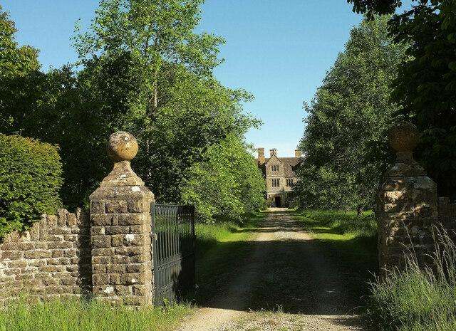
The village itself is relatively small, consisting of quaint cottages and traditional English architecture. Pleck Green is known for its tight-knit community, where residents take pride in maintaining a friendly and welcoming atmosphere. The village green is a central gathering place, hosting community events and providing a space for locals to relax and socialize.

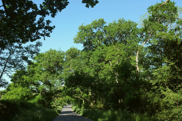
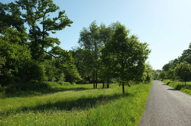
Surrounded by verdant fields and rolling hills, Pleck Green is a paradise for hikers and walkers. Several footpaths and trails wind through the countryside, offering breathtaking views of the surrounding landscapes and glimpses of the local wildlife. Additionally, the nearby River Stour provides opportunities for fishing and boating, adding to the outdoor activities available in the area.

Though small, Pleck Green is conveniently located near larger towns and cities, allowing residents easy access to amenities and services. The village is just a short drive away from the bustling market town of Dorchester, where one can find a range of shops, restaurants, and cultural attractions.

In summary, Pleck Green offers a peaceful and picturesque retreat for those seeking a slower pace of life. With its stunning natural beauty and strong sense of community, the village provides an inviting and relaxing environment for residents and visitors alike.

If you have any feedback on the listing, please let us know in the comments section below.
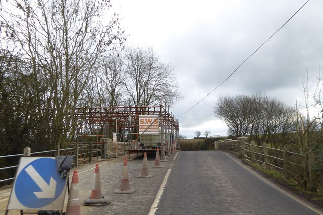
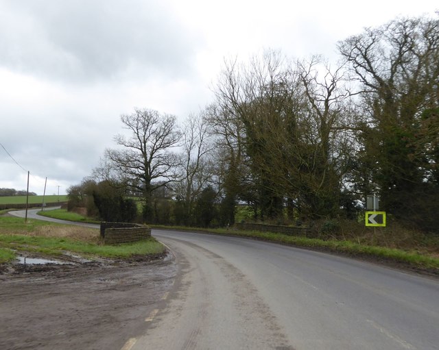
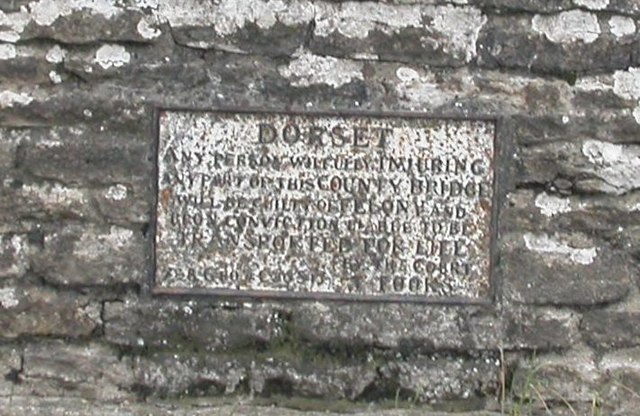
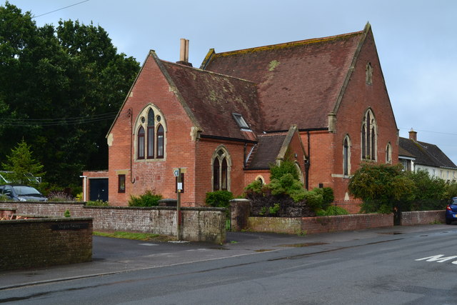
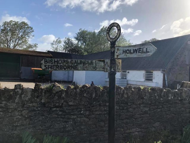
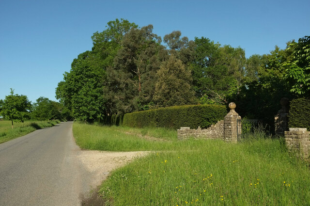
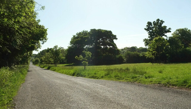
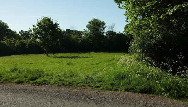
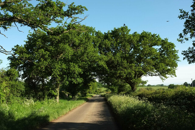
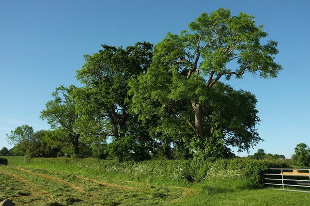
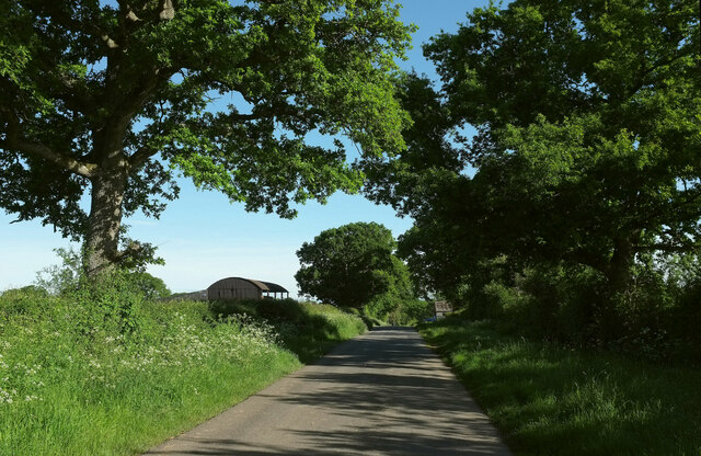
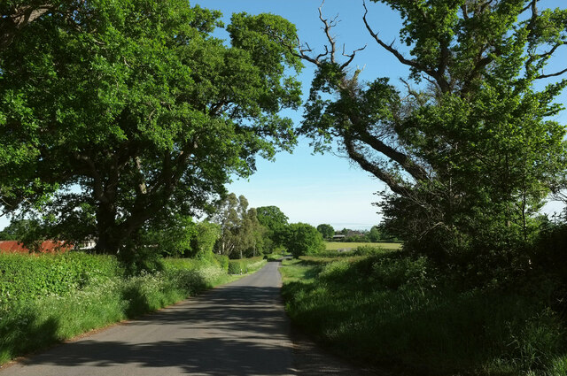
Pleck Green Images

Images are sourced within 2km of 50.897933/-2.4187733 or Grid Reference ST7011. Thanks to Geograph Open Source API. All images are credited.

Repairing Higher Wood Bridge, Bishop's Caundle
Lower Wood Bridge, east of Bishop's Caundle
Old Bridge Marker by the A3030, Higher Wood Bridge, Bishops Caundle parish Bridge Marker by the A3030, in parish of Bishops Caundle (West Dorset District), Higher Wood Bridge, Northeast side of road. (Dangerous road). For some reason this plate was replaced by a new inaccurate plate between 2015/6, presumably when the bridge was re-pointed. 

Inscription reads:-
DORSET
ANY PERSON WILFULLY INJURING
ANY PART OF THIS COUNTY BRIDGE
WILL BE GUILTY OF FELONY AND
UPON CONVICTION LIABLE TO BE
TRANSPORTED FOR LIFE
BY THE COURT
7&8 GEO 4 C30 S13 T FOOKS

Surveyed

Milestone Society National ID: DO_TRAHWObr
Old Bridge Marker by the A3030, Higher Wood Bridge, Bishops Caundle parish
Bridge Marker by the A3030, in parish of Bishops Caundle (West Dorset District), Higher Wood Bridge, Northeast side of road. (Dangerous road). For some reason this plate was replaced by a new inaccurate plate between 2015/6, presumably when the bridge was re-pointed. Inscription reads:- DORSET ANY PERSON WILFULLY INJURING ANY PART OF THIS COUNTY BRIDGE WILL BE GUILTY OF FELONY AND UPON CONVICTION LIABLE TO BE TRANSPORTED FOR LIFE BY THE COURT 7&8 GEO 4 C30 S13 T FOOKS Surveyed Milestone Society National ID: DO_TRAHWObr
Former chapel at Holwell
Direction Sign – Signpost Located on the north side of the A3030 beside the entrance to Woodbridge Farm, opposite Peaceful Lane in Holwell parish. 3 arms, 1 missing, and annulus finial. See also <a title="https://www.geograph.org.uk/photo/458327" href="https://www.geograph.org.uk/photo/458327">Link</a>.

Milestone Society National ID: DO_ST7112
Direction Sign – Signpost
Located on the north side of the A3030 beside the entrance to Woodbridge Farm, opposite Peaceful Lane in Holwell parish. 3 arms, 1 missing, and annulus finial. See also Link. Milestone Society National ID: DO_ST7112
Holwell Drove Approaching a slight right bend, the only bend in the one and a half kilometres road between Holwell and Sandhills. Its drove-like quality is more pronounced towards the western end.
Holwell Drove
Approaching a slight right bend, the only bend in the one and a half kilometres road between Holwell and Sandhills. Its drove-like quality is more pronounced towards the western end.
Holwell Manor House Grade II* listed. "Country House, C16 with much rebuilding of 1889" <span class="nowrap"><a title="https://historicengland.org.uk/listing/the-list/list-entry/1118845?section=official-list-entry" rel="nofollow ugc noopener" href="https://historicengland.org.uk/listing/the-list/list-entry/1118845?section=official-list-entry">Link</a><img style="margin-left:2px;" alt="External link" title="External link - shift click to open in new window" src="https://s1.geograph.org.uk/img/external.png" width="10" height="10"/></span> . Seen past the entrance gate on Holwell Drove <a href="https://www.geograph.org.uk/photo/7564503">ST6810 : Holwell Drove</a>.
Holwell Manor House
Grade II* listed. "Country House, C16 with much rebuilding of 1889" LinkExternal link . Seen past the entrance gate on Holwell Drove ST6810 : Holwell Drove.
Track past The Hazels The Hazels being a wood on the right of this track running away from Holwell Drove. It looks very tempting on this lovely morning but it's not a right of way.
Track past The Hazels
The Hazels being a wood on the right of this track running away from Holwell Drove. It looks very tempting on this lovely morning but it's not a right of way.
Drive to Westrow House Also to Westrow Farm, while on the way it passes two listed cottages. This is beside Holwell Drove.
Drive to Westrow House
Also to Westrow Farm, while on the way it passes two listed cottages. This is beside Holwell Drove.
Holwell Drove The road shown in <a href="https://www.geograph.org.uk/photo/7563632">ST7010 : Holwell Drove</a> becoming a little more drove-like, but it will be far more so in about 150 metres. The trees on the left hide a 100-metre long pond.
Holwell Drove
The road shown in ST7010 : Holwell Drove becoming a little more drove-like, but it will be far more so in about 150 metres. The trees on the left hide a 100-metre long pond.
Holwell Drove The unfenced symbol comes into play on maps here, as the western end of the road has the very wide verges characteristic of drove roads.
Holwell Drove
The unfenced symbol comes into play on maps here, as the western end of the road has the very wide verges characteristic of drove roads.
Holwell Drove The former drove road passes the entrance gateway to the Manor House, glimpsed at <a href="https://www.geograph.org.uk/photo/7184701">ST6810 : Holwell Manor House</a>
Holwell Drove
The former drove road passes the entrance gateway to the Manor House, glimpsed at ST6810 : Holwell Manor House
Holwell Drove Looking left from as the wide verge appears. See also <a href="https://www.geograph.org.uk/photo/7564475">ST6910 : Holwell Drove</a>.
Holwell Drove
Looking left from as the wide verge appears. See also ST6910 : Holwell Drove.
Verge by Holwell Drove Looking right from <a href="https://www.geograph.org.uk/photo/7564516">ST6810 : Holwell Drove</a>, with the wide verge ending abruptly.
Verge by Holwell Drove
Looking right from ST6810 : Holwell Drove, with the wide verge ending abruptly.
Lane to Holwell Roadside trees on a straight lane passing Oakwood View.
Lane to Holwell
Roadside trees on a straight lane passing Oakwood View.
Trees near Hartmoor Farm Along the lane from Holwell to Pulham.
Trees near Hartmoor Farm
Along the lane from Holwell to Pulham.
Passing Holwell Hill Farm On the lane from Pulham to Holwell.
Passing Holwell Hill Farm
On the lane from Pulham to Holwell.
Lane to Holwell A little further north from <a href="https://www.geograph.org.uk/photo/7184565">ST7010 : Passing Holwell Hill Farm</a>. A little of the village of Holwell is visible ahead right of centre.
Lane to Holwell
A little further north from ST7010 : Passing Holwell Hill Farm. A little of the village of Holwell is visible ahead right of centre.
Show me another place!

Pleck Green is located at Grid Ref: ST7011 (Lat: 50.897933, Lng: -2.4187733)

Unitary Authority: Dorset

Police Authority: Dorset

What 3 Words

///regress.fooling.narrate. Near Stalbridge, Dorset

Nearby Locations

Hill Street Pleck Green

Related Wikis

Pleck Green

Pleck Green is a hamlet in Holwell, near Sherborne, Dorset, England. == References ==

Holwell, Dorset

Holwell is a village and civil parish in the county of Dorset in southern England, situated approximately 5 miles (8.0 km) south-east of Sherborne. It...

Woodbridge, Dorset

Woodbridge is a hamlet in Dorset, England. The village is on the A3030 road and to the north east of Holwell. == History == Woodbridge was part of the...

King's Stag Memorial Chapel

King's Stag Memorial Chapel is a Church of England chapel in King's Stag, Dorset, England. == History == The memorial chapel at King's Stag was built in...

Nearby Amenities

Located within 500m of 50.897933,-2.4187733
Post Box
Post Box Type: lamp
Ref: DT9 124
Ref GB Uprn: 10015306217
Royal Cypher: EIIR
Royal Cypher Wikidata: Q33102113
Lat/Long: 50.8953933/-2.418798
Telephone
Booth: K6
Covered: booth
Lat/Long: 50.8955091/-2.4246756
Holwell
Is In: Dorset, England, UK
Place: village
Source: NPE
Lat/Long: 50.8962798/-2.4222916
Board Type: notice
Information: board
Tourism: information
Lat/Long: 50.895517/-2.4247585
Material: wood
Power: pole
Source: bing
Lat/Long: 50.8994468/-2.4125541
Material: wood
Power: pole
Source: bing
Lat/Long: 50.8998665/-2.4134693
Material: wood
Power: pole
Source: bing
Lat/Long: 50.9007211/-2.4153271
Material: wood
Power: pole
Source: bing
Lat/Long: 50.9011621/-2.4162632
Turning Circle
Lat/Long: 50.8983579/-2.422429
Power: pole
Source: bing
Lat/Long: 50.9002976/-2.4143851
Power: pole
Source: bing
Lat/Long: 50.9019063/-2.4157248
Power: pole
Source: bing
Transformer: distribution
Lat/Long: 50.8998739/-2.420923
Power: pole
Source: bing
Lat/Long: 50.8995178/-2.4214849
Power: pole
Source: bing
Lat/Long: 50.9002291/-2.4203253
Power: pole
Source: bing
Lat/Long: 50.9004043/-2.419468
Power: pole
Source: bing
Lat/Long: 50.9005962/-2.4185877
Power: pole
Source: bing
Transformer: distribution
Lat/Long: 50.9011011/-2.4173999
Power: pole
Source: bing
Lat/Long: 50.8989638/-2.4223767
Power: pole
Source: bing
Lat/Long: 50.8986787/-2.4235663
Power: pole
Source: bing
Lat/Long: 50.8974937/-2.4235891
Power: pole
Source: bing
Lat/Long: 50.8969718/-2.4230137
Power: pole
Source: bing
Lat/Long: 50.8963357/-2.4221595
Power: pole
Source: bing
Lat/Long: 50.8957538/-2.4213883
Power: pole
Source: bing
Lat/Long: 50.8953812/-2.4213488
Power: pole
Source: bing
Lat/Long: 50.8940408/-2.4205273
Power: pole
Source: bing
Lat/Long: 50.8936035/-2.4202323
Power: pole
Source: bing
Lat/Long: 50.8992116/-2.4255055
Power: pole
Source: bing
Lat/Long: 50.8979522/-2.4241081
Power: pole
Source: bing
Lat/Long: 50.8984207/-2.4246097
Power: pole
Source: bing
Lat/Long: 50.8981695/-2.4256557
Direction: 170
Generator Method: photovoltaic
Generator Output Electricity: yes
Generator Solar Modules: 10
Generator Source: solar
Generator Type: solar_photovoltaic_panel
Location: roof
Power: generator
Lat/Long: 50.8951363/-2.4192532
Direction: 105
Generator Method: photovoltaic
Generator Output Electricity: yes
Generator Solar Modules: 8
Generator Source: solar
Generator Type: solar_photovoltaic_panel
Location: roof
Power: generator
Lat/Long: 50.8957139/-2.4199774
Direction: 125
Generator Method: photovoltaic
Generator Output Electricity: yes
Generator Solar Modules: 56
Generator Source: solar
Generator Type: solar_photovoltaic_panel
Location: roof
Power: generator
Lat/Long: 50.8998645/-2.4203717
Direction: 185
Generator Method: photovoltaic
Generator Output Electricity: yes
Generator Solar Modules: 4
Generator Source: solar
Generator Type: solar_photovoltaic_panel
Location: roof
Power: generator
Lat/Long: 50.8952583/-2.4218175
Direction: 170
Generator Method: photovoltaic
Generator Output Electricity: yes
Generator Solar Modules: 16
Generator Source: solar
Generator Type: solar_photovoltaic_panel
Location: roof
Power: generator
Lat/Long: 50.8955997/-2.4175586
Direction: S
Generator Method: photovoltaic
Generator Output Electricity: yes
Generator Solar Modules: 12
Generator Source: solar
Generator Type: solar_photovoltaic_panel
Location: roof
Power: generator
Lat/Long: 50.8953466/-2.4243164
Direction: 285
Generator Method: photovoltaic
Generator Output Electricity: yes
Generator Solar Modules: 8
Generator Source: solar
Generator Type: solar_photovoltaic_panel
Location: roof
Power: generator
Lat/Long: 50.8957534/-2.4200394
Direction: 185
Generator Method: photovoltaic
Generator Output Electricity: yes
Generator Solar Modules: 4
Generator Source: solar
Generator Type: solar_photovoltaic_panel
Location: roof
Power: generator
Lat/Long: 50.8952605/-2.4218847
Direction: S
Generator Method: photovoltaic
Generator Output Electricity: yes
Generator Solar Modules: 16
Generator Source: solar
Generator Type: solar_photovoltaic_panel
Location: roof
Power: generator
Lat/Long: 50.8951453/-2.4202327
Direction: S
Generator Method: photovoltaic
Generator Output Electricity: yes
Generator Solar Modules: 16
Generator Source: solar
Generator Type: solar_photovoltaic_panel
Location: roof
Power: generator
Lat/Long: 50.8951609/-2.4198788
The data included in this document is from www.openstreetmap.org. The data is made available under ODbL.

Have you been to Pleck Green?

Leave your review of Pleck Green below (or comments, questions and feedback).