Hill of Keir

Settlement in Aberdeenshire

Scotland

Hill of Keir

Village store no more The old village shop in Balmedie.  It evidently couldn't compete with the convenience stores built in the newer parts of the village.
Village store no more Credit: Bill Harrison

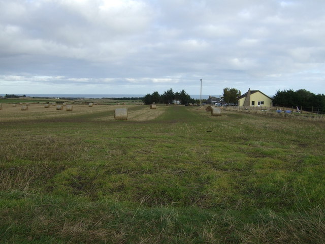
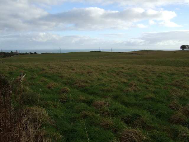
Hill of Keir is a small village located in Aberdeenshire, Scotland. Situated in the northeast of the country, it lies approximately 13 miles northwest of the city of Aberdeen. The village is nestled in the picturesque countryside, surrounded by rolling hills and offering stunning views of the Aberdeenshire landscape.

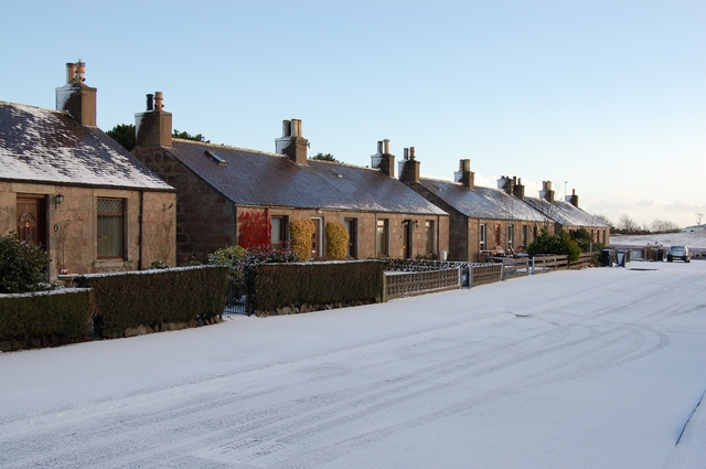
Hill of Keir is known for its tranquil and idyllic setting, making it a popular destination for those seeking a peaceful escape from the bustle of city life. The village is characterized by its charming stone cottages and well-maintained gardens, which add to its quaint and traditional atmosphere.

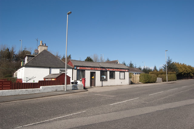
While Hill of Keir may be small, it offers a range of amenities for its residents and visitors. There is a local pub where locals and visitors can enjoy a drink or a meal, as well as a small convenience store for basic supplies. The village also boasts several walking trails, allowing visitors to explore the surrounding countryside and take in the natural beauty of the area.

For those interested in history and heritage, Hill of Keir is also home to a number of ancient sites and landmarks. These include a nearby standing stone, believed to date back to the Bronze Age, and the ruins of a medieval castle, offering a glimpse into the village's rich past.

Overall, Hill of Keir is a charming and peaceful village, providing a serene retreat for those looking to experience the beauty of the Aberdeenshire countryside.

If you have any feedback on the listing, please let us know in the comments section below.

Hill of Keir Images

Images are sourced within 2km of 57.258585/-2.0864116 or Grid Reference NJ9418. Thanks to Geograph Open Source API. All images are credited.

Village store no more The old village shop in Balmedie.  It evidently couldn't compete with the convenience stores built in the newer parts of the village.
Village store no more
The old village shop in Balmedie. It evidently couldn't compete with the convenience stores built in the newer parts of the village.
Chance Inn Farm
Chance Inn Farm
Road to Shiels The mound on the right seems to be spoil from a small quarry.
Road to Shiels
The mound on the right seems to be spoil from a small quarry.
Towards the junction Causeyend Farm is on the left in the distance.
Towards the junction
Causeyend Farm is on the left in the distance.
Out in the country The gently rolling countryside in this part of Aberdeenshire is criss-crossed by numerous single-track roads.  Cattle and sheep and gorse are everywhere...   In this view, Westburn Croft is in the distance.
Out in the country
The gently rolling countryside in this part of Aberdeenshire is criss-crossed by numerous single-track roads. Cattle and sheep and gorse are everywhere... In this view, Westburn Croft is in the distance.
Content Cows As seen all over this part of Aberdeenshire
Content Cows
As seen all over this part of Aberdeenshire
Stubble field near Causeyend
Country road towards Middlemuir Croft Heading north west.
Country road towards Middlemuir Croft
Heading north west.
Minor road heading south Towards Causeyend.
Minor road heading south
Towards Causeyend.
Causeyend
Causeyend
Whitehills
Whitehills
Farmland, Denhead of Orrock
Country road heading south Towards Hill of Keir.
Country road heading south
Towards Hill of Keir.
Grazing, Hill of Keir With a distant sea view.
Grazing, Hill of Keir
With a distant sea view.
Country road heading east, Hill of Keir Towards Drumhead and the A90.
Country road heading east, Hill of Keir
Towards Drumhead and the A90.
Belhelvie Community Education Centre
Farmland, Belhelvie
Farmland, Belhelvie
B977 heading south Through Belhelvie.
B977 heading south
Through Belhelvie.
Show me another place!

Hill of Keir is located at Grid Ref: NJ9418 (Lat: 57.258585, Lng: -2.0864116)

Unitary Authority: Aberdeenshire

Police Authority: North East

What 3 Words

///bulge.straddled.scouting. Near Balmedie, Aberdeenshire

Nearby Locations

Hill of Keir

Related Wikis

Belhelvie

Belhelvie (Scottish Gaelic: Baile Shealbhaigh) is a small village and civil parish in Aberdeenshire in Scotland. The parish has a population of 3,802...

Balmedie

Balmedie (Scottish Gaelic: Baile Mheadhain) is a large village in Aberdeenshire in Scotland. It lies north of the city of Aberdeen, in the civil parish...

Whitecairns

Whitecairns is a village in the Formartine area of Aberdeenshire, Scotland, lying 3.6 kilometres (2.2 mi) north of Potterton and 9.7 kilometres (6.0 mi...

Potterton

Potterton is a village north of Aberdeen, Scotland, in Aberdeenshire, west of Balmedie. Population in 1991 was 1159, falling by 2001 to 886. == References ==

Nearby Amenities

Located within 500m of 57.258585,-2.0864116
Power: pole
Lat/Long: 57.2596512/-2.0938333
Power: pole
Lat/Long: 57.2593269/-2.0925252
Power: pole
Lat/Long: 57.2590013/-2.0912031
Power: pole
Lat/Long: 57.2587008/-2.0899876
Power: pole
Lat/Long: 57.2587133/-2.0889018
Power: pole
Lat/Long: 57.2587246/-2.0877395
Power: pole
Lat/Long: 57.262334/-2.086122
Power: pole
Lat/Long: 57.2616118/-2.0861313
Power: pole
Lat/Long: 57.2608966/-2.0861665
Power: pole
Lat/Long: 57.2602555/-2.0861998
Power: pole
Lat/Long: 57.2601774/-2.0853404
Power: pole
Lat/Long: 57.2600972/-2.0844865
Power: pole
Lat/Long: 57.2600211/-2.0836771
Power: pole
Lat/Long: 57.25996/-2.0830381
Power: pole
Lat/Long: 57.2598909/-2.0823065
Power: pole
Lat/Long: 57.2598408/-2.0818101
Power: pole
Lat/Long: 57.2547543/-2.0837769
Power: pole
Lat/Long: 57.2546034/-2.0826049
Power: pole
Lat/Long: 57.2550415/-2.0817524
Power: pole
Lat/Long: 57.2555002/-2.0808773
Power: pole
Lat/Long: 57.2559929/-2.0799101
Power: pole
Lat/Long: 57.2557593/-2.0928131
Power: pole
Lat/Long: 57.2559017/-2.0916591
Power: pole
Lat/Long: 57.2560088/-2.090937
Power: pole
Lat/Long: 57.2561085/-2.0902082
Power: pole
Lat/Long: 57.2562314/-2.0894186
Power: pole
Lat/Long: 57.2563969/-2.0879227
Power: pole
Lat/Long: 57.2564845/-2.0868902
Power: pole
Lat/Long: 57.2565672/-2.0859027
Power: pole
Lat/Long: 57.2565405/-2.0844
Power: pole
Lat/Long: 57.2565551/-2.0833225
Power: pole
Lat/Long: 57.2565745/-2.0821505
Power: pole
Lat/Long: 57.2565867/-2.0809111
Power: pole
Lat/Long: 57.2566122/-2.0797256
Power: pole
Lat/Long: 57.2586076/-2.0793184
Power: pole
Lat/Long: 57.2586927/-2.0807581
Power: pole
Lat/Long: 57.2587207/-2.0818626
Power: pole
Lat/Long: 57.2587755/-2.0830008
Power: pole
Lat/Long: 57.2587743/-2.0840446
Power: pole
Lat/Long: 57.2587597/-2.0850569
Power: pole
Lat/Long: 57.259267/-2.0856665
Power: pole
Lat/Long: 57.2598887/-2.0860152
The data included in this document is from www.openstreetmap.org. The data is made available under ODbL.

Have you been to Hill of Keir?

Leave your review of Hill of Keir below (or comments, questions and feedback).