Higher Buxton

Settlement in Derbyshire High Peak

England

Higher Buxton

The southern entrance to the Pavilion Gardens Buxton
The southern entrance to the Pavilion Gardens Buxton Credit: Rod Allday

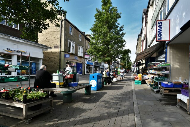
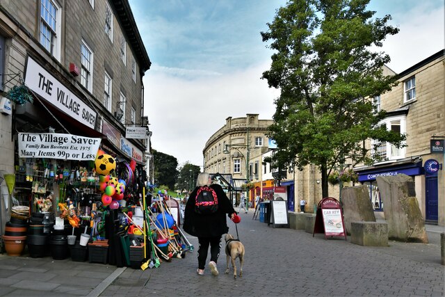
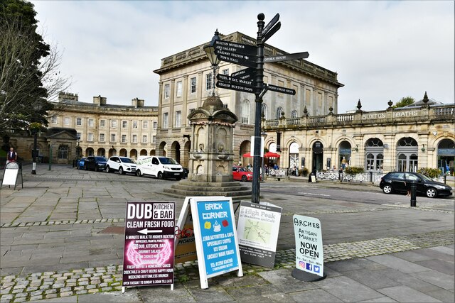
Higher Buxton is a small town located in the county of Derbyshire, England. Situated in the Peak District National Park, it is part of the larger town of Buxton and is located approximately 300 meters above sea level, earning it the name "Higher" Buxton. The town is surrounded by picturesque landscapes, with rolling hills, lush green pastures, and stunning views of the Peak District.

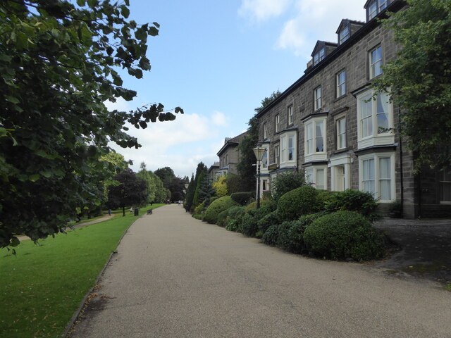
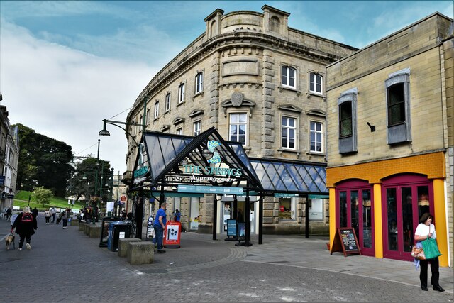
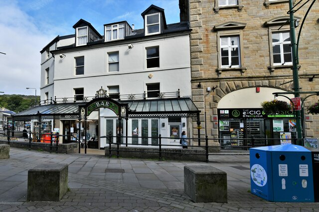
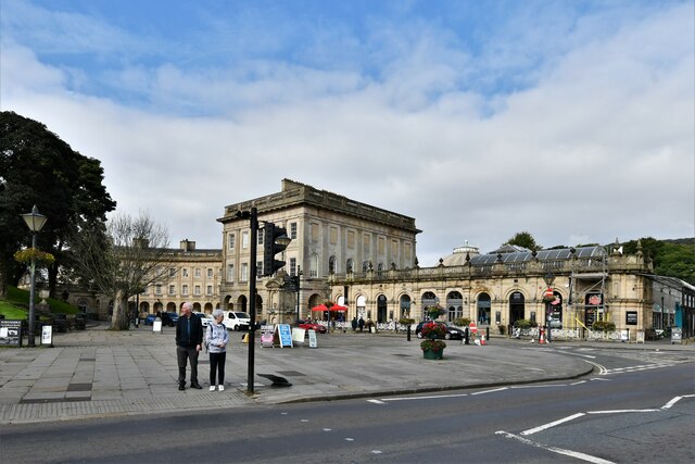
Higher Buxton is renowned for its rich history and heritage, with evidence of human settlement dating back to the Roman times. The town's development was primarily influenced by the growth of the spa industry in the 18th and 19th centuries, attracting visitors who sought the healing properties of its natural spring waters. Today, remnants of this era can still be seen in the grand Georgian and Victorian architecture that adorns the town.

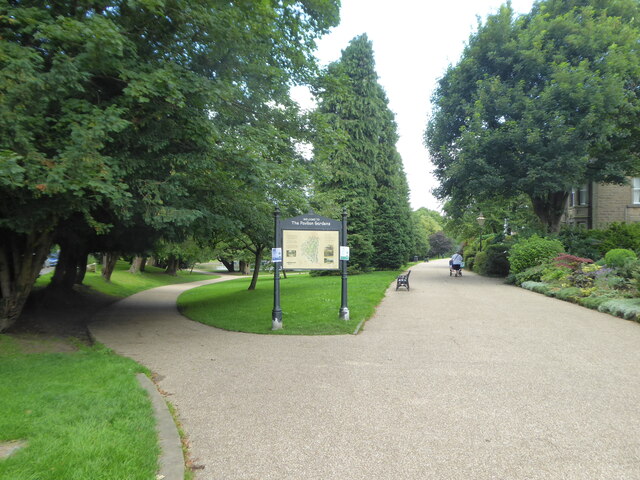
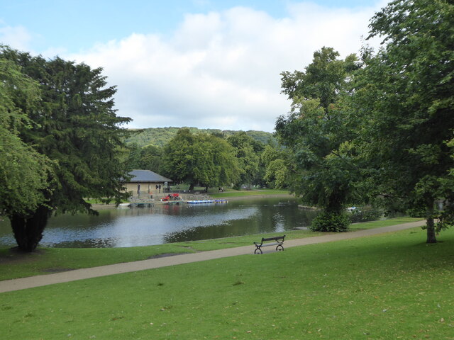
The town is a popular tourist destination, offering a range of attractions and activities. One of the most notable landmarks is the Pavilion Gardens, a beautifully landscaped park that features tropical plant displays, a miniature railway, and a children's play area. The Buxton Opera House, a stunning Victorian theater, also attracts visitors with its diverse program of shows and performances.

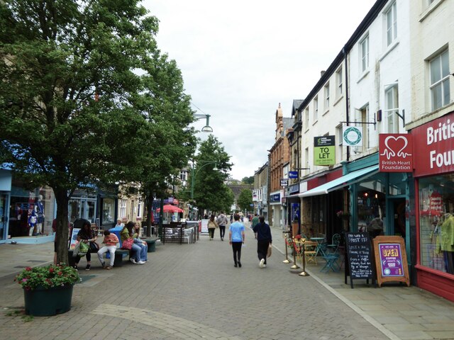
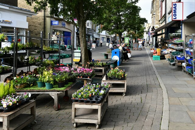
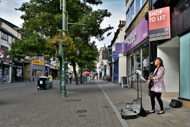
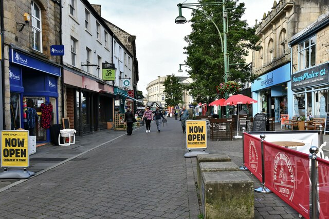
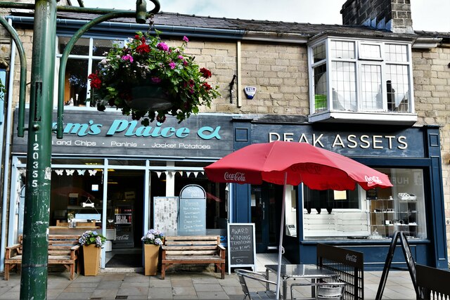
Higher Buxton is well-served by amenities, including a variety of shops, restaurants, and pubs. It also offers excellent transport links, with regular bus services connecting it to other towns in the Peak District and a train station providing direct access to Manchester, Sheffield, and other major cities in the region.

Overall, Higher Buxton is a charming town that combines natural beauty, historical significance, and modern amenities, making it an appealing destination for visitors and a comfortable place to live.

If you have any feedback on the listing, please let us know in the comments section below.

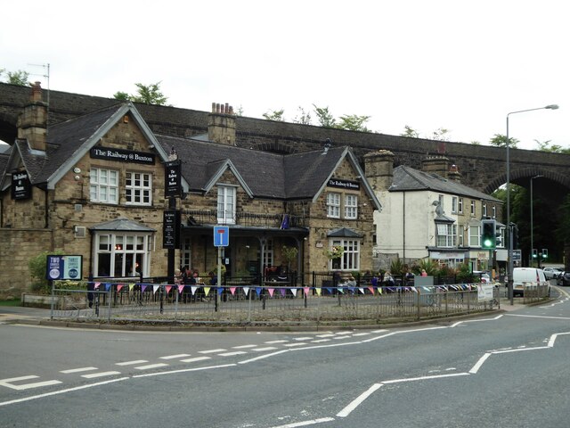
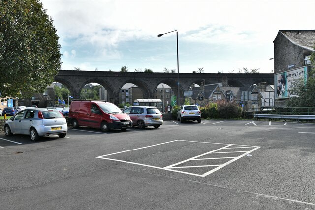
Higher Buxton Images

Images are sourced within 2km of 53.254732/-1.910897 or Grid Reference SK0673. Thanks to Geograph Open Source API. All images are credited.

The southern entrance to the Pavilion Gardens Buxton
The lake in Pavilion Gardens Buxton
Large houses on Broad Walk overlooking Pavilion Gardens Originally grand town houses these are now nearly all guest accommodation or businesses.
Large houses on Broad Walk overlooking Pavilion Gardens
Originally grand town houses these are now nearly all guest accommodation or businesses.
Queen Victoria (VR) Post Box (1837-1901), Buxton
Looking east along Spring Gardens
The Railway @ Buxton public house
Buxton: Small private car park
Buxton: Spring Gardens
Buxton: Busking in Spring Gardens
Buxton: Spring Gardens
Buxton, Spring Gardens: Sam's Plaice and Peak Assets
Buxton: Spring Gardens
Buxton: Entrance to the Spring Gardens Shopping Centre
Buxton: Busking near to the entrance to the Spring Gardens Shopping Centre
Buxton: Spring Gardens
Buxton: The Crescent
Buxton: Multidirectional sign and a few ads in front of The Crescent
Show me another place!

Higher Buxton is located at Grid Ref: SK0673 (Lat: 53.254732, Lng: -1.910897)

Administrative County: Derbyshire

District: High Peak

Police Authority: Derbyshire

What 3 Words

///sunblock.daunted.hiker. Near Buxton, Derbyshire

Related Wikis

Higher Buxton railway station

Higher Buxton railway station was opened in 1894 to the south east of Buxton, Derbyshire, on the LNWR line to Ashbourne and the south. It utilised part...
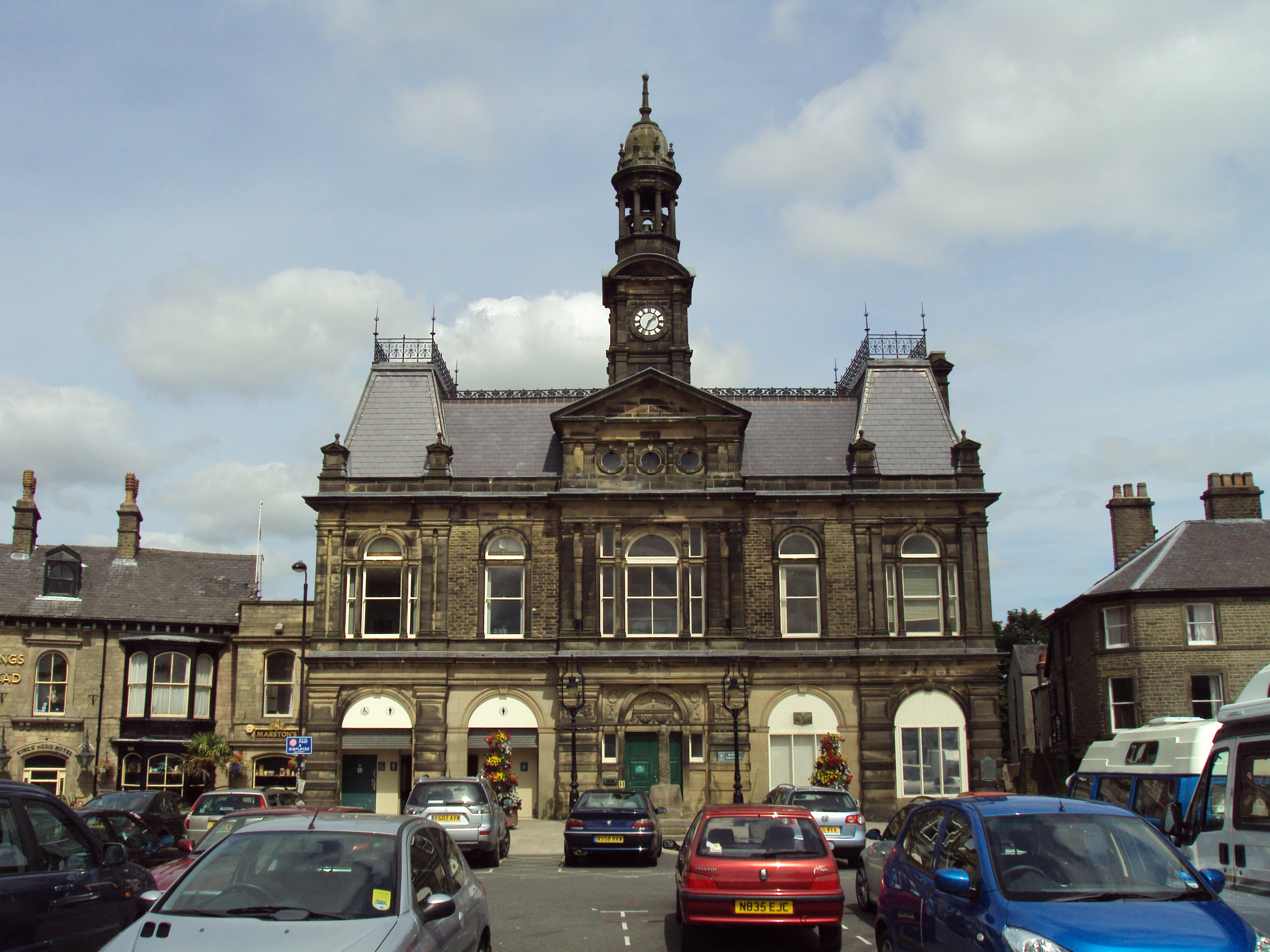
Buxton Town Hall

Buxton Town Hall was opened in 1889 on the Market Place in Buxton, Derbyshire, England. It lies in the town's central Conservation Area overlooking The...

Buxton Museum and Art Gallery

Buxton Museum and Art Gallery focuses its collection on history, geology and archaeology primarily from the Peak District and Derbyshire.The museum is...

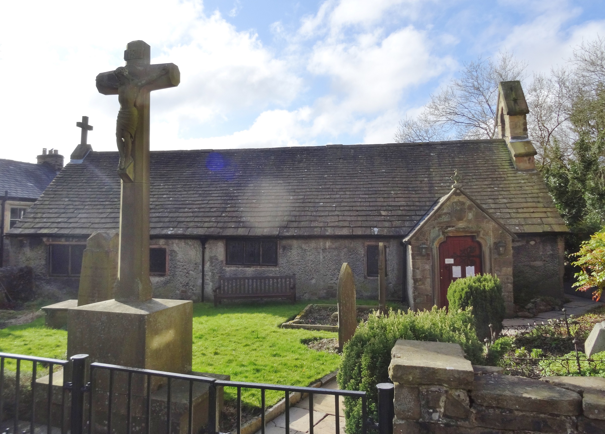
St Anne's Church, Buxton

St Anne's Church is a Grade II* listed parish church in the Church of England in Buxton, Derbyshire. == History == The single-storey church dates from...

Buxton F.C.

Buxton Football Club is a football club based in Buxton, Derbyshire, England. They are currently members of the National League North and play at the Silverlands...

Hogshawe

Hogshawe or Hogshaw is an area of settlement in Derbyshire, England. It is a part of Buxton, located between the A6 Fairfield Road and the present Peak...
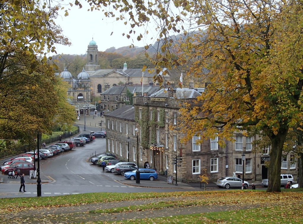
Buxton

Buxton is a spa town in the Borough of High Peak, Derbyshire, in the East Midlands region of England. It is England's highest market town, sited at some...

Municipal Borough of Buxton

Buxton was an Urban District from 1894 to 1917 and a Municipal Borough from 1917 to 1974 in Derbyshire, England.It was created as an Urban District in...

Nearby Amenities

Located within 500m of 53.254732,-1.910897
Guest House: bed_and_breakfast
Tourism: guest_house
Lat/Long: 53.2520256/-1.9144849
Guest House: bed_and_breakfast
Tourism: guest_house
Lat/Long: 53.2523653/-1.9156047
Griff House
Guest House: bed_and_breakfast
Tourism: guest_house
Lat/Long: 53.2522269/-1.9154537
Traffic Signals
Fiveways
Lat/Long: 53.253328/-1.9147511
Fuel
Esso Buxton Express
Brand: Esso
Brand Wikidata: Q867662
Brand Wikipedia: en:Esso
Compressed Air: yes
Contact Website: https://www.esso.co.uk/en-gb/find-station/esso-buxton-essotescobuxtonexpress-100200302
Operator: Esso
Toilets Wheelchair: yes
Wheelchair: yes
Lat/Long: 53.2504984/-1.9108849
Crossing
Crossing: unmarked
Crossing Island: no
Tactile Paving: yes
Lat/Long: 53.2568087/-1.9145834
Pub
The Eagle
Addr City: Buxton
Addr Housenumber: 10
Addr Postcode: SK17 6EQ
Addr Street: Eagle Parade
Fhrs Id: 1563749
Old Fhrs Id: 389889
Operator: Hydes
Real Ale: yes
Wheelchair: limited
Lat/Long: 53.2564528/-1.9147784
Barrier: kerb
Bicycle: yes
Kerb: lowered
Tactile Paving: no
Lat/Long: 53.2576696/-1.9153791
Toilets
Check Date: 2024-04-04
Lat/Long: 53.256886/-1.9143033
Traffic Signals
Button Operated: yes
Crossing: traffic_signals
Kerb: lowered
Tactile Paving: yes
Traffic Signals: pedestrian_crossing
Traffic Signals Sound: yes
Traffic Signals Vibration: yes
Lat/Long: 53.258975/-1.9131066
Traffic Signals
Button Operated: yes
Crossing: traffic_signals
Kerb: lowered
Tactile Paving: yes
Traffic Signals: pedestrian_crossing
Traffic Signals Sound: yes
Traffic Signals Vibration: yes
Lat/Long: 53.2587288/-1.912952
Traffic Signals
Button Operated: yes
Crossing: traffic_signals
Kerb: lowered
Tactile Paving: yes
Traffic Signals: pedestrian_crossing
Traffic Signals Sound: yes
Lat/Long: 53.2564332/-1.9139441
Crossing
Crossing: traffic_signals
Crossing Island: no
Tactile Paving: yes
Lat/Long: 53.2557349/-1.9148181
Crossing
Crossing: traffic_signals
Crossing Island: no
Crossing Ref: puffin
Tactile Paving: yes
Lat/Long: 53.2550392/-1.9152873
Turning Circle
Lat/Long: 53.2556294/-1.9053359
Turning Circle
Lat/Long: 53.2547398/-1.9063604
Turning Circle
Lat/Long: 53.2555011/-1.9062751
Traffic Signals
Lat/Long: 53.2541917/-1.9121085
Post Office
Higher Buxton Post Office
Addr Postcode: SK17 6EU
Branch: Higher Buxton
Brand: Post Office
Brand Wikidata: Q1783168
Check Date: 2020-02-20
Contact Website: https://www.postoffice.co.uk/branch-finder/3234320/higher-buxton
Ref Pol Id: 12829
Lat/Long: 53.2549155/-1.9154941
Bar
MYST
Wheelchair: no
Lat/Long: 53.2566005/-1.9147087
Nightclub
Level Two
Wheelchair: no
Lat/Long: 53.255498/-1.914432
Pub
Blazing Rag
Addr City: Buxton
Addr Housenumber: 103
Addr Postcode: SK17 9NT
Addr Street: London Road
Fhrs Id: 1523893
Old Fhrs Id: 668358
Operator: Marston's
Real Ale: yes
Toilets Wheelchair: no
Wheelchair: no
Lat/Long: 53.2512206/-1.91123
Restaurant
Number 13
Old Name: Nat's Kitchen
Smoking: outside
Website: https://www.number13.co.uk/
Lat/Long: 53.2556717/-1.9135996
Crossing
Crossing: pedestrian_signals
Crossing Island: no
Tactile Paving: yes
Lat/Long: 53.2531888/-1.9145961
Noexit: yes
Lat/Long: 53.2552385/-1.9140417
Traffic Signals
Lat/Long: 53.2549618/-1.91017
Turning Circle
Lat/Long: 53.2559696/-1.9061614
Turning Circle
Lat/Long: 53.2560376/-1.905166
Police
'B' Divisional Headquarters (Buxton Enquiry Office)
Addr City: Buxton
Addr Housename: Buxton Enquiry Office
Addr Postcode: SK17 6QL
Addr Street: Silverlands
Opening Hours: Mo-Fr 10:00-16:00
Operator: Derbyshire Constabulary
Operator Wikidata: Q5261560
Website: https://www.derbyshire.police.uk/area/your-area/derbyshire/high-peak/buxton-town/about-us/top-reported-crimes-in-this-area
Lat/Long: 53.2574438/-1.9069027
Buxton Museum & Art Gallery
Fee: no
Tourism: museum
Website: https://www.derbyshire.gov.uk/leisure/buxton-museum/buxton-museum-and-art-gallery.aspx
Wheelchair: yes
Wikidata: Q5003273
Wikipedia: en:Buxton Museum and Art Gallery
Lat/Long: 53.2569238/-1.9130816
Braemar
Source: survey
Tourism: guest_house
Lat/Long: 53.2516289/-1.9121087
Restaurant
Luciano's
Addr City: Buxton
Addr Housenumber: 3
Addr Postcode: SK17 6EQ
Addr Street: Eagle Parade
Cuisine: italian
Fhrs Id: 1563741
Old Fhrs Id: 1258678
Old Name: Ithaca
Opening Hours: Tu-Sa 16:00-21:00
Source: survey
Lat/Long: 53.2567047/-1.9147113
Restaurant
Great Panda
Addr City: Buxton
Addr Housenumber: 7
Addr Postcode: SK17 6EQ
Addr Street: Eagle Parade
Cuisine: chinese
Fhrs Id: 1259164
Source: survey
Website: http://www.greatpandarestaurant.co.uk/
Lat/Long: 53.2565299/-1.9147489
Pharmacy
Peak Pharmacy
Healthcare: pharmacy
Source: survey
Wheelchair: limited
Lat/Long: 53.2559223/-1.9141244
Barrier: fence
Lat/Long: 53.2561214/-1.9038937
Barrier: fence
Lat/Long: 53.2561624/-1.9040264
Higher Buxton
Historic Railway: station
Railway: site
Lat/Long: 53.2557894/-1.9083298
Access: no
Barrier: bollard
Bicycle: yes
Bollard: fixed
Foot: yes
Horse: unknown
Motor Vehicle: no
Lat/Long: 53.2576942/-1.9155484
Crossing
Crossing: unmarked
Crossing Island: no
Kerb: lowered
Tactile Paving: yes
Lat/Long: 53.2580537/-1.9150963
Atm
Brand: Sainsbury's Bank
Brand Wikidata: Q7400525
Brand Wikipedia: en:Sainsbury's Bank
Drive Through: no
Fee: no
Operator: Sainsbury's Bank
Operator Wikidata: Q7400525
Lat/Long: 53.2557901/-1.9153869
Morrisons Daily
Addr City: Buxton
Addr Housenumber: 11
Addr Postcode: SK17 6EF
Addr Street: Scarsdale Place
Brand: Morrisons Daily
Brand Wikidata: Q99752411
Fhrs Id: 1258739
Operator: McColl's
Operator Wikidata: Q16997477
Shop: convenience
Toilets Wheelchair: no
Website: https://my.morrisons.com/storefinder/64705/morrisons-daily-buxton-11-scarsdale-place
Wheelchair: yes
Lat/Long: 53.2556013/-1.91458
Car Wash
Automated: yes
Name Signed: no
Self Service: no
Lat/Long: 53.2506037/-1.9106696
Marketplace
Buxton Market
Building: no
Opening Hours: Tu,Sa
Lat/Long: 53.2565047/-1.914236
Jack's barbers
Shop: hairdresser
Lat/Long: 53.2562131/-1.9151701
Recycling
Location: overground
Operator: Salvation Army, Morrisons Foundation
Recycling Clothes: yes
Recycling Shoes: yes
Recycling Type: container
Lat/Long: 53.2542001/-1.9038477
Barrier: bollard
Lat/Long: 53.2559164/-1.9175166
Barrier: bollard
Lat/Long: 53.2559273/-1.9175031
Barrier: bollard
Lat/Long: 53.2559361/-1.9174911
Barrier: bollard
Lat/Long: 53.2559466/-1.9174748
Barrier: bollard
Lat/Long: 53.2559558/-1.917462
Barrier: bollard
Lat/Long: 53.2559052/-1.91753
Restaurant
Columbine Restaurant
Addr City: Buxton
Addr Housenumber: 7
Addr Postcode: SK17 6EW
Addr Street: Hall Bank
Cuisine: italian
Lat/Long: 53.25729/-1.9149028
Fountain
Lat/Long: 53.2574501/-1.9165063
Fast Food
Coach House
Addr City: Buxton
Addr Housenumber: 3
Addr Postcode: SK17 6EF
Addr Street: Scarsdale Place
Cuisine: fish_and_chips
Fhrs Id: 1259220
Source: survey
Wheelchair: no
Lat/Long: 53.2558614/-1.914291
Potters
Shop: clothes
Source: survey
Website: https://www.pottersofbuxton.co.uk/
Lat/Long: 53.2584174/-1.91263
Addr City: Buxton
Addr Housenumber: 7
Addr Postcode: SK17 6ET
Addr Street: High Street
Disused Amenity: fast_food
Old Fhrs Id: 1259309
Old Name: Speedy Pepper
Source: survey
Lat/Long: 53.2552009/-1.9150761
Buxton Lodge
Source: survey
Tourism: guest_house
Website: http://www.buxtonlodge.co.uk/
Lat/Long: 53.2524386/-1.9134657
Drinking Water
St Ann's Well
Access: yes
Bottle: yes
Description: St Ann's Well is a free source of Buxton natural mineral water!
Fee: no
Fountain: bubbler
Image: http://findafountain.org/system/512/original/uk-derbyshire-buxton-st-anns-well-outdoor-fountain.jpg
Maintenance: ok
Source: osmsync:findafountain
Source Pkey: 1030
Wikidata: Q26549183
Wikipedia: en:St Ann's Well (Buxton)
Lat/Long: 53.258569/-1.914566
Fast Food
Buxton Food Spot
Addr City: Buxton
Addr Housenumber: 4
Addr Postcode: SK17 6EB
Addr Street: Market Place
Fhrs Id: 1695122
Toilets Wheelchair: no
Wheelchair: no
Lat/Long: 53.2563319/-1.9136944
New Inn
Addr City: Buxton
Addr Housenumber: 2-3
Addr Postcode: SK17 6EB
Addr Street: Market Place
Disused Amenity: pub
Was Operator: Robinsons
Wikidata: Q26549325
Lat/Long: 53.2563813/-1.9136159
Traffic Calming: table
Lat/Long: 53.2529426/-1.9094284
Traffic Calming: hump
Lat/Long: 53.2527072/-1.9090463
Traffic Calming: hump
Lat/Long: 53.2545908/-1.9100951
Traffic Calming: hump
Lat/Long: 53.2537677/-1.9096716
Crossing
Crossing: unmarked
Lat/Long: 53.2540221/-1.9153005
Traffic Signals
Crossing: traffic_signals
Crossing Island: no
Crossing Ref: puffin
Kerb: lowered
Tactile Paving: yes
Traffic Signals: signal
Lat/Long: 53.25174/-1.911922
Atm
Check Date: 2024-04-04
Fee: no
Operator: LINK
Lat/Long: 53.2556425/-1.9145499
Atm: yes
Disused Amenity: bank
Note: Closed January 2019
Old Name: RBS
Toilets Wheelchair: no
Wheelchair: no
Lat/Long: 53.2545161/-1.9155741
Fast Food
Buxton Grill
Addr City: Buxton
Addr Housenumber: 8
Addr Postcode: SK17 6EU
Addr Street: High Street
Fhrs Id: 1439241
Old Fhrs Id: 389781;1259137
Old Name: Olivers
Lat/Long: 53.2549718/-1.9155003
Bargain Booze
Addr City: Buxton
Addr Housenumber: 23-27
Addr Postcode: SK17 6ET
Addr Street: High Street
Brand: Bargain Booze
Brand Wikidata: Q16971315
Brand Wikipedia: en:Bargain Booze
Old Fhrs Id: 1258861
Shop: alcohol
Lat/Long: 53.2546164/-1.9152536
Arnold Mycock & Sons
Addr Housenumber: 1
Addr Postcode: SK17 6EF
Addr Street: Scarsdale Place
Shop: butcher
Toilets Wheelchair: no
Wheelchair: yes
Lat/Long: 53.2559739/-1.9140546
The Buxton Trading Post
Addr City: Buxton
Addr Housenumber: 52
Addr Postcode: SK17 6BZ
Addr Street: Spring Gardens
Note: Costa Coffee, Moved to old KFC 85 on the other side of Spring Gardens
Opening Hours: Tu-Sa 09:00-17:00; Su 10:00-16:00
Phone: +44 776 947 2017
Shop: art
Website: https://thebuxtontradingpost.co.uk
Lat/Long: 53.2592062/-1.9106178
Barrier: bollard
Lat/Long: 53.2544045/-1.9174382
Barrier: bollard
Lat/Long: 53.254395/-1.9173901
Traffic Calming: hump
Lat/Long: 53.2544439/-1.9109582
Traffic Calming: hump
Lat/Long: 53.2537467/-1.9105572
Traffic Calming: hump
Lat/Long: 53.2530511/-1.9103319
Traffic Calming: hump
Lat/Long: 53.2546357/-1.9090604
Traffic Calming: hump
Lat/Long: 53.2532781/-1.908414
Traffic Calming: hump
Lat/Long: 53.253283/-1.9084141
Traffic Calming: cushion
Lat/Long: 53.2513532/-1.9077784
Bench
Backrest: yes
Lat/Long: 53.255507/-1.9181202
Bench
Backrest: yes
Lat/Long: 53.2555238/-1.9180853
Waste Basket
Lat/Long: 53.2574421/-1.9161474
Waste Basket
Source: survey
Lat/Long: 53.2555229/-1.9152836
Vending Machine
Vending: parking_tickets
Lat/Long: 53.2555278/-1.9153093
Entrance: main
Lat/Long: 53.2581246/-1.9126162
Entrance: main
Lat/Long: 53.2582299/-1.9119114
Crossing
Crossing: unmarked
Crossing Island: no
Tactile Paving: yes
Lat/Long: 53.2582755/-1.9126806
Entrance: main
Lat/Long: 53.2570258/-1.9107759
Barrier: entrance
Source: Bing
Lat/Long: 53.2578003/-1.9127324
Historic: memorial
Memorial: war_memorial
Source: Bing
Lat/Long: 53.2582185/-1.9137658
Man Made: monitoring_station
Monitoring Weather: yes
Operator: Met Office with Volunteers
Source: Local Knowledge;aerial imagery
Lat/Long: 53.2579213/-1.9138837
Barrier: entrance
Lat/Long: 53.2571047/-1.9118017
Entrance: main
Lat/Long: 53.2571365/-1.9127823
Noexit: yes
Lat/Long: 53.2552192/-1.9142675
Addr City: Buxton
Addr Housenumber: 8A
Addr Postcode: SK17 6EW
Addr Street: Hall Bank
Disused Amenity: pub
Old Fhrs Id: 1259163
Old Name: Beltane
Old Name 2: 53 Degrees North
Real Ale: yes
Smoking: outside
Source: survey
Lat/Long: 53.2571485/-1.9148453
Courthouse
Magistrates' Court
Lat/Long: 53.2567751/-1.9131306
Pub
The Ale Stop
Addr City: Buxton
Addr Housenumber: 3
Addr Postcode: SK17 6HX
Addr Street: Chapel Street
Contact Facebook: https://www.facebook.com/people/The-Ale-Stop/100063725103155/
Fhrs Id: 1419319
Note: "First micropub in the High Peak" but is perhaps a little larger than the average micropub
Old Fhrs Id: 739156
Pub: micropub
Real Ale: yes
Smoking: outside
Lat/Long: 53.2552381/-1.9156858
The Green Man Gallery
Addr City: Buxton
Addr Housename: Hardwick Hall
Addr Postcode: SK17 6PY
Addr Street: Hardwick Square South
Note: To leave a message outside opening hours: 07977 956707 Email: hello@thegreenmangallery.com Follow us on Facebook https://www.facebook.com/TheGreenManGallery
Phone: +441298937375
Shop: art
Tourism: gallery
Lat/Long: 53.2568835/-1.9126693
Post Box
Collection Times: Mo-Fr 09:00; Sa 07:00
Operator: Royal Mail
Operator Wikidata: Q638098
Post Box Type: pillar
Ref: SK17 61D
Royal Cypher: VR
Royal Cypher Wikidata: Q33102356
Lat/Long: 53.2537842/-1.9062458
Restaurant
Michelangelo's
Addr City: Buxton
Addr Housenumber: 1
Addr Postcode: SK17 6EB
Addr Street: Market Place
Cuisine: italian
Fhrs Id: 1259203
Old Fhrs Id: 579812
Source: survey
Wheelchair: no
Lat/Long: 53.2564536/-1.9135536
Cafe
Caffè Nero
Addr City: Buxton
Addr Housenumber: 20-22
Addr Postcode: SK17 6DE
Addr Street: Spring Gardens
Brand: Caffè Nero
Brand Wikidata: Q675808
Brand Wikipedia: en:Caffè Nero
Contact Website: https://caffenero.com/uk/store/buxton-314/
Cuisine: coffee_shop
Fhrs Id: 1259139
Takeaway: yes
Lat/Long: 53.2589609/-1.912083
Cafe
The Chakra Lounge
Addr City: Buxton
Addr Housenumber: 50
Addr Postcode: SK17 6BZ
Addr Street: Spring Gardens
Fhrs Id: 1258895
Opening Hours: Mo-Fr 08:30-17:00; Sa 08:30-18:00; Su 09:00-17:00
Outdoor Seating: yes
Phone: +44 1298 938280
Website: https://www.thechakralounge.co.uk/
Lat/Long: 53.259203/-1.9107096
Fast Food
Greggs
Addr City: Buxton
Addr Housenumber: 30-32
Addr Postcode: SK17 6DE
Addr Street: Spring Gardens
Brand: Greggs
Brand Wikidata: Q3403981
Brand Wikipedia: en:Greggs
Contact Website: https://www.greggs.co.uk/shop-finder?shop-code=1351
Cuisine: sandwich;bakery
Fhrs Id: 1259225
Takeaway: yes
Toilets Wheelchair: no
Wheelchair: yes
Lat/Long: 53.2590388/-1.9117901
Track & Trail
Disused Shop: outdoor
Lat/Long: 53.2590927/-1.9123211
Bank
TSB
Atm: yes
Brand: TSB
Brand Wikidata: Q7671560
Brand Wikipedia: en:TSB Bank (United Kingdom)
Website: https://branches.tsb.co.uk/buxton/buxton.html
Lat/Long: 53.2589874/-1.9119741
Post Box
Post Box Type: pillar
Royal Cypher: GR
Royal Cypher Wikidata: Q33102273
Lat/Long: 53.2583896/-1.9111062
Cafe
Cafe at The Green Pavilion
Addr City: Buxton
Addr Housenumber: 4
Addr Postcode: SK17 6DR
Addr Street: Terrace Road
Fhrs Id: 1258658
Old Fhrs Id: 389546
Lat/Long: 53.2586744/-1.9127483
Pub
High Stakes
Addr City: Buxton
Addr Housenumber: 5-5a
Addr Postcode: SK17 6ET
Addr Street: High Street
Diet Vegan: no
Diet Vegetarian: yes
Fhrs Id: 1339744
Note: "bar/eatery" - could be described as a pub or as a cafe
Old Fhrs Id: 1258719
Real Ale: yes
Website: http://www.gilbertsbuxton.com/
Lat/Long: 53.2552783/-1.9150314
Restaurant
Sushi Kaji
Addr City: Buxton
Addr Housenumber: 55
Addr Postcode: SK17 6HB
Addr Street: High Street
Cuisine: nepalese
Fhrs Id: 1698934
Lat/Long: 53.2534623/-1.9145808
Cafe
Five Ways Cafe
Addr City: Buxton
Addr Housenumber: 1
Addr Postcode: SK17 6HE
Addr Street: West Road
Fhrs Id: 1258613
Source: survey
Toilets Wheelchair: no
Wheelchair: no
Lat/Long: 53.2531498/-1.9151173
TechZone
Craft: electronics_repair
Lat/Long: 53.2592145/-1.9103049
Mountain Warehouse
Addr Housenumber: 44-46
Addr Street: Spring Gardens
Brand: Mountain Warehouse
Brand Wikidata: Q6925414
Brand Wikipedia: en:Mountain Warehouse
Opening Hours: Mo-Sa 09:00-17:30; Su 10:30-16:30
Phone: +44 1298 79442
Shop: outdoor
Website: https://www.mountainwarehouse.com/stores/bux/buxton
Lat/Long: 53.2591796/-1.9109258
White Stuff
Addr Housenumber: 40-42
Addr Street: Spring Gardens
Brand: White Stuff
Brand Wikidata: Q7995442
Brand Wikipedia: en:White Stuff Clothing
Opening Hours: Tu 09:00-17:00; We, Th 09:00-17:30; Fr, Sa 09:00-18:00; Su 09:00-15:30
Phone: +44 1298 78098
Shop: clothes
Website: https://www.whitestuff.com
Lat/Long: 53.2591656/-1.9110227
The Village Saver
Shop: variety_store
Lat/Long: 53.2591614/-1.9111278
Timpson
Addr Housenumber: 36
Addr Street: Spring Gardens
Brand: Timpson
Brand Wikidata: Q7807658
Brand Wikipedia: en:Timpson (retailer)
Opening Hours: Mo-Sa 09:00-17:30
Phone: +44 1298 26465
Shop: locksmith
Website: https://www.timpson.co.uk/stores/buxton-spring-gardens
Lat/Long: 53.2591537/-1.9111873
Restaurant
Kwei Lin
Addr City: Buxton
Addr Housenumber: 1-2
Addr Postcode: SK17 6DQ
Addr Street: Lower Hardwick Street
Cuisine: chinese
Fhrs Id: 1259223
Lat/Long: 53.2585854/-1.912421
Cafe
Hargreaves Tea Rooms
Addr City: Buxton
Addr Housenumber: 16-18
Addr Postcode: SK17 6DE
Addr Street: Spring Gardens
Alt Name: Hargreaves Edwardian Tearoom
Fhrs Id: 1259224
Opening Hours: Mo-Sa 9:00-17:00; Su 11:00-15:00
Payment Cash: yes
Payment Contactless: yes
Payment Credit Cards: yes
Payment Debit Cards: yes
Phone: +44 1298 23083
Website: https://www.hargreavesofbuxton.com/our-cafe-tea-rooms
Wheelchair: no
Lat/Long: 53.2589093/-1.912159
Cafe
Vintage Tea Rooms
Addr City: Buxton
Addr Housenumber: 8
Addr Postcode: SK17 6DH
Addr Street: Hardwick Street
Fhrs Id: 1258624
Lat/Long: 53.2589563/-1.9117497
Charging Station
Capacity: 2
Covered: no
Manufacturer: EVBox
Operator: GeniePoint
Operator Wikidata: Q111363966
Lat/Long: 53.2537764/-1.9038439
Direction: 170
Generator Method: photovoltaic
Generator Output Electricity: yes
Generator Solar Modules: 15
Generator Source: solar
Generator Type: solar_photovoltaic_panel
Location: roof
Power: generator
Lat/Long: 53.2511634/-1.9083423
Generator Method: photovoltaic
Generator Output Electricity: yes
Generator Source: solar
Generator Type: solar_photovoltaic_panel
Location: roof
Power: generator
Lat/Long: 53.2516513/-1.9139146
Generator Method: photovoltaic
Generator Output Electricity: yes
Generator Source: solar
Generator Type: solar_photovoltaic_panel
Location: roof
Power: generator
Lat/Long: 53.2517492/-1.9133755
Generator Method: photovoltaic
Generator Output Electricity: yes
Generator Source: solar
Generator Type: solar_photovoltaic_panel
Location: roof
Power: generator
Lat/Long: 53.255826/-1.9063452
Generator Method: photovoltaic
Generator Output Electricity: yes
Generator Source: solar
Generator Type: solar_photovoltaic_panel
Location: roof
Power: generator
Lat/Long: 53.2558765/-1.9064042
Generator Method: photovoltaic
Generator Output Electricity: yes
Generator Source: solar
Generator Type: solar_photovoltaic_panel
Location: roof
Power: generator
Lat/Long: 53.2555479/-1.9069849
Generator Method: photovoltaic
Generator Output Electricity: yes
Generator Source: solar
Generator Type: solar_photovoltaic_panel
Location: roof
Power: generator
Lat/Long: 53.2553136/-1.9073792
Generator Method: photovoltaic
Generator Output Electricity: yes
Generator Source: solar
Generator Type: solar_photovoltaic_panel
Location: roof
Power: generator
Lat/Long: 53.2545642/-1.906832
Generator Method: photovoltaic
Generator Output Electricity: yes
Generator Source: solar
Generator Type: solar_photovoltaic_panel
Location: roof
Power: generator
Lat/Long: 53.2564207/-1.9124325
Generator Method: photovoltaic
Generator Output Electricity: yes
Generator Source: solar
Generator Type: solar_photovoltaic_panel
Location: roof
Power: generator
Lat/Long: 53.2563822/-1.9124097
Generator Method: photovoltaic
Generator Output Electricity: yes
Generator Source: solar
Generator Type: solar_photovoltaic_panel
Location: roof
Power: generator
Lat/Long: 53.2564455/-1.9122448
Generator Method: photovoltaic
Generator Output Electricity: yes
Generator Source: solar
Generator Type: solar_photovoltaic_panel
Location: roof
Power: generator
Lat/Long: 53.256397/-1.912224
Generator Method: photovoltaic
Generator Output Electricity: yes
Generator Source: solar
Generator Type: solar_photovoltaic_panel
Location: roof
Power: generator
Lat/Long: 53.254884/-1.9108038
Generator Method: photovoltaic
Generator Output Electricity: yes
Generator Source: solar
Generator Type: solar_photovoltaic_panel
Location: roof
Power: generator
Lat/Long: 53.254888/-1.9108695
Direction: 165
Generator Method: photovoltaic
Generator Output Electricity: yes
Generator Solar Modules: 6
Generator Source: solar
Generator Type: solar_photovoltaic_panel
Location: roof
Power: generator
Lat/Long: 53.2537146/-1.9099087
Direction: 75
Generator Method: photovoltaic
Generator Output Electricity: yes
Generator Solar Modules: 7
Generator Source: solar
Generator Type: solar_photovoltaic_panel
Location: roof
Power: generator
Lat/Long: 53.2536741/-1.9088149
Direction: 255
Generator Method: photovoltaic
Generator Output Electricity: yes
Generator Solar Modules: 7
Generator Source: solar
Generator Type: solar_photovoltaic_panel
Location: roof
Power: generator
Lat/Long: 53.2536637/-1.9089263
Generator Method: photovoltaic
Generator Output Electricity: yes
Generator Source: solar
Generator Type: solar_photovoltaic_panel
Location: roof
Power: generator
Lat/Long: 53.2524288/-1.9159639
Generator Method: photovoltaic
Generator Output Electricity: yes
Generator Source: solar
Generator Type: solar_photovoltaic_panel
Location: roof
Power: generator
Lat/Long: 53.2524112/-1.9158459
Parking
Parking: surface
Lat/Long: 53.2503112/-1.9098911
Parking
Parking: surface
Lat/Long: 53.2503018/-1.9108326
Bicycle Parking
Access: yes
Bicycle Parking: stands
Capacity: 2
Covered: no
Description: Serpentine/wave style parking - capacity limited to two if locking to frame
Fee: no
Operator: HPBC
Operator Type: public
Lat/Long: 53.2588901/-1.9115983
Bicycle Parking
Bicycle Parking: stands
Capacity: 2
Covered: no
Fee: yes
Operator: HIgh Peak Borough Council
Operator Type: public
Lat/Long: 53.2561335/-1.9140678
Bench
Backrest: yes
Lat/Long: 53.258167/-1.913757
Bench
Backrest: yes
Lat/Long: 53.2581975/-1.9136812
Bus Stop
Buxton, London Road / Heath Grove
Alt Name: Buxton, London Road Inn
Bench: no
Bin: no
Bus: yes
Naptan AltCommonName: London Road Inn
Naptan AltIndicator: opp
Naptan AltLandmark: Heath Grove
Naptan AltStreet: London Road
Naptan AtcoCode: 1000DBLR2574
Naptan Bearing: N
Naptan CommonName: Heath Grove
Naptan Indicator: Opp
Naptan Landmark: Heath Grove
Naptan LocalityName: Buxton
Naptan NaptanCode: dbsgtdmj
Naptan PlusbusZoneRef: BUXTON
Naptan Street: London Road
Public Transport: platform
Shelter: no
Source: naptan_import
Tactile Paving: no
Lat/Long: 53.2509094/-1.9114065
Bus Stop
Buxton, London Road / Heath Grove
Bench: no
Bin: yes
Bus: yes
Naptan AtcoCode: 1000D0007878
Naptan Bearing: S
Naptan BusStopType: CUS
Naptan CommonName: Heath Grove
Naptan Indicator: Adj
Naptan Landmark: Heath Grove
Naptan LocalityName: Buxton
Naptan NaptanCode: dbsgwpwj
Naptan PlusbusZoneRef: BUXTON
Naptan Street: London Road
Public Transport: platform
Shelter: no
Source: naptan_import
Tactile Paving: no
Lat/Long: 53.2509078/-1.9112563
Crossing
Crossing: unmarked
Crossing Island: no
Kerb: lowered
Tactile Paving: yes
Lat/Long: 53.2579757/-1.9152633
Crossing
Crossing: unmarked
Crossing Island: no
Kerb: lowered
Tactile Paving: yes
Lat/Long: 53.2578809/-1.9152172
Crossing
Crossing: unmarked
Crossing Island: no
Kerb: lowered
Tactile Paving: yes
Lat/Long: 53.2578759/-1.9151212
Barrier: cycle_barrier
Bicycle: dismount
Cycle Barrier: double
Cycle Barrier Installation: fixed
Foot: yes
Motor Vehicle: no
Wheelchair: no
Lat/Long: 53.2579678/-1.9127156
Bicycle Parking
Access: yes
Bicycle Parking: stands
Capacity: 4
Covered: no
Description: Sheffield type cycle stands in public car park
Fee: no
Operator: High Peak Borough Council
Operator Type: public
Lat/Long: 53.2572855/-1.9140282
Bus Stop
Buxton, Terrace Road
Bench: yes
Bin: yes
Bus: yes
Lit: yes
Naptan AtcoCode: 1000DBTRP014
Naptan Bearing: S
Naptan CommonName: Terrace Road
Naptan Indicator: S-bound
Naptan Landmark: Lower Hardwick Street
Naptan LocalityName: Buxton
Naptan NaptanCode: dbsgjpwd
Naptan PlusbusZoneRef: BUXTON
Naptan Street: Terrace Road
Network: Derbyshire County Council
Operator: Derbyshire County Council
Public Transport: platform
Shelter: yes
Source: naptan_import
Tactile Paving: no
Lat/Long: 53.2584858/-1.9127516
Bus Stop
Buxton, Terrace Road / Market Place (Stop E)
Bench: yes
Bin: no
Bus: yes
Lit: no
Network: Derbyshire County Council
Operator: Derbyshire County Council
Public Transport: platform
Ref: E
Shelter: yes
Tactile Paving: no
Lat/Long: 53.2560106/-1.9143543
Bus Stop
Buxton, Terrace Road / Market Place (Stop D)
Bus: yes
Naptan AtcoCode: 1000DBMP2585
Naptan NaptanCode: dbsgtgag
Network: Derbyshire County Council
Operator: Derbyshire County Council
Public Transport: platform
Ref: D
Lat/Long: 53.2559346/-1.914448
Bus Stop
Buxton, Terrace Road / Market Place (Stop C)
Bus: yes
Naptan AtcoCode: 1000DBMP2582
Naptan NaptanCode: dbsgtdwt
Network: Derbyshire County Council
Operator: Derbyshire County Council
Public Transport: platform
Ref: C
Lat/Long: 53.2561176/-1.9145344
Bus Stop
Buxton, Terrace Road / Market Place (Stop B)
Bus: yes
Naptan AtcoCode: 1000DBMP2581
Naptan NaptanCode: dbsgtdwp
Network: Derbyshire County Council
Operator: Derbyshire County Council
Public Transport: platform
Ref: B
Lat/Long: 53.2562489/-1.9143663
Bus Stop
Buxton, Terrace Road / Market Place (Stop A)
Bench: no
Bin: yes
Bus: yes
Lit: yes
Naptan AtcoCode: 1000DBMP2580
Naptan NaptanCode: dbsgtdwm
Network: Derbyshire County Council
Operator: Derbyshire County Council
Public Transport: platform
Ref: A
Shelter: no
Tactile Paving: yes
Lat/Long: 53.2563879/-1.9141585
Bus Stop
Buxton, Terrace Road
Bench: yes
Bin: yes
Bus: yes
Lit: no
Naptan AtcoCode: 100000008418
Naptan Bearing: N
Naptan CommonName: Terrace Road
Naptan Indicator: N-bound
Naptan Landmark: Lower Hardwick Street
Naptan LocalityName: Buxton
Naptan NaptanCode: dbsdwmjg
Naptan PlusbusZoneRef: BUXTON
Naptan Street: Terrace Road
Network: Derbyshire County Council
Operator: Derbyshire County Council
Public Transport: platform
Shelter: yes
Source: naptan_import
Tactile Paving: no
Lat/Long: 53.2584732/-1.9129846
Barrier: cycle_barrier
Bicycle: dismount
Cycle Barrier: double
Foot: yes
Horse: no
Motor Vehicle: no
Wheelchair: unknown
Lat/Long: 53.2511872/-1.9116483
Barrier: cycle_barrier
Bicycle: dismount
Foot: yes
Horse: no
Motor Vehicle: no
Wheelchair: bad
Lat/Long: 53.2527534/-1.9111191
Barrier: kerb
Kerb: lowered
Tactile Paving: yes
Wheelchair: yes
Lat/Long: 53.2589848/-1.9130593
Barrier: kerb
Kerb: lowered
Tactile Paving: yes
Wheelchair: yes
Lat/Long: 53.2589642/-1.9131522
Barrier: kerb
Kerb: lowered
Tactile Paving: yes
Wheelchair: yes
Lat/Long: 53.2587396/-1.912889
Barrier: kerb
Kerb: lowered
Tactile Paving: yes
Wheelchair: yes
Lat/Long: 53.2587147/-1.9130273
Barrier: kerb
Kerb: lowered
Tactile Paving: yes
Wheelchair: yes
Lat/Long: 53.2580622/-1.915152
Barrier: kerb
Kerb: lowered
Tactile Paving: yes
Wheelchair: yes
Lat/Long: 53.2580471/-1.9150547
Barrier: kerb
Kerb: lowered
Tactile Paving: yes
Lat/Long: 53.2579364/-1.9150727
Barrier: kerb
Kerb: lowered
Tactile Paving: yes
Lat/Long: 53.2578522/-1.9151402
Barrier: kerb
Kerb: lowered
Tactile Paving: yes
Wheelchair: yes
Lat/Long: 53.2569787/-1.9147127
Crossing
Crossing: unmarked
Crossing Island: no
Tactile Paving: yes
Lat/Long: 53.2569292/-1.9147005
Barrier: kerb
Kerb: lowered
Tactile Paving: yes
Wheelchair: yes
Lat/Long: 53.2568678/-1.9146818
Barrier: kerb
Kerb: lowered
Tactile Paving: yes
Wheelchair: yes
Lat/Long: 53.2568051/-1.9146288
Barrier: kerb
Kerb: lowered
Tactile Paving: yes
Wheelchair: yes
Lat/Long: 53.2568101/-1.9145378
Barrier: kerb
Kerb: lowered
Tactile Paving: yes
Wheelchair: yes
Lat/Long: 53.2566335/-1.9137738
Barrier: kerb
Kerb: lowered
Tactile Paving: yes
Wheelchair: yes
Lat/Long: 53.2566909/-1.9136866
Barrier: kerb
Kerb: lowered
Tactile Paving: yes
Lat/Long: 53.2582201/-1.9126882
Barrier: kerb
Kerb: lowered
Tactile Paving: yes
Wheelchair: yes
Lat/Long: 53.2583165/-1.912676
Barrier: kerb
Kerb: lowered
Tactile Paving: no
Lat/Long: 53.2585594/-1.9127819
Crossing
Crossing: unmarked
Crossing Markings: no
Lat/Long: 53.2585799/-1.9127931
Barrier: kerb
Kerb: lowered
Tactile Paving: yes
Lat/Long: 53.2586141/-1.9128108
Barrier: kerb
Kerb: lowered
Tactile Paving: yes
Wheelchair: yes
Lat/Long: 53.2564038/-1.9138896
Barrier: kerb
Kerb: lowered
Tactile Paving: yes
Wheelchair: yes
Lat/Long: 53.2564645/-1.9140143
Barrier: kerb
Kerb: lowered
Tactile Paving: yes
Lat/Long: 53.2559418/-1.9148307
Crossing
Crossing Island: no
Crossing Markings: no
Crossing Signals: no
Tactile Paving: yes
Lat/Long: 53.2559519/-1.9148823
Barrier: kerb
Kerb: lowered
Tactile Paving: yes
Lat/Long: 53.2559563/-1.9149157
Barrier: kerb
Kerb: lowered
Tactile Paving: yes
Wheelchair: limited
Lat/Long: 53.2563109/-1.9140165
Barrier: kerb
Kerb: lowered
Tactile Paving: yes
Wheelchair: limited
Lat/Long: 53.2562605/-1.9139919
Barrier: kerb
Kerb: lowered
Tactile Paving: yes
Wheelchair: yes
Lat/Long: 53.2562125/-1.9140062
Crossing
Crossing: unmarked
Crossing Island: no
Tactile Paving: yes
Lat/Long: 53.2561847/-1.9140421
Barrier: kerb
Kerb: lowered
Tactile Paving: yes
Wheelchair: yes
Lat/Long: 53.2561615/-1.9140792
Barrier: kerb
Kerb: lowered
Tactile Paving: yes
Wheelchair: yes
Lat/Long: 53.2550308/-1.9152453
Crossing
Crossing: unmarked
Lat/Long: 53.2537623/-1.9149201
Barrier: kerb
Kerb: lowered
Tactile Paving: yes
Wheelchair: yes
Lat/Long: 53.2534389/-1.9147041
Barrier: kerb
Kerb: lowered
Tactile Paving: yes
Wheelchair: yes
Lat/Long: 53.253406/-1.9145332
Crossing
Crossing: pedestrian_signals
Crossing Island: no
Tactile Paving: yes
Lat/Long: 53.25337/-1.9145093
Barrier: kerb
Kerb: lowered
Tactile Paving: yes
Wheelchair: yes
Lat/Long: 53.2533185/-1.9144744
Barrier: kerb
Kerb: lowered
Lat/Long: 53.2532413/-1.9144801
Barrier: kerb
Kerb: lowered
Tactile Paving: yes
Wheelchair: yes
Lat/Long: 53.2531538/-1.9146756
Barrier: kerb
Kerb: lowered
Tactile Paving: yes
Wheelchair: yes
Lat/Long: 53.2531618/-1.9148028
Crossing
Crossing: pedestrian_signals
Crossing Island: no
Tactile Paving: yes
Lat/Long: 53.2531883/-1.9148454
Barrier: kerb
Kerb: lowered
Tactile Paving: yes
Wheelchair: yes
Lat/Long: 53.2532254/-1.9148997
Barrier: kerb
Kerb: lowered
Tactile Paving: yes
Wheelchair: yes
Lat/Long: 53.2532617/-1.9149338
Crossing
Crossing: pedestrian_signals
Crossing Island: no
Tactile Paving: yes
Lat/Long: 53.2533053/-1.914951
Barrier: kerb
Kerb: lowered
Tactile Paving: yes
Wheelchair: yes
Lat/Long: 53.2533503/-1.9149623
Barrier: kerb
Kerb: lowered
Tactile Paving: yes
Wheelchair: yes
Lat/Long: 53.2534014/-1.9148978
Crossing
Crossing: pedestrian_signals
Crossing Island: no
Tactile Paving: yes
Lat/Long: 53.2534225/-1.9148054
Barrier: kerb
Kerb: lowered
Tactile Paving: yes
Wheelchair: yes
Lat/Long: 53.2539943/-1.9152623
Barrier: kerb
Kerb: lowered
Tactile Paving: yes
Wheelchair: limited
Lat/Long: 53.254048/-1.9153252
Barrier: kerb
Kerb: lowered
Tactile Paving: yes
Wheelchair: yes
Lat/Long: 53.2540949/-1.9159495
Crossing
Crossing: unmarked
Lat/Long: 53.2541323/-1.9159472
Barrier: kerb
Kerb: lowered
Tactile Paving: yes
Wheelchair: yes
Lat/Long: 53.2541645/-1.9159456
Barrier: kerb
Kerb: lowered
Tactile Paving: no
Lat/Long: 53.2541604/-1.9155799
Barrier: kerb
Kerb: lowered
Tactile Paving: yes
Wheelchair: yes
Lat/Long: 53.2550508/-1.9153505
Barrier: kerb
Kerb: lowered
Tactile Paving: yes
Wheelchair: yes
Lat/Long: 53.2552189/-1.9153392
Crossing
Crossing: unmarked
Lat/Long: 53.2552572/-1.9153245
Barrier: kerb
Kerb: lowered
Tactile Paving: yes
Wheelchair: yes
Lat/Long: 53.2552946/-1.9153082
Barrier: kerb
Kerb: lowered
Tactile Paving: yes
Wheelchair: yes
Lat/Long: 53.2558362/-1.9148547
Crossing
Crossing: unmarked
Tactile Paving: yes
Lat/Long: 53.2558575/-1.9148389
Barrier: kerb
Kerb: lowered
Tactile Paving: yes
Wheelchair: yes
Lat/Long: 53.2558999/-1.9148113
Barrier: kerb
Kerb: lowered
Tactile Paving: yes
Wheelchair: yes
Lat/Long: 53.2537829/-1.9149334
Barrier: kerb
Kerb: lowered
Tactile Paving: yes
Wheelchair: yes
Lat/Long: 53.2537337/-1.9149009
Barrier: kerb
Kerb: raised
Lat/Long: 53.2540864/-1.9154623
Clarks
Brand: Clarks
Brand Wikidata: Q1095857
Brand Wikipedia: en:C. & J. Clark
Shop: shoes
Wheelchair: yes
Lat/Long: 53.2591606/-1.9120755
Vape Shop Outlet
Addr Housenumber: 56
Addr Street: Spring Gardens
Opening Hours: Mo-Sa 08:30-18:00; Su 10:00-17:00
Phone: +44 1298 608956
Shop: e-cigarette
Website: https://www.vapeshop.co.uk/pages/vape-shop-outlet-buxton
Lat/Long: 53.2592155/-1.9104212
Argos
Addr Housenumber: 32A
Addr Street: Spring Gardens
Brand: Argos
Brand Wikidata: Q4789707
Brand Wikipedia: en:Argos (retailer)
Contact Website: https://www.argos.co.uk/stores/311-buxton-argos
Opening Hours: Mo, Tu 10:00-17:30; We-Sa 09:00-17:30; Su 10:00-16:00
Phone: +44 345 1657311
Shop: catalogue
Website: https://www.argos.co.uk/stores/search/Buxton,%20Derbyshire
Lat/Long: 53.2590896/-1.9115335
Buxton Bargains
Shop: yes
Lat/Long: 53.2591302/-1.911369
British Heart Foundation
Addr Street: Spring Gardens
Check Date: 2023-12-10
Disused Shop: charity
Lat/Long: 53.259199/-1.9107902
Mind
Addr Housenumber: 54
Addr Street: Spring Gardens
Brand: Mind
Brand Wikidata: Q3314763
Brand Wikipedia: en:Mind (charity)
Phone: +44 1298 938001
Shop: charity
Website: https://www.mind.org.uk
Lat/Long: 53.2592193/-1.9105014
High Peak Carpets & Furniture
Shop: carpet
Lat/Long: 53.2590389/-1.909113
Cancer Research UK
Addr City: Buxton
Addr Street: Spring Gardens
Brand: Cancer Research UK
Brand Wikidata: Q326079
Brand Wikipedia: en:Cancer Research UK
Second Hand: yes
Shop: charity
Lat/Long: 53.2590752/-1.9124344
e-CIG & CBD Store
Shop: cannabis
Website: https://theecig.co.uk/
Lat/Long: 53.2590565/-1.9125347
Appleyard W & Son
Shop: tobacco
Lat/Long: 53.2590426/-1.9129423
Bus Stop
Buxton, West Road / Five Ways Cafe
Bus: yes
Naptan AtcoCode: 100000008417
Naptan Bearing: W
Naptan CommonName: Five Ways Cafe
Naptan Indicator: adj
Naptan Landmark: Five Ways Cafe
Naptan LocalityName: Buxton
Naptan NaptanCode: dbsdwmjd
Naptan PlusbusZoneRef: BUXTON
Naptan Street: West Road
Public Transport: platform
Source: naptan_import
Lat/Long: 53.253217/-1.915097
Bus Stop
Buxton, London Road / Five Ways Junction
Bus: yes
Naptan AtcoCode: 1000DBLR2575
Naptan Bearing: NW
Naptan CommonName: Five Ways Junction
Naptan Indicator: Adj
Naptan Landmark: Five Ways Junction
Naptan LocalityName: Buxton
Naptan NaptanCode: dbsgtdmp
Naptan PlusbusZoneRef: BUXTON
Naptan Street: London Road
Public Transport: platform
Source: naptan_import
Lat/Long: 53.252911/-1.914198
Bus Stop
Buxton, London Road / Five Ways Junction
Bench: no
Bin: yes
Bus: yes
Lit: no
Naptan AtcoCode: 1000DBLR2725
Naptan Bearing: SE
Naptan CommonName: Five Ways Junction
Naptan Indicator: Opp
Naptan Landmark: Five Ways Junction
Naptan LocalityName: Buxton
Naptan NaptanCode: dbsgtdmt
Naptan PlusbusZoneRef: BUXTON
Naptan Street: London Road
Public Transport: platform
Shelter: no
Source: naptan_import
Tactile Paving: no
Lat/Long: 53.253019/-1.914228
Sew-in
Addr City: Buxton
Addr Housenumber: 1
Addr Postcode: SK17 6BJ
Addr Street: Spring Gardens
Shop: sewing
Lat/Long: 53.2590266/-1.9128061
Restaurant
La Gaby
Addr City: Buxton
Addr Housenumber: 3
Addr Postcode: SK17 6BJ
Addr Street: Spring Gardens
Cuisine: pizza
Fhrs Id: 1388493
Website: https://www.lagabypizza.com/
Lat/Long: 53.2590363/-1.9126572
Post Box
Collection Times: Mo-Fr 09:00; Sa 07:00
Post Box Type: pillar
Royal Cypher: EVIIR
Lat/Long: 53.2567339/-1.9138612
Post Box
Post Box Type: pillar
Royal Cypher: EIIR
Lat/Long: 53.2549308/-1.9154516
declare
Shop: beauty
Lat/Long: 53.2567533/-1.9137195
Natwest
Addr Street: Spring Gardens
Brand Wikipedia: en:NatWest
Check Date: 2023-08-24
Disused Shop: bank
Lat/Long: 53.2587837/-1.9128047
Hargreaves & Sons of Buxton
Addr City: Buxton
Addr Housenumber: 16-18
Addr Postcode: SK17 6DE
Addr Street: Spring Gardens
Opening Hours: Mo-Sa 9:00-17:30; Su 13:00-16:00
Payment Cash: yes
Payment Contactless: yes
Payment Credit Cards: yes
Payment Debit Cards: yes
Phone: +44 1298 23083
Shop: houseware
Website: https://www.hargreavesofbuxton.com
Lat/Long: 53.2589365/-1.912186
Buxton Pets
Shop: pet
Lat/Long: 53.2589145/-1.9122998
Ponden Home Interiors
Addr City: Buxton
Addr Housenumber: 8
Addr Postcode: SK17 6DE
Addr Street: Spring Gardens
Branch: Buxton
Opening Hours: Mo-Sa 09:00-17:00; Su 11:00-16:00
Payment Cards: yes
Payment Cash: yes
Payment Contactless: yes
Phone: +44 1298 70281
Shop: household_linen
Website: https://www.pondenhome.co.uk/
Lat/Long: 53.2588883/-1.9124087
Fitzgerald Craft Bakery
Addr City: Buxton
Addr Housenumber: 12
Addr Postcode: SK17 6DE
Addr Street: Spring Gardens
Fhrs Id: 1259159
Opening Hours: Mo-Su 09:00-17:00
Payment Cards: yes
Payment Cash: yes
Payment Contactless: yes
Phone: +44 1298 22923
Shop: bakery
Lat/Long: 53.2588584/-1.912517
Bank
The Nottingham
Addr City: Buxton
Addr Housenumber: 28
Addr Postcode: SK17 6DE
Addr Street: Spring Gardens
Atm: no
Brand: The Nottingham
Brand Wikidata: Q7063598
Drive Through: no
Opening Hours: Mo-Fr 09:30-16:30; Sa 09:00-12:00
Website: https://www.thenottingham.com/branch/buxton/
Wikipedia: en:Nottingham Building Society
Lat/Long: 53.2590127/-1.9118721
Atm
Brand: TSB
Brand Wikidata: Q7671560
Drive Through: no
Operator: TSB
Operator Wikidata: Q7671560
Lat/Long: 53.258997/-1.9120271
IT Solutions
Addr City: Buxton
Addr Housenumber: 20
Addr Street: Hardwick Street
Contact Facebook: https://www.facebook.com/ITSolutionsBuxton/
Craft: electronics_repair
Electronics Repair: computer
Opening Hours: Mo-Fr 10:00-17:30
Payment Apple Pay: yes
Payment Cash: yes
Payment Google Pay: yes
Payment Mastercard: yes
Payment Visa: yes
Phone: +44 1298 22396
Takeaway: no
Website: https://www.it-solutions.uk.net/
Wheelchair: no
Lat/Long: 53.2586459/-1.9115984
Buxton Pudding Emporium
Fixme: more info needed
Shop: yes
Lat/Long: 53.2588475/-1.9116077
Dentist
Broadwalk Dental
Healthcare: dentist
Healthcare Speciality: dentist
Lat/Long: 53.2568562/-1.9163039
Man Made: flagpole
Lat/Long: 53.2571157/-1.9073518
Power: substation
Lat/Long: 53.2571093/-1.9074992
Crossing
Crossing: unmarked
Crossing Markings: no
Lat/Long: 53.257196/-1.9073695
Barrier: kerb
Kerb: lowered
Lat/Long: 53.2570918/-1.9074472
Crossing
Crossing: unmarked
Crossing Markings: no
Lat/Long: 53.2571837/-1.906501
Barrier: kerb
Kerb: lowered
Lat/Long: 53.2571976/-1.9063391
Barrier: kerb
Kerb: lowered
Lat/Long: 53.2571802/-1.9065401
Crossing
Crossing: unmarked
Crossing Markings: no
Lat/Long: 53.2570873/-1.9074824
Barrier: kerb
Kerb: lowered
Lat/Long: 53.2570829/-1.9075157
Buxton Detactment Army Cadets - A Company
Military: office
Website: https://armycadets.com/county/derbyshire-acf/
Lat/Long: 53.2573258/-1.9062918
Buxton Sea Cadet Corps - T S Bulwark
Military: office
Website: https://www.sea-cadets.org/buxton
Lat/Long: 53.2573286/-1.9061939
2517 (Buxton) Squadron Air Training Corps
Military: office
Lat/Long: 53.2573332/-1.9060877
Camera Mount: pole
Camera Type: panning
Man Made: surveillance
Surveillance: public
Surveillance Type: camera
Lat/Long: 53.2556099/-1.9150453
Camera Mount: pole
Camera Type: dome
Man Made: surveillance
Surveillance: public
Surveillance Type: camera
Surveillance Zone: town
Lat/Long: 53.2580498/-1.9151605
Camera Mount: pole
Camera Type: panning
Man Made: surveillance
Surveillance: public
Surveillance Type: camera
Surveillance Zone: town
Lat/Long: 53.2562309/-1.914027
Waste Basket
Lat/Long: 53.2586694/-1.9134176
Recycling
Recycling Beverage Cartons: no
Recycling Cans: yes
Recycling Plastic: no
Recycling Plastic Bottles: yes
Recycling Plastic Packaging: no
Recycling Type: container
Lat/Long: 53.2586106/-1.9145907
Waste Basket
Lat/Long: 53.2572101/-1.9129291
Bench
Backrest: yes
Lat/Long: 53.2585872/-1.9139238
Waste Basket
Lat/Long: 53.2576476/-1.9161187
Bench
Lat/Long: 53.258667/-1.9134661
Board Type: history
Information: board
Tourism: information
Lat/Long: 53.2564/-1.9141932
Defibrillator
Emergency: defibrillator
Indoor: no
Lat/Long: 53.2556059/-1.9154933
Waste Basket
Lat/Long: 53.2586001/-1.9145943
Bench
Backrest: yes
Material: wood
Lat/Long: 53.2576744/-1.9160703
Bench
Backrest: yes
Material: wood
Lat/Long: 53.257239/-1.9129139
Camera Mount: wall
Camera Type: dome
Man Made: surveillance
Surveillance: public
Surveillance Type: camera
Lat/Long: 53.2586408/-1.9144748
The data included in this document is from www.openstreetmap.org. The data is made available under ODbL.

Have you been to Higher Buxton?

Leave your review of Higher Buxton below (or comments, questions and feedback).