Greenvale

Settlement in Somerset

England

Greenvale

Direction Sign – Signpost in Radford Located in Radford on the southwest side of a T junction opposite Radford Villa, Paulton parish. 2 arms and pyramid finial.

Milestone Society National ID: SO_ST6757B
Direction Sign – Signpost in Radford Credit: J Dowding

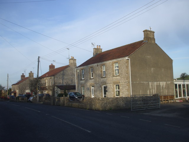
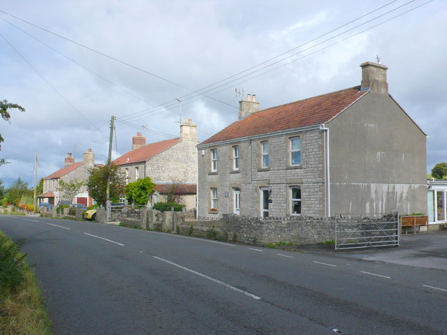
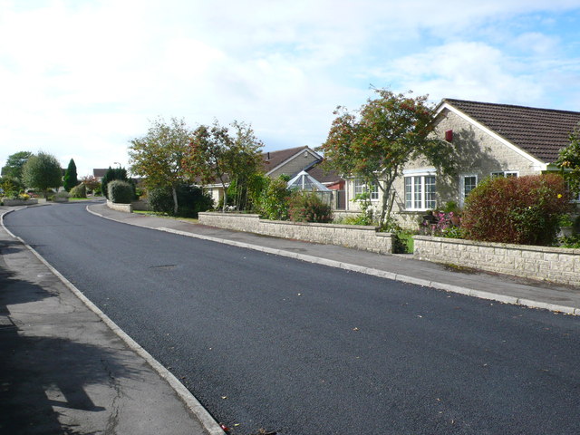
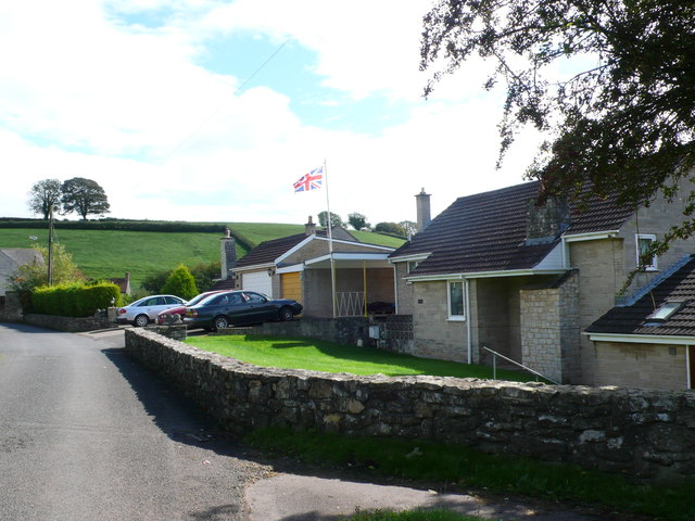
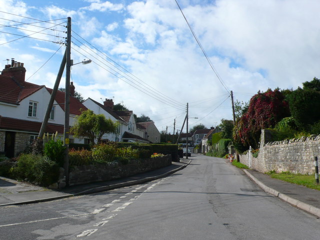
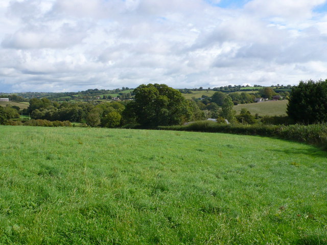
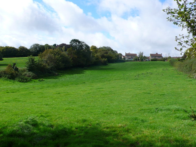
Greenvale is a charming village located in the county of Somerset, England. Situated amidst the beautiful rolling hills of the Mendip Hills Area of Outstanding Natural Beauty, Greenvale offers residents and visitors a tranquil and picturesque setting.

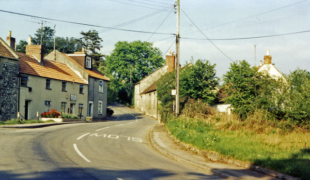
The village is home to around 500 inhabitants and is known for its close-knit community and friendly atmosphere. The traditional stone houses, neatly lined streets, and well-maintained gardens contribute to the village's quaint and idyllic character.

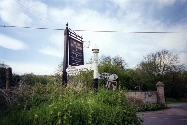
Greenvale boasts a range of amenities, including a post office, a village shop, and a local pub, which serves as a lively meeting point for residents. The village hall hosts various community events and gatherings, fostering a strong sense of belonging among the residents.

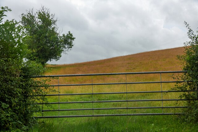
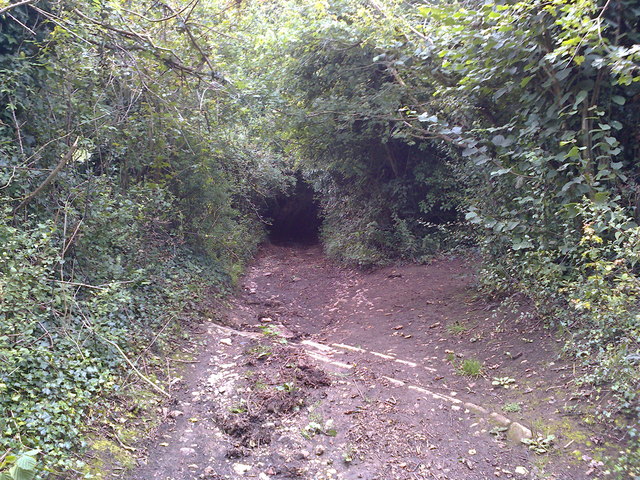
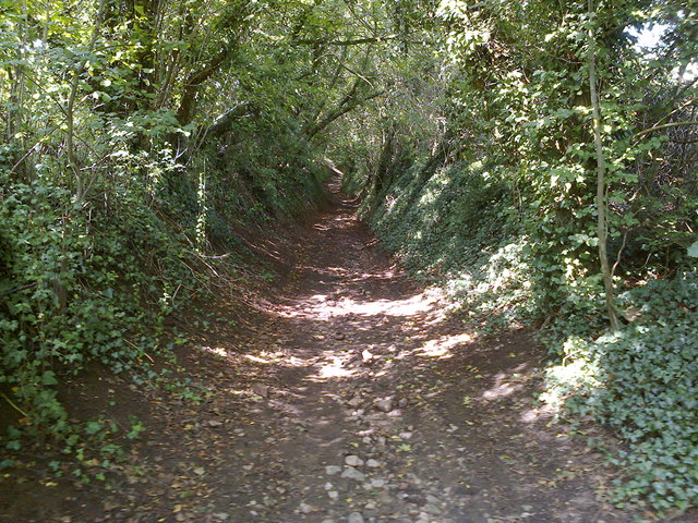
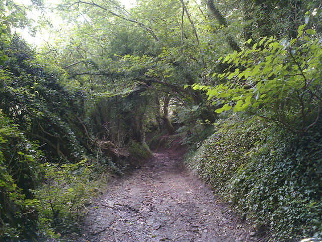
Nature enthusiasts are drawn to Greenvale for its stunning surroundings. The nearby Mendip Hills offer countless opportunities for outdoor activities such as hiking, cycling, and horseback riding. The rolling landscapes, filled with lush green meadows, ancient woodlands, and sparkling streams, provide a breathtaking backdrop for exploration and relaxation.

For those seeking a taste of history, the village is located within easy reach of several historical sites, including the iconic Glastonbury Abbey and the fascinating Cheddar Gorge and Caves.

Greenvale's convenient location, charming ambiance, and natural beauty make it a highly sought-after place to live or visit for those looking to escape the hustle and bustle of city life and immerse themselves in the tranquility of the Somerset countryside.

If you have any feedback on the listing, please let us know in the comments section below.

Greenvale Images

Images are sourced within 2km of 51.32376/-2.4805052 or Grid Reference ST6658. Thanks to Geograph Open Source API. All images are credited.

Direction Sign – Signpost in Radford Located in Radford on the southwest side of a T junction opposite Radford Villa, Paulton parish. 2 arms and pyramid finial.

Milestone Society National ID: SO_ST6757B
Direction Sign – Signpost in Radford
Located in Radford on the southwest side of a T junction opposite Radford Villa, Paulton parish. 2 arms and pyramid finial. Milestone Society National ID: SO_ST6757B
High Littleton : Grassy Field & Gate A field seen from Bungay's Hill.
High Littleton : Grassy Field & Gate
A field seen from Bungay's Hill.
Mill Lane Looking downhill from close to where the footpath crosses the byway
Mill Lane
Looking downhill from close to where the footpath crosses the byway
Mill Lane BOAT Looking uphill at the point where the footpath crosses the byway
Mill Lane BOAT
Looking uphill at the point where the footpath crosses the byway
Houses at the point where Timsbury Rd is about to become Bloomfield Rd, near Bloomfield
St Mary's Church, Timsbury
Houses on Bloomfield Road. These attractive stone built semi detached houses are on the east side of Bloomfield Rd between Farmborough and Timsbury. Bloomfield is the northern part of Timsbury.
Houses on Bloomfield Road.
These attractive stone built semi detached houses are on the east side of Bloomfield Rd between Farmborough and Timsbury. Bloomfield is the northern part of Timsbury.
Somerset Folly Somerset Folly is a twisting residential street consisting mainly of rather boring grey bungalows. It runs west from The Avenue to St Mary's Close.
Somerset Folly
Somerset Folly is a twisting residential street consisting mainly of rather boring grey bungalows. It runs west from The Avenue to St Mary's Close.
Site of Demolished Works This is the site of the former works of the Wheeler Reconstructed Stone Company which produces artificial stone from a mix of cement and crushed Bath stone.This is used in new build house projects as a cheap replacement for natural stone. They appear to have relocated to Marsh Lane, Temple Cloud but it is uncertain if they are still manufacturing. In this image it can be seen that on the remaining site there appears to be evidence of an old kiln , perhaps a lime kiln.
Site of Demolished Works
This is the site of the former works of the Wheeler Reconstructed Stone Company which produces artificial stone from a mix of cement and crushed Bath stone.This is used in new build house projects as a cheap replacement for natural stone. They appear to have relocated to Marsh Lane, Temple Cloud but it is uncertain if they are still manufacturing. In this image it can be seen that on the remaining site there appears to be evidence of an old kiln , perhaps a lime kiln.
Houses on Priorshill These houses are at the bottom of Priorshill where it joins Loves Hill. Priorshill rises up to the hamlet of Tyning
Houses on Priorshill
These houses are at the bottom of Priorshill where it joins Loves Hill. Priorshill rises up to the hamlet of Tyning
Houses on Timsbury Rd View up Timsbury Rd towards its junction with the A39. The road coming in on the left is The Batch leading on to Goosard Lane.
Houses on Timsbury Rd
View up Timsbury Rd towards its junction with the A39. The road coming in on the left is The Batch leading on to Goosard Lane.
Countryside near Paulton These pasture fields are just south of Goosard lane between High Littleton and Paulton.
Countryside near Paulton
These pasture fields are just south of Goosard lane between High Littleton and Paulton.
Fields at High Littleton This is at the southern end of High Littleton looking up from near Goosard Lane. The houses that can be seen at the top of the hill are on Langfords lane at the very northern edge of the grid square.
Fields at High Littleton
This is at the southern end of High Littleton looking up from near Goosard Lane. The houses that can be seen at the top of the hill are on Langfords lane at the very northern edge of the grid square.
Bridleway sign on Parkway Lane Although the tarmac continues to Wallmead Cottage, the public road ends here for motor vehicles unless you have resident's access rights.  Parkway Lane is a bridleway from this point northwards.  A public footpath also crosses the road here and Newton Brook passes under it.
Bridleway sign on Parkway Lane
Although the tarmac continues to Wallmead Cottage, the public road ends here for motor vehicles unless you have resident's access rights. Parkway Lane is a bridleway from this point northwards. A public footpath also crosses the road here and Newton Brook passes under it.
Parkway Lane Tarmac surface all the way to the end of the lane.
Parkway Lane
Tarmac surface all the way to the end of the lane.
Mill Lane Looking downhill just before the byway becomes a sunken lane in a deep gulley.
Mill Lane
Looking downhill just before the byway becomes a sunken lane in a deep gulley.
Camerton: site of station, 1987 View northward, across the course of the GWR Limpley Stoke (right) - Hallatrow (left) branch, which was closed way back on 21/9/25 - after only 15 years, to goods from 15/2/51. No trace seems to be left.
Camerton: site of station, 1987
View northward, across the course of the GWR Limpley Stoke (right) - Hallatrow (left) branch, which was closed way back on 21/9/25 - after only 15 years, to goods from 15/2/51. No trace seems to be left.
Show me another place!

Greenvale is located at Grid Ref: ST6658 (Lat: 51.32376, Lng: -2.4805052)

Unitary Authority: Bath and North East Somerset

Police Authority: Avon and Somerset

What 3 Words

///spoons.pure.thickens. Near Timsbury, Somerset

Related Wikis

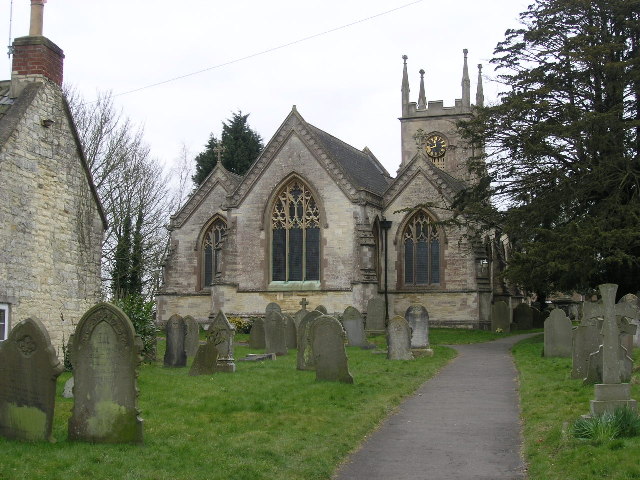
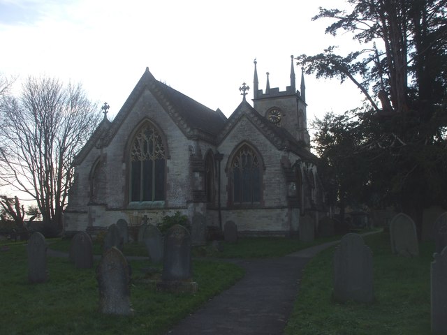
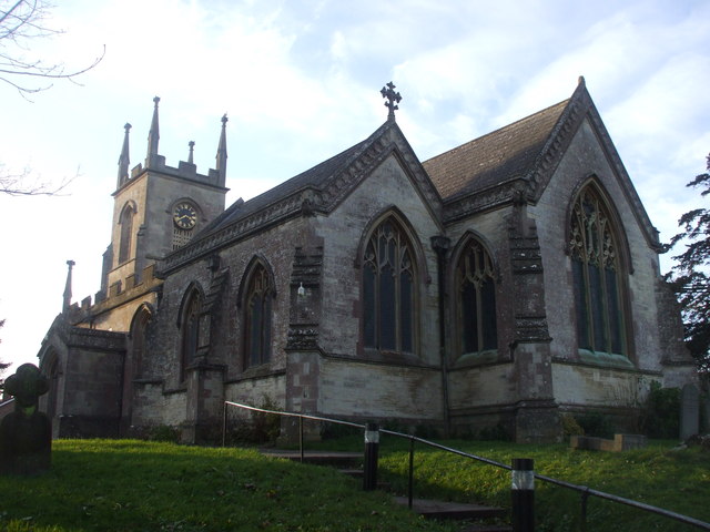
Church of St Mary The Virgin, Timsbury

The Anglican Church of St Mary The Virgin in Timsbury within the English county of Somerset is a Grade II* listed building.An old church on the site had...

Timsbury, Somerset

Timsbury is a village and civil parish in England, in the Bath and North East Somerset unitary authority of the county of Somerset. It lies 8 miles (13...

Radford and Timsbury Halt railway station

Radford and Timsbury Halt railway station was on the Camerton branch of the Great Western Railway in Somerset, England. It was in use from 1910 until 1915...

Paulton Halt railway station

Paulton Halt railway station was on the Camerton branch of the Great Western Railway in Somerset, England. It was in use from 1914 until 1925, however...

Camerton railway station (Somerset)

Camerton (Somerset) railway station served the village of Camerton, England from 1882 to 1951 on the Bristol and North Somerset Railway. In common with...

Wansdyke (UK Parliament constituency)

Wansdyke was a county constituency represented in the House of Commons of the Parliament of the United Kingdom. It elected one Member of Parliament (MP...

North East Somerset (UK Parliament constituency)

North East Somerset is a constituency represented in the House of Commons of the UK Parliament, since it was created for the 2010 general election, by...

Tunley Camp

Tunley Camp is an vallate Iron Age hill fort situated approximately 0.8 miles (1.3 km) north-east from the small village of Camerton in the Bath and North...

Nearby Amenities

Located within 500m of 51.32376,-2.4805052
Turning Circle
Lat/Long: 51.32342/-2.4791838
Post Box
Operator: Royal Mail
Operator Type: private
Operator Wikidata: Q638098
Ref: BA2 310
Lat/Long: 51.3225/-2.4798229
Post Box
Collection Times: Mo-Fr 17:00; Sa 11:00
Operator: Royal Mail
Post Box Type: pillar
Ref: BA2 239
Royal Cypher: EIIR
Royal Cypher Wikidata: Q33102113
Lat/Long: 51.3262965/-2.4767957
Bus Stop
Guss and Crook
Bus: yes
Naptan AtcoCode: 0180BAC31062;0180BAC31061
Naptan Bearing: E;W
Naptan BusStopType: CUS
Naptan CommonName: Guss and Crook
Naptan Crossing: Church Hill;Maggs Hill
Naptan NaptanCode: bthawpd;bthawpm
Naptan Street: South Road
Naptan Verified: no
Public Transport: platform
Source: naptan_import
Lat/Long: 51.3254614/-2.4770983
Bus Stop
St Marys Cl
Naptan AtcoCode: 0180BAC31063
Naptan Bearing: N
Naptan CommonName: St Marys Cl
Naptan Crossing: St Mary's Close
Naptan NaptanCode: bthawjw
Naptan Street: The Avenue
Naptan Verified: no
Source: naptan_import
Lat/Long: 51.326946/-2.47908
Bus Stop
St Marys Cl
Naptan AtcoCode: 0180BAC31064
Naptan Bearing: E
Naptan CommonName: St Marys Cl
Naptan Crossing: The Avenue
Naptan NaptanCode: bthawma
Naptan Street: St Mary's Close
Naptan Verified: no
Shelter: no
Source: naptan_import
Lat/Long: 51.3266397/-2.478675
Bus Stop
Greenvale Close
Naptan AtcoCode: 0180BAC31065
Naptan Bearing: N
Naptan CommonName: Greenvale Close
Naptan Crossing: Greenvale Close
Naptan NaptanCode: bthawgw
Naptan Street: Greenvale Drive
Naptan Verified: no
Source: naptan_import
Lat/Long: 51.3230656/-2.4802594
Barrier: kissing_gate
Lat/Long: 51.321582/-2.479198
Barrier: kissing_gate
Lat/Long: 51.3259808/-2.4744022
Barrier: kissing_gate
Lat/Long: 51.3251819/-2.4745126
Barrier: cycle_barrier
Lat/Long: 51.3253136/-2.4787464
Barrier: bollard
Lat/Long: 51.3249535/-2.4784014
Barrier: bollard
Lat/Long: 51.3265263/-2.4786092
Barrier: cycle_barrier
Lat/Long: 51.3223937/-2.4791245
Cookery School
Vale House Kitchen
Addr Postcode: BA2 0EU
Fhrs Id: 642865
Fixme: rough location
Website: https://valehousekitchen.co.uk/
Lat/Long: 51.3240233/-2.4856538
Public Bookcase
Booth: K6
Disused Amenity: telephone
Man Made: telephone_box
Public Bookcase Type: phone_box
Lat/Long: 51.3254965/-2.4764291
Bench
Lat/Long: 51.3254915/-2.4763853
Waste Basket
Lat/Long: 51.3254918/-2.4763495
Power: pole
Transformer: distribution
Lat/Long: 51.3249728/-2.4736399
Power: pole
Transformer: distribution
Lat/Long: 51.324894/-2.4745996
Power: pole
Lat/Long: 51.3245947/-2.4738694
Power: pole
Lat/Long: 51.3240621/-2.4735122
Power: pole
Lat/Long: 51.3243788/-2.4758495
Power: substation
Lat/Long: 51.3225739/-2.4796106
Waste Basket
Lat/Long: 51.32252/-2.4797169
Generator Method: photovoltaic
Generator Output Electricity: yes
Generator Source: solar
Generator Type: solar_photovoltaic_panel
Location: roof
Power: generator
Lat/Long: 51.3216681/-2.4806789
Generator Method: photovoltaic
Generator Output Electricity: yes
Generator Source: solar
Generator Type: solar_photovoltaic_panel
Location: roof
Power: generator
Lat/Long: 51.3224256/-2.4786552
Generator Method: photovoltaic
Generator Output Electricity: yes
Generator Source: solar
Generator Type: solar_photovoltaic_panel
Location: roof
Power: generator
Lat/Long: 51.3228283/-2.4785271
Generator Method: photovoltaic
Generator Output Electricity: yes
Generator Source: solar
Generator Type: solar_photovoltaic_panel
Location: roof
Power: generator
Lat/Long: 51.3229033/-2.4783137
Generator Method: photovoltaic
Generator Output Electricity: yes
Generator Source: solar
Generator Type: solar_photovoltaic_panel
Location: roof
Power: generator
Lat/Long: 51.3231116/-2.4786918
Generator Method: photovoltaic
Generator Output Electricity: yes
Generator Source: solar
Generator Type: solar_photovoltaic_panel
Location: roof
Power: generator
Lat/Long: 51.3231574/-2.4795801
Generator Method: photovoltaic
Generator Output Electricity: yes
Generator Source: solar
Generator Type: solar_photovoltaic_panel
Location: roof
Power: generator
Lat/Long: 51.3232437/-2.4792691
Power: pole
Transformer: distribution
Lat/Long: 51.3238668/-2.4771723
Generator Method: photovoltaic
Generator Output Electricity: yes
Generator Source: solar
Generator Type: solar_photovoltaic_panel
Location: roof
Power: generator
Lat/Long: 51.3245215/-2.4804459
Power: substation
Lat/Long: 51.3243078/-2.4811326
Generator Method: photovoltaic
Generator Output Electricity: yes
Generator Source: solar
Generator Type: solar_photovoltaic_panel
Location: roof
Power: generator
Lat/Long: 51.3250604/-2.4814115
Generator Method: photovoltaic
Generator Output Electricity: yes
Generator Source: solar
Generator Type: solar_photovoltaic_panel
Location: roof
Power: generator
Lat/Long: 51.3256302/-2.4799511
Generator Method: photovoltaic
Generator Output Electricity: yes
Generator Source: solar
Generator Type: solar_photovoltaic_panel
Location: roof
Power: generator
Lat/Long: 51.3251052/-2.4790671
Generator Method: photovoltaic
Generator Output Electricity: yes
Generator Source: solar
Generator Type: solar_photovoltaic_panel
Location: roof
Power: generator
Lat/Long: 51.3252602/-2.4781228
Generator Method: photovoltaic
Generator Output Electricity: yes
Generator Source: solar
Generator Type: solar_photovoltaic_panel
Location: roof
Power: generator
Lat/Long: 51.3242895/-2.4788546
Generator Method: photovoltaic
Generator Output Electricity: yes
Generator Source: solar
Generator Type: solar_photovoltaic_panel
Location: roof
Power: generator
Lat/Long: 51.3242428/-2.4789993
Generator Method: photovoltaic
Generator Output Electricity: yes
Generator Source: solar
Generator Type: solar_photovoltaic_panel
Location: roof
Power: generator
Lat/Long: 51.3234717/-2.4794302
Generator Method: photovoltaic
Generator Output Electricity: yes
Generator Source: solar
Generator Type: solar_photovoltaic_panel
Location: roof
Power: generator
Lat/Long: 51.3243429/-2.4782887
Grit Bin
Colour: yellow
Material: plastic
Lat/Long: 51.3249639/-2.4783765
Waste Basket
Lat/Long: 51.3249263/-2.4784381
Power: substation
Lat/Long: 51.3252963/-2.4789799
Waste Basket
Lat/Long: 51.3251775/-2.4791822
Grit Bin
Colour: yellow
Material: plastic
Lat/Long: 51.325175/-2.4792055
Street Lamp
Lat/Long: 51.3252207/-2.4789728
Power: substation
Lat/Long: 51.3265919/-2.4762306
Waste Basket
Lat/Long: 51.3267533/-2.4764675
Generator Method: photovoltaic
Generator Output Electricity: yes
Generator Source: solar
Generator Type: solar_photovoltaic_panel
Location: roof
Power: generator
Lat/Long: 51.3261404/-2.4770437
Bench
Backrest: yes
Material: wood
Lat/Long: 51.3264789/-2.476004
Bench
Backrest: yes
Material: wood
Lat/Long: 51.3264541/-2.4759074
Waste Basket
Lat/Long: 51.326463/-2.4760731
Give Way
Direction: backward
Lat/Long: 51.3254538/-2.4763013
Canine Craze
Addr Postcode: BA2 0LD
Addr Street: South Road
Opening Hours: Tu-We 10:00-16:00; Th 13:00-18:00; Fr 10:00-16:00; Sa 10:00-13:00
Shop: pet
Website: https://www.caninecraze-shop.com/
Lat/Long: 51.3256479/-2.4762813
Grit Bin
Colour: yellow
Material: plastic
Lat/Long: 51.3254999/-2.4764526
Power: pole
Lat/Long: 51.3248729/-2.4823316
Power: pole
Lat/Long: 51.3250766/-2.4863327
Power: pole
Lat/Long: 51.3249096/-2.4873608
Power: pole
Lat/Long: 51.3252381/-2.485347
Power: pole
Lat/Long: 51.3253719/-2.4840198
Power: pole
Lat/Long: 51.3254349/-2.4833562
Generator Method: photovoltaic
Generator Output Electricity: yes
Generator Source: solar
Generator Type: solar_photovoltaic_panel
Location: roof
Power: generator
Lat/Long: 51.3249833/-2.4839238
Grit Bin
Lat/Long: 51.3234396/-2.4872121
The data included in this document is from www.openstreetmap.org. The data is made available under ODbL.

Have you been to Greenvale?

Leave your review of Greenvale below (or comments, questions and feedback).