Gauxholme

Settlement in Lancashire

England

Gauxholme

Causey Stones on Packhorse Track The climb up after Dean Royd Farm towards Bottomley
Causey Stones on Packhorse Track Credit: Kevin Waterhouse

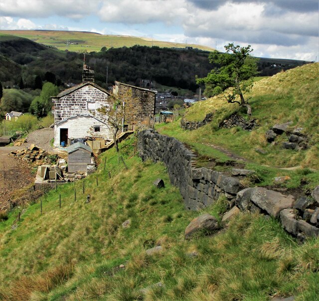
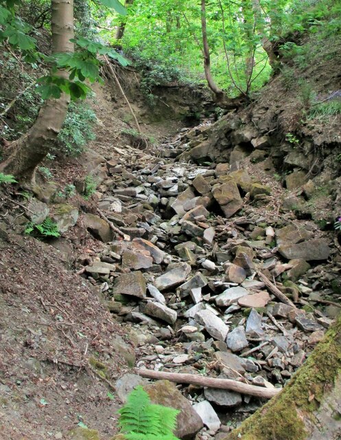
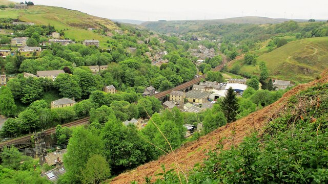
Gauxholme is a small village located in the county of Lancashire, England. It is situated in the South Pennines, near the town of Todmorden. The village is nestled in a picturesque valley, surrounded by rolling hills and lush green countryside.

Gauxholme is known for its rich history, dating back to medieval times. The village was mentioned in the Domesday Book, a survey of England completed in 1086. In the past, Gauxholme was primarily an agricultural community, with farming and textile production being the main industries. However, with the decline of the textile industry in the 20th century, the village has transitioned into a predominantly residential area.

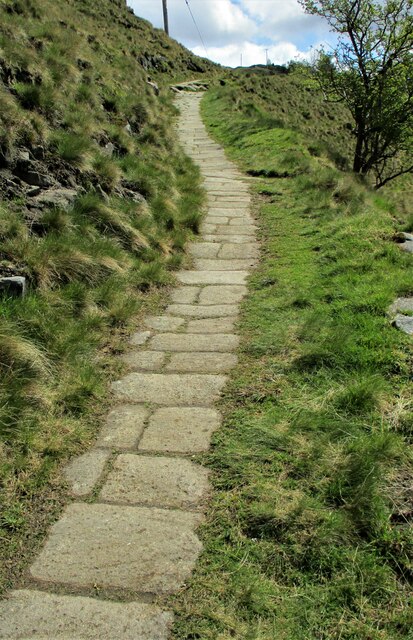
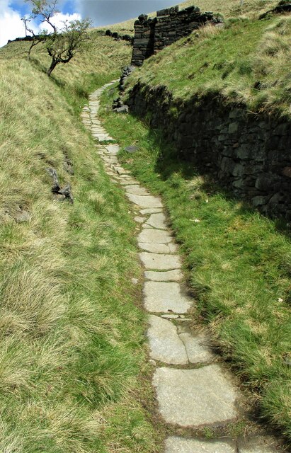
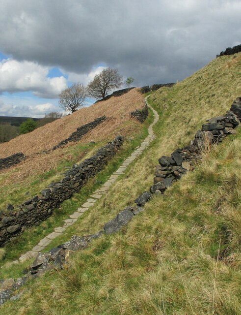
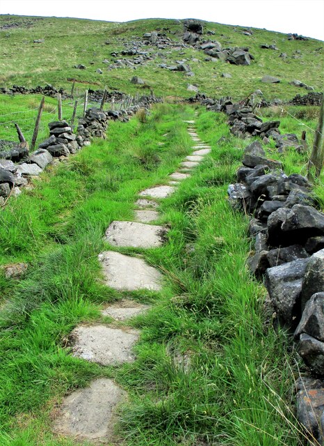
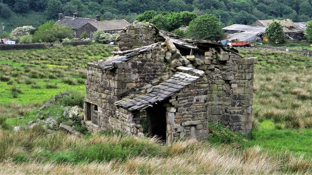
The village itself is characterized by charming stone-built houses and narrow winding streets. It has a close-knit community feel, with a small but active population. The village boasts a number of amenities, including a local pub, shops, and a primary school. The surrounding area offers opportunities for outdoor activities such as hiking, cycling, and fishing, thanks to its beautiful natural landscape.

Gauxholme is well-connected to nearby towns and cities, with good transport links. It is located just off the A646 road, which connects to major routes leading to Manchester, Leeds, and Halifax. The village also benefits from regular bus services, making it easily accessible for both residents and visitors alike.

Overall, Gauxholme is a peaceful and picturesque village, offering a tranquil countryside setting while still providing convenient access to nearby urban areas.

If you have any feedback on the listing, please let us know in the comments section below.
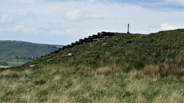
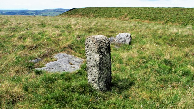
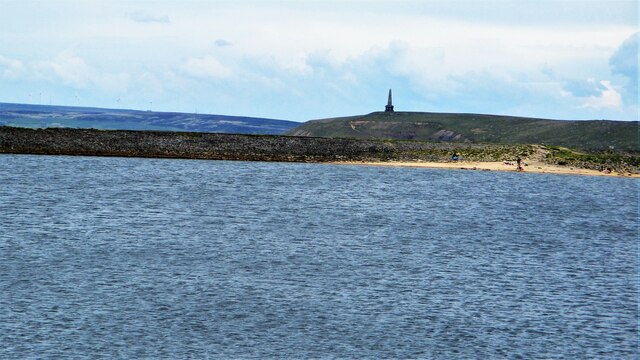
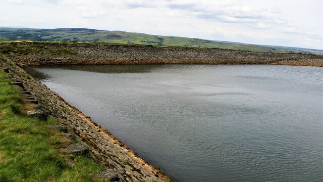
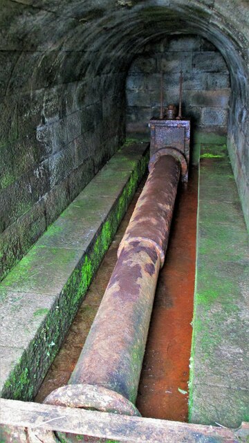
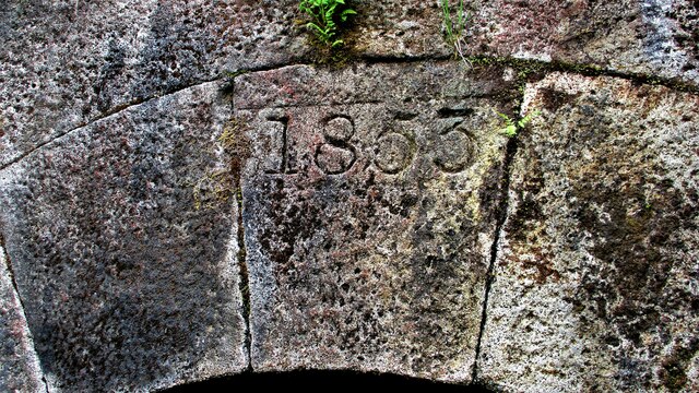
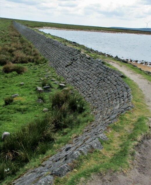
Gauxholme Images

Images are sourced within 2km of 53.701578/-2.1057799 or Grid Reference SD9322. Thanks to Geograph Open Source API. All images are credited.

Causey Stones on Packhorse Track The climb up after Dean Royd Farm towards Bottomley
Causey Stones on Packhorse Track
The climb up after Dean Royd Farm towards Bottomley
Packhorse Track behind Dean Royd Farm The track at this point has a substantial embankment
Packhorse Track behind Dean Royd Farm
The track at this point has a substantial embankment
Causey Stones on Packhorse Track The climb up after Dean Royd Farm to Hollingworth Gate
Causey Stones on Packhorse Track
The climb up after Dean Royd Farm to Hollingworth Gate
Causey Stones on Packhorse Track Final climb of track before flatter section to Hollingworth Gate
Causey Stones on Packhorse Track
Final climb of track before flatter section to Hollingworth Gate
Lower Knowl A work in progress
Lower Knowl
A work in progress
Swineshead Farm View from Lower Knowl
Swineshead Farm
View from Lower Knowl
Lower Knowl A farmhouse hopefully work in progress
Lower Knowl
A farmhouse hopefully work in progress
Steps at Gaddings Dam Steps at western corner of dam showing daylight through them
Steps at Gaddings Dam
Steps at western corner of dam showing daylight through them
Langfield Common Boundary Stone Stone with L on face away from camera, nothing discernible on other. Gaddings Dam steps in background
Langfield Common Boundary Stone
Stone with L on face away from camera, nothing discernible on other. Gaddings Dam steps in background
Costa del Todmordo The beach in Gaddings Dam, a very popular spot for Todmorden folk. Stoodley Pike Monument in the background
Costa del Todmordo
The beach in Gaddings Dam, a very popular spot for Todmorden folk. Stoodley Pike Monument in the background
Gaddings Dam The stone inner face of the dam. Gaddings is maintained by a local Group with Friends support.
Gaddings Dam
The stone inner face of the dam. Gaddings is maintained by a local Group with Friends support.
Gaddings Dam Outlet Pipe The culvert in the North West dam wall
Gaddings Dam Outlet Pipe
The culvert in the North West dam wall
Gaddings Dam Outlet Culvert Keystone 1853 datestone on outlet culvert in North West dam wall
Gaddings Dam Outlet Culvert Keystone
1853 datestone on outlet culvert in North West dam wall
Gaddings Dam (East) Wall The dam wall that separates the East & West dams. The East dam has been drained by United Utilities. The West dam is maintained by a local support group
Gaddings Dam (East) Wall
The dam wall that separates the East & West dams. The East dam has been drained by United Utilities. The West dam is maintained by a local support group
Causey Stones up Moor Lane Track south of Top O Th Rough towards Rake End
Causey Stones up Moor Lane
Track south of Top O Th Rough towards Rake End
Derelict Top O Th Rough Viewed from Moor Lane
Derelict Top O Th Rough
Viewed from Moor Lane
Dobroyd Clough after storms At the bottom of the Clough, Network Rail have done much work to stop this sort of debris blocking the culvert under the railway
Dobroyd Clough after storms
At the bottom of the Clough, Network Rail have done much work to stop this sort of debris blocking the culvert under the railway
Gauxholme Railway Viaduct View South over Shade & Gauxholme from Dobroyd Road
Gauxholme Railway Viaduct
View South over Shade & Gauxholme from Dobroyd Road
Show me another place!

Gauxholme is located at Grid Ref: SD9322 (Lat: 53.701578, Lng: -2.1057799)

Unitary Authority: Calderdale

Police Authority: West Yorkshire

What 3 Words

///lanes.darker.shook. Near Walsden, West Yorkshire

Related Wikis

Walsden railway station

Walsden railway station (; WOLZ-dən) serves the village of Walsden, Todmorden in West Yorkshire, England, on the edge of the Pennines. It is served by...

Walsden

Walsden (; WOLZ-dən) is a large village in the civil parish of Todmorden in the Metropolitan Borough of Calderdale, West Yorkshire, England. It was historically...

Dobroyd Castle

Dobroyd Castle is an important historic building above the town of Todmorden, West Yorkshire, England. It was built for John Fielden, local mill owner...

Todmorden Unitarian Church

Todmorden Unitarian Church is a Unitarian church located in Honey Hole Road, Todmorden, West Yorkshire, England (grid reference SD935239). Built in honour...

Nearby Amenities

Located within 500m of 53.701578,-2.1057799
Seamark Type: gate
Waterway: lock_gate
Lat/Long: 53.7053227/-2.1082052
Seamark Type: gate
Waterway: lock_gate
Lat/Long: 53.7058936/-2.1074009
Seamark Type: gate
Waterway: lock_gate
Lat/Long: 53.7055081/-2.1079676
Seamark Type: gate
Waterway: lock_gate
Lat/Long: 53.7041356/-2.1087637
Seamark Type: gate
Waterway: lock_gate
Lat/Long: 53.7043512/-2.1087294
Seamark Type: gate
Waterway: lock_gate
Lat/Long: 53.7002154/-2.1052775
Seamark Type: gate
Waterway: lock_gate
Lat/Long: 53.7004335/-2.1053808
Seamark Type: gate
Waterway: lock_gate
Lat/Long: 53.6984442/-2.1051725
Seamark Type: gate
Waterway: lock_gate
Lat/Long: 53.6986549/-2.1053289
Bus Stop
Rochdale Road Bacup Road
Bus: yes
Local Ref: 45018930
Naptan AtcoCode: 450018930
Naptan Bearing: SW
Naptan CommonName: Rochdale Road Bacup Road
Naptan Crossing: Bacup Road
Naptan Indicator: Stop 45018930
Naptan PlusbusZoneRef: LEEDS
Naptan ShortCommonName: Bacup Road
Naptan Street: Rochdale Road
Naptan Verified: no
Public Transport: platform
Source: naptan_import
Lat/Long: 53.7052274/-2.1066324
Bus Stop
Rochdale Road Bacup Road
Bus: yes
Local Ref: 45018931
Naptan AtcoCode: 450018931
Naptan Bearing: NE
Naptan CommonName: Rochdale Road Bacup Road
Naptan Crossing: Bacup Road
Naptan Indicator: Stop 45018931
Naptan PlusbusZoneRef: LEEDS
Naptan ShortCommonName: Bacup Road
Naptan Street: Rochdale Road
Naptan Verified: no
Public Transport: platform
Source: naptan_import
Lat/Long: 53.7052182/-2.1068596
Bus Stop
Rochdale Road
Bus: yes
Local Ref: 45018932
Naptan AtcoCode: 450018932
Naptan Bearing: NW
Naptan CommonName: Rochdale Road
Naptan Crossing: Nr Bacup Road
Naptan Indicator: Stop 45018932
Naptan PlusbusZoneRef: LEEDS
Naptan ShortCommonName: Knowlwood Bottom
Naptan Street: Rochdale Road
Naptan Verified: no
Public Transport: platform
Source: naptan_import
Lat/Long: 53.7031686/-2.1070514
Bus Stop
Rochdale Road
Bus: yes
Local Ref: 45018933
Naptan AtcoCode: 450018933
Naptan Bearing: S
Naptan CommonName: Rochdale Road
Naptan Crossing: Nr-At Hollins Road
Naptan Indicator: Stop 45018933
Naptan PlusbusZoneRef: LEEDS
Naptan ShortCommonName: Hollins Road
Naptan Street: Rochdale Road
Naptan Verified: no
Public Transport: platform
Source: naptan_import
Lat/Long: 53.7029622/-2.1067327
Bus Stop
Rochdale Road Hollins Road
Bus: yes
Local Ref: 45018934
Naptan AtcoCode: 450018934
Naptan Bearing: N
Naptan CommonName: Rochdale Road Hollins Road
Naptan Crossing: Hollins Road
Naptan Indicator: Stop 45018934
Naptan PlusbusZoneRef: LEEDS
Naptan ShortCommonName: Hollins Road
Naptan Street: Rochdale Road
Naptan Verified: no
Public Transport: platform
Source: naptan_import
Lat/Long: 53.7019106/-2.1066695
Bus Stop
Rochdale Road Hollins Road
Bus: yes
Local Ref: 45018935
Naptan AtcoCode: 450018935
Naptan Bearing: S
Naptan CommonName: Rochdale Road Hollins Road
Naptan Crossing: Hollins Road
Naptan Indicator: Stop 45018935
Naptan Landmark: Chemical Co Ltd
Naptan PlusbusZoneRef: LEEDS
Naptan ShortCommonName: Hollins Road
Naptan Street: Rochdale Road
Naptan Verified: no
Public Transport: platform
Source: naptan_import
Lat/Long: 53.701713/-2.1065478
Bus Stop
Rochdale Road Mona-s Terrace
Bus: yes
Local Ref: 45018936
Naptan AtcoCode: 450018936
Naptan Bearing: N
Naptan CommonName: Rochdale Road Mona-s Terrace
Naptan Crossing: Adj Monas Terrace
Naptan Indicator: Stop 45018936
Naptan PlusbusZoneRef: LEEDS
Naptan ShortCommonName: Granville Street
Naptan Street: Rochdale Road
Naptan Verified: no
Public Transport: platform
Source: naptan_import
Lat/Long: 53.6984146/-2.1062062
Bus Stop
Rochdale Road
Bus: yes
Local Ref: 45018937
Naptan AtcoCode: 450018937
Naptan Bearing: SE
Naptan CommonName: Rochdale Road
Naptan Crossing: Granville Street
Naptan Indicator: Stop 45018937
Naptan PlusbusZoneRef: LEEDS
Naptan ShortCommonName: Lacy Avenue
Naptan Street: Rochdale Road
Naptan Verified: no
Public Transport: platform
Shelter: no
Source: naptan_import
Lat/Long: 53.6977681/-2.1054473
Bus Stop
Hollins Road
Bus: yes
Local Ref: 45018960
Naptan AtcoCode: 450018960
Naptan Bearing: S
Naptan CommonName: Hollins Road
Naptan Crossing: Top O The Hill Road
Naptan Indicator: Stop 45018960
Naptan PlusbusZoneRef: LEEDS
Naptan ShortCommonName: Walsden
Naptan Street: Hollins Road
Naptan Verified: no
Public Transport: platform
Source: naptan_import
Lat/Long: 53.6989647/-2.1040568
Bus Stop
Hollins Road
Bus: yes
Local Ref: 45018961
Naptan AtcoCode: 450018961
Naptan Bearing: SE
Naptan CommonName: Hollins Road
Naptan Crossing: Lumbutts Road
Naptan Indicator: Stop 45018961
Naptan PlusbusZoneRef: LEEDS
Naptan ShortCommonName: Knowlwood Road
Naptan Street: Hollins Road
Naptan Verified: no
Public Transport: platform
Source: naptan_import
Lat/Long: 53.7009322/-2.1052129
Bus Stop
Lumbutts Road Old Lane
Bus: yes
Local Ref: 45018962
Naptan AtcoCode: 450018962
Naptan Bearing: NE
Naptan CommonName: Lumbutts Road Old Lane
Naptan Crossing: Old Lane
Naptan Indicator: Stop 45018962
Naptan PlusbusZoneRef: LEEDS
Naptan ShortCommonName: Old Lane
Naptan Street: Lumbutts Road
Naptan Verified: no
Public Transport: platform
Source: naptan_import
Lat/Long: 53.7041222/-2.1051911
Bus Stop
Knowlwood Road Hill Place
Bus: yes
Local Ref: 45018984
Naptan AtcoCode: 450018984
Naptan Bearing: SW
Naptan CommonName: Knowlwood Road Hill Place
Naptan Crossing: Hill Place
Naptan Indicator: Stop 45018984
Naptan Landmark: Shade Junior & Infant School
Naptan PlusbusZoneRef: LEEDS
Naptan ShortCommonName: Knowlwood Road
Naptan Street: Knowlwood Road
Naptan Verified: no
Public Transport: platform
Source: naptan_import
Lat/Long: 53.7055885/-2.1048457
Bus Stop
Knowlwood Road
Bus: yes
Local Ref: 45018985
Naptan AtcoCode: 450018985
Naptan Bearing: NE
Naptan CommonName: Knowlwood Road
Naptan Crossing: Nr-Opp Lumbutts Road (Shade Side)
Naptan Indicator: Stop 45018985
Naptan Landmark: Flats
Naptan PlusbusZoneRef: LEEDS
Naptan ShortCommonName: Knowlwood Road
Naptan Street: Knowlwood Road
Naptan Verified: no
Public Transport: platform
Source: naptan_import
Lat/Long: 53.7050934/-2.105708
Bus Stop
Knowlwood Road
Bus: yes
Local Ref: 45018986
Naptan AtcoCode: 450018986
Naptan Bearing: SW
Naptan CommonName: Knowlwood Road
Naptan Crossing: Nr Old Lane
Naptan Indicator: Stop 45018986
Naptan PlusbusZoneRef: LEEDS
Naptan ShortCommonName: Knowlwood Road
Naptan Street: Knowlwood Road
Naptan Verified: no
Public Transport: platform
Source: naptan_import
Lat/Long: 53.7048237/-2.1057376
Bus Stop
Knowlwood Road
Bus: yes
Local Ref: 45018987
Naptan AtcoCode: 450018987
Naptan Bearing: S
Naptan CommonName: Knowlwood Road
Naptan Crossing: Old Lane
Naptan Indicator: Stop 45018987
Naptan PlusbusZoneRef: LEEDS
Naptan ShortCommonName: Old Lane
Naptan Street: Knowlwood Road
Naptan Verified: no
Public Transport: platform
Source: naptan_import
Lat/Long: 53.7031963/-2.1062486
Bus Stop
Rochdale Road Walsden
Bus: yes
Local Ref: 45023734
Naptan AtcoCode: 450023734
Naptan Bearing: S
Naptan CommonName: Rochdale Road Walsden
Naptan Crossing: Mona-s Terrace
Naptan Indicator: Stop 45023734
Naptan PlusbusZoneRef: LEEDS
Naptan ShortCommonName: Monas Terrace
Naptan Street: Rochdale Road
Naptan Verified: no
Public Transport: platform
Source: naptan_import
Lat/Long: 53.6996727/-2.1064518
Bus Stop
Rochdale Road
Bus: yes
Local Ref: 45023785
Naptan AtcoCode: 450023785
Naptan Bearing: N
Naptan CommonName: Rochdale Road
Naptan Crossing: Mona-s Terrace
Naptan Indicator: Stop 45023785
Naptan PlusbusZoneRef: LEEDS
Naptan ShortCommonName: Mona-s Terrace
Naptan Street: Rochdale Road
Naptan Verified: no
Public Transport: platform
Source: naptan_import
Lat/Long: 53.6999512/-2.1066494
Bus Stop
Hollins Road Henshaw Wood
Bus: yes
Naptan AtcoCode: 450028843
Naptan Bearing: N
Naptan CommonName: Hollins Road Henshaw Wood
Naptan Crossing: Henshaw Wood
Naptan Landmark: Unknown
Naptan ShortCommonName: Hollins Road
Naptan Street: Hollins Road
Naptan Verified: no
Public Transport: platform
Source: naptan_import
Lat/Long: 53.69945/-2.1042246
Bus Stop
Knowlwood Road Old Lane
Bus: yes
Local Ref: 45050725
Naptan AtcoCode: 450050725
Naptan Bearing: N
Naptan BusStopType: CUS
Naptan CommonName: Knowlwood Road Old Lane
Naptan Indicator: Stop 45050725
Naptan PlusbusZoneRef: LEEDS
Naptan ShortCommonName: Hollins Road
Naptan Street: Knowlwood Road
Naptan Verified: no
Public Transport: platform
Source: naptan_import
Lat/Long: 53.7031872/-2.1064
Hollins Road
Local Ref: 45050708
Naptan AtcoCode: 450050708
Naptan Bearing: NW
Naptan BusStopType: CUS
Naptan CommonName: Hollins Road
Naptan Indicator: Stop 45050708
Naptan PlusbusZoneRef: LEEDS
Naptan ShortCommonName: Lumbutts Road
Naptan Street: Hollins Road
Naptan Verified: no
Source: naptan_import
Lat/Long: 53.7008871/-2.1053491
Lumbutts Road Old Lane
Local Ref: 45050709
Naptan AtcoCode: 450050709
Naptan Bearing: SW
Naptan BusStopType: CUS
Naptan CommonName: Lumbutts Road Old Lane
Naptan Indicator: Stop 45050709
Naptan PlusbusZoneRef: LEEDS
Naptan ShortCommonName: Knowl Wood
Naptan Street: Lumbutts Road
Naptan Verified: no
Source: naptan_import
Lat/Long: 53.7040692/-2.1051298
Barrier: stile
Stile: stepover
Lat/Long: 53.7009907/-2.0988035
Barrier: stile
Lat/Long: 53.7010787/-2.1010526
Barrier: stile
Stile: squeezer
Lat/Long: 53.7053043/-2.1022462
Steeltech Kinetix
Addr City: Todmorden
Addr Housename: Bridge Mill
Addr Postcode: OL14 7PW
Addr Street: Gauxholme Fold
Man Made: works
Product: steel_products
Website: https://www.steeltech-kinetix.co.uk/
Lat/Long: 53.7045457/-2.1080724
Longcroft Engineering
Addr City: Todmorden
Addr Housename: Bridge Mill
Addr Postcode: OL14 7PW
Addr Street: Gauxholme Fold
Man Made: works
Product: springs
Website: https://www.longcroftengineering.co.uk/
Lat/Long: 53.7041489/-2.1082873
The data included in this document is from www.openstreetmap.org. The data is made available under ODbL.

Have you been to Gauxholme?

Leave your review of Gauxholme below (or comments, questions and feedback).