Gawthorpe Green

Settlement in Yorkshire

England

Gawthorpe Green

Woodcock Hall, Upper Hopton The hall seems to have been extended considerably since first photographed for this site in 2005 <a href="https://www.geograph.org.uk/photo/80868">SE2018 : Woodcock Hall</a>.
Woodcock Hall, Upper Hopton Credit: Stephen Craven

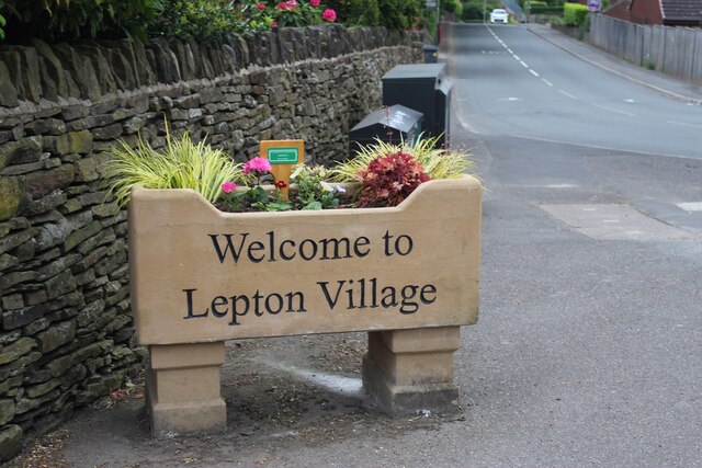
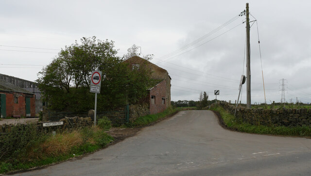
Gawthorpe Green is a charming village located in the county of Yorkshire, England. Situated in the metropolitan borough of Kirklees, this picturesque village is nestled amidst the scenic beauty of the Pennines, offering residents and visitors alike a tranquil and idyllic setting.

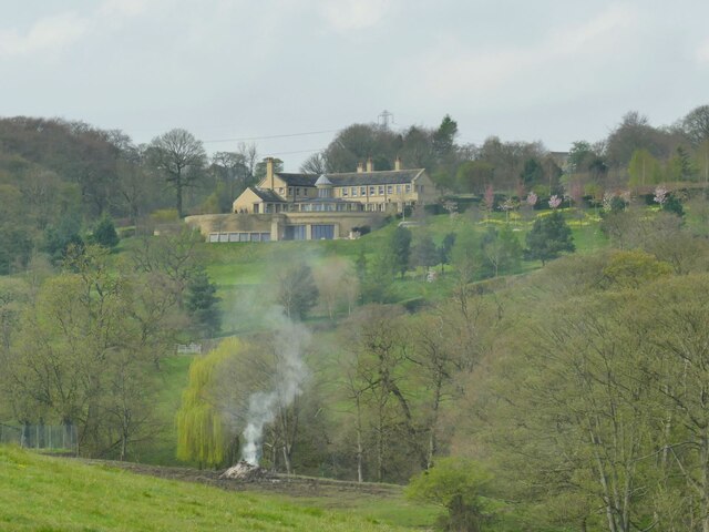
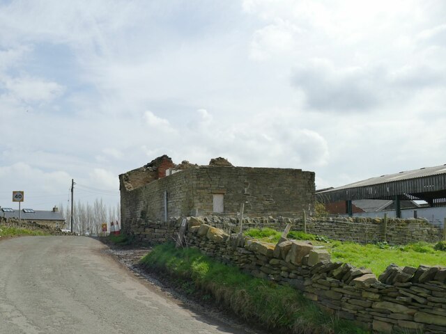
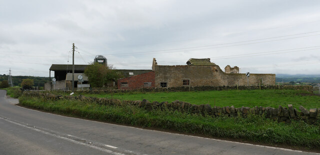
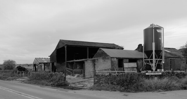
With a population of approximately 500 people, Gawthorpe Green exudes a welcoming and close-knit community atmosphere. The village is known for its well-preserved historic buildings, including traditional stone cottages and farmhouses, which add to the village's character and charm.

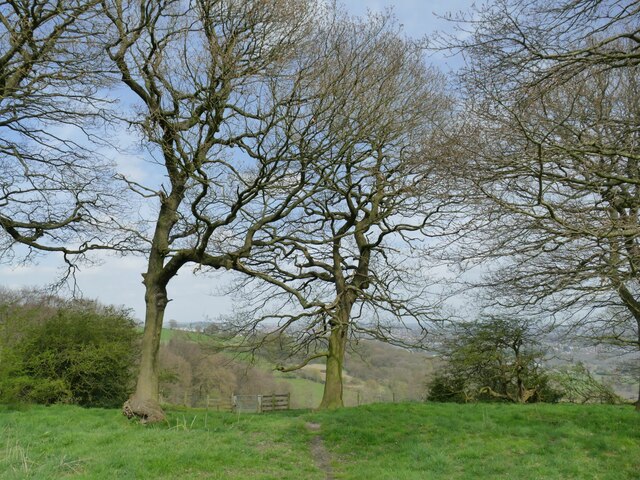
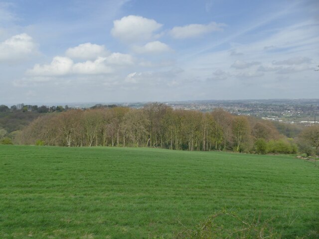
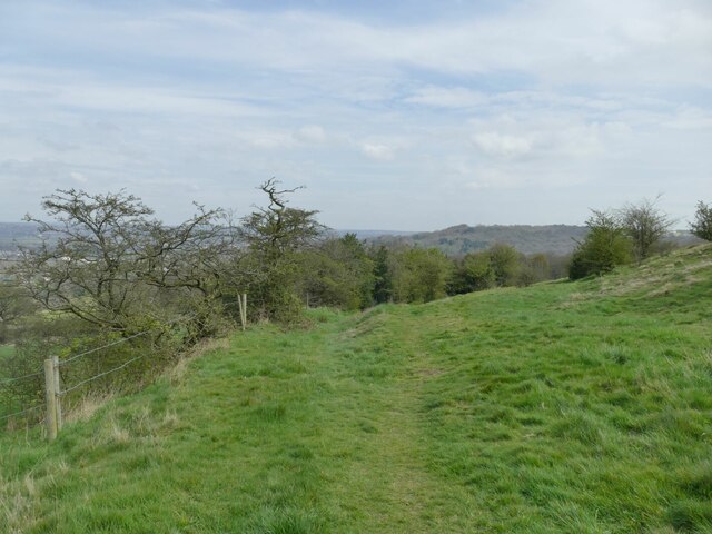
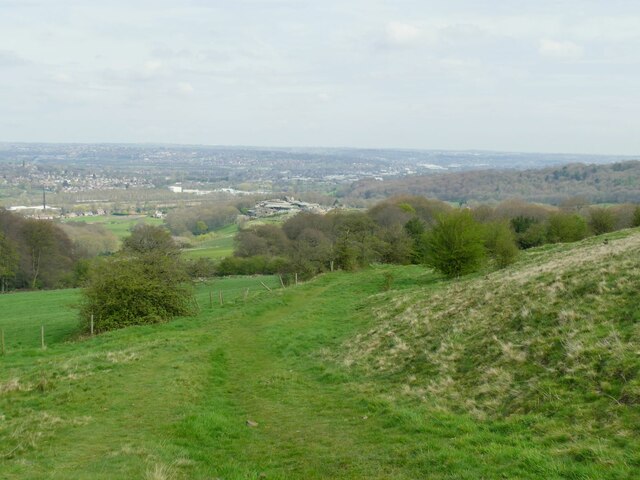
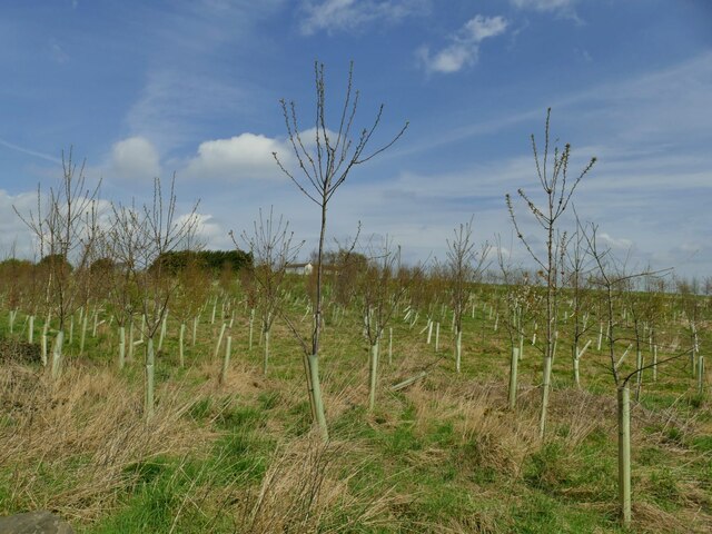
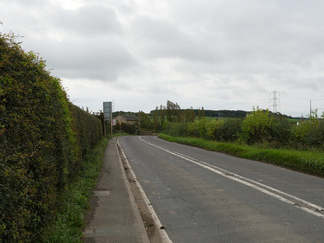
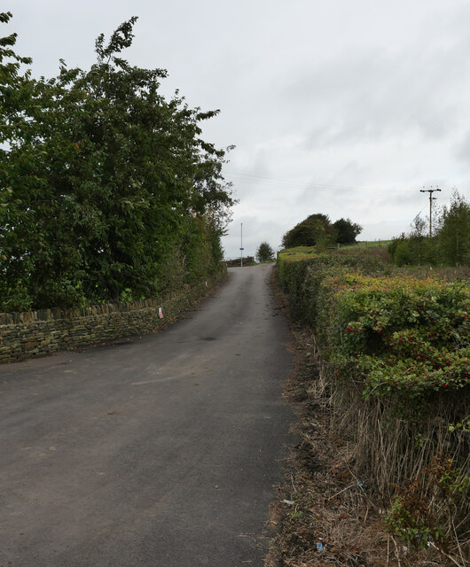
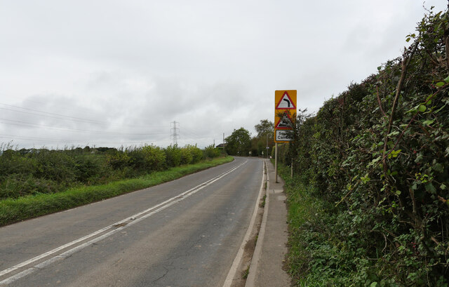
The surrounding countryside offers breathtaking views, with rolling hills and lush green fields stretching as far as the eye can see. This makes Gawthorpe Green an ideal destination for nature lovers, hikers, and outdoor enthusiasts who can explore the numerous walking trails and scenic routes that crisscross the area.

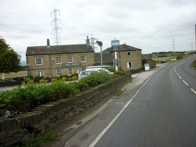
The village boasts a small but vibrant local economy, with several independent shops, a post office, and a village pub that serves as a social hub for residents. The nearby town of Ossett provides additional amenities and services, including supermarkets, schools, and healthcare facilities.

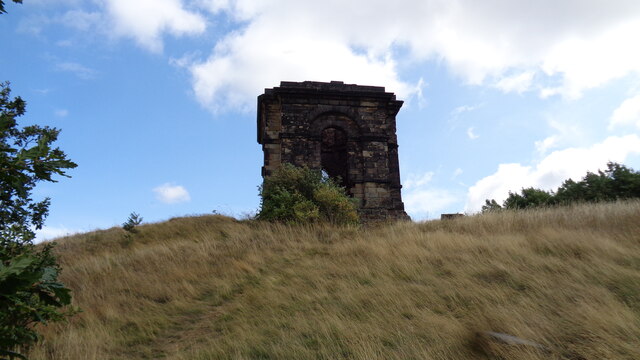
Gawthorpe Green is steeped in history, with evidence of human habitation dating back to the Neolithic period. The area is also associated with the textile industry, once being a major center for cloth production during the Industrial Revolution.

Overall, Gawthorpe Green offers a peaceful and picturesque retreat from the hustle and bustle of modern life, providing residents and visitors with a slice of traditional Yorkshire charm.

If you have any feedback on the listing, please let us know in the comments section below.

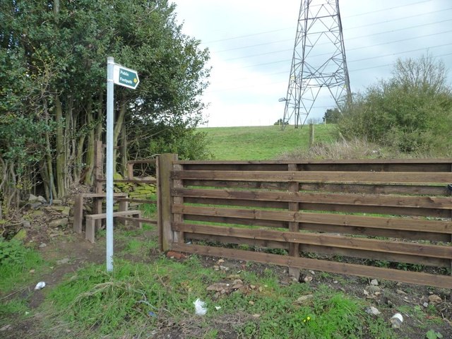
Gawthorpe Green Images

Images are sourced within 2km of 53.647476/-1.7118101 or Grid Reference SE1916. Thanks to Geograph Open Source API. All images are credited.

Woodcock Hall, Upper Hopton The hall seems to have been extended considerably since first photographed for this site in 2005 <a href="https://www.geograph.org.uk/photo/80868">SE2018 : Woodcock Hall</a>.
Woodcock Hall, Upper Hopton
The hall seems to have been extended considerably since first photographed for this site in 2005 SE2018 : Woodcock Hall.
Bridleway above Hepworth Wood
Hepworth Wood Viewed from a nearby bridleway.
Hepworth Wood
Viewed from a nearby bridleway.
Hollies alongside a bridleway The holly bushes were filled with song thrushes and other small birds responding to the first warm weather of spring.
Hollies alongside a bridleway
The holly bushes were filled with song thrushes and other small birds responding to the first warm weather of spring.
View from Dransfield Hill Looking north-east across the lower Calder Valley.
View from Dransfield Hill
Looking north-east across the lower Calder Valley.
Plantation at Dransfield Hill Farm
Ruined barn on Healey Green Lane Part of Croft Side Farm.
Ruined barn on Healey Green Lane
Part of Croft Side Farm.
Croft Side Farm  Viewed from Healey Green Lane.
Croft Side Farm
Viewed from Healey Green Lane.
The Temple on the crest of the hill A gazebo for the demolished Whitley Hall
The Temple on the crest of the hill
A gazebo for the demolished Whitley Hall
New village sign Not a sign for a new village, but a new sign for an old village.
New village sign
Not a sign for a new village, but a new sign for an old village.
Liley Lane (B6118), Kirkheaton
Bridleway from Liley Lane to Newhall (KIR/158/10), Kirkheaton
Derelict buildings on Healey Green Lane seen from Liley Lane (B6118), Kirkheaton
Healey Green Lane, Kirkheaton
Derelict Buildings, Croft Side, Liley Lane (B6118), Kirkheaton
Liley Lane (B6118), Kirkheaton
The Hare and Hounds on Liley Lane
Footpath to Liley Lane Heading south from Tanhouse Lane.
Footpath to Liley Lane
Heading south from Tanhouse Lane.
Show me another place!

Gawthorpe Green is located at Grid Ref: SE1916 (Lat: 53.647476, Lng: -1.7118101)

Division: West Riding

Unitary Authority: Kirklees

Police Authority: West Yorkshire

What 3 Words

///roofs.slams.stamp. Near Mirfield, West Yorkshire

Related Wikis

Gawthorpe, Kirklees

Gawthorpe, also known as Gawthorp, is a hamlet in the Kirklees district, in the English county of West Yorkshire, about 4 miles (6 km) east of Huddersfield...

Kirkheaton

Kirkheaton (English: ) is a village in the parish of Kirkburton, in the Kirklees district of West Yorkshire, England, Historically, it is part of the West...

Kirkheaton railway station

Kirkheaton railway station served the village of Kirkheaton, West Yorkshire, England until closure in 1930. It was located immediately north of the junction...

Waterloo, Huddersfield

Waterloo is a suburb of Huddersfield, West Yorkshire, England. It is 2 miles (3.2 km) to the east of Huddersfield Town Centre. It is the part of Dalton...

Related Videos

WORLD'S STRANGEST NAMED PLACES #shorts

in this video we visit a strange named road in yorkshire called long tongue scrog lane. I dont even know what a scrog is (any ideas ...

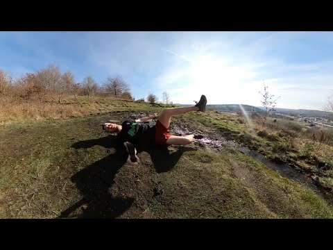
Dolly Woods Trail Run (Dalton Bank Nature Reserve)

This is the route for one of my favourite local trail runs around Dalton Bank Nature Reserve. The footage is quite a fast time-lapse ...

Nearby Amenities

Located within 500m of 53.647476,-1.7118101
Power: tower
Lat/Long: 53.6504381/-1.7086032
Power: tower
Lat/Long: 53.650451/-1.7129765
Gawthorpe Green
Place: locality
Lat/Long: 53.6464909/-1.7129723
Gawthorpe
Place: locality
Lat/Long: 53.6446306/-1.7156116
Bracken Hill
Place: locality
Lat/Long: 53.6459418/-1.7159271
Generator Method: photovoltaic
Generator Output Electricity: yes
Generator Source: solar
Generator Type: solar_photovoltaic_panel
Location: roof
Power: generator
Lat/Long: 53.6465497/-1.7063557
Generator Method: photovoltaic
Generator Output Electricity: yes
Generator Source: solar
Generator Type: solar_photovoltaic_panel
Location: roof
Power: generator
Lat/Long: 53.6466801/-1.7062725
Generator Method: photovoltaic
Generator Output Electricity: yes
Generator Source: solar
Generator Type: solar_photovoltaic_panel
Location: roof
Power: generator
Lat/Long: 53.6466213/-1.7062309
Generator Method: photovoltaic
Generator Output Electricity: yes
Generator Source: solar
Generator Type: solar_photovoltaic_panel
Location: roof
Power: generator
Lat/Long: 53.6466912/-1.7060056
Generator Method: photovoltaic
Generator Output Electricity: yes
Generator Source: solar
Generator Type: solar_photovoltaic_panel
Location: roof
Power: generator
Lat/Long: 53.6466793/-1.7060217
Generator Method: photovoltaic
Generator Output Electricity: yes
Generator Source: solar
Generator Type: solar_photovoltaic_panel
Location: roof
Power: generator
Lat/Long: 53.6466054/-1.7059708
Generator Method: photovoltaic
Generator Output Electricity: yes
Generator Source: solar
Generator Type: solar_photovoltaic_panel
Location: roof
Power: generator
Lat/Long: 53.6466253/-1.7058983
Generator Method: photovoltaic
Generator Output Electricity: yes
Generator Source: solar
Generator Type: solar_photovoltaic_panel
Location: roof
Power: generator
Lat/Long: 53.6464639/-1.7067634
Generator Method: photovoltaic
Generator Output Electricity: yes
Generator Source: solar
Generator Type: solar_photovoltaic_panel
Location: roof
Power: generator
Lat/Long: 53.6464766/-1.7062792
Generator Method: photovoltaic
Generator Output Electricity: yes
Generator Source: solar
Generator Type: solar_photovoltaic_panel
Location: roof
Power: generator
Lat/Long: 53.6464329/-1.706188
Generator Method: photovoltaic
Generator Output Electricity: yes
Generator Source: solar
Generator Type: solar_photovoltaic_panel
Location: roof
Power: generator
Lat/Long: 53.646126/-1.7066561
Generator Method: photovoltaic
Generator Output Electricity: yes
Generator Source: solar
Generator Type: solar_photovoltaic_panel
Location: roof
Power: generator
Lat/Long: 53.6460441/-1.7064267
The data included in this document is from www.openstreetmap.org. The data is made available under ODbL.

Have you been to Gawthorpe Green?

Leave your review of Gawthorpe Green below (or comments, questions and feedback).