Henshaw Wood

Wood, Forest in Lancashire

England

Henshaw Wood

Rochdale Canal at Gauxholme View from Rochdale to Leeds railway
Rochdale Canal at Gauxholme Credit: Raymond Knapman

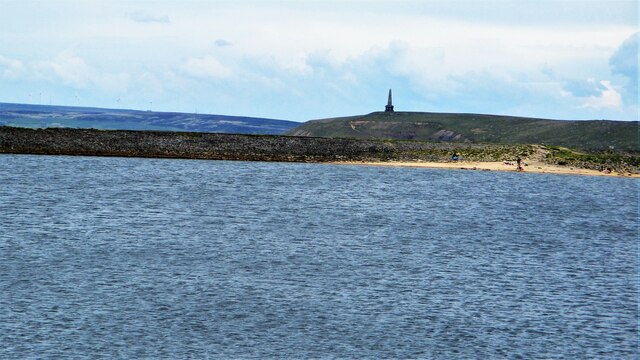
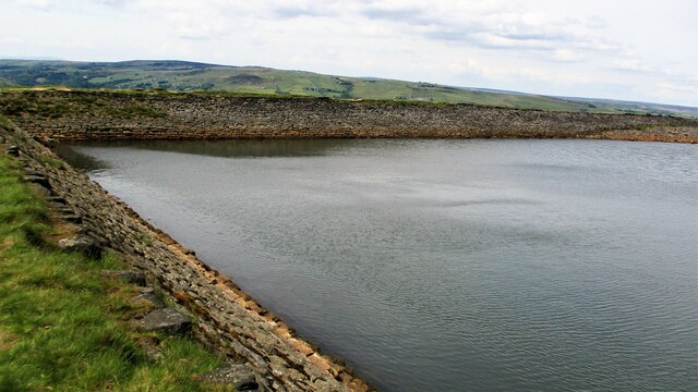
Henshaw Wood, located in Lancashire, is a picturesque forest that covers an area of approximately 500 acres. This woodland is renowned for its natural beauty, captivating visitors with its diverse flora and fauna. The wood is a mix of deciduous and coniferous trees, including oak, beech, and pine, creating a varied and enchanting landscape.

Henshaw Wood offers a haven for wildlife, attracting a wide range of species. It is home to various birds, such as woodpeckers, owls, and buzzards, making it a popular spot for birdwatching enthusiasts. The forest floor is teeming with small mammals, including squirrels, rabbits, and badgers, providing an opportunity for nature lovers to observe these creatures in their natural habitat.

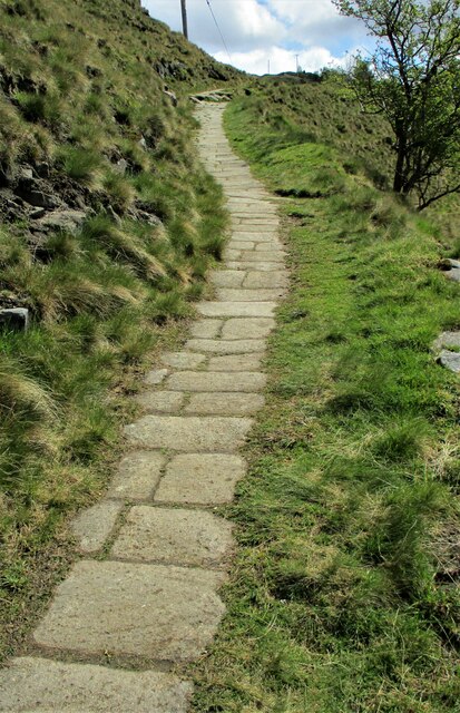
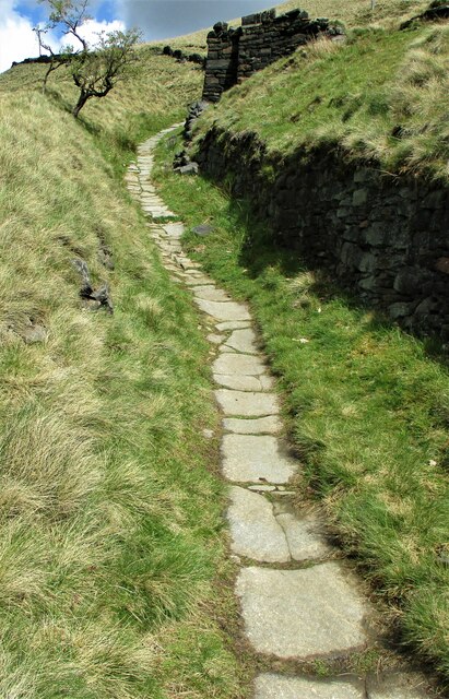
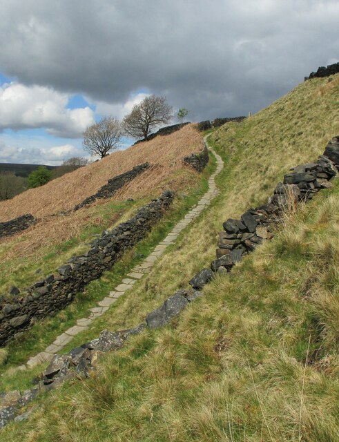
The wood is crisscrossed with numerous walking trails, allowing visitors to explore its beauty at their own pace. These well-maintained paths meander through the forest, providing a peaceful and tranquil setting for leisurely walks or more adventurous hikes. The forest also offers opportunities for cycling and horseback riding, with designated trails catering to these activities.

Visitors to Henshaw Wood can enjoy a range of recreational activities. The forest has designated picnic areas where families and friends can relax and enjoy a meal amidst the natural surroundings. Additionally, there are several areas for camping and outdoor cooking, providing an opportunity for overnight stays and a chance to experience the wood's serenity under the starry night sky.

In conclusion, Henshaw Wood in Lancashire is a stunning forest that offers a delightful escape into nature. With its diverse plant and animal life, well-maintained trails, and recreational facilities, it is a haven for outdoor enthusiasts and a place of tranquility for all who visit.

If you have any feedback on the listing, please let us know in the comments section below.
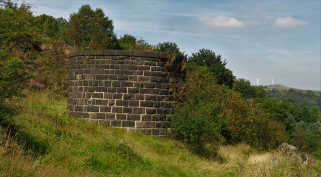
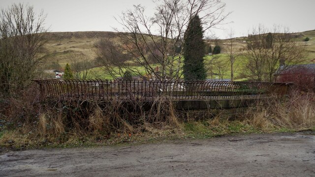
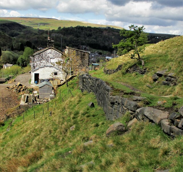
Henshaw Wood Images

Images are sourced within 2km of 53.697836/-2.0986823 or Grid Reference SD9322. Thanks to Geograph Open Source API. All images are credited.

Rochdale Canal at Gauxholme View from Rochdale to Leeds railway
Rochdale Canal at Gauxholme
View from Rochdale to Leeds railway
Burnley Road, Todmorden View from Rochdale to Leeds railway
Burnley Road, Todmorden
View from Rochdale to Leeds railway
Summit Railway Tunnel Air Shaft No.12 Shaft South East of Rough Stones
Summit Railway Tunnel Air Shaft No.12
Shaft South East of Rough Stones
Summit Railway Tunnel Air Shaft, Bottomley Large Oval Shaft off Bottomley Road
Summit Railway Tunnel Air Shaft, Bottomley
Large Oval Shaft off Bottomley Road
Causey Stones on Packhorse Track The climb up after Dean Royd Farm towards Bottomley
Causey Stones on Packhorse Track
The climb up after Dean Royd Farm towards Bottomley
Packhorse Track behind Dean Royd Farm The track at this point has a substantial embankment
Packhorse Track behind Dean Royd Farm
The track at this point has a substantial embankment
Causey Stones on Packhorse Track The climb up after Dean Royd Farm to Hollingworth Gate
Causey Stones on Packhorse Track
The climb up after Dean Royd Farm to Hollingworth Gate
Causey Stones on Packhorse Track Final climb of track before flatter section to Hollingworth Gate
Causey Stones on Packhorse Track
Final climb of track before flatter section to Hollingworth Gate
Lower Knowl A work in progress
Lower Knowl
A work in progress
Swineshead Farm View from Lower Knowl
Swineshead Farm
View from Lower Knowl
Lower Knowl A farmhouse hopefully work in progress
Lower Knowl
A farmhouse hopefully work in progress
Steps at Gaddings Dam Steps at western corner of dam showing daylight through them
Steps at Gaddings Dam
Steps at western corner of dam showing daylight through them
Langfield Common Boundary Stone Stone with L on face away from camera, nothing discernible on other. Gaddings Dam steps in background
Langfield Common Boundary Stone
Stone with L on face away from camera, nothing discernible on other. Gaddings Dam steps in background
Costa del Todmordo The beach in Gaddings Dam, a very popular spot for Todmorden folk. Stoodley Pike Monument in the background
Costa del Todmordo
The beach in Gaddings Dam, a very popular spot for Todmorden folk. Stoodley Pike Monument in the background
Gaddings Dam The stone inner face of the dam. Gaddings is maintained by a local Group with Friends support.
Gaddings Dam
The stone inner face of the dam. Gaddings is maintained by a local Group with Friends support.
Gaddings Dam Outlet Pipe The culvert in the North West dam wall
Gaddings Dam Outlet Pipe
The culvert in the North West dam wall
Gaddings Dam Outlet Culvert Keystone 1853 datestone on outlet culvert in North West dam wall
Gaddings Dam Outlet Culvert Keystone
1853 datestone on outlet culvert in North West dam wall
Gaddings Dam (East) Wall The dam wall that separates the East & West dams. The East dam has been drained by United Utilities. The West dam is maintained by a local support group
Gaddings Dam (East) Wall
The dam wall that separates the East & West dams. The East dam has been drained by United Utilities. The West dam is maintained by a local support group
Show me another place!

Henshaw Wood is located at Grid Ref: SD9322 (Lat: 53.697836, Lng: -2.0986823)

Unitary Authority: Calderdale

Police Authority: West Yorkshire

What 3 Words

///unimpeded.hinders.ducks. Near Walsden, West Yorkshire

Related Wikis

Walsden

Walsden (; WOLZ-dən) is a large village in the civil parish of Todmorden in the Metropolitan Borough of Calderdale, West Yorkshire, England. It was historically...

Walsden railway station

Walsden railway station (; WOLZ-dən) serves the village of Walsden, Todmorden in West Yorkshire, England, on the edge of the Pennines. It is served by...

Todmorden Unitarian Church

Todmorden Unitarian Church is a Unitarian church located in Honey Hole Road, Todmorden, West Yorkshire, England (grid reference SD935239). Built in honour...

Dobroyd Castle

Dobroyd Castle is an important historic building above the town of Todmorden, West Yorkshire, England. It was built for John Fielden, local mill owner...

Summit Tunnel

Summit Tunnel in England is one of the world's oldest railway tunnels. It was constructed between 1838 and 1841 by the Manchester and Leeds Railway Company...

Todmorden

Todmorden ( TOD-mər-dən; locally ) is a market town and civil parish in the Upper Calder Valley in Calderdale, West Yorkshire, England. It is 17 miles...

Todmorden railway station

Todmorden railway station serves the town of Todmorden in West Yorkshire, England, originally on the Yorkshire and Lancashire border. It was built by the...

Todmorden Town Hall

Todmorden Town Hall is a municipal building in Halifax Road, Todmorden, West Yorkshire, England. The town hall, which is the meeting place of Todmorden...

Nearby Amenities

Located within 500m of 53.697836,-2.0986823
Walsden
Created By: YahooApplet 1.0
Is In: Calderdale, West Yorkshire, Yorkshire, UK
Place: village
Wikidata: Q7963802
Lat/Long: 53.6951303/-2.1014452
Seamark Type: gate
Waterway: lock_gate
Lat/Long: 53.6940578/-2.0995734
Seamark Type: gate
Waterway: lock_gate
Lat/Long: 53.6984442/-2.1051725
Seamark Type: gate
Waterway: lock_gate
Lat/Long: 53.6986549/-2.1053289
Seamark Type: gate
Waterway: lock_gate
Lat/Long: 53.6962696/-2.1032692
Seamark Type: gate
Waterway: lock_gate
Lat/Long: 53.6964686/-2.1034292
Seamark Type: gate
Waterway: lock_gate
Lat/Long: 53.6942956/-2.0995911
Bus Stop
Rochdale Road Mona-s Terrace
Bus: yes
Local Ref: 45018936
Naptan AtcoCode: 450018936
Naptan Bearing: N
Naptan CommonName: Rochdale Road Mona-s Terrace
Naptan Crossing: Adj Monas Terrace
Naptan Indicator: Stop 45018936
Naptan PlusbusZoneRef: LEEDS
Naptan ShortCommonName: Granville Street
Naptan Street: Rochdale Road
Naptan Verified: no
Public Transport: platform
Source: naptan_import
Lat/Long: 53.6984146/-2.1062062
Bus Stop
Rochdale Road
Bus: yes
Local Ref: 45018937
Naptan AtcoCode: 450018937
Naptan Bearing: SE
Naptan CommonName: Rochdale Road
Naptan Crossing: Granville Street
Naptan Indicator: Stop 45018937
Naptan PlusbusZoneRef: LEEDS
Naptan ShortCommonName: Lacy Avenue
Naptan Street: Rochdale Road
Naptan Verified: no
Public Transport: platform
Shelter: no
Source: naptan_import
Lat/Long: 53.6977681/-2.1054473
Bus Stop
Rochdale Road
Bus: yes
Local Ref: 45018938
Naptan AtcoCode: 450018938
Naptan Bearing: NW
Naptan CommonName: Rochdale Road
Naptan Crossing: Industry Street
Naptan Indicator: Stop 45018938
Naptan Landmark: Walsden Train Station
Naptan PlusbusZoneRef: LEEDS
Naptan ShortCommonName: Walsden Station
Naptan Street: Rochdale Road
Naptan Verified: no
Public Transport: platform
Shelter: yes
Source: naptan_import
Lat/Long: 53.6963579/-2.1043382
Bus Stop
Rochdale Road
Bus: yes
Local Ref: 45018939
Naptan AtcoCode: 450018939
Naptan Bearing: SE
Naptan CommonName: Rochdale Road
Naptan Crossing: Vulcan Street
Naptan Indicator: Stop 45018939
Naptan PlusbusZoneRef: LEEDS
Naptan ShortCommonName: Vulcan Street
Naptan Street: Rochdale Road
Naptan Verified: no
Public Transport: platform
Source: naptan_import
Lat/Long: 53.6955501/-2.1030034
Bus Stop
Rochdale Road Nelson Street
Bus: yes
Local Ref: 45018940
Naptan AtcoCode: 450018940
Naptan Bearing: S
Naptan CommonName: Rochdale Road Nelson Street
Naptan Crossing: Nelson Street
Naptan Indicator: Stop 45018940
Naptan Landmark: Cross Keys PH
Naptan PlusbusZoneRef: LEEDS
Naptan ShortCommonName: Nelson Street
Naptan Street: Rochdale Road
Naptan Verified: no
Public Transport: platform
Source: naptan_import
Lat/Long: 53.693755/-2.09997
Bus Stop
Hollins Road
Bus: yes
Local Ref: 45018959
Naptan AtcoCode: 450018959
Naptan Bearing: N
Naptan CommonName: Hollins Road
Naptan Crossing: Knowsley Avenue
Naptan Indicator: Stop 45018959
Naptan PlusbusZoneRef: LEEDS
Naptan ShortCommonName: Knowsley Avenue
Naptan Street: Hollins Road
Naptan Verified: no
Public Transport: platform
Source: naptan_import
Lat/Long: 53.6949858/-2.1006999
Bus Stop
Hollins Road
Bus: yes
Local Ref: 45018960
Naptan AtcoCode: 450018960
Naptan Bearing: S
Naptan CommonName: Hollins Road
Naptan Crossing: Top O The Hill Road
Naptan Indicator: Stop 45018960
Naptan PlusbusZoneRef: LEEDS
Naptan ShortCommonName: Walsden
Naptan Street: Hollins Road
Naptan Verified: no
Public Transport: platform
Source: naptan_import
Lat/Long: 53.6989647/-2.1040568
Bus Stop
Rochdale Road
Bus: yes
Local Ref: 45024710
Naptan AtcoCode: 450024710
Naptan Bearing: NW
Naptan CommonName: Rochdale Road
Naptan Crossing: Winterbutlee Road
Naptan Indicator: Stop 45024710
Naptan Landmark: Hollins Mill
Naptan PlusbusZoneRef: LEEDS
Naptan ShortCommonName: Winterbutlee Road
Naptan Street: Rochdale Road
Naptan Verified: no
Public Transport: platform
Source: naptan_import
Lat/Long: 53.694841/-2.1018658
Bus Stop
Hollins Road Henshaw Wood
Bus: yes
Naptan AtcoCode: 450028843
Naptan Bearing: N
Naptan CommonName: Hollins Road Henshaw Wood
Naptan Crossing: Henshaw Wood
Naptan Landmark: Unknown
Naptan ShortCommonName: Hollins Road
Naptan Street: Hollins Road
Naptan Verified: no
Public Transport: platform
Source: naptan_import
Lat/Long: 53.69945/-2.1042246
Bus Stop
Hollins Road Works
Bus: yes
Local Ref: 45050706
Naptan AtcoCode: 450050706
Naptan Bearing: S
Naptan BusStopType: CUS
Naptan CommonName: Hollins Road Works
Naptan Indicator: Stop 45050706
Naptan PlusbusZoneRef: LEEDS
Naptan ShortCommonName: Hollins Mews
Naptan Street: Hollins Road
Naptan Verified: no
Public Transport: platform
Source: naptan_import
Lat/Long: 53.6950128/-2.1005485
Post Office
Walsden Post Office
Addr City: Todmorden
Addr Postcode: OL14 7SN
Branch: Walsden
Brand: Post Office
Brand Wikidata: Q1783168
Check Date: 2020-02-20
Contact Website: https://www.postoffice.co.uk/branch-finder/2804247/walsden
Ref Pol Id: 11237
Lat/Long: 53.694151/-2.1000499
Pub
Cross Keys
Lat/Long: 53.693612/-2.099862
Noexit: yes
Lat/Long: 53.6946419/-2.0999042
Bicycle Parking
Covered: yes
Lat/Long: 53.6961545/-2.1042311
Crossing
Lat/Long: 53.6961694/-2.1040371
Walsden
Naptan AtcoCode: 9100WDEN
Network: National Rail
Network Website: https://www.nationalrail.co.uk/stations/wdn/
Network Wikidata: Q26334
Operator: Northern Rail
Operator Website: https://www.northernrailway.co.uk/stations/walsden
Operator Wikidata: Q85789775
Public Transport: station
Railway: station
Ref Crs: WDN
Train: yes
Wikidata: Q7963803
Wikipedia: en:Walsden railway station
Lat/Long: 53.6965305/-2.1047674
Walsden
Public Transport: stop_position
Railway: stop
Train: yes
Lat/Long: 53.6968012/-2.1050391
Operator: Northern Powergrid
Operator Wikidata: Q7058871
Power: transformer
Lat/Long: 53.695954/-2.1020096
Barrier: stile
Stile: stepover
Lat/Long: 53.7009907/-2.0988035
Barrier: stile
Lat/Long: 53.7010787/-2.1010526
Vending Machine
Vending: public_transport_tickets
Lat/Long: 53.6964373/-2.1045582
Siren
Emergency: siren
Operator: Environment Agency
Operator Wikidata: Q5381011
Siren Purpose: flood_warning
Lat/Long: 53.6955348/-2.1029412
The data included in this document is from www.openstreetmap.org. The data is made available under ODbL.

Have you been to Henshaw Wood?

Leave your review of Henshaw Wood below (or comments, questions and feedback).