Flanderstown

Settlement in Shetland

Scotland

Flanderstown

Mail Burial Ground Adjacent to the sea as is usual on Scottish islands.
Mail Burial Ground Credit: Oliver Dixon

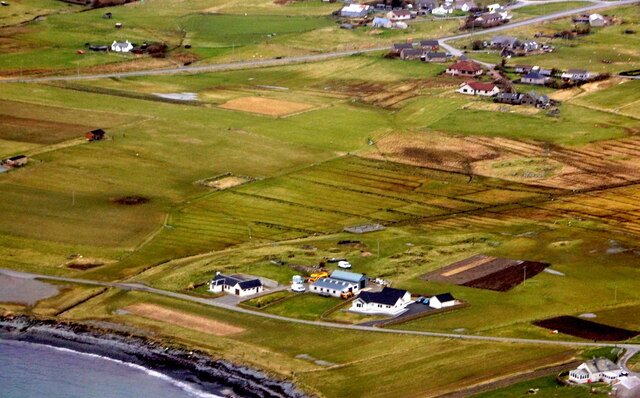
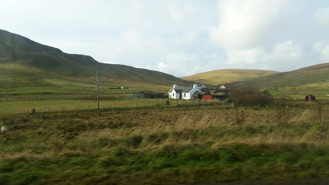
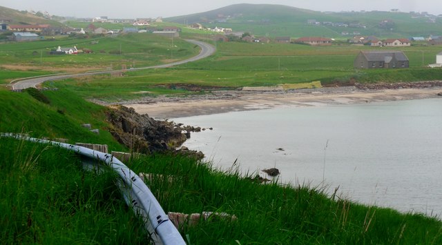
Flanderstown is a small village located on the island of Yell in the Shetland Islands, Scotland. Situated on the northeastern coast of Yell, it overlooks the North Sea and offers stunning panoramic views of the surrounding landscape. With a population of around 300 residents, Flanderstown is a tight-knit community known for its tranquil and picturesque settings.

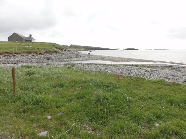
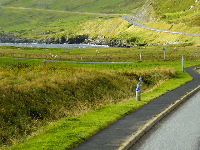
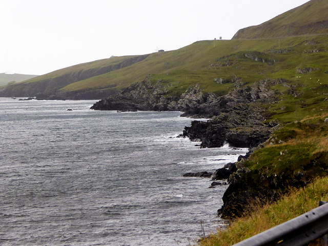
The village is surrounded by rolling hills, green fields, and rocky shores, providing ample opportunities for outdoor activities such as hiking, birdwatching, and fishing. The rugged yet beautiful coastline is dotted with small, sandy beaches and rocky coves, making it an ideal destination for nature enthusiasts.

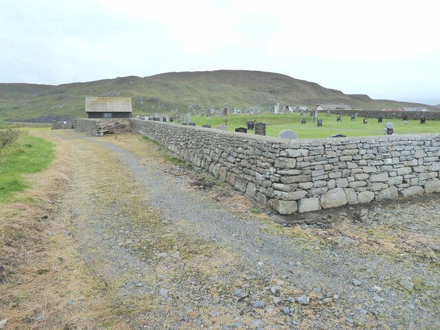
Flanderstown has a rich history that dates back centuries. It was once a bustling fishing and crofting community, and remnants of its maritime heritage can still be found in the village. The traditional stone houses and narrow winding streets give a glimpse into the past, showcasing the village's timeless charm.

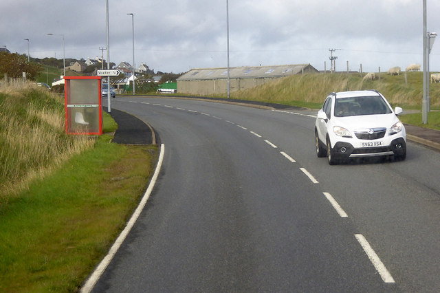
Today, Flanderstown is a peaceful residential area with a few essential amenities, including a local shop and a primary school. For more extensive services, residents often travel to nearby towns or Lerwick, the capital of the Shetland Islands.

Visitors to Flanderstown can expect a warm welcome from the friendly locals and a chance to experience the serenity and natural beauty that defines this remote corner of Scotland. Whether it's exploring the rugged coastline, immersing in the village's history, or simply enjoying the tranquility, Flanderstown offers a true escape from the hustle and bustle of modern life.

If you have any feedback on the listing, please let us know in the comments section below.
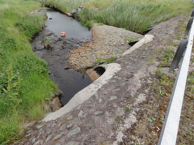
Flanderstown Images

Images are sourced within 2km of 60.045204/-1.2282771 or Grid Reference HU4329. Thanks to Geograph Open Source API. All images are credited.

Mail Burial Ground Adjacent to the sea as is usual on Scottish islands.
Mail Burial Ground
Adjacent to the sea as is usual on Scottish islands.
Aith, Cunningsburgh, from the air
Greenmow and Helli Ness, Cunningsburgh, from the air
South Voxter, Cunningsburgh, from the air
Mail, Cunningsburgh, from the air
Aithsetter, Cunningsburgh, from the air
Shoreline with joining stream Small sandy pebble beach with joining stream to the sea
Shoreline with joining stream
Small sandy pebble beach with joining stream to the sea
Road bridge Road bridge buttress as it passes over the stream. It should have been the location of an Ordnance Survey OSBM Bolt, which seems to have been destroyed in the rebuilding of the road.
Road bridge
Road bridge buttress as it passes over the stream. It should have been the location of an Ordnance Survey OSBM Bolt, which seems to have been destroyed in the rebuilding of the road.
House under renovation, Cunningsburgh
Vadsgarth, Cunningsburgh
Small beach at the Sands of Mail The road is the A970 approaching Cunningsburgh.
Small beach at the Sands of Mail
The road is the A970 approaching Cunningsburgh.
A970 at Cunningsburgh Cunningsburgh, formerly also known as Coningsburgh (from the Old Norse: Konungsborgr meaning "King's castle"), is a hamlet on the coast of Mainland Shetland, nine miles south-west of Lerwick, about halfway between there and Sumburgh Head.
A970 at Cunningsburgh
Cunningsburgh, formerly also known as Coningsburgh (from the Old Norse: Konungsborgr meaning "King's castle"), is a hamlet on the coast of Mainland Shetland, nine miles south-west of Lerwick, about halfway between there and Sumburgh Head.
Bus Stop at Cunningsburgh Bus stop outside Cunningsburgh Primary School.
Bus Stop at Cunningsburgh
Bus stop outside Cunningsburgh Primary School.
Bus Stop on the A970 at Cunningsburgh Cunningsburgh, formerly also known as Coningsburgh (from the Old Norse: Konungsborgr meaning "King's castle"), is a hamlet on the coast of Mainland Shetland, nine miles south-west of Lerwick, about halfway between there and Sumburgh Head.
Bus Stop on the A970 at Cunningsburgh
Cunningsburgh, formerly also known as Coningsburgh (from the Old Norse: Konungsborgr meaning "King's castle"), is a hamlet on the coast of Mainland Shetland, nine miles south-west of Lerwick, about halfway between there and Sumburgh Head.
Bus Stop at Cunningsburgh Cunningsburgh, formerly also known as Coningsburgh (from the Old Norse: Konungsborgr meaning "King's castle"), is a hamlet on the coast of Mainland Shetland, nine miles south-west of Lerwick, about halfway between there and Sumburgh Head.
Bus Stop at Cunningsburgh
Cunningsburgh, formerly also known as Coningsburgh (from the Old Norse: Konungsborgr meaning "King's castle"), is a hamlet on the coast of Mainland Shetland, nine miles south-west of Lerwick, about halfway between there and Sumburgh Head.
Coastal Sheep Farm near Mail
Cunningsburgh, A970 Cunningsburgh, formerly also known as Coningsburgh (from the Old Norse: Konungsborgr meaning "King's castle"), is a hamlet on the coast of Mainland Shetland, nine miles south-west of Lerwick, about halfway between there and Sumburgh Head.
Cunningsburgh, A970
Cunningsburgh, formerly also known as Coningsburgh (from the Old Norse: Konungsborgr meaning "King's castle"), is a hamlet on the coast of Mainland Shetland, nine miles south-west of Lerwick, about halfway between there and Sumburgh Head.
Rocky Shoreline near Mail
Show me another place!

Flanderstown is located at Grid Ref: HU4329 (Lat: 60.045204, Lng: -1.2282771)

Unitary Authority: Shetland Islands

Police Authority: Highlands and Islands

What 3 Words

///happy.received.unfocused. Near Sandwick, Shetland Islands

Nearby Locations

Gord Flanderstown

Related Wikis

Bremirehoull

Bremirehoull is a settlement on the island of Mainland, in Shetland, Scotland. Bremirehoull is situated on the A970 in the Cunningsburgh area. == References... ==
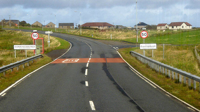
Cunningsburgh

Cunningsburgh, formerly also known as Coningsburgh (Old Norse: Konungsborgr meaning "King's castle"), is a new hamlet and ancient parish in the south of...

Mail, Shetland

Mail is a hamlet on the island of Mainland, in the Shetland Islands, Scotland. == Geography == Mail is located on the south-eastern side of the island...

Aithsetter

Aithsetter (Old Norse: Eiðseti, meaning "the farm at the isthmus") is a village on the island of Mainland, in Shetland, Scotland. Aithsetter is in the...

Catpund

Catpund is a quarry site in Shetland, Scotland, where steatite vessels were cut from the rock from prehistory onwards. The quarrying marks are still visible...

South Mainland

The South Mainland of the Shetland Islands is the southern peninsula of Mainland island. It lies south of Hellister (60° 14′N). The greater southern part...

Sandwick, Dunrossness

see also Sandwick, Whalsay and Sandwick, OrkneySandwick (Old Norse: Sandvik "Sandy Bay") is a village and an ancient parish in the Shetland Islands, Scotland...

Hoswick

Hoswick is a settlement in Sandwick in the south mainland of Shetland, Scotland, on the eastern part of the Dunrossness civil parish. It is separated from...

Nearby Amenities

Located within 500m of 60.045204,-1.2282771
Cunningsburgh
Place: hamlet
Wikidata: Q2816653
Wikipedia: en:Cunningsburgh
Lat/Long: 60.0456345/-1.2282246
Ford: yes
Lat/Long: 60.0485125/-1.222618
Barrier: cattle_grid
Lat/Long: 60.0477525/-1.2273824
Telephone
Booth: KX100
Covered: booth
Lat/Long: 60.0456526/-1.2281454
Bus Stop
Cunningsburgh Hall
Bus: yes
Public Transport: platform
Lat/Long: 60.0452067/-1.2281347
Bus Stop
Cunningsburgh Hall
Bus: yes
Public Transport: platform
Lat/Long: 60.0453405/-1.2284244
Barrier: cattle_grid
Lat/Long: 60.0417459/-1.2296552
Bus Stop
Bus: yes
Public Transport: platform
Shelter: yes
Lat/Long: 60.0458424/-1.2277964
Bus Stop
Bus: yes
Public Transport: platform
Shelter: yes
Lat/Long: 60.0476478/-1.2277871
Power: pole
Lat/Long: 60.041891/-1.2337169
Power: pole
Lat/Long: 60.0424562/-1.2333092
Power: pole
Lat/Long: 60.0430724/-1.2328908
Power: pole
Lat/Long: 60.0438612/-1.232585
Power: pole
Lat/Long: 60.0446059/-1.2323061
Power: pole
Lat/Long: 60.0453184/-1.2319922
Power: pole
Lat/Long: 60.0460242/-1.2317267
Power: pole
Lat/Long: 60.0468719/-1.2313941
Power: pole
Lat/Long: 60.0476285/-1.2310749
Power: pole
Lat/Long: 60.0483892/-1.2307638
Power: pole
Lat/Long: 60.0491632/-1.2304607
Passing Place
Lat/Long: 60.0443124/-1.2268161
Power: pole
Lat/Long: 60.044095/-1.2261222
Street Lamp
Lat/Long: 60.0417326/-1.2293448
Street Lamp
Lat/Long: 60.0419945/-1.2292428
Street Lamp
Lat/Long: 60.0422583/-1.2291557
Street Lamp
Lat/Long: 60.0425135/-1.2291154
Street Lamp
Lat/Long: 60.0428014/-1.2290779
Street Lamp
Lat/Long: 60.0446785/-1.2283175
Power: pole
Lat/Long: 60.0408067/-1.2276731
Power: pole
Lat/Long: 60.0413016/-1.2274374
Power: pole
Lat/Long: 60.0420191/-1.2271002
Power: pole
Lat/Long: 60.0424771/-1.2268854
Power: pole
Lat/Long: 60.0427954/-1.2267352
Power: pole
Lat/Long: 60.0433145/-1.2264857
Power: pole
Lat/Long: 60.0445268/-1.2259082
Power: pole
Lat/Long: 60.0457667/-1.2252822
Power: pole
Lat/Long: 60.0457482/-1.224155
Power: pole
Lat/Long: 60.0457229/-1.2230531
Power: pole
Lat/Long: 60.0464276/-1.2230162
Power: pole
Lat/Long: 60.0470412/-1.2229561
Power: pole
Lat/Long: 60.0478277/-1.222896
Power: pole
Lat/Long: 60.0486074/-1.2228406
Power: pole
Lat/Long: 60.0486097/-1.2241134
Power: pole
Lat/Long: 60.0486016/-1.2252245
Power: pole
Lat/Long: 60.0486097/-1.2263194
Power: pole
Lat/Long: 60.0486097/-1.227151
Power: pole
Lat/Long: 60.0490191/-1.2281605
Power: pole
Lat/Long: 60.0494239/-1.2280057
Power: pole
Lat/Long: 60.0484563/-1.2222931
Power: pole
Lat/Long: 60.0438566/-1.2203181
Power: pole
Lat/Long: 60.0429927/-1.2360051
Power: pole
Lat/Long: 60.0426882/-1.2352821
Power: pole
Lat/Long: 60.0421645/-1.2340879
Power: pole
Lat/Long: 60.0417988/-1.233217
Power: pole
Lat/Long: 60.0414008/-1.2323254
Power: pole
Lat/Long: 60.0409775/-1.2313298
Power: pole
Lat/Long: 60.0422833/-1.2351297
Power: pole
Lat/Long: 60.0431161/-1.2354762
The data included in this document is from www.openstreetmap.org. The data is made available under ODbL.

Have you been to Flanderstown?

Leave your review of Flanderstown below (or comments, questions and feedback).