Flakebridge

Settlement in Westmorland Eden

England

Flakebridge

House nearly finished, Langton The fresh local sandstone construction looks quite colourful but will no doubt weather quite quickly to be a match for the other nearby properties. Open eaves on the nearest part of the building show that there is still work to do on the house, but the next main challenge will surely be the garden. It's a heavy clay soil left by the retreat of the Eden Valley glacier, but at least the site is not beset by the sort of rubble often seen on building sites. I wish them luck.
House nearly finished, Langton Credit: Andy Waddington

Flakebridge is a charming village located in the district of Westmorland, in the county of Cumbria, England. Situated amidst the picturesque countryside of the Lake District National Park, Flakebridge offers a serene and idyllic setting.

The village is known for its stunning natural beauty, with rolling hills, lush green meadows, and the meandering Flake River that flows through its heart. The surrounding landscape provides ample opportunities for outdoor activities such as hiking, cycling, and fishing, attracting nature enthusiasts and adventurers alike.

Flakebridge is a close-knit community with a population of approximately 500 residents. The village is characterized by its traditional stone cottages, which are beautifully preserved and add to the area's historic charm. The local architecture showcases the region's rich heritage, and some buildings date back several centuries.

The village has a small but vibrant local economy, supported by a handful of independent shops, cafes, and pubs. The community is friendly and welcoming, and visitors often find themselves immersed in a warm and inviting atmosphere. The annual Flakebridge Village Fair is a highlight for both locals and tourists, offering a chance to celebrate local traditions, enjoy live music, and indulge in delicious regional cuisine.

Flakebridge's central location within the Lake District makes it an ideal base for exploring the wider region. The nearby town of Windermere, with its famous lake, is a short drive away, offering further attractions and amenities.

Overall, Flakebridge is a hidden gem within the Lake District National Park, offering a tranquil and picturesque escape for visitors seeking natural beauty, a tight-knit community, and a taste of rural English life.

If you have any feedback on the listing, please let us know in the comments section below.
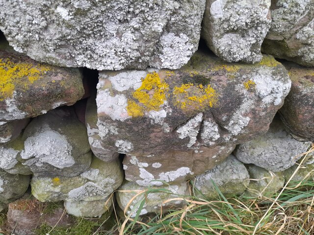
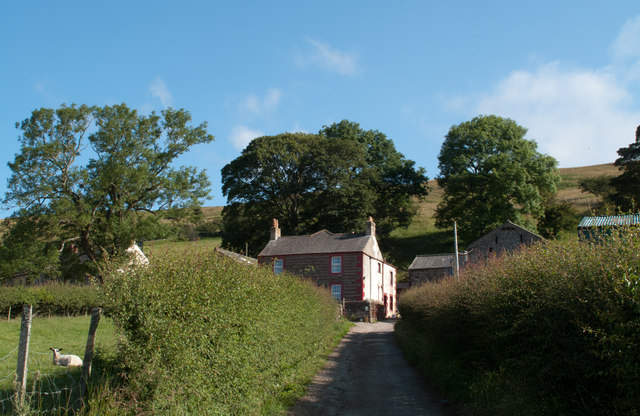
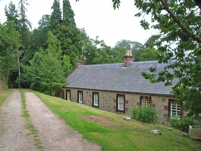
Flakebridge Images

Images are sourced within 2km of 54.592903/-2.4605172 or Grid Reference NY7022. Thanks to Geograph Open Source API. All images are credited.

House nearly finished, Langton The fresh local sandstone construction looks quite colourful but will no doubt weather quite quickly to be a match for the other nearby properties. Open eaves on the nearest part of the building show that there is still work to do on the house, but the next main challenge will surely be the garden. It's a heavy clay soil left by the retreat of the Eden Valley glacier, but at least the site is not beset by the sort of rubble often seen on building sites. I wish them luck.
House nearly finished, Langton
The fresh local sandstone construction looks quite colourful but will no doubt weather quite quickly to be a match for the other nearby properties. Open eaves on the nearest part of the building show that there is still work to do on the house, but the next main challenge will surely be the garden. It's a heavy clay soil left by the retreat of the Eden Valley glacier, but at least the site is not beset by the sort of rubble often seen on building sites. I wish them luck.
Footpath south of Low Barn The footpath leaves the minor road to Flakebridge to follow the northern edge of a patch of woodland. The bits of plastic pipe (seemingly much loved by gamekeepers as markers for all sorts of things) bear numbers for shooting positions, presumably to annihilate pheasant being driven over the horizon from the fields to the north (right, in this view). Anything being driven out of the woods would be in your face before having time to fire a shot and a shorter-range weapon would seem more in order. Tennis rackets to return serve or a net on a long pole as used for Puffins in the Faeroes, perhaps ?
Footpath south of Low Barn
The footpath leaves the minor road to Flakebridge to follow the northern edge of a patch of woodland. The bits of plastic pipe (seemingly much loved by gamekeepers as markers for all sorts of things) bear numbers for shooting positions, presumably to annihilate pheasant being driven over the horizon from the fields to the north (right, in this view). Anything being driven out of the woods would be in your face before having time to fire a shot and a shorter-range weapon would seem more in order. Tennis rackets to return serve or a net on a long pole as used for Puffins in the Faeroes, perhaps ?
Flakebridge Flakebridge comprises a scattering of houses along the southern edge of Flakebridge Wood, above the very flat valley of Murton Beck. This house sits opposite the junction track heading north alongside Swine Gill, deeper into the forest. Judging by the noise which assailed us for the best part of an hour as we approached this point, which had fortunately ceased by the time we got here, the main activity here is slaughtering anything that comes into shotgun range. Just to the west, after the shooting had desisted, the howls of very many dogs serenaded our passing from a building in which they were clearly imprisoned but keen to escape and either greet or devour passers by.
Flakebridge
Flakebridge comprises a scattering of houses along the southern edge of Flakebridge Wood, above the very flat valley of Murton Beck. This house sits opposite the junction track heading north alongside Swine Gill, deeper into the forest. Judging by the noise which assailed us for the best part of an hour as we approached this point, which had fortunately ceased by the time we got here, the main activity here is slaughtering anything that comes into shotgun range. Just to the west, after the shooting had desisted, the howls of very many dogs serenaded our passing from a building in which they were clearly imprisoned but keen to escape and either greet or devour passers by.
Copse south of Murton Beck This stand of trees (which we would have called a copse where I grew up, but they are not coppiced, so whether the term would apply here I'm less sure) occupies the corner of a field south of Murton Beck, the northern edge of which is followed by the public footpath from the Flakebridge road towards Murton, upon which the photographer and his trusty but dawdling hound are standing as the daylight fades (again).
Copse south of Murton Beck
This stand of trees (which we would have called a copse where I grew up, but they are not coppiced, so whether the term would apply here I'm less sure) occupies the corner of a field south of Murton Beck, the northern edge of which is followed by the public footpath from the Flakebridge road towards Murton, upon which the photographer and his trusty but dawdling hound are standing as the daylight fades (again).
Footbridge over Murton Beck The public footpath west from Murton splits here with one way remaining on the north bank of Murton Beck to turn northwards shortly, heading for Brackenthwaite, whilst the footbridge carries the other branch across the beck, to head west to Shepherd's Cottage and Flakebridge (and the end of a minor road to Appleby).
Footbridge over Murton Beck
The public footpath west from Murton splits here with one way remaining on the north bank of Murton Beck to turn northwards shortly, heading for Brackenthwaite, whilst the footbridge carries the other branch across the beck, to head west to Shepherd's Cottage and Flakebridge (and the end of a minor road to Appleby).
Ordnance Survey Cut Mark This OS cut mark can be found on the barn at Langton Farm. It marks a point 159.602m above mean sea level.
Ordnance Survey Cut Mark
This OS cut mark can be found on the barn at Langton Farm. It marks a point 159.602m above mean sea level.
Ordnance Survey Pivot This OS pivot can be found on the wall SW side of the road. It marks a point 164.857m above mean sea level.
Ordnance Survey Pivot
This OS pivot can be found on the wall SW side of the road. It marks a point 164.857m above mean sea level.
Ordnance Survey Cut Mark This OS cut mark can be found on the gatepost south side of the road. It marks a point 244.377m above mean sea level.
Ordnance Survey Cut Mark
This OS cut mark can be found on the gatepost south side of the road. It marks a point 244.377m above mean sea level.
Hay field south-west of Town Head A narrow minor road connects the two villages, Dufton and Murton; the view here is from that road near to the farm at Town Head showing a field with three phases of hay making on show: unmown grass to the right, mown grass to the left and at the centre, an area of grass where the hay has been lifted.
Note: it's also possible that the product of this field will be 'haylage', similar to hay but with a higher moisture content; the name being a portmanteau word of hay and silage.
Hay field south-west of Town Head
A narrow minor road connects the two villages, Dufton and Murton; the view here is from that road near to the farm at Town Head showing a field with three phases of hay making on show: unmown grass to the right, mown grass to the left and at the centre, an area of grass where the hay has been lifted. Note: it's also possible that the product of this field will be 'haylage', similar to hay but with a higher moisture content; the name being a portmanteau word of hay and silage.
Keisley Keisley is a farm lying north of a minor road connecting the villages of Dufton and Murton.
Keisley
Keisley is a farm lying north of a minor road connecting the villages of Dufton and Murton.
Fields divided by hedge and fence Lying on the south-west side of the minor road between Dufton and Murton these two fields are separated by a hedge and fence.
Fields divided by hedge and fence
Lying on the south-west side of the minor road between Dufton and Murton these two fields are separated by a hedge and fence.
High Cup Winery and Townhead farm
Road to Murton Murton Pike is in the background.
Road to Murton
Murton Pike is in the background.
Keisley
Keisley
Seat near Keisley
Seat near Keisley
Keisley House
Keisley House
Cattle near Flakebridge
Bridge in Flakebridge Woods
Show me another place!

Flakebridge is located at Grid Ref: NY7022 (Lat: 54.592903, Lng: -2.4605172)

Administrative County: Cumbria

District: Eden

Police Authority: Cumbria

What 3 Words

///relished.stirs.darting. Near Appleby-in-Westmorland, Cumbria

Related Wikis

Flakebridge

Flakebridge is a woodland and small hamlet in the Eden District, Cumbria, England, 3 kilometres (1.9 mi) south-west from the village of Dufton and 1.95...

Keisley

Keisley is a small hamlet in the English county of Cumbria. It is located in the Dufton civil parish and the Eden district. == Location and geography... ==

Appleby East railway station

Appleby East railway station is a closed railway station that was situated on the Eden Valley Railway between Kirkby Stephen East and Penrith in Cumberland...

Appleby railway station

Appleby is a railway station on the Settle and Carlisle Line, which runs between Carlisle and Leeds via Settle. The station, situated 30 miles 60 chains...

Nearby Amenities

Located within 500m of 54.592903,-2.4605172
Power: pole
Lat/Long: 54.5884157/-2.460871
Power: pole
Lat/Long: 54.5890207/-2.4619388
Power: pole
Lat/Long: 54.5901355/-2.4623105
Power: pole
Lat/Long: 54.5912686/-2.4626981
Power: pole
Lat/Long: 54.5916604/-2.4628207
Power: pole
Lat/Long: 54.5921805/-2.4630125
Power: pole
Lat/Long: 54.5930054/-2.4632754
Power: pole
Lat/Long: 54.5928965/-2.4625755
Power: pole
Lat/Long: 54.5928095/-2.4618715
Power: pole
Lat/Long: 54.5927109/-2.4611992
The data included in this document is from www.openstreetmap.org. The data is made available under ODbL.

Have you been to Flakebridge?

Leave your review of Flakebridge below (or comments, questions and feedback).