Gord

Settlement in Shetland

Scotland

Gord

Mail Burial Ground Adjacent to the sea as is usual on Scottish islands.
Mail Burial Ground Credit: Oliver Dixon

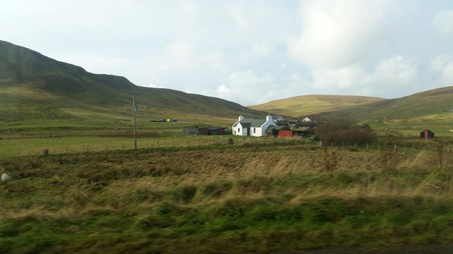
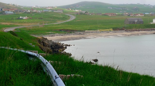
Gord, Shetland is a small picturesque village located on the northernmost tip of the Shetland Islands, Scotland. Situated on the east coast of Mainland Shetland, Gord is nestled between the North Sea and the rugged cliffs that characterize this region. With a population of around 300 inhabitants, Gord offers a tranquil and idyllic setting for residents and visitors alike.

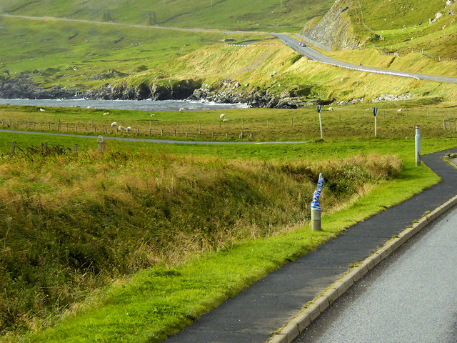
The village is renowned for its stunning natural beauty, with rolling green hills, pristine beaches, and breathtaking coastal views that attract nature enthusiasts and hikers from all over. The surrounding area is home to a diverse range of wildlife, including seals, otters, and numerous seabirds, making it a haven for birdwatchers.

Despite its small size, Gord has a strong sense of community, with a close-knit population that takes pride in maintaining the village's unique character. The village is centered around a charming harbor, where fishing boats and pleasure crafts can be seen bobbing on the water. The harbor also serves as a focal point for social gatherings and events, such as the annual Gord Regatta, where locals and visitors come together to celebrate the village's maritime heritage.

While Gord may lack the amenities and services found in larger towns, it compensates with its peaceful atmosphere and natural wonders. Visitors can enjoy leisurely walks along the coastline, explore ancient archaeological sites, or simply relax and take in the tranquility of this remote corner of the world. For those seeking a true escape from the hustle and bustle of modern life, Gord, Shetland offers a slice of unspoiled paradise.

If you have any feedback on the listing, please let us know in the comments section below.
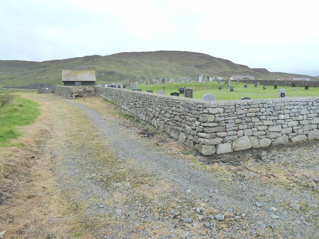
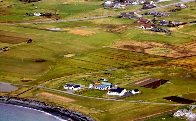
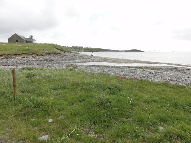
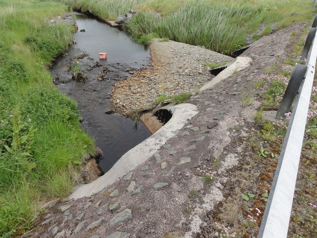
Gord Images

Images are sourced within 2km of 60.047614/-1.214929 or Grid Reference HU4329. Thanks to Geograph Open Source API. All images are credited.

Mail Burial Ground Adjacent to the sea as is usual on Scottish islands.
Mail Burial Ground
Adjacent to the sea as is usual on Scottish islands.
Helli Ness to Bard Head We are at the parking place above Crossie Geo halfway between Lerwick and Sumburgh Head on the mainland of Shetland and I am looking north east across Greenmow and Helli Ness to Bard Head, Bressay. The Isle of Noss can be seen beyond Bressay.
Helli Ness to Bard Head
We are at the parking place above Crossie Geo halfway between Lerwick and Sumburgh Head on the mainland of Shetland and I am looking north east across Greenmow and Helli Ness to Bard Head, Bressay. The Isle of Noss can be seen beyond Bressay.
Aith, Cunningsburgh, from the air
Greenmow and Helli Ness, Cunningsburgh, from the air
South Voxter, Cunningsburgh, from the air
Mail, Cunningsburgh, from the air
Aithsetter, Cunningsburgh, from the air
Ukinsetter, Fladdabister, from the air
Shoreline with joining stream Small sandy pebble beach with joining stream to the sea
Shoreline with joining stream
Small sandy pebble beach with joining stream to the sea
Road bridge Road bridge buttress as it passes over the stream. It should have been the location of an Ordnance Survey OSBM Bolt, which seems to have been destroyed in the rebuilding of the road.
Road bridge
Road bridge buttress as it passes over the stream. It should have been the location of an Ordnance Survey OSBM Bolt, which seems to have been destroyed in the rebuilding of the road.
House under renovation, Cunningsburgh
Vadsgarth, Cunningsburgh
Small beach at the Sands of Mail The road is the A970 approaching Cunningsburgh.
Small beach at the Sands of Mail
The road is the A970 approaching Cunningsburgh.
A970 at Cunningsburgh Cunningsburgh, formerly also known as Coningsburgh (from the Old Norse: Konungsborgr meaning "King's castle"), is a hamlet on the coast of Mainland Shetland, nine miles south-west of Lerwick, about halfway between there and Sumburgh Head.
A970 at Cunningsburgh
Cunningsburgh, formerly also known as Coningsburgh (from the Old Norse: Konungsborgr meaning "King's castle"), is a hamlet on the coast of Mainland Shetland, nine miles south-west of Lerwick, about halfway between there and Sumburgh Head.
Bus Stop at Cunningsburgh Bus stop outside Cunningsburgh Primary School.
Bus Stop at Cunningsburgh
Bus stop outside Cunningsburgh Primary School.
Bus Stop on the A970 at Cunningsburgh Cunningsburgh, formerly also known as Coningsburgh (from the Old Norse: Konungsborgr meaning "King's castle"), is a hamlet on the coast of Mainland Shetland, nine miles south-west of Lerwick, about halfway between there and Sumburgh Head.
Bus Stop on the A970 at Cunningsburgh
Cunningsburgh, formerly also known as Coningsburgh (from the Old Norse: Konungsborgr meaning "King's castle"), is a hamlet on the coast of Mainland Shetland, nine miles south-west of Lerwick, about halfway between there and Sumburgh Head.
Bus Stop at Cunningsburgh Cunningsburgh, formerly also known as Coningsburgh (from the Old Norse: Konungsborgr meaning "King's castle"), is a hamlet on the coast of Mainland Shetland, nine miles south-west of Lerwick, about halfway between there and Sumburgh Head.
Bus Stop at Cunningsburgh
Cunningsburgh, formerly also known as Coningsburgh (from the Old Norse: Konungsborgr meaning "King's castle"), is a hamlet on the coast of Mainland Shetland, nine miles south-west of Lerwick, about halfway between there and Sumburgh Head.
Coastal Sheep Farm near Mail
Show me another place!

Gord is located at Grid Ref: HU4329 (Lat: 60.047614, Lng: -1.214929)

Unitary Authority: Shetland Islands

Police Authority: Highlands and Islands

What 3 Words

///rested.dwell.should. Near Sandwick, Shetland Islands

Nearby Locations

Flanderstown Gord

Related Wikis

Bremirehoull

Bremirehoull is a settlement on the island of Mainland, in Shetland, Scotland. Bremirehoull is situated on the A970 in the Cunningsburgh area. == References... ==

Cunningsburgh

Cunningsburgh, formerly also known as Coningsburgh (Old Norse: Konungsborgr meaning "King's castle"), is a new hamlet and ancient parish in the south of...

Aithsetter

Aithsetter (Old Norse: Eiðseti, meaning "the farm at the isthmus") is a village on the island of Mainland, in Shetland, Scotland. Aithsetter is in the...

Mail, Shetland

Mail is a hamlet on the island of Mainland, in the Shetland Islands, Scotland. == Geography == Mail is located on the south-eastern side of the island...

Catpund

Catpund is a quarry site in Shetland, Scotland, where steatite vessels were cut from the rock from prehistory onwards. The quarrying marks are still visible...

South Mainland

The South Mainland of the Shetland Islands is the southern peninsula of Mainland island. It lies south of Hellister (60° 14′N). The greater southern part...

Sandwick, Dunrossness

see also Sandwick, Whalsay and Sandwick, OrkneySandwick (Old Norse: Sandvik "Sandy Bay") is a village and an ancient parish in the Shetland Islands, Scotland...

Mousa

Mousa (Old Norse: Mosey "moss island") is a small island in Shetland, Scotland, uninhabited since the nineteenth century. The island is known for the...

Nearby Amenities

Located within 500m of 60.047614,-1.214929
Ford: yes
Lat/Long: 60.0485125/-1.222618
Gord
Place: hamlet
Lat/Long: 60.0475832/-1.2148695
Power: pole
Lat/Long: 60.0457229/-1.2230531
Power: pole
Lat/Long: 60.0464276/-1.2230162
Power: pole
Lat/Long: 60.0470412/-1.2229561
Power: pole
Lat/Long: 60.0478277/-1.222896
Power: pole
Lat/Long: 60.0486074/-1.2228406
Power: pole
Lat/Long: 60.0489591/-1.2228175
Power: pole
Lat/Long: 60.0493547/-1.2228348
Power: pole
Lat/Long: 60.0484563/-1.2222931
Power: pole
Lat/Long: 60.048191/-1.2208725
Power: pole
Lat/Long: 60.0479431/-1.2194588
Power: pole
Lat/Long: 60.0476963/-1.2181259
Power: pole
Lat/Long: 60.0475002/-1.2170864
Power: pole
Lat/Long: 60.0473756/-1.2163265
Power: pole
Lat/Long: 60.0473779/-1.2149613
Power: pole
Lat/Long: 60.0473306/-1.2136538
Power: pole
Lat/Long: 60.0472914/-1.212388
Power: pole
Lat/Long: 60.0472488/-1.2111175
Power: pole
Lat/Long: 60.0472072/-1.2101288
Power: pole
Lat/Long: 60.0471773/-1.2091771
Power: pole
Lat/Long: 60.0471311/-1.2078812
Power: pole
Lat/Long: 60.047085/-1.2062758
Power: pole
Lat/Long: 60.0480792/-1.2180174
Power: pole
Lat/Long: 60.0486616/-1.217858
Power: pole
Lat/Long: 60.0484275/-1.2170864
Power: pole
Lat/Long: 60.0481553/-1.216278
Power: pole
Lat/Long: 60.0478566/-1.2154094
Power: pole
Lat/Long: 60.0481945/-1.2153909
Power: pole
Lat/Long: 60.0485566/-1.2153748
Power: pole
Lat/Long: 60.0489395/-1.2153655
Power: pole
Lat/Long: 60.0468682/-1.2151877
Power: pole
Lat/Long: 60.046228/-1.2154325
Power: pole
Lat/Long: 60.0454979/-1.2153031
Power: pole
Lat/Long: 60.0448751/-1.2151969
Power: pole
Lat/Long: 60.0442211/-1.2150953
Power: pole
Lat/Long: 60.0439143/-1.2194265
Power: pole
Lat/Long: 60.0439604/-1.218581
Power: pole
Lat/Long: 60.0440066/-1.2176801
Power: pole
Lat/Long: 60.0440769/-1.2166083
Power: pole
Lat/Long: 60.0441242/-1.2157328
Power: pole
Lat/Long: 60.0441727/-1.214959
Power: pole
Lat/Long: 60.0442315/-1.2140581
The data included in this document is from www.openstreetmap.org. The data is made available under ODbL.

Have you been to Gord?

Leave your review of Gord below (or comments, questions and feedback).