Cross Stone

Settlement in Yorkshire

England

Cross Stone

Sunlight on Todmorden from ridge south of Stoodley Pike Monument
Sunlight on Todmorden from ridge south of Stoodley Pike Monument Credit: Colin Park

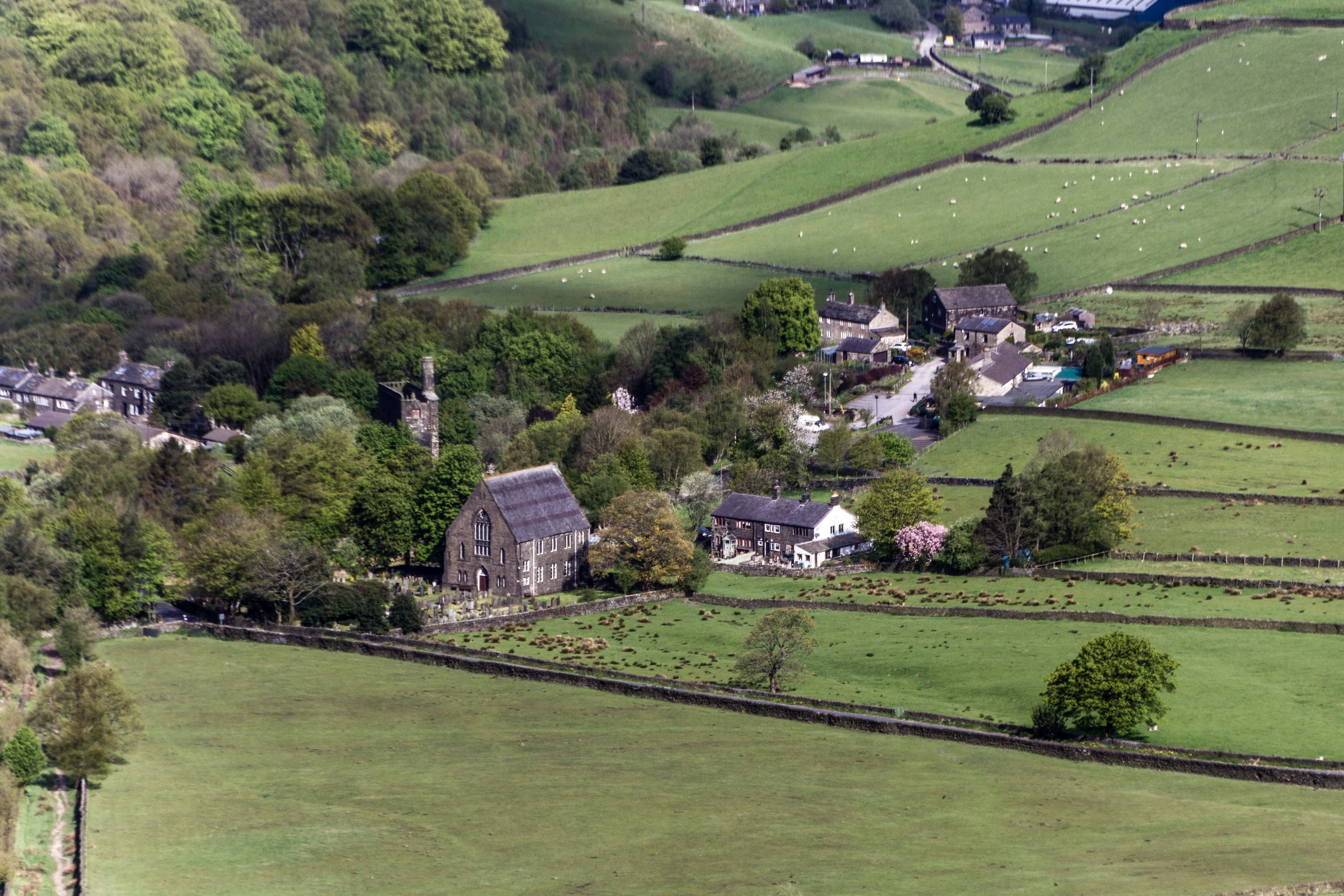
Cross Stone is a small village located in the Calderdale district of West Yorkshire, England. Situated in the picturesque area of Calder Valley, it is nestled between the towns of Todmorden and Hebden Bridge. The village gets its name from a large stone cross that stands at its center, believed to date back to medieval times.

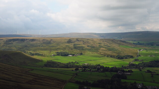
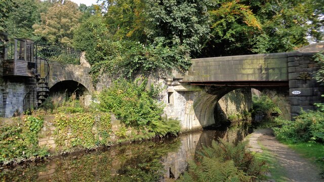
Cross Stone is renowned for its tranquil and idyllic setting, surrounded by rolling hills, lush green fields, and picturesque countryside. The village is a popular destination for hikers, nature enthusiasts, and those seeking a retreat from the bustling city life. The nearby Calder River adds to the charm of the area, offering scenic walks along its banks.

Although small in size, Cross Stone has a close-knit community that is known for its welcoming nature and strong community spirit. The village is home to a few local amenities, including a charming village pub and a small village hall that hosts various community events throughout the year. Additionally, the village is in close proximity to nearby towns, offering residents easy access to a wider range of facilities and services.

Cross Stone's rich history is evident in its architecture, with a mix of traditional stone cottages and more modern buildings. The village retains its rural charm, and its peaceful atmosphere makes it a desirable place to live for those seeking a slower pace of life.

Overall, Cross Stone offers a charming and peaceful retreat in the heart of Yorkshire's countryside, with its stunning natural surroundings and strong community spirit.

If you have any feedback on the listing, please let us know in the comments section below.

Cross Stone Images

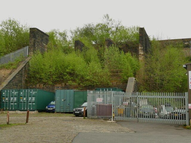
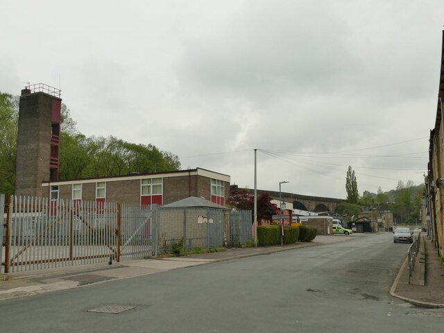
Images are sourced within 2km of 53.717115/-2.0754228 or Grid Reference SD9524. Thanks to Geograph Open Source API. All images are credited.

Sunlight on Todmorden from ridge south of Stoodley Pike Monument
Lumbutts from Stoodley Pike Monument
Old Boundary Marker in Stoodley Glen, Calderdale Township Boundary Marker above Stoodley Glen and south of Stoodley Lane. Formerly on the boundary of Langfield and Sowerby townships in Halifax parish. It marked the boundary of the Sowerby Ramble, a narrow strip of land along the Calder valley and up Stoodley Glen between Erringden and Stansfield townships and Erringden and Langfield township. Sowerby Ramble was part of Sowerby township but in 1850 it became part of Erringden township, later parish. In 1897 Langfield and Stansfield became part of Todmorden parish and in 1937 this part of Erringden parish also became part of Todmorden parish. 

Milestone Society National ID: YW_LANSOW02pb
Old Boundary Marker in Stoodley Glen, Calderdale
Township Boundary Marker above Stoodley Glen and south of Stoodley Lane. Formerly on the boundary of Langfield and Sowerby townships in Halifax parish. It marked the boundary of the Sowerby Ramble, a narrow strip of land along the Calder valley and up Stoodley Glen between Erringden and Stansfield townships and Erringden and Langfield township. Sowerby Ramble was part of Sowerby township but in 1850 it became part of Erringden township, later parish. In 1897 Langfield and Stansfield became part of Todmorden parish and in 1937 this part of Erringden parish also became part of Todmorden parish. Milestone Society National ID: YW_LANSOW02pb
Old Boundary Marker in Stoodley Glen, Calderdale Parish Boundary Marker in Stoodley Glen below Height Wood. Formerly on the boundary of Langfield and Sowerby townships in Halifax parish. It marked the boundary of the Sowerby Ramble, a narrow strip of land along the Calder valley and up Stoodley Glen between Erringden and Stansfield townships and Erringden and Langfield township. Sowerby Ramble was part of Sowerby township but in 1850 it became part of Erringden township, later parish. In 1897 Langfield and Stansfield became part of Todmorden parish and in 1937 this part of Erringden parish also became part of Todmorden parish..

Milestone Society National ID: YW_SOWERR01pb
Old Boundary Marker in Stoodley Glen, Calderdale
Parish Boundary Marker in Stoodley Glen below Height Wood. Formerly on the boundary of Langfield and Sowerby townships in Halifax parish. It marked the boundary of the Sowerby Ramble, a narrow strip of land along the Calder valley and up Stoodley Glen between Erringden and Stansfield townships and Erringden and Langfield township. Sowerby Ramble was part of Sowerby township but in 1850 it became part of Erringden township, later parish. In 1897 Langfield and Stansfield became part of Todmorden parish and in 1937 this part of Erringden parish also became part of Todmorden parish.. Milestone Society National ID: YW_SOWERR01pb
Old Boundary Marker Estate Boundary Marker set in a stone wall on Matthew Lane, a green lane. In the former Stansfield township and parish, absorbed into Todmorden parish in 1897. Not on any township or parish boundary so is thought to mark an estate boundary.

Milestone Society National ID: YW_TOD10em
Old Boundary Marker
Estate Boundary Marker set in a stone wall on Matthew Lane, a green lane. In the former Stansfield township and parish, absorbed into Todmorden parish in 1897. Not on any township or parish boundary so is thought to mark an estate boundary. Milestone Society National ID: YW_TOD10em
Old Boundary Marker on Baulk Head Lane, Todmorden Estate Boundary Marker set in a stone wall on Baulk Head Lane, a green lane. In the former Stansfield township and parish, absorbed into Todmorden parish in 1897. Not on any township or parish boundary so is thought to mark an estate boundary.

Milestone Society National ID: YW_TOD11em
Old Boundary Marker on Baulk Head Lane, Todmorden
Estate Boundary Marker set in a stone wall on Baulk Head Lane, a green lane. In the former Stansfield township and parish, absorbed into Todmorden parish in 1897. Not on any township or parish boundary so is thought to mark an estate boundary. Milestone Society National ID: YW_TOD11em
Dobroyd Road Canal Bridge The South portal of the bridge that has a small building built abutting the bridge on the West bank (door obscured by the foliage). There are a lot of structures around what is Rochdale Canal Bridge No.30a
Dobroyd Road Canal Bridge
The South portal of the bridge that has a small building built abutting the bridge on the West bank (door obscured by the foliage). There are a lot of structures around what is Rochdale Canal Bridge No.30a
Plaque to John Ramsbottom on Todmorden station The plaque is on the wall of the staircase of the westbound platform. It commemorates a former Director of the Lancashire and Yorkshire Railway.
Plaque to John Ramsbottom on Todmorden station
The plaque is on the wall of the staircase of the westbound platform. It commemorates a former Director of the Lancashire and Yorkshire Railway.
Sprinter entering Todmorden station This train is operating a service to Blackburn, using the curve north of Todmorden station that was reopened a few years ago.
Sprinter entering Todmorden station
This train is operating a service to Blackburn, using the curve north of Todmorden station that was reopened a few years ago.
Train coming off Todmorden viaduct The line was opened by the Manchester and Leeds Railway in 1840 and passed through the hands of the Lancashire and Yorkshire, London Midland & Scottish Railway and eventually British Rail. Trains are currently operated by Northern Railway (a publicly owned company).  This recently introduced Civity diesel unit (195132) is operating a service to Manchester Victoria.
Train coming off Todmorden viaduct
The line was opened by the Manchester and Leeds Railway in 1840 and passed through the hands of the Lancashire and Yorkshire, London Midland & Scottish Railway and eventually British Rail. Trains are currently operated by Northern Railway (a publicly owned company). This recently introduced Civity diesel unit (195132) is operating a service to Manchester Victoria.
Tower of St Mary's Todmorden The parish church was built in 1770 on the site of an earlier chapel of ease to Rochdale parish (reflecting the town's earlier allegiance to Lancashire), and the clock was added to the tower in 1860. It is listed grade II (list entry 1133750).  The tower was being repointed at this time. See <a href="https://www.geograph.org.uk/photo/990646">SD9324 : The Parish Church of St Mary's, Todmorden</a> for a full height view.
Tower of St Mary's Todmorden
The parish church was built in 1770 on the site of an earlier chapel of ease to Rochdale parish (reflecting the town's earlier allegiance to Lancashire), and the clock was added to the tower in 1860. It is listed grade II (list entry 1133750). The tower was being repointed at this time. See SD9324 : The Parish Church of St Mary's, Todmorden for a full height view.
Railway arch over Ridge Road This is the southernmost arch of Todmorden railway viaduct, built c.1840 by George Stephenson for the Manchester and Leeds Railway.
Railway arch over Ridge Road
This is the southernmost arch of Todmorden railway viaduct, built c.1840 by George Stephenson for the Manchester and Leeds Railway.
ALDI car park, Todmorden The car park occupies the site of the former Ridgefoot cotton mill.
ALDI car park, Todmorden
The car park occupies the site of the former Ridgefoot cotton mill.
Boundary monument, Todmorden Todmorden was on the boundary (some would say border) of Lancashire and Yorkshire, until the whole town became part of West Yorkshire in 1974. The monument is on the site of the former Ridgefoot cotton mill, a little way on the Lancashire side of the old boundary. It illustrates the Town Hall nearby, which famously straddled the boundary.
Boundary monument, Todmorden
Todmorden was on the boundary (some would say border) of Lancashire and Yorkshire, until the whole town became part of West Yorkshire in 1974. The monument is on the site of the former Ridgefoot cotton mill, a little way on the Lancashire side of the old boundary. It illustrates the Town Hall nearby, which famously straddled the boundary.
River Calder downstream of Stansfield Road, Todmorden The Yorkshire Calder is quite insignificant, at least in dry weather, at this point approaching the grade II listed railway viaduct of 1840, though the whole upper section of the river is prone to flash flooding.
River Calder downstream of Stansfield Road, Todmorden
The Yorkshire Calder is quite insignificant, at least in dry weather, at this point approaching the grade II listed railway viaduct of 1840, though the whole upper section of the river is prone to flash flooding.
Coal drops, Todmorden The disused coal drops (or staithes) at Halifax and Sowerby Bridge are well known to railway enthusiasts, but I hadn't been aware that Todmorden had them too. This is where hopper wagons would be emptied into wagons or lorries waiting below to distribute coal to customers in the area.
Coal drops, Todmorden
The disused coal drops (or staithes) at Halifax and Sowerby Bridge are well known to railway enthusiasts, but I hadn't been aware that Todmorden had them too. This is where hopper wagons would be emptied into wagons or lorries waiting below to distribute coal to customers in the area.
Empire Books, Stansfield Street, Todmorden The building is shown on early 20th century maps as 'Carr Mill (Slipper)'. It presumably made carpet slippers from fabric produced in one of the many local cotton mills.  A comment on a local history website says 'The footwear industry in Rossendale [not far from Todmorden] didn't really finish until the late 1980s'.
Empire Books, Stansfield Street, Todmorden
The building is shown on early 20th century maps as 'Carr Mill (Slipper)'. It presumably made carpet slippers from fabric produced in one of the many local cotton mills. A comment on a local history website says 'The footwear industry in Rossendale [not far from Todmorden] didn't really finish until the late 1980s'.
Fire station, Stansfield Street, Todmorden See also <a href="https://www.geograph.org.uk/photo/2432393">SD9324 : Todmorden Fire Station</a>. The ambulance station is just beyond it.
Fire station, Stansfield Street, Todmorden
See also SD9324 : Todmorden Fire Station. The ambulance station is just beyond it.
Show me another place!

Cross Stone is located at Grid Ref: SD9524 (Lat: 53.717115, Lng: -2.0754228)

Division: West Riding

Unitary Authority: Calderdale

Police Authority: West Yorkshire

What 3 Words

///guests.quoted.trifle. Near Todmorden, West Yorkshire

Related Wikis

Mankinholes

Mankinholes is a hamlet in the Metropolitan Borough of Calderdale, in West Yorkshire, England. It is situated in the Pennines and the nearest town is Todmorden...

Lumbutts

Lumbutts is a former mill village just to the south of Todmorden, in West Yorkshire, England. Lumbutts and the adjacent village of Mankinholes, were traditionally...

Stansfield Hall railway station

Stansfield Hall railway station (English: ) was the second station in Stansfield, Todmorden in West Yorkshire, England and was situated on the Copy Pit...

Todmorden Markets

Todmorden Markets consist of an indoor market held in the Public Market Hall and an outdoor open air market held to the front of the Public Market Hall...

Nearby Amenities

Located within 500m of 53.717115,-2.0754228
Seamark Type: gate
Waterway: lock_gate
Lat/Long: 53.7149659/-2.0798946
Seamark Type: gate
Waterway: lock_gate
Lat/Long: 53.715053/-2.0795521
Seamark Type: gate
Waterway: lock_gate
Wikidata: Q26567948
Lat/Long: 53.7179536/-2.0710109
Seamark Type: gate
Waterway: lock_gate
Lat/Long: 53.7179901/-2.0706407
Waterway: weir
Lat/Long: 53.7178381/-2.0724241
Bus Stop
Halifax Road Horsfall Street
Bus: yes
Local Ref: 45019840
Naptan AtcoCode: 450019840
Naptan Bearing: E
Naptan CommonName: Halifax Road Horsfall Street
Naptan Crossing: Horsfall Street
Naptan Indicator: Stop 45019840
Naptan Notes: OSR taken place 181105
Naptan PlusbusZoneRef: LEEDS
Naptan ShortCommonName: Horsfall Street
Naptan Street: Halifax Road
Naptan Verified: no
Public Transport: platform
Shelter: no
Source: naptan_import
Lat/Long: 53.718467/-2.0704186
Bus Stop
Halifax Road Horsfall Street
Bus: yes
Local Ref: 45019841
Naptan AtcoCode: 450019841
Naptan Bearing: W
Naptan CommonName: Halifax Road Horsfall Street
Naptan Crossing: Horsfall Street
Naptan Indicator: Stop 45019841
Naptan PlusbusZoneRef: LEEDS
Naptan ShortCommonName: Horsefall Street
Naptan Street: Halifax Road
Naptan Verified: no
Public Transport: platform
Shelter: no
Source: naptan_import
Lat/Long: 53.718359/-2.0707063
Bus Stop
Halifax Road Cooper Street
Bus: yes
Local Ref: 45019842
Naptan AtcoCode: 450019842
Naptan Bearing: E
Naptan CommonName: Halifax Road Cooper Street
Naptan Crossing: Cooper Street
Naptan Indicator: Stop 45019842
Naptan PlusbusZoneRef: LEEDS
Naptan ShortCommonName: Cooper Street
Naptan Street: Halifax Road
Naptan Verified: no
Public Transport: platform
Source: naptan_import
Lat/Long: 53.7179076/-2.0739484
Bus Stop
Halifax Road Woodhouse Road
Bus: yes
Local Ref: 45019843
Naptan AtcoCode: 450019843
Naptan Bearing: W
Naptan CommonName: Halifax Road Woodhouse Road
Naptan Crossing: Woodhouse Road
Naptan Indicator: Stop 45019843
Naptan Notes: OSR taken place 181105
Naptan PlusbusZoneRef: LEEDS
Naptan ShortCommonName: Woodhouse Road
Naptan Street: Halifax Road
Naptan Verified: no
Public Transport: platform
Source: naptan_import
Lat/Long: 53.7177725/-2.0743573
Bus Stop
Halifax Road
Bench: no
Bin: no
Bus: yes
Lit: yes
Local Ref: 45019844
Naptan AtcoCode: 450019844
Naptan Bearing: E
Naptan CommonName: Halifax Road
Naptan Crossing: Castle Lane
Naptan Indicator: Stop 45019844
Naptan Landmark: Castle Hill School
Naptan PlusbusZoneRef: LEEDS
Naptan ShortCommonName: Carr House
Naptan Street: Halifax Road
Naptan Verified: no
Public Transport: platform
Shelter: no
Source: naptan_import
Tactile Paving: no
Lat/Long: 53.7171497/-2.0784778
Bus Stop
Halifax Road
Bench: yes
Bin: no
Bus: yes
Lit: yes
Local Ref: 45019845
Naptan AtcoCode: 450019845
Naptan Bearing: W
Naptan CommonName: Halifax Road
Naptan Crossing: Castle Lane
Naptan Indicator: Stop 45019845
Naptan Landmark: Castle Hill School
Naptan PlusbusZoneRef: LEEDS
Naptan ShortCommonName: Castle Lane
Naptan Street: Halifax Road
Naptan Verified: no
Public Transport: platform
Shelter: yes
Source: naptan_import
Tactile Paving: no
Lat/Long: 53.7170058/-2.0786139
Bus Stop
Halifax Road Phoenix Street
Bench: yes
Bin: yes
Bus: yes
Lit: yes
Local Ref: 45019846
Naptan AtcoCode: 450019846
Naptan Bearing: E
Naptan CommonName: Halifax Road Phoenix Street
Naptan Crossing: Phoenix Street
Naptan Indicator: Stop 45019846
Naptan Landmark: First Bus Depot
Naptan PlusbusZoneRef: LEEDS
Naptan ShortCommonName: Phoenix Street
Naptan Street: Halifax Road
Naptan Verified: no
Public Transport: platform
Shelter: yes
Source: naptan_import
Tactile Paving: no
Lat/Long: 53.7166167/-2.0824317
Bus Stop
Halifax Road Phoenix Street
Bench: no
Bin: no
Bus: yes
Lit: yes
Local Ref: 45019847
Naptan AtcoCode: 450019847
Naptan Bearing: W
Naptan CommonName: Halifax Road Phoenix Street
Naptan Crossing: Phoenix Street
Naptan Indicator: Stop 45019847
Naptan Landmark: Todmorden Bus Depot (First)
Naptan PlusbusZoneRef: LEEDS
Naptan ShortCommonName: River Street
Naptan Street: Halifax Road
Naptan Verified: no
Public Transport: platform
Shelter: no
Source: naptan_import
Tactile Paving: no
Lat/Long: 53.7164818/-2.0825375
Bus Stop
Phoenix Street Halifax Road
Bus: yes
Local Ref: 45019848
Naptan AtcoCode: 450019848
Naptan Bearing: S
Naptan CommonName: Phoenix Street Halifax Road
Naptan Crossing: Halifax Road
Naptan Indicator: Stop 45019848
Naptan Notes: OSR taken place 060106
Naptan PlusbusZoneRef: LEEDS
Naptan ShortCommonName: Halifax Road
Naptan Street: Phoenix Street
Naptan Verified: no
Public Transport: platform
Source: naptan_import
Lat/Long: 53.7169046/-2.0821141
Bus Stop
Keats Avenue Tennyson Avenue
Bus: yes
Local Ref: 45019849
Naptan AtcoCode: 450019849
Naptan Bearing: N
Naptan CommonName: Keats Avenue Tennyson Avenue
Naptan Crossing: Opp Tennyson Avenue
Naptan Indicator: Stop 45019849
Naptan Notes: OSR taken place 060106
Naptan PlusbusZoneRef: LEEDS
Naptan ShortCommonName: Tennyson Avenue
Naptan Street: Keats Avenue
Naptan Verified: no
Public Transport: platform
Source: naptan_import
Lat/Long: 53.7179738/-2.0826465
Bus Stop
Keats Avenue
Bus: yes
Local Ref: 45019850
Naptan AtcoCode: 450019850
Naptan Bearing: E
Naptan CommonName: Keats Avenue
Naptan Crossing: Adj Tennyson Avenue
Naptan Indicator: Stop 45019850
Naptan Landmark: Unknown
Naptan PlusbusZoneRef: LEEDS
Naptan ShortCommonName: Keats Avenue
Naptan Street: Keats Avenue
Naptan Verified: no
Public Transport: platform
Source: naptan_import
Lat/Long: 53.7185773/-2.0807535
Bus Stop
Keats Avenue Tennyson Avenue
Bus: yes
Local Ref: 45019851
Naptan AtcoCode: 450019851
Naptan Bearing: SE
Naptan CommonName: Keats Avenue Tennyson Avenue
Naptan Crossing: Tennyson Avenue
Naptan Indicator: Stop 45019851
Naptan Notes: OSR taken place 060106
Naptan PlusbusZoneRef: LEEDS
Naptan ShortCommonName: Tennyson
Naptan Street: Keats Avenue
Naptan Verified: no
Public Transport: platform
Source: naptan_import
Lat/Long: 53.7187043/-2.0790111
Bus Stop
Shakespeare Avenue
Bus: yes
Local Ref: 45019852
Naptan AtcoCode: 450019852
Naptan Bearing: W
Naptan CommonName: Shakespeare Avenue
Naptan Crossing: Adj Keats Avenue
Naptan Indicator: Stop 45019852
Naptan PlusbusZoneRef: LEEDS
Naptan ShortCommonName: Shakespeare Avenue
Naptan Street: Shakespeare Avenue
Naptan Verified: no
Public Transport: platform
Source: naptan_import
Lat/Long: 53.7179483/-2.0804492
Bus Stop
Shakespeare Avenue
Bus: yes
Local Ref: 45019853
Naptan AtcoCode: 450019853
Naptan Bearing: W
Naptan CommonName: Shakespeare Avenue
Naptan Crossing: Phoenix Street
Naptan Indicator: Stop 45019853
Naptan PlusbusZoneRef: LEEDS
Naptan ShortCommonName: Phoenix Street
Naptan Street: Shakespeare Avenue
Naptan Verified: no
Public Transport: platform
Source: naptan_import
Lat/Long: 53.7176596/-2.0821459
Parking
Lat/Long: 53.7180571/-2.0714899
Man Made: chimney
Source: Bing
Lat/Long: 53.7159272/-2.0750495
Turning Circle
Lat/Long: 53.7143131/-2.0808451
Turning Circle
Lat/Long: 53.7142274/-2.0807271
Crossing
Crossing Markings: no
Crossing Signals: no
Tactile Paving: no
Lat/Long: 53.7172892/-2.0774998
Barrier: chain
Lat/Long: 53.7171501/-2.0796311
Barrier: yes
Lat/Long: 53.7162003/-2.0827246
Generator Method: photovoltaic
Generator Output Electricity: yes
Generator Source: solar
Generator Type: solar_photovoltaic_panel
Power: generator
Lat/Long: 53.7166889/-2.0803201
Generator Method: photovoltaic
Generator Output Electricity: yes
Generator Source: solar
Generator Type: solar_photovoltaic_panel
Power: generator
Lat/Long: 53.7167135/-2.0801886
Generator Method: photovoltaic
Generator Output Electricity: yes
Generator Source: solar
Generator Type: solar_photovoltaic_panel
Power: generator
Lat/Long: 53.7176238/-2.0829433
Generator Method: photovoltaic
Generator Output Electricity: yes
Generator Source: solar
Generator Type: solar_photovoltaic_panel
Power: generator
Lat/Long: 53.7183714/-2.0821654
Generator Method: photovoltaic
Generator Output Electricity: yes
Generator Source: solar
Generator Type: solar_photovoltaic_panel
Power: generator
Lat/Long: 53.7183912/-2.0820662
Generator Method: photovoltaic
Generator Output Electricity: yes
Generator Source: solar
Generator Type: solar_photovoltaic_panel
Power: generator
Lat/Long: 53.7187595/-2.0801699
Generator Method: photovoltaic
Generator Output Electricity: yes
Generator Source: solar
Generator Type: solar_photovoltaic_panel
Power: generator
Lat/Long: 53.7187801/-2.080068
Generator Method: photovoltaic
Generator Output Electricity: yes
Generator Source: solar
Generator Type: solar_photovoltaic_panel
Power: generator
Lat/Long: 53.7186428/-2.0787014
Power: pole
Lat/Long: 53.7129076/-2.0766668
Power: pole
Lat/Long: 53.7140473/-2.0749998
Power: pole
Lat/Long: 53.7147442/-2.0739806
Power: pole
Lat/Long: 53.7151307/-2.07342
Power: pole
Lat/Long: 53.715522/-2.0725402
Power: pole
Lat/Long: 53.7159863/-2.0715398
Power: pole
Lat/Long: 53.7164371/-2.070424
Power: pole
Lat/Long: 53.7169259/-2.0693015
Power: pole
Lat/Long: 53.7172474/-2.0679711
Generator Method: photovoltaic
Generator Output Electricity: yes
Generator Source: solar
Generator Type: solar_photovoltaic_panel
Power: generator
Lat/Long: 53.7188425/-2.0797312
Generator Method: photovoltaic
Generator Output Electricity: yes
Generator Source: solar
Generator Type: solar_photovoltaic_panel
Power: generator
Lat/Long: 53.718264/-2.0824657
Generator Method: photovoltaic
Generator Output Electricity: yes
Generator Source: solar
Generator Type: solar_photovoltaic_panel
Power: generator
Lat/Long: 53.7181529/-2.0825931
Noexit: yes
Lat/Long: 53.7170553/-2.0801577
Childcare
Castle Hill Day Nursery
Addr City: Todmorden
Addr Housenumber: 5
Addr Postcode: OL14 5SL
Addr Street: King Street
Website: https://castlehillnursery.uk
Lat/Long: 53.7170716/-2.0815115
Hoyles of Todmorden
Addr City: Todmorden
Addr Housename: Phoenix Garage
Addr Postcode: OL14 5SG
Addr Street: Phoenix Street
Second Hand: only
Shop: car
Website: https://www.hoylesoftodmorden.co.uk
Lat/Long: 53.7172148/-2.0820178
Crossing
Crossing Island: no
Crossing Signals: no
Tactile Paving: no
Lat/Long: 53.7178078/-2.0746261
Barrier: stile
Lat/Long: 53.7146484/-2.0780311
Car Wash
Supershine Hand Car Wash and Valeting Centre
Automated: no
Opening Hours: Mo-Sa 09:00-18:00; Su 10:00-18:00
Self Service: no
Lat/Long: 53.7177828/-2.0753247
Vagary Custom Culture
Shop: tattoo
Lat/Long: 53.7179636/-2.0752741
The data included in this document is from www.openstreetmap.org. The data is made available under ODbL.

Have you been to Cross Stone?

Leave your review of Cross Stone below (or comments, questions and feedback).