Rodwell End Clough

Valley in Yorkshire

England

Rodwell End Clough

Burnley Road, Todmorden View from Rochdale to Leeds railway
Burnley Road, Todmorden Credit: Raymond Knapman

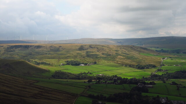
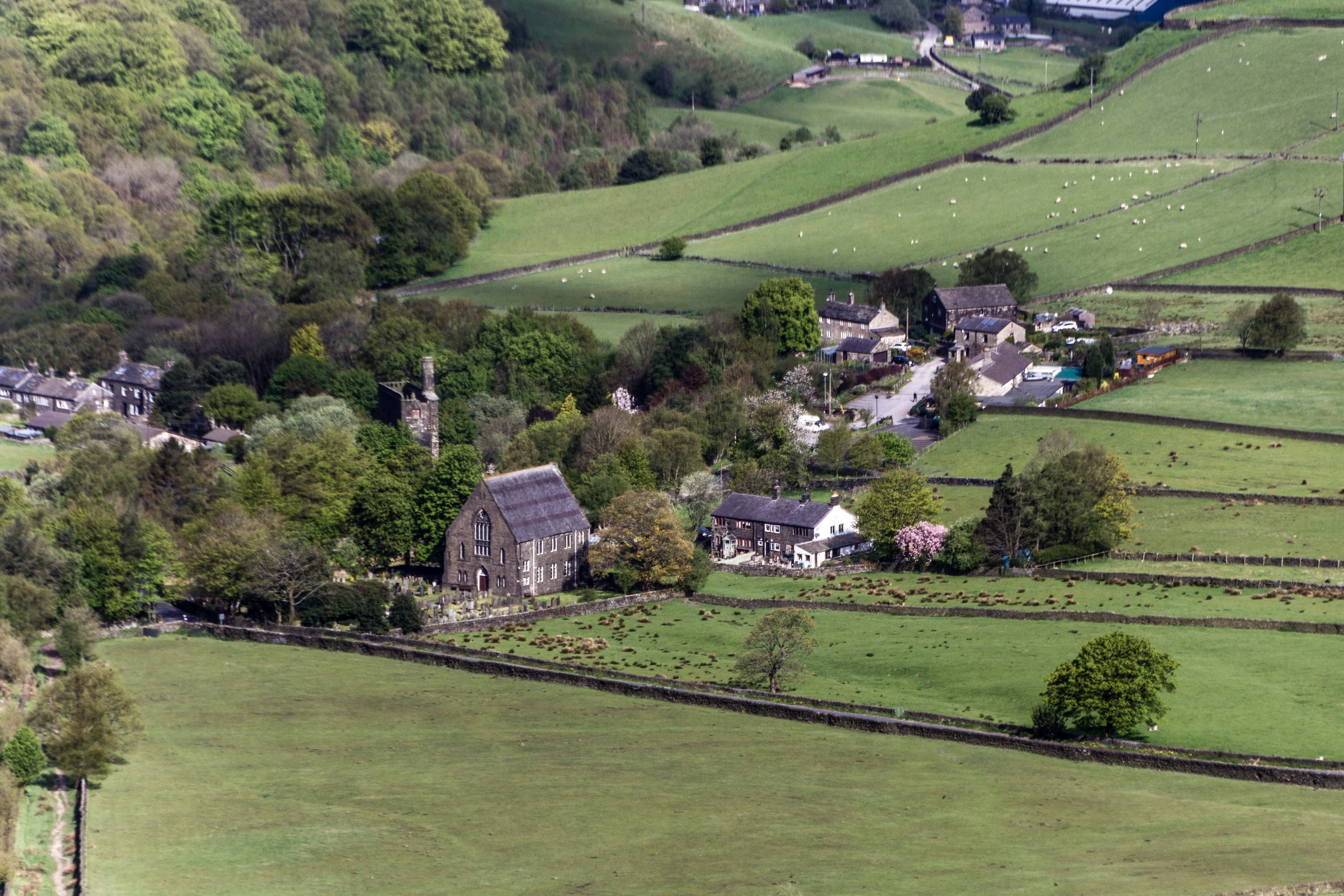
Rodwell End Clough is a picturesque valley located in Yorkshire, England. Situated in the heart of the countryside, this stunning natural landscape is a haven for nature enthusiasts and hikers alike. The valley is characterized by its steep slopes, dense woodlands, and meandering streams, offering visitors a serene and tranquil environment.

Covered in a vibrant tapestry of flora and fauna, Rodwell End Clough is home to a wide variety of plant and animal species. The woodlands are adorned with an array of ancient oak, beech, and ash trees, providing a habitat for numerous bird species, including the melodious song thrush and the striking green woodpecker.

The valley is crisscrossed by several footpaths, making it an ideal destination for walkers and hikers. These trails wind through the valley, offering breathtaking views of the surrounding countryside and the opportunity to spot wildlife in its natural habitat. The babbling streams and cascading waterfalls add to the charm of the landscape, creating a soothing and peaceful atmosphere.

Rodwell End Clough is also steeped in history, with remnants of old mill buildings and stone walls scattered throughout the valley. These remnants serve as a reminder of the area's industrial past and offer a glimpse into the lives of the people who lived and worked in the valley centuries ago.

Overall, Rodwell End Clough is a hidden gem in Yorkshire, offering visitors a chance to reconnect with nature and immerse themselves in the beauty of the English countryside. Whether it's exploring the woodlands, enjoying a picnic by the stream, or simply taking in the breathtaking views, this valley provides a truly memorable experience for all who visit.

If you have any feedback on the listing, please let us know in the comments section below.

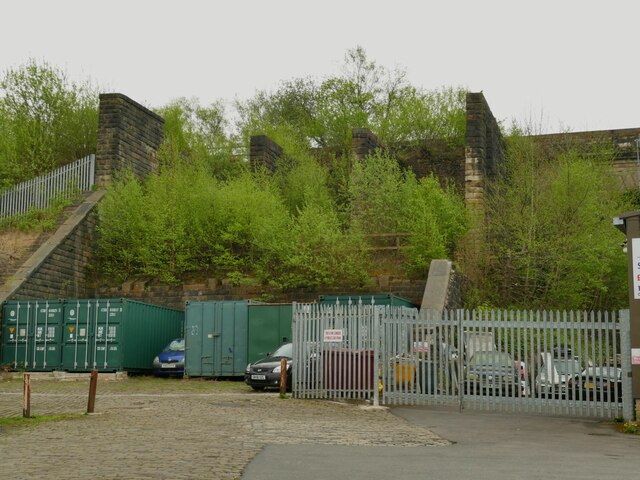
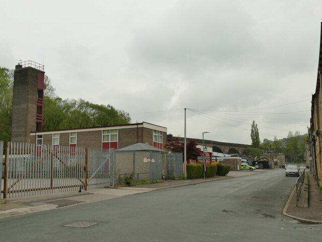
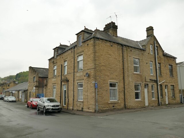
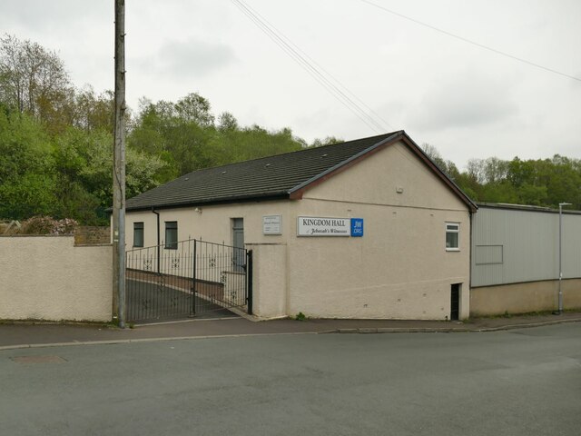
Rodwell End Clough Images

Images are sourced within 2km of 53.720722/-2.0693373 or Grid Reference SD9524. Thanks to Geograph Open Source API. All images are credited.

Burnley Road, Todmorden View from Rochdale to Leeds railway
Burnley Road, Todmorden
View from Rochdale to Leeds railway
Rodwell End Clough View from Lobb Mill Viaduct
Rodwell End Clough
View from Lobb Mill Viaduct
Sunlight on Todmorden from ridge south of Stoodley Pike Monument
Lumbutts from Stoodley Pike Monument
Chinook Helicopter passing close to Stoodley Pike Monument A close encounter!
Chinook Helicopter passing close to Stoodley Pike Monument
A close encounter!
Old Boundary Marker in Stoodley Glen, Calderdale Township Boundary Marker above Stoodley Glen and south of Stoodley Lane. Formerly on the boundary of Langfield and Sowerby townships in Halifax parish. It marked the boundary of the Sowerby Ramble, a narrow strip of land along the Calder valley and up Stoodley Glen between Erringden and Stansfield townships and Erringden and Langfield township. Sowerby Ramble was part of Sowerby township but in 1850 it became part of Erringden township, later parish. In 1897 Langfield and Stansfield became part of Todmorden parish and in 1937 this part of Erringden parish also became part of Todmorden parish. 

Milestone Society National ID: YW_LANSOW02pb
Old Boundary Marker in Stoodley Glen, Calderdale
Township Boundary Marker above Stoodley Glen and south of Stoodley Lane. Formerly on the boundary of Langfield and Sowerby townships in Halifax parish. It marked the boundary of the Sowerby Ramble, a narrow strip of land along the Calder valley and up Stoodley Glen between Erringden and Stansfield townships and Erringden and Langfield township. Sowerby Ramble was part of Sowerby township but in 1850 it became part of Erringden township, later parish. In 1897 Langfield and Stansfield became part of Todmorden parish and in 1937 this part of Erringden parish also became part of Todmorden parish. Milestone Society National ID: YW_LANSOW02pb
Old Boundary Marker in Stoodley Glen, Calderdale Parish Boundary Marker in Stoodley Glen below Height Wood. Formerly on the boundary of Langfield and Sowerby townships in Halifax parish. It marked the boundary of the Sowerby Ramble, a narrow strip of land along the Calder valley and up Stoodley Glen between Erringden and Stansfield townships and Erringden and Langfield township. Sowerby Ramble was part of Sowerby township but in 1850 it became part of Erringden township, later parish. In 1897 Langfield and Stansfield became part of Todmorden parish and in 1937 this part of Erringden parish also became part of Todmorden parish..

Milestone Society National ID: YW_SOWERR01pb
Old Boundary Marker in Stoodley Glen, Calderdale
Parish Boundary Marker in Stoodley Glen below Height Wood. Formerly on the boundary of Langfield and Sowerby townships in Halifax parish. It marked the boundary of the Sowerby Ramble, a narrow strip of land along the Calder valley and up Stoodley Glen between Erringden and Stansfield townships and Erringden and Langfield township. Sowerby Ramble was part of Sowerby township but in 1850 it became part of Erringden township, later parish. In 1897 Langfield and Stansfield became part of Todmorden parish and in 1937 this part of Erringden parish also became part of Todmorden parish.. Milestone Society National ID: YW_SOWERR01pb
Old Boundary Marker Estate Boundary Marker set in a stone wall on Matthew Lane, a green lane. In the former Stansfield township and parish, absorbed into Todmorden parish in 1897. Not on any township or parish boundary so is thought to mark an estate boundary.

Milestone Society National ID: YW_TOD10em
Old Boundary Marker
Estate Boundary Marker set in a stone wall on Matthew Lane, a green lane. In the former Stansfield township and parish, absorbed into Todmorden parish in 1897. Not on any township or parish boundary so is thought to mark an estate boundary. Milestone Society National ID: YW_TOD10em
Old Boundary Marker on Baulk Head Lane, Todmorden Estate Boundary Marker set in a stone wall on Baulk Head Lane, a green lane. In the former Stansfield township and parish, absorbed into Todmorden parish in 1897. Not on any township or parish boundary so is thought to mark an estate boundary.

Milestone Society National ID: YW_TOD11em
Old Boundary Marker on Baulk Head Lane, Todmorden
Estate Boundary Marker set in a stone wall on Baulk Head Lane, a green lane. In the former Stansfield township and parish, absorbed into Todmorden parish in 1897. Not on any township or parish boundary so is thought to mark an estate boundary. Milestone Society National ID: YW_TOD11em
ALDI car park, Todmorden The car park occupies the site of the former Ridgefoot cotton mill.
ALDI car park, Todmorden
The car park occupies the site of the former Ridgefoot cotton mill.
Boundary monument, Todmorden Todmorden was on the boundary (some would say border) of Lancashire and Yorkshire, until the whole town became part of West Yorkshire in 1974. The monument is on the site of the former Ridgefoot cotton mill, a little way on the Lancashire side of the old boundary. It illustrates the Town Hall nearby, which famously straddled the boundary.
Boundary monument, Todmorden
Todmorden was on the boundary (some would say border) of Lancashire and Yorkshire, until the whole town became part of West Yorkshire in 1974. The monument is on the site of the former Ridgefoot cotton mill, a little way on the Lancashire side of the old boundary. It illustrates the Town Hall nearby, which famously straddled the boundary.
River Calder downstream of Stansfield Road, Todmorden The Yorkshire Calder is quite insignificant, at least in dry weather, at this point approaching the grade II listed railway viaduct of 1840, though the whole upper section of the river is prone to flash flooding.
River Calder downstream of Stansfield Road, Todmorden
The Yorkshire Calder is quite insignificant, at least in dry weather, at this point approaching the grade II listed railway viaduct of 1840, though the whole upper section of the river is prone to flash flooding.
Coal drops, Todmorden The disused coal drops (or staithes) at Halifax and Sowerby Bridge are well known to railway enthusiasts, but I hadn't been aware that Todmorden had them too. This is where hopper wagons would be emptied into wagons or lorries waiting below to distribute coal to customers in the area.
Coal drops, Todmorden
The disused coal drops (or staithes) at Halifax and Sowerby Bridge are well known to railway enthusiasts, but I hadn't been aware that Todmorden had them too. This is where hopper wagons would be emptied into wagons or lorries waiting below to distribute coal to customers in the area.
Empire Books, Stansfield Street, Todmorden The building is shown on early 20th century maps as 'Carr Mill (Slipper)'. It presumably made carpet slippers from fabric produced in one of the many local cotton mills.  A comment on a local history website says 'The footwear industry in Rossendale [not far from Todmorden] didn't really finish until the late 1980s'.
Empire Books, Stansfield Street, Todmorden
The building is shown on early 20th century maps as 'Carr Mill (Slipper)'. It presumably made carpet slippers from fabric produced in one of the many local cotton mills. A comment on a local history website says 'The footwear industry in Rossendale [not far from Todmorden] didn't really finish until the late 1980s'.
Fire station, Stansfield Street, Todmorden See also <a href="https://www.geograph.org.uk/photo/2432393">SD9324 : Todmorden Fire Station</a>. The ambulance station is just beyond it.
Fire station, Stansfield Street, Todmorden
See also SD9324 : Todmorden Fire Station. The ambulance station is just beyond it.
House on the corner of Whiteplatts Street, Todmorden A grander residence than most in the area, maybe built for a manager of one of the nearby cotton mills.
House on the corner of Whiteplatts Street, Todmorden
A grander residence than most in the area, maybe built for a manager of one of the nearby cotton mills.
Kingdom Hall, Stansfield Street, Todmorden A place of worship of the Jehovah's Witnesses.
Kingdom Hall, Stansfield Street, Todmorden
A place of worship of the Jehovah's Witnesses.
Railway footbridge at the end of Stansfield Road I presume this is a modern steel replacement for the original bridge. See <a href="https://www.geograph.org.uk/photo/2011138">SD9324 : Footbridge at the end of Stansfield Road</a> for a wider view including the stone setted approach ramp.
Railway footbridge at the end of Stansfield Road
I presume this is a modern steel replacement for the original bridge. See SD9324 : Footbridge at the end of Stansfield Road for a wider view including the stone setted approach ramp.
Show me another place!

Rodwell End Clough is located at Grid Ref: SD9524 (Lat: 53.720722, Lng: -2.0693373)

Division: West Riding

Unitary Authority: Calderdale

Police Authority: West Yorkshire

What 3 Words

///wobbling.careless.studs. Near Todmorden, West Yorkshire

Related Wikis

Eastwood, West Yorkshire

Eastwood is a place within the civil parish of Todmorden and Metropolitan Borough of Calderdale, in West Yorkshire, England. It lies 8 miles (12.9 km)...

Mankinholes

Mankinholes is a hamlet in the Metropolitan Borough of Calderdale, in West Yorkshire, England. It is situated in the Pennines and the nearest town is Todmorden...

Lumbutts

Lumbutts is a former mill village just to the south of Todmorden, in West Yorkshire, England. Lumbutts and the adjacent village of Mankinholes, were traditionally...

Eastwood (L&Y) railway station

Eastwood Railway Station served the village of Eastwood in the civil parish of Todmorden, West Yorkshire, England. The station opened with the line on...

Nearby Amenities

Located within 500m of 53.720722,-2.0693373
Seamark Type: gate
Waterway: lock_gate
Wikidata: Q26567948
Lat/Long: 53.7179536/-2.0710109
Seamark Type: gate
Waterway: lock_gate
Lat/Long: 53.7179901/-2.0706407
Seamark Type: gate
Waterway: lock_gate
Lat/Long: 53.7186658/-2.0632558
Seamark Type: gate
Waterway: lock_gate
Lat/Long: 53.7187398/-2.062893
Waterway: weir
Lat/Long: 53.7178381/-2.0724241
Bus Stop
Halifax Road
Bus: yes
Local Ref: 45019837
Naptan AtcoCode: 450019837
Naptan Bearing: SW
Naptan CommonName: Halifax Road
Naptan Crossing: Shaw Wood Road
Naptan Indicator: Stop 45019837
Naptan Landmark: Higher Stoodley Farm
Naptan Notes: Advert panels fitted on 28/1/08.
Naptan PlusbusZoneRef: LEEDS
Naptan ShortCommonName: Shaw Wood Road
Naptan Street: Halifax Road
Naptan Verified: no
Public Transport: platform
Source: naptan_import
Lat/Long: 53.7199278/-2.0619044
Bus Stop
Halifax Road
Bus: yes
Local Ref: 45019838
Naptan AtcoCode: 450019838
Naptan Bearing: E
Naptan CommonName: Halifax Road
Naptan Crossing: Nr-Opp Shaw Wood Road
Naptan Indicator: Stop 45019838
Naptan PlusbusZoneRef: LEEDS
Naptan ShortCommonName: Halifax Road
Naptan Street: Halifax Road
Naptan Verified: no
Public Transport: platform
Source: naptan_import
Lat/Long: 53.7188294/-2.0653124
Bus Stop
Halifax Road
Bus: yes
Local Ref: 45019839
Naptan AtcoCode: 450019839
Naptan Bearing: W
Naptan CommonName: Halifax Road
Naptan Crossing: Nr-At Shaw Wood Road
Naptan Indicator: Stop 45019839
Naptan PlusbusZoneRef: LEEDS
Naptan ShortCommonName: Halifax Road
Naptan Street: Halifax Road
Naptan Verified: no
Public Transport: platform
Source: naptan_import
Lat/Long: 53.7184873/-2.0662514
Bus Stop
Halifax Road Horsfall Street
Bus: yes
Local Ref: 45019840
Naptan AtcoCode: 450019840
Naptan Bearing: E
Naptan CommonName: Halifax Road Horsfall Street
Naptan Crossing: Horsfall Street
Naptan Indicator: Stop 45019840
Naptan Notes: OSR taken place 181105
Naptan PlusbusZoneRef: LEEDS
Naptan ShortCommonName: Horsfall Street
Naptan Street: Halifax Road
Naptan Verified: no
Public Transport: platform
Shelter: no
Source: naptan_import
Lat/Long: 53.718467/-2.0704186
Bus Stop
Halifax Road Horsfall Street
Bus: yes
Local Ref: 45019841
Naptan AtcoCode: 450019841
Naptan Bearing: W
Naptan CommonName: Halifax Road Horsfall Street
Naptan Crossing: Horsfall Street
Naptan Indicator: Stop 45019841
Naptan PlusbusZoneRef: LEEDS
Naptan ShortCommonName: Horsefall Street
Naptan Street: Halifax Road
Naptan Verified: no
Public Transport: platform
Shelter: no
Source: naptan_import
Lat/Long: 53.718359/-2.0707063
Bus Stop
Halifax Road Cooper Street
Bus: yes
Local Ref: 45019842
Naptan AtcoCode: 450019842
Naptan Bearing: E
Naptan CommonName: Halifax Road Cooper Street
Naptan Crossing: Cooper Street
Naptan Indicator: Stop 45019842
Naptan PlusbusZoneRef: LEEDS
Naptan ShortCommonName: Cooper Street
Naptan Street: Halifax Road
Naptan Verified: no
Public Transport: platform
Source: naptan_import
Lat/Long: 53.7179076/-2.0739484
Bus Stop
Halifax Road Woodhouse Road
Bus: yes
Local Ref: 45019843
Naptan AtcoCode: 450019843
Naptan Bearing: W
Naptan CommonName: Halifax Road Woodhouse Road
Naptan Crossing: Woodhouse Road
Naptan Indicator: Stop 45019843
Naptan Notes: OSR taken place 181105
Naptan PlusbusZoneRef: LEEDS
Naptan ShortCommonName: Woodhouse Road
Naptan Street: Halifax Road
Naptan Verified: no
Public Transport: platform
Source: naptan_import
Lat/Long: 53.7177725/-2.0743573
Parking
Lat/Long: 53.7180571/-2.0714899
Ford: yes
Lat/Long: 53.7186775/-2.0634822
Power: pole
Lat/Long: 53.7164371/-2.070424
Power: pole
Lat/Long: 53.7169259/-2.0693015
Power: pole
Lat/Long: 53.7172474/-2.0679711
Power: pole
Lat/Long: 53.7175442/-2.0667923
Power: pole
Lat/Long: 53.7177005/-2.0659916
Power: pole
Lat/Long: 53.7183695/-2.0656282
Power: pole
Lat/Long: 53.720536/-2.0644641
Power: pole
Lat/Long: 53.721374/-2.0639947
Power: pole
Lat/Long: 53.721985/-2.0636299
Power: pole
Lat/Long: 53.7225215/-2.0633751
The data included in this document is from www.openstreetmap.org. The data is made available under ODbL.

Have you been to Rodwell End Clough?

Leave your review of Rodwell End Clough below (or comments, questions and feedback).