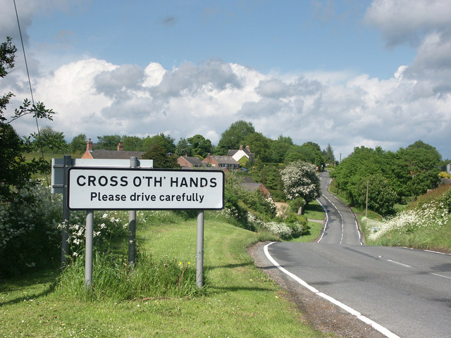
Cross o'th hands

Settlement in Derbyshire Derbyshire Dales

England

Cross o'th hands

Ecclesbourne Valley Railway
Ecclesbourne Valley Railway Credit: Tim Glover

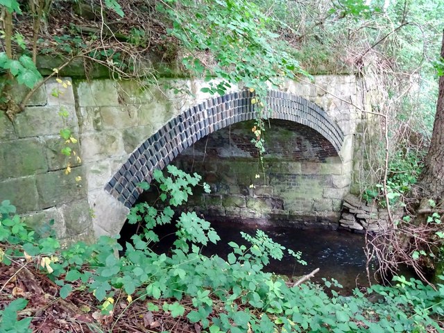
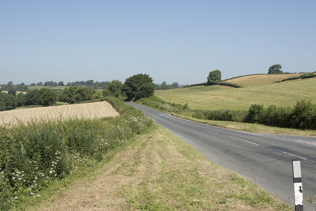
Cross o'th hands is a small village located in the county of Derbyshire, England. Situated near the town of Chapel-en-le-Frith, it is nestled within the Peak District National Park, offering picturesque views and a tranquil setting. The village gets its name from a historic crossroads where two ancient roads, known as the Long Causeway and the Old Salt Road, intersected.

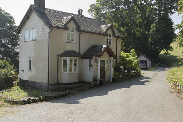
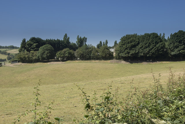
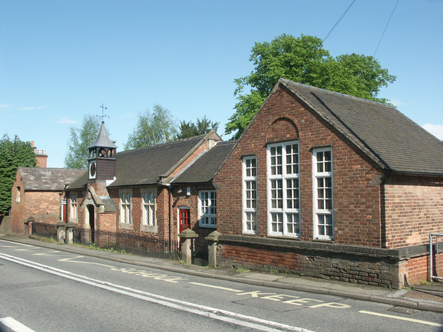
Despite its small size, Cross o'th hands has a rich history dating back to medieval times. It was once a bustling market town and played a significant role in the local agricultural industry. Today, remnants of its past can still be seen in the form of charming stone houses and traditional cottages that line the streets.

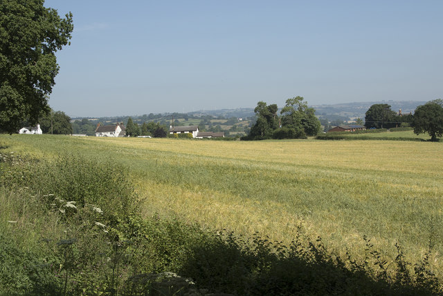
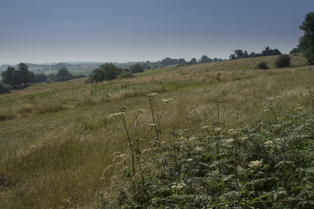
Nature enthusiasts are drawn to Cross o'th hands for its proximity to the stunning Peak District landscape. The village serves as an excellent base for outdoor activities such as hiking, cycling, and birdwatching. The nearby Kinder Scout and Mam Tor offer challenging trails and breathtaking views of the surrounding countryside.

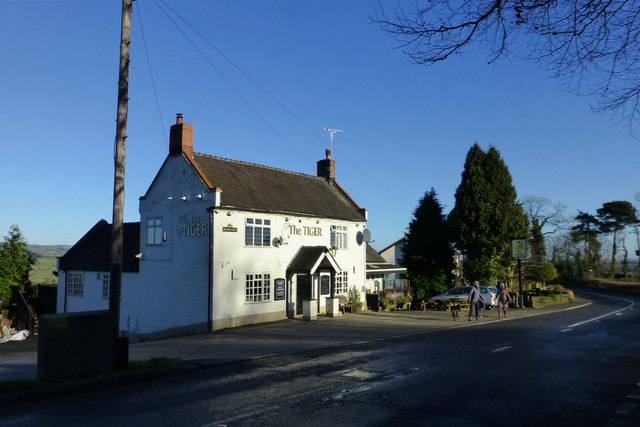
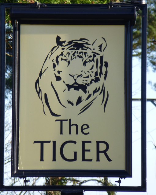
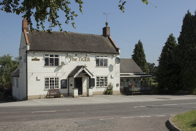
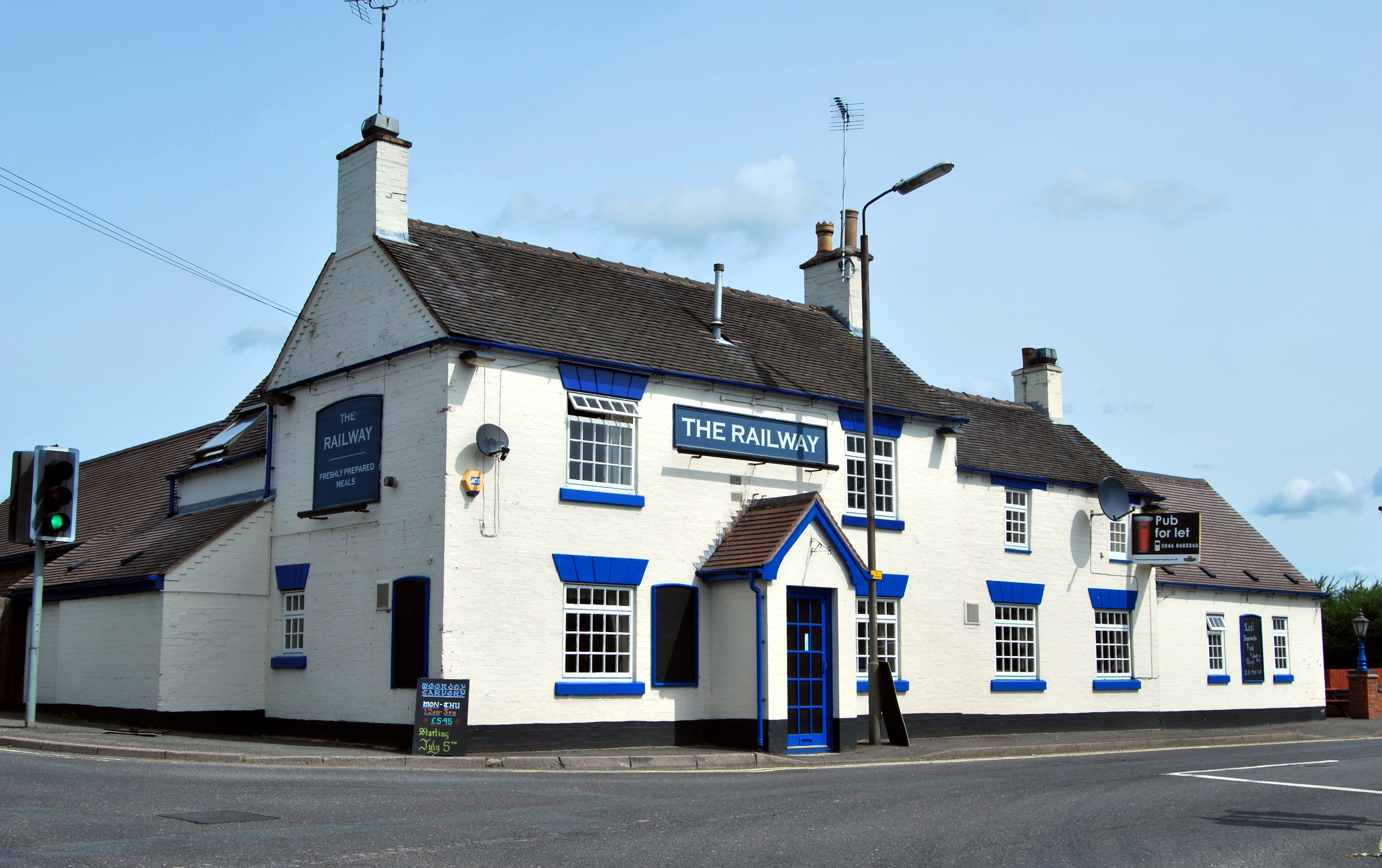
In terms of amenities, Cross o'th hands boasts a small but welcoming community. It is home to a local pub, The Cross Inn, which serves traditional British cuisine and acts as a social hub for residents and visitors alike. The village also has a village hall, where various events and community gatherings take place throughout the year.

Overall, Cross o'th hands provides a peaceful retreat for those seeking a rural getaway, with its idyllic countryside setting and close proximity to the natural wonders of the Peak District.

If you have any feedback on the listing, please let us know in the comments section below.

Cross o'th hands Images

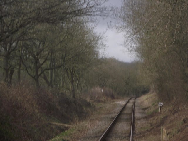
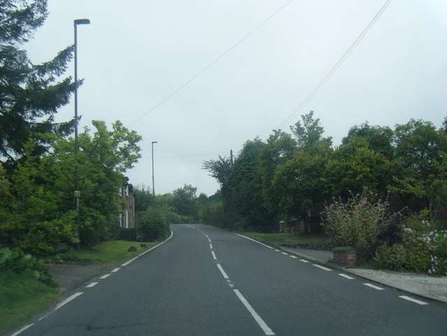
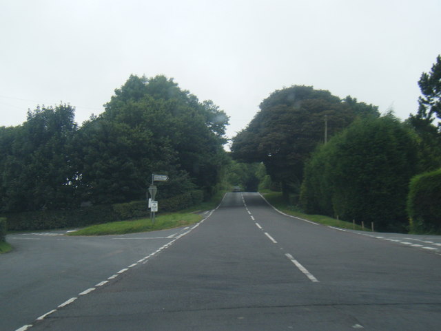
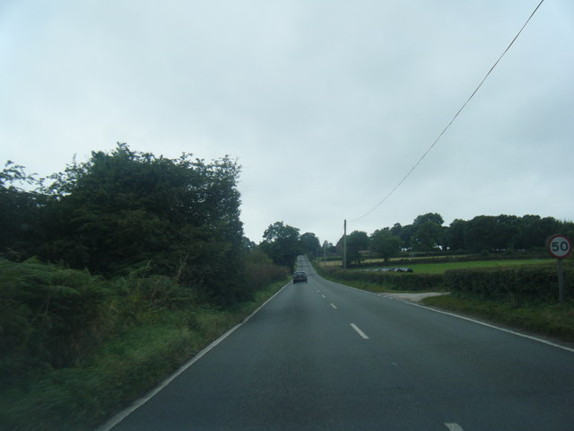
Images are sourced within 2km of 53.014592/-1.5792974 or Grid Reference SK2846. Thanks to Geograph Open Source API. All images are credited.

Ecclesbourne Valley Railway
A517 heading west out of Turnditch
A517 at Cross o' th' hands junction
A517 westbound near Massey's Barn
The Tiger On the western approach to Turnditch.
The Tiger
On the western approach to Turnditch.
The sign of The Tiger
D5343 at Willow Crossing In the summer of 2017, class 26 D5343 visited the Ecclesbourne Valley Railway from the Gloucestershire and Warwickshire Railway. Here, it is passing the crossing for footpath F10, known as Willow Crossing.
D5343 at Willow Crossing
In the summer of 2017, class 26 D5343 visited the Ecclesbourne Valley Railway from the Gloucestershire and Warwickshire Railway. Here, it is passing the crossing for footpath F10, known as Willow Crossing.
Footbridge over the Ecclesbourne
Ecclesbourne culvert under Wirksworth Road A rather fancy brick and stone lined culvert for the Ecclesbourne. By the looks of it, it may date from the time of the Idridgehay and Duffield Turnpike Trust.
Ecclesbourne culvert under Wirksworth Road
A rather fancy brick and stone lined culvert for the Ecclesbourne. By the looks of it, it may date from the time of the Idridgehay and Duffield Turnpike Trust.
Old Milepost north of Muggintonlane End Cast iron post by the UC road, in parish of Hulland Ward (Derbyshire Dales District), Derby Lane; just South (down hill) from Common Farm, on grass verge in front of high hedge (not easily seen from North), on West side of road. Hulland iron casting, erected by the Wirksworth & Derby turnpike trust in the 19th century. 

Inscription reads:-
: HULL.ND / WARD / 1 / MILE : : 134 / LONDON / HULLANDWARD : : DERBY / 8 / MILES : : J. HAYWOOD JUNᴿ. / PHOENIX FOUNDRY/ DERBY :

Grade II listed.
List Entry Number: 1109719 <span class="nowrap"><a title="https://historicengland.org.uk/listing/the-list/list-entry/1109719" rel="nofollow ugc noopener" href="https://historicengland.org.uk/listing/the-list/list-entry/1109719">Link</a><img style="margin-left:2px;" alt="External link" title="External link - shift click to open in new window" src="https://s1.geograph.org.uk/img/external.png" width="10" height="10"/></span>

Milestone Society National ID: DE_DEHW08
Old Milepost north of Muggintonlane End
Cast iron post by the UC road, in parish of Hulland Ward (Derbyshire Dales District), Derby Lane; just South (down hill) from Common Farm, on grass verge in front of high hedge (not easily seen from North), on West side of road. Hulland iron casting, erected by the Wirksworth & Derby turnpike trust in the 19th century. Inscription reads:- : HULL.ND / WARD / 1 / MILE : : 134 / LONDON / HULLANDWARD : : DERBY / 8 / MILES : : J. HAYWOOD JUNᴿ. / PHOENIX FOUNDRY/ DERBY : Grade II listed. List Entry Number: 1109719 LinkExternal link Milestone Society National ID: DE_DEHW08
Old Milepost by the B5023, Wirksworth Road Cast iron post by the B5023, in parish of SHOTTLE AND POSTERN (AMBER VALLEY District), Wirksworth Road; South East of Old Lane junction and Toll Bar Cottage, on grass verge in front hedge, on West side of road. Harrison iron casting, erected by the Ideridgehay & Duffield turnpike trust in the 19th century. 

Inscription reads:-
: WIRKSW.H / 4 / MILES : : Shottle / LONDON / 135 / MILES : : DERBY / 9 / MILES : : J. Harrison / DERBY. :

Grade II Listed.  List Entry Number:1158802
<span class="nowrap"><a title="https://historicengland.org.uk/listing/the-list/list-entry/1158802" rel="nofollow ugc noopener" href="https://historicengland.org.uk/listing/the-list/list-entry/1158802">Link</a><img style="margin-left:2px;" alt="External link" title="External link - shift click to open in new window" src="https://s1.geograph.org.uk/img/external.png" width="10" height="10"/></span>

Milestone Society National ID: DE_DEWW09.
Old Milepost by the B5023, Wirksworth Road
Cast iron post by the B5023, in parish of SHOTTLE AND POSTERN (AMBER VALLEY District), Wirksworth Road; South East of Old Lane junction and Toll Bar Cottage, on grass verge in front hedge, on West side of road. Harrison iron casting, erected by the Ideridgehay & Duffield turnpike trust in the 19th century. Inscription reads:- : WIRKSW.H / 4 / MILES : : Shottle / LONDON / 135 / MILES : : DERBY / 9 / MILES : : J. Harrison / DERBY. : Grade II Listed. List Entry Number:1158802 LinkExternal link Milestone Society National ID: DE_DEWW09.
A country cottage A cottage on the corner of two minor roads.
A country cottage
A cottage on the corner of two minor roads.
A field of ripening wheat In this hot weather it should not take too long for the field of wheat to become fully ripe.
A field of ripening wheat
In this hot weather it should not take too long for the field of wheat to become fully ripe.
The Tiger Pub A country pub at a road junction of minor roads in Derbyshire.
The Tiger Pub
A country pub at a road junction of minor roads in Derbyshire.
Drying farmland The field is empty of grazing animals and the grass looks quite short so maybe it has already been grazed or perhaps cut for silage or hay.
Drying farmland
The field is empty of grazing animals and the grass looks quite short so maybe it has already been grazed or perhaps cut for silage or hay.
Rough pasture The field looks as though it is very rough pasture with a wide range natural plants that some would call weeds but are really just our normal countryside plants.
Rough pasture
The field looks as though it is very rough pasture with a wide range natural plants that some would call weeds but are really just our normal countryside plants.
Looking along Intake Lane The lane runs quite close to Mercaston Farm
Looking along Intake Lane
The lane runs quite close to Mercaston Farm
A minor road near Cross o' the Hands Cross o' the Hands is a very small village about 400 metres from this road which leads away from the junction that leads towards the village.
A minor road near Cross o' the Hands
Cross o' the Hands is a very small village about 400 metres from this road which leads away from the junction that leads towards the village.
Show me another place!

Cross o'th hands is located at Grid Ref: SK2846 (Lat: 53.014592, Lng: -1.5792974)

Administrative County: Derbyshire

District: Derbyshire Dales

Police Authority: Derbyshire

Also known as: Cross o' th' hands

What 3 Words

///storage.spenders.slice. Near Belper, Derbyshire

Related Wikis

Cross o' th' Hands

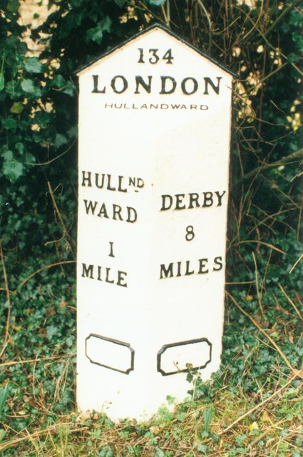
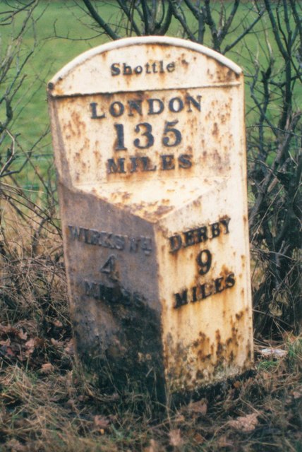
Cross o' th' Hands is a small area of settlement in Derbyshire, England, 10 miles (16 km) north-west of Derby on the A517 road between Hulland and Turnditch...

Turnditch

Turnditch is a village and civil parish in the Amber Valley district of Derbyshire, England. The population of the civil parish at the 2011 Census was...

All Saints' Church, Turnditch

All Saints' Church, Turnditch is a Grade II listed parish church in the Church of England: 347  in Turnditch, Derbyshire. == History == A date of 1630...

Frederick Inglefield

Admiral Sir Frederick Samuel Inglefield, (29 April 1854 – 8 August 1921) was a Royal Navy officer who served as Fourth Sea Lord, was appointed as a Grand...

Shottle railway station

Shottle railway station is the second intermediate station on the former Midland Railway branch line to the small town of Wirksworth in Derbyshire. The...

Idridgehay and Alton

Idridgehay and Alton is a civil parish in the Amber Valley district of Derbyshire, England. The population of the civil parish taken at the 2011 Census...

Cowers Lane

Cowers Lane is a settlement in Derbyshire bordering Shottle, within the civil parish of Shottle and Postern, near Belper, Derbyshire England along the...

Idridgehay

Idridgehay is a village in the civil parish of Idridgehay and Alton, in the Amber Valley district of Derbyshire, England. The population of this parish...

Nearby Amenities

Located within 500m of 53.014592,-1.5792974
Post Box
Operator: Royal Mail
Ref: DE56 158
Lat/Long: 53.0145327/-1.5795741
Parking
Access: private
Description: Patch of gravel
Ele: 183
Source Access: Sign
Lat/Long: 53.0123432/-1.5834152
Note: 50 mph speed limit sign NE-bound, national speed limit sign SW-bound
Lat/Long: 53.0146533/-1.5792325
Note: 50 mph speed limit sign SW-bound, national speed limit sign NE-bound
Lat/Long: 53.014939/-1.5785793
Cross o' th' hands
Junction: yes
Lat/Long: 53.0147749/-1.5788083
Parking
Parking: layby
Lat/Long: 53.0154563/-1.5838176
Barrier: yes
Lat/Long: 53.0145187/-1.5778115
Barrier: cattle_grid
Lat/Long: 53.018042/-1.5754707
Barrier: cattle_grid
Lat/Long: 53.0182595/-1.5750415
The data included in this document is from www.openstreetmap.org. The data is made available under ODbL.

Have you been to Cross o'th hands?

Leave your review of Cross o'th hands below (or comments, questions and feedback).